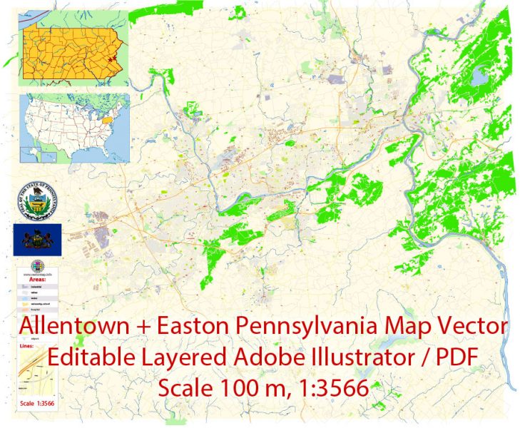
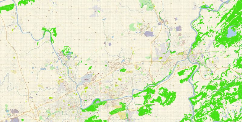
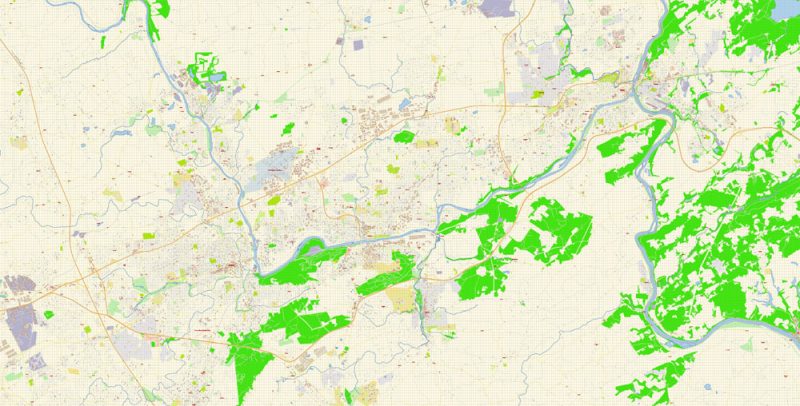
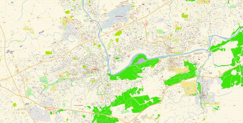
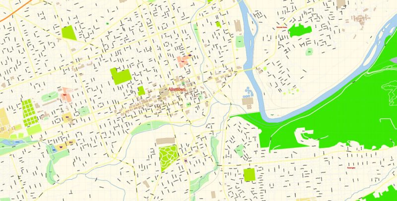
Printable PDF Vector Map of Allentown and Easton Pennsylvania US detailed City Plan scale 100 m 1:3566 full editable Adobe PDF Street Map in layers, scalable, text format all names, 86 MB ZIP
All street names, Main Objects, Principal Buildings. Map for design, printing, arts, projects, presentations, for architects, designers, and builders, business, logistics.
Layers: color_fills, water, streets_roads, labels_roads, names_objects, names_streets, names_places, arrows_streets, buildings, grids, legend, etc.
The most exact and detailed map of the city in scale.
For Editing and High-Quality Printing
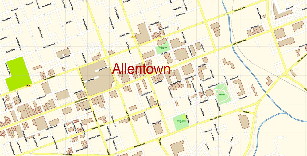
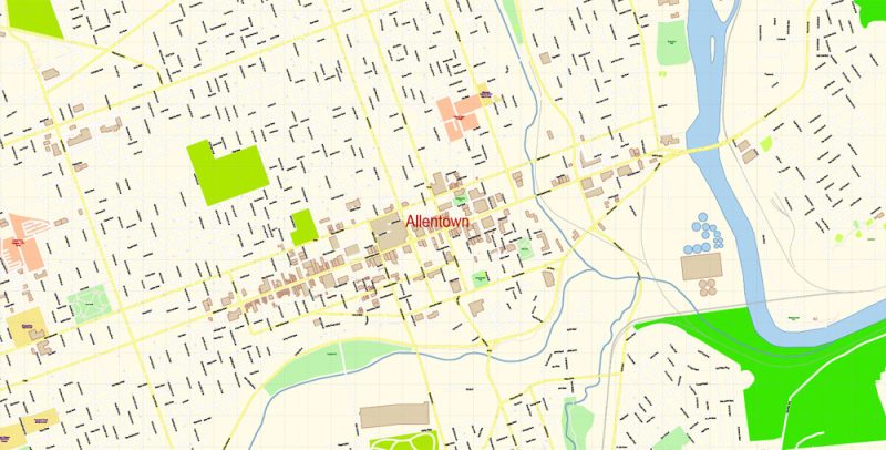
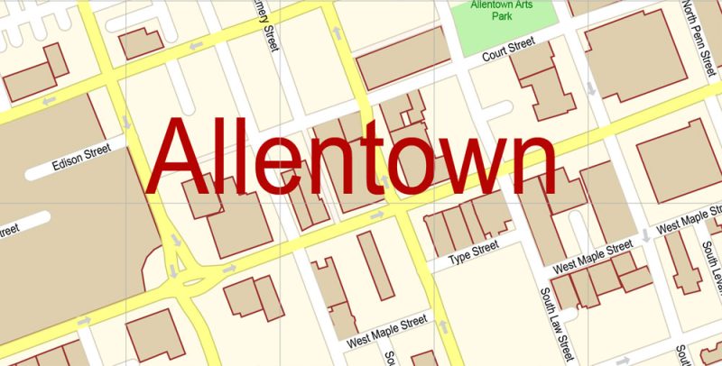
Allentown
City in Pennsylvania
Allentown is a city in eastern Pennsylvania. The Liberty Bell Museum houses a full-size replica of the iconic bell, plus a mural about its history. Nearby, the Allentown Art Museum’s collections include Renaissance and modern American works. On the Lehigh River, the America On Wheels Museum showcases vintage vehicles. East of the river, Coca-Cola Park is home to the IronPigs Minor League Baseball team.
Population: 121,283
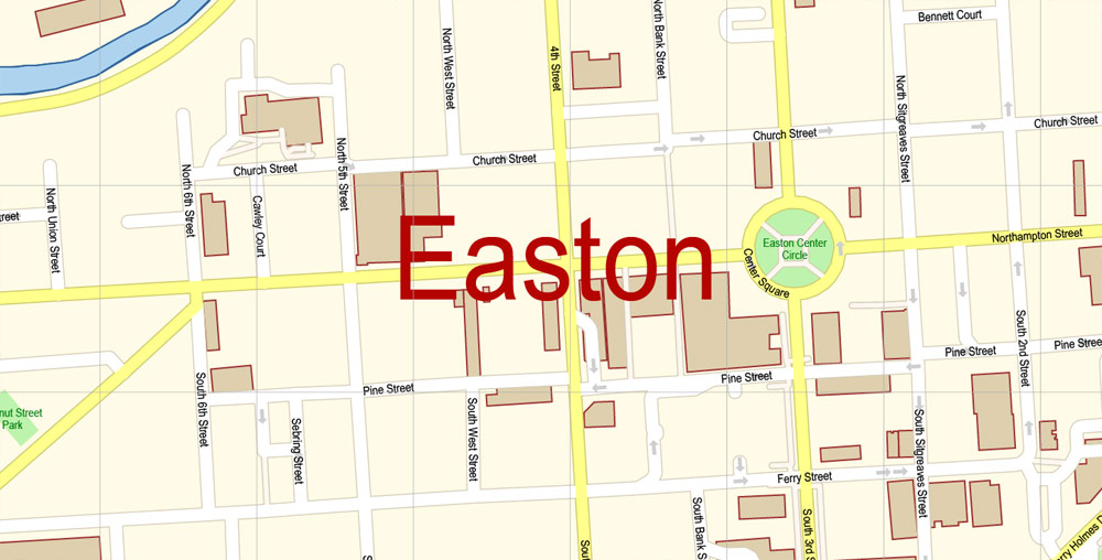
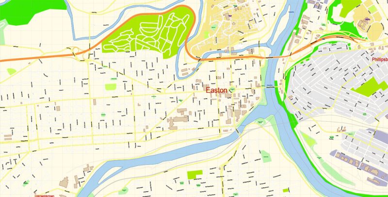
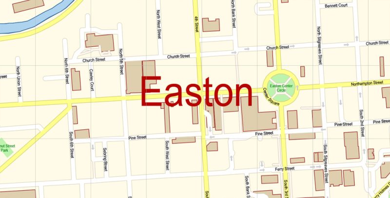
Easton
City in Pennsylvania
Easton is a city in and the county seat of Northampton County, Pennsylvania, United States. The city’s population was 26,800 as of the 2010 census. Easton is located at the confluence of the Delaware River and the Lehigh River, roughly 55 miles north of Philadelphia and 70 miles west of New York City. Wikipedia
Population: 27,109
Urban plan Allentown Easton Pennsylvania PDF: Digital Cartography
Allentown is a city in eastern Pennsylvania in Lehigh County. It is the third-largest city in Pennsylvania after Philadelphia and Pittsburgh. The population of the city is more than 1,100,000 people.
The city was founded in 1762 by William Allen and was named Northampton town, and in 1932 it was renamed in honor of its founder. Allentown is located on the Lehigh River and is the administrative center of Lehigh County. It is the largest of the three contiguous cities that make up the conurbation of eastern Pennsylvania and western New Jersey, known as the Lehigh Valley, which includes Allentown, Bethlehem and Easton. The city’s air traffic is carried out through Lehigh Valley Airport (IATA: ABE, ICAO: KABE).
There are two four-year colleges in the city: Cedar Crest and Muhlenberg. Among the attractions are: the Symphony Hall and the Symphony Orchestra of the city of Allentown, as well as an entertainment park and a water park

The official name of the state is the Commonwealth of Pennsylvania
State Region — Mid-Atlantic States, Northeastern USA
The area of the state is 119,283 km2 (including land – 116,075 km2 and water surface – 3,208 km2), the 33rd place among the US states
The length of the state:
from north to south – 273 km
from west to east – 455 km
The elevation of the state relief above sea level:
maximum — 979 m
minimum — 0 m
The state’s time zone is the Eastern time zone of the USA
Date of foundation of the state – December 12, 1787 (2 states in the USA)
The state capital is Harrisburg
The largest city in the state is Philadelphia
The population of the state is about 12,800 000 people (5th place among the US states)
The population density in the state is about 110 people/km2 (9th place among US states)
The average household income in the state is about $59,195 (25th place among US states)
The state’s motto is Virtue, Liberty and Independence (“Dignity, freedom and independence”)
The nicknames of the state are “Keystone”, “Quaker State”, “Independence State”, “Coal State”
The abbreviation of the state is PA

The state of Pennsylvania is located in the Northeastern United States and belongs to the Mid-Atlantic states of the United States. Pennsylvania borders Canada (with the province of Ontario, the border runs along Lake Erie) to the northwest; with the states of New York to the north, New Jersey to the east, Delaware to the southeast, Maryland to the south, West Virginia to the southwest and Ohio to the west.
Almost the entire territory of Pennsylvania lies within the Appalachian mountain system. Southeastern (or “Dutch”) Pennsylvania is located on the gentle hills of the Piedmont Plateau. In the northeast of the state are the low mountains of Endless and Pocono, which are part of the Allegheny Plateau, which also occupy almost the entire western part of Pennsylvania. In the northwest, the state has access to Lake Erie.
The largest rivers in the state are Delaware (forming the eastern border) and the Susquehanna (whose basin is located in the central part of Pennsylvania). In western Pennsylvania, the confluence of the Allegheny and Monongiela Rivers forms the Ohio River, one of the tributaries of the Mississippi.
Most of Pennsylvania has a humid continental climate with hot summers and cool winters. In the northwest, in the Lake Erie area, there are often heavy snowfalls in winter, there is twice as much precipitation as the state average. In the southeast, in the Philadelphia area, the climate is hotter, humid subtropical.
The first European explorer to see the shores of Pennsylvania was the Italian Giovanni da Verrazzano in 1524. At the beginning of the XVII century, the rights to the lands of the state were disputed by England and Holland, in fact, the first European settlements in Pennsylvania (trading posts) were founded in the twenties of the XVII century by the Dutch.
In 1681, King Charles II of England transferred the rights to a vast territory in North America to William Penn (as repayment of a royal debt to his father). The new colony got its name, Pennsylvania, from the Latin words Penn Sylvania, which means “The land and forests of Penn.” Being a staunch supporter of the religious movement of Protestant Quakers, Penn tried to embody their principles in Pennsylvania – religious tolerance, equality and rejection of violence. William Penn named the new city he founded in the Delaware River Valley Philadelphia, which means “The City of Brotherly Love.”
In the sixties of the XVIII century, English surveyors Charles Mason and Jeremiah Dixon carried out the necessary measurements and marked the boundary between the colonies of Pennsylvania and Maryland on the ground, resolving a dispute that had been dragging on for decades. This boundary was called the “Mason-Dixon Line”.
The most important events of the formation of the USA took place on the territory of Pennsylvania. The First and Second Continental Congresses worked here, the Liberty Bell informed the residents of Philadelphia about the declaration of independence, fierce battles were fought here during the War of Independence, the US Constitution was adopted here at the Constitutional Convention.
During the American Civil War, the state played a very important role in the victory of the Northerners. Pennsylvania was one of the main suppliers of artillery, small arms, ammunition, and food; several major battles took place in the state, including the Battle of Gettysburg.
In the second half of the XIX—early XX centuries, mining (oil, coal, and iron ore) and industry developed rapidly in Pennsylvania. Having survived the recession during the Great Depression, the state received a new boost during World War II. In 1979, an accident occurred at the Three Mile Island nuclear power plant in Pennsylvania, the most serious incident in the history of US nuclear power.
In the seventies and eighties of the XX century, Pennsylvania, like other states of the “Industrial Belt”, was going through a period of decline. In recent decades, the state’s economy has become much more diversified and adapted to the realities of modernity.
About 1,590,000 people live in the largest city in Pennsylvania, Philadelphia, and about 6,100,000 people live in the megacity that has formed around it. The state capital city of Harrisburg has about 50,000 residents.
Continuing to be one of the most industrially developed US states, Pennsylvania is traditionally strong in metallurgy, mechanical engineering, and the production of electronic devices. In addition, the chemical, pharmaceutical and food industries are well developed in the state. Agriculture is also very well developed in Pennsylvania, especially on the fertile lands of “Dutch Pennsylvania”.

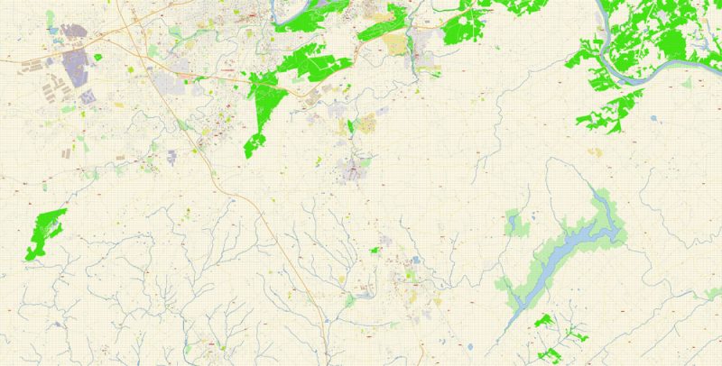
Related Images “Urban plan Allentown Easton Pennsylvania PDF”:
Allentown Easton Pennsylvania PDF Map Vector Exact City Plan detailed Street Map Adobe PDF in layers
Allentown Easton Pennsylvania PDF Map Vector Exact City Plan detailed Street Map Adobe PDF in layers
Allentown Easton Pennsylvania PDF Map Vector Exact City Plan detailed Street Map Adobe PDF in layers
Allentown Easton Pennsylvania PDF Map Vector Exact City Plan detailed Street Map Adobe PDF in layers
Allentown Easton Pennsylvania PDF Map Vector Exact City Plan detailed Street Map Adobe PDF in layers
Allentown Easton Pennsylvania PDF Map Vector Exact City Plan detailed Street Map Adobe PDF in layers
Allentown Easton Pennsylvania PDF Map Vector Exact City Plan detailed Street Map Adobe PDF in layers
Allentown Easton Pennsylvania PDF Map Vector Exact City Plan detailed Street Map Adobe PDF in layers

Allentown Easton Pennsylvania PDF Map Vector Exact City Plan detailed Street Map Adobe PDF in layers
Allentown Easton Pennsylvania PDF Map Vector Exact City Plan detailed Street Map Adobe PDF in layers
Allentown Easton Pennsylvania PDF Map Vector Exact City Plan detailed Street Map Adobe PDF in layers


 Author: Kirill Shrayber, Ph.D. FRGS


