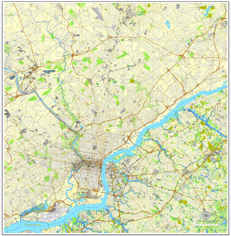
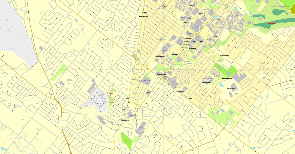
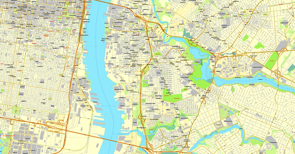
Philadelphia, Pennsylvania, US, exact vector map street City Plan V.3.09.2016 full editable, Adobe PDF, full vector, scalable, editable text format street names, 49 mb ZIP
All streets, Some more buildings. Map for design, printing, arts, projects, presentations, for architects, designers and builders, business, logistics.
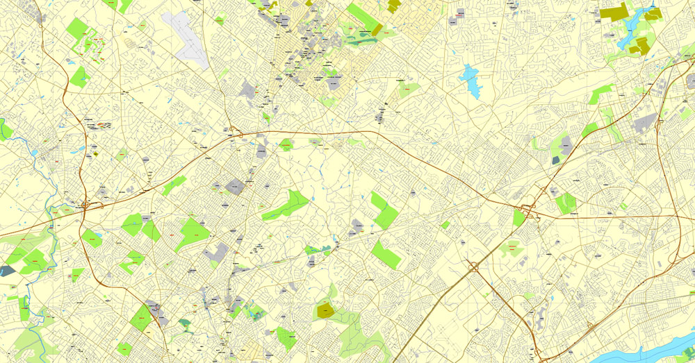
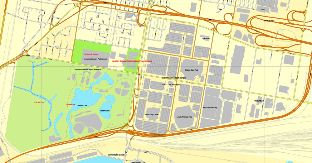
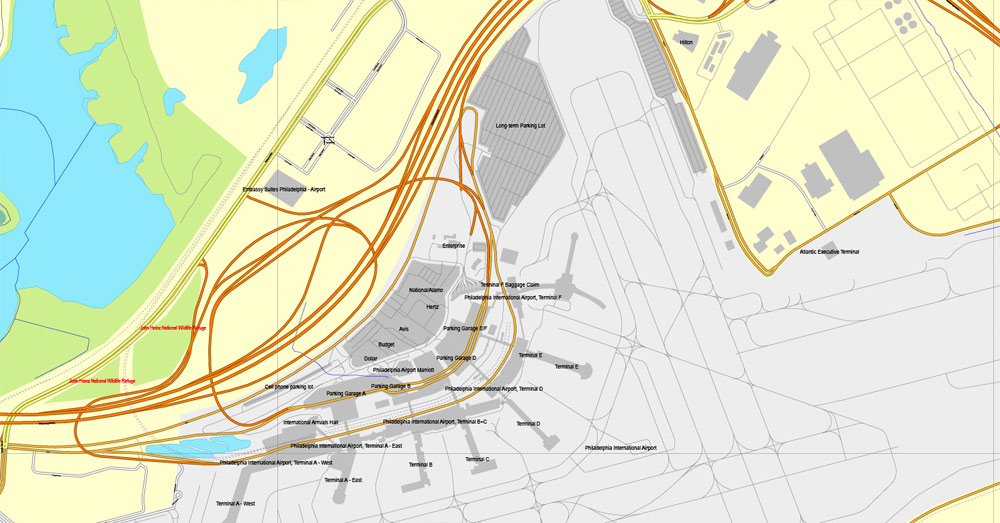
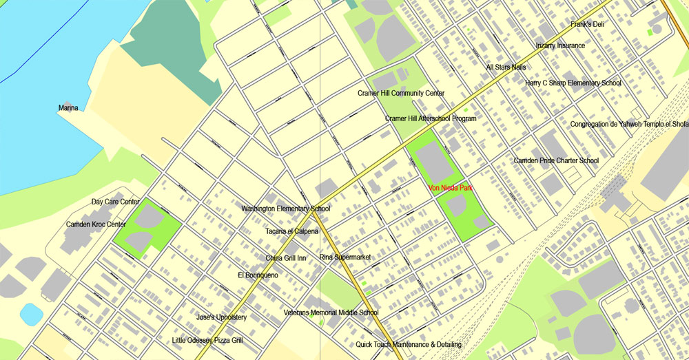
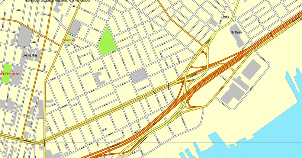
The most exact and detailed map of the city.
You can edit this file by Adobe Illustrator, Adobe Acrobat, Corel Draw.
DWG, DXF, CDR and other formats – on request, same price, please, contact.
Philadelphia, Pennsylvania, USA.
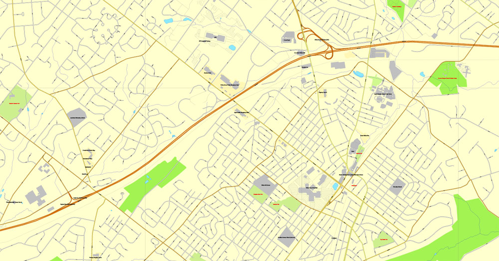
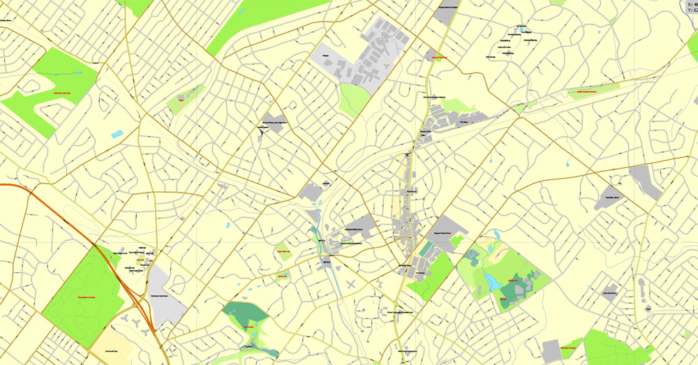
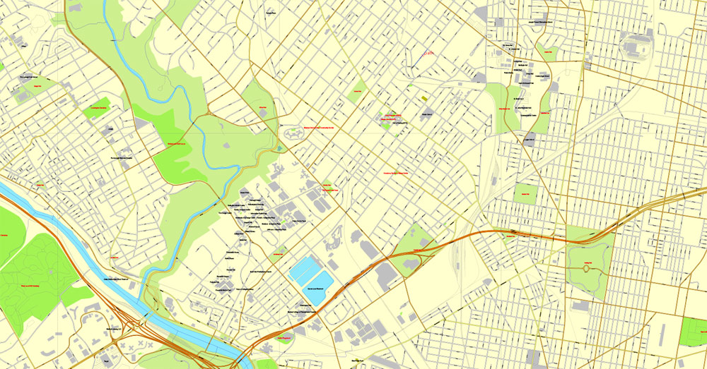
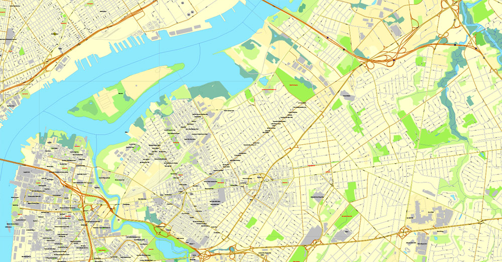
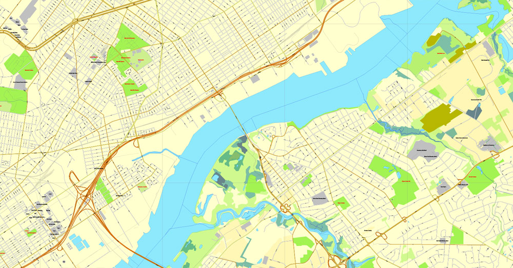
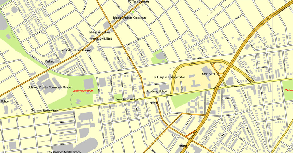
This vector map of Philadelphia city is used as a basis for design, editing, and further printing.
This is the most detailed, exact map of Philadelphia city for high-quality printing and polygraphy. You can always clarify the map development date by contacting us.
For your convenience, all objects on Philadelphia vector city map are divided into layers. And the editing is very easy – colors, lines, etc.
One of the advantages of Philadelphia city vector maps of our production is the relevance of cartographic data, we constantly update all our products.
Philadelphia, often called Philly, is the largest city in the U.S. state and Commonwealth of Pennsylvania, and the sixth-most populous U.S. city, with a 2017 census-estimated population of 1,580,863.
This vector map of Philadelphia city is used by:
designers, layout designers, printers, advertisers and architects. Our product – vector maps – is designed for further editing and printing in large formats – from @Wall format (a few meters) to A-0 and A-1, A-2, A-3.
The advertising and presentation map of Philadelphia city (usually the final designer marks the routes, and puts the client’s objects (shops, saloons, gas stations etc.)
The undoubted advantage is that people will NEVER throw out this advertising product – the map. In fact, as an advertising medium, a city map is the most “long-playing” of the well-known polygraphic advertising media, with the longest lifespan, and the maximum number of interactions with the customer.
For travelers, maps are sold at the airports and gas stations around the world. Often the source is our vector maps.
Take a look, who purchases our vector maps of Philadelphia city in “Our Clients and Friends” page – these are large and small companies, from super-brands like Volvo and Starbucks, to small design studios and printing houses.
It’s very easy to work with vector maps of Philadelphia city, even for a not very experienced designer who can turn on and off the map layers, add new objects, change the colors of fill and lines according to customer requirements.
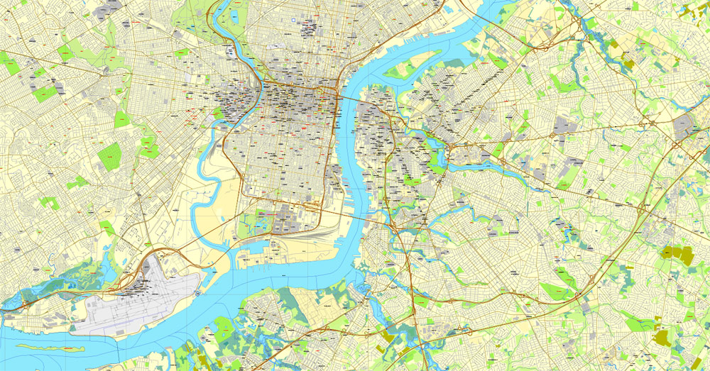
The undoubted advantage of Philadelphia city vector maps in printing is an excellent and detailed visualization, when customer can expand a large paper map and instantly define his location, find a landmark, an object or address on map, unlike using the popular electronic formats of Google and Yandex maps for example.
Printable vector maps of Philadelphia city are much more convenient and efficient than any electronic maps on your smartphone, because ALL DETAILS are displayed in the entire space of Philadelphia city map.
Useful tips on working with vector maps of cities and countries in Adobe Illustrator.
«V» – launches the Selection tool (cursor, black arrow), which makes active any vector line.
«А» – launches the Direct Selection tool (white cursor), allows you to select curve elements and drag them to the desired place.
«R» – activates the Rotate tool, which helps you rotating selected objects around the center point by 360 degrees.
«E» – gives you the opportunity to use the Eraser tool and erase unnecessary parts.
«X» – switches between Fill and Stroke in the Tools section. Try to get used to this hot key and
you will quickly understand that you can’t live and work without it.
Since 1854, the city has been coterminous with Philadelphia County, the most populous county in Pennsylvania and the urban core of the eighth-largest U.S. metropolitan statistical area, with over 6 million residents as of 2017. Philadelphia is also the economic and cultural anchor of the greater Delaware Valley, located along the lower Delaware and Schuylkill Rivers, within the Northeast megalopolis. The Delaware Valley’s population of 7.2 million ranks it as the eighth-largest combined statistical area in the United States.
Guides are not limited to vertical and horizontal in Adobe Illustrator. You can also create a diagonal guide for example. Moreover, you can turn any contours into guides. Select the outline and go to View > Guides > Make Guides (Create Guides), or simply press Cmd/Ctrl + 5. You can also turn the guides back into an editable object. Go to menu, View > Guides > Unlock Guides (Release Guides), select the guide you want to edit and select View > Guides > Release Guides (Reset Guides), or just press Cmd/Ctrl + Option / Alt + 5).
You will probably want to change the color scheme used on our Philadelphia vector city map.
To quickly and effectively play with colors.
Of course, you can do it manually, all objects in our Philadelphia city vector map are divided according to types and layers, and you can easily change the color gamma of vector objects in groups and layers.
But there is more effective way of working with the whole VECTOR MAP of Philadelphia city and all layers:
The overview dialog «Edit colors»/«Repaint Graphic Object» (this dialog box name can change depending on the context):
If you have selected a part or a layer of Philadelphia city vector map and open the dialog box by clicking the icon in the Control panel, on the Samples palette or the Color Catalog, or if you choose Edit > Edit Colors> Repaint Graphic Object, then the «Repaint Graphic Object» dialog box appears, and you get access to «Assign» and «Edit» tabs.
If a picture or a map fragment is not selected, and you open the dialog box by clicking the icon in the Control panel, on the Samples palette or in the Color Catalog, the «Edit Colors» dialog box appears and you can only access the «Edit» tab.
Regardless of the name at the top of the dialog box, the right-hand side always displays the color group of the current document, as well as two default color groups: Print Color and Grayscale. These color groups can be selected and used any time.
William Penn, an English Quaker, founded the city in 1682 to serve as capital of the Pennsylvania Colony. Philadelphia played an instrumental role in the American Revolution as a meeting place for the Founding Fathers of the United States, who signed the Declaration of Independence in 1776 at the Second Continental Congress, and the Constitution at the Philadelphia Convention of 1787. Several other key events occurred in Philadelphia during the Revolutionary War including the First Continental Congress, the preservation of the Liberty Bell, the Battle of Germantown, and the Siege of Fort Mifflin.
Create and edit color groups of Philadelphia city vector map, and also assign colors using the «Edit Colors»/ а «Repaint Graphic Object» dialog box.
A. Creating and editing of a color group on the «Edit» tab
B. Assigning colors on the «Assign» tab
C. Select a group of colors from the «Color groups» list
The option «Repaint a graphic object» in the lower part of the dialog box allows you to preview the colors on a selected layer of Vector map, or a group of elements, and specify whether its colors will be redefined when the dialog box is closed.
The main areas of the dialog box are:
«Edit»
The «Edit» tab is designed to create a new or edit the existing color groups.
The harmony rules Menu and the Color Wheel are used to conduct experiments with color harmonies. The color wheel shows how colors are related in color harmony, and the color bars allow you to view and manipulate an individual color values. In addition, you can adjust the brightness, add and remove colors, save color groups and view colors on the selected Vector Map of Philadelphia city or a separated layers.
Philadelphia was one of the nation’s capitals during the revolution, and served as temporary U.S. capital while Washington, D.C., was under construction. In the 19th century, Philadelphia became a major industrial center and a railroad hub. The city grew from an influx of European immigrants, most of whom came from Ireland, Italy and Germany—the three largest reported ancestry groups in the city as of 2015. In the early 20th century, Philadelphia became a prime destination for African Americans during the Great Migration after the Civil War, as well as Puerto Ricans. The city’s population doubled from one million to two million people between 1890 and 1950.
«Assign»
The «Assign» tab is used to view and control on how the original colors are replaced with colors from the color group like your corporate colors in the Vector Map of Philadelphia city.
The assign color ability is provided only if the entire map, layer or fragment is selected in the document. You can specify which of new colors replace the current colors, whether the spot colors should be preserved and how colors are replaced (for example, you can replace colors completely or changing the color tone while maintaining the brightness). The «Assign» tab allows you to redefine colors in the Vector Map of Philadelphia city, or in separate layers and fragments using the current color group or reducing the number of colors in the current Vector Map.
Color groups
Is a list of all saved color groups for current document (the same groups appear in the «Samples» palette). You can edit and delete the existing color groups, as well as creating a new ones using the list of “Color Groups” in the dialog box. All changes appear in the «Samples» palette.
The highlighted color group shows, which color group is currently edited.
The Philadelphia area’s many universities and colleges make it a top study destination, as the city has evolved into an educational and economic hub. According to the Bureau of Economic Analysis, the Philadelphia area had a gross domestic product of US$445 billion in 2017, the eighth-largest metropolitan economy in the United States. Philadelphia is the center of economic activity in Pennsylvania and is home to five Fortune 1000 companies.
Any color group can be selected and edited, or used to redefine the colors in the selected vector map of Philadelphia city, its fragments or elements.
Saving a color group adds this group to the specified list.
Opening the «Edit Colors»/«Repaint Graphic Object» dialog box.
Open the «Edit Colors»/«Repaint Graphic Object» dialog box using one of the following methods:
«Edit»> «Edit Colors»> «Repaint Graphic object» or «Repaint With Style».
Use these commands if you need to edit the colors in the selected vector map of Philadelphia city.
«Repaint Graphic object» button on the «Control» panel.
Use this button if you need to adjust colors of Philadelphia city vector map using the а «Repaint graphic object» dialog box.
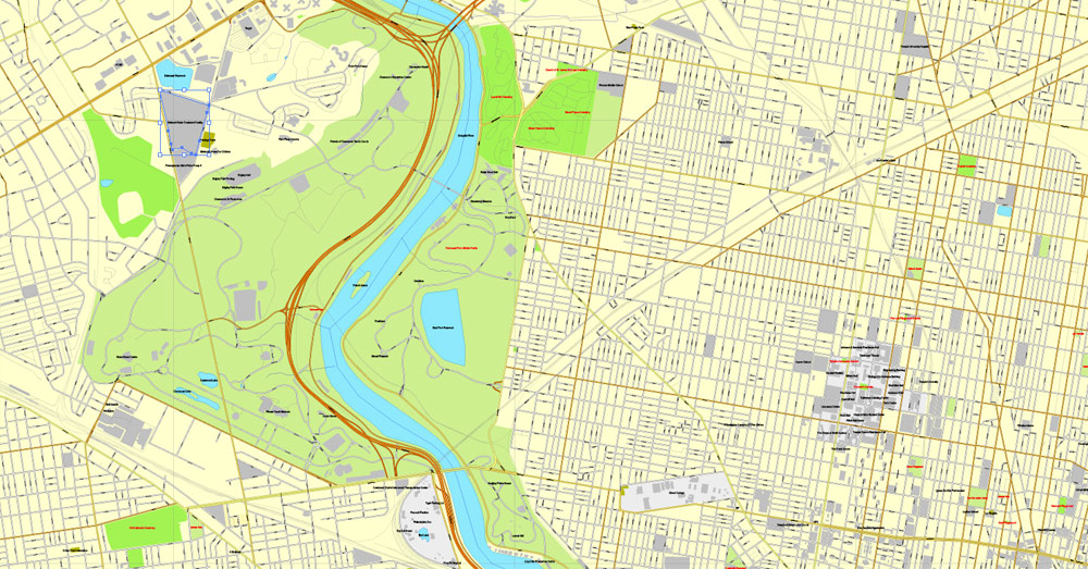
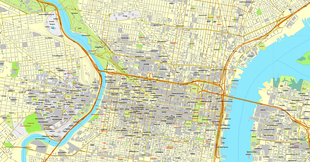
The Philadelphia skyline is expanding, with a market of almost 81,900 commercial properties in 2016, including several nationally prominent skyscrapers. Philadelphia has more outdoor sculptures and murals than any other American city. Fairmount Park, when combined with the adjacent Wissahickon Valley Park in the same watershed, is one of the largest contiguous urban park areas in the United States.
The specified button is available if the selected vector map or its fragment contains two or more colors.
Note. This color editing method is convenient for global color adjustment in a vector map, if global colors were not used when creating a City Map of Philadelphia.
The «Edit colors» button or «Edit or apply colors» on the «Color Catalog» palette
Click this button if you need to edit colors on the «Color Catalog» palette or edit and then apply them to the selected Vector Map of Philadelphia city or its fragment.
The «Edit color group» button or «Edit or apply color group» on the «Samples» palette.
Click this button if you need to edit the colors in the specific color group or edit and apply them to the selected Vector Map of Philadelphia city or a group of its elements, for example, the whole layer “Streets and lines”. You can also double-click the color group in the Samples panel to open the dialog box.
If the map file is too large and your computer freezes or even can’t open it quickly:
1. Try to reduce the color resolution of the video card (display) to 256 colors while working with a large map.
2. Using Windows Task Manager, select all the application you don’t need, while working with map, just turn them off.
3. Launch Adobe Illustrator. (DO NOT OPEN the vector map file)
4. Start the Windows Task Manager using administrator rights > Find the “Illustrator” process > set the «real time» priority,
5. Open the file. When you see the LEGACY FONT popup window – click “OK” (do not update). You can restore the TEXT later.
6. Can also be useful: When file is opened – Edit > Settings > Basic Settings > disable smoothing. /// It looks scary, but works quickly)))
We recommend saving the file in Adobe Illustrator 10 version. It’s much more stable when working with VERY BIG size files.
The city is known for its arts, culture, cuisine, and colonial history, attracting 42 million domestic tourists in 2016 who spent US$6.8 billion, generating an estimated $11 billion in total economic impact in the city and surrounding four counties of Pennsylvania. Philadelphia has also emerged as a biotechnology hub.
Philadelphia is the birthplace of the United States Marine Corps, and is also the home of many U.S. firsts, including the first library (1731), hospital (1751), medical school (1765), national capital (1774), stock exchange (1790), zoo (1874), and business school (1881). Philadelphia contains 67 National Historic Landmarks and the World Heritage Site of Independence Hall. The city became a member of the Organization of World Heritage Cities in 2015, as the first World Heritage City in the United States. Although Philadelphia is rapidly undergoing gentrification, the city actively maintains mitigation strategies to minimize displacement of homeowners in gentrifying neighborhoods.
Geography
Topography
The geographic center of Philadelphia is located approximately at 40° 0′ 34″ north latitude and 75° 8′ 0″ west longitude. The 40th parallel north passes through neighborhoods in Northeast Philadelphia, North Philadelphia, and West Philadelphia including Fairmount Park. The city encompasses 142.71 square miles (369.62 km2), of which 134.18 square miles (347.52 km2) is land and 8.53 square miles (22.09 km2), or 6%, is water. Natural bodies of water include the Delaware and Schuylkill rivers, the lakes in Franklin Delano Roosevelt Park, and Cobbs, Wissahickon, and Pennypack creeks. The largest artificial body of water is the East Park Reservoir in Fairmount Park.
The lowest point is sea level, while the highest point is in Chestnut Hill, about 446 feet (136 m) above sea level on Summit Street near the intersection of Germantown Avenue and Bethlehem Pike (example coordinates near high point: 40.07815 N, 75.20747 W).
Philadelphia is situated on the Fall Line that separates the Atlantic coastal plain from the Piedmont. The rapids on the Schuylkill River at East Falls were inundated by the completion of the dam at the Fairmount Water Works.
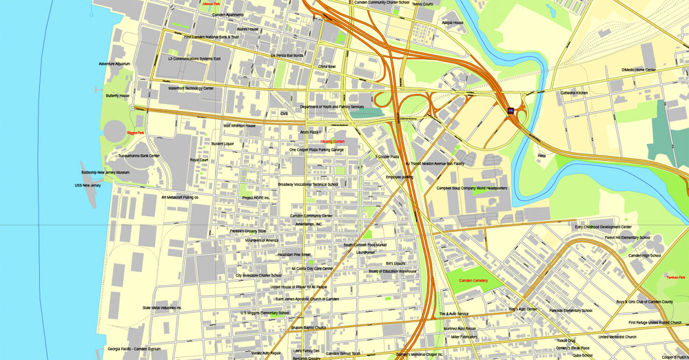
The city is the seat of its own county. The adjacent counties are Montgomery to the northwest; Bucks to the north and northeast; Burlington County, New Jersey, to the east; Camden County, New Jersey, to the southeast; Gloucester County, New Jersey, to the south; and Delaware County to the southwest.
List of Philadelphia neighborhoods
The following is a list of neighborhoods, districts, and other places located in the city of Philadelphia, Pennsylvania, United States. The list is organized by broad geographical sections within the city. While there is no official list of neighborhoods, districts, and places, this list was compiled from the sources listed in the References and External links sections, as well as from information from residents of Philadelphia.
Common usage for Philadelphia’s neighborhood names does not respect “official” borders used by the city’s police, planning commission or other entities. Therefore, some of the places listed here may overlap geographically, and residents do not always agree where one neighborhood ends and another begins. Philadelphia has 41 ZIP codes, which are often used for neighborhood analysis.
Historically, many neighborhoods were defined by incorporated townships (Blockley, Roxborough), districts (Belmont, Kensington, Moyamensing, Richmond), or boroughs (Bridesburg, Frankford, Germantown, Manayunk) before being incorporated into the city with the Act of Consolidation of 1854. Adding further complication is the fact that in some parts of Philadelphia, especially the central areas of North, West, and South Philadelphia, residents have long been more likely to identify with the name of their section of the city than with any specific neighborhood name. Today, community development corporations, neighborhood watches, and other civic organizations are influential in shaping the use of neighborhood names and approximate boundaries.
For planning purposes, the city is divided into 12 Planning Analysis Sections, which are Center City; South Philadelphia; Southwest Philadelphia; West Philadelphia; Lower North Philadelphia; Upper North Philadelphia; Bridesburg-Kensington-Port Richmond; Roxborough-Manayunk; Germantown-Chestnut Hill; Olney-Oak Lane; Near Northeast Philadelphia; and Far Northeast Philadelphia.
Southwest Philadelphia
Southwest Philadelphia (formerly Kingsessing Township) is a section of Philadelphia, Pennsylvania that can be described as extending from the western side of the Schuylkill River to the city line, with the northern border defined by the Philadelphia City Planning Commission as east from the city line along Baltimore Avenue moving south along 51st Street to Springfield Ave. It follows the train tracks until 49th Street. From 49th and Kingsessing Ave the line moves east along Kingsessing Ave. The line then moves south along 46th St to Paschall Ave where it jogs to join Grays Ferry where the line runs to the Schuylkill River.
West Philadelphia
West Philadelphia, nicknamed West Philly, is a section of Philadelphia. Though there is no official definition of its boundaries, it is generally considered to reach from the western shore of the Schuylkill River, to City Line Avenue to the northwest, Cobbs Creek to the southwest, and the SEPTA Media/Elwyn Line to the south.
Lower North Philadelphia
Lower North Philadelphia is a section of Philadelphia that is immediately north of Center City and below Upper North Philadelphia and can be described as a section of Philadelphia that was designated as a “Model City” target, in hopes of overcoming poverty and blight through a federal funding program since 1966. Bounded by Spring Garden Street to the south, Front Street to the east, York Street to the north, and Fairmount Park to the west.
Upper North Philadelphia
The area is bounded by York Street to the south, Front Street to the east, Lincoln Highway/Roosevelt Expressway to the north, and Ridge Avenue/Fairmount Park to the west. Upper North Philadelphia, is a section of Philadelphia that is immediately north of Lower North Philadelphia, and can be described as an area that has a “…large and rapidly growing Puerto Rican population”. The list of communities in this section is as follows:
Allegheny West
Fairhill
Glenwood
Hunting Park
Nicetown-Tioga
Bridesburg-Kensington-Port Richmond
The Bridesburg-Kensington-Port Richmond section of Philadelphia is the area north of Center City. This area “… consists of the neighborhoods including: Bridesburg, Fishtown, Olde Richmond, Juniata Park, New Kensington, North West Kensington, Port Richmond…” and “… was once predominantly industrial. However, most heavy industry has now left.
Philadelphia, Pennsylvania
Philadelphia is the largest city in the Commonwealth of Pennsylvania and the fifth-most populous in the United States, with an estimated population in 2014 of 1,560,297.
In the Northeastern United States, at the confluence of the Delaware and Schuylkill rivers, Philadelphia is the economic and cultural anchor of the Delaware Valley, a
metropolitan area home to 7.2 million people and the eighth-largest combined statistical area in the United States.
In 1682, William Penn founded the city to serve as capital of the Pennsylvania Colony. Philadelphia played an instrumental role in the American Revolution as a meeting
place for the Founding Fathers of the United States, who signed the Declaration of Independence in 1776 and the Constitution in 1787. Philadelphia was one of the nation’s
capitals in the Revolutionary War, and served as temporary U.S. capital while Washington, D.C., was under construction. In the 19th century, Philadelphia became a major industrial center and railroad hub that grew from an influx of European immigrants. It became a prime destination for African-Americans in the Great Migration and surpassed two million occupants by 1950.
Based on the similar shifts underway the nation’s economy in the late 1960s Philadelphia experienced a loss of manufacturing companies and jobs to lower taxed regions of the USA and often overseas. As a result, the economic base of Philadelphia, which had historically been manufacturing, declined significantly. In addition, consolidation
in several American industries (retailing, financial services and health care in particular) reduced the number of companies headquartered in Philadelphia. The economic
impact of these changes would reduce Philadelphia’s tax base and the resources of local government. Philadelphia struggled through a long period of adjustment to these
economic changes, coupled with significant demographic change as wealthier residents moved into the nearby suburbs and more immigrants moved into the city. The city in
fact approached bankruptcy in the late 1980s. Revitalization began in the late 1990s, with gentrification turning around many neighborhoods and reversing its decades-long
trend of population loss.
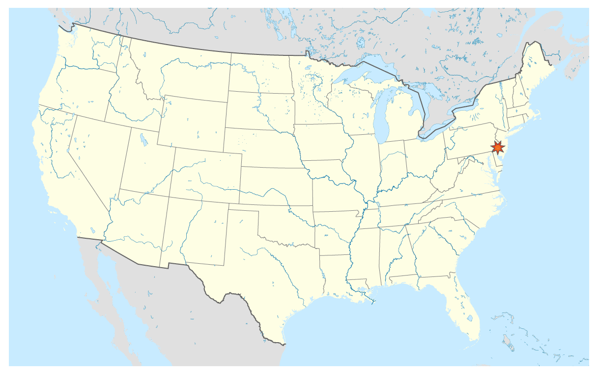
Download this Free vector map Philadelphia US Location >>>>>
Philadelphia_Free_Vector_Map_Usa_location_map
The area’s many universities and colleges make Philadelphia a top international study destination, as the city has evolved into an educational and economic hub. With a
gross domestic product of $388 billion, Philadelphia ranks ninth among world cities and fourth in the nation. Philadelphia is the center of economic activity in
Pennsylvania and is home to seven Fortune 1000 companies. The Philadelphia skyline is growing, with several nationally prominent skyscrapers. The city is known for its
arts, culture, and history, attracting over 39 million domestic tourists in 2013. Philadelphia has more outdoor sculptures and murals than any other American city, and
Fairmount Park is the largest landscaped urban park in the world. The 67 National Historic Landmarks in the city helped account for the $10 billion generated by tourism.
Philadelphia is the birthplace of the United States Marine Corps, and is also the home of many U.S. firsts, including the first library (1731), first hospital (1751)
and medical school (1765), first Capitol (1777), first stock exchange (1790), first zoo (1874), and first business school (1881). Philadelphia is the only World
Heritage City in the United States.
Area
• Consolidated city-county 141.6 sq mi (367 km2)
• Land 134.1 sq mi (347.3 km2)
• Water 7.5 sq mi (19.4 km2)
• Urban 1,799.5 sq mi (4,660.5 km2)
• Metro 4,629 sq mi (11,988.6 km2)
Elevation 39 ft (12 m)
Population (2015)
• Consolidated city-county 1,567,442
• Rank US: 5th
• Density 11,635.3/sq mi (4,492.4/km2)
• Metro 6,051,170 (US: 6th)
• CSA 7,164,790 (US: 8th)
• Demonym Philadelphian
Time zone EST (UTC-5)
• Summer (DST) EDT (UTC-4)
ZIP code 19092-19093, 19099, 191xx
Area code(s) 215, 267
Geography
Philadelphia is at 39° 57? north latitude and 75° 10? west longitude, and the 40th parallel north passes through the northern parts of the city. The city encompasses 142.6
square miles (369.3 km2), of which 135.1 square miles (349.9 km2) is land and 7.6 square miles (19.7 km2), or 5.29%, is water. Bodies of water include the Delaware and
Schuylkill rivers, and Cobbs, Wissahickon, and Pennypack creeks.
The lowest point is 10 feet (3 m) above sea level, while the highest point is in Chestnut Hill, about 445 feet (136 m) above sea level (near the intersection of Germantown
Avenue and Bethlehem Pike).
Philadelphia sits on the Fall Line that separates the Atlantic Coastal Plain from the Piedmont. The rapids on the Schuylkill River at East Falls were inundated by the completion of the Fairmount Dam.
The city is the seat of its own county. The adjacent counties are Montgomery to the north; Bucks to the northeast; Burlington County, New Jersey, to the east; Camden
County, New Jersey, to the southeast; Gloucester County, New Jersey, to the south; and Delaware County to the west.
https://en.wikipedia.org/wiki/Philadelphia
Free vector map World, Adobe Illustrator, download now maps vector clipart
Map for design, projects, presentation free to use as you like.
See also: TERMS & CONDITIONS: SOFTWARE LICENSE AGREEMENT FOR DIGITAL CARTOGRAPHIC DATA.
Need more USA Vector Maps, printable and editable?

 Author: Kirill Shrayber, Ph.D. FRGS


