Extended Description of the Vector Map
Printable PDF Vector Map of Ottawa Canada Low Detailed (for small print size) City Plan scale 1:52856 full editable Adobe PDF Street Map in layers, scalable, text/curves format all names, 57 MB ZIP
Principal street names, Main Objects, Buildings. Map for design, printing, arts, projects, presentations, for architects, designers, and builders, business, logistics.
Also: We can add (additional layer for this map), any other objects for you. It’s free for our customers.
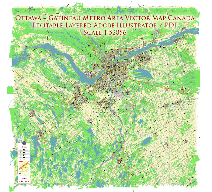
Ottawa Canada PDF Vector Map: City Plan Low Detailed (for small print size) Street Map editable Adobe PDF in layers
Layers list:
- Legend
- Grids
- Labels of roads
- Names of places (city, hamlet, etc.)
- Names of objects (hospitals, parks, water)
- Names of main streets
- Halo Names 1,2,3
- Main Streets, roads
- Residential streets
- Railroads
- Buildings
- Waterways
- Water objects (rivers, lakes, ponds)
- Airports and Heliports
- Color fills (parks, hospital areas, land use, etc.)
- Background

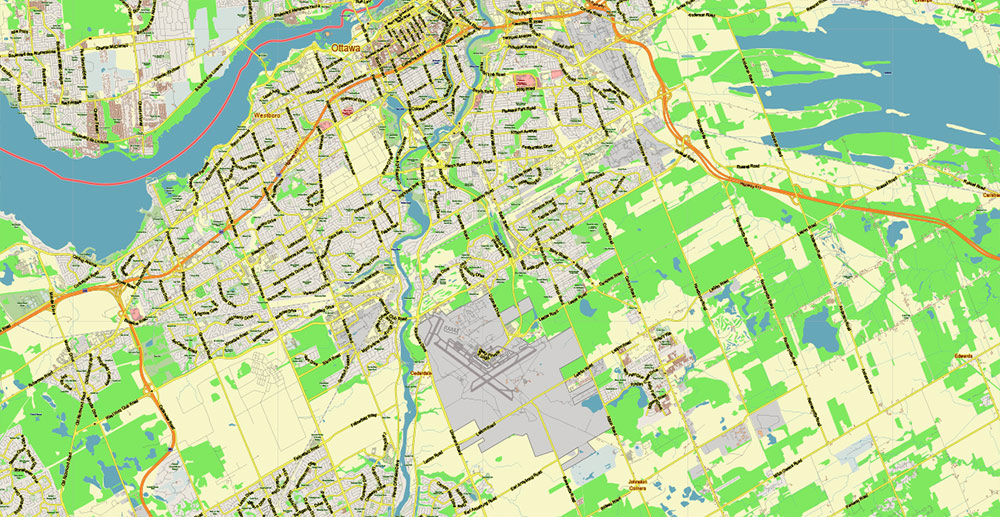
Ottawa Canada PDF Vector Map: City Plan Low Detailed (for small print size) Street Map editable Adobe PDF in layers
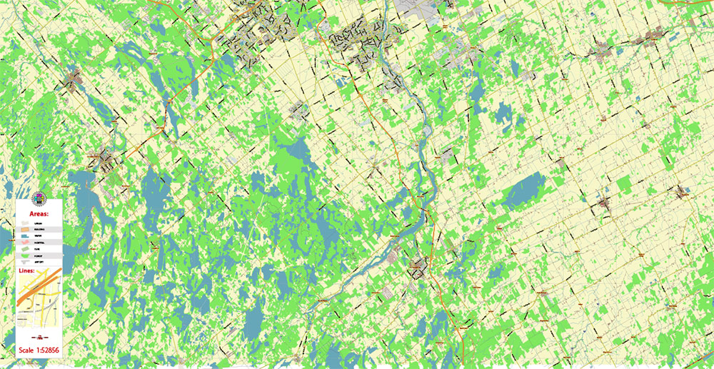
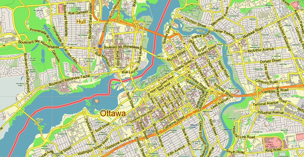
Ottawa Canada PDF Vector Map: City Plan Low Detailed (for small print size) Street Map editable Adobe PDF in layers

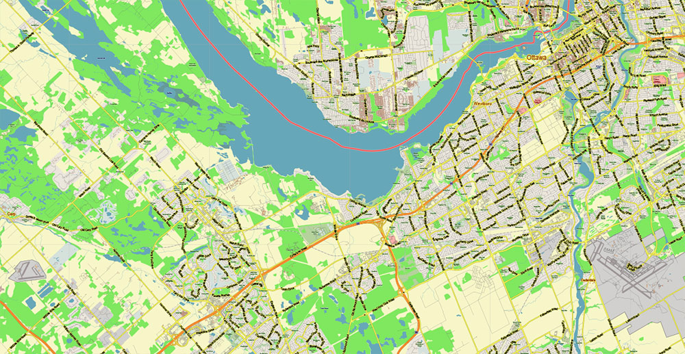
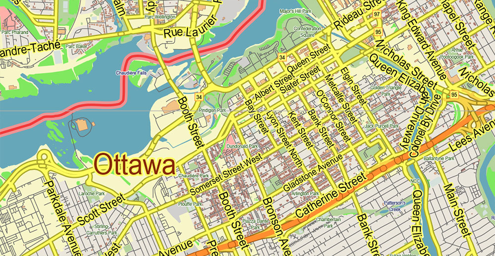
Ottawa Canada PDF Vector Map: City Plan Low Detailed (for small print size) Street Map editable Adobe PDF in layers

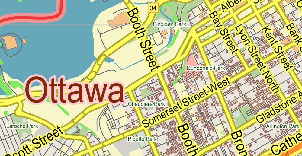
Ottawa Canada PDF Vector Map: City Plan Low Detailed (for small print size) Street Map editable Adobe PDF in layers
Ottawa Canada PDF Vector Map: City Plan Low Detailed (for small print size) Street Map editable Adobe PDF in layers
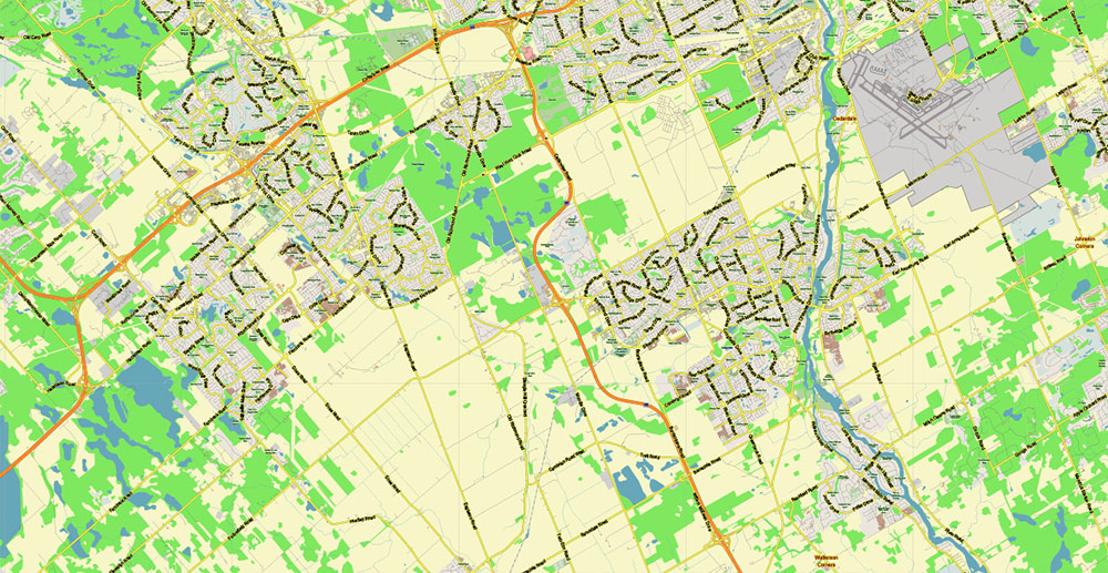
Ottawa Canada PDF Vector Map: City Plan Low Detailed (for small print size) Street Map editable Adobe PDF in layers
Ottawa Canada PDF Vector Map: City Plan Low Detailed (for small print size) Street Map editable Adobe PDF in layers

Ottawa Canada PDF Vector Map: City Plan Low Detailed (for small print size) Street Map editable Adobe PDF in layers
Ottawa Canada PDF Vector Map: City Plan Low Detailed (for small print size) Street Map editable Adobe PDF in layers
Ottawa Canada PDF Vector Map: City Plan Low Detailed (for small print size) Street Map editable Adobe PDF in layers
Ottawa Canada PDF Vector Map: City Plan Low Detailed (for small print size) Street Map editable Adobe PDF in layers

 Author: Kirill Shrayber, Ph.D. FRGS
 Street Map editable Adobe Illustrator in layers")


