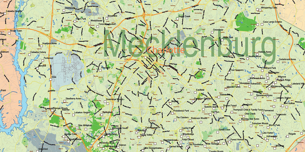
Extended Description of the Vector Map
Printable Vector Map of North Carolina US Extended detailed Roads Admin (addon layers – Cities by Population) scale 1:61578 full editable Adobe Illustrator Road Map in layers, scalable, text format all names, 144 MB ZIP
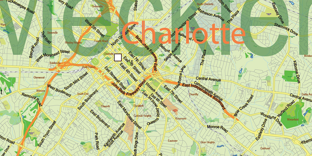
Principal street names, Main Objects. Map for design, printing, arts, projects, presentations, for architects, designers, and builders, business, logistics.
Included: Simple vector map North Carolina.
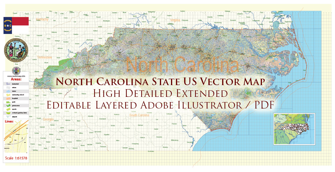
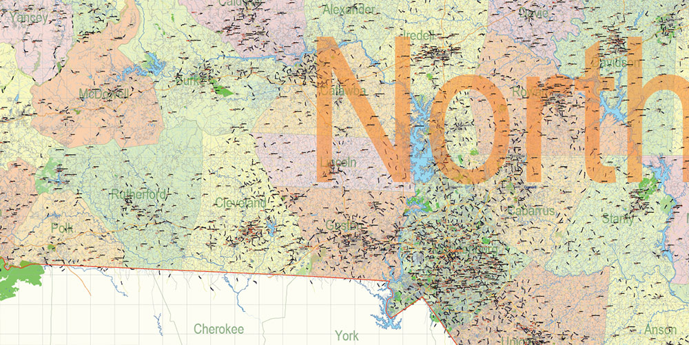
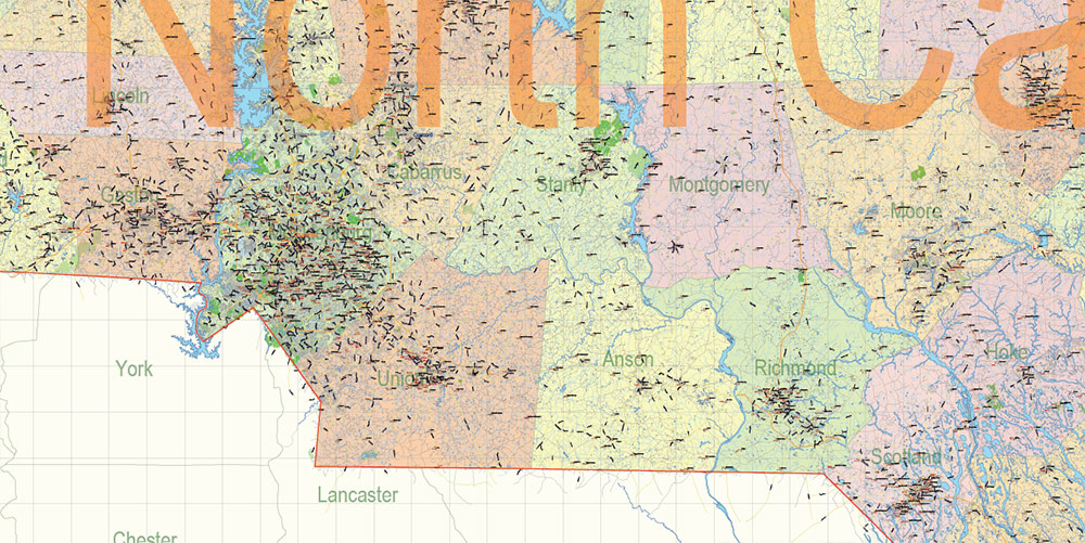
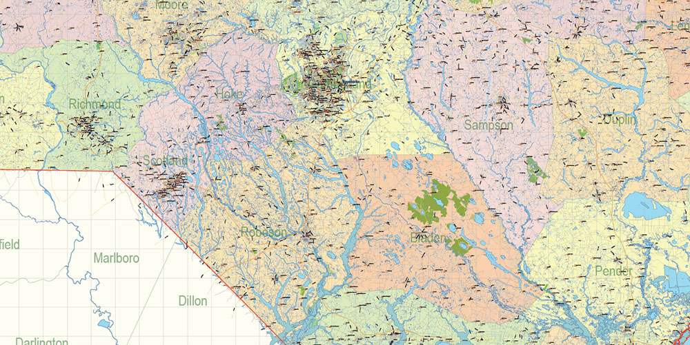
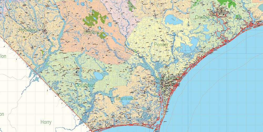
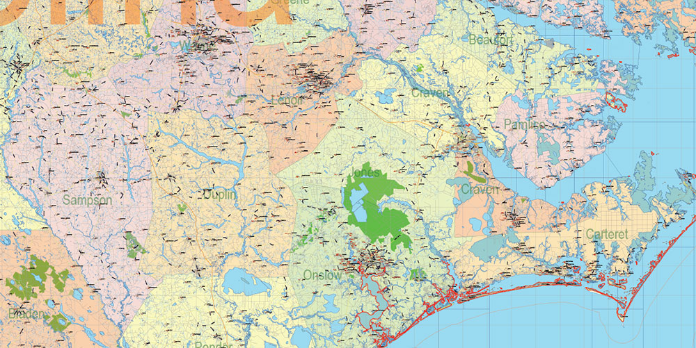
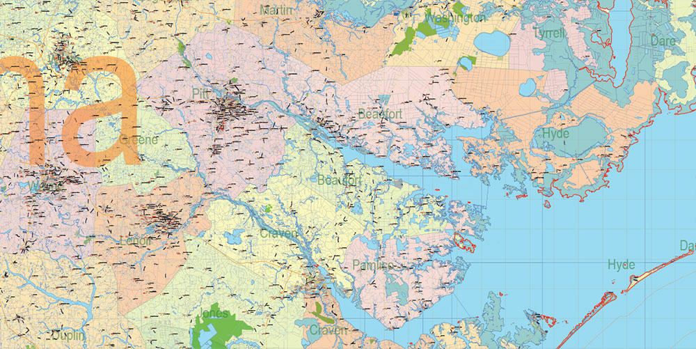
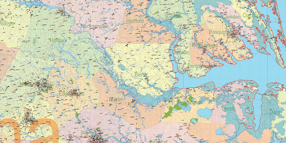
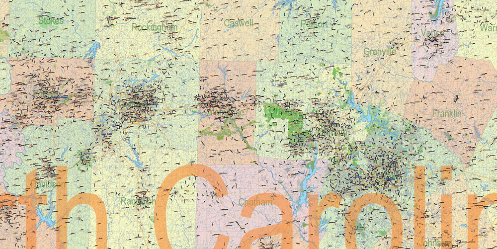
North Carolina State US Map Vector Exact Extended High Detailed Road Admin Map editable Adobe Illustrator in layers
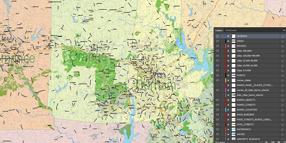
Layers list North Carolina State Roads Admin map:
- Legend
- Grids
- Labels of roads
- Addon layers – Cities by population categories + addon points
- Points of airports
- Names of airports
- Names of places (city, hamlet, etc.)
- Names of cities, towns, hamlets 2
- Names of objects (hospitals, schools, parks, water)
- Points of cities, towns, hamlets
- Names of Main streets
- Main Streets, roads.
- Civil streets
- Railroads
- Waterways (lines)
- Water objects (rivers, lakes, ponds) areas
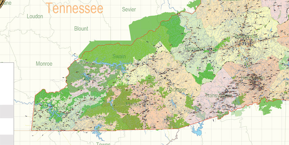
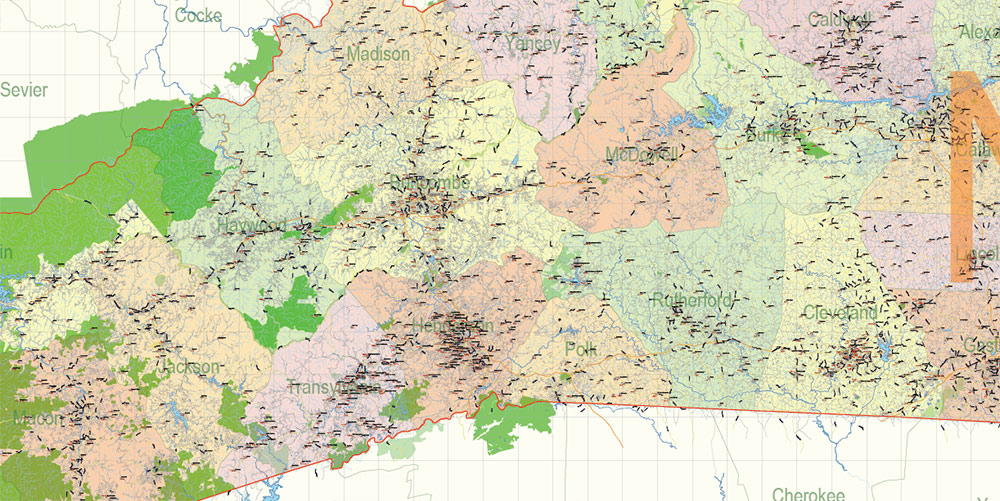
- Names of Counties
- Names of States
- Zipcodes areas
- Zipcodes numbers
- Counties areas
- States areas
- Color fills (parks, hospital areas, school areas, etc.)
- Background and sea
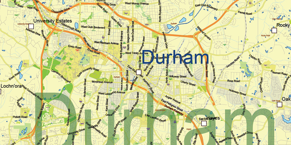
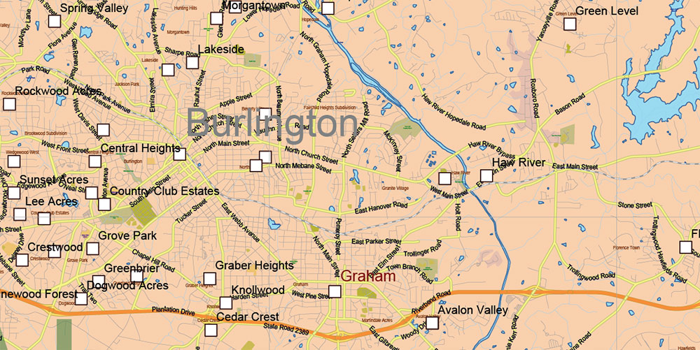
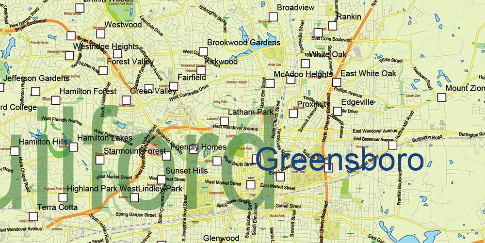
The most exact and detailed map of the State North Carolina in scale.
ALSO: DWG, DXF, CDR and other formats: free convert for our customers.
For Editing and High-Quality Printing
North Carolina State US Map Vector Exact Extended High Detailed Road Admin Map editable Adobe Illustrator in layers
North Carolina State US Map Vector Exact Extended High Detailed Road Admin Map editable Adobe Illustrator in layers
North Carolina State US Map Vector Exact Extended High Detailed Road Admin Map editable Adobe Illustrator in layers
North Carolina State US Map Vector Exact Extended High Detailed Road Admin Map editable Adobe Illustrator in layers
North Carolina State US Map Vector Exact Extended High Detailed Road Admin Map editable Adobe Illustrator in layers
North Carolina State US Map Vector Exact Extended High Detailed Road Admin Map editable Adobe Illustrator in layers
North Carolina State US Map Vector Exact Extended High Detailed Road Admin Map editable Adobe Illustrator in layers
North Carolina State US Map Vector Exact Extended High Detailed Road Admin Map editable Adobe Illustrator in layers
North Carolina State US Map Vector Exact Extended High Detailed Road Admin Map editable Adobe Illustrator in layers
North Carolina State US Map Vector Exact Extended High Detailed Road Admin Map editable Adobe Illustrator in layers
North Carolina State US Map Vector Exact Extended High Detailed Road Admin Map editable Adobe Illustrator in layers
North Carolina State US Map Vector Exact Extended High Detailed Road Admin Map editable Adobe Illustrator in layers
North Carolina State US Map Vector Exact Extended High Detailed Road Admin Map editable Adobe Illustrator in layers
North Carolina State US Map Vector Exact Extended High Detailed Road Admin Map editable Adobe Illustrator in layers
North Carolina State US Map Vector Exact Extended High Detailed Road Admin Map editable Adobe Illustrator in layers
North Carolina State US Map Vector Exact Extended High Detailed Road Admin Map editable Adobe Illustrator in layers
Author Rating
Aggregate Rating
no rating based on 0 votes
@vectormapper
Product Name North Carolina US Map Vector Exact Plan High Detailed Road Admin Map editable Adobe Illustrator in layers
Price
USD 79
Product Availability
Available in Stock


 Author: Kirill Shrayber, Ph.D. FRGS

