Extended Description of the Vector Map
Printable PDF Shaded Relief Vector Map of Minnesota State US extra high detailed State Plan fully editable Adobe PDF Road Map in layers, scalable, text/curves format all names, 755 MB ZIP
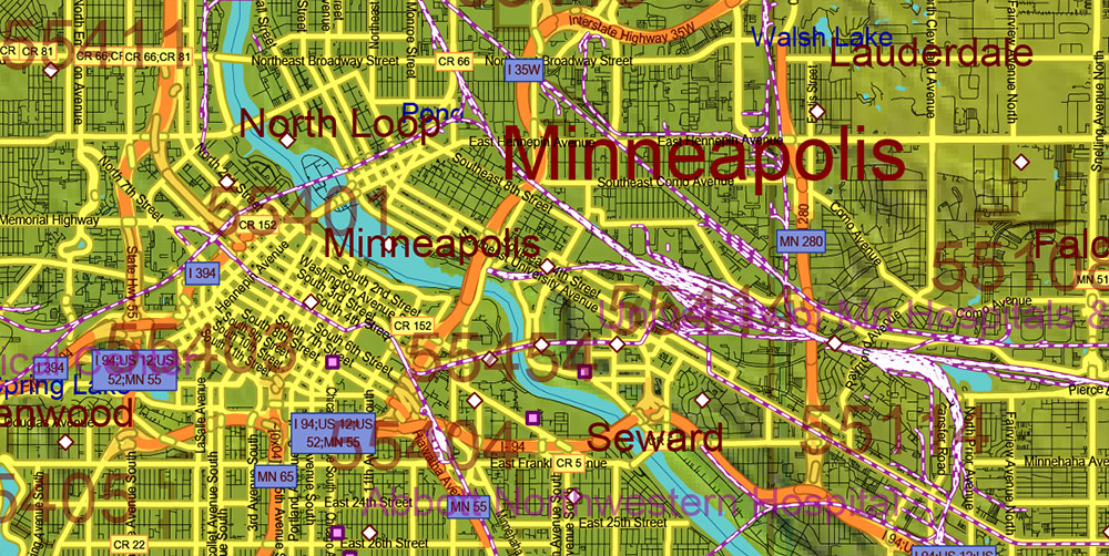
All Roads and Streets, All cities, towns and villages, Counties, Zip (postal) codes, Airports, Shaded Relief raster. Map for design, printing, arts, projects, presentations, for architects, designers, and builders, business, logistics.
NOTE: on the preview images – all layers are enabled. You can simply turn off any layer, which you don’t need.
Also: We can add (additional layer for this map), any other objects for you. It’s free for our customers.
If you need any OTHER format – DWG, DXF, Corel, or something else – please, email us
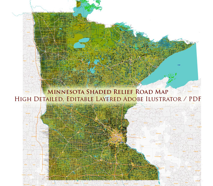
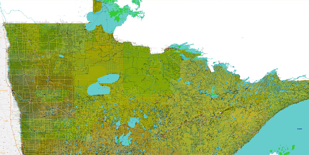
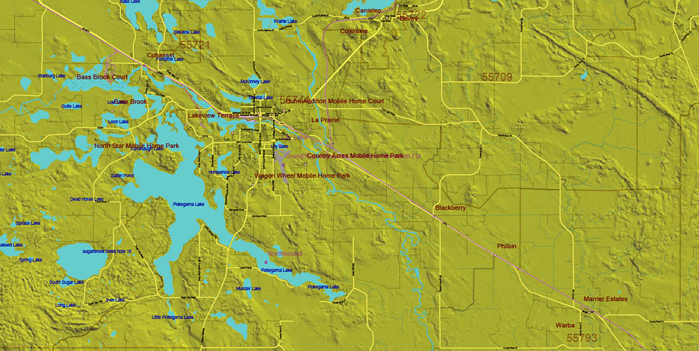
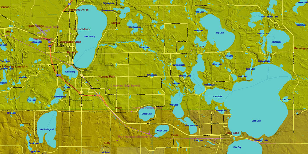
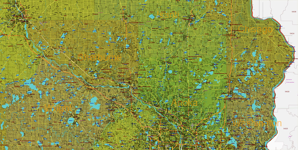
Minnesota State US Shaded Relief Vector Map: Full Extra High Detailed (all roads, zipcodes, airports) + Admin Areas + main road names and shields editable Adobe Illustrator in layers
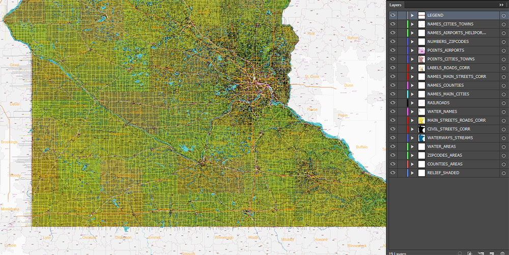
Layers list:
- Legend
- Names of places (city, hamlet, etc.)
- Points of Places
- Points of Airports, Heliports
- Names of water objects
- Names of Airports and Heliports
- Names of Main Cities
- Names of Counties
- Numbers of Zip codes
- Main Road shields (labels)
- Main roads and streets names
- Main Streets and Roads
- Residential streets and small roads
- Railroads
- Waterways / streams
- Water objects (rivers, lakes, ponds, islands)
- ZIP-codes areas
- Counties areas (color)
- Shaded Relief Raster JPG
AO BRIEF — MINNESOTA (STATEWIDE)
Shaded Relief • Extra-High Detail
Operational Overview
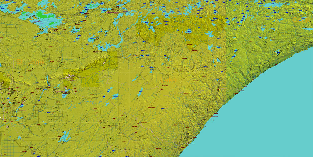
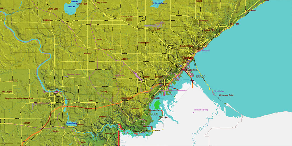
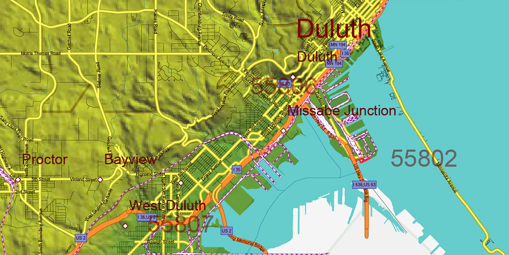
Statewide shaded relief vector map of Minnesota with extra-high detail and full transport, administrative, and settlement coverage. Engineered for professional design, analytical work, and large-scale printing with no loss of precision.
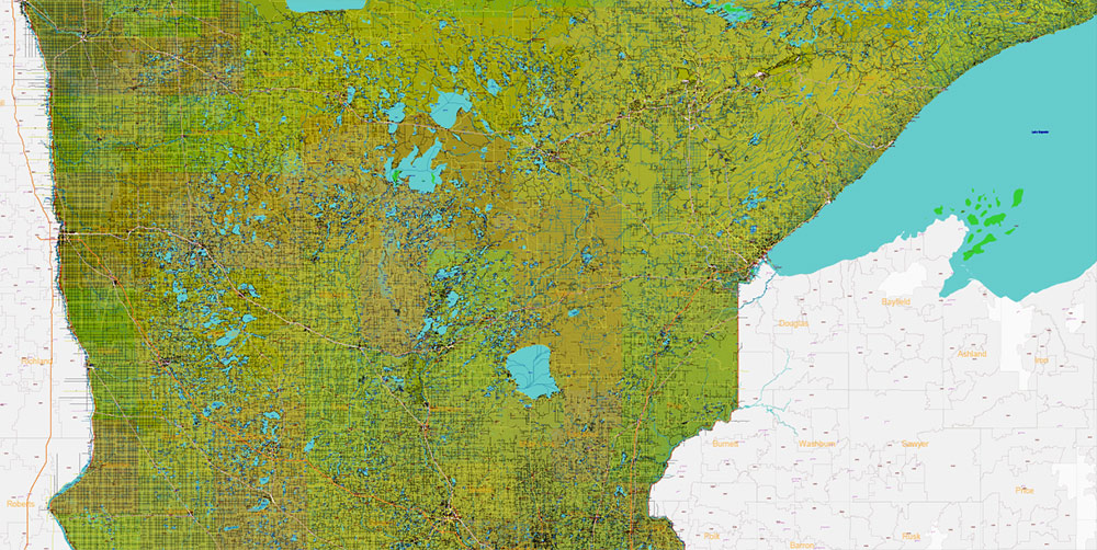
Terrain & Shaded Relief
-
Subtle shaded relief revealing Minnesota’s low-to-moderate relief profile
-
Clear differentiation between the Canadian Shield uplands, Central Lowlands, river valleys, and glacial lake plains
-
Terrain shading enhances spatial depth without overwhelming dense road and urban data
-
Glacial landforms, drainage patterns, and elevation transitions remain legible at all scales
Lines of Communication (Road Network)
-
ALL roads and streets included, from interstates to local streets
-
Road hierarchy maintained across urban, suburban, and rural areas
-
Designed for transport visualization, logistics planning, and accessibility analysis
Urban & Human Terrain
-
All cities, towns, and villages included and labeled
-
Settlement distribution clearly reflects transport corridors, water systems, and terrain constraints
-
Suitable for demographic, economic, and regional planning layouts
Administrative & Postal Structure
-
Counties fully delineated and labeled
-
ZIP (postal) code boundaries included as analytical layers
-
Layered structure allows selective display for planning, business, and presentation use
Hydrography & Natural Systems
-
Extensive lake systems, rivers, and wetlands accurately integrated
-
Water features clearly readable against shaded terrain
-
Supports environmental, infrastructure, and land-use visualization
Aviation & Infrastructure Nodes
Map Engineering & Format
-
Fully editable vector Adobe PDF with layered organization
-
All labels in text and curves format — no rasterized names
-
Shaded relief supplied as high-quality raster layer
-
Scalable without resolution limits for large-format print
Command Takeaways
-
Terrain-aware, data-dense cartography optimized for professional use
-
Shaded relief adds depth while preserving clarity
-
Suitable for architects, designers, planners, logistics, and business analysis
-
Built for users requiring maximum detail, control, and print flexibility
Minnesota State US Shaded Relief Vector Map: Full Extra High Detailed (all roads, zipcodes, airports) + Admin Areas + main road names and shields editable Adobe Illustrator in layers
Minnesota State US Shaded Relief Vector Map: Full Extra High Detailed (all roads, zipcodes, airports) + Admin Areas + main road names and shields editable Adobe Illustrator in layers
Minnesota State US Shaded Relief Vector Map: Full Extra High Detailed (all roads, zipcodes, airports) + Admin Areas + main road names and shields editable Adobe Illustrator in layers
Minnesota State US Shaded Relief Vector Map: Full Extra High Detailed (all roads, zipcodes, airports) + Admin Areas + main road names and shields editable Adobe Illustrator in layers
Minnesota State US Shaded Relief Vector Map: Full Extra High Detailed (all roads, zipcodes, airports) + Admin Areas + main road names and shields editable Adobe Illustrator in layers
Minnesota State US Shaded Relief Vector Map: Full Extra High Detailed (all roads, zipcodes, airports) + Admin Areas + main road names and shields editable Adobe Illustrator in layers
Minnesota State US Shaded Relief Vector Map: Full Extra High Detailed (all roads, zipcodes, airports) + Admin Areas + main road names and shields editable Adobe Illustrator in layers
Minnesota State US Shaded Relief Vector Map: Full Extra High Detailed (all roads, zipcodes, airports) + Admin Areas + main road names and shields editable Adobe Illustrator in layers
Minnesota State US Shaded Relief Vector Map: Full Extra High Detailed (all roads, zipcodes, airports) + Admin Areas + main road names and shields editable Adobe Illustrator in layers

Minnesota State US Shaded Relief Vector Map: Full Extra High Detailed (all roads, zipcodes, airports) + Admin Areas + main road names and shields editable Adobe Illustrator in layers
Minnesota State US Shaded Relief Vector Map: Full Extra High Detailed (all roads, zipcodes, airports) + Admin Areas + main road names and shields editable Adobe Illustrator in layers

Minnesota State US Shaded Relief Vector Map: Full Extra High Detailed (all roads, zipcodes, airports) + Admin Areas + main road names and shields editable Adobe Illustrator in layers

Minnesota State US Shaded Relief Vector Map: Full Extra High Detailed (all roads, zipcodes, airports) + Admin Areas + main road names and shields editable Adobe Illustrator in layers

Minnesota State US Shaded Relief Vector Map: Full Extra High Detailed (all roads, zipcodes, airports) + Admin Areas + main road names and shields editable Adobe Illustrator in layers

Minnesota State US Shaded Relief Vector Map: Full Extra High Detailed (all roads, zipcodes, airports) + Admin Areas + main road names and shields editable Adobe Illustrator in layers

 Author: Kirill Shrayber, Ph.D. FRGS

 Street Map editable Adobe Illustrator in layers")