Extended Description of the Vector Map
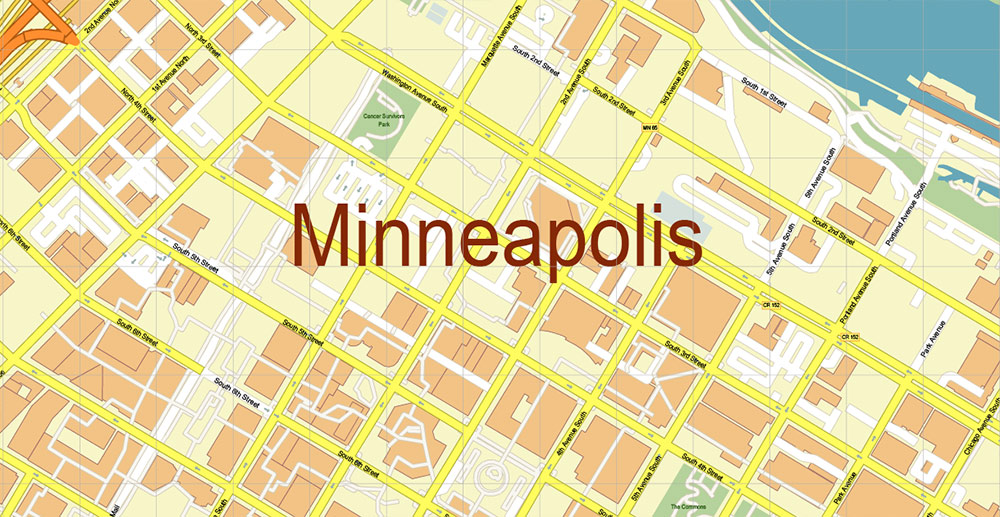
Minneapolis is the largest city in the state of Minnesota, bordering its capital, the city of St. Paul. Despite the fact that they are very often called twin cities, they have clearly defined borders and their own governing bodies. Minneapolis looks more modern and concise, which is facilitated by numerous high-rises and wide streets. According to the most authoritative publication of business circles – Forbes magazine — the twin city of St. Paul is recognized as a city where the most affordable housing prices and high quality of life are combined.
Minneapolis residents have a special sense of friendliness and lack of snobbery, and this is despite the fact that the city ranks third in the United States in terms of education, after Washington and Seattle. It is not surprising that the basis of the city’s attractions are museums and theaters — leisure here is rich and cultural.
How to get
There are several ways to get to Minneapolis: by flights (American Airlines, Southwest Airlines, United Airlines, US Airways, and other air carriers), by train (a major train station is located in St. Paul, almost on the border with Minneapolis), by bus or by car from almost any other city or state in America.
By plane
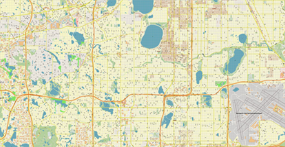
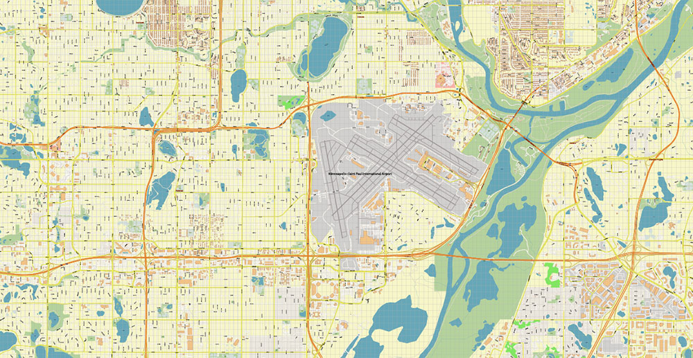
Minneapolis / St. Paul International Airport consists of two terminals: Charles Lindbergh Terminal-1 and Hubert Humphrey Terminal-2. Most flights are operated at Terminal 1.
90% of all departures and arrivals at the airport are Delta flights. From the airport to downtown Minneapolis, passengers are transported by the Hiawatha Light Rail line. The fare is 1.75-2.25 USD depending on the time of day.
By train
Amtrak trains from Chicago and Seattle arrive at Midway Station, located in St. Paul near the border with Minneapolis. From the railway station to Minneapolis can be reached by taxi or bus number 16.
Northstar trains connect the northwest suburbs and downtown Minneapolis.
By bus
Greyhound buses connect Minneapolis to Chicago and Milwaukee, and Jefferson Lines buses connect South Dakota. Buses from both companies arrive at the Hawthorne Transportation Center, located in downtown Minneapolis.
By car
The main thoroughfares leading into the city are I — 35W and I-94, both extending all the way to Downtown Minneapolis. The I-35W highway crosses the city from north to south and I-94-from east to west.
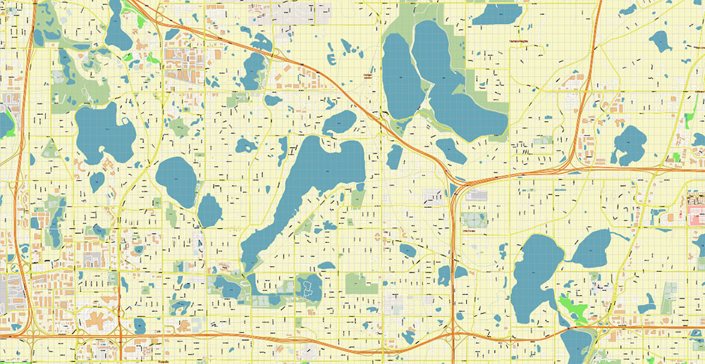
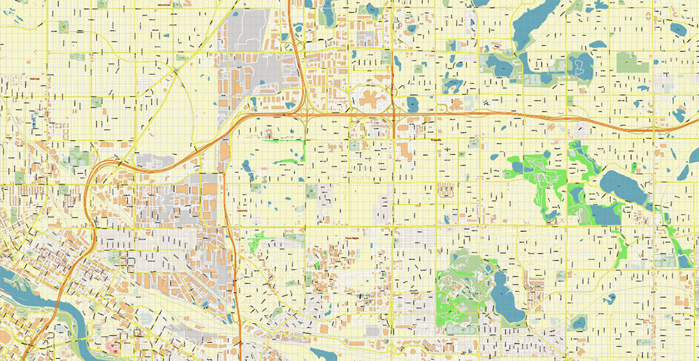
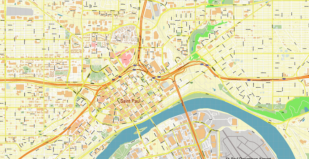
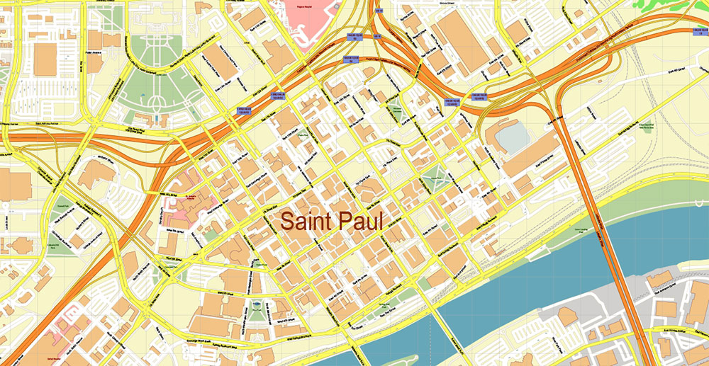
Printable PDF Vector Map of Minneapolis + Saint Paul Minnesota US detailed City Plan scale 1:3322 full editable Adobe PDF Street Map in layers, scalable, text format all names, 105 MB ZIP
All street names, Main Objects, Buildings. Map for design, printing, arts, projects, presentations, for architects, designers, and builders, business, logistics.
If you need: We can add some objects to this map (add-on layers) – for example, zip codes areas with numbers, or any other.
Free for our customers.
Need AutoCAD DWG / DXF or any other format? Please, contact us!
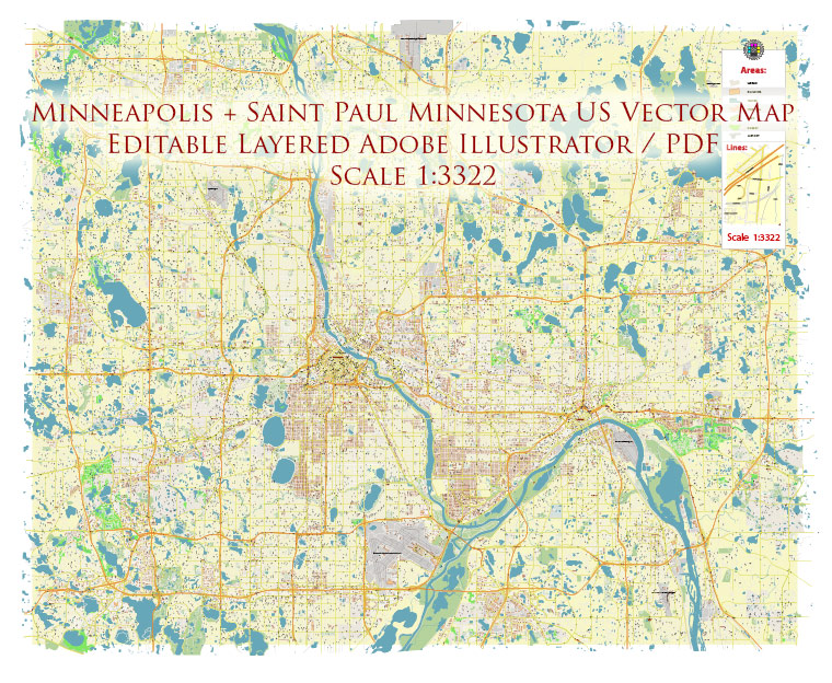
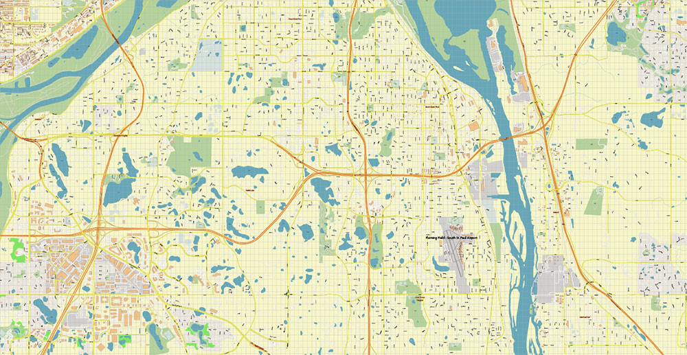
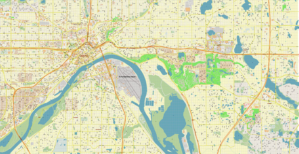
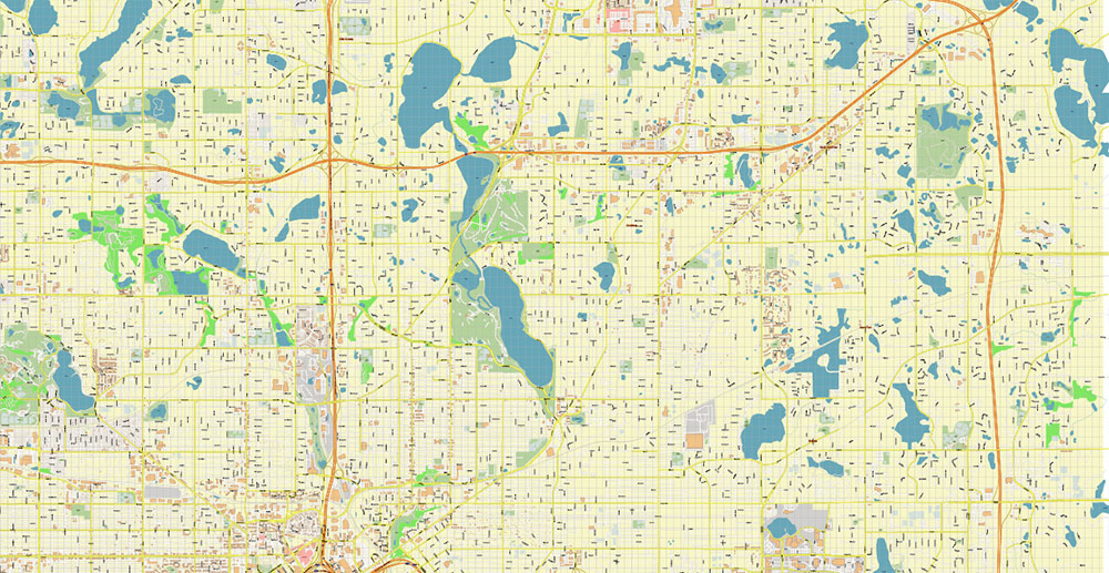
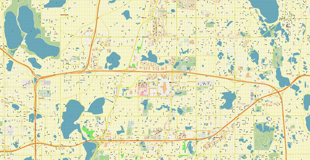
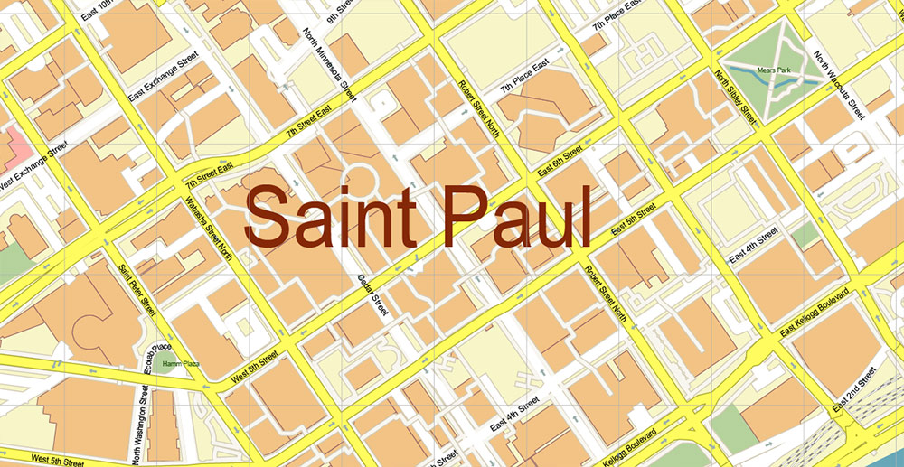
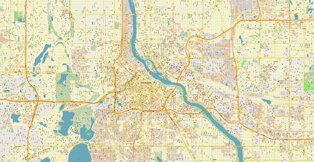
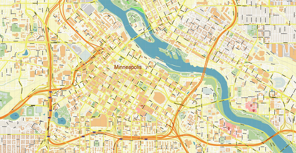
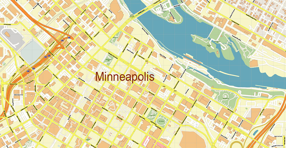
Minneapolis + Saint Paul Minnesota US PDF Vector Map: Accurate High Detailed City Plan editable Adobe PDF Street Map in layers
Layers list:
- Legend
- Grids
- Labels of roads
- Names of places (city, hamlet, etc.)
- Names of objects (hospitals, parks, water)
- Names of main streets
- Names of civil streets
- Arrows of street drive direction
- Main Streets, roads
- Civil streets
- Railroads
- Buildings
- Airports and heliports
- Water objects (rivers, lakes, ponds)
- Waterways
- Color fills (parks, hospital areas, land use, etc.)
- Background
Minneapolis + Saint Paul Minnesota US PDF Vector Map: Accurate High Detailed City Plan editable Adobe PDF Street Map in layers
Minneapolis + Saint Paul Minnesota US PDF Vector Map: Accurate High Detailed City Plan editable Adobe PDF Street Map in layers
Minneapolis + Saint Paul Minnesota US PDF Vector Map: Accurate High Detailed City Plan editable Adobe PDF Street Map in layers
Minneapolis + Saint Paul Minnesota US PDF Vector Map: Accurate High Detailed City Plan editable Adobe PDF Street Map in layers
Minneapolis + Saint Paul Minnesota US PDF Vector Map: Accurate High Detailed City Plan editable Adobe PDF Street Map in layers
Minneapolis + Saint Paul Minnesota US PDF Vector Map: Accurate High Detailed City Plan editable Adobe PDF Street Map in layers
Minneapolis + Saint Paul Minnesota US PDF Vector Map: Accurate High Detailed City Plan editable Adobe PDF Street Map in layers
Minneapolis + Saint Paul Minnesota US PDF Vector Map: Accurate High Detailed City Plan editable Adobe PDF Street Map in layers
Minneapolis + Saint Paul Minnesota US PDF Vector Map: Accurate High Detailed City Plan editable Adobe PDF Street Map in layers
Minneapolis + Saint Paul Minnesota US PDF Vector Map: Accurate High Detailed City Plan editable Adobe PDF Street Map in layers
Minneapolis + Saint Paul Minnesota US PDF Vector Map: Accurate High Detailed City Plan editable Adobe PDF Street Map in layers
Minneapolis + Saint Paul Minnesota US PDF Vector Map: Accurate High Detailed City Plan editable Adobe PDF Street Map in layers
Minneapolis + Saint Paul Minnesota US PDF Vector Map: Accurate High Detailed City Plan editable Adobe PDF Street Map in layers
Minneapolis + Saint Paul Minnesota US PDF Vector Map: Accurate High Detailed City Plan editable Adobe PDF Street Map in layers
Minneapolis + Saint Paul Minnesota US PDF Vector Map: Accurate High Detailed City Plan editable Adobe PDF Street Map in layers


 Author: Kirill Shrayber, Ph.D. FRGS

 Street Map editable Adobe Illustrator in layers")
 full editable, Adobe Illustrator")