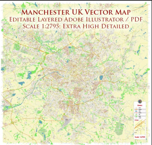
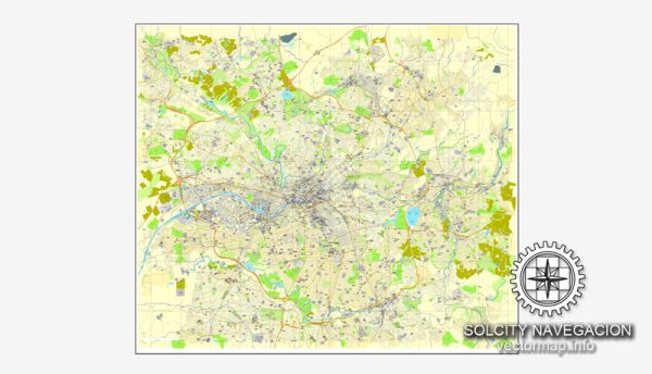
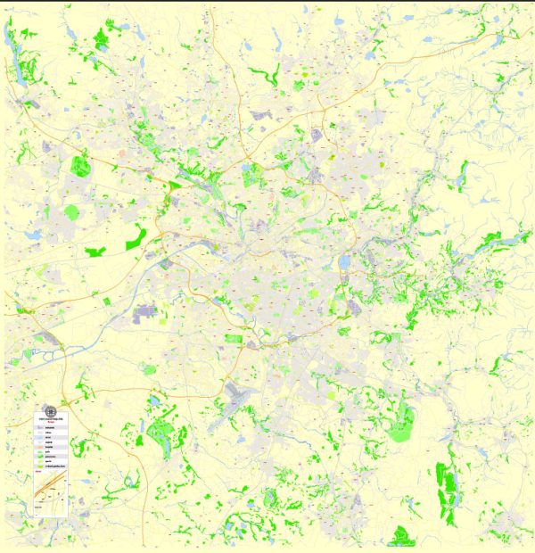
About editable vector map of Manchester, England
Archive size: 52 Mb, AI zipped
Download a free example of Manchester map in vector.
DPI: 300
License: Royalty Free
We provide editable vector maps of Manchester in all possible vector formats: [.AI], [.DWG], [.PDF], [.EPS]; [.CDR], [.DXF]
You can edit all map data using different vector graphics editors like Adobe Illustrator, Freehand or CorelDraw, cropping, changing colors, fonts or borders, also adding your company logo or necessary objects. And also is a fully scalable map, no matter what size you need.
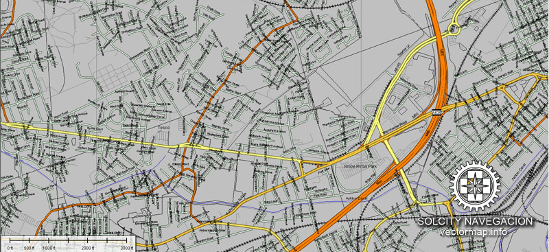
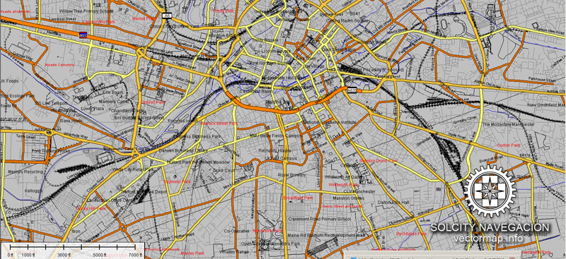
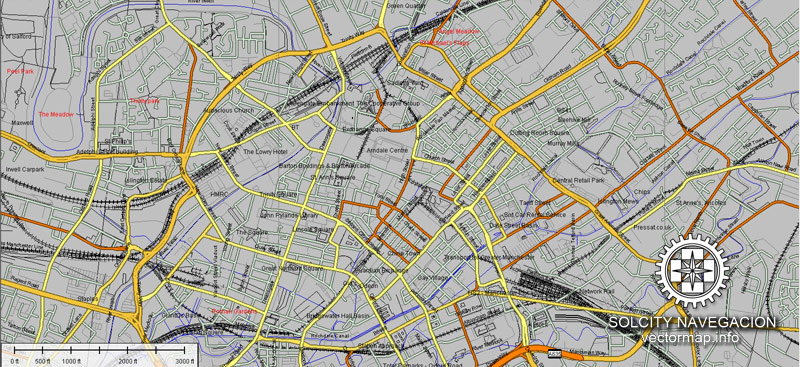
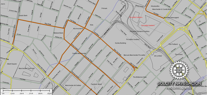
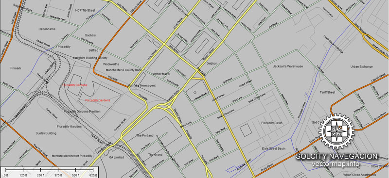
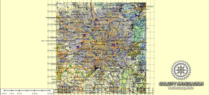
Manchester vector map features (check the preview images):
Highways with names,
Major streets with names,
Major Roads,
Airports,
Houses,
Railway,
Minor Roads,
Private Roads,
Cemeteries,
Big and small Rivers, small streams also,
Lake, ponds and other water bodies,
Landmark fill,
County Borders with fill,
Parks.
Probably you need more data on map? Please feel free to contact us, and we add it with no problem.
Manchester, England.
This vector map of Manchester city is used as a basis for design, editing, and further printing.
This is the most detailed, exact map of Manchester city for high-quality printing and polygraphy. You can always clarify the map development date by contacting us.
For your convenience, all objects on Manchester vector city map are divided into layers. And the editing is very easy – colors, lines, etc.
You can easily add any objects needed (e.g. shops, salons, sale points, gas station or attraction) on any layer of Manchester vector map.
One of the advantages of Manchester city vector maps of our production is the relevance of cartographic data, we constantly update all our products.c
Manchester is a city and metropolitan borough in Greater Manchester, England, with a population of 545,500 as of 2017. It lies within the United Kingdom’s third-most populous metropolitan area, with a population of 3.2 million. It is fringed by the Cheshire Plain to the south, the Pennines to the north and east, and an arc of towns with which it forms a continuous conurbation. The local authority is Manchester City Council.
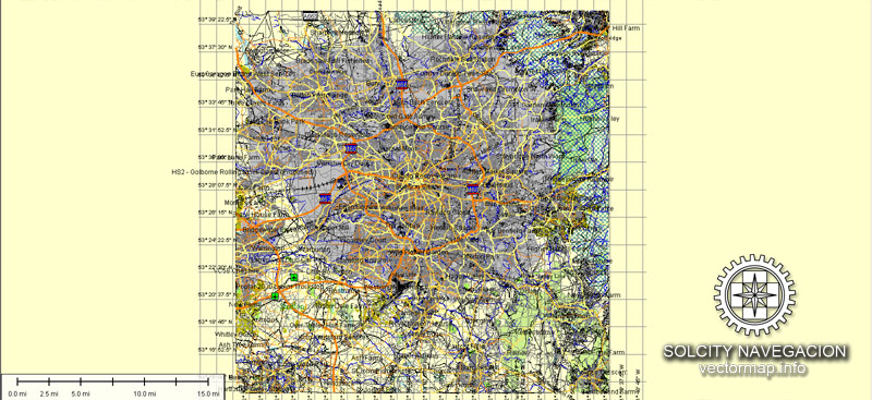
This vector map of Manchester city is used by:
designers, layout designers, printers, advertisers and architects. Our product – vector maps – is designed for further editing and printing in large formats – from @Wall format (a few meters) to A-0 and A-1, A-2, A-3.
The Manchester city map in vector format is used for design, urban planning, presentations and media visualizations.
The advertising and presentation map of Manchester city (usually the final designer marks the routes, and puts the client’s objects (shops, saloons, gas stations etc.)
The undoubted advantage is that people will NEVER throw out this advertising product – the map. In fact, as an advertising medium, a city map is the most “long-playing” of the well-known polygraphic advertising media, with the longest lifespan, and the maximum number of interactions with the customer.
For travelers, maps are sold at the airports and gas stations around the world. Often the source is our vector maps.
The recorded history of Manchester began with the civilian settlement associated with the Roman fort of Mamucium or Mancunium, which was established in about AD 79 on a sandstone bluff near the confluence of the rivers Medlock and Irwell. It was historically a part of Lancashire, although areas of Cheshire south of the River Mersey were incorporated in the 20th century. The first to be included, Wythenshawe, was added to the city in 1931. Throughout the Middle Ages Manchester remained a manorial township, but began to expand “at an astonishing rate” around the turn of the 19th century. Manchester’s unplanned urbanisation was brought on by a boom in textile manufacture during the Industrial Revolution, and resulted in it becoming the world’s first industrialised city.
Take a look, who purchases our vector maps of Manchester city in “Our Clients and Friends” page – these are large and small companies, from super-brands like Volvo and Starbucks, to small design studios and printing houses.
It’s very easy to work with vector maps of Manchester city, even for a not very experienced designer who can turn on and off the map layers, add new objects, change the colors of fill and lines according to customer requirements.
The undoubted advantage of Manchester city vector maps in printing is an excellent and detailed visualization, when customer can expand a large paper map and instantly define his location, find a landmark, an object or address on map, unlike using the popular electronic formats of Google and Yandex maps for example.
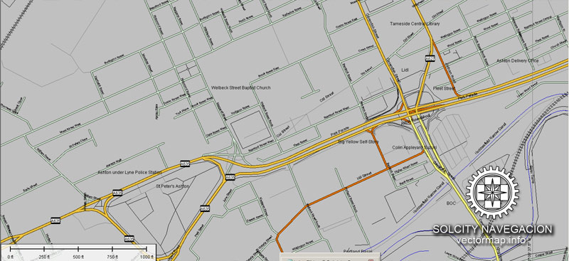
Printable vector maps of Manchester city are much more convenient and efficient than any electronic maps on your smartphone, because ALL DETAILS are displayed in the entire space of Manchester city map.
Useful tips on working with vector maps of cities and countries in Adobe Illustrator.
«V» – launches the Selection tool (cursor, black arrow), which makes active any vector line.
«А» – launches the Direct Selection tool (white cursor), allows you to select curve elements and drag them to the desired place.
«R» – activates the Rotate tool, which helps you rotating selected objects around the center point by 360 degrees.
«E» – gives you the opportunity to use the Eraser tool and erase unnecessary parts.
«X» – switches between Fill and Stroke in the Tools section. Try to get used to this hot key and
you will quickly understand that you can’t live and work without it.
Guides are not limited to vertical and horizontal in Adobe Illustrator. You can also create a diagonal guide for example. Moreover, you can turn any contours into guides. Select the outline and go to View > Guides > Make Guides (Create Guides), or simply press Cmd/Ctrl + 5. You can also turn the guides back into an editable object. Go to menu, View > Guides > Unlock Guides (Release Guides), select the guide you want to edit and select View > Guides > Release Guides (Reset Guides), or just press Cmd/Ctrl + Option / Alt + 5).
You will probably want to change the color scheme used on our Manchester vector city map.
To quickly and effectively play with colors.
Of course, you can do it manually, all objects in our Manchester city vector map are divided according to types and layers, and you can easily change the color gamma of vector objects in groups and layers.
But there is more effective way of working with the whole VECTOR MAP of Manchester city and all layers:
The overview dialog «Edit colors»/«Repaint Graphic Object» (this dialog box name can change depending on the context):
If you have selected a part or a layer of Manchester city vector map and open the dialog box by clicking the icon in the Control panel, on the Samples palette or the Color Catalog, or if you choose Edit > Edit Colors> Repaint Graphic Object, then the «Repaint Graphic Object» dialog box appears, and you get access to «Assign» and «Edit» tabs.
If a picture or a map fragment is not selected, and you open the dialog box by clicking the icon in the Control panel, on the Samples palette or in the Color Catalog, the «Edit Colors» dialog box appears and you can only access the «Edit» tab.
Regardless of the name at the top of the dialog box, the right-hand side always displays the color group of the current document, as well as two default color groups: Print Color and Grayscale. These color groups can be selected and used any time.
Create and edit color groups of Manchester city vector map, and also assign colors using the «Edit Colors»/ а «Repaint Graphic Object» dialog box.
A. Creating and editing of a color group on the «Edit» tab
B. Assigning colors on the «Assign» tab
C. Select a group of colors from the «Color groups» list
The option «Repaint a graphic object» in the lower part of the dialog box allows you to preview the colors on a selected layer of Vector map, or a group of elements, and specify whether its colors will be redefined when the dialog box is closed.
The main areas of the dialog box are:
«Edit»
The «Edit» tab is designed to create a new or edit the existing color groups.
The harmony rules Menu and the Color Wheel are used to conduct experiments with color harmonies. The color wheel shows how colors are related in color harmony, and the color bars allow you to view and manipulate an individual color values. In addition, you can adjust the brightness, add and remove colors, save color groups and view colors on the selected Vector Map of Manchester city or a separated layers.
«Assign»
The «Assign» tab is used to view and control on how the original colors are replaced with colors from the color group like your corporate colors in the Vector Map of Manchester city.
The assign color ability is provided only if the entire map, layer or fragment is selected in the document. You can specify which of new colors replace the current colors, whether the spot colors should be preserved and how colors are replaced (for example, you can replace colors completely or changing the color tone while maintaining the brightness). The «Assign» tab allows you to redefine colors in the Vector Map of Manchester city, or in separate layers and fragments using the current color group or reducing the number of colors in the current Vector Map.
Color groups
Is a list of all saved color groups for current document (the same groups appear in the «Samples» palette). You can edit and delete the existing color groups, as well as creating a new ones using the list of “Color Groups” in the dialog box. All changes appear in the «Samples» palette.
The highlighted color group shows, which color group is currently edited.
Any color group can be selected and edited, or used to redefine the colors in the selected vector map of Manchester city, its fragments or elements.
Saving a color group adds this group to the specified list.
Opening the «Edit Colors»/«Repaint Graphic Object» dialog box.
Open the «Edit Colors»/«Repaint Graphic Object» dialog box using one of the following methods:
«Edit»> «Edit Colors»> «Repaint Graphic object» or «Repaint With Style».
Use these commands if you need to edit the colors in the selected vector map of Manchester city.
«Repaint Graphic object» button on the «Control» panel.
Use this button if you need to adjust colors of Manchester city vector map using the а «Repaint graphic object» dialog box.
The specified button is available if the selected vector map or its fragment contains two or more colors.
Note. This color editing method is convenient for global color adjustment in a vector map, if global colors were not used when creating a City Map of Manchester.
The «Edit colors» button or «Edit or apply colors» on the «Color Catalog» palette
Click this button if you need to edit colors on the «Color Catalog» palette or edit and then apply them to the selected Vector Map of Manchester city or its fragment.
The «Edit color group» button or «Edit or apply color group» on the «Samples» palette.
Click this button if you need to edit the colors in the specific color group or edit and apply them to the selected Vector Map of Manchester city or a group of its elements, for example, the whole layer “Streets and lines”. You can also double-click the color group in the Samples panel to open the dialog box.
If the map file is too large and your computer freezes or even can’t open it quickly:
1. Try to reduce the color resolution of the video card (display) to 256 colors while working with a large map.
2. Using Windows Task Manager, select all the application you don’t need, while working with map, just turn them off.
3. Launch Adobe Illustrator. (DO NOT OPEN the vector map file)
4. Start the Windows Task Manager using administrator rights > Find the “Illustrator” process > set the «real time» priority,
5. Open the file. When you see the LEGACY FONT popup window – click “OK” (do not update). You can restore the TEXT later.
6. Can also be useful: When file is opened – Edit > Settings > Basic Settings > disable smoothing. /// It looks scary, but works quickly)))
We recommend saving the file in Adobe Illustrator 10 version. It’s much more stable when working with VERY BIG size files.
Manchester achieved city status in 1853. The Manchester Ship Canal opened in 1894, creating the Port of Manchester and directly linking the city to the Irish Sea, 36 miles (58 km) to the west. Its fortune declined after the Second World War, owing to deindustrialisation, but the IRA bombing in 1996 led to extensive investment and regeneration.
In 2014, the Globalisation and World Cities Research Network ranked Manchester as a beta world city, the highest-ranked British city apart from London. Manchester is the third-most visited city in the UK, after London and Edinburgh. It is notable for its architecture, culture, musical exports, media links, scientific and engineering output, social impact, sports clubs and transport connections. Manchester Liverpool Road railway station was the world’s first inter-city passenger railway station; scientists first split the atom, developed the stored-program computer and produced graphene in the city. Manchester hosted the 2002 Commonwealth Games.
Geography
At 53°28′0″N 2°14′0″W, 160 miles (260 km) northwest of London, Manchester lies in a bowl-shaped land area bordered to the north and east by the Pennines, an upland chain that runs the length of northern England, and to the south by the Cheshire Plain. Manchester is 35.0 miles (56.3 km) north-east of Liverpool and 35.0 miles (56.3 km) north-west of Sheffield, making the city the halfway point between the two. The city centre is on the east bank of the River Irwell, near its confluences with the Rivers Medlock and Irk, and is relatively low-lying, being between 35 to 42 metres (115 to 138 feet) above sea level. The River Mersey flows through the south of Manchester. Much of the inner city, especially in the south, is flat, offering extensive views from many highrise buildings in the city of the foothills and moors of the Pennines, which can often be capped with snow in the winter months. Manchester’s geographic features were highly influential in its early development as the world’s first industrial city. These features are its climate, its proximity to a seaport at Liverpool, the availability of water power from its rivers, and its nearby coal reserves.
The City of Manchester. The land use is overwhelmingly urban
The name Manchester, though officially applied only to the metropolitan district within Greater Manchester, has been applied to other, wider divisions of land, particularly across much of the Greater Manchester county and urban area. The “Manchester City Zone”, “Manchester post town” and the “Manchester Congestion Charge” are all examples of this.
For purposes of the Office for National Statistics, Manchester forms the most populous settlement within the Greater Manchester Urban Area, the United Kingdom’s third-largest conurbation. There is a mixture of high-density urban and suburban locations in Manchester. The largest open space in the city, at around 260 hectares (642 acres), is Heaton Park. Manchester is contiguous on all sides with several large settlements, except for a small section along its southern boundary with Cheshire. The M60 and M56 motorways pass through the south of Manchester, through Northenden and Wythenshawe respectively. Heavy rail lines enter the city from all directions, the principal destination being Manchester Piccadilly station.
Climate
Manchester experiences a temperate Oceanic climate (Köppen: Cfb), like much of the British Isles, with mild summers and cool winters. Summer daytime temperatures regularly top 20 Celsius, typically reaching 25 Celsius on sunny days throughout July and August in particular. In more recent years, temperatures now reach over 30 Celsius on occasions. There is regular but generally light precipitation throughout the year. The city’s average annual rainfall is 806.6 millimetres (31.76 in) compared to the UK average of 1,125.0 millimetres (44.29 in), and its mean rain days are 140.4 per annum, compared to the UK average of 154.4. Manchester has a relatively high humidity level and this, along with the abundant supply of soft water, was one of the factors that led to the localisation of the textile industry in the area. Snowfalls are not common in the city because of the urban warming effect but the West Pennine Moors to the northwest, South Pennines to the northeast and Peak District to the east receive more snow, which can close roads leading out of the city. They include the A62 via Oldham and Standedge, the A57, Snake Pass, towards Sheffield, and the Pennine section of the M62. The lowest temperature ever recorded in Manchester was −17.6 °C (0.3 °F) on 7 January 2010.
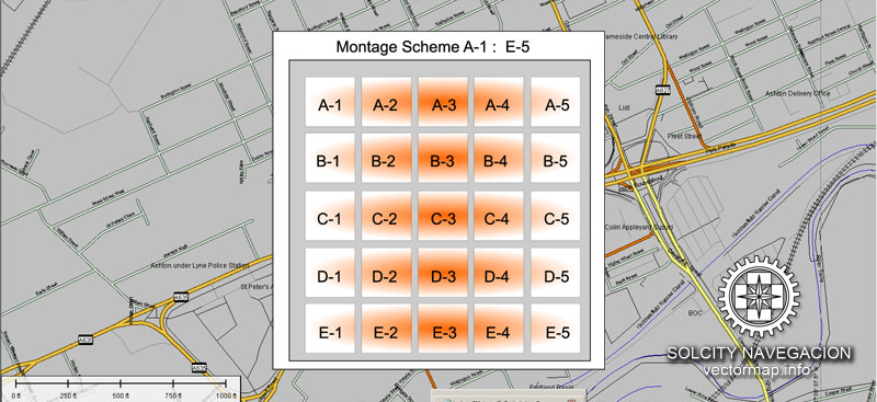
Cities and counties near Manchester city vector map.
Prestwich, Pendlebury, Swinton, Droylsden, Failsworth, Denton, Dukinfield, Stretford, Sale, Urmston, Eccles, Salford, Worsley.
Purchasing of AI vector map of Manchester, England
This is a Royalty Free license. You don`t pay extra for copying or editing.
We accept credit cards and PayPal. After the payment you will be redirected to the download page.
We always have: unbeatable prices and quality. View a full collection of vector maps.



 Author: Kirill Shrayber, Ph.D. FRGS