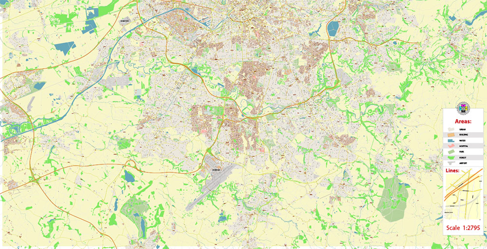
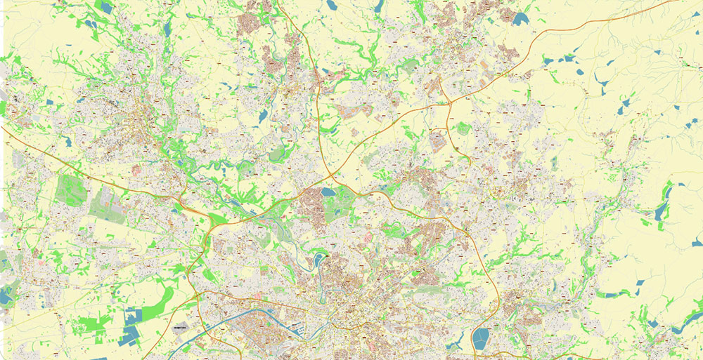
Extended Description of the Vector Map
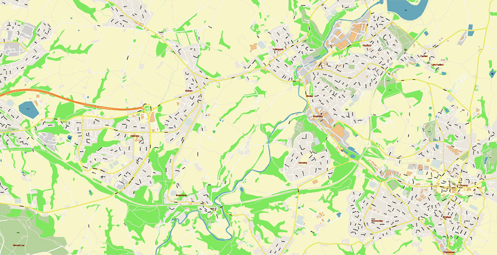
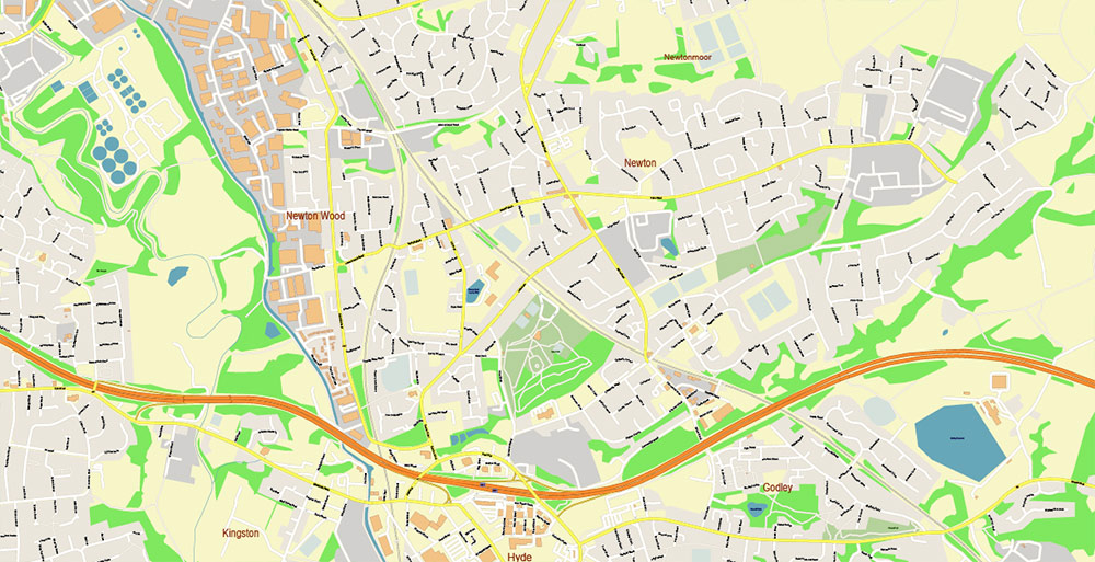
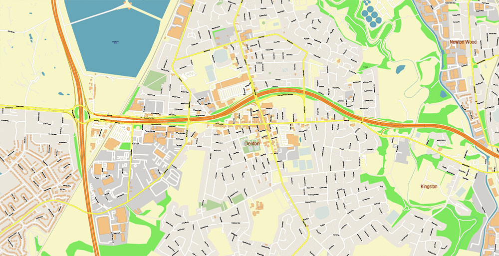
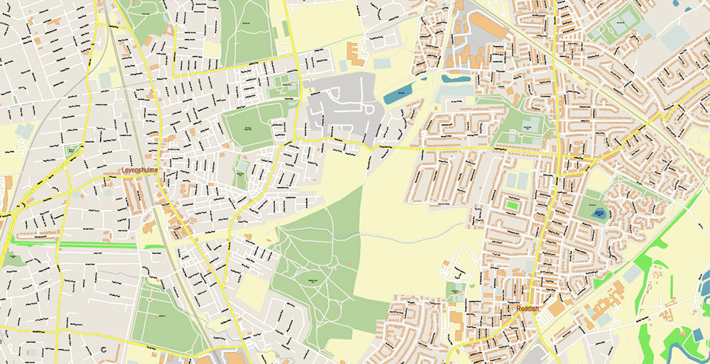
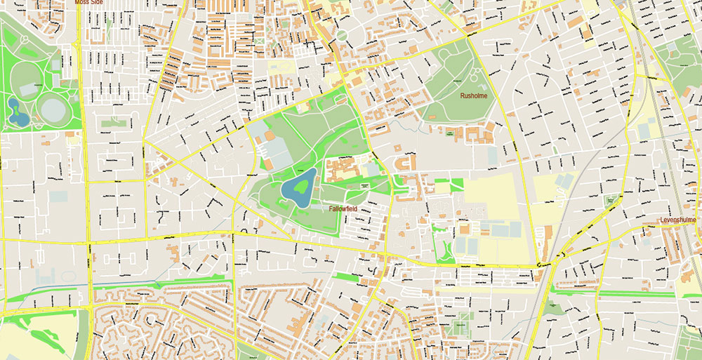
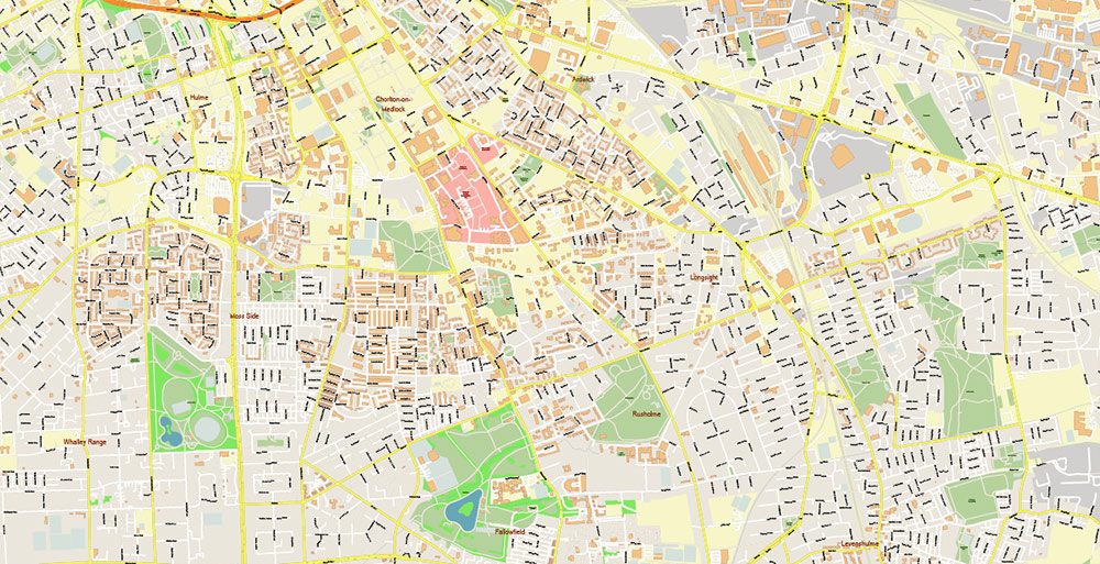
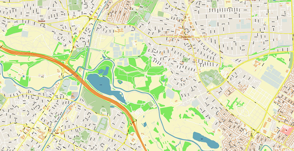
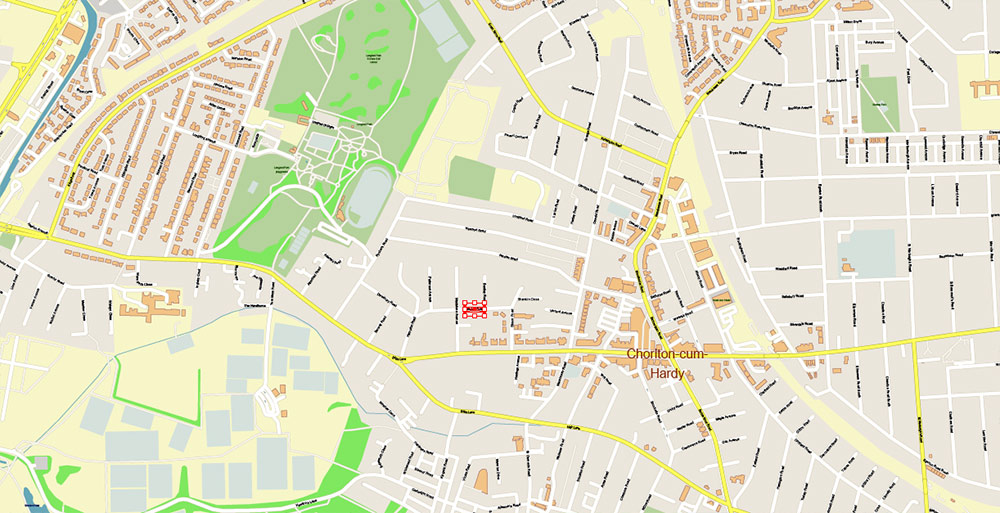
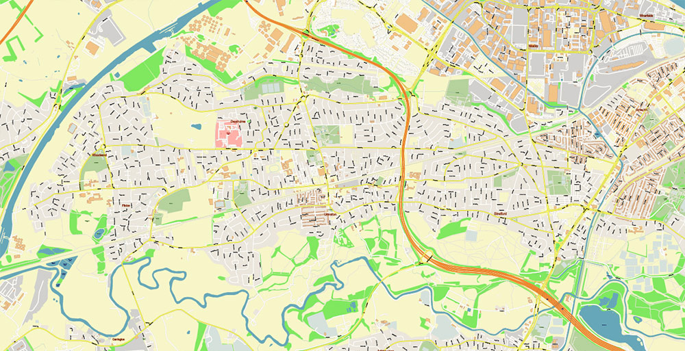
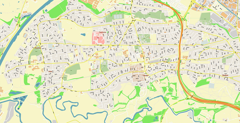
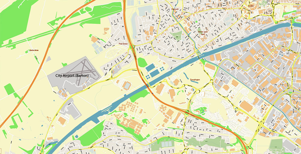
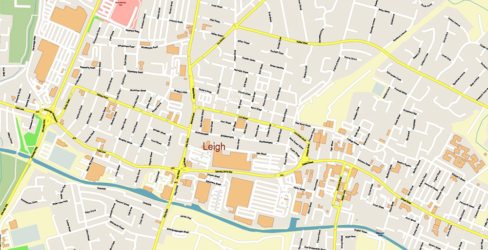
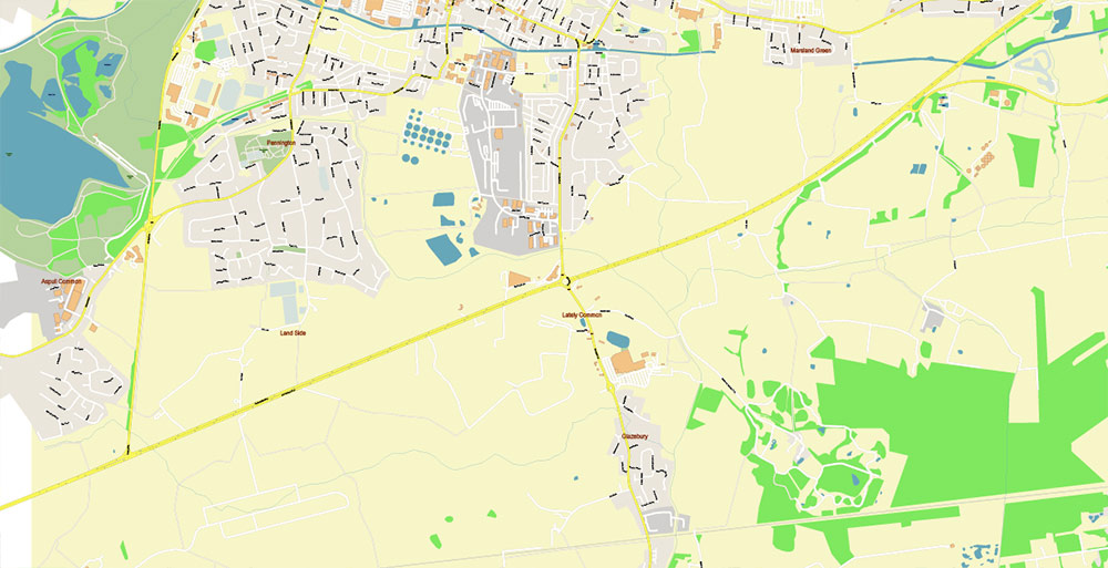
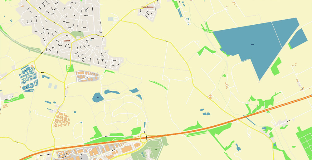
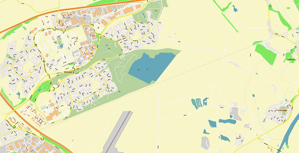
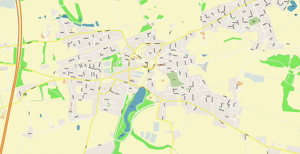
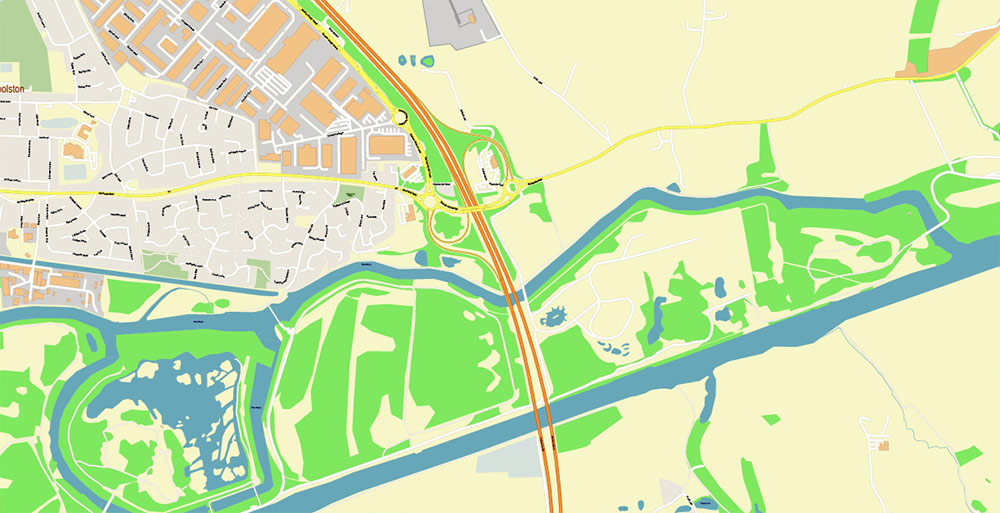
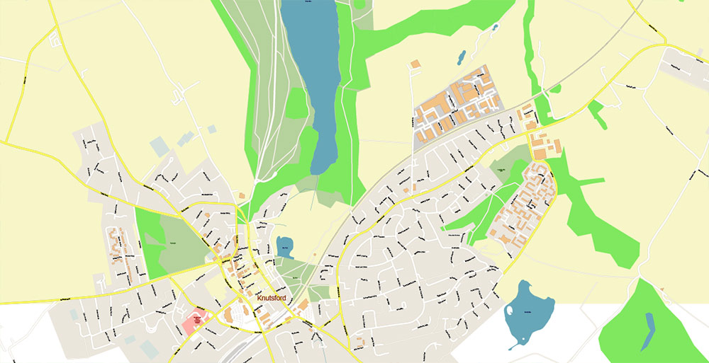
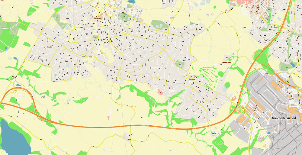
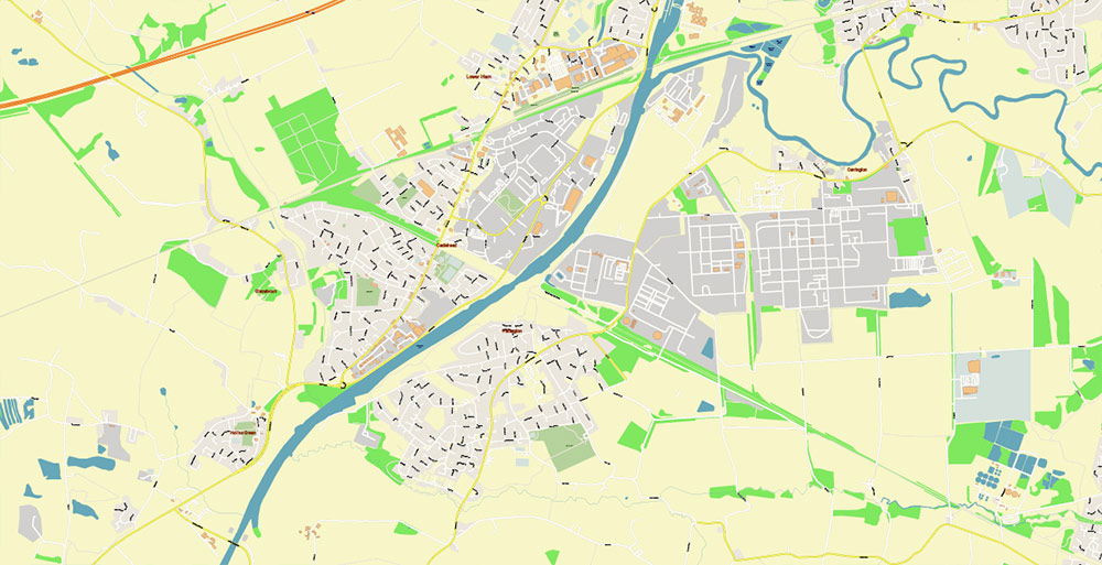
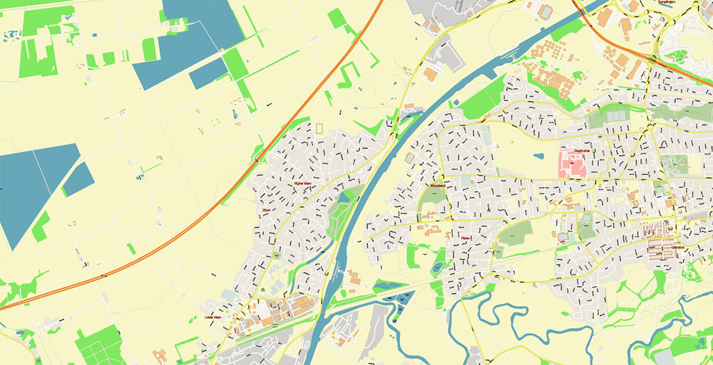
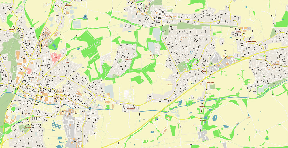
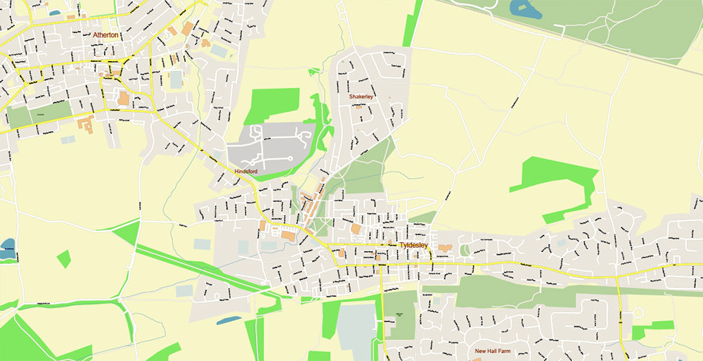
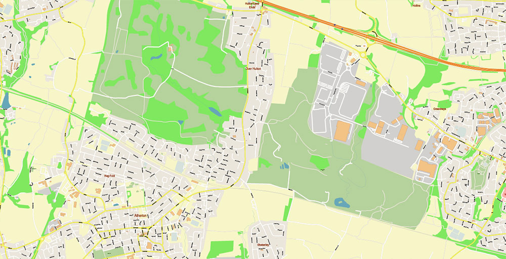
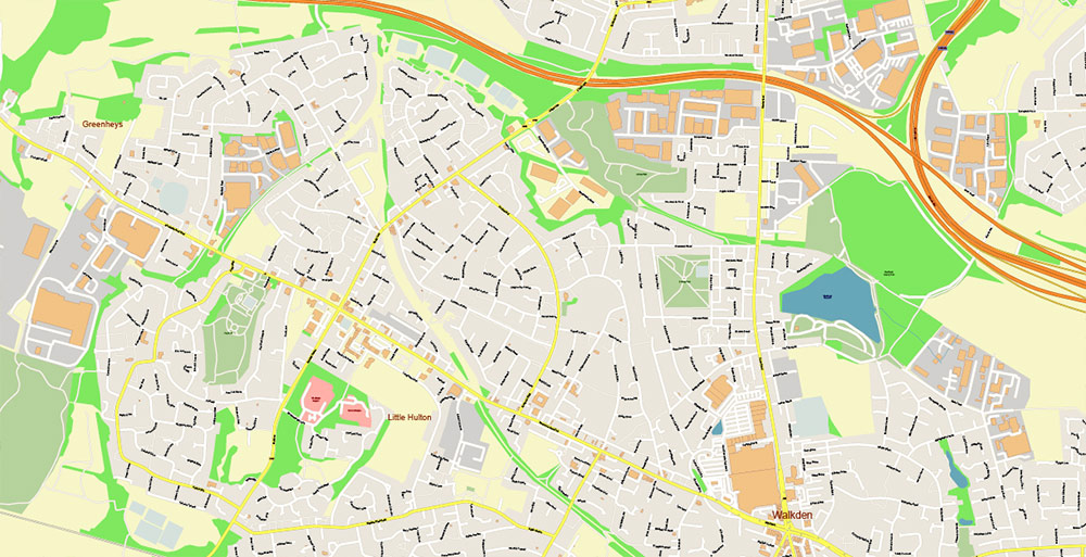
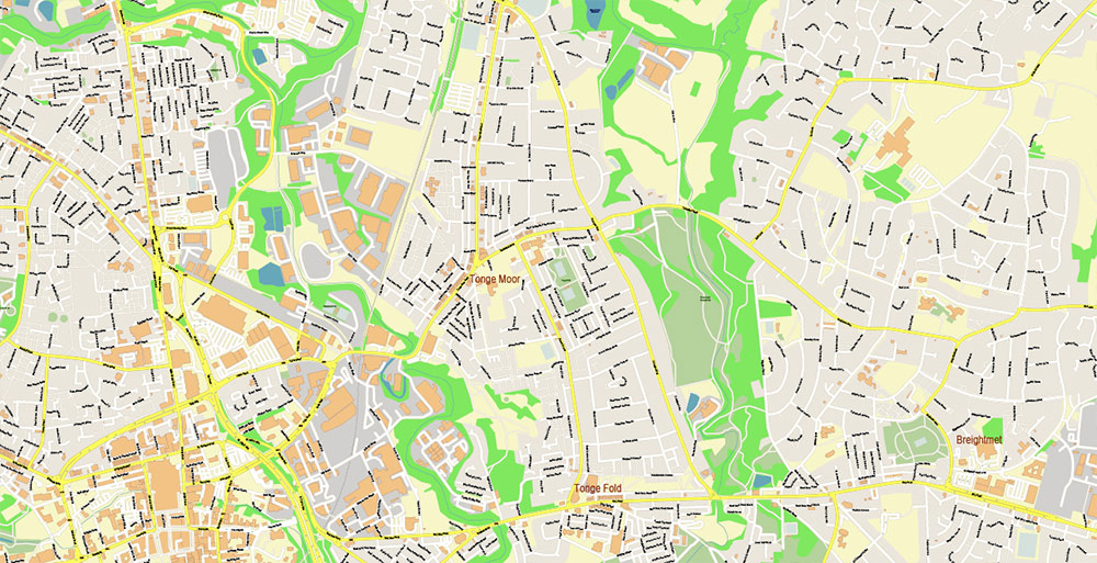
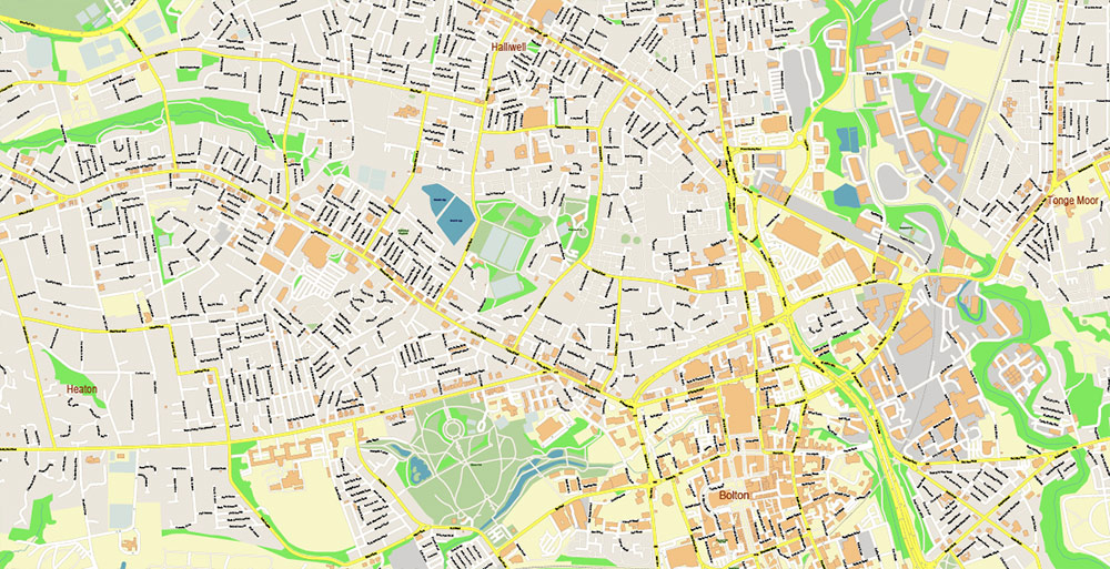
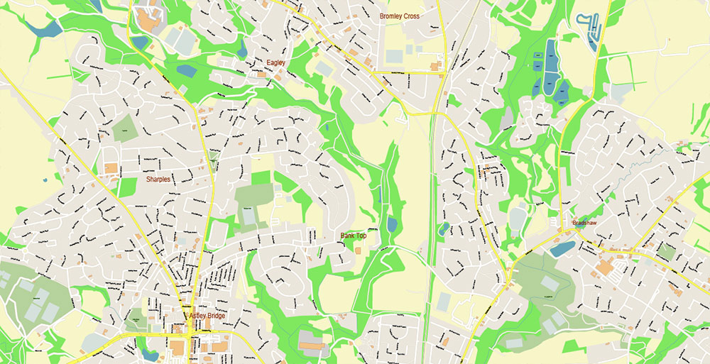
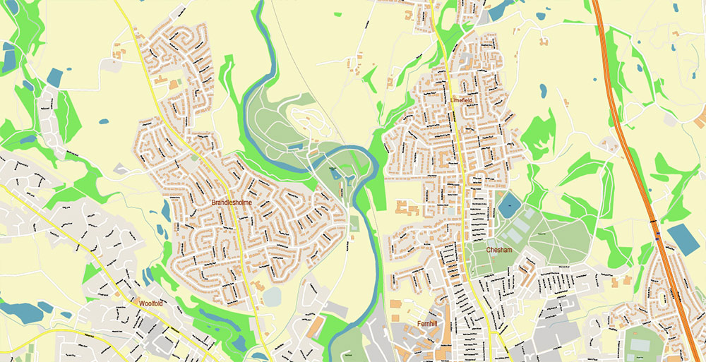
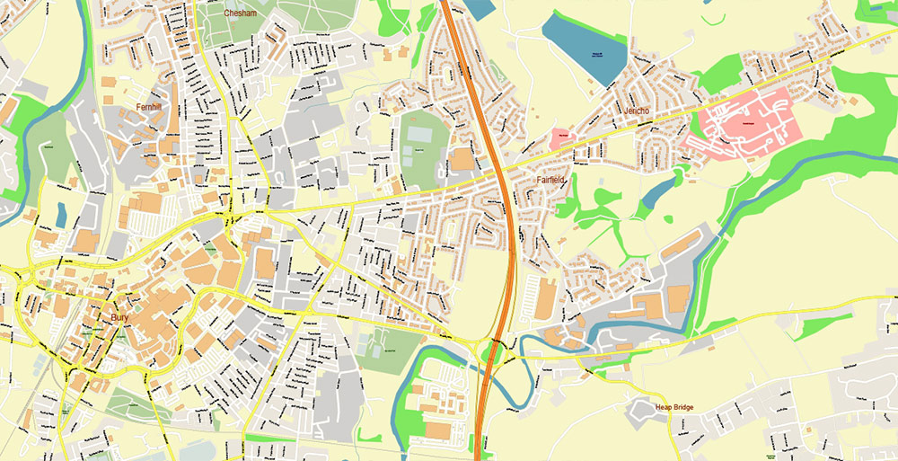
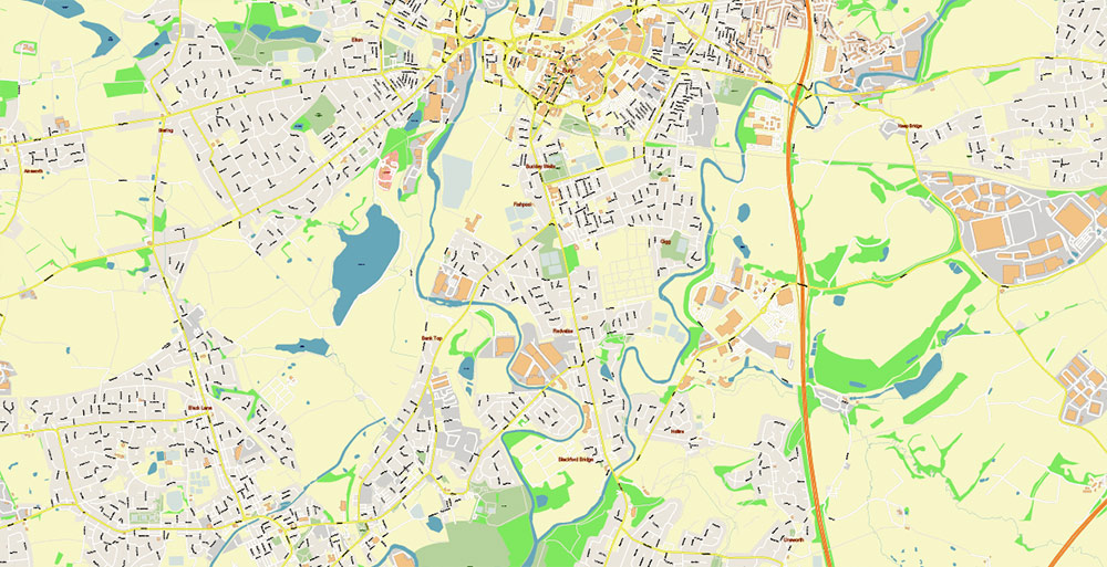
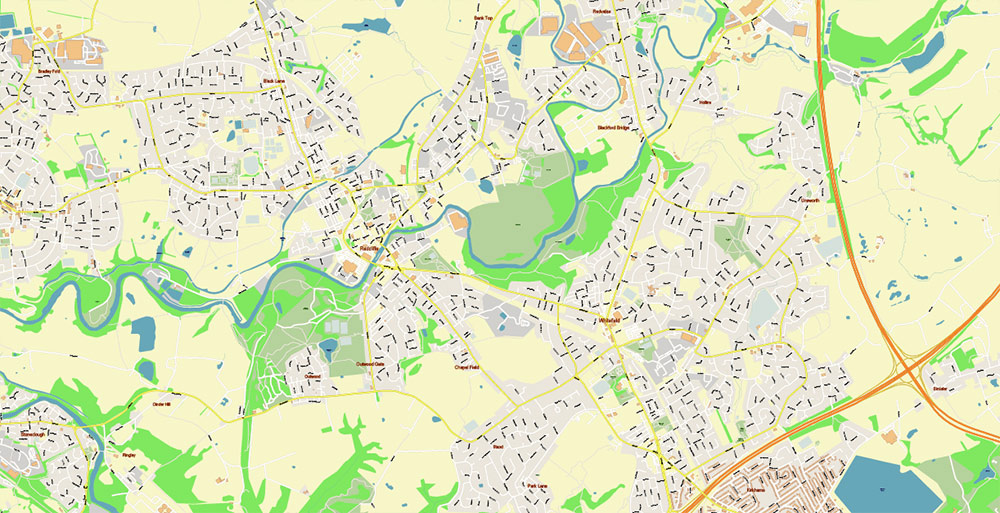
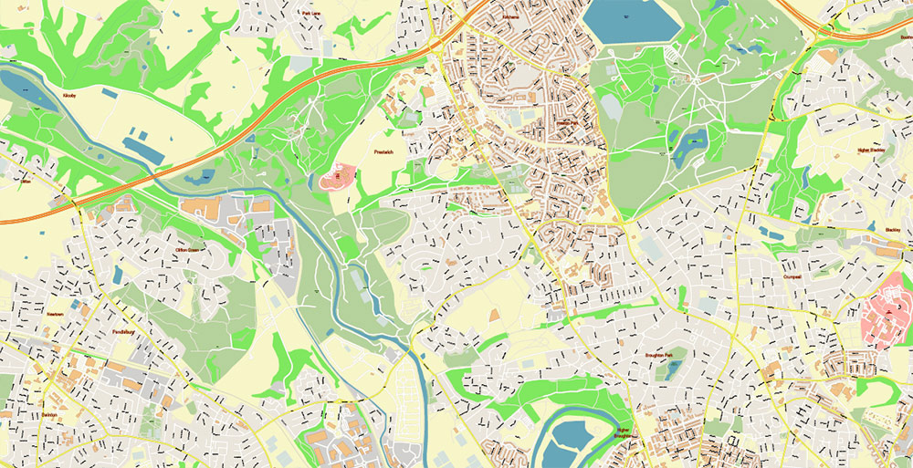
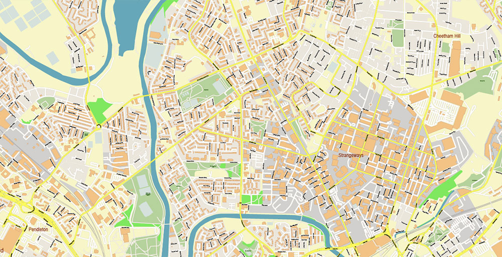
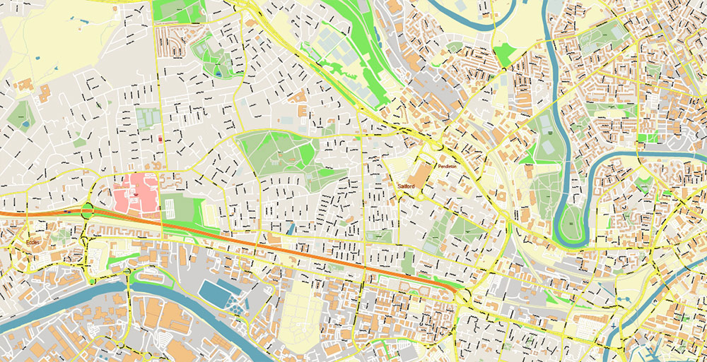
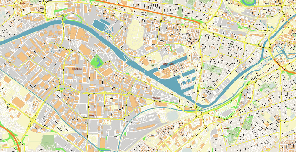
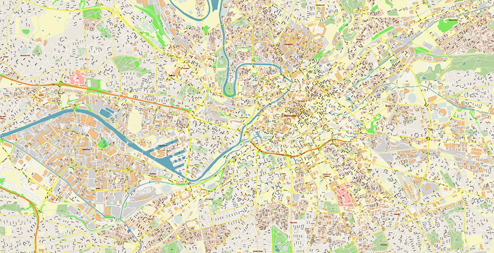
Printable Vector Map of Manchester UK detailed City Plan scale 1:2795 full editable Adobe PDF + Illustrator + DWG High Detailed Street Map in layers, scalable, text/curves format all names, 320 MB ZIP
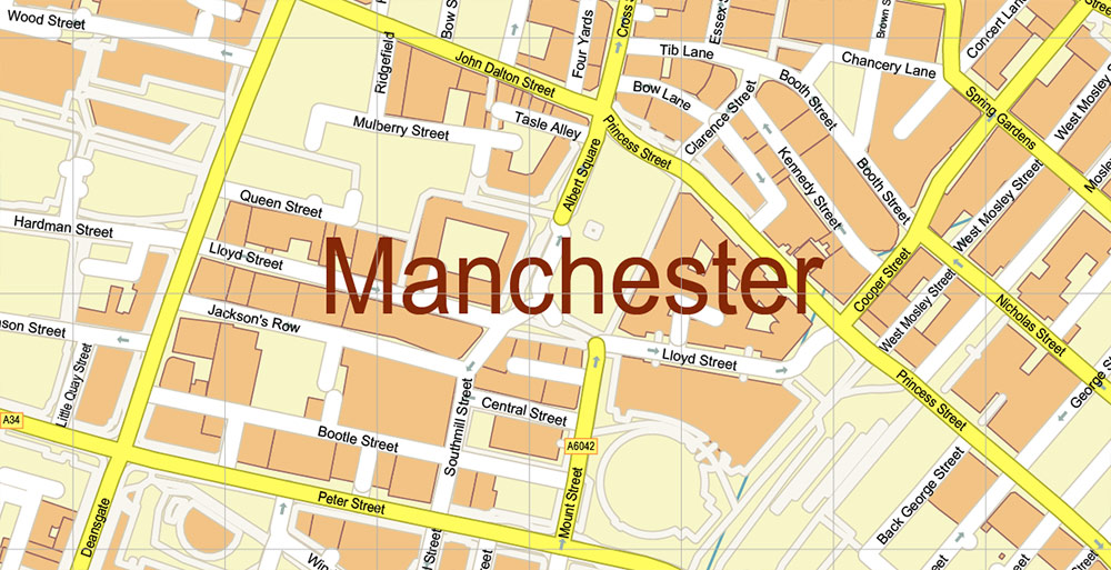
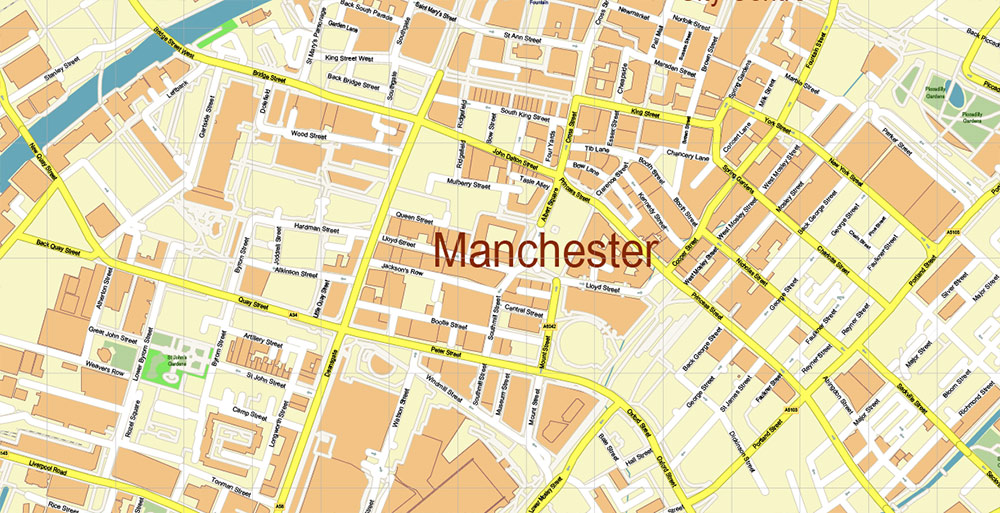
All street names, Main Objects, Buildings. Map for design, printing, arts, projects, presentations, for architects, designers, and builders, business, logistics.
Also: We can add (additional layer for this map), any other objects for you. It’s free for our customers.
If you need any OTHER format – Corel, or something else – please, email us.
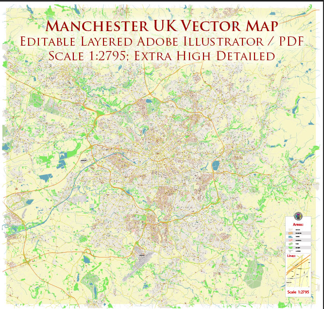
Manchester UK City Vector Map Exact High Detailed editable Adobe PDF + Illustrator + DWG Street Map in
Layers list:
- Legend
- Grids
- Labels of roads
- Names of places (city, hamlet, etc.)
- Names of objects (hospitals, parks, water)
- Names of main streets
- Names of residential streets
- Arrows of the street directions
- Main Streets, roads
- Residential streets
- Railroads
- Buildings
- Waterways
- Water objects (rivers, lakes, ponds)
- Airports and Heliports
- Color fills (parks, hospital areas, land use, etc.)
- Background
A/O BRIEF — Manchester, United Kingdom
1) Geographic Orientation
-
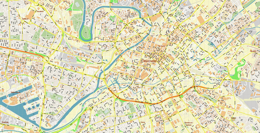
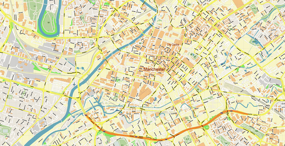
Location: Manchester sits in North West England, in the lowlands of the Irwell–Mersey river system, roughly midway between the Pennines (east) and the Cheshire Plain (south-west).
-
Terrain & elevation: Mostly flat to gently rolling urban terrain with river valleys; higher ground and moorland begin to the east/north-east (toward the Pennines).
-
Water features: The River Irwell runs through the city; the wider Mersey basin influences drainage. A key engineered corridor is the Manchester Ship Canal (to the west/south-west) linking the region to the coast.
-
Urban form: Dense city core; surrounding ring of mixed residential/industrial districts; broader Greater Manchester is a multi-centre urban area (Salford, Trafford, Stockport, Oldham, Rochdale, Bury, Bolton, Wigan).
2) Key Road Network (Main Ground Lines)
Primary motorways (strategic):
-
M60 (Manchester Outer Ring Road): The main orbital motorway tying together the whole conurbation; critical for cross-city distribution and bypassing the centre.
-
M62 (East–West spine): Links Greater Manchester to Liverpool (west) and Leeds/Hull (east); major freight corridor.
-
M56 (South-west connector): Fast connection from Manchester area to Manchester Airport and toward Chester/North Wales.
-
M6 (regional north–south trunk, west of the city): The key long-distance route for NW England and UK freight.
Major A-roads (high-capacity urban/regional):
-
A57 / A580: Important west–east routes; A57 also runs toward the Pennines.
-
A6: South-east axis connecting inner districts toward Stockport and beyond.
-
A34: A significant south corridor linking to airport/Cheshire and business parks.
-
A5103: Primary approach into the city from the south (busy commuter flow).
Practical notes:
-
Congestion: Peak-hour pressure is common on M60, inner radial A-roads, and key bridges/crossings.
-
Bottlenecks: River crossings, motorway interchanges (especially around the ring), and approaches to the centre.
3) Transport (Air / Rail / Tram / Bus / Water)
Air
Rail
-
Manchester Piccadilly: Principal long-distance hub (intercity + regional) and a major node for north–south and east–west services.
-
Manchester Victoria: Important for northern routes and regional services.
-
Oxford Road / Deansgate: Key city-centre stations supporting commuter flow.
-
Freight rail: Present across the region; supports logistics to industrial zones and ports.
Tram (Metrolink)
Bus & Coach
Water / Canal Infrastructure
4) Industry & Economic Profile (Operationally Relevant)
Key sectors
-
Advanced manufacturing & engineering: Long industrial heritage; modern clusters in precision engineering and high-value manufacturing in the broader region.
-
Logistics & distribution: Strong due to motorway web, airport access, and regional warehousing (notably in Trafford and along M60/M62 corridors).
-
Professional services & finance: Concentrated in the city centre and Salford/Spinningfields-type districts (high commuter flow).
-
Digital/creative/media: Major cluster around Salford Quays / MediaCityUK; spillover into central districts.
-
Life sciences & research: Strong university-driven ecosystem; hospital and research anchors create steady day/night activity patterns.
-
Construction & regeneration: Continuous redevelopment in multiple districts; local disruptions can be frequent.
Industrial geography (where it tends to concentrate)
-
Trafford Park area: One of Europe’s largest industrial estates; large footprint, warehouses, distribution, and light industry.
-
Airport corridor: Business parks, freight activity, hotels, and time-sensitive services.
-
East/North industrial belts: Mixed legacy industrial areas with modern redevelopments.
5) Demographics (High-Level)
-
Population: Manchester is a large, dense, and youthful core city within the much larger Greater Manchester conurbation.
-
Age profile: Generally younger-than-UK-average in the city core due to large student and early-career professional populations.
-
Diversity: Highly multicultural population with long-established communities and newer migrant groups; a wide range of languages and cultural districts.
-
Day/night population swing: Significant—commuters, students, nightlife and event-driven surges can substantially change footfall patterns between daytime and late evening.
-
Spatial pattern:
-
City centre: Higher proportion of apartments, students, professionals, visitors.
-
Outer districts: More family housing, mixed deprivation/affluence by neighbourhood.
-
Greater Manchester towns: Distinct local centres with their own commuting dynamics.
6) Quick “On-the-Ground” Orientation (Useful Patterns)
-
Primary mobility logic:
-
Activity hotspots:
-
City centre (business + retail + nightlife), Piccadilly/Victoria rail zones, Salford Quays/MediaCityUK, Trafford Centre area, Airport corridor.
-
Event sensitivity:
-
Football matches, concerts, and city-centre events can sharply affect traffic, policing presence, and crowd density.
layers in 1 archive
Manchester UK City Vector Map Exact High Detailed editable Adobe PDF + Illustrator + DWG Street Map in layers in 1 archive
Manchester UK City Vector Map Exact High Detailed editable Adobe PDF + Illustrator + DWG Street Map in layers in 1 archive
Manchester UK City Vector Map Exact High Detailed editable Adobe PDF + Illustrator + DWG Street Map in layers in 1 archive
Manchester UK City Vector Map Exact High Detailed editable Adobe PDF + Illustrator + DWG Street Map in layers in 1 archive
Manchester UK City Vector Map Exact High Detailed editable Adobe PDF + Illustrator + DWG Street Map in layers in 1 archive
Manchester UK City Vector Map Exact High Detailed editable Adobe PDF + Illustrator + DWG Street Map in layers in 1 archive
Manchester UK City Vector Map Exact High Detailed editable Adobe PDF + Illustrator + DWG Street Map in layers in 1 archive
Manchester UK City Vector Map Exact High Detailed editable Adobe PDF + Illustrator + DWG Street Map in layers in 1 archive
Manchester UK City Vector Map Exact High Detailed editable Adobe PDF + Illustrator + DWG Street Map in layers in 1 archive
Manchester UK City Vector Map Exact High Detailed editable Adobe PDF + Illustrator + DWG Street Map in layers in 1 archive
Manchester UK City Vector Map Exact High Detailed editable Adobe PDF + Illustrator + DWG Street Map in layers in 1 archive
Manchester UK City Vector Map Exact High Detailed editable Adobe PDF + Illustrator + DWG Street Map in layers in 1 archive
Manchester UK City Vector Map Exact High Detailed editable Adobe PDF + Illustrator + DWG Street Map in layers in 1 archive
Manchester UK City Vector Map Exact High Detailed editable Adobe PDF + Illustrator + DWG Street Map in layers in 1 archive
Manchester UK City Vector Map Exact High Detailed editable Adobe PDF + Illustrator + DWG Street Map in layers in 1 archive
Manchester UK City Vector Map Exact High Detailed editable Adobe PDF + Illustrator + DWG Street Map in layers in 1 archive
Manchester UK City Vector Map Exact High Detailed editable Adobe PDF + Illustrator + DWG Street Map in layers in 1 archive
Manchester UK City Vector Map Exact High Detailed editable Adobe PDF + Illustrator + DWG Street Map in layers in 1 archive
Manchester UK City Vector Map Exact High Detailed editable Adobe PDF + Illustrator + DWG Street Map in layers in 1 archive
Manchester UK City Vector Map Exact High Detailed editable Adobe PDF + Illustrator + DWG Street Map in layers in 1 archive
Manchester UK City Vector Map Exact High Detailed editable Adobe PDF + Illustrator + DWG Street Map in layers in 1 archive
Manchester UK City Vector Map Exact High Detailed editable Adobe PDF + Illustrator + DWG Street Map in layers in 1 archive
Manchester UK City Vector Map Exact High Detailed editable Adobe PDF + Illustrator + DWG Street Map in layers in 1 archive
Manchester UK City Vector Map Exact High Detailed editable Adobe PDF + Illustrator + DWG Street Map in layers in 1 archive
Manchester UK City Vector Map Exact High Detailed editable Adobe PDF + Illustrator + DWG Street Map in layers in 1 archive
Manchester UK City Vector Map Exact High Detailed editable Adobe PDF + Illustrator + DWG Street Map in layers in 1 archive
Manchester UK City Vector Map Exact High Detailed editable Adobe PDF + Illustrator + DWG Street Map in layers in 1 archive
Manchester UK City Vector Map Exact High Detailed editable Adobe PDF + Illustrator + DWG Street Map in layers in 1 archive
Manchester UK City Vector Map Exact High Detailed editable Adobe PDF + Illustrator + DWG Street Map in layers in 1 archive
Manchester UK City Vector Map Exact High Detailed editable Adobe PDF + Illustrator + DWG Street Map in layers in 1 archive
Manchester UK City Vector Map Exact High Detailed editable Adobe PDF + Illustrator + DWG Street Map in layers in 1 archive
Manchester UK City Vector Map Exact High Detailed editable Adobe PDF + Illustrator + DWG Street Map in layers in 1 archive
Manchester UK City Vector Map Exact High Detailed editable Adobe PDF + Illustrator + DWG Street Map in layers in 1 archive
Manchester UK City Vector Map Exact High Detailed editable Adobe PDF + Illustrator + DWG Street Map in layers in 1 archive
Manchester UK City Vector Map Exact High Detailed editable Adobe PDF + Illustrator + DWG Street Map in layers in 1 archive
Manchester UK City Vector Map Exact High Detailed editable Adobe PDF + Illustrator + DWG Street Map in layers in 1 archive

Manchester UK City Vector Map Exact High Detailed editable Adobe PDF + Illustrator + DWG Street Map in layers in 1 archive
Manchester UK City Vector Map Exact High Detailed editable Adobe PDF + Illustrator + DWG Street Map in layers in 1 archive
Manchester UK City Vector Map Exact High Detailed editable Adobe PDF + Illustrator + DWG Street Map in layers in 1 archive
Manchester UK City Vector Map Exact High Detailed editable Adobe PDF + Illustrator + DWG Street Map in layers in 1 archive
Manchester UK City Vector Map Exact High Detailed editable Adobe PDF + Illustrator + DWG Street Map in layers in 1 archive
Manchester UK City Vector Map Exact High Detailed editable Adobe PDF + Illustrator + DWG Street Map in layers in 1 archive
Manchester UK City Vector Map Exact High Detailed editable Adobe PDF + Illustrator + DWG Street Map in layers in 1 archive
Manchester UK City Vector Map Exact High Detailed editable Adobe PDF + Illustrator + DWG Street Map in layers in 1 archive

 Author: Kirill Shrayber, Ph.D. FRGS


, fully editable, Adobe Illustrator")