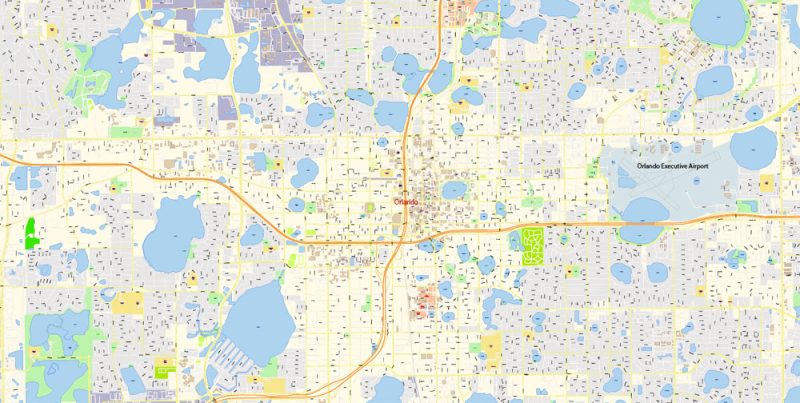
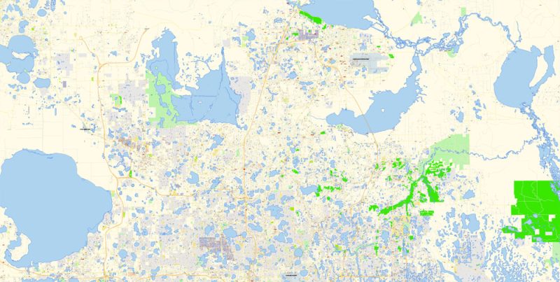
Printable PDF Vector Map of Florida Central Part with Orlando and Atlantic coast US detailed City Plan scale 100 m 1:4128 full editable Adobe PDF Street Map in layers, scalable, text format all names, 311 MB ZIP
All street names, Main Objects, Buildings. Map for design, printing, arts, projects, presentations, for architects, designers, and builders, business, logistics.
Layers: color_fills, water, streets_roads, labels_roads, names_objects, names_streets, names_places, arrows_streets, buildings, legend, etc.
The most exact and detailed map of the city in scale.
IF YOU NEED: We can add the layer areas and numbers zip (postal) codes.
For Editing and High-Quality Printing
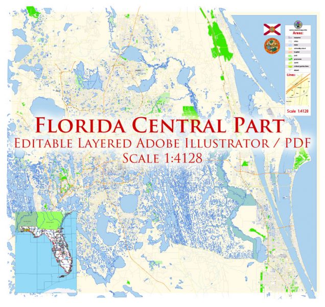
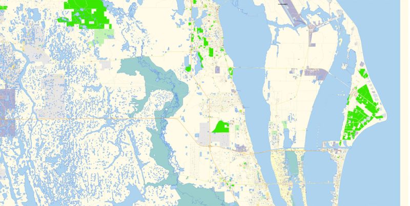
Florida Central Part with Orlando US PDF Map Vector Exact City Plan High Detailed Street Map editable Adobe PDF in layers
Orlando
Useful information for tourists about Orlando in the United States – geographical location, tourist infrastructure, map, architectural features, and attractions.
Orlando is the largest inland city of the Florida Peninsula and the fourth largest city in the state. The city was named after a United States Army soldier, Orlando Reeves, who participated in the Second Seminole war (1835-1842) and died here.
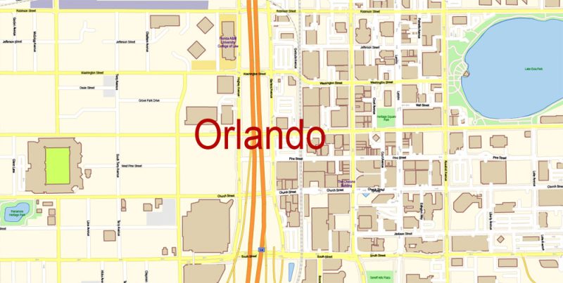
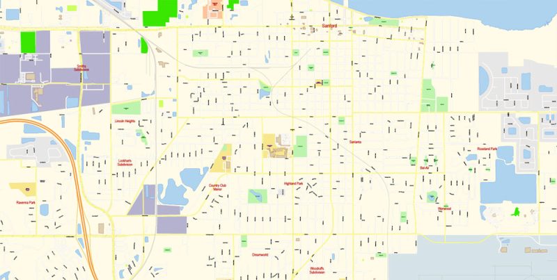
Florida Central Part with Orlando US PDF Map Vector Exact City Plan High Detailed Street Map editable Adobe PDF in layers
Orlando was founded in 1857 as a military camp for troops who participated in a brutal war with the Indian peoples. In 1885 it was officially granted the status of a city. In 1890 on the territory of Orlando lived no more than 3 thousand inhabitants. Throughout its history, the city has experienced several periods of UPS and downs. However, Orlando gained worldwide fame only after the world’s largest entertainment Park, called “Disney World”, was built here. As a result, the little-known city has become one of the most popular places on earth, where not only children but also adults can immerse themselves in the magical world of fairy tales and eternal holiday.
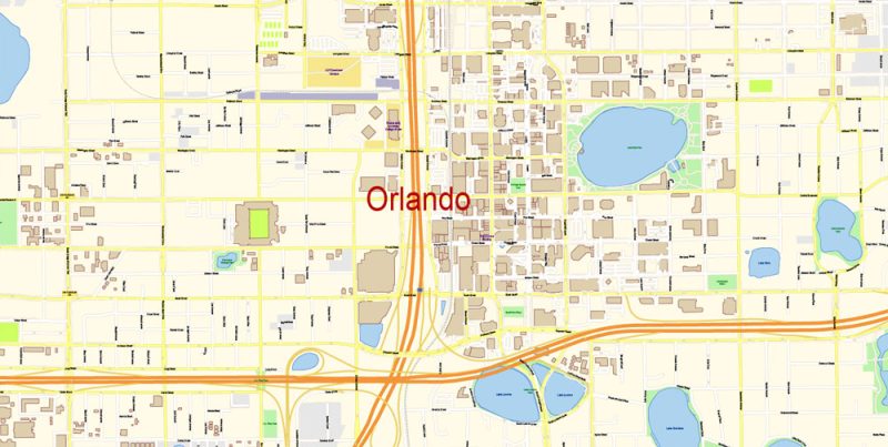
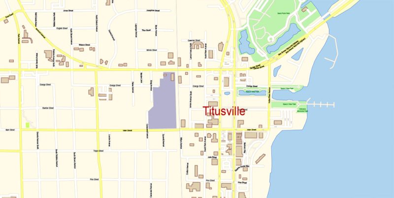
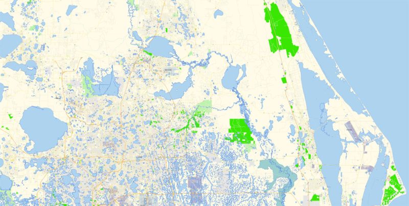
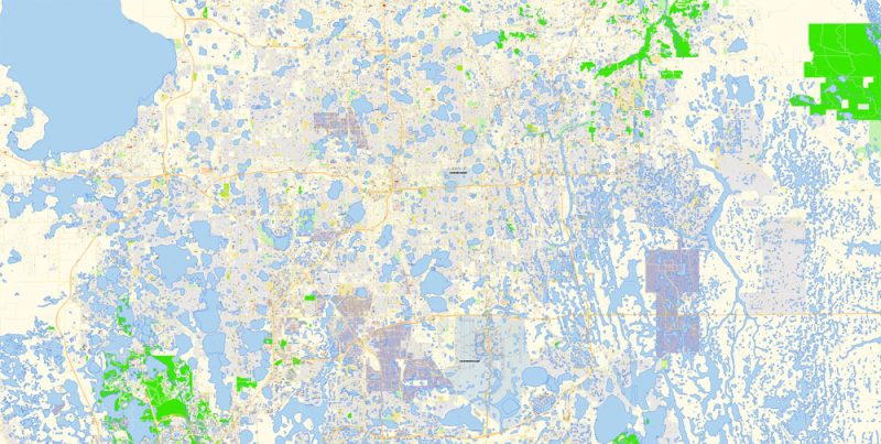
Florida Central Part with Orlando US PDF Map Vector Exact City Plan High Detailed Street Map editable Adobe PDF in layers
In addition, Orlando is a popular American resort, famous for its beautiful climate, luxurious restaurants and a wide variety of entertainment. Every year about 52 million tourists and vacationers visit this region, which allows the entire region to develop actively.
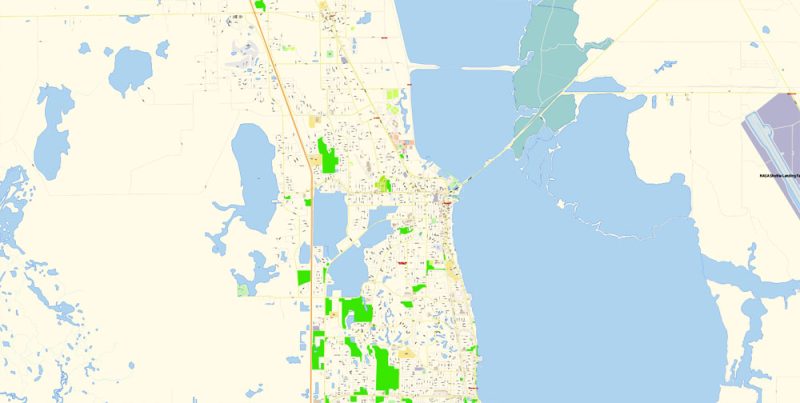
Florida Central Part with Orlando US PDF Map Vector Exact City Plan High Detailed Street Map editable Adobe PDF in layers
Orlando is a real find for outdoor enthusiasts. In and around the city there are 176 Golf courses, more than 800 tennis courts, several riding centers, more than 80 parks and about 2 thousand ponds, which provides a huge selection of different sports, including Cycling, Rafting, Canoeing and more.
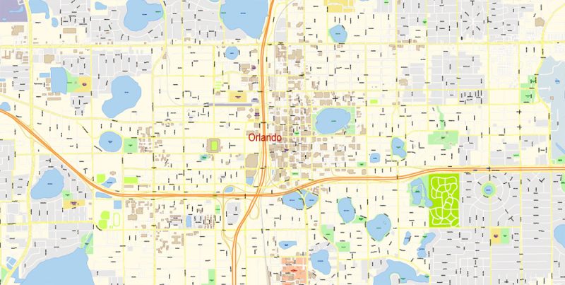
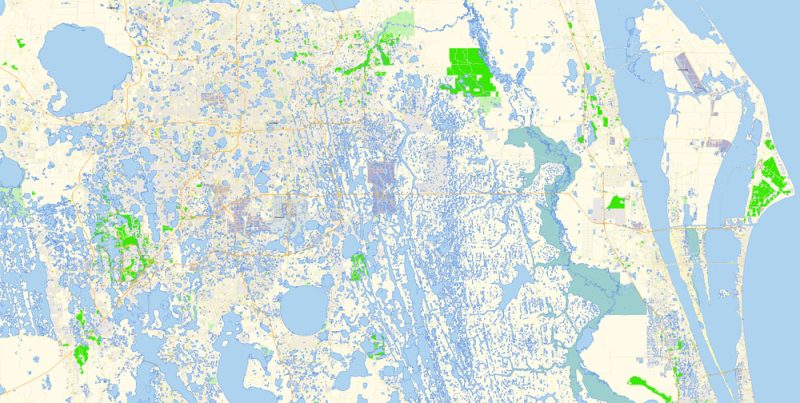
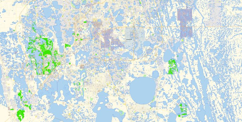
Florida Central Part with Orlando US PDF Map Vector Exact City Plan High Detailed Street Map editable Adobe PDF in layers
Orlando is a very beautiful and interesting city. The main attraction of the city is undoubtedly the world’s largest amusement Park “Walt Disney World” with amazing attractions, various shows, marine parks, and fairy-tale characters. The Park with a total area of more than 100 square kilometers includes four theme parks, two water parks, twenty-five themed hotels, a dozen Golf courses, a couple of shopping centers, about a hundred restaurants, cafes and everything you need for a wonderful holiday and sports. Especially popular is the Disney-MGM film Studio, where you can meet your favorite cartoon characters.
Florida Central Part with Orlando US PDF Map Vector Exact City Plan High Detailed Street Map editable Adobe PDF in layers
No less popular is the Park called Universal Studious. The complex, which is a huge film Studio with scenery, film sets, exciting attractions, and various entertainment programs, consists of two theme parks Universal’s Islands of Adventure and Universal Studios Florida, shopping and entertainment center Universal CityWalk and premium hotels.
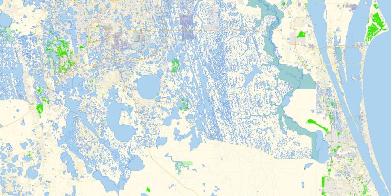
Florida Central Part with Orlando US PDF Map Vector Exact City Plan High Detailed Street Map editable Adobe PDF in layers
Walking through the streets of Orlando is also worth a visit to the Park “Sea World”, offering a large number of educational and entertainment attractions. Every day there are amazing performances with marine life-killer whales, dolphins, and penguins.
Florida Central Part with Orlando US PDF Map Vector Exact City Plan High Detailed Street Map editable Adobe PDF in layers
Another famous landmark of the city is the Epcot Center – the prototype of the society of the future. There are exhibits from all over the planet, as well as models of our earth, spaceship and time machine.
In addition, there are several very interesting museums in Orlando, including the Orlando Museum of Art, the Museum of American Art and The Museum of trains and trams.
Florida Central Part with Orlando US PDF Map Vector Exact City Plan High Detailed Street Map editable Adobe PDF in layers
Florida Central Part with Orlando US PDF Map Vector Exact City Plan High Detailed Street Map editable Adobe PDF in layers
Florida Central Part with Orlando US PDF Map Vector Exact City Plan High Detailed Street Map editable Adobe PDF in layers
Florida Central Part with Orlando US PDF Map Vector Exact City Plan High Detailed Street Map editable Adobe PDF in layers
Florida Central Part with Orlando US PDF Map Vector Exact City Plan High Detailed Street Map editable Adobe PDF in layers
Florida Central Part with Orlando US PDF Map Vector Exact City Plan High Detailed Street Map editable Adobe PDF in layers
Florida Central Part with Orlando US PDF Map Vector Exact City Plan High Detailed Street Map editable Adobe PDF in layers


 Author: Kirill Shrayber, Ph.D. FRGS


