Editable PDF Vector Map Slovakia Country, Relief, Roads and Admin map fully editable Adobe PDF, full vector, scalable, editable text format of names, 16 Mb ZIP.
Relief Road Admin Map for publishing, design, printing, publications, arts, projects, presentations, for architects, designers and builders, business, logistics. The most exact and detailed map of the country.
For printing any format
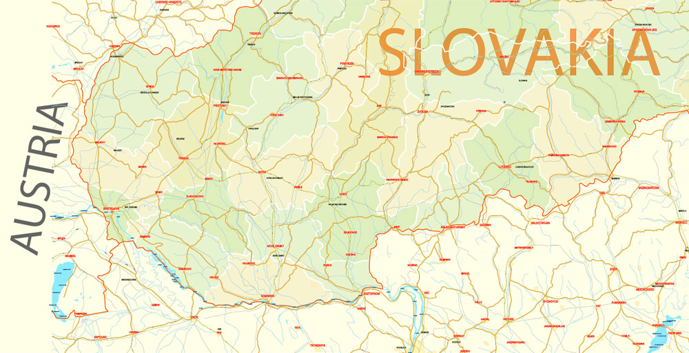
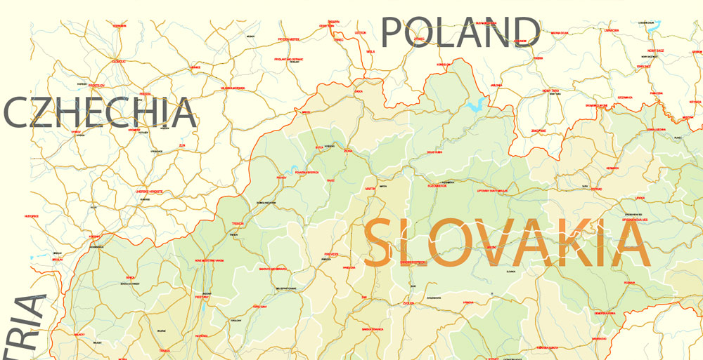
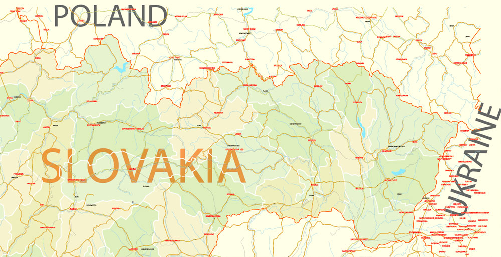
Separated layers: names, halo, relief, roads and waterways, railways, admin zones etc.
You can edit this file by Adobe Illustrator, Adobe Acrobat, Corel Draw.
DWG, DXF, CDR, ESRI Shapes, and other formats – by request, same price, please contact.
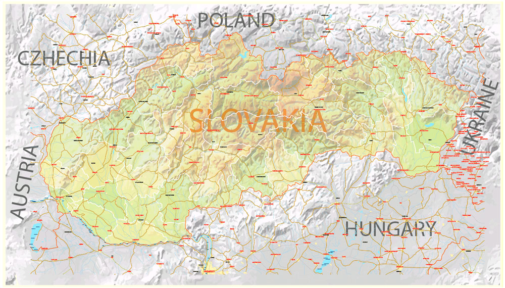
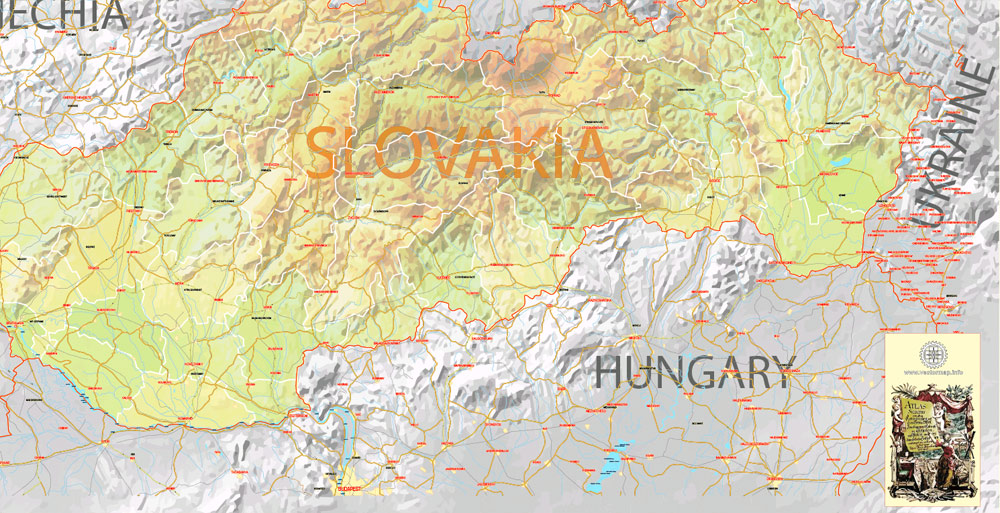
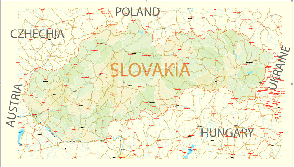
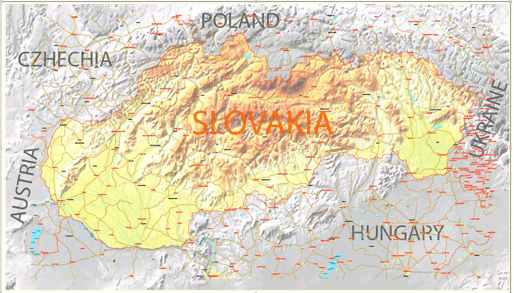
Slovakia.
This vector map of Slovakia is used as a basis for design, editing, and further printing.
This is the most detailed, exact map of Slovakia for high-quality printing and polygraphy. You can always clarify the map development date by contacting us.
For your convenience, all objects on Slovakia vector map are divided into layers. And the editing is very easy – colors, lines, etc.
You can easily add any objects needed (e.g. shops, salons, sale points, gas station or attraction) on any layer of Slovakia vector map.
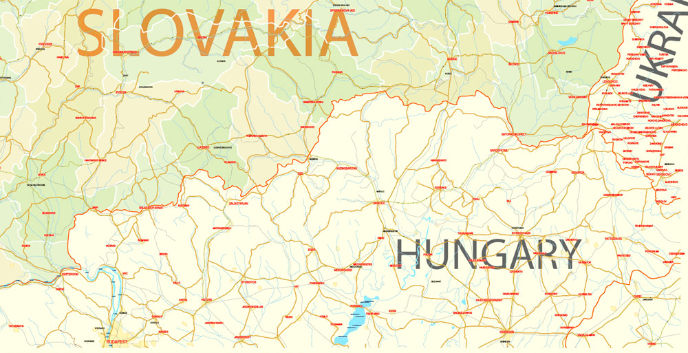
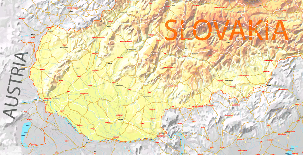
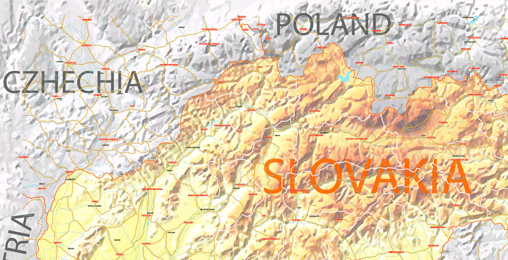
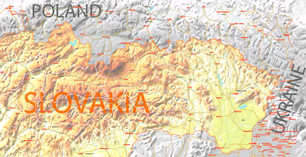
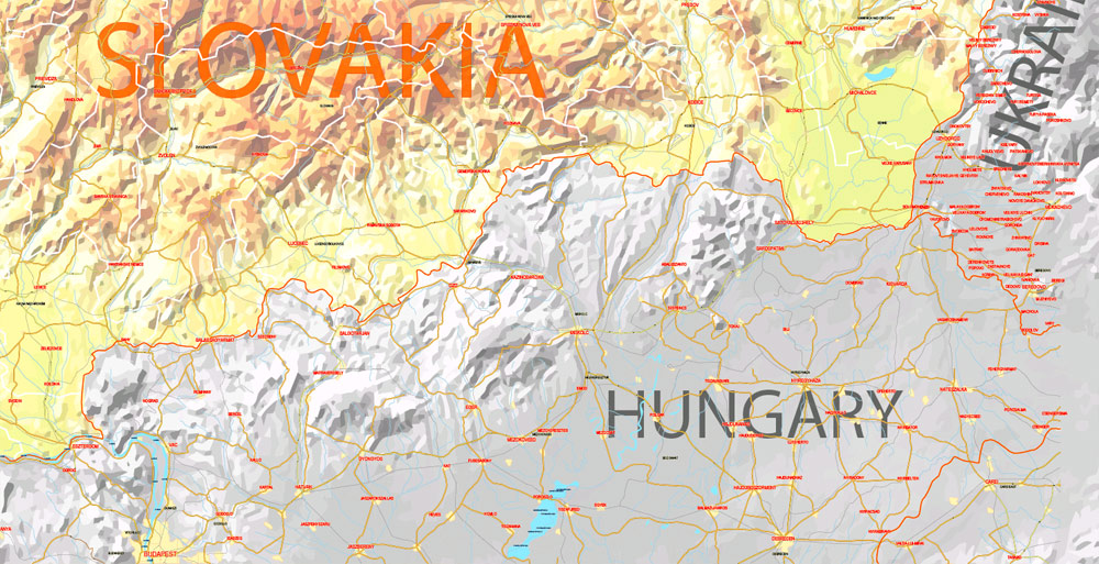
Slovakia is a landlocked country in Central Europe. It is bordered by Poland to the north, Ukraine to the east, Hungary to the south, Austria to the west, and the Czech Republic to the northwest. Slovakia’s territory spans about 49,000 square kilometres (19,000 sq mi) and is mostly mountainous. The population is over 5.4 million and consists mostly of Slovaks. The capital and largest city is Bratislava, and the second largest city is Košice. The official language is Slovak.
One of the advantages of Slovakia vector maps of our production is the relevance of cartographic data, we constantly update all our products.
This vector map of Slovakia is used by:
designers, layout designers, printers, advertisers and architects. Our product – vector maps – is designed for further editing and printing in large formats – from @Wall format (a few meters) to A-0 and A-1, A-2, A-3.
The Slovakia map in vector format is used for design, urban planning, presentations and media visualizations.
The advertising and presentation map of Slovakia (usually the final designer marks the routes, and puts the client’s objects (shops, saloons, gas stations etc.)
The undoubted advantage is that people will NEVER throw out this advertising product – the map. In fact, as an advertising medium, a map is the most “long-playing” of the well-known polygraphic advertising media, with the longest lifespan, and the maximum number of interactions with the customer.
For travelers, maps are sold at the airports and gas stations around the world. Often the source is our vector maps.
Take a look, who purchases our vector maps of Slovakia in “Our Clients and Friends” page – these are large and small companies, from super-brands like Volvo and Starbucks, to small design studios and printing houses.
It’s very easy to work with vector maps of Slovakia city, even for a not very experienced designer who can turn on and off the map layers, add new objects, change the colors of fill and lines according to customer requirements.
The undoubted advantage of Slovakia vector maps in printing is an excellent and detailed visualization, when customer can expand a large paper map and instantly define his location, find a landmark, an object or address on map, unlike using the popular electronic formats of Google and Yandex maps for example.
Printable vector maps of Slovakia are much more convenient and efficient than any electronic maps on your smartphone, because ALL DETAILS are displayed in the entire space of Slovakia map.
Useful tips on working with vector maps of cities and countries in Adobe Illustrator.
«V» – launches the Selection tool (cursor, black arrow), which makes active any vector line.
«А» – launches the Direct Selection tool (white cursor), allows you to select curve elements and drag them to the desired place.
«R» – activates the Rotate tool, which helps you rotating selected objects around the center point by 360 degrees.
«E» – gives you the opportunity to use the Eraser tool and erase unnecessary parts.
«X» – switches between Fill and Stroke in the Tools section. Try to get used to this hot key and
you will quickly understand that you can’t live and work without it.
Guides are not limited to vertical and horizontal in Adobe Illustrator. You can also create a diagonal guide for example. Moreover, you can turn any contours into guides. Select the outline and go to View > Guides > Make Guides (Create Guides), or simply press Cmd/Ctrl + 5. You can also turn the guides back into an editable object. Go to menu, View > Guides > Unlock Guides (Release Guides), select the guide you want to edit and select View > Guides > Release Guides (Reset Guides), or just press Cmd/Ctrl + Option / Alt + 5).
The Slavs arrived in the territory of present-day Slovakia in the 5th and 6th centuries. In the 7th century, they played a significant role in the creation of Samo’s Empire and in the 9th century established the Principality of Nitra, which was later conquered by the Principality of Moravia to establish Great Moravia. In the 10th century, after the dissolution of Great Moravia, the territory was integrated into the Principality of Hungary, which would become the Kingdom of Hungary in 1000.
You will probably want to change the color scheme used on our Slovakia vector map.
To quickly and effectively play with colors.
Of course, you can do it manually, all objects in our Slovakia vector map are divided according to types and layers, and you can easily change the color gamma of vector objects in groups and layers.
But there is more effective way of working with the whole VECTOR MAP of Slovakia and all layers:
The overview dialog «Edit colors»/«Repaint Graphic Object» (this dialog box name can change depending on the context):
If you have selected a part or a layer of Slovakia vector map and open the dialog box by clicking the icon in the Control panel, on the Samples palette or the Color Catalog, or if you choose Edit > Edit Colors> Repaint Graphic Object, then the «Repaint Graphic Object» dialog box appears, and you get access to «Assign» and «Edit» tabs.
If a picture or a map fragment is not selected, and you open the dialog box by clicking the icon in the Control panel, on the Samples palette or in the Color Catalog, the «Edit Colors» dialog box appears and you can only access the «Edit» tab.
Regardless of the name at the top of the dialog box, the right-hand side always displays the color group of the current document, as well as two default color groups: Print Color and Grayscale. These color groups can be selected and used any time.
Create and edit color groups of Slovakia vector map, and also assign colors using the «Edit Colors»/ а «Repaint Graphic Object» dialog box.
A. Creating and editing of a color group on the «Edit» tab
B. Assigning colors on the «Assign» tab
C. Select a group of colors from the «Color groups» list
The option «Repaint a graphic object» in the lower part of the dialog box allows you to preview the colors on a selected layer of Vector map, or a group of elements, and specify whether its colors will be redefined when the dialog box is closed.
In 1241 and 1242, much of the territory was destroyed by the Mongols during their invasion of Central and Eastern Europe. The area was recovered largely thanks to Béla IV of Hungary who also settled Germans which became an important ethnic group in the area, especially in what are today parts of central and eastern Slovakia. After World War I and the dissolution of the Austro-Hungarian Empire, the Czechoslovak National Council established Czechoslovakia (1918–1939).
The main areas of the dialog box are:
«Edit»
The «Edit» tab is designed to create a new or edit the existing color groups.
The harmony rules Menu and the Color Wheel are used to conduct experiments with color harmonies. The color wheel shows how colors are related in color harmony, and the color bars allow you to view and manipulate an individual color values. In addition, you can adjust the brightness, add and remove colors, save color groups and view colors on the selected Vector Map of Slovakia or a separated layers.
«Assign»
The «Assign» tab is used to view and control on how the original colors are replaced with colors from the color group like your corporate colors in the Vector Map of Slovakia city.
The assign color ability is provided only if the entire map, layer or fragment is selected in the document. You can specify which of new colors replace the current colors, whether the spot colors should be preserved and how colors are replaced (for example, you can replace colors completely or changing the color tone while maintaining the brightness). The «Assign» tab allows you to redefine colors in the Vector Map of Slovakia city, or in separate layers and fragments using the current color group or reducing the number of colors in the current Vector Map.
Color groups
Is a list of all saved color groups for current document (the same groups appear in the «Samples» palette). You can edit and delete the existing color groups, as well as creating a new ones using the list of “Color Groups” in the dialog box. All changes appear in the «Samples» palette.
The highlighted color group shows, which color group is currently edited.
Any color group can be selected and edited, or used to redefine the colors in the selected vector map of Slovakia city, its fragments or elements.
Saving a color group adds this group to the specified list.
Opening the «Edit Colors»/«Repaint Graphic Object» dialog box.
Open the «Edit Colors»/«Repaint Graphic Object» dialog box using one of the following methods:
«Edit»> «Edit Colors»> «Repaint Graphic object» or «Repaint With Style».
Use these commands if you need to edit the colors in the selected vector map of Slovakia city.
«Repaint Graphic object» button on the «Control» panel.
Use this button if you need to adjust colors of Slovakia vector map using the а «Repaint graphic object» dialog box.
The specified button is available if the selected vector map or its fragment contains two or more colors.
Note. This color editing method is convenient for global color adjustment in a vector map, if global colors were not used when creating a Map of Slovakia.
The «Edit colors» button or «Edit or apply colors» on the «Color Catalog» palette
Click this button if you need to edit colors on the «Color Catalog» palette or edit and then apply them to the selected Vector Map of Slovakia or its fragment.
The «Edit color group» button or «Edit or apply color group» on the «Samples» palette.
Click this button if you need to edit the colors in the specific color group or edit and apply them to the selected Vector Map of Slovakia or a group of its elements, for example, the whole layer “Streets and lines”. You can also double-click the color group in the Samples panel to open the dialog box.
If the map file is too large and your computer freezes or even can’t open it quickly:
1. Try to reduce the color resolution of the video card (display) to 256 colors while working with a large map.
2. Using Windows Task Manager, select all the application you don’t need, while working with map, just turn them off.
3. Launch Adobe Illustrator. (DO NOT OPEN the vector map file)
4. Start the Windows Task Manager using administrator rights > Find the “Illustrator” process > set the «real time» priority,
5. Open the file. When you see the LEGACY FONT popup window – click “OK” (do not update). You can restore the TEXT later.
6. Can also be useful: When file is opened – Edit > Settings > Basic Settings > disable smoothing. /// It looks scary, but works quickly)))
We recommend saving the file in Adobe Illustrator 10 version. It’s much more stable when working with VERY BIG size files.
A separate (First) Slovak Republic (1939–1945) existed during World War II as a totalitarian, clero-fascist one-party client state of Nazi Germany. At the end of World War II, Czechoslovakia was re-established as an independent country. A coup in 1948 ushered in a totalitarian one-party state under the Communist regime during whose rule the country existed as a satellite of the Soviet Union. Attempts for liberalization of communism in Czechoslovakia culminated in the Prague Spring, which was crushed by the Warsaw Pact invasion of Czechoslovakia in August 1968. In 1989, the Velvet Revolution ended the Communist rule in Czechoslovakia peacefully. Slovakia became an independent state on 1 January 1993 after the peaceful dissolution of Czechoslovakia, sometimes known as the Velvet Divorce.
Slovakia is a high-income advanced economy with a very high Human Development Index, a very high standard of living and performs favourably in measurements of civil liberties, press freedom, internet freedom, democratic governance and peacefulness. The country maintains a combination of market economy with a comprehensive social security system. Citizens of Slovakia are provided with universal health care, free education and one of the longest paid parental leave in the OECD. The country joined the European Union in 2004 and the Eurozone on 1 January 2009. Slovakia is also a member of the Schengen Area, NATO, the United Nations, the OECD, the WTO, CERN, the OSCE, the Council of Europe and the Visegrád Group. Although regional income inequality is high, 90% of citizens own their homes. In 2018, Slovak citizens had visa-free or visa-on-arrival access to 179 countries and territories, ranking the Slovak passport 10th in the world. Its legal tender (Euro) is the world’s 2nd-most-traded currency. Slovakia is the world’s largest per-capita car producer with a total of 1,040,000 cars manufactured in the country in 2016 alone and the 7th largest car producer in the European Union. The car industry represents 43% of Slovakia’s industrial output, and a quarter of its exports.
Geography
Slovakia lies between latitudes 47° and 50° N, and longitudes 16° and 23° E. The Slovak landscape is noted primarily for its mountainous nature, with the Carpathian Mountains extending across most of the northern half of the country. Among these mountain ranges are the high peaks of the Fatra-Tatra Area (including Tatra Mountains, Greater Fatra and Lesser Fatra), Slovak Ore Mountains, Slovak Central Mountains or Beskids. The largest lowland is the fertile Danubian Lowland in the southwest, followed by the Eastern Slovak Lowland in the southeast. Forests cover 41% of Slovak land surface.
Party to: Air Pollution, Air Pollution-Nitrogen Oxides, Air Pollution-Persistent Organic Pollutants, Air Pollution-Sulfur 85, Air Pollution-Sulfur 94, Air Pollution-Volatile Organic Compounds, Antarctic Treaty, Biodiversity, Climate Change, Climate Change-Kyoto Protocol, Desertification, Endangered Species, Environmental Modification, Hazardous Wastes, Law of the Sea, Ozone Layer Protection, Ship Pollution, Wetlands, Whaling
Area
Slovakia’s cities and main towns
The northernmost point is near Beskydok, a mountain on the border with Poland near the village of Oravská Polhora in the Beskides. The southernmost point is near the village of Patince on the Danube on the border with Hungary. The westernmost point is on the Morava River near Záhorská Ves on the Austrian border. The easternmost point is close to the summit of Kremenec, a mountain near the village of Nová Sedlica at the meeting point of Slovak, Polish, and Ukrainian borders.
Natural resources of Slovakia. Mg — magneisum, Mn — manganese, Fe — iron ore, Cu — copper, Sb — antimony; PM — polymetals (Pb, Zn and similar metals); L — lignite, O — oil.
The highest point is at the summit of Gerlachovský štít in the High Tatras, 2,655 m (8,710.6 ft), the lowest point is the surface of the Bodrog River on the Hungarian border at 94 m (308.4 ft).
The country’s area is 48,845 km2 (18,859 sq mi). 31% is arable land, 17% pastures, 41% forests, 3% cultivated land. The remaining 8% is mostly covered with human structures and infrastructure, and partly with rocky mountain ridges and other unimproved land.
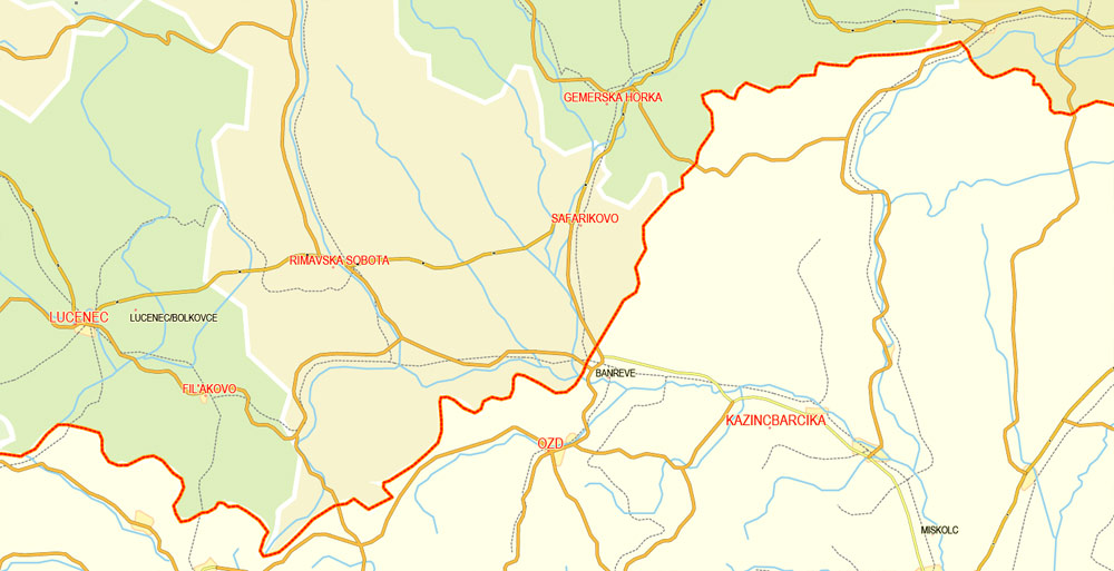
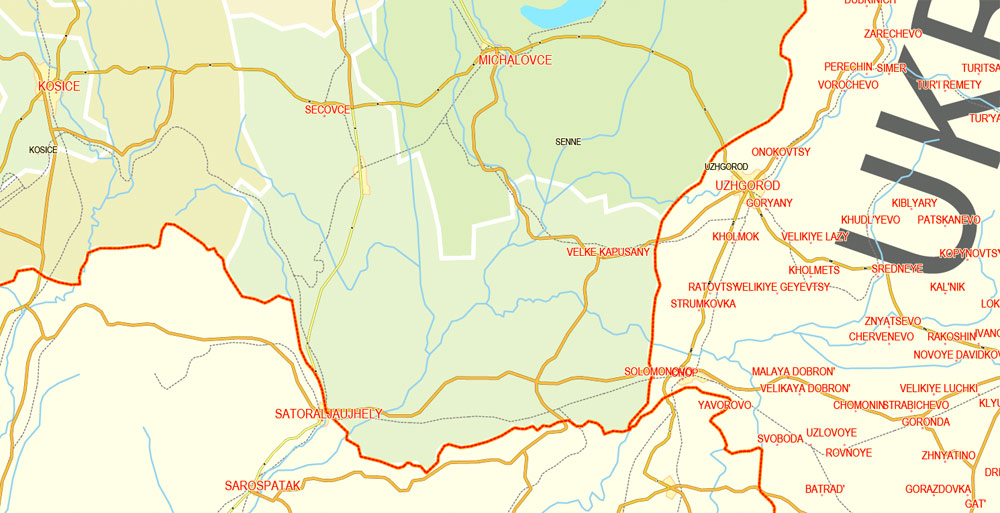
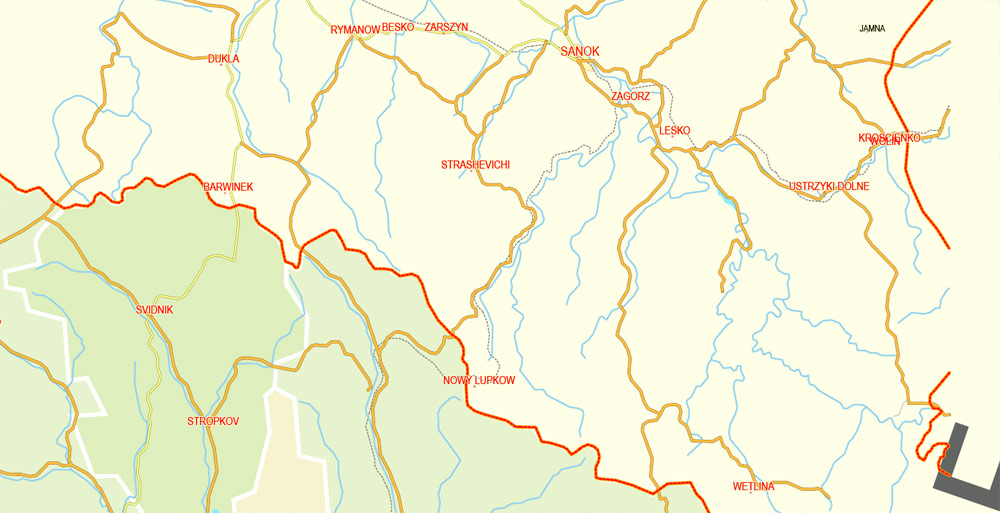
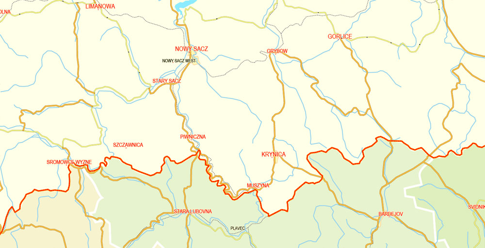
Slovakia borders Poland in the north – 547 km (339.9 mi), Ukraine in the east – 98 km (60.9 mi), Hungary in the south – 679 km (421.9 mi), Austria in the south-west – 106 km (65.9 mi), and the Czech Republic in the north-west – 252 km (156.6 mi) for a total border length of 1,672 km (1,038.9 mi).
Slovakia
Country in Europe
Slovakia is a central European country known for its dramatic natural landscape and many castles. Near the Austrian border, capital city Bratislava features a pedestrian-only Old Town with a lively cafe scene. Rising on a hill above the Danube River, Bratislava Castle houses a branch of the Slovak National Museum, with displays ranging from Roman artifacts to 20th-century arts and crafts.
Capital: Bratislava
Dialing code: +421
Currency: Euro
Capital and largest city: Bratislava; 48°09′N 17°07′E / 48.150°N 17.117°E
Official language: Slovak
Area
• Total
49,035 km2 (18,933 sq mi) (129th)
• Water (%) negligible
Population
• 2015 5,426,252
• 2011 census 5,397,036
• Density
111/km2 (287.5/sq mi) (88th)
Free vector maps:

Free download printable map Europe vector Adobe Illustrator >>>
Free download printable PDF map Europe vector Adobe PDF >>>

 Author: Kirill Shrayber, Ph.D. FRGS