The first settlement on the site of present-day Denver was founded in the summer of 1858 and was called Montana City. This was the time of the “gold rush” in Colorado (known as the “Pikes Peak Rush“), when a flood of gold prospectors poured into the territory, previously almost undeveloped by European settlers. A year later, the village was abandoned, and the prospectors moved to other, more promising areas.
Nevertheless, with the long-term goal of increasing the number of migrant miners, a land speculator from Kansas, William Larimer, bought up land here and founded a new settlement, calling it Denver City. With this name, Larmer intended to ingratiate himself with James Denver, the governor of the Kansas Territory, which at that time included these lands. But ironically, by the time Denver City got its name, James Denver had already left the governorship. The governor left, but the name remained, changing later to Denver.
As Denver City grew, it was a typical “frontier town”, whose economy at that time was based on providing miners with goods and entertainment, as well as trading cattle. In 1861, the city became the capital of the newly created Arapahoe County, and in 1867, the capital of the Colorado Territory.
In 1870, Denver was connected by rail to the Transcontinental Mainline further north in Wyoming, and to Kansas. Since then, the city has become an important transport hub, which has largely determined its development.
When the state of Colorado was formed in 1876, Denver claimed the right to be its capital. Denver was already the largest city in the new state, in fact, it was here that legislators gathered and the government of Colorado worked. However, given that there were several contenders for the right to be the “main city”, the final status of the capital was assigned to Denver only after a referendum held in the state in 1881.
By 1890, the population of Denver exceeded one hundred thousand people. The “gold rush” in Colorado was replaced in the eighties of the XIX century by the “silver boom”, the state and its capital developed rapidly. Luxury hotels, mansions of millionaires were built in the city, and an opera house appeared. At the same time, in the last two decades, Denver has become infamous for its high level of corruption and crime.
At the turn of the XIX-XX centuries, Denver was the fifth most populous city in the United States (more than one hundred and thirty thousand people) west of the Mississippi River and the second (after San Francisco) in the Western United States.
In 1908, the National Convention of the Democratic Party was held in Denver. It was the first political event of its kind in the Western states, and it was a clear recognition of Denver as one of the most important centers of public life in the United States.
At the beginning of the 20th century, the economy of Denver, as well as the state of Colorado as a whole, was based on the extraction of minerals and processing of agricultural products (primarily livestock). In 1928, a railroad tunnel through the Rocky Mountains was completed near the city, significantly shortening the route to the Pacific coast and further increasing the visibility of Denver as an important transportation hub. In 1929, the first airport was opened in the city.
During the Great Depression, the city was severely affected by the decline in industrial production. In the thirties, many Denver residents were involved in public works programs funded by the U.S. government.
With the outbreak of World War II, Denver, due to its distance from the ocean shores, became a very attractive place for the development of the military industry. Several defense companies began operating in the city, which led to an increase in the number of federal employees. The trend continued after the war when a number of federal agencies (including the National Nuclear Energy Commission, the National Institute of Standards and Metrology, and others) opened their offices in the Colorado capital. The Federal Government remains one of the largest employers in the state today.
Following the federal agencies, large corporations focused on military orders also came to the city. Later, in the sixties and seventies, oil and gas companies opened their offices in Denver.
Denver was chosen as the venue for the 1976 Winter Olympics, but the authorities rejected the idea due to the high cost of preparation.
Modern Denver is not only the economic but also the cultural center of the region. The Denver Art Museum, the largest art museum between Kansas City and San Francisco, is primarily known for its collection of American Indian art. In the Museum of Nature and Science, one of the largest natural science museums in the United States, you can see (and even touch something) rich expositions dedicated to paleontology, anthropology, geology, zoology, medicine, space exploration, and other topics. The theater Arts complex in Denver is the second largest in the United States after Lincoln Center in New York. Here you can see performances of dramatic theater groups, classical ballet, and modern dance; listen to opera singing and symphony orchestras. The complex also includes an opera house, known as the”Ellie Caulkins Opera“. Nature lovers can visit the Denver Botanical Garden, Zoo, and Aquarium.
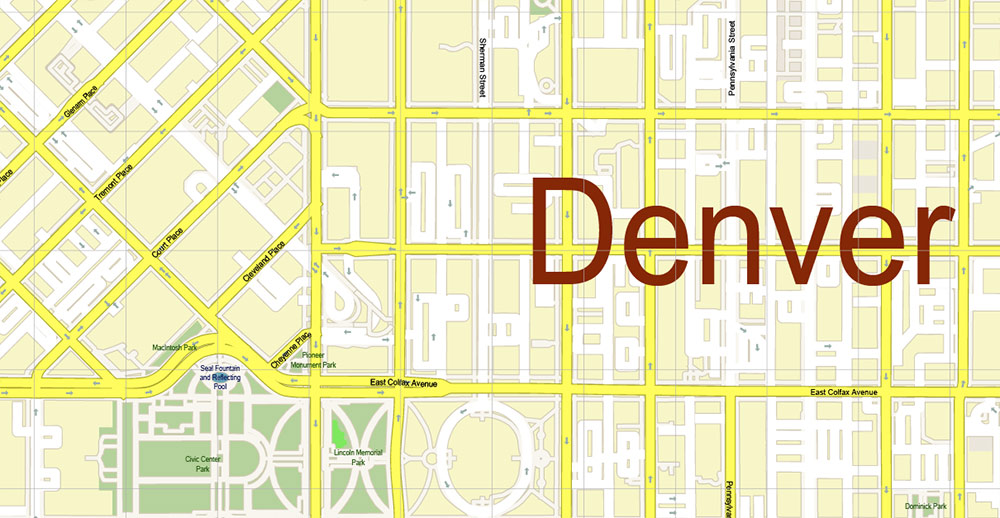
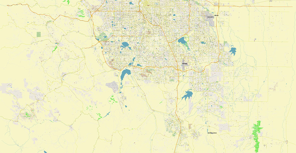
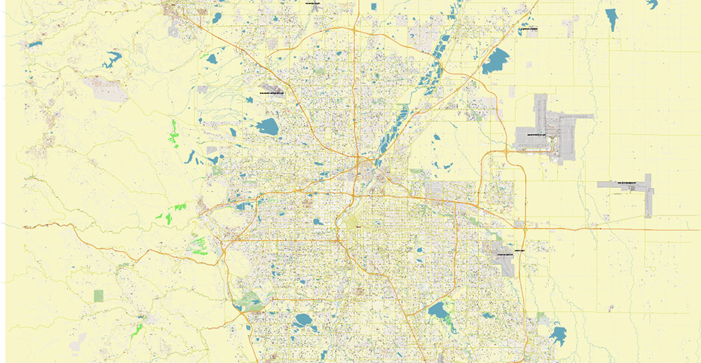
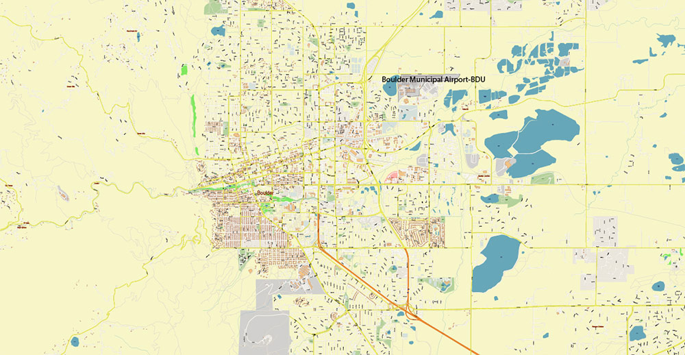
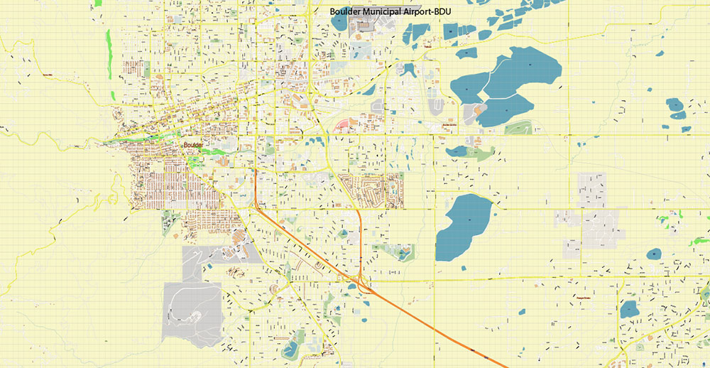
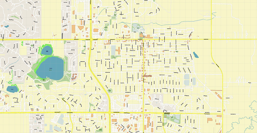
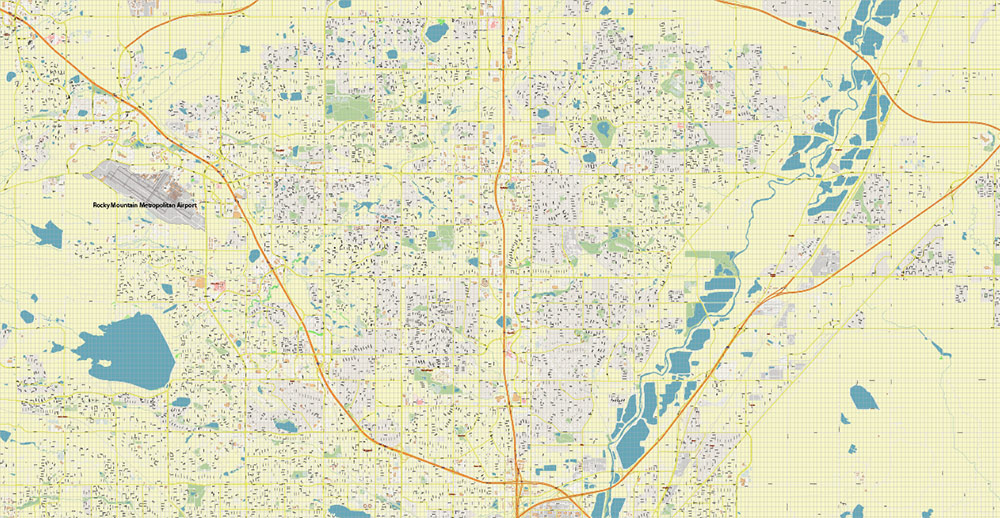
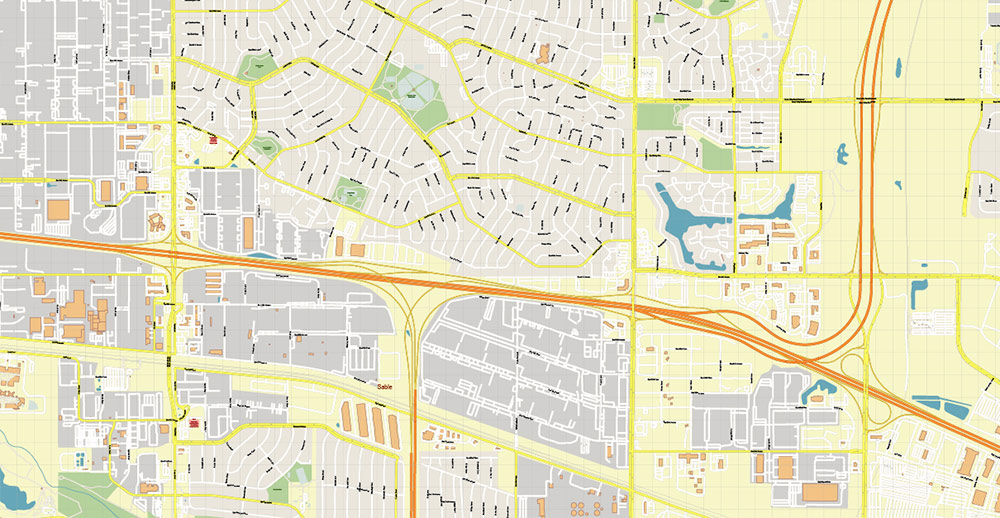
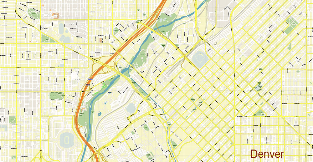
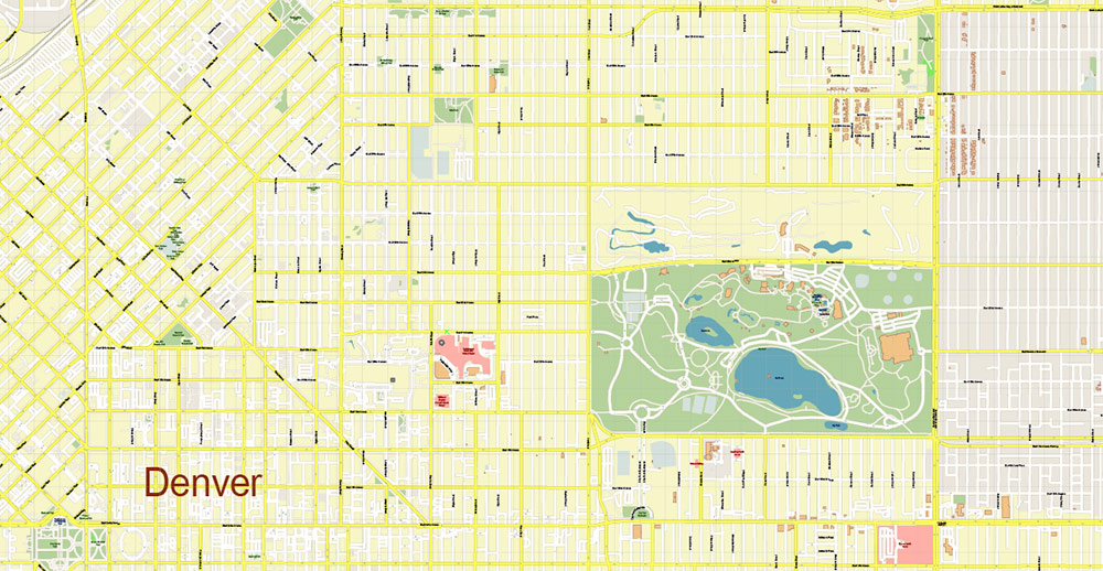
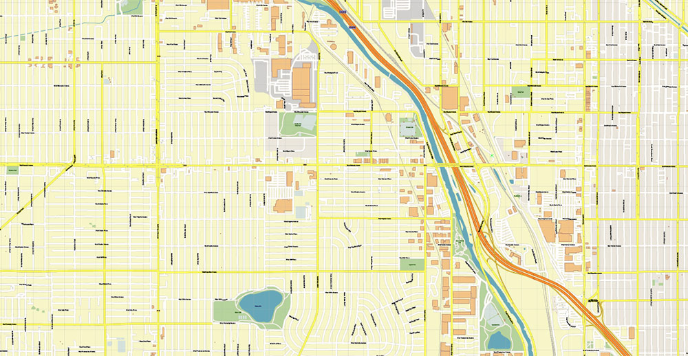
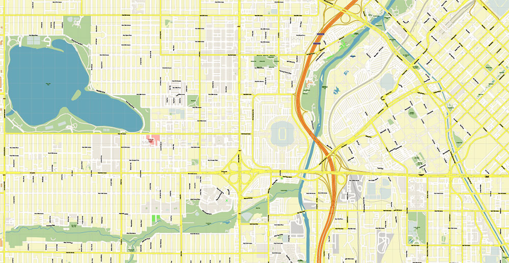
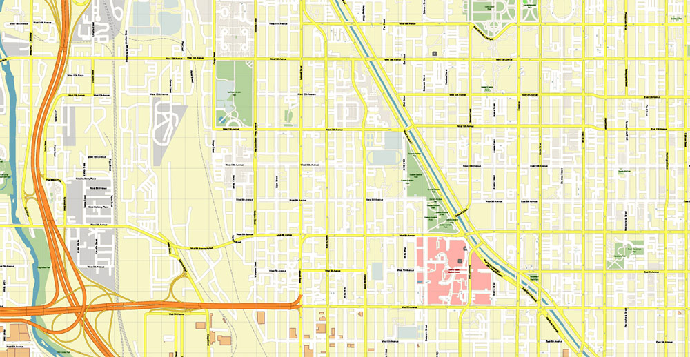
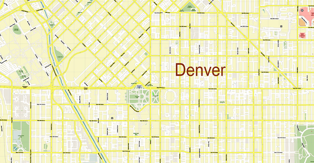
Printable Vector Map of Denver Boulder Colorado US detailed City Plan scale 1:3610 full editable Adobe Illustrator Street Map in layers, scalable, text / curves format all names, 67 MB ZIP
All street names, Main Objects, Buildings. Map for design, printing, arts, projects, presentations, for architects, designers, and builders, business, logistics.
Need AutoCAD DWG / DXF or any other format? Please, contact us!
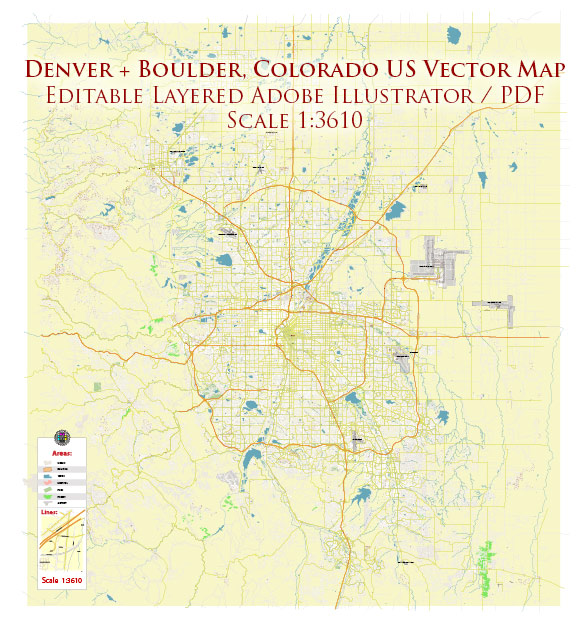
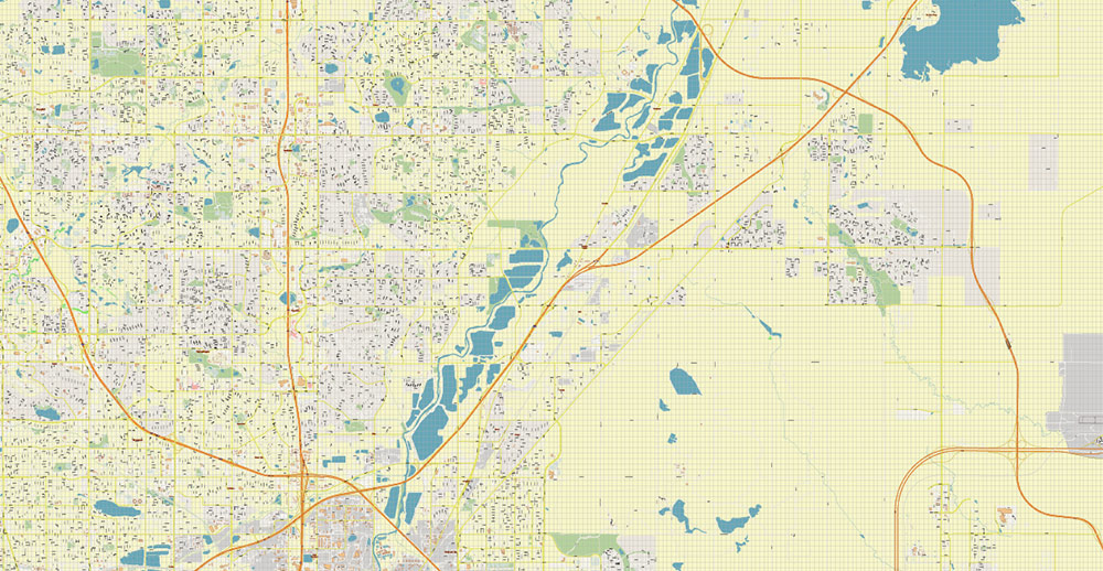
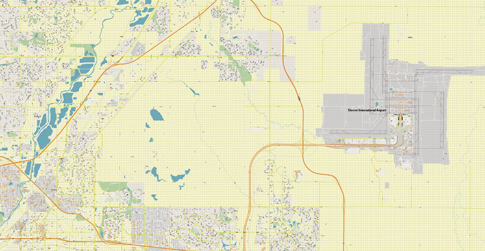
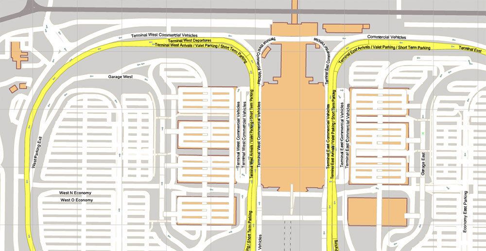
Denver Boulder Colorado US Map Vector Accurate High Detailed City Plan editable Adobe Illustrator Street Map in layers
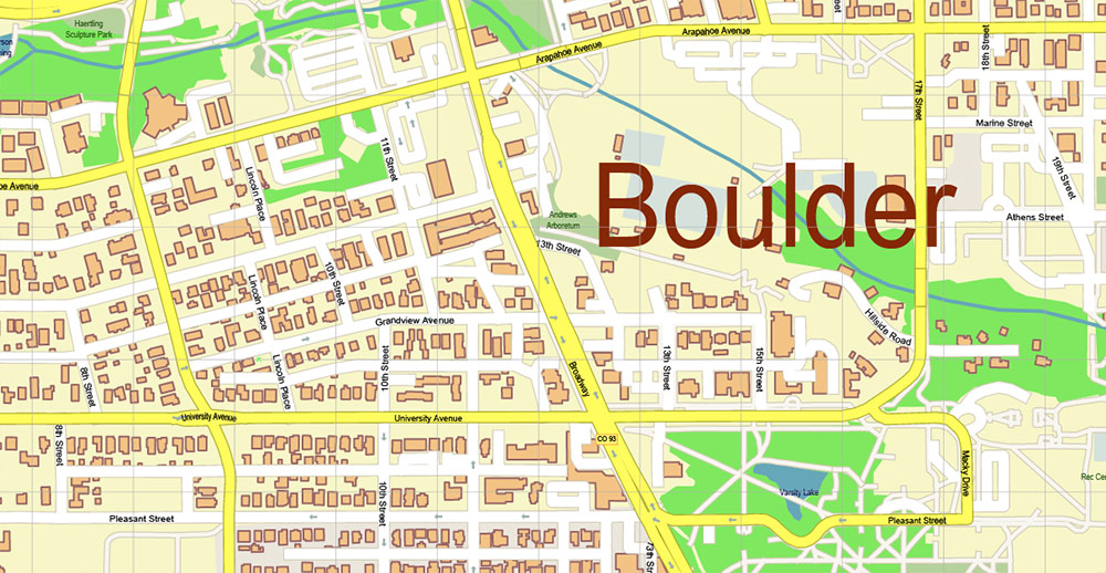
Layers list:
- Legend
- Grids
- Labels of roads
- Names of places (city, hamlet, etc.)
- Names of objects (hospitals, parks, water)
- Names of main streets
- Names of civil streets
- Arrows of street drive direction
- Main Streets, roads
- Civil streets
- Railroads
- Buildings
- Airports and heliports
- Water objects (rivers, lakes, ponds)
- Waterways
- Color fills (parks, hospital areas, land use, etc.)
- Background
Denver Boulder Colorado US Map Vector Accurate High Detailed City Plan editable Adobe Illustrator Street Map in layers
Denver Boulder Colorado US Map Vector Accurate High Detailed City Plan editable Adobe Illustrator Street Map in layers

Denver Boulder Colorado US Map Vector Accurate High Detailed City Plan editable Adobe Illustrator Street Map in layers
Denver Boulder Colorado US Map Vector Accurate High Detailed City Plan editable Adobe Illustrator Street Map in layers
Denver Boulder Colorado US Map Vector Accurate High Detailed City Plan editable Adobe Illustrator Street Map in layers

Denver Boulder Colorado US Map Vector Accurate High Detailed City Plan editable Adobe Illustrator Street Map in layers
Denver Boulder Colorado US Map Vector Accurate High Detailed City Plan editable Adobe Illustrator Street Map in layers
Denver Boulder Colorado US Map Vector Accurate High Detailed City Plan editable Adobe Illustrator Street Map in layers

Denver Boulder Colorado US Map Vector Accurate High Detailed City Plan editable Adobe Illustrator Street Map in layers
Denver Boulder Colorado US Map Vector Accurate High Detailed City Plan editable Adobe Illustrator Street Map in layers

Denver Boulder Colorado US Map Vector Accurate High Detailed City Plan editable Adobe Illustrator Street Map in layers
Denver Boulder Colorado US Map Vector Accurate High Detailed City Plan editable Adobe Illustrator Street Map in layers
Denver Boulder Colorado US Map Vector Accurate High Detailed City Plan editable Adobe Illustrator Street Map in layers
Denver Boulder Colorado US Map Vector Accurate High Detailed City Plan editable Adobe Illustrator Street Map in layers
Denver Boulder Colorado US Map Vector Accurate High Detailed City Plan editable Adobe Illustrator Street Map in layers
Denver Boulder Colorado US Map Vector Accurate High Detailed City Plan editable Adobe Illustrator Street Map in layers

Denver Boulder Colorado US Map Vector Accurate High Detailed City Plan editable Adobe Illustrator Street Map in layers
Denver Boulder Colorado US Map Vector Accurate High Detailed City Plan editable Adobe Illustrator Street Map in layers
Denver Boulder Colorado US Map Vector Accurate High Detailed City Plan editable Adobe Illustrator Street Map in layers
Denver Boulder Colorado US Map Vector Accurate High Detailed City Plan editable Adobe Illustrator Street Map in layers

Denver Boulder Colorado US Map Vector Accurate High Detailed City Plan editable Adobe Illustrator Street Map in layers
Denver Boulder Colorado US Map Vector Accurate High Detailed City Plan editable Adobe Illustrator Street Map in layers
Denver Boulder Colorado US Map Vector Accurate High Detailed City Plan editable Adobe Illustrator Street Map in layers
Denver Boulder Colorado US Map Vector Accurate High Detailed City Plan editable Adobe Illustrator Street Map in layers

 Author: Kirill Shrayber, Ph.D. FRGS
 editable Adobe Illustrator in layers")


