Dallas map in Adobe Illustrator (.AI). TX, USA
Archive size: 110 Mb
We provide editable vector maps of Dallas in different formats.
Content: 25 parts Atlas map
[Available in PDF and other formats: .DWG; .AI; .EPS; .CDR; .PPT.]
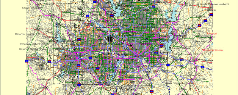
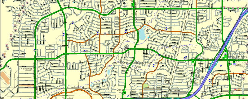
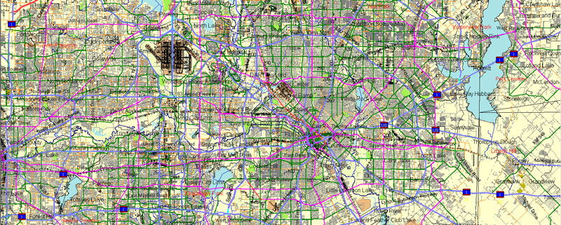
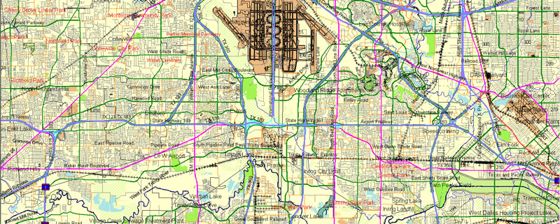
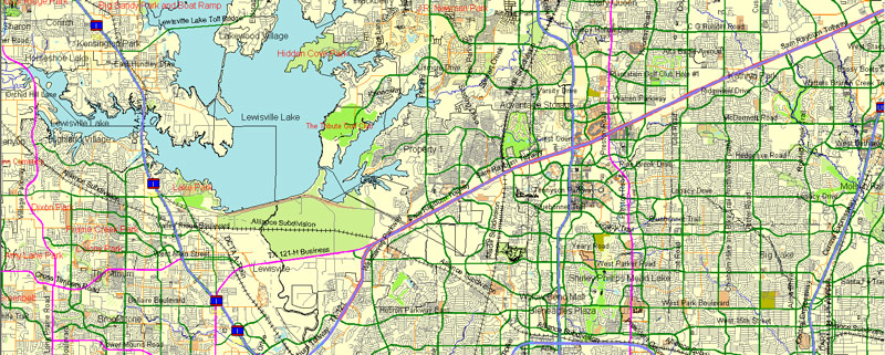
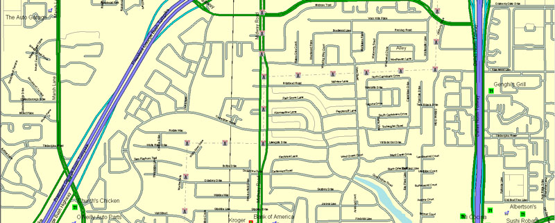
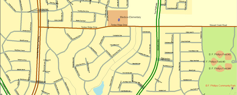
This vector maps show Dallas city with all main streets, highways, airports, railways, power lines, rivers and other. Here below you can see a full list of features this Dallas vector map has.
Our printable maps of Dallas are full editable and ready for printing. You can change style or fonts, add images, or change the color scheme. Vector maps can be adjusted to any necessary size, no matter what big it is.
Dallas vectorial map features:
Highways with names,
Major streets with names,
Major Roads,
Minor Roads,
Private Roads,
Latitude and Longitude data,
Lake, ponds and other water bodies,
Landmark fill,
Cemeteries,
County Borders with fill,
National Park Borders,
Airports
Houses,
Big and small Rivers, small streams also,
Railway lines with stops,
Recreation zones,
Parking,
Sidewalk/Walkway/Pedestrian roads,
Power Lines,
Dam,
Pipeline,
Parks.
Need some specific POI (points of interest like stores and shops for example) to be displayed on our layered vector maps of Dallas? Please feel free to contact us.
Dallas + Fort Worth, Texas, USA.
This vector map of Dallas city is used as a basis for design, editing, and further printing.
This is the most detailed, exact map of Dallas city for high-quality printing and polygraphy. You can always clarify the map development date by contacting us.
For your convenience, all objects on Dallas vector city map are divided into layers. And the editing is very easy – colors, lines, etc.
You can easily add any objects needed (e.g. shops, salons, sale points, gas station or attraction) on any layer of Dallas vector map.
Dallas is a city in the U.S. state of Texas. With an estimated 2017 population of 1,341,075, it is the ninth most-populous city in the U.S. and third in Texas after Houston and San Antonio. Dallas is the main core of the largest metropolitan area in the Southern United States and the largest inland metropolitan area in the U.S. that lacks any navigable link to the sea. It is the most populous city in the Dallas–Fort Worth metroplex, the fourth-largest metropolitan area in the country at 7.3 million people as of 2017. Dallas is the seat of Dallas County. Sections of the city extend into Collin, Denton, Kaufman, and Rockwall counties.
One of the advantages of Dallas city vector maps of our production is the relevance of cartographic data, we constantly update all our products.
This vector map of Dallas city is used by:
designers, layout designers, printers, advertisers and architects. Our product – vector maps – is designed for further editing and printing in large formats – from @Wall format (a few meters) to A-0 and A-1, A-2, A-3.
The Dallas city map in vector format is used for design, urban planning, presentations and media visualizations.
The advertising and presentation map of Dallas city (usually the final designer marks the routes, and puts the client’s objects (shops, saloons, gas stations etc.)
The undoubted advantage is that people will NEVER throw out this advertising product – the map. In fact, as an advertising medium, a city map is the most “long-playing” of the well-known polygraphic advertising media, with the longest lifespan, and the maximum number of interactions with the customer.
Dallas and nearby Fort Worth initially developed due to the construction of major railroad lines through the area allowing access to cotton, cattle, and later oil in North and East Texas. The construction of the Interstate Highway System reinforced Dallas’s prominence as a transportation hub, with four major interstate highways converging in the city and a fifth interstate loop around it. Dallas then developed as a strong industrial and financial center, and a major inland port, due to the convergence of major railroad lines, interstate highways, and the construction of Dallas/Fort Worth International Airport, one of the largest and busiest airports in the world.
For travelers, maps are sold at the airports and gas stations around the world. Often the source is our vector maps.
Take a look, who purchases our vector maps of Dallas city in “Our Clients and Friends” page – these are large and small companies, from super-brands like Volvo and Starbucks, to small design studios and printing houses.
It’s very easy to work with vector maps of Dallas city, even for a not very experienced designer who can turn on and off the map layers, add new objects, change the colors of fill and lines according to customer requirements.
The undoubted advantage of Dallas city vector maps in printing is an excellent and detailed visualization, when customer can expand a large paper map and instantly define his location, find a landmark, an object or address on map, unlike using the popular electronic formats of Google and Yandex maps for example.
Printable vector maps of Dallas city are much more convenient and efficient than any electronic maps on your smartphone, because ALL DETAILS are displayed in the entire space of Dallas city map.
Dallas is rated a “beta(+)” global city. The economy of Dallas is considered diverse, with dominant sectors including defense, financial services, information technology, telecommunications, and transportation. It serves as the headquarters for 9 Fortune 500 companies within the city limits. The Dallas–Fort Worth metroplex hosts additional Fortune 500 companies, including American Airlines (Fort Worth), ExxonMobil (Irving), and J.C. Penney (Plano). The city has a population from a myriad of ethnic and religious backgrounds and the sixth-largest LGBT population in the United States.
Useful tips on working with vector maps of cities and countries in Adobe Illustrator.
«V» – launches the Selection tool (cursor, black arrow), which makes active any vector line.
«А» – launches the Direct Selection tool (white cursor), allows you to select curve elements and drag them to the desired place.
«R» – activates the Rotate tool, which helps you rotating selected objects around the center point by 360 degrees.
«E» – gives you the opportunity to use the Eraser tool and erase unnecessary parts.
«X» – switches between Fill and Stroke in the Tools section. Try to get used to this hot key and
you will quickly understand that you can’t live and work without it.
Guides are not limited to vertical and horizontal in Adobe Illustrator. You can also create a diagonal guide for example. Moreover, you can turn any contours into guides. Select the outline and go to View > Guides > Make Guides (Create Guides), or simply press Cmd/Ctrl + 5. You can also turn the guides back into an editable object. Go to menu, View > Guides > Unlock Guides (Release Guides), select the guide you want to edit and select View > Guides > Release Guides (Reset Guides), or just press Cmd/Ctrl + Option / Alt + 5).
Geography
Dallas is the county seat of Dallas County. Portions of the city extend into neighboring Collin, Denton, Kaufman, and Rockwall counties. According to the United States Census Bureau, the city has a total area of 385.8 square miles (999.3 km2). 340.5 square miles (881.9 km2) of Dallas is land and 45.3 square miles (117.4 km2) of it (11.75%) is water. Dallas makes up one-fifth of the much larger urbanized area known as the Dallas–Fort Worth metroplex, in which one quarter of all Texans live.
You will probably want to change the color scheme used on our Dallas vector city map.
To quickly and effectively play with colors.
Of course, you can do it manually, all objects in our Dallas city vector map are divided according to types and layers, and you can easily change the color gamma of vector objects in groups and layers.
But there is more effective way of working with the whole VECTOR MAP of Dallas city and all layers:
The overview dialog «Edit colors»/«Repaint Graphic Object» (this dialog box name can change depending on the context):
If you have selected a part or a layer of Dallas city vector map and open the dialog box by clicking the icon in the Control panel, on the Samples palette or the Color Catalog, or if you choose Edit > Edit Colors> Repaint Graphic Object, then the «Repaint Graphic Object» dialog box appears, and you get access to «Assign» and «Edit» tabs.
If a picture or a map fragment is not selected, and you open the dialog box by clicking the icon in the Control panel, on the Samples palette or in the Color Catalog, the «Edit Colors» dialog box appears and you can only access the «Edit» tab.
Regardless of the name at the top of the dialog box, the right-hand side always displays the color group of the current document, as well as two default color groups: Print Color and Grayscale. These color groups can be selected and used any time.
Create and edit color groups of Dallas city vector map, and also assign colors using the «Edit Colors»/ а «Repaint Graphic Object» dialog box.
A. Creating and editing of a color group on the «Edit» tab
B. Assigning colors on the «Assign» tab
C. Select a group of colors from the «Color groups» list
The option «Repaint a graphic object» in the lower part of the dialog box allows you to preview the colors on a selected layer of Vector map, or a group of elements, and specify whether its colors will be redefined when the dialog box is closed.
The main areas of the dialog box are:
«Edit»
The «Edit» tab is designed to create a new or edit the existing color groups.
The harmony rules Menu and the Color Wheel are used to conduct experiments with color harmonies. The color wheel shows how colors are related in color harmony, and the color bars allow you to view and manipulate an individual color values. In addition, you can adjust the brightness, add and remove colors, save color groups and view colors on the selected Vector Map of Dallas city or a separated layers.
«Assign»
The «Assign» tab is used to view and control on how the original colors are replaced with colors from the color group like your corporate colors in the Vector Map of Dallas city.
The assign color ability is provided only if the entire map, layer or fragment is selected in the document. You can specify which of new colors replace the current colors, whether the spot colors should be preserved and how colors are replaced (for example, you can replace colors completely or changing the color tone while maintaining the brightness). The «Assign» tab allows you to redefine colors in the Vector Map of Dallas city, or in separate layers and fragments using the current color group or reducing the number of colors in the current Vector Map.
Central Dallas
Central Dallas is anchored by Downtown, the center of the city, along with Oak Lawn and Uptown, areas characterized by dense retail, restaurants, and nightlife. Downtown Dallas has a variety of named districts, including the West End Historic District, the Arts District, the Main Street District, Farmers Market District, the City Center business district, the Convention Center District, and the Reunion District. “Hot spots” in this area include Uptown, Victory Park, Harwood, Oak Lawn, Dallas Design District, Trinity Groves, Turtle Creek, Cityplace, Knox/Henderson, Greenville and West Village.
Color groups
Is a list of all saved color groups for current document (the same groups appear in the «Samples» palette). You can edit and delete the existing color groups, as well as creating a new ones using the list of “Color Groups” in the dialog box. All changes appear in the «Samples» palette.
The highlighted color group shows, which color group is currently edited.
Any color group can be selected and edited, or used to redefine the colors in the selected vector map of Dallas city, its fragments or elements.
Saving a color group adds this group to the specified list.
Opening the «Edit Colors»/«Repaint Graphic Object» dialog box.
Open the «Edit Colors»/«Repaint Graphic Object» dialog box using one of the following methods:
«Edit»> «Edit Colors»> «Repaint Graphic object» or «Repaint With Style».
Use these commands if you need to edit the colors in the selected vector map of Dallas city.
«Repaint Graphic object» button on the «Control» panel.
Use this button if you need to adjust colors of Dallas city vector map using the а «Repaint graphic object» dialog box.
The specified button is available if the selected vector map or its fragment contains two or more colors.
Note. This color editing method is convenient for global color adjustment in a vector map, if global colors were not used when creating a City Map of Dallas.
The «Edit colors» button or «Edit or apply colors» on the «Color Catalog» palette
Click this button if you need to edit colors on the «Color Catalog» palette or edit and then apply them to the selected Vector Map of Dallas city or its fragment.
The «Edit color group» button or «Edit or apply color group» on the «Samples» palette.
Click this button if you need to edit the colors in the specific color group or edit and apply them to the selected Vector Map of Dallas city or a group of its elements, for example, the whole layer “Streets and lines”. You can also double-click the color group in the Samples panel to open the dialog box.
If the map file is too large and your computer freezes or even can’t open it quickly:
1. Try to reduce the color resolution of the video card (display) to 256 colors while working with a large map.
2. Using Windows Task Manager, select all the application you don’t need, while working with map, just turn them off.
3. Launch Adobe Illustrator. (DO NOT OPEN the vector map file)
4. Start the Windows Task Manager using administrator rights > Find the “Illustrator” process > set the «real time» priority,
5. Open the file. When you see the LEGACY FONT popup window – click “OK” (do not update). You can restore the TEXT later.
6. Can also be useful: When file is opened – Edit > Settings > Basic Settings > disable smoothing. /// It looks scary, but works quickly)))
We recommend saving the file in Adobe Illustrator 10 version. It’s much more stable when working with VERY BIG size files.
East Dallas
East Dallas is home to Deep Ellum, a trendy arts area close to Downtown, the homey Lakewood neighborhood (and adjacent areas, including Lakewood Heights, Wilshire Heights, Lower Greenville, Junius Heights, and Hollywood Heights/Santa Monica), historic Vickery Place and Bryan Place, and the architecturally significant neighborhoods of Swiss Avenue and Munger Place. Its historic district has one of the largest collections of Frank Lloyd Wright-inspired prairie-style homes in the United States. In the northeast quadrant of the city is Lake Highlands, one of Dallas’s most unified middle-class neighborhoods.
Southern Dallas
South Dallas, a distinct neighborhood southeast of Downtown, lays claim to the Cedars, an eclectic artist hotbed, and Fair Park, home of the annual State Fair of Texas, held from late September through mid-October. Southwest of Downtown lies Oak Cliff, a hilly area that has undergone gentrification in recent years, in neighborhoods such as the Bishop Arts District. Oak Cliff was a township founded in the mid-1800s and annexed in 1903 by Dallas. Today, most of the area’s northern residents are Hispanic. The ghost town of La Reunion once occupied the north tip of Oak Cliff. South Oak Cliff’s population is a mix of African American, Hispanic, and Native American.
South Side Dallas is a popular location for nightly entertainment at the NYLO rooftop patio and lounge, The Cedars Social. The neighborhood has undergone extensive development and community integration. What was once an area characterized by high rates of poverty and crime is now one of the city’s most attractive social and living destinations.
Further east, in the southeast quadrant of the city, is the large neighborhood of Pleasant Grove. Once an independent city, it is a collection of mostly lower-income residential areas stretching to Seagoville in the southeast. Though a city neighborhood, Pleasant Grove is surrounded by undeveloped land on all sides. Swampland and wetlands separating it from South Dallas will in the future be part of the Great Trinity Forest, a subsection of the city’s Trinity River Project which is planned to restore and preserve wetlands, newly appreciated for habitat and flood control.
Fort Worth, Texas, USA.
Fort Worth is the 15th-largest city in the United States and the fifth-largest city in the state of Texas. It is the county seat of Tarrant County, covering nearly 350 square miles (910 km2) into four other counties: Denton, Johnson, Parker and Wise. According to the 2017 census estimates, Fort Worth’s population is 874,168. The city is the second-largest in the Dallas–Fort Worth–Arlington metropolitan area (the “DFW Metroplex”), which is the 4th most populous metropolitan area in the United States.
Fort Worth was established in 1849 as an army outpost on a bluff overlooking the Trinity River. It still embraces its Western heritage and traditional architecture and design. USS Fort Worth (LCS-3) is the first ship of the United States Navy named after the city.
Fort Worth is home to the Van Cliburn International Piano Competition and several world-class museums designed by internationally known contemporary architects. The Kimbell Art Museum, considered to have one of the best collections in Texas, is housed in what is widely regarded as one of the state’s foremost works of modern architecture, designed by Louis Kahn with an addition by Renzo Piano. Also of note is the Modern Art Museum of Fort Worth, designed by Tadao Ando. The Amon Carter Museum of American Art, designed by Philip Johnson, houses one of the world’s most extensive collections of American art. The Sid Richardson Museum, redesigned by David M. Schwarz, has one of the most focused collections of Western art in the U.S., emphasizing Frederic Remington and Charles Russell.
The city is stimulated by several university communities: Texas Christian University, Texas Wesleyan, University of North Texas Health Science Center, and Texas A&M University School of Law, and many multinational corporations, including Bell Helicopter, Lockheed Martin, American Airlines, BNSF Railway, Pier 1 Imports, XTO Energy and RadioShack.
Geography
Fort Worth is located in North Texas, and has a generally humid subtropical climate. It is part of the Cross Timbers region; this region is a boundary between the more heavily forested eastern parts and the rolling hills and prairies of the central part. Specifically, the city is part of the Grand Prairie ecoregion within the Cross Timbers.
The Dallas–Fort Worth metroplex is the hub of the North Texas region. According to the United States Census Bureau, the city has a total area of 349.2 square miles (904 km2), of which 342.2 square miles (886 km2) is land and 7.0 square miles (18 km2) is covered by water.
A large storage dam was completed in 1914 on the West Fork of the Trinity River, 7 miles (11 km) from the city, with a storage capacity of 33,495 acre feet of water. The lake formed by this dam is known as Lake Worth.
The city is not entirely contiguous and has several enclaves, practical enclaves, semi-enclaves and cities that are otherwise completely or nearly surrounded by it, including: Westworth Village, River Oaks, Saginaw, Blue Mound, Benbrook, Everman, Forest Hill, Edgecliff Village, Westover Hills, White Settlement, Sansom Park, Lake Worth, Lakeside, and Haslet.
Dallas city vector map. Cities and counties near
This scalable vector map of Dallas also includes maps of (please check the preview image):
Highland Park, University Park, Irving, Farmers Branch, Richardson, Balch Springs, Addison, Mesquite, Garland, Carrollton, Duncanville, Grand Prairie, Lancaster, Rowlett, DeSoto, Plano, Cockrell Hill, Hutchins, Sunnyvale, Seagoville.
Dallas vector maps. Purchasing of editable
This purchase has a Royalty Free license, which means you don`t have to pay an extra cost for more copies. You can edit, copy, print as many times as you need. We accept PayPal and Credit Card payment. After the payment you will be redirected to the download page.
If you need a specific vector map of the city we don`t have – feel free to write us and we will prepare it as soon as possible: secreto@solcity.info
We always have: unbeatable prices and quality. VectorMap.info
Small guide: How to work with the vector map?
You can: Mass select objects by type and color – for example, the objects type “building” (they are usually dark gray) – and remove them from the map, if you do not need them in your print or design project. You can also easily change the thickness of lines (streets), just bulk selection the road by the line color.
The streets are separated by type, for example, type “residential road” are usually white with a gray stroke. Highway usually orange with a brown or dark gray stroke.
All objects are divided by types: different types of roads and streets, polygons of buildings, landfills, urban areas, parks and more other.
It is easy to change the font of inscriptions, all or each individually. Also, just can be make and any other manipulation of objects on the vector map in Adobe illustrator format.
Important: All the proportions on the map are true, that is, the relative sizes of the objects are true, because Map is based on an accurate GPS projection, and It transated into the (usual for all) the Mercator projection.
You can easily change the color, stroke and fill of any object on the map, zoom without loss of quality Image Verification.
Select object

Bulk selection the same objects on the vector map

See the bulk selected objects on the vector map

Bulk delete buildungs from the vector map

Select residencial road (small street) on the vector map

Bulk selection the same lines (streets, roads) on the full map

Create fat lines of the streets on the vector maps (bulk action) 1

Create fat lines of the streets on the vector maps (bulk action) 2

Create fat lines of the streets on the vector maps (bulk action) 3

You can easily change the color, stroke and fill of any object on the map, zoom without loss of quality Image Verification.


 Author: Kirill Shrayber, Ph.D. FRGS

