Extended Description of the Vector Map
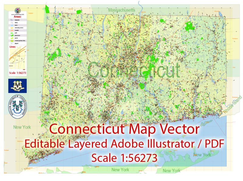
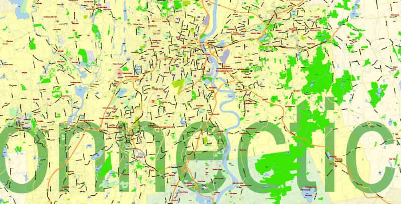
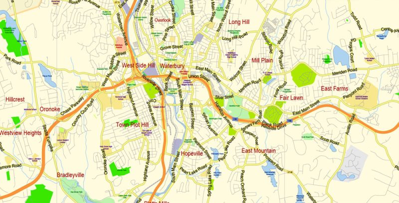
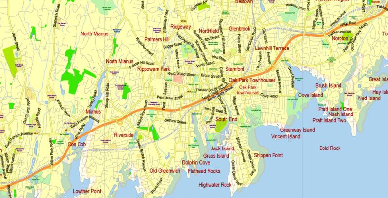
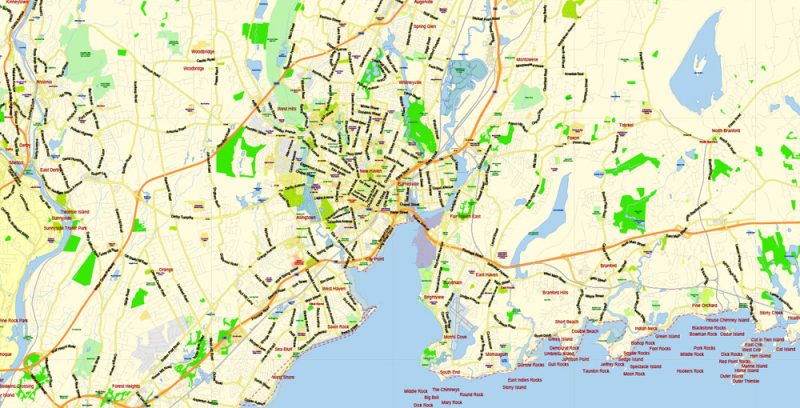
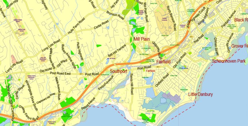
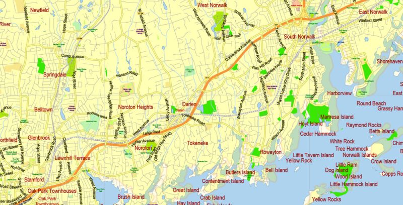
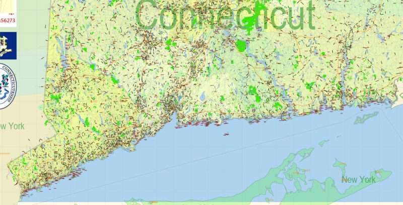
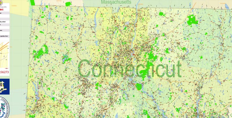
Printable PDF Vector Map of Connecticut State US detailed Plan scale 1:56273 full editable Adobe PDF Road Admin Map in layers, scalable, text format all names, 73 MB ZIP
Principal street names, All Cities and Towns, Main Objects, Counties. Map for design, printing, arts, projects, presentations, for architects, designers, and builders, business, logistics.
Layers: color_fills, water, streets_roads, labels_roads, counties_areas, state_areas, names_objects, names_streets, names_places, grids, legend, etc.
If you need: we can add postal codes (zip codes areas with numbers) to the map as a separated layer.
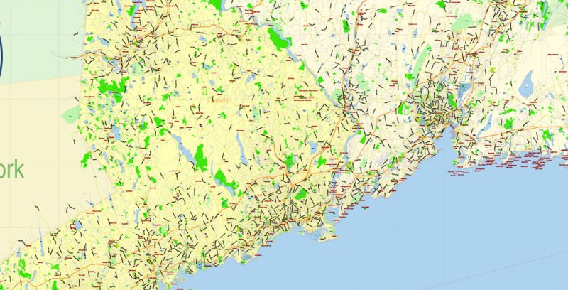
The most exact and detailed map of the state in scale.
For Editing and High-Quality Printing
Connecticut
Connecticut is a state of the New England region. Connecticut is located in the northeastern part of the United States. This is one of the smallest in area of the States – occupies 48-e a place.
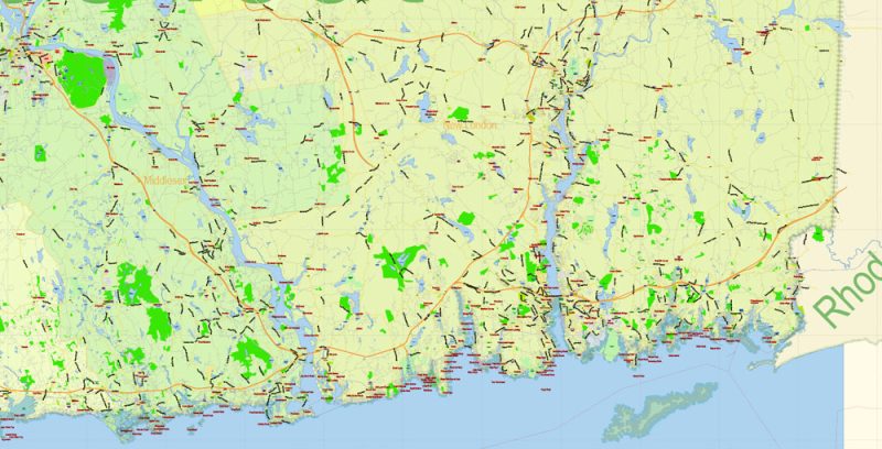
Connecticut State Map Vector Exact Plan detailed Road Admin Map editable Adobe Illustrator in layers
One of his “edge” he goes to the Atlantic Ocean and the Strait of long island, among the neighbors has the States of New York, Massachusetts, and Rhode Island. The capital of Connecticut is Hartford, founded by the Dutch in the first third of the XVII century, but the largest city in the state and has not become – about 125 thousand people inhabit Hartford. The population of the whole state is 3.5 million people (29th place among the States).
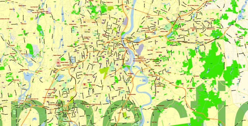
Connecticut State Map Vector Exact Plan detailed Road Admin Map editable Adobe Illustrator in layers
Connecticut is called the “State of the Constitution” because it, while still a colony, announced the adoption of the world’s first Constitution. It is also one of the 13 British colonies that declared their independence.
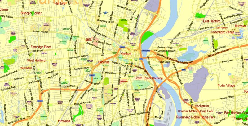
Connecticut State Map Vector Exact Plan detailed Road Admin Map editable Adobe Illustrator in layers
Taconic mountains, part of the Appalachian mountain system, are located along the border with the state of New York. The highest points of these mountains – the top of Frissell (almost 750 meters) and Bear mountain, mount Bear (708 meters). In the mountains Tectonic padded “Appalachian trail” – a popular route for Hiking. It runs through several States, starting in Georgia and finishing in Maine. Flowing in these mountains Housatonic River and lakes in its valley – the habitat of trout and good fishing.
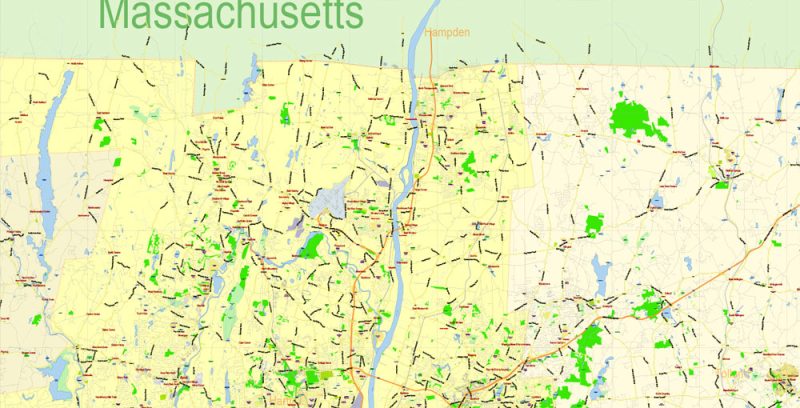
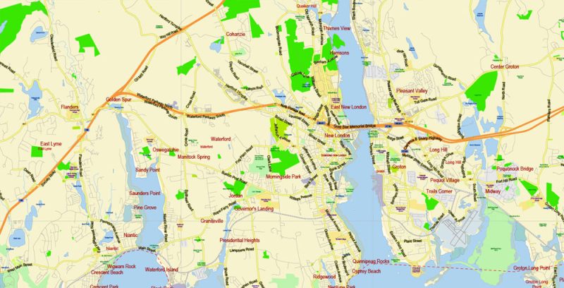
Connecticut State Map Vector Exact Plan detailed Road Admin Map editable Adobe Illustrator in layers
On the coast of long island are sandy beaches. And in the mountains of Connecticut is ski resorts – Woodbury and Mohawk near Lichfield, Ski sundown near Hartford, Southington near New Haven.
Connecticut State Map Vector Exact Plan detailed Road Admin Map editable Adobe Illustrator in layers
Hartford is recognized as the economic center of New England. It housed its office’s large companies, such as the manufacturer of elevators Otis. In Hartford, there are two houses-museums of famous American writers – Mark Twain and Harriet Beecher Stowe. The author of the Connecticut Yankee at King Arthur’s court lived in Hartford in the 70s and 90s of the 19TH century, and Beecher Stowe, who wrote Uncle Tom’s Cabin, is a native of Connecticut (Litchfield city), and Hartford became the place of her death.
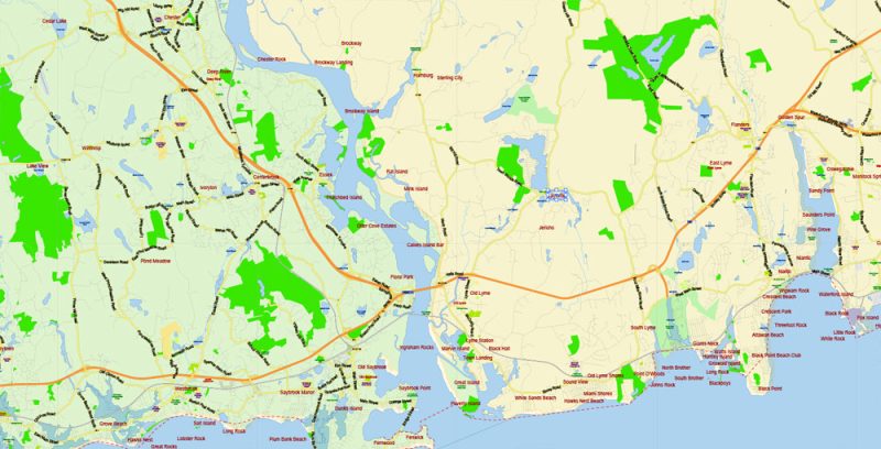
Connecticut State Map Vector Exact Plan detailed Road Admin Map editable Adobe Illustrator in layers
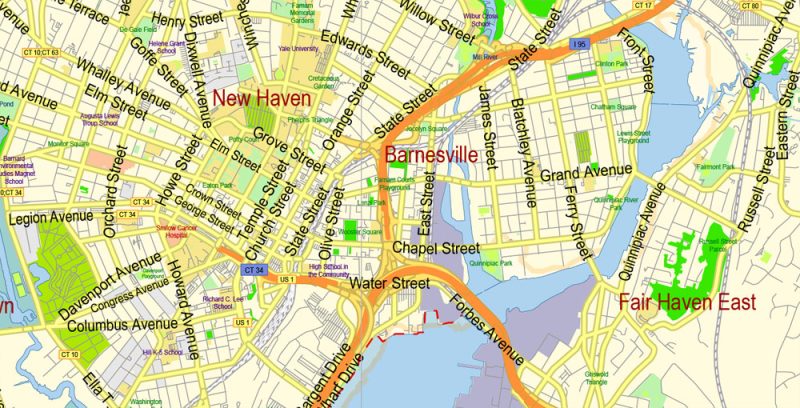
New Haven, one of the largest cities in the state, is famous for the fact that it is the oldest American University – Yale. Harvard, Princeton, and Yale make up the “Big three” us universities. The University campus is a historical and architectural complex in the Gothic style with the Hackness tower. The University was founded at the beginning of the XVIII century and was named after one of the famous Connecticut patrons of art named Yale. On the territory of the University, there are several museums, access for tourists is allowed. New Haven, by the way, from time to time became the capital of the state, in turn with Hartford.
Connecticut State Map Vector Exact Plan detailed Road Admin Map editable Adobe Illustrator in layers
Connecticut State Map Vector Exact Plan detailed Road Admin Map editable Adobe Illustrator in layers
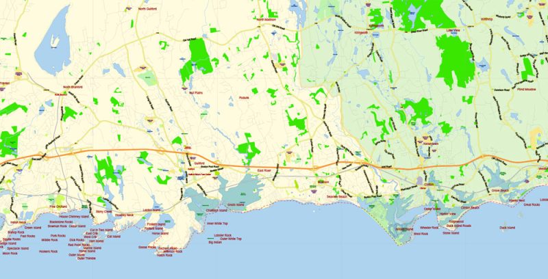
Connecticut State Map Vector Exact Plan detailed Road Admin Map editable Adobe Illustrator in layers
Connecticut State Map Vector Exact Plan detailed Road Admin Map editable Adobe Illustrator in layers
Connecticut State Map Vector Exact Plan detailed Road Admin Map editable Adobe Illustrator in layers
Connecticut State Map Vector Exact Plan detailed Road Admin Map editable Adobe Illustrator in layers
Connecticut State Map Vector Exact Plan detailed Road Admin Map editable Adobe Illustrator in layers
Connecticut State Map Vector Exact Plan detailed Road Admin Map editable Adobe Illustrator in layers
Connecticut State Map Vector Exact Plan detailed Road Admin Map editable Adobe Illustrator in layers
Connecticut State Map Vector Exact Plan detailed Road Admin Map editable Adobe Illustrator in layers
Connecticut State Map Vector Exact Plan detailed Road Admin Map editable Adobe Illustrator in layers
Connecticut State Map Vector Exact Plan detailed Road Admin Map editable Adobe Illustrator in layers
Connecticut State Map Vector Exact Plan detailed Road Admin Map editable Adobe Illustrator in layers
Connecticut State Map Vector Exact Plan detailed Road Admin Map editable Adobe Illustrator in layers


 Author: Kirill Shrayber, Ph.D. FRGS

