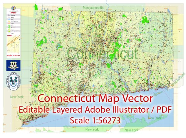
Connecticut, located in the New England region of the United States, has several principal waterways and main roads that play crucial roles in transportation and commerce. Here is an overview of some of the key waterways and roads in the state:
Principal Waterways:
- Connecticut River: The Connecticut River is the longest river in New England and serves as a major waterway in the region. It flows through the entire length of Connecticut, from the northern border with Massachusetts to the southern border with Long Island Sound. The river is navigable in certain sections and historically played a significant role in transportation and trade.
- Long Island Sound: While not entirely within Connecticut’s borders, Long Island Sound is a vital water body along Connecticut’s southern coast. It provides a connection to the Atlantic Ocean and supports various maritime activities, including shipping and fishing.
- Housatonic River: This river flows through western Connecticut, originating in Massachusetts and emptying into Long Island Sound. The Housatonic River has been important historically for industry and transportation.
- Thames River: Located in eastern Connecticut, the Thames River flows into Long Island Sound. The Port of New London, situated along the Thames River, serves as a significant harbor for the region.
Main Roads:
- Interstate 95 (I-95): I-95 is a major north-south interstate highway that runs along the eastern coast of the United States. In Connecticut, it passes through cities such as Stamford, Bridgeport, New Haven, and New London, connecting the state with neighboring states and serving as a crucial transportation corridor.
- Interstate 91 (I-91): I-91 is a north-south interstate highway that runs through the center of Connecticut, connecting New Haven, Hartford, and Springfield, Massachusetts. It provides a key route for north-south travel in the state.
- Interstate 84 (I-84): I-84 is an east-west interstate highway that passes through the western part of Connecticut, connecting cities like Danbury, Waterbury, and Hartford. It serves as a major transportation route in the region.
- Merritt Parkway (Route 15): The Merritt Parkway is a scenic limited-access highway running through southwestern Connecticut. It is known for its park-like setting and serves as an alternative to I-95 for certain travelers.
- Wilbur Cross Parkway (Route 15): Another section of Route 15, the Wilbur Cross Parkway is part of the Merritt Parkway system, providing a route through central Connecticut.
These waterways and roads collectively contribute to Connecticut’s transportation network, supporting the movement of goods, people, and services throughout the state and beyond.


 Author: Kirill Shrayber, Ph.D.