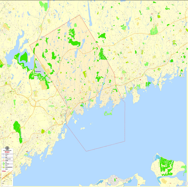
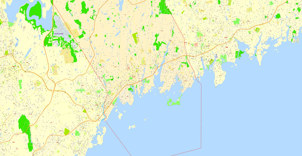
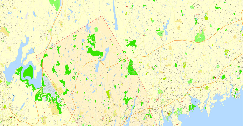
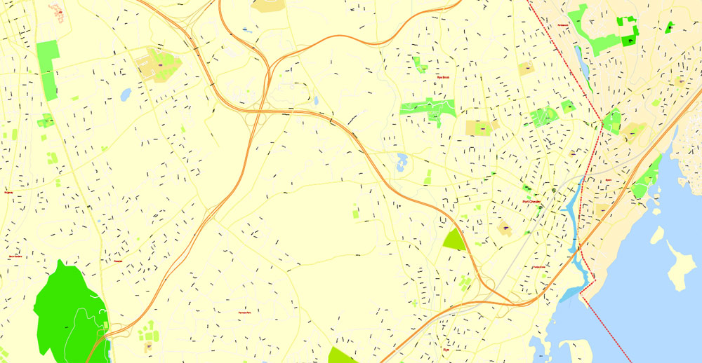
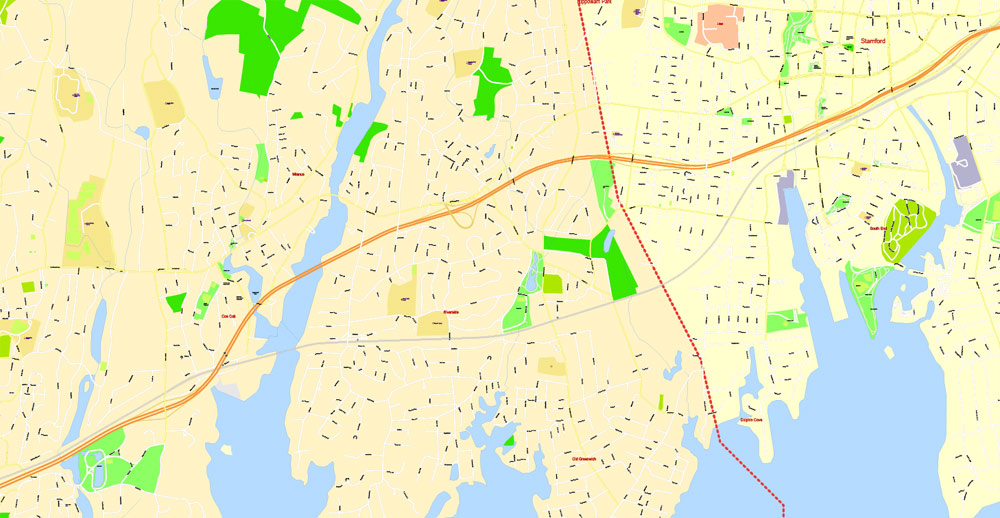
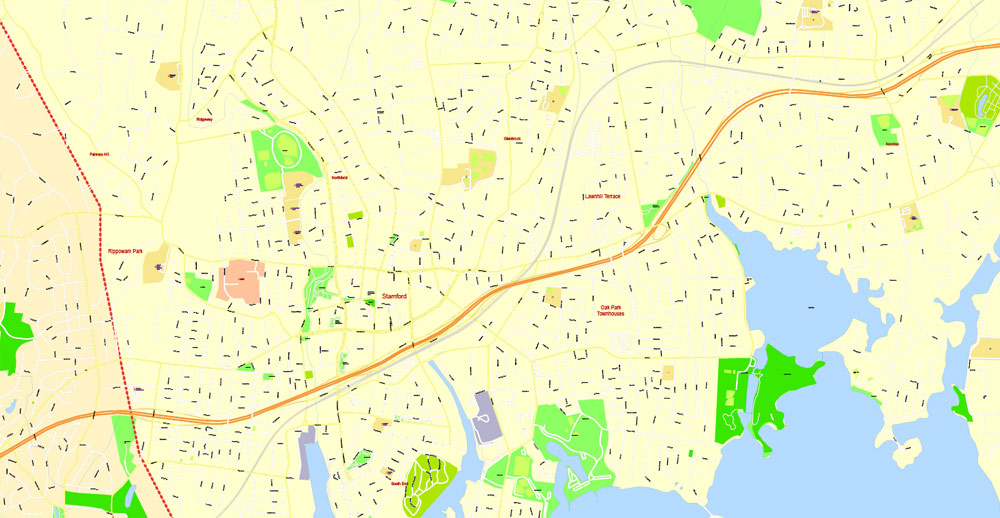
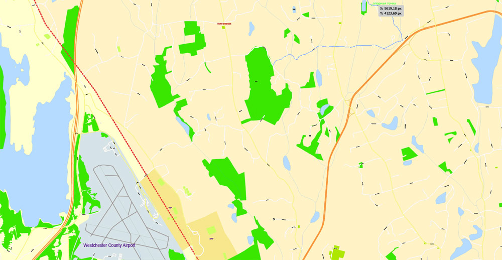
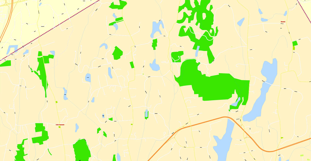
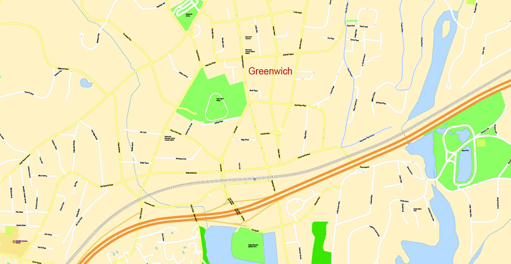
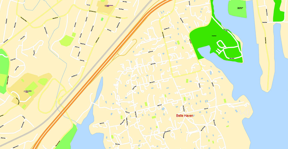
PDF Map Greenwich, Connecticut, US, exact vector street G-View Plan City Level 17 (100 meters scale) map, fully editable, Adobe PDF, full vector, scalable, editable text format of street names, 18 Mb ZIP.
All streets named, main objects, no buildings. Map for publishing, design, printing, publications, arts, projects, presentations, for architects, designers and builders, business, logistics. The most exact and detailed map. Included Disney World area.
Separated layers: streets and roads, color fills, road labels, names 1,2,3, street arrows, objects, scales, grids, legend.
For printing LARGE (WALL) format.
You can edit this file by Adobe Illustrator, Adobe Acrobat, Corel Draw.
DWG, DXF, CDR, ESRI Shapes, and other formats – by request, same price, please contact.
Greenwich, London, England.
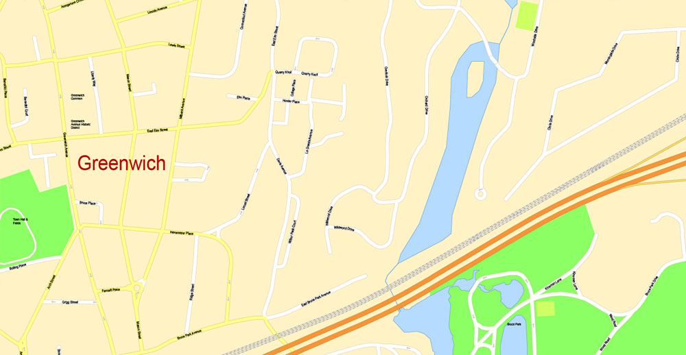
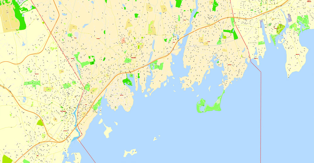
This vector map of Greenwich city is used as a basis for design, editing, and further printing.
This is the most detailed, exact map of Greenwich city for high-quality printing and polygraphy. You can always clarify the map development date by contacting us.
For your convenience, all objects on Greenwich vector city map are divided into layers. And the editing is very easy – colors, lines, etc.
You can easily add any objects needed (e.g. shops, salons, sale points, gas station or attraction) on any layer of Greenwich vector map.
Greenwich is an area of south east London, England, located 5.5 miles (8.9 km) east-southeast of Charing Cross. It is located within the Royal Borough of Greenwich, to which it lends its name.
Greenwich is notable for its maritime history and for giving its name to the Greenwich Meridian (0° longitude) and Greenwich Mean Time. The town became the site of a royal palace, the Palace of Placentia from the 15th century, and was the birthplace of many Tudors, including Henry VIII and Elizabeth I. The palace fell into disrepair during the English Civil War and was rebuilt as the Royal Naval Hospital for Sailors by Sir Christopher Wren and his assistant Nicholas Hawksmoor. These buildings became the Royal Naval College in 1873, and they remained an establishment for military education until 1998 when they passed into the hands of the Greenwich Foundation. The historic rooms within these buildings remain open to the public; other buildings are used by University of Greenwich and Trinity Laban Conservatoire of Music and Dance.
One of the advantages of Greenwich city vector maps of our production is the relevance of cartographic data, we constantly update all our products.
This vector map of Greenwich city is used by:
designers, layout designers, printers, advertisers and architects. Our product – vector maps – is designed for further editing and printing in large formats – from @Wall format (a few meters) to A-0 and A-1, A-2, A-3.
Greenwich city map in vector format is used for design, urban planning, presentations and media visualizations.
Advertising and presentation map of Greenwich city (usually the final designer marks the routes, and puts the client’s objects (shops, saloons, gas stations etc.)
The undoubted advantage is that people will NEVER throw out this advertising product – the map. In fact, as an advertising medium, a city map is the most “long-playing” of the well-known polygraphic advertising media, with the longest lifespan, and the maximum number of interactions with the customer.
The town became a popular resort in the 18th century and many grand houses were built there, such as Vanbrugh Castle (1717) established on Maze Hill, next to the park. From the Georgian period estates of houses were constructed above the town centre. The maritime connections of Greenwich were celebrated in the 20th century, with the siting of the Cutty Sark and Gipsy Moth IV next to the river front, and the National Maritime Museum in the former buildings of the Royal Hospital School in 1934. Greenwich formed part of Kent until 1889 when the County of London was created.
For travelers, maps are sold at the airports and gas stations around the world. Often the source is our vector maps.
Take a look, who purchases our vector maps of Greenwich city in “Our Clients and Friends” page – these are large and small companies, from super-brands like Volvo and Starbucks, to small design studios and printing houses.
It’s very easy to work with vector maps of Greenwich city, even for a not very experienced designer who can turn on and off the map layers, add new objects, change the colors of fill and lines according to customer requirements.
The undoubted advantage of Greenwich city vector maps in printing is an excellent and detailed visualization, when customer can expand a large paper map and instantly define his location, find a landmark, an object or address on map, unlike using the popular electronic formats of Google and Yandex maps for example.
Printable vector maps of Greenwich city are much more convenient and efficient than any electronic maps on your smartphone, because ALL DETAILS are displayed in the entire space of Greenwich city map.
Useful tips on working with vector maps of cities and countries in Adobe Illustrator.
«V» – launches the Selection tool (cursor, black arrow), which makes active any vector line.
«А» – launches the Direct Selection tool (white cursor), allows you to select curve elements and drag them to the desired place.
«R» – activates the Rotate tool, which helps you rotating selected objects around the center point by 360 degrees.
«E» – gives you the opportunity to use the Eraser tool and erase unnecessary parts.
«X» – switches between Fill and Stroke in the Tools section. Try to get used to this hot key and
you will quickly understand that you can’t live and work without it.
Geography
Topography
The town of Greenwich is built on a broad platform to the south of the outside of a broad meander in the River Thames, with a safe deep water anchorage lying in the river. To the south, the land rises steeply, 100 feet (30 m) through Greenwich Park to the town of Blackheath. The higher areas consist of a sedimentary layer of gravelly soils, known as the Blackheath Beds, that spread through much of the south-east over a chalk outcrop—with sands, loam and seams of clay at the lower levels by the river.
Guides are not limited to vertical and horizontal in Adobe Illustrator. You can also create a diagonal guide for example. Moreover, you can turn any contours into guides. Select the outline and go to View > Guides > Make Guides (Create Guides), or simply press Cmd/Ctrl + 5. You can also turn the guides back into an editable object. Go to menu, View > Guides > Unlock Guides (Release Guides), select the guide you want to edit and select View > Guides > Release Guides (Reset Guides), or just press Cmd/Ctrl + Option / Alt + 5).
You will probably want to change the color scheme used on our Greenwich vector city map.
To quickly and effectively play with colors.
Of course, you can do it manually, all objects in our Greenwich city vector map are divided according to types and layers, and you can easily change the color gamma of vector objects in groups and layers.
But there is more effective way of working with the whole VECTOR MAP of Greenwich city and all layers:
The overview dialog «Edit colors»/«Repaint Graphic Object» (this dialog box name can change depending on the context):
If you have selected a part or a layer of Greenwich city vector map and open the dialog box by clicking the icon in the Control panel, on the Samples palette or the Color Catalog, or if you choose Edit > Edit Colors> Repaint Graphic Object, then the «Repaint Graphic Object» dialog box appears, and you get access to «Assign» and «Edit» tabs.
If a picture or a map fragment is not selected, and you open the dialog box by clicking the icon in the Control panel, on the Samples palette or in the Color Catalog, the «Edit Colors» dialog box appears and you can only access the «Edit» tab.
Regardless of the name at the top of the dialog box, the right-hand side always displays the color group of the current document, as well as two default color groups: Print Color and Grayscale. These color groups can be selected and used any time.
Create and edit color groups of Greenwich city vector map, and also assign colors using the «Edit Colors»/ а «Repaint Graphic Object» dialog box.
A. Creating and editing of a color group on the «Edit» tab
B. Assigning colors on the «Assign» tab
C. Select a group of colors from the «Color groups» list
The option «Repaint a graphic object» in the lower part of the dialog box allows you to preview the colors on a selected layer of Vector map, or a group of elements, and specify whether its colors will be redefined when the dialog box is closed.
Greenwich is bordered by Deptford Creek and Deptford to the west; the residential area of Westcombe Park to the east; the River Thames to the north; and the A2 and Blackheath to the south. The Greenwich Peninsula, also known as North Greenwich, is situated to the northeast of the town centre.
Greenwich Park
Behind the former Naval College is the National Maritime Museum housed in buildings forming another symmetrical group and grand arcade around the Queen’s House, designed by Inigo Jones. Continuing to the south, Greenwich Park is a Royal Park of 183 acres (0.7 km2), laid out in the 17th century and formed from the hunting grounds of the Royal Palace of Placentia.
Spiral staircase and lantern at the Queen’s House in Greenwich

The main areas of the dialog box are:
«Edit»
The «Edit» tab is designed to create a new or edit the existing color groups.
The harmony rules Menu and the Color Wheel are used to conduct experiments with color harmonies. The color wheel shows how colors are related in color harmony, and the color bars allow you to view and manipulate an individual color values. In addition, you can adjust the brightness, add and remove colors, save color groups and view colors on the selected Vector Map of Greenwich city or a separated layers.
«Assign»
The «Assign» tab is used to view and control on how the original colors are replaced with colors from the color group like your corporate colors in the Vector Map of Greenwich city.
The assign color ability is provided only if the entire map, layer or fragment is selected in the document. You can specify which of new colors replace the current colors, whether the spot colors should be preserved and how colors are replaced (for example, you can replace colors completely or changing the color tone while maintaining the brightness). The «Assign» tab allows you to redefine colors in the Vector Map of Greenwich city, or in separate layers and fragments using the current color group or reducing the number of colors in the current Vector Map.
Color groups
Is a list of all saved color groups for current document (the same groups appear in the «Samples» palette). You can edit and delete the existing color groups, as well as creating a new ones using the list of “Color Groups” in the dialog box. All changes appear in the «Samples» palette.
The highlighted color group shows, which color group is currently edited.
Any color group can be selected and edited, or used to redefine the colors in the selected vector map of Greenwich city, its fragments or elements.
Saving a color group adds this group to the specified list.
Opening the «Edit Colors»/«Repaint Graphic Object» dialog box.
Open the «Edit Colors»/«Repaint Graphic Object» dialog box using one of the following methods:
«Edit»> «Edit Colors»> «Repaint Graphic object» or «Repaint With Style».
Use these commands if you need to edit the colors in the selected vector map of Greenwich city.
«Repaint Graphic object» button on the «Control» panel.
Use this button if you need to adjust colors of Greenwich city vector map using the а «Repaint graphic object» dialog box.
The specified button is available if the selected vector map or its fragment contains two or more colors.
Note. This color editing method is convenient for global color adjustment in a vector map, if global colors were not used when creating a City Map of Greenwich.
The «Edit colors» button or «Edit or apply colors» on the «Color Catalog» palette
Click this button if you need to edit colors on the «Color Catalog» palette or edit and then apply them to the selected Vector Map of Greenwich city or its fragment.
The «Edit color group» button or «Edit or apply color group» on the «Samples» palette.
Click this button if you need to edit the colors in the specific color group or edit and apply them to the selected Vector Map of Greenwich city or a group of its elements, for example, the whole layer “Streets and lines”. You can also double-click the color group in the Samples panel to open the dialog box.
If the map file is too large and your computer freezes or even can’t open it quickly:
1. Try to reduce the color resolution of the video card (display) to 256 colors while working with a large map.
2. Using Windows Task Manager, select all the application you don’t need, while working with map, just turn them off.
3. Launch Adobe Illustrator. (DO NOT OPEN the vector map file)
4. Start the Windows Task Manager using administrator rights > Find the “Illustrator” process > set the «real time» priority,
5. Open the file. When you see the LEGACY FONT popup window – click “OK” (do not update). You can restore the TEXT later.
6. Can also be useful: When file is opened – Edit > Settings > Basic Settings > disable smoothing. /// It looks scary, but works quickly)))
We recommend saving the file in Adobe Illustrator 10 version. It’s much more stable when working with VERY BIG size files.
The park rises towards Blackheath and at the top of this hill is a statue of James Wolfe, commander of the British expedition to capture Quebec. Nearby a major group of buildings within the park includes the former Royal Observatory, Greenwich; the Prime Meridian passes through this building.
Greenwich Mean Time was at one time based on the time observations made at the Royal Greenwich Observatory, before being superseded by Coordinated Universal Time. While there is no longer a working astronomical observatory at Greenwich, a ball still drops daily to mark the exact moment of 1 p.m., and there is a museum of astronomical and navigational tools, particularly John Harrison’s marine chronometers.
The Ranger’s House lies at the Blackheath end of the park and houses the Wernher Collection of art, and many fine houses, including Vanbrugh’s house lie on Maze Hill, on the western edge of the park.
Town centre
A curving street with older two- and three-storey buildings on either side. In front is a black London taxicab with an advert; midway down the street is an intersection with heavy traffic.
Georgian and Victorian architecture dominates in the town centre which spreads to the west of the park and Royal Naval College. Much of this forms a one-way system around a covered market, Greenwich Market and the arthouse Greenwich Cinema. Up the hill from the centre, there are many streets of Georgian houses, including the Fan Museum, on Croom’s Hill. Nearby at the junction of Croom’s Hill with Nevada Street, is Greenwich Theatre. The Greenwich Playhouse closed in 2012
Market
An interior of a building with a translucent glass roof supported by blue-painted steel latticework. On the main floor are a number of different stalls with customers inspecting various wares.
Greenwich Market
There has been a market at Greenwich since the 14th century, but the history of the present market dates from 1700 when a charter to run two markets, on Wednesdays and Saturdays, was assigned by Lord Romney (Henry, Earl of Romney) to the Commissioners of Greenwich Hospital for 1000 years.
The market is part of “the Island site”, bounded by College Approach, Greenwich Church Street, King William Walk and Nelson Road, near the National Maritime Museum and the Royal Observatory. The buildings surrounding the market are Grade 2 listed and were established in 1827–1833 under the direction of Joseph Kay. A market roof was added in 1902–08 (and replaced in 2016). Later significant development occurred in 1958–60 and during the 1980s. The landowner, Greenwich Hospital, has been enhancing the Market since 2014 and due to complete in Spring 2016.
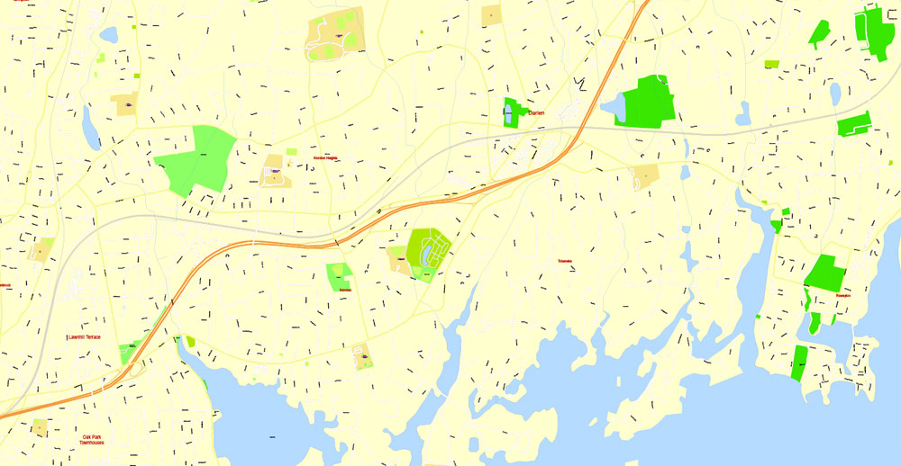

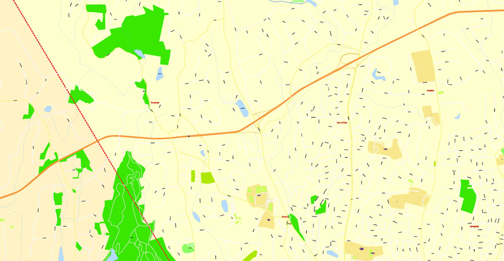

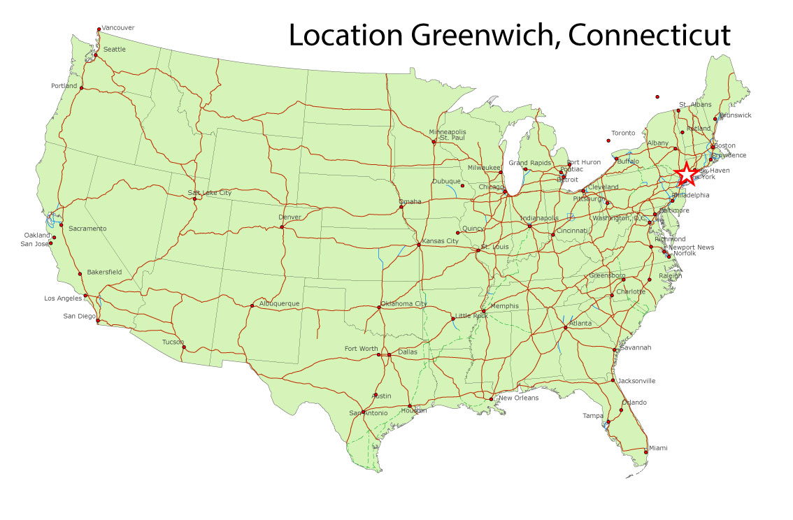
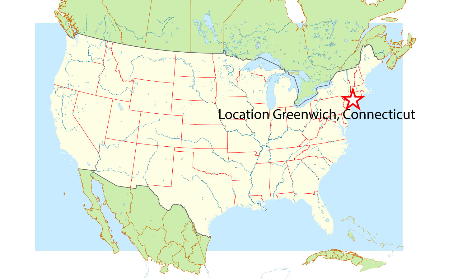
Greenwich is a town in Fairfield County, Connecticut, United States. As of the 2010 census, the town had a total population of 61,171. The largest town on Connecticut’s Gold Coast, it is home to many hedge funds and other financial service companies. Greenwich is the southernmost and westernmost municipality in Connecticut as well as the six-state region of New England. It is 38+ minutes by train (express) from Grand Central Terminal in Manhattan. CNN/Money and Money magazine ranked Greenwich first on its list of the “100 Best Places to Live in the United States” in 2005. The town is named after Greenwich, a borough of London in the United Kingdom.
Area
• Total 67.2 sq mi (174.0 km2)
• Land 47.8 sq mi (123.8 km2)
• Water 19.4 sq mi (50.3 km2)
Elevation 56 ft (17 m)
Population
• Total 62,396
• Density 930/sq mi (360/km2)
Time zone Eastern (UTC-5)
• Summer (DST) Eastern (UTC-4)
ZIP code 06807, 06830, 06831, 06870, 06878
Area code(s) 203
Free vector maps:
free download vector file greenwich_usa_location-ai
free download vector map greenwich_usa_location_2-ai

Free download Vector Map US Interstate roads, Adobe PDF, V.2 Free_Map_US_Interstates_Roads_2.pdf
Free download Vector Map US Interstate roads, Adobe Illustrator, V.2 Free_Map_US_Interstates_Roads_2.ai

Free Download Vector Map US County and State Adobe Illustrator
Free_Vector_Map_US_States_County_Map.ai
Free Download Vector Map US County and State Adobe PDF
Free_Vector_Map_US_States_County_Map.pdf

Free Vector Map US Census Data Top US Ancestries by County Adobe Illustrator
Free_Vector_Map_US_Census-Data-Top-US-Ancestries-by-County.ai
Free Vector Map US Census Data Top US Ancestries by County Adobe PDF
Free_Vector_Map_US_Census-Data-Top-US-Ancestries-by-County.pdf
Free US Maps from WIKIPEDIA
Small guide: How to work with the vector map?
You can: Mass select objects by type and color – for example, the objects type “building” (they are usually dark gray) – and remove them from the map, if you do not need them in your print or design project. You can also easily change the thickness of lines (streets), just bulk selection the road by the line color.
The streets are separated by type, for example, type “residential road” are usually white with a gray stroke. Highway usually orange with a brown or dark gray stroke.
It is easy to change the font of inscriptions, all or each individually. Also, just can be make and any other manipulation of objects on the vector map in Adobe illustrator format.
Important: All the proportions on the map are true, that is, the relative sizes of the objects are true, because Map is based on an accurate GPS projection, and It transated into the (usual for all) the Mercator projection.
You can easily change the color, stroke and fill of any object on the map, zoom without loss of quality Image Verification.
Select object

Bulk selection the same objects on the vector map

See the bulk selected objects on the vector map

Bulk delete buildungs from the vector map

Select residencial road (small street) on the vector map

Bulk selection the same lines (streets, roads) on the full map

Create fat lines of the streets on the vector maps (bulk action) 1

Create fat lines of the streets on the vector maps (bulk action) 2

Create fat lines of the streets on the vector maps (bulk action) 3

You can easily change the color, stroke and fill of any object on the map, zoom without loss of quality Image Verification.

 Author: Kirill Shrayber, Ph.D. FRGS

