Extended Description of the Vector Map
Printable Vector Map of Belgium Netherlands Luxembourg – 4 administrative layers + cities-hamlets + zip codes (postal codes) full editable ESRI Shapes + Layered editable vector PDF 37 MB ZIP
MERCATOR PROJECTION
Map for design, printing, arts, projects, presentations, for architects, designers, and builders, business, logistics.
Good for use in any GIS apps.
Archive included: .shp, .prj, .dbf, .cpg, .shx files
Statistics:
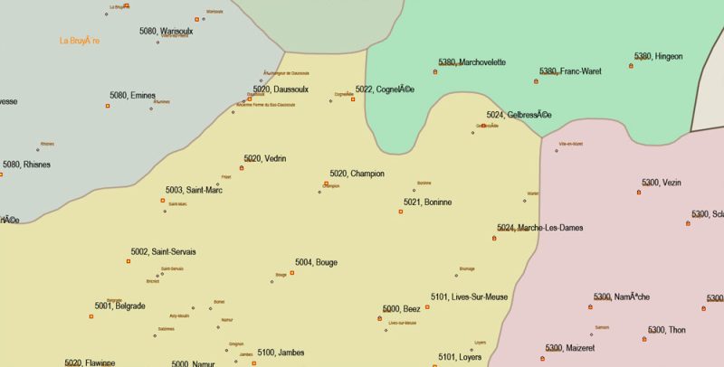
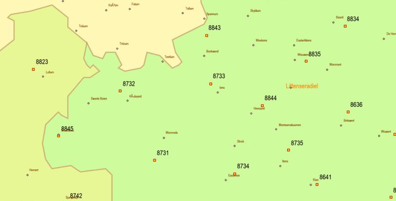
Cities-towns-villages-hamlets = 19954 points
Post offices (postal codes, zipcodes) = 10978 points
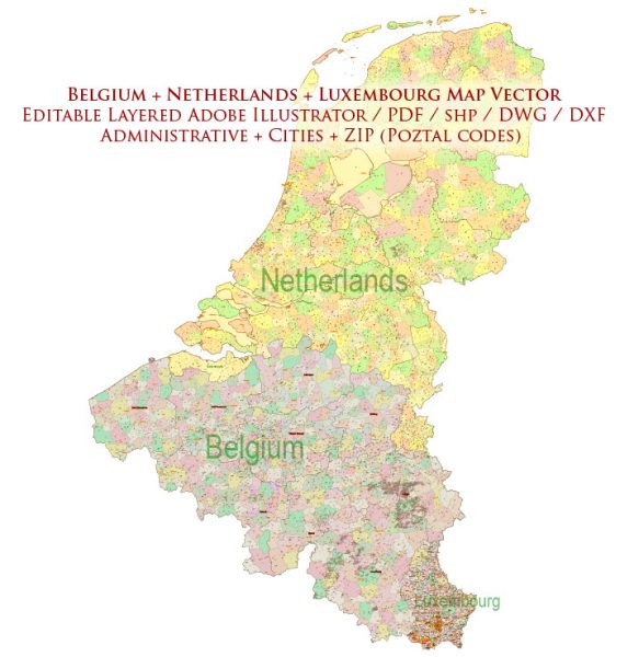
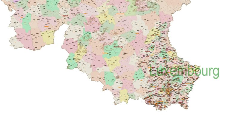
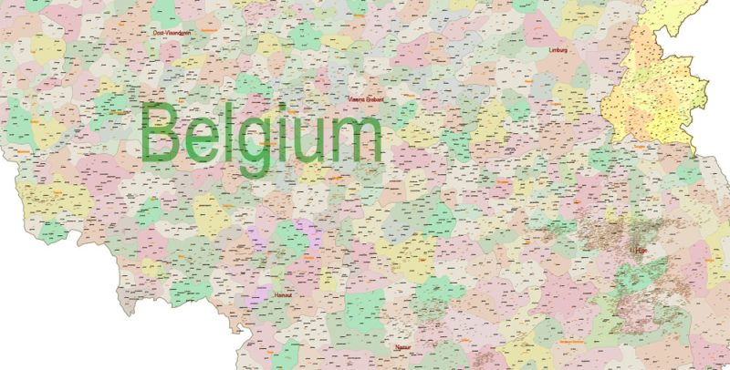
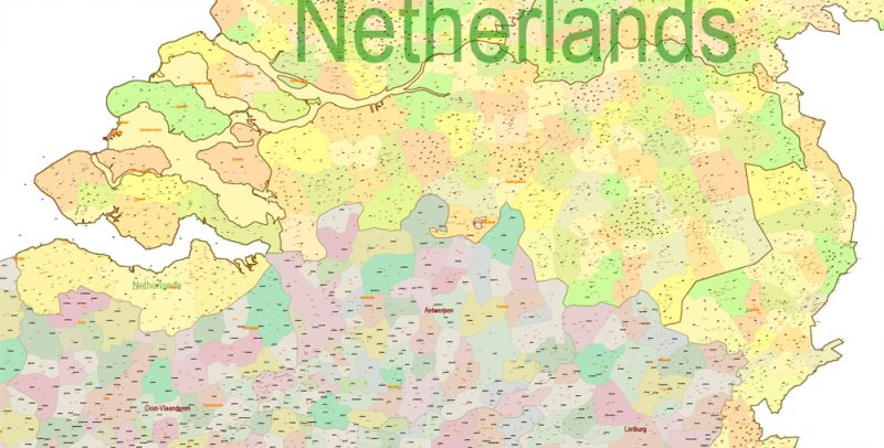
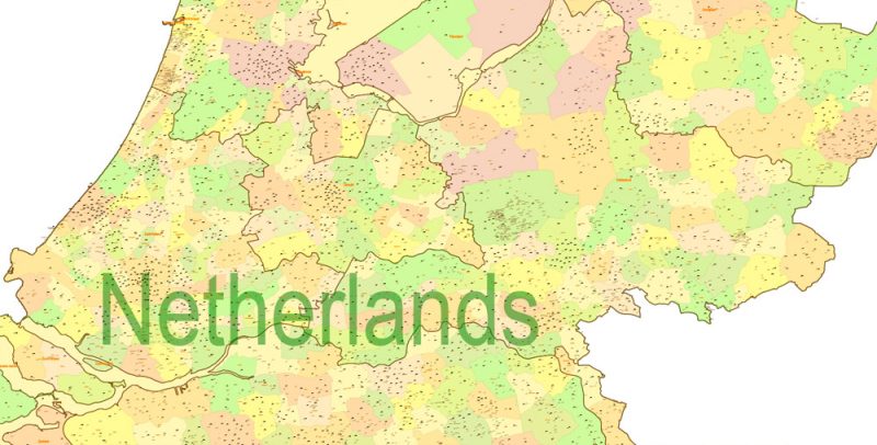
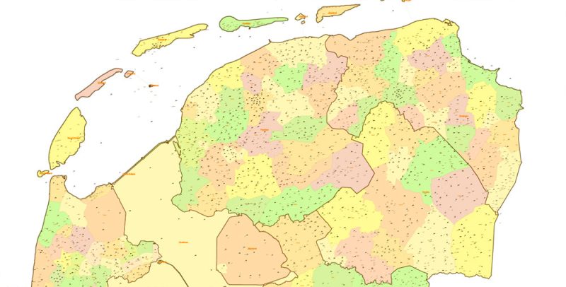
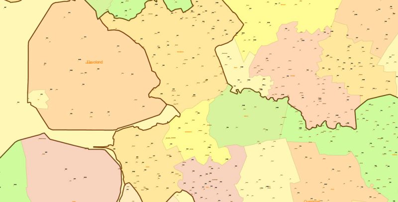
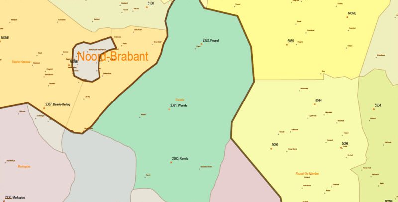
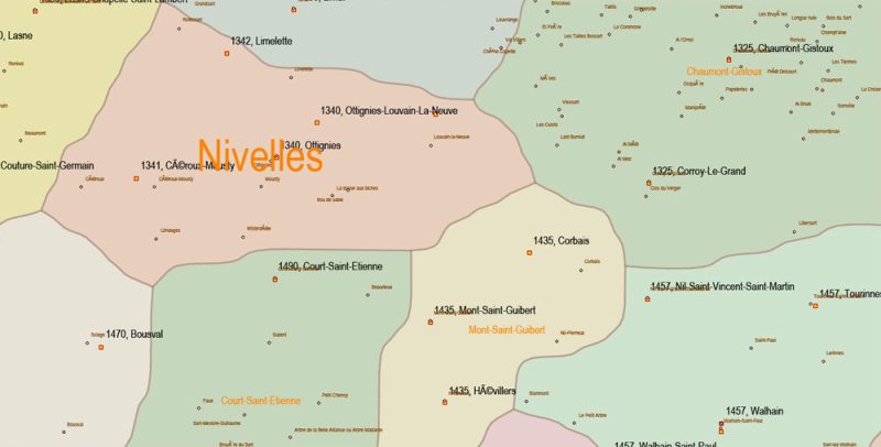
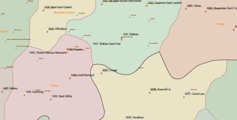
Belgium Netherlands Luxembourg Map Vector Cities + Admin + Postcodes Map editable ESRI Shapes .shp + PDF in layers
Layers list:
- admin_areas_0. = countries level + names layer
- admin_areas_1. = provinces level + names layer
- admin_areas_2. = district level + names layer
- admin_areas_3. = communes level + names layer
- cities_villages. = points + names layer
- postcodes. = zip codes, post offices + numbers layer
ATTENTION!!!
1. Some (~100) post office points have no numbers (no postcodes) but have correctly coordinated and indexed as NONE.
2. In Luxembourg, some postcodes (~63) attached to ONLY ONE building.
Belgium Netherlands Luxembourg Map Vector Cities + Admin + Postcodes Map editable ESRI Shapes .shp + PDF in layers
Belgium Netherlands Luxembourg Map Vector Cities + Admin + Postcodes Map editable ESRI Shapes .shp + PDF in layers
Belgium Netherlands Luxembourg Map Vector Cities + Admin + Postcodes Map editable ESRI Shapes .shp + PDF in layers
Belgium Netherlands Luxembourg Map Vector Cities + Admin + Postcodes Map editable ESRI Shapes .shp + PDF in layers
Belgium Netherlands Luxembourg Map Vector Cities + Admin + Postcodes Map editable ESRI Shapes .shp + PDF in layers
Belgium Netherlands Luxembourg Map Vector Cities + Admin + Postcodes Map editable ESRI Shapes .shp + PDF in layers
Belgium Netherlands Luxembourg Map Vector Cities + Admin + Postcodes Map editable ESRI Shapes .shp + PDF in layers
Belgium Netherlands Luxembourg Map Vector Cities + Admin + Postcodes Map editable ESRI Shapes .shp + PDF in layers
Belgium Netherlands Luxembourg Map Vector Cities + Admin + Postcodes Map editable ESRI Shapes .shp + PDF in layers
Belgium Netherlands Luxembourg Map Vector Cities + Admin + Postcodes Map editable ESRI Shapes .shp + PDF in layers
Belgium Netherlands Luxembourg Map Vector Cities + Admin + Postcodes Map editable ESRI Shapes .shp + PDF in layers


 Author: Kirill Shrayber, Ph.D. FRGS


