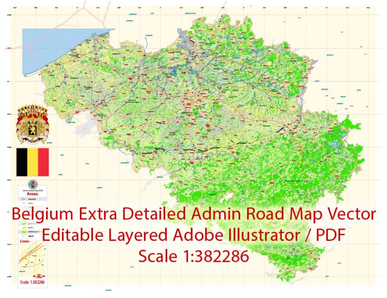
Extended Description of the Vector Map
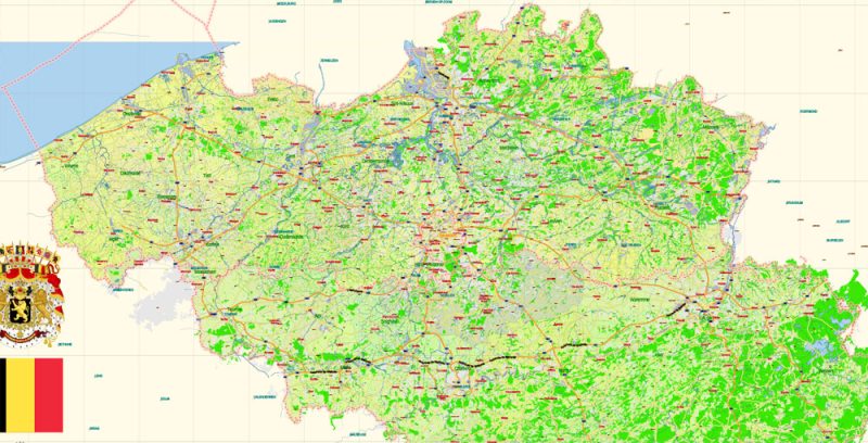
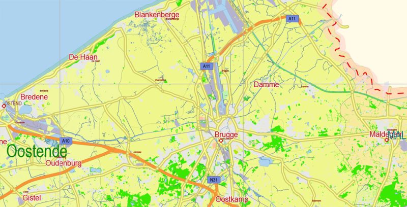
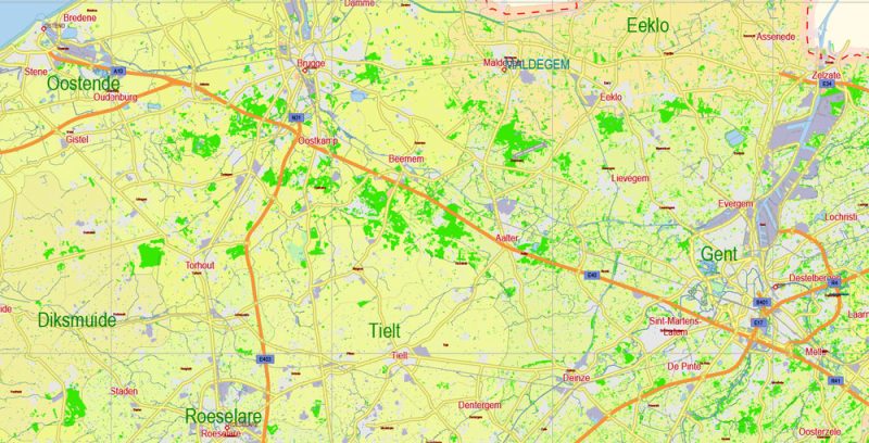
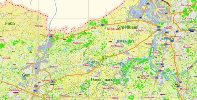
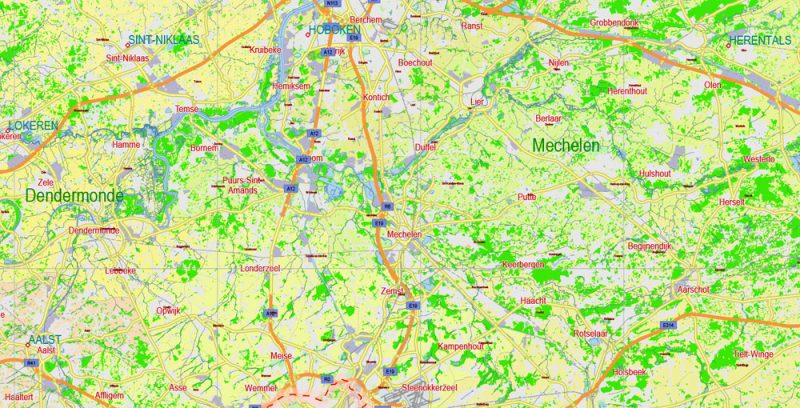
Printable PDF Vector Map of Belgium extra detailed Plan scale 1:382286 full editable Adobe PDF Road Admin Map in layers, scalable, text format all names, 113 MB ZIP
Principal Road names, All Cities and Towns, Admin areas 1;2;3;4. Map for design, printing, arts, projects, presentations, for architects, designers, and builders, business, logistics.
Layers: color_fills, water, waterways, streets_roads, labels_roads, admin_areas 1;2;3;4, names_objects 1;2;3, names_main_roads, names_places, grids, legend, etc. (22 layers)
The most exact and detailed map of Belgium in scale.
For Editing and High-Quality Printing
Geography Of Belgium
Belgium is located in Western Europe, on the East coast of the North sea. It borders on the Netherlands, Germany, Luxembourg, France. Washed by the North sea.
There are three geographical regions: the coastal plain, the Central Plateau, and the Ardennes upland. The highest point is Botrange (694 m). The main rivers – the Scheldt and the Meuse.
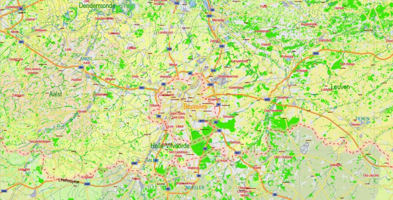
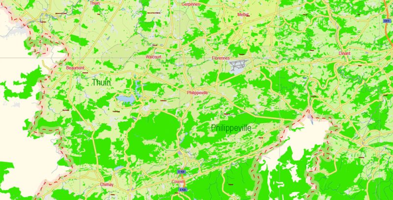
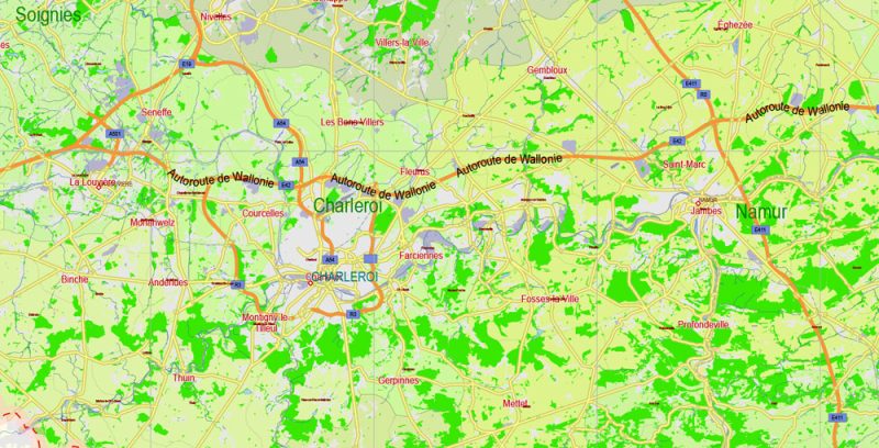
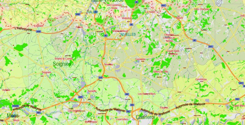
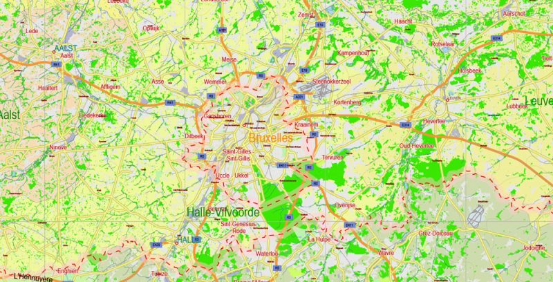
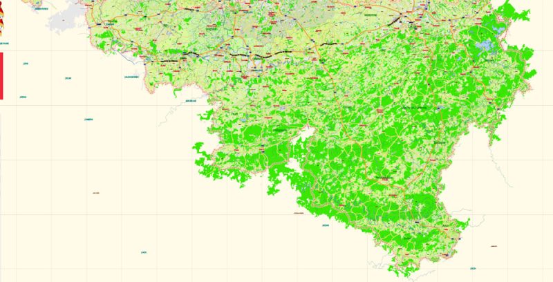
Belgium 01 PDF Map Vector Exact Plan Extra Detailed Road Admin Map editable Adobe PDF in layers
Principal Cities
- Antwerp
- Bruges
- Brussels
- Charleroi
- Ghent
- Liege
- Namur
- Oostende
State system
A constitutional monarchy and a Federal state. The head of state is the king (currently Philip I). The actual head of state is the Prime Minister.
Language
Official language: French, Dutch (Flemish) and German
According to the Constitution, the population of Belgium is divided into 3 linguistic communities: French, Flemish, and German. The area of distribution of the Dutch language (Flanders) is located in the North of the country and has 5.86 million lives. (58%), French (Walloon) – 3,29 million (32,2%), the population of Brussels – about 80%, Francophones and 20% Flemish. In the East of Wallonia, the area of distribution of the German language, where 67 thousand people live.
Belgium 01 PDF Map Vector Exact Plan Extra Detailed Road Admin Map editable Adobe PDF in layers
Religion
Catholicism (70%), Islam (200 thousand), Protestantism (70 thousand), Judaism (35 thousand), Anglican Church (40 thousand), Orthodoxy (20 thousand). The Church is separated from the state.
Currency
International name: EUR
History Of Belgium
The first person in Belgium appeared about 400 thousand years ago. From that time until the first Millennium BC the country was inhabited by unknown disappeared peoples. The conquest of Europe by Western tribes marked the beginning of the change of ethnic composition in Belgium. Her chunky dark-skinned natives had vanished, replaced by a high military blonde Gauls. About 300 BC Gallic family of Belg finally settled here, giving the name of the state.
Belgium 01 Map Vector Exact Plan Extra Detailed Road Admin Map editable Adobe Illustrator in layers
In 57 BC, Julius Caesar deprived the Belg of independence, including them in the Roman Empire. As a result of centuries-old romanization, the local population lost its language. Latin speech came into use, serving as the basis of the modern Walloon language of southern Belgium. In Northern Belgium, since the III century BC began to actively settle the Germans. They laid the Foundation of the Flemish nation. So on the territory of this small state began to exist two languages. In the V–IX centuries Belgium belonged first to the Franks, and then to the “Holy Roman Empire”.
Belgium 01 PDF Map Vector Exact Plan Extra Detailed Road Admin Map editable Adobe PDF in layers
The development of cities in the XII-XIV centuries turned Belgium into a “workshop” of Europe. For possession of it for a long time fought France and Germany, until the XVI century, it is 150 years has not moved to Spain. But at the beginning of the XVIII century, the Belgian territories became the possession of the Austrian Habsburgs. In 1794, Belgium was occupied by the troops of revolutionary France, which included it under Napoleon I. the Defeat of Napoleon I did not bring freedom to Belgium. In 1815, the Congress of Vienna United Belgium with the Netherlands in an effort to make them a barrier against France. In 1830, as a result of the popular uprising, Belgium was liberated from Dutch rule and became an independent state. In 1831, the state proclaimed a constitutional monarchy. From this time begins a period of the rapid development of the industry, the acquisition of their own colonies.
Belgium 01 PDF Map Vector Exact Plan Extra Detailed Road Admin Map editable Adobe PDF in layers
Two world wars prevented such a favorable development of the country’s economy. Belgian foreign policy in the postwar period determined the development of the country for many decades: in 1944, the Benelux was created, in 1945, Belgium joined the UN, in 1949 — became one of the founders of NATO and a member of the Council of Europe. Joining the Western European Union in 1954 helped Belgium to become a much stronger economic and strategic partner.
Belgium 01 PDF Map Vector Exact Plan Extra Detailed Road Admin Map editable Adobe PDF in layers
Belgium 01 PDF Map Vector Exact Plan Extra Detailed Road Admin Map editable Adobe PDF in layers
Belgium 01 PDF Map Vector Exact Plan Extra Detailed Road Admin Map editable Adobe PDF in layers
Belgium 01 PDF Map Vector Exact Plan Extra Detailed Road Admin Map editable Adobe PDF in layers
Belgium 01 PDF Map Vector Exact Plan Extra Detailed Road Admin Map editable Adobe PDF in layers
Belgium 01 PDF Map Vector Exact Plan Extra Detailed Road Admin Map editable Adobe PDF in layers
Belgium 01 PDF Map Vector Exact Plan Extra Detailed Road Admin Map editable Adobe PDF in layers


 Author: Kirill Shrayber, Ph.D. FRGS


