Extended Description of the Vector Map
Printable PDF Vector Map of Belgium Netherlands Luxembourg – 4 administrative layers + cities-hamlets + zip codes (postal codes) full editable Adobe PDF Layered 34 MB ZIP
MERCATOR PROJECTION
Map for design, printing, arts, projects, presentations, for architects, designers, and builders, business, logistics.
Statistics:
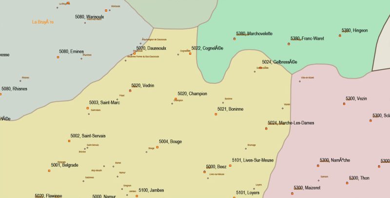
Cities-towns-villages-hamlets = 19954 points
Post offices (postal codes, zipcodes) = 10978 points
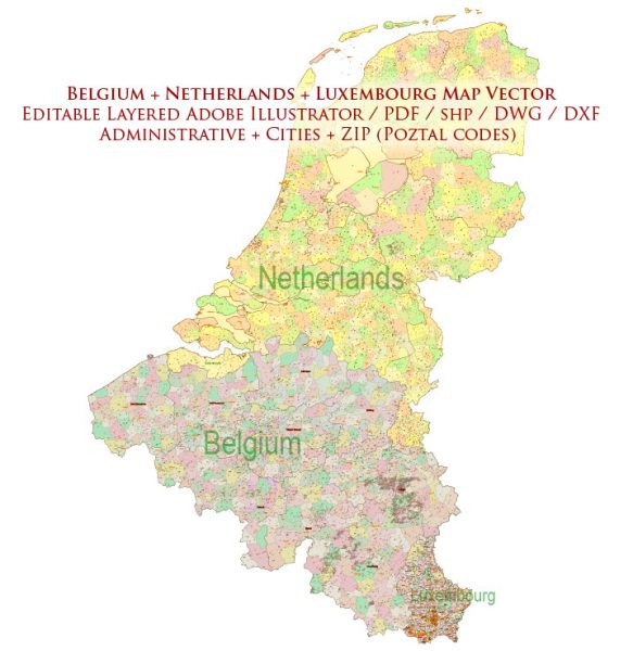
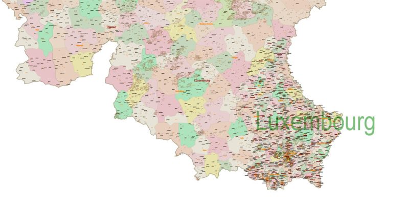
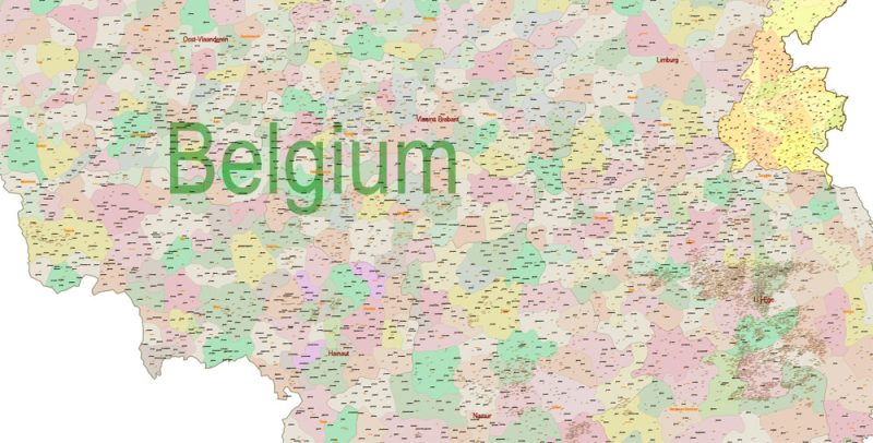
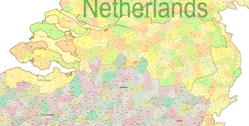
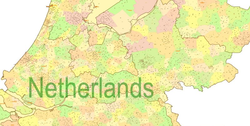
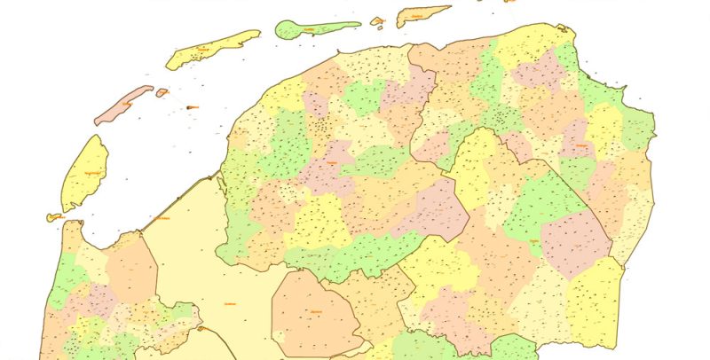
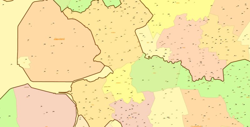
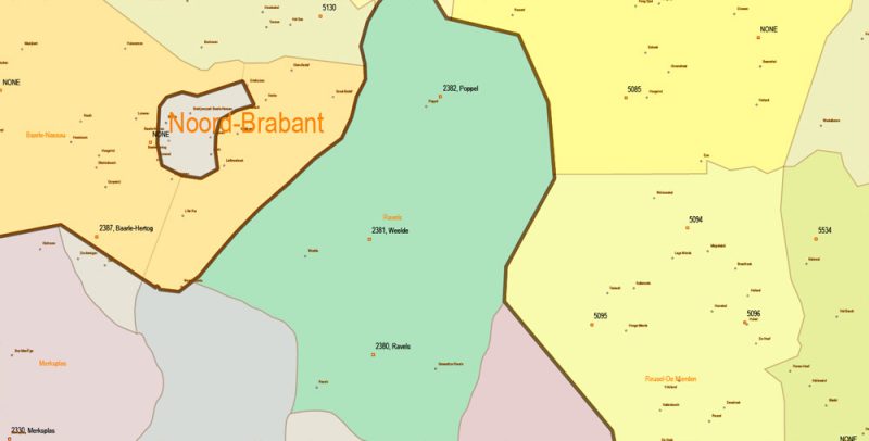
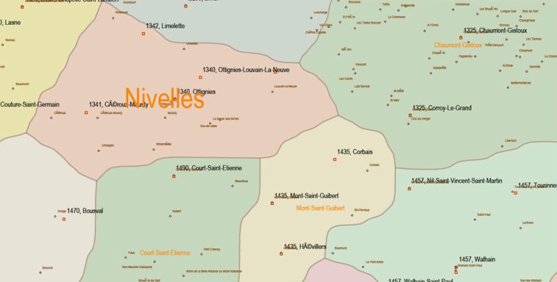
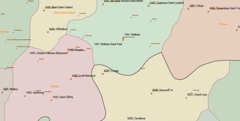
Belgium Netherlands Luxembourg PDF Map Vector Cities + Admin + Postcodes Map editable Adobe PDF in layers
Layers list:
- admin_areas_0. = countries level
- + names layer
- admin_areas_1. = provinces level
- + names layer
- admin_areas_2. = district level
- + names layer
- admin_areas_3. = communes level
- + names layer
- cities_villages. = points
- + names layer
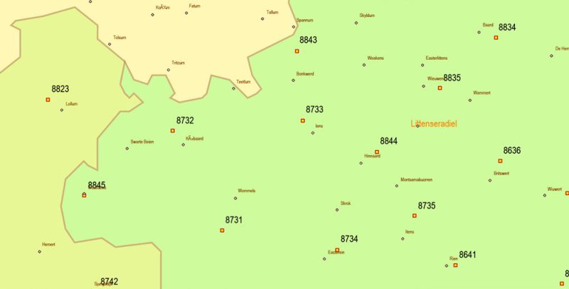
- postcodes. = zip codes, post offices
- + numbers layer
ATTENTION!!!
1. Some (~100) post office points have no numbers (no postcodes) but have correctly coordinated and indexed as NONE.
2. In Luxembourg, some postcodes (~63) attached to ONLY ONE building.
Belgium Netherlands Luxembourg PDF Map Vector Cities + Admin + Postcodes Map editable Adobe PDF in layers
Belgium Netherlands Luxembourg PDF Map Vector Cities + Admin + Postcodes Map editable Adobe PDF in layers
Belgium Netherlands Luxembourg PDF Map Vector Cities + Admin + Postcodes Map editable Adobe PDF in layers
Belgium Netherlands Luxembourg PDF Map Vector Cities + Admin + Postcodes Map editable Adobe PDF in layers
Belgium Netherlands Luxembourg PDF Map Vector Cities + Admin + Postcodes Map editable Adobe PDF in layers
Belgium Netherlands Luxembourg PDF Map Vector Cities + Admin + Postcodes Map editable Adobe PDF in layers
Belgium Netherlands Luxembourg PDF Map Vector Cities + Admin + Postcodes Map editable Adobe PDF in layers
Belgium Netherlands Luxembourg PDF Map Vector Cities + Admin + Postcodes Map editable Adobe PDF in layers
Belgium Netherlands Luxembourg PDF Map Vector Cities + Admin + Postcodes Map editable Adobe PDF in layers
Belgium Netherlands Luxembourg PDF Map Vector Cities + Admin + Postcodes Map editable Adobe PDF in layers
Belgium Netherlands Luxembourg PDF Map Vector Cities + Admin + Postcodes Map editable Adobe PDF in layers


 Author: Kirill Shrayber, Ph.D. FRGS


