Extended Description of the Vector Map
On the sandy shore of the Irish Sea, at the mouth of the River Lagan, on the east coast of Ireland, the city of Belfast is located. At the present time, Belfast is familiar to tourists thanks to the infamous steamship Titanic. It was from the port of Belfast that she was launched in 1911. Today, a museum is opened in honor of the legendary steamship. Thousands of tourists come here to visit the museum.
Today’s Belfast is a thriving European capital and a traditional seaport. This is a truly unique city with a rich history, an abundance of castles, temples, and historical buildings. The sea pier with huge ships evokes the romance of long-distance travel and discovery, the healing sea climate has a positive effect on health, and the vibrant nightlife does not let even the most active get bored.
Belfast is an industrial center, a center of shipbuilding and light industry. Here are the protected areas and the world-famous Belfast Zoo.
Population 278,000
Founded XII century
Area 115 km2
Population density 2,408 people/km2
Currency pound sterling, euro
Time zone UTC+0, summer UTC+1
Postal code BT1-BT17, BT29, BT58
International phone code +44 28
Climate and weather
The climate of Belfast is not mild, but it can not be called harsh. In the summer months, the daytime temperature is kept at +18 °C, in January, the thermometer is kept at an average of +3 °C. A big disadvantage is the sharp changes in air temperature at night, especially in summer.
To visit Belfast, it is better to choose the summertime, when all the beauty of nature on the shores of the Irish Sea is revealed in full. The city regularly receives precipitation, most of which falls in September, October, and January.
The nature of the city, the territory is characterized by a variety of landscapes. The river valley combined with the high hills on the north-west side provide a unique appearance of the city. The local natural landmark — the Road of the Giants – is included in the UNESCO World Heritage List.
The Strangford Nature Reserve is home to dozens of species of the rarest representatives of marine fauna (eels, mussels, from large animals — seals), which are under the care of the state.
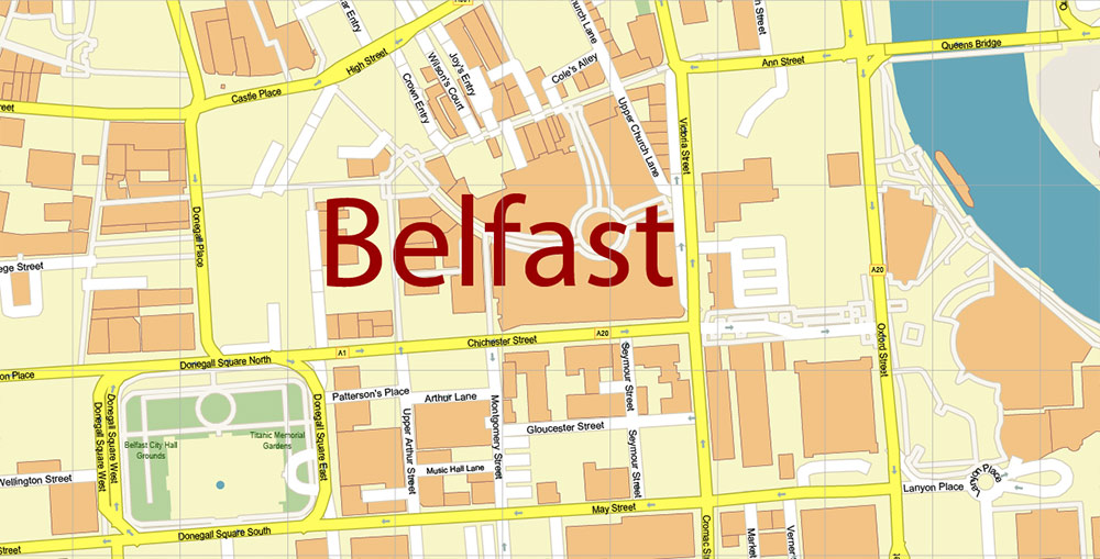
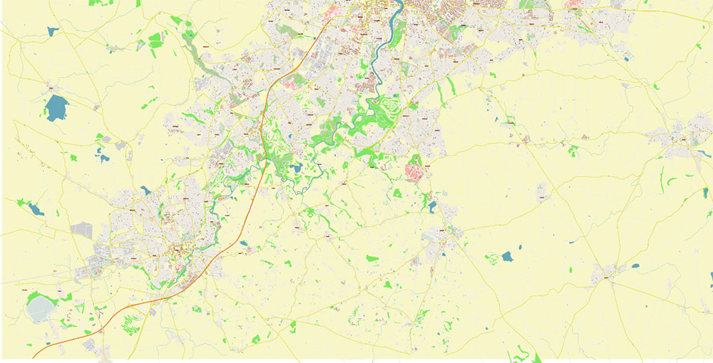
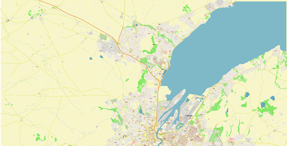
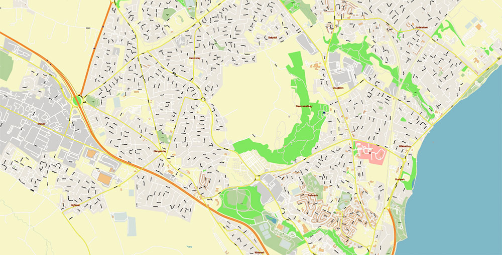
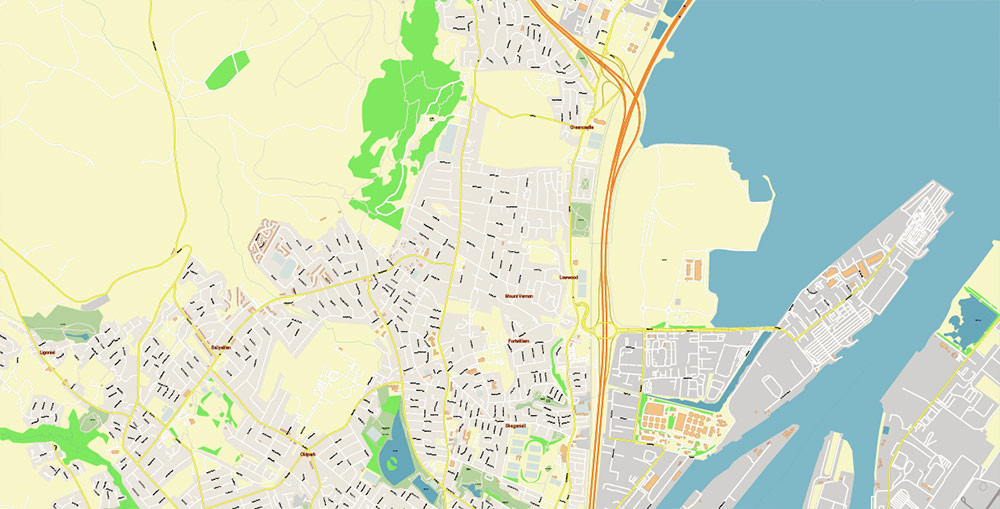
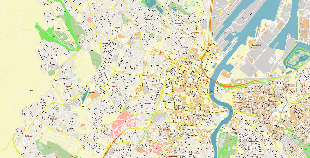
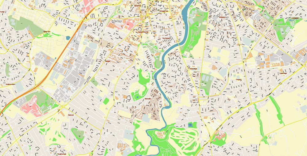
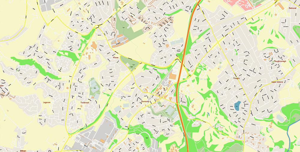
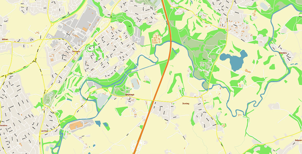
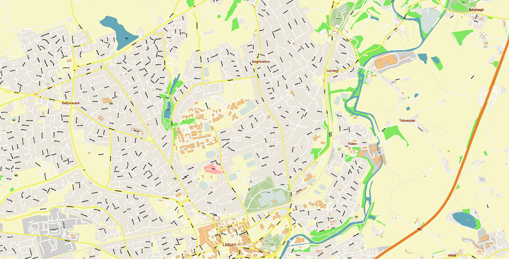
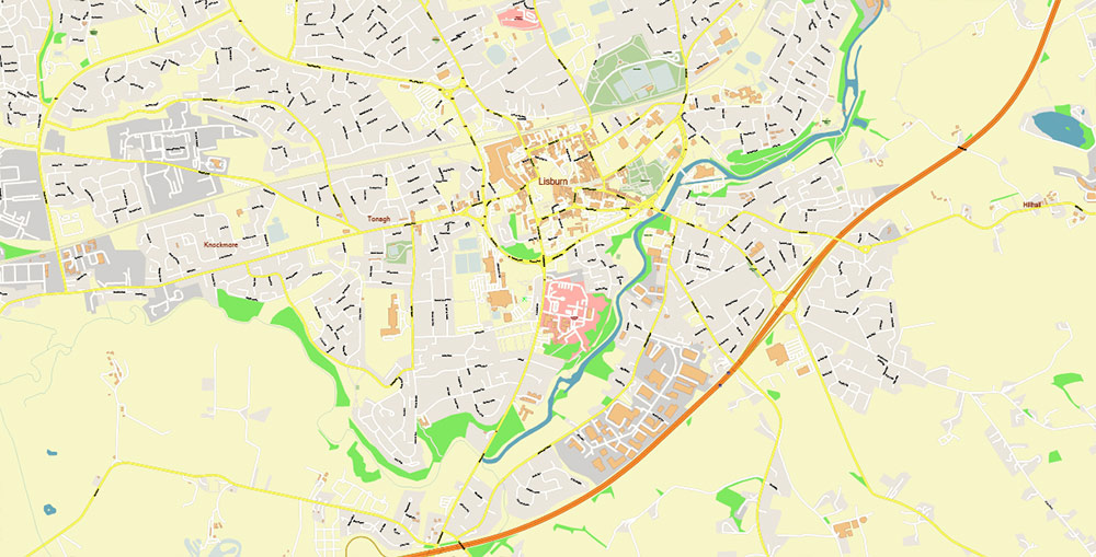
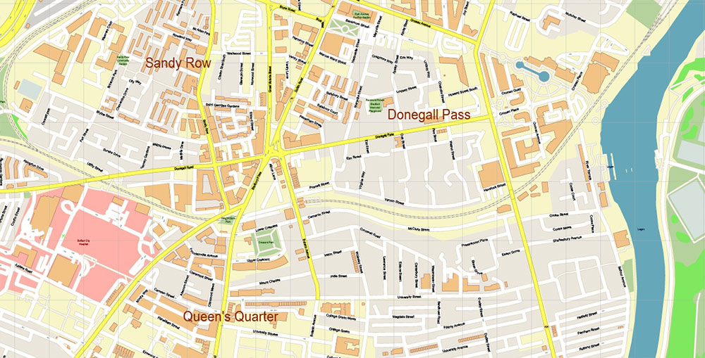
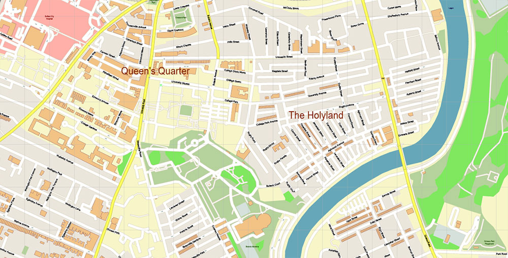
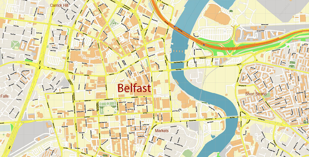
Printable PDF Vector Map of Belfast Northern Ireland UK High Detailed City Plan scale 1:2721 full editable Adobe PDF Street Map in layers, scalable, text format all names, 37 MB ZIP
All street names, Main Objects, Buildings. Map for design, printing, arts, projects, presentations, for architects, designers, and builders, business, logistics.
Need CDR, DWG or any other format? Please, contact us!
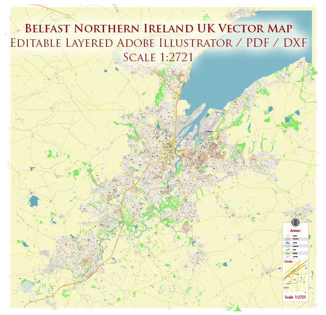
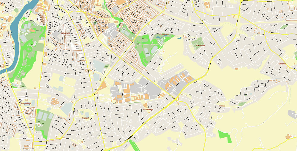
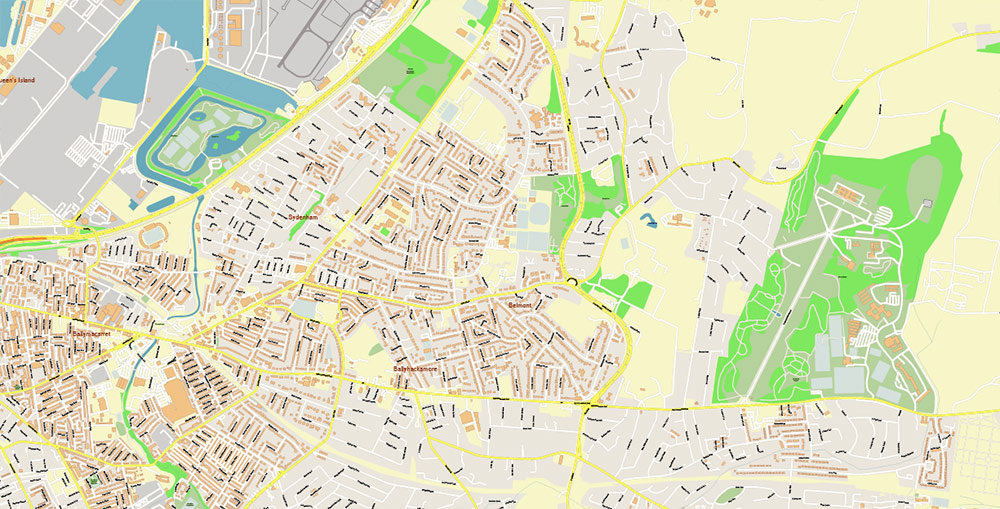
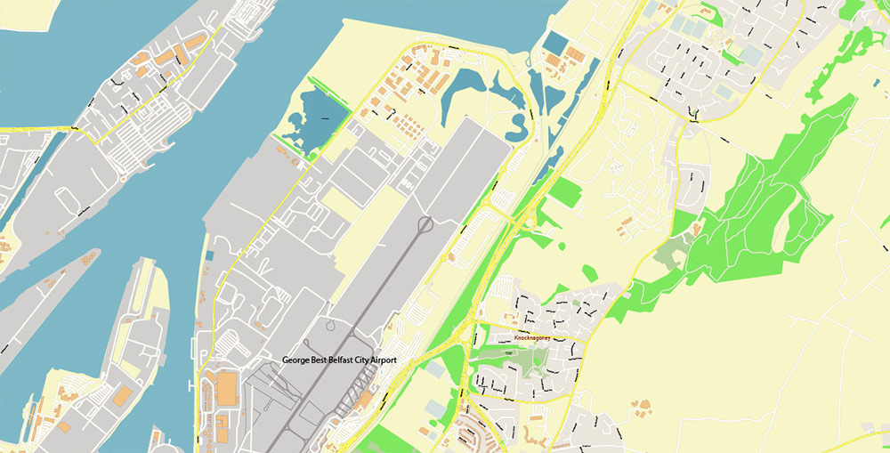
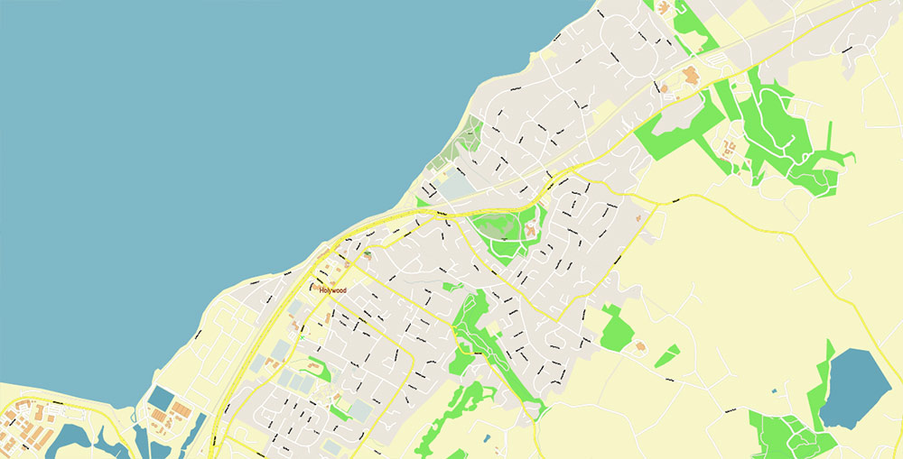
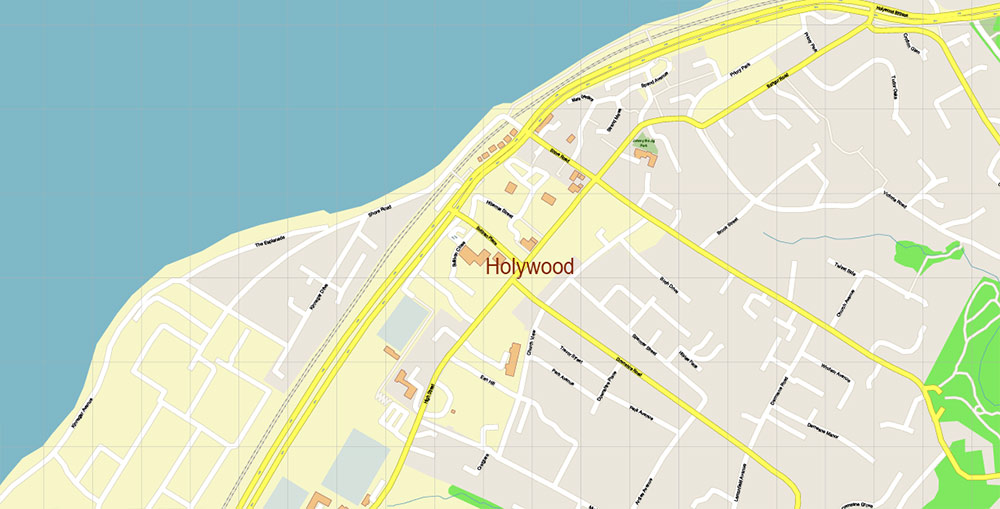
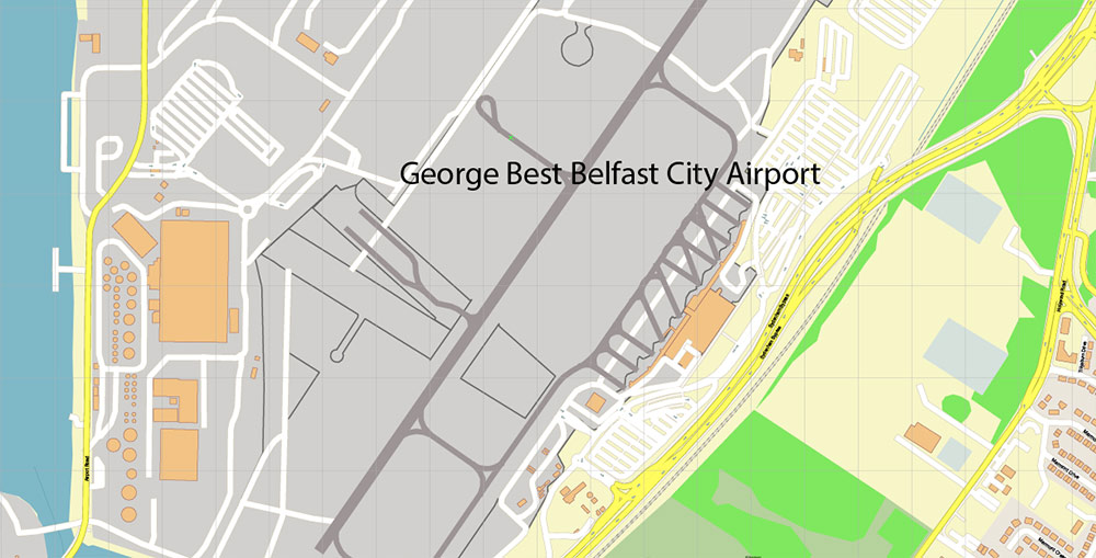
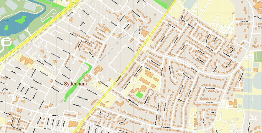
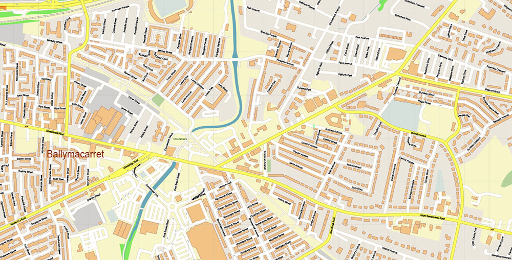
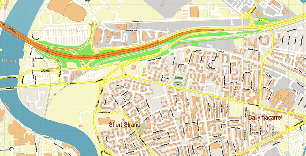
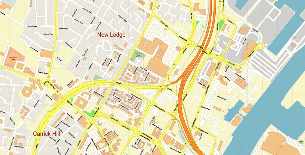
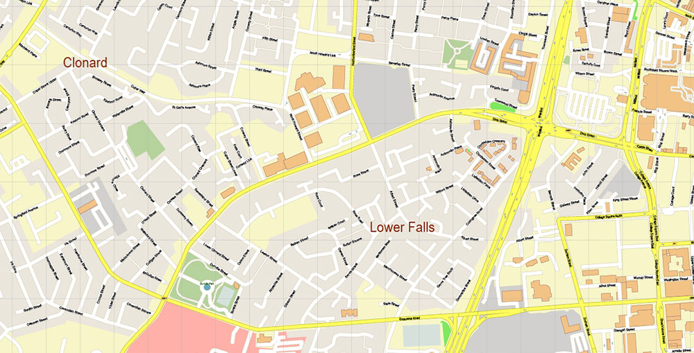
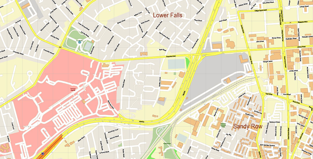
Belfast Northern Ireland UK PDF Vector Map Exact City Plan High Detailed Street Map Adobe PDF in layers
Layers list:
- Legend
- Grids
- Labels of roads
- Names of places (city, hamlet, etc.)
- Names of objects (hospitals, parks, water)
- Names of main streets
- Names of residential streets
- Arrows of street drive direction
- Main Streets, roads
- Residential streets
- Railroads
- Buildings
- Airports and heliports
- Water objects (rivers, lakes, ponds)
- Waterways
- Color fills (parks, hospital areas, land use, etc.)
- Islands
- Background and Sea
Belfast Northern Ireland UK PDF Vector Map Exact City Plan High Detailed Street Map Adobe PDF in layers
Belfast Northern Ireland UK PDF Vector Map Exact City Plan High Detailed Street Map Adobe PDF in layers
Belfast Northern Ireland UK PDF Vector Map Exact City Plan High Detailed Street Map Adobe PDF in layers
Belfast Northern Ireland UK PDF Vector Map Exact City Plan High Detailed Street Map Adobe PDF in layers
Belfast Northern Ireland UK PDF Vector Map Exact City Plan High Detailed Street Map Adobe PDF in layers
Belfast Northern Ireland UK PDF Vector Map Exact City Plan High Detailed Street Map Adobe PDF in layers
Belfast Northern Ireland UK PDF Vector Map Exact City Plan High Detailed Street Map Adobe PDF in layers
Belfast Northern Ireland UK PDF Vector Map Exact City Plan High Detailed Street Map Adobe PDF in layers
Belfast Northern Ireland UK PDF Vector Map Exact City Plan High Detailed Street Map Adobe PDF in layers
Belfast Northern Ireland UK PDF Vector Map Exact City Plan High Detailed Street Map Adobe PDF in layers
Belfast Northern Ireland UK PDF Vector Map Exact City Plan High Detailed Street Map Adobe PDF in layers
Belfast Northern Ireland UK PDF Vector Map Exact City Plan High Detailed Street Map Adobe PDF in layers
Belfast Northern Ireland UK PDF Vector Map Exact City Plan High Detailed Street Map Adobe PDF in layers
Belfast Northern Ireland UK PDF Vector Map Exact City Plan High Detailed Street Map Adobe PDF in layers
Belfast Northern Ireland UK PDF Vector Map Exact City Plan High Detailed Street Map Adobe PDF in layers
Belfast Northern Ireland UK PDF Vector Map Exact City Plan High Detailed Street Map Adobe PDF in layers
Belfast Northern Ireland UK PDF Vector Map Exact City Plan High Detailed Street Map Adobe PDF in layers
Belfast Northern Ireland UK PDF Vector Map Exact City Plan High Detailed Street Map Adobe PDF in layers
Belfast Northern Ireland UK PDF Vector Map Exact City Plan High Detailed Street Map Adobe PDF in layers
Belfast Northern Ireland UK PDF Vector Map Exact City Plan High Detailed Street Map Adobe PDF in layers
Belfast Northern Ireland UK PDF Vector Map Exact City Plan High Detailed Street Map Adobe PDF in layers
Belfast Northern Ireland UK PDF Vector Map Exact City Plan High Detailed Street Map Adobe PDF in layers
Belfast Northern Ireland UK PDF Vector Map Exact City Plan High Detailed Street Map Adobe PDF in layers
Belfast Northern Ireland UK PDF Vector Map Exact City Plan High Detailed Street Map Adobe PDF in layers
Belfast Northern Ireland UK PDF Vector Map Exact City Plan High Detailed Street Map Adobe PDF in layers
Belfast Northern Ireland UK PDF Vector Map Exact City Plan High Detailed Street Map Adobe PDF in layers

 Author: Kirill Shrayber, Ph.D. FRGS

 Street Map editable Adobe Illustrator in layers")