Extended Description of the Vector Map
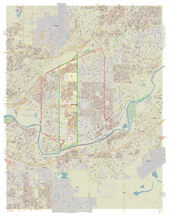
Printable PDF Vector Map of Arden-Arcade Sacramento California USA detailed street map scale 1:3671 full editable Adobe PDF scalable, text all names, 28 MB ZIP
All street names, Main Objects, Buildings. Map for design, printing, arts, projects, presentations, for architects, designers, and builders, business, logistics.

Arden-Arcade Sacramento California USA PDF Map Vector Exact City Plan High Detailed Street Map editable Adobe PDF in layers
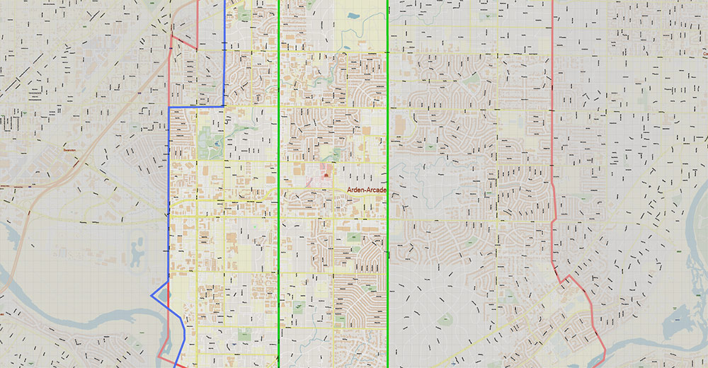
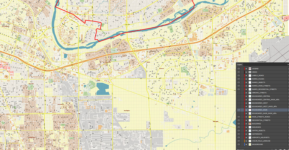
Layers list:
- Legend
- Grids
- Labels of roads
- Names of places (city, hamlet, etc.)
- Names of objects (parks, water, Hospitals)
- Names of main streets
- Names of residential streets
- Arrows of streets
- Main Streets, roads
- Residential streets
- Main Boundaries + Mask 40% transparent
- West Boundaries Blue + Mask 40% transparent
- Central Boundaries Green + Mask 40% transparent
- Buildings
- Airports and Heliports
- Water objects (rivers, lakes, ponds)
- Waterways
- Color fills (parks, hospital areas, land use, etc.)
- Background
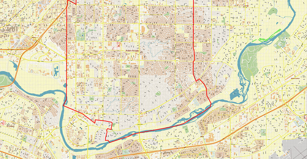
The most exact and detailed map of the city in scale.
For Editing and High-Quality Printing
AO BRIEF — ARDEN-ARCADE (SACRAMENTO COUNTY, CALIFORNIA, USA)
Cartographic / terrain-focused format
1. OVERVIEW
Inner suburban belt east of Sacramento.
Unincorporated urbanized zone with dense residential grid, retail corridors, and mature tree canopy. Functions as a transitional layer between Sacramento CBD and eastern suburbs.
2. TERRAIN & LANDSCAPE
- Relief: Flat alluvial plain (Central Valley), minimal elevation variation
- Hydro: Influenced by proximity to American River (north boundary zone)
- Land cover: Urban fabric + high tree density (notable suburban canopy)
- Soils: Alluvial deposits, floodplain influence in northern sectors
3. ROAD NETWORK / LINES OF COMMUNICATION (LOCs)
Primary corridors:
- Interstate 80 — northern perimeter, high-speed east–west transit
- Capital City Freeway (Business 80) — western boundary, direct access to downtown
- Watt Avenue — major north–south arterial, key commercial spine
- Fulton Avenue — secondary north–south corridor
Secondary grid:
- Arden Way — main east–west commercial axis
- Fair Oaks Blvd — diagonal connector with higher-end residential zones
- Marconi Ave — parallel east–west distributor
Pattern:
- Semi-regular suburban grid with commercial strip clustering
- High intersection density → moderate congestion potential
4. URBAN STRUCTURE
- Core zones: Retail clusters along Arden Way / Watt Ave intersection
- Residential: Medium-density suburban blocks, post-WWII layout
- Commercial: Strip malls, shopping centers, office pockets
- Notable node: Arden Fair Mall (regional retail hub)
5. CLIMATE & SEASONALITY
- Type: Mediterranean (hot dry summers, mild wet winters)
- Summer: High heat load, dry conditions
- Winter: Light precipitation, low flood risk except near river margins
- Visibility: Occasional Central Valley haze/smog
6. DEMOGRAPHY / HUMAN TERRAIN
- Dense suburban population
- Mixed socio-economic profile
- High commercial activity → daytime population inflow
- Ethnically diverse urban population typical for Sacramento metro
7. TOURISM / KEY POINTS
- American River Parkway — major recreational corridor (north)
- Retail destination zones (Arden Fair area)
- Proximity access to Sacramento downtown (~10–15 min drive)
8. HAZARDS / RISKS
- Flooding: Limited, localized near river-adjacent areas
- Heat: High summer thermal stress
- Traffic: Congestion along Watt Ave & Arden Way
- Air quality: Seasonal degradation (wildfire smoke / valley inversion)
9. LOGISTICS / ACCESS
- Strong vehicular accessibility via I-80 and Business 80
- Public transit: bus network integration with Sacramento system
- No rail hub inside AO; nearest connections in Sacramento core
10. COMMAND TAKEAWAYS
- Flat, fully urbanized AO → no terrain obstacles
- Mobility dominated by arterial congestion, not geography
- Key control nodes: Watt Ave / Arden Way junction, freeway interchanges
- Strategic value: commercial density + proximity to Sacramento core
- Best operational movement: off-peak hours via freeway connectors

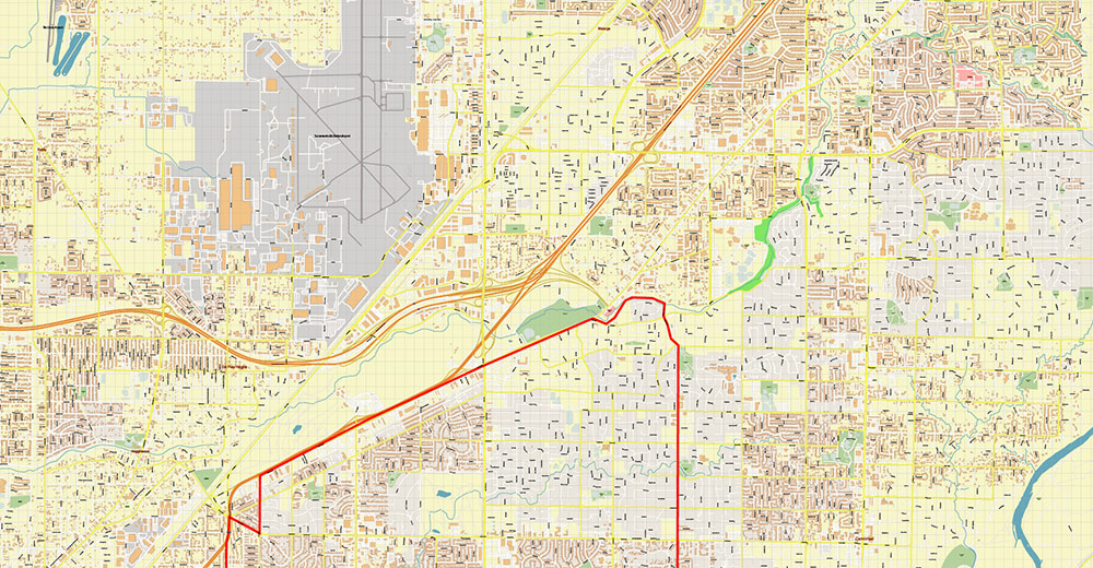
Arden-Arcade Sacramento California USA PDF Map Vector Exact City Plan High Detailed Street Map editable Adobe PDF in layers
Arden-Arcade Sacramento California USA PDF Map Vector Exact City Plan High Detailed Street Map editable Adobe PDF in layers
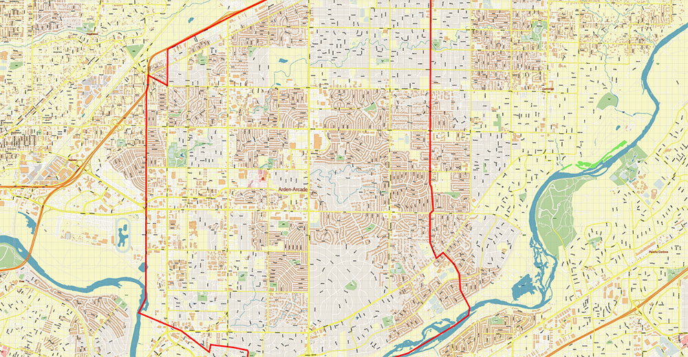
Arden-Arcade Sacramento California USA PDF Map Vector Exact City Plan High Detailed Street Map editable Adobe PDF in layers
Arden-Arcade Sacramento California USA PDF Map Vector Exact City Plan High Detailed Street Map editable Adobe PDF in layers
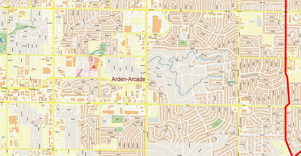
Arden-Arcade Sacramento California USA PDF Map Vector Exact City Plan High Detailed Street Map editable Adobe PDF in layers
Arden-Arcade Sacramento California USA PDF Map Vector Exact City Plan High Detailed Street Map editable Adobe PDF in layers
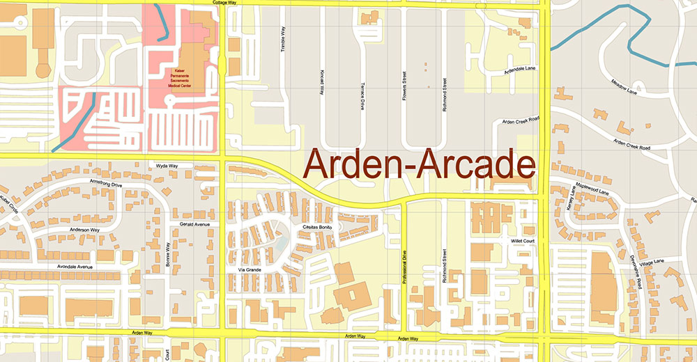
Arden-Arcade Sacramento California USA PDF Map Vector Exact City Plan High Detailed Street Map editable Adobe PDF in layers
Arden-Arcade Sacramento California USA PDF Map Vector Exact City Plan High Detailed Street Map editable Adobe PDF in layers
Arden-Arcade Sacramento California USA PDF Map Vector Exact City Plan High Detailed Street Map editable Adobe PDF in layers

 Author: Kirill Shrayber, Ph.D. FRGS

