Extended Description of the Vector Map
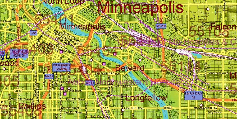
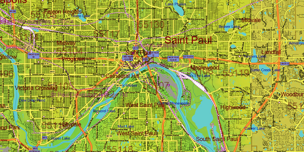
Printable PDF Colored Relief Vector Map of Minnesota State US extra high detailed State Plan fully editable Adobe PDF Road Map in layers, scalable, text/curves format all names, 419 MB ZIP
All Roads and Streets, All cities, towns and villages, Counties, Zip (postal) codes, Airports, Colored Relief rester. Map for design, printing, arts, projects, presentations, for architects, designers, and builders, business, logistics.
NOTE: on the preview images – all layers are enabled. You can simply turn off any layer, which you don’t need.
Also: We can add (additional layer for this map), any other objects for you. It’s free for our customers.
If you need any OTHER format – DWG, DXF, Corel, or something else – please, email us
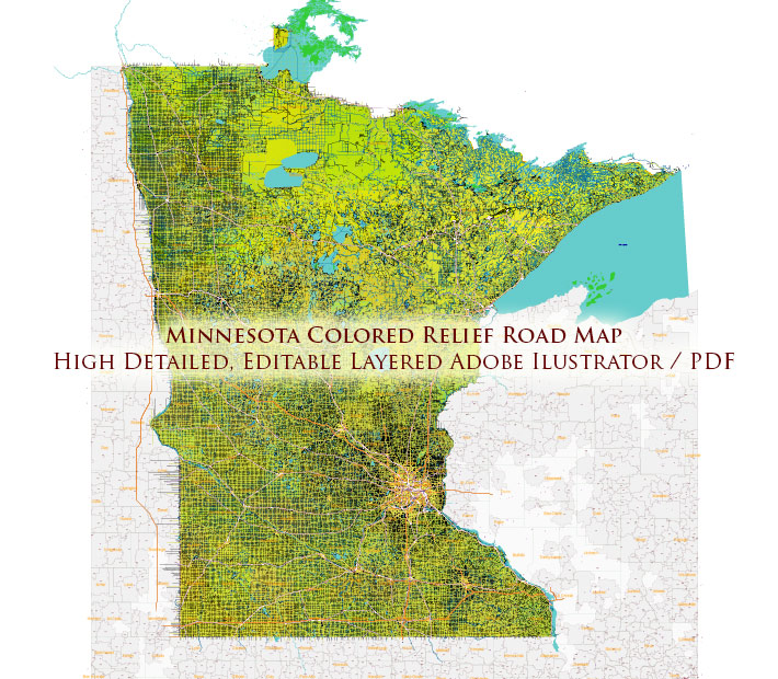
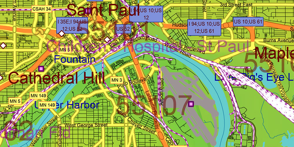
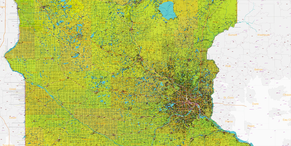
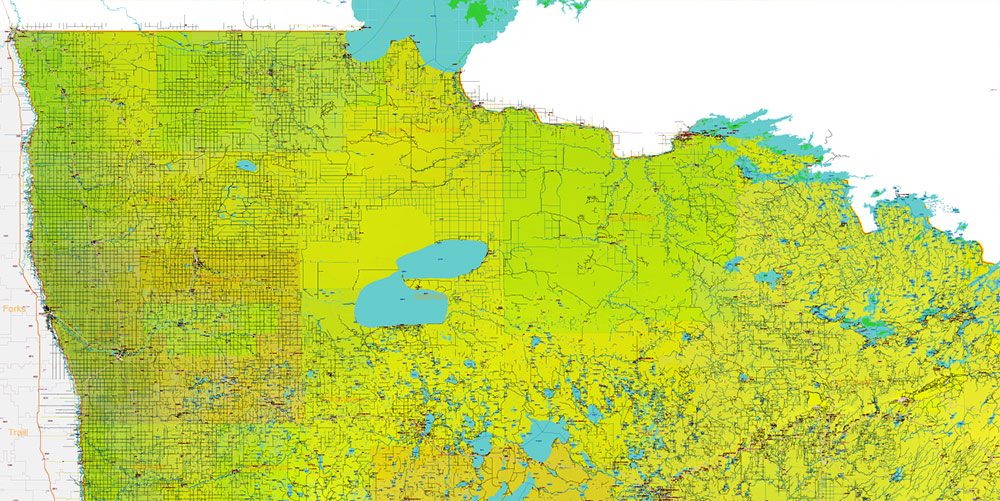
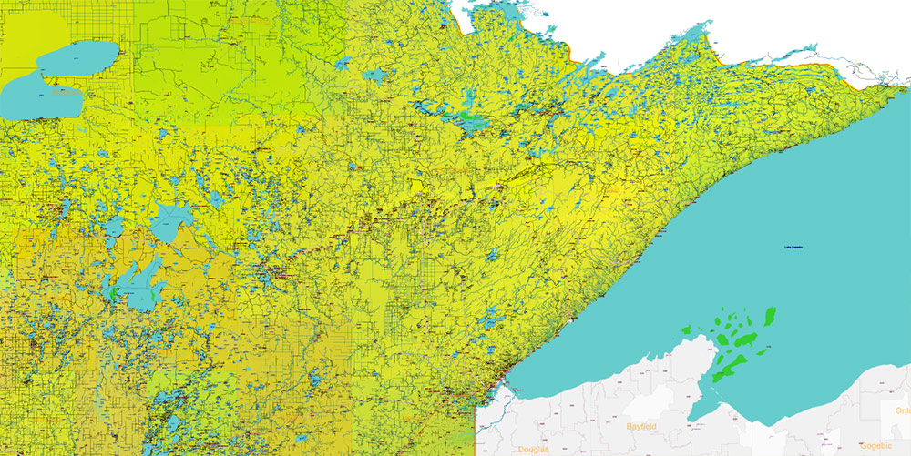
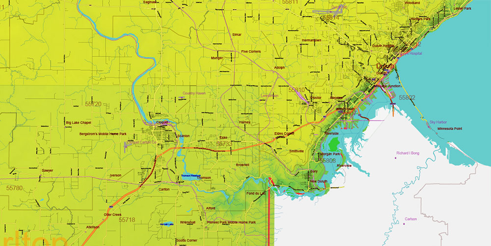
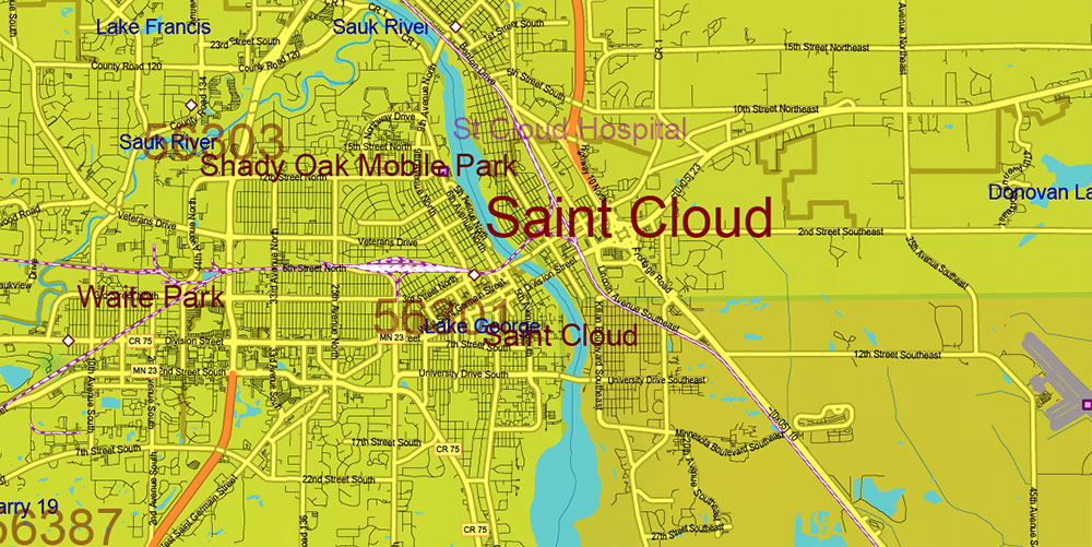
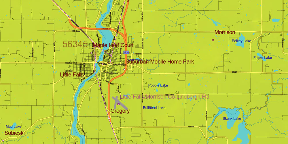
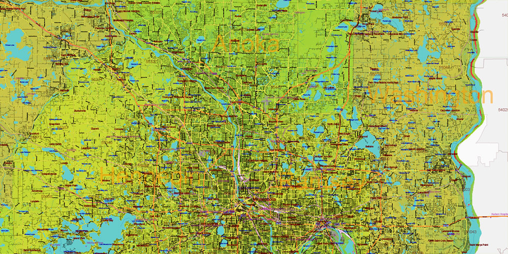
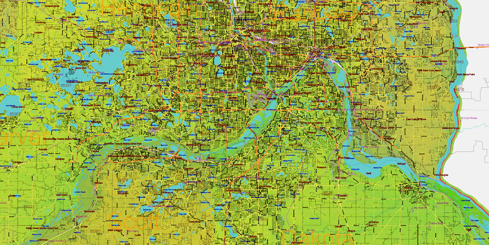
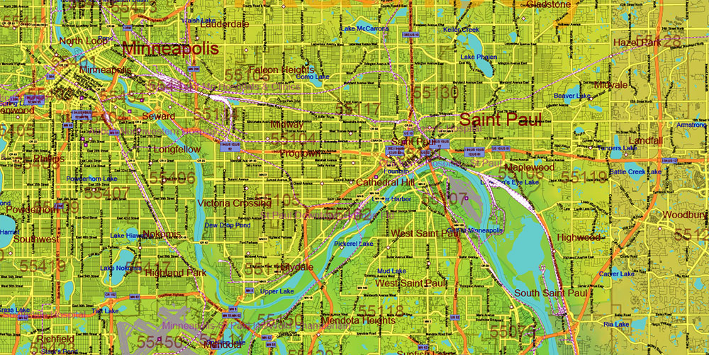
Minnesota State US Colored Relief PDF Vector Map: Full Extra High Detailed (all roads, zipcodes, airports) + Admin Areas + main road names and shields editable Adobe PDF in layers
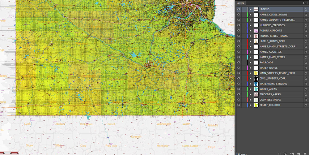
Layers list:
- Legend
- Names of places (city, hamlet, etc.)
- Points of Places
- Points of Airports, Heliports
- Names of water objects
- Names of Airports and Heliports
- Names of Main Cities
- Names of Counties
- Numbers of Zip codes
- Main Road shields (labels)
- Main roads and streets names
- Main Streets and Roads
- Residential streets and small roads
- Railroads
- Waterways / streams
- Water objects (rivers, lakes, ponds, islands)
- ZIP-codes areas
- Counties areas (color)
- Colored Relief Raster JPG
AO BRIEF — MINNESOTA (STATEWIDE)
Colored Relief • No Shading • Print & Wall Art Focus
Operational Overview
Statewide color relief vector map of Minnesota using elevation-based color layers without terrain shading. Designed for clean, high-density cartographic layouts where visual balance, readability, and print quality are primary objectives.
Relief Representation
-
Elevation expressed through calibrated color bands only
-
No shadows or directional lighting — neutral and timeless appearance
-
Clear visualization of glacial plains, uplands, lake districts, and river valleys
-
Terrain structure remains legible without visual noise
Visual Balance & Composition
-
Even tonal distribution optimized for large-format printing
-
Color relief supports dense road, settlement, and administrative layers
-
Designed to remain readable and aesthetically stable at any print size
Hydrography as Visual Structure
-
Extensive lake systems and river networks act as key compositional elements
-
Water bodies provide natural rhythm and balance across the map
-
Clean contrast between land, water, and infrastructure layers
Human & Administrative Geography
-
All cities, towns, and villages clearly labeled
-
Counties and ZIP (postal) codes readable without overpowering the layout
-
Suitable for educational, business, and decorative cartographic products
Transport Framework
-
Complete road and street network integrated with restrained visual weight
-
Infrastructure enhances geographic context while preserving graphic clarity
-
Effective for wall maps, reports, and presentation graphics
Print Engineering
-
Fully editable layered vector Adobe PDF
-
All names in text/curves format, print-safe and scalable
-
No resolution limits for large-format posters or wall installations
-
Suitable for fine art prints, framed maps, and interior design projects
Aesthetic Intent
-
Modern, restrained cartographic design emphasizing clarity over effect
-
Balanced between geographic accuracy and visual harmony
-
Designed for long-term display in offices, studios, and public spaces
Command Takeaways
-
Color relief without shading for clean, decorative output
-
High legibility with dense data layers
-
Unlimited print scalability
-
Ideal for professional print, wall art, and refined design applications
Minnesota State US Colored Relief PDF Vector Map: Full Extra High Detailed (all roads, zipcodes, airports) + Admin Areas + main road names and shields editable Adobe PDF in layers
Minnesota State US Colored Relief PDF Vector Map: Full Extra High Detailed (all roads, zipcodes, airports) + Admin Areas + main road names and shields editable Adobe PDF in layers
Minnesota State US Colored Relief PDF Vector Map: Full Extra High Detailed (all roads, zipcodes, airports) + Admin Areas + main road names and shields editable Adobe PDF in layers
Minnesota State US Colored Relief PDF Vector Map: Full Extra High Detailed (all roads, zipcodes, airports) + Admin Areas + main road names and shields editable Adobe PDF in layers
Minnesota State US Colored Relief PDF Vector Map: Full Extra High Detailed (all roads, zipcodes, airports) + Admin Areas + main road names and shields editable Adobe PDF in layers
Minnesota State US Colored Relief PDF Vector Map: Full Extra High Detailed (all roads, zipcodes, airports) + Admin Areas + main road names and shields editable Adobe PDF in layers
Minnesota State US Colored Relief PDF Vector Map: Full Extra High Detailed (all roads, zipcodes, airports) + Admin Areas + main road names and shields editable Adobe PDF in layers
Minnesota State US Colored Relief PDF Vector Map: Full Extra High Detailed (all roads, zipcodes, airports) + Admin Areas + main road names and shields editable Adobe PDF in layers
Minnesota State US Colored Relief PDF Vector Map: Full Extra High Detailed (all roads, zipcodes, airports) + Admin Areas + main road names and shields editable Adobe PDF in layers
Minnesota State US Colored Relief PDF Vector Map: Full Extra High Detailed (all roads, zipcodes, airports) + Admin Areas + main road names and shields editable Adobe PDF in layers
Minnesota State US Colored Relief PDF Vector Map: Full Extra High Detailed (all roads, zipcodes, airports) + Admin Areas + main road names and shields editable Adobe PDF in layers
Minnesota State US Colored Relief PDF Vector Map: Full Extra High Detailed (all roads, zipcodes, airports) + Admin Areas + main road names and shields editable Adobe PDF in layers
Minnesota State US Colored Relief PDF Vector Map: Full Extra High Detailed (all roads, zipcodes, airports) + Admin Areas + main road names and shields editable Adobe PDF in layers

 Author: Kirill Shrayber, Ph.D. FRGS

 Street Map editable Adobe Illustrator in layers")