Extended Description of the Vector Map
Printable Vector Map of the Ireland Complete (Ireland and Northern Ireland) High detailed fully editable Road Map, Adobe Illustrator Map in layers V.9 Print Size 1600 mm, ready for print, scalable, curves format all names, 106 MB ZIP
All ROADS and railroads, min 12 pt fonts, Water Objects, Cities and Towns, Map for design, printing, arts, projects, presentations, for architects, designers, and builders, business, logistics.
The most exact and detailed map of the Ireland in scale.
ALSO: DWG, DXF, CDR and other formats: free convert for our customers.
For Editing and High-Quality Printing Size 1600 mm height (wall size), CMYK colors
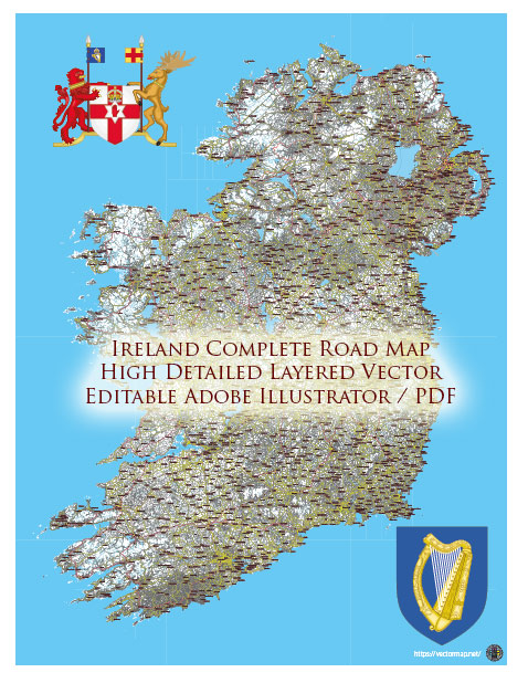
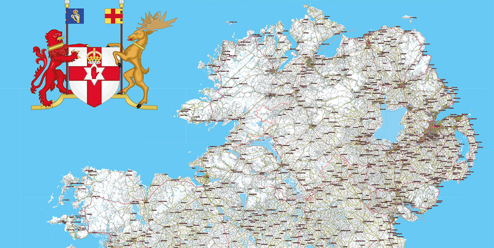
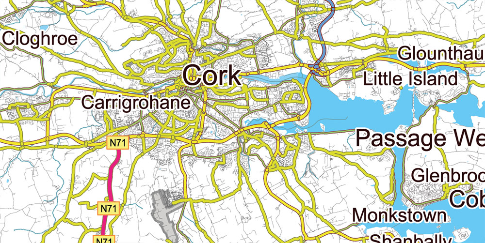
Ireland Full Roads Vector Map, High Detailed Editable Layered Adobe Illustrator all roads, cities, towns ready for print size h1600 mm CMYK
Layers list Ireland Roads map:
- Names of places (city, towns, etc.)
- Labels of roads
- Main roads
- All small roads and streets
- Railroads
- Waterways (lines)
- Water objects (rivers, lakes, ponds) areas
- Airports
- Islands
- Sea
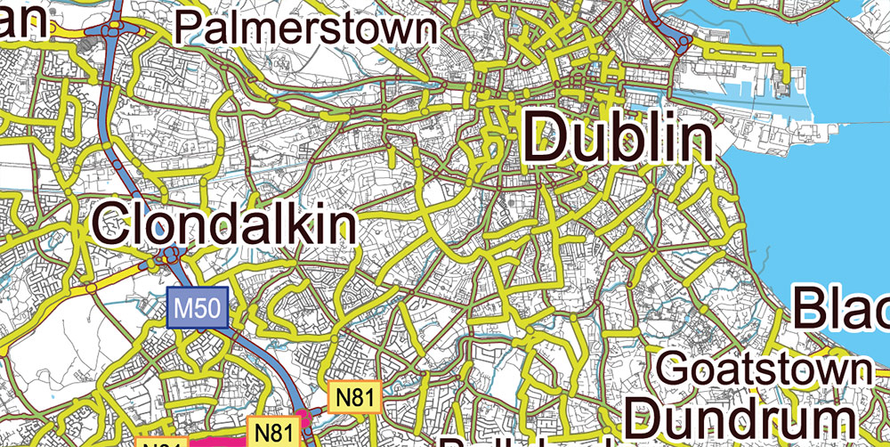
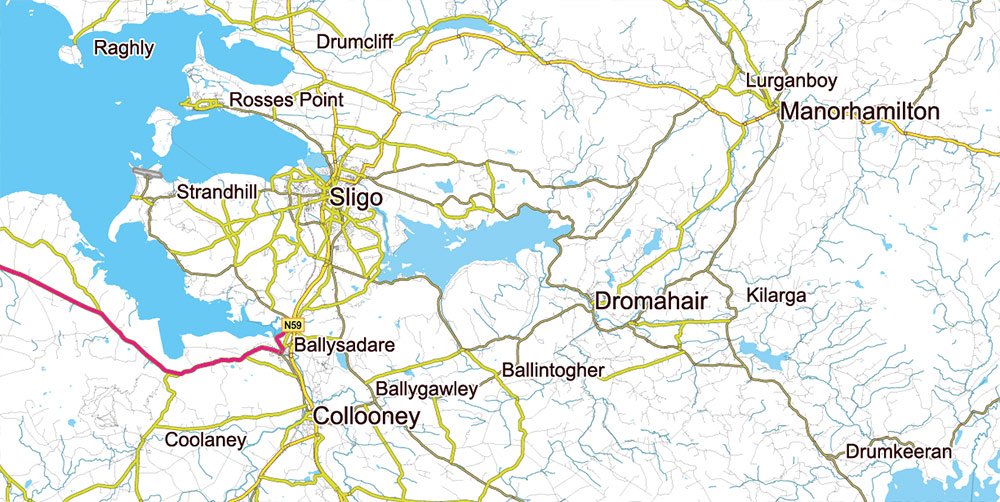
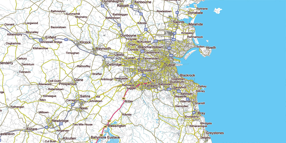
Ireland Full Roads Vector Map, High Detailed Editable Layered Adobe Illustrator all roads, cities, towns ready for print size h1600 mm CMYK
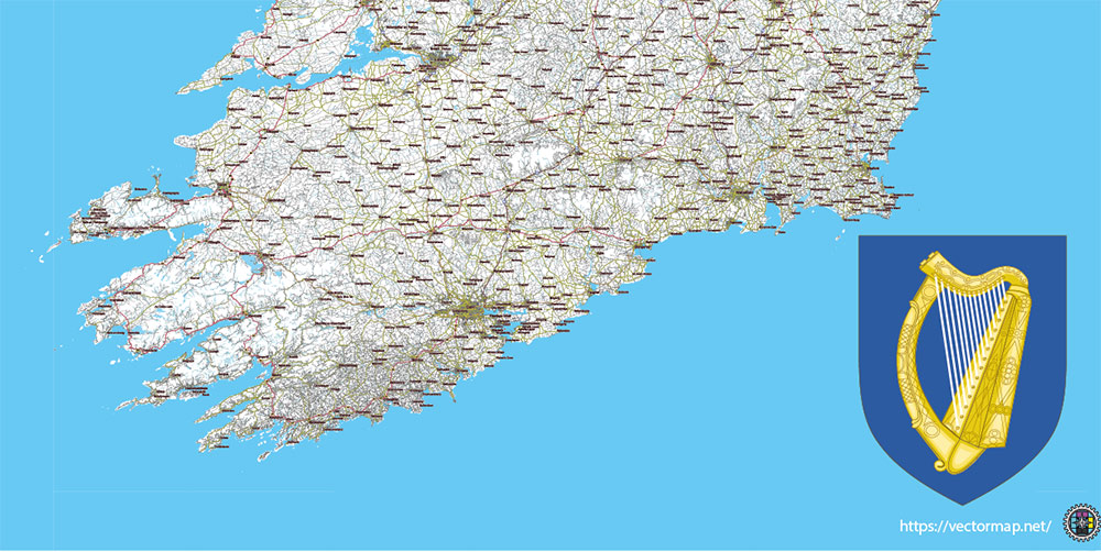
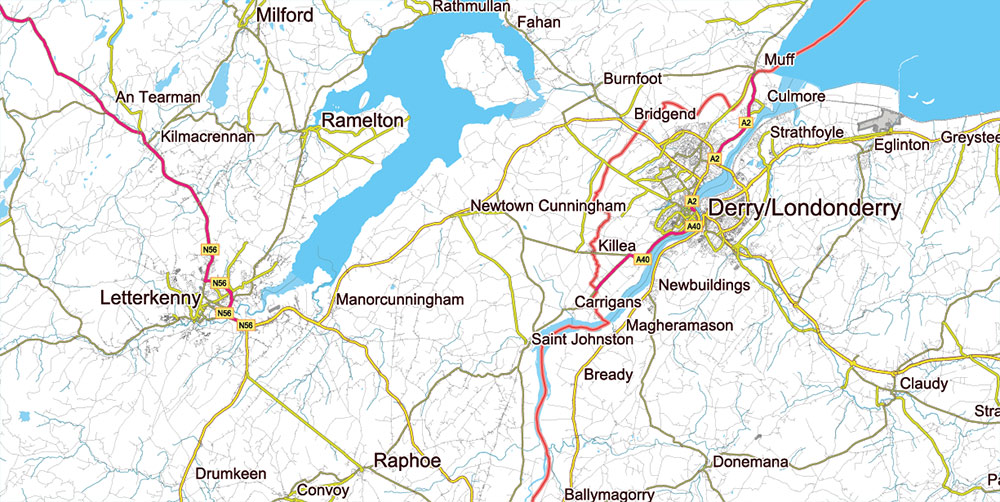
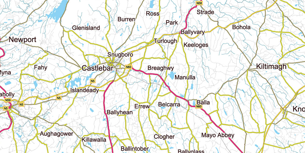
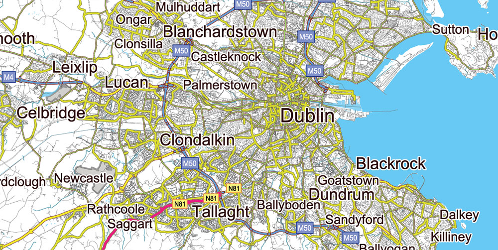
Ireland Full Roads Vector Map, High Detailed Editable Layered Adobe Illustrator all roads, cities, towns ready for print size h1600 mm CMYK
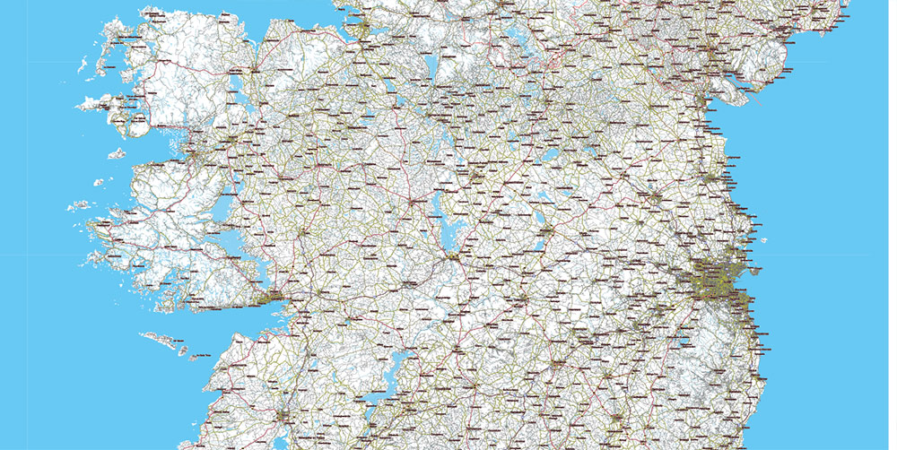
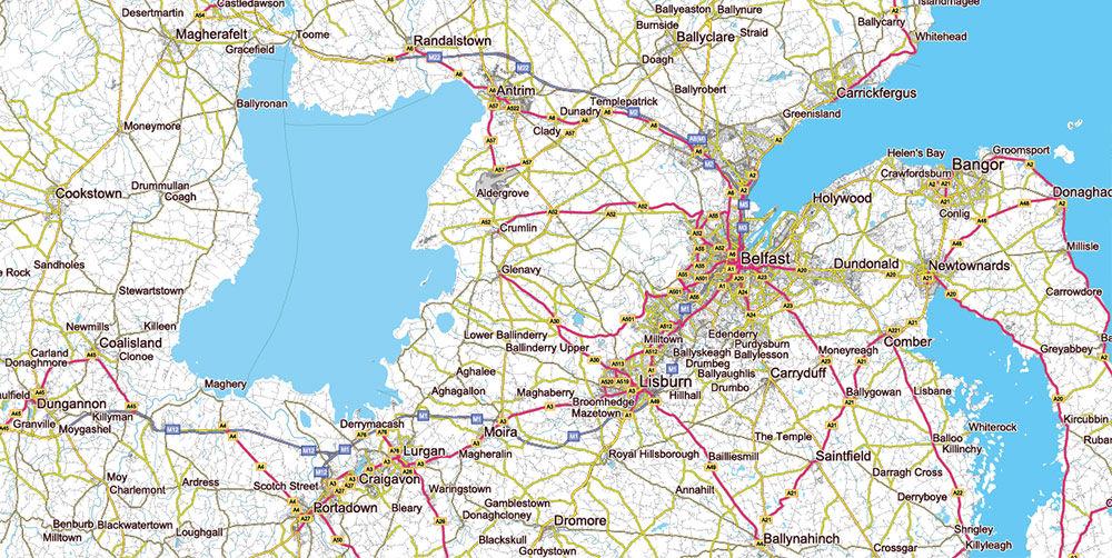
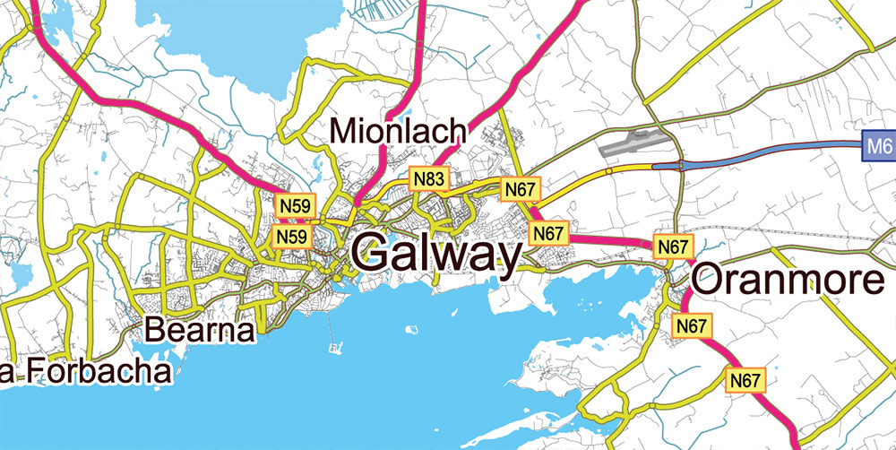
Ireland Full Roads Vector Map, High Detailed Editable Layered Adobe Illustrator all roads, cities, towns ready for print size h1600 mm CMYK
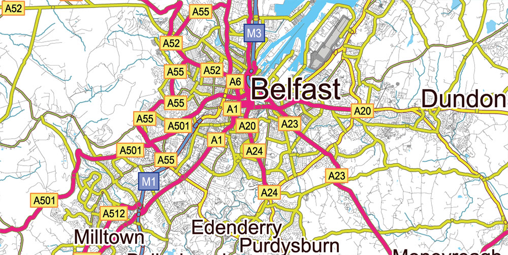
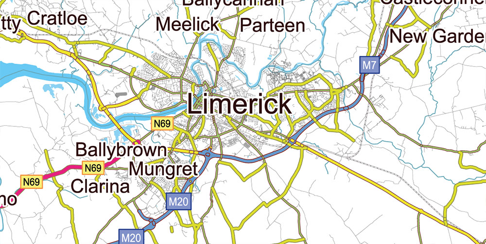
Ireland Full Roads Vector Map, High Detailed Editable Layered Adobe Illustrator all roads, cities, towns ready for print size h1600 mm CMYK
Ireland Full Roads Vector Map, High Detailed Editable Layered Adobe Illustrator all roads, cities, towns ready for print size h1600 mm CMYK
Ireland Full Roads Vector Map, High Detailed Editable Layered Adobe Illustrator all roads, cities, towns ready for print size h1600 mm CMYK
Ireland Full Roads Vector Map, High Detailed Editable Layered Adobe Illustrator all roads, cities, towns ready for print size h1600 mm CMYK
Ireland Full Roads Vector Map, High Detailed Editable Layered Adobe Illustrator all roads, cities, towns ready for print size h1600 mm CMYK
Ireland Full Roads Vector Map, High Detailed Editable Layered Adobe Illustrator all roads, cities, towns ready for print size h1600 mm CMYK
Ireland Full Roads Vector Map, High Detailed Editable Layered Adobe Illustrator all roads, cities, towns ready for print size h1600 mm CMYK
Ireland Full Roads Vector Map, High Detailed Editable Layered Adobe Illustrator all roads, cities, towns ready for print size h1600 mm CMYK
Ireland Full Roads Vector Map, High Detailed Editable Layered Adobe Illustrator all roads, cities, towns ready for print size h1600 mm CMYK
Ireland Full Roads Vector Map, High Detailed Editable Layered Adobe Illustrator all roads, cities, towns ready for print size h1600 mm CMYK
Ireland Full Roads Vector Map, High Detailed Editable Layered Adobe Illustrator all roads, cities, towns ready for print size h1600 mm CMYK

 Author: Kirill Shrayber, Ph.D. FRGS


