Extended Description of the Vector Map
Printable PDF Vector Map of the Ireland Complete (Ireland and Northern Ireland) High detailed fully editable Road Map, Adobe PDF Map in layers V.9 Print Size 1600 mm, ready for print, scalable, curves format all names, 191 MB ZIP
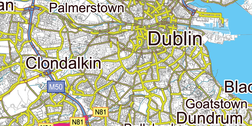
All ROADS and railroads, min 12 pt fonts, Water Objects, Cities and Towns, Map for design, printing, arts, projects, presentations, for architects, designers, and builders, business, logistics.
The most exact and detailed map of the Ireland in scale.
ALSO: DWG, DXF, CDR and other formats: free convert for our customers.
For Editing and High-Quality Printing Size 1600 mm height (wall size), CMYK colors
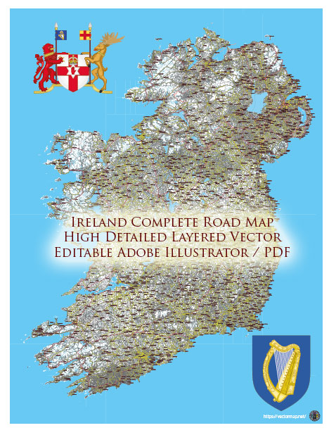
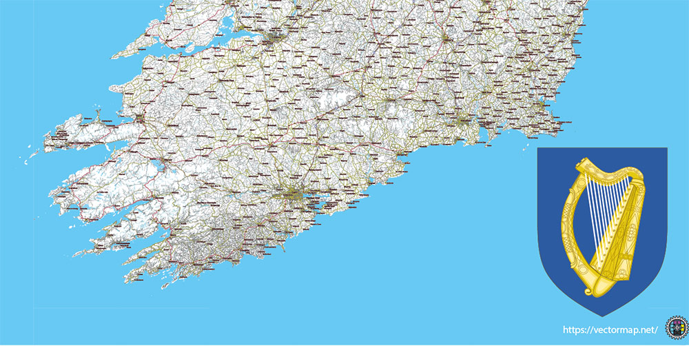
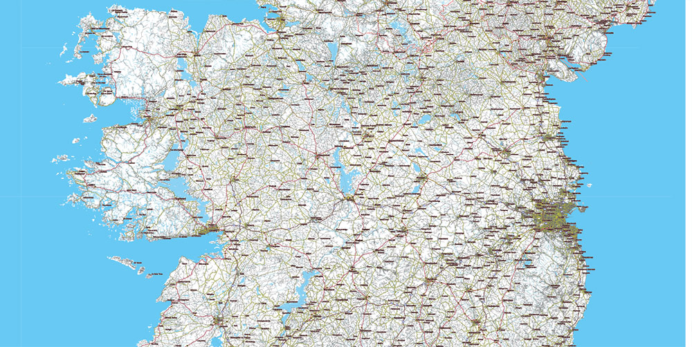
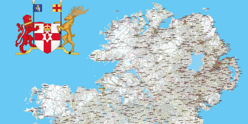
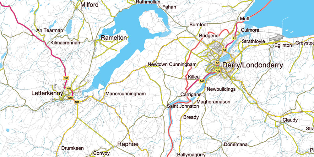
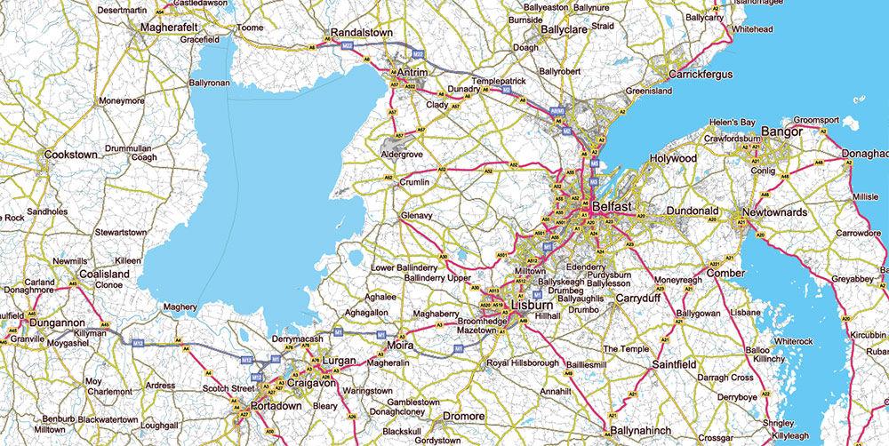
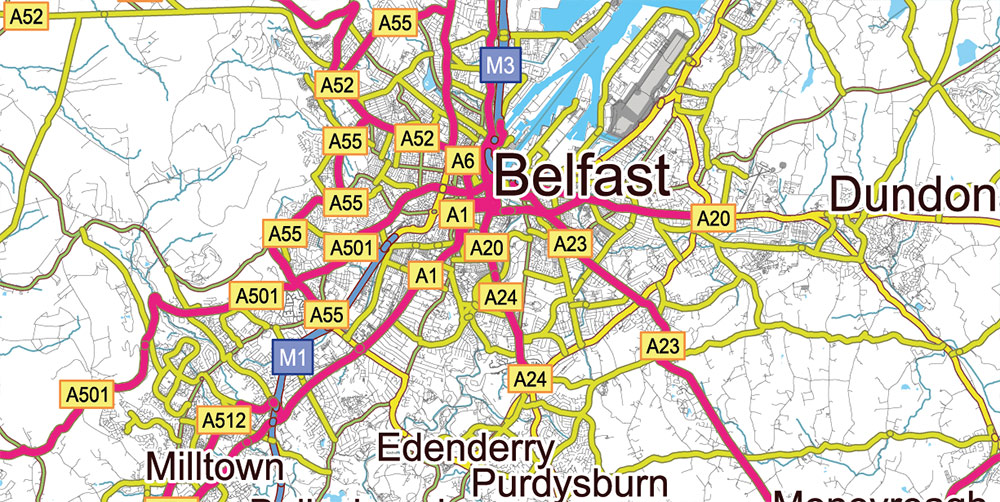
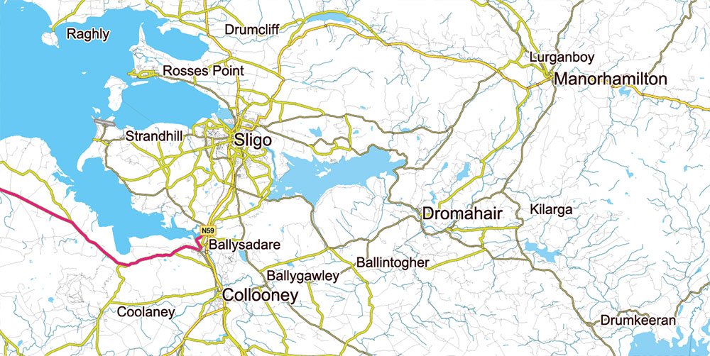
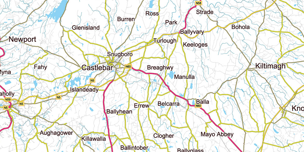
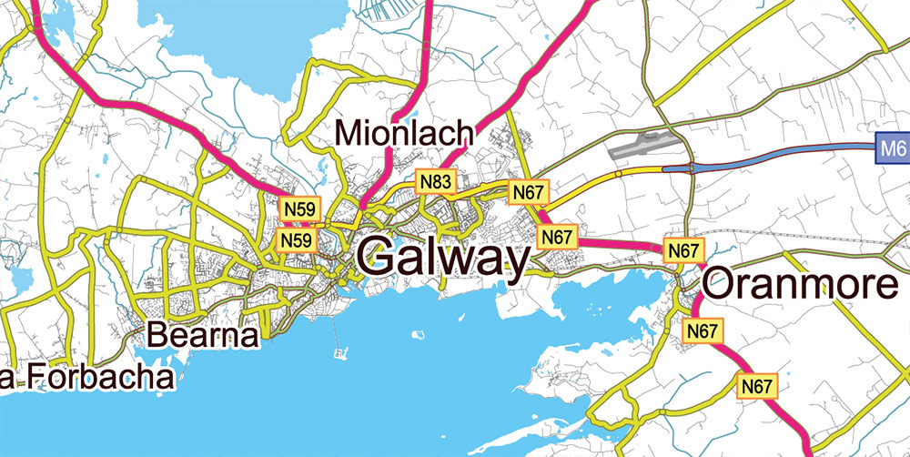
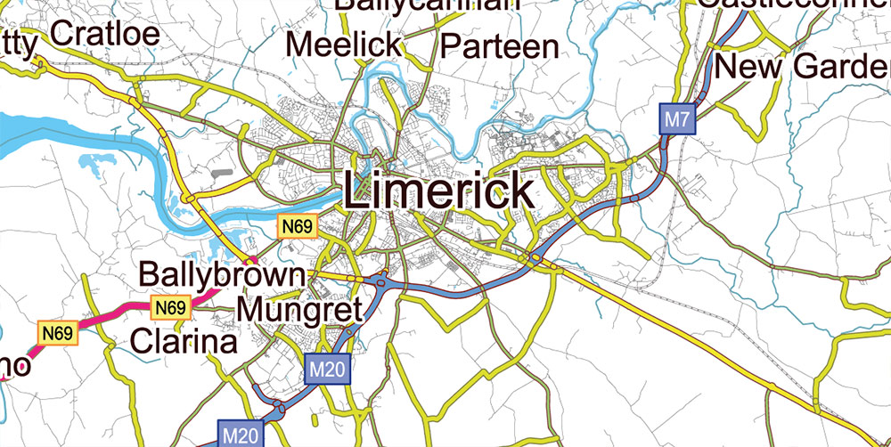
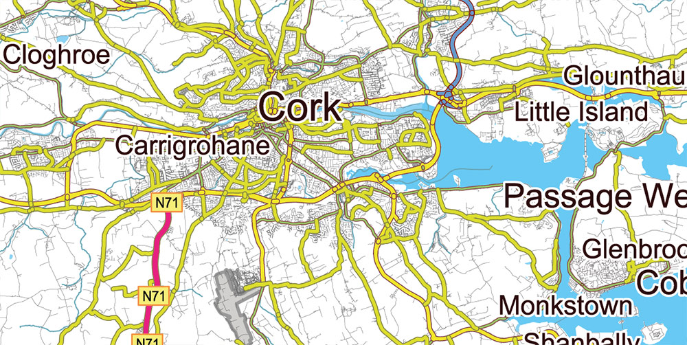
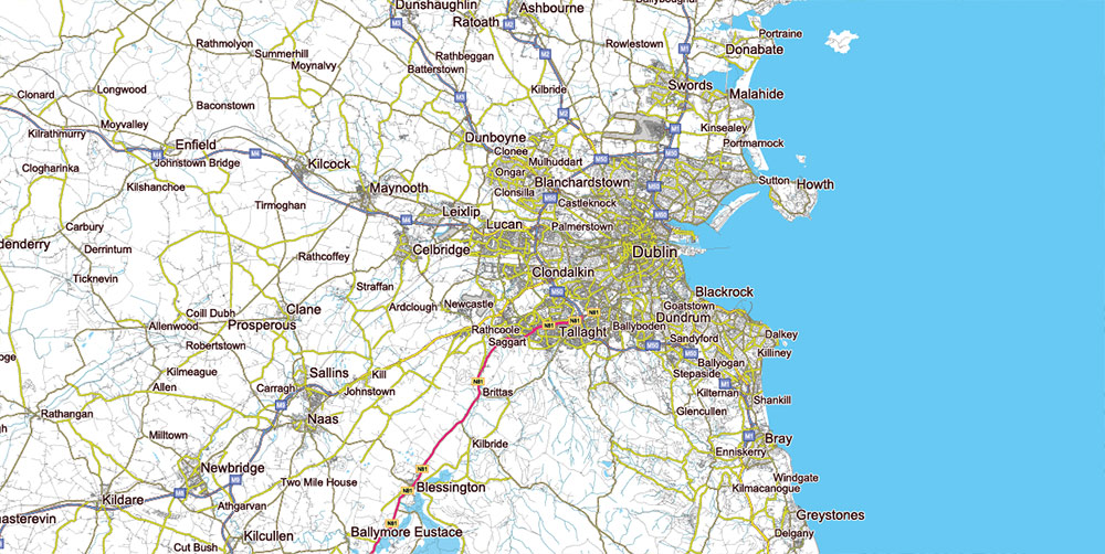
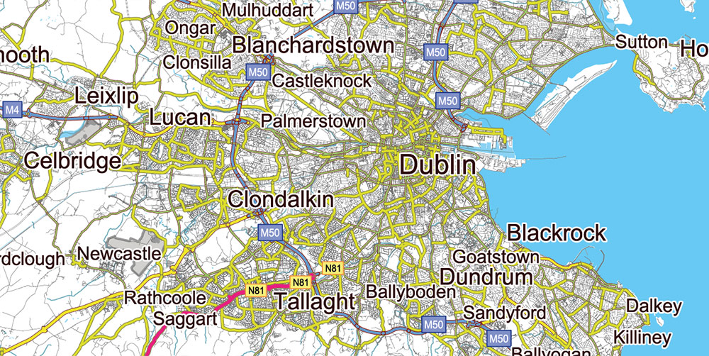
9 Ireland Full Roads PDF Vector Map, High Detailed Editable Layered Adobe PDF all roads, cities, towns ready for print size h1600 mm CMYK
Layers list Ireland Roads map:
- Names of places (city, towns, etc.)
- Labels of roads
- Main roads
- All small roads and streets
- Railroads
- Waterways (lines)
- Water objects (rivers, lakes, ponds) areas
- Airports
- Islands
- Sea
Snapshot
-
Area (island): ~84,400 km²
-
Population: Republic of Ireland ≈ 5.15M (2022); Northern Ireland ≈ 1.90M (2021)
-
Capital cities: Dublin (ROI), Belfast (NI)
-
Time zone: GMT/UTC (UTC+1 in summer)
Major urban hubs (approx. city/urban-area figures)
Republic of Ireland
Northern Ireland
-
Belfast ~345k (city district)
-
Derry/Londonderry ~85k (urban area)
-
Other sizable centers (district scale): Lisburn & Castlereagh ~149k, Newry, Mourne & Down ~182k
Note: ROI reports “city & suburbs”; NI often reports city districts or urban areas—numbers aren’t strictly like-for-like but are operationally useful.
Terrain & environment
-
Topography: Central lowland plain ringed by uplands. Mountain blocks: Wicklow Mountains (E), MacGillycuddy’s Reeks (SW), Mourne Mountains (NI).
-
Hydrography: River Shannon dominates W–midlands; large lakes include Lough Neagh (NI), Lough Corrib (W).
-
Coast: Highly indented W coast (bays, peninsulas); gentler E coast.
-
Climate: Temperate oceanic—frequent rain, low cloud, strong westerlies in exposed Atlantic coasts; winter icing/snow usually brief at low elevations.
Movement & infrastructure
Primary roads (strategic corridors)
ROI
-
M1 Dublin–Dundalk–border → connects to NI A1 to Belfast.
-
M4/M6 Dublin–Galway; M7 Dublin–Limerick; M8 Dublin–Cork; M9 Dublin–Waterford.
-
M11/N11 Dublin–Wexford; M50 orbital around Dublin (key choke point).
NI
-
M1 Belfast–Lisburn–Dungannon (feeds A4/A5 west).
-
M2 Belfast–Antrim; M3 inner link; M5 short spur.
-
A1 (dual) to ROI M1 for the Belfast–Dublin spine.
Rail
-
ROI: Intercity radiates from Dublin to Cork, Limerick, Galway, Waterford, Rosslare; DART suburban on east coast.
-
NI: Belfast hub to Derry/Londonderry, Larne, Bangor; cross-border Enterprise service Belfast–Dublin.
Ports (island gateways)
-
Dublin Port (unitized traffic hub; ferries to GB; containers/Ro-Ro).
-
Cork (Ringaskiddy) container/Ro-Ro; Shannon Foynes bulk (west); Rosslare Europort ferries to GB/France; Waterford regional.
-
NI: Belfast Harbour (major freight/passengers), Larne (ferries to Scotland), Foyle Port (Derry).
Airports
-
Dublin (DUB)—primary island gateway, widest long-haul/short-haul mix.
-
ROI regionals: Cork (ORK), Shannon (SNN), Ireland West/Knock (NOC), Kerry (KIR), Donegal (CFN).
-
NI: Belfast International (BFS), Belfast City/George Best (BHD), City of Derry (LDY).
Demography (operational)
-
Languages: English island-wide; Irish (Gaeilge) official in ROI (Gaeltacht areas); Ulster Scots present mainly in NI.
-
Urbanization: Heaviest around Dublin and Belfast; secondary coastal cities in south/west.
-
Age/mobility: ROI relatively young profile by EU standards; net in-migration positive in recent years. NI shows balanced community backgrounds (Catholic/Protestant), relevant for cultural/engagement contexts.
-
Education/health: High literacy; tertiary attainment concentrated around larger metros.
Chokepoints & operational notes
-
M50 (Dublin): principal orbital—congestion risk; controls access to DUB and Dublin Port.
-
Belfast inner motorways (M1/M2): short but critical; bottlenecks near city center.
-
Cross-border spine: M1/A1 + Enterprise rail—fastest Dublin–Belfast link.
-
Ferry axes: Dublin–Holyhead; Rosslare–Pembroke/Fishguard/Cherbourg; Belfast/Larne–Cairnryan; Belfast–Liverpool.
-
Weather impacts: Atlantic storms affect W ports/airfields; low cloud/wind shear episodes at coastal airports; rural flooding along the Shannon after prolonged rain.
9 Ireland Full Roads PDF Vector Map, High Detailed Editable Layered Adobe PDF all roads, cities, towns ready for print size h1600 mm CMYK
9 Ireland Full Roads PDF Vector Map, High Detailed Editable Layered Adobe PDF all roads, cities, towns ready for print size h1600 mm CMYK
9 Ireland Full Roads PDF Vector Map, High Detailed Editable Layered Adobe PDF all roads, cities, towns ready for print size h1600 mm CMYK
9 Ireland Full Roads PDF Vector Map, High Detailed Editable Layered Adobe PDF all roads, cities, towns ready for print size h1600 mm CMYK
9 Ireland Full Roads PDF Vector Map, High Detailed Editable Layered Adobe PDF all roads, cities, towns ready for print size h1600 mm CMYK
9 Ireland Full Roads PDF Vector Map, High Detailed Editable Layered Adobe PDF all roads, cities, towns ready for print size h1600 mm CMYK
9 Ireland Full Roads PDF Vector Map, High Detailed Editable Layered Adobe PDF all roads, cities, towns ready for print size h1600 mm CMYK
9 Ireland Full Roads PDF Vector Map, High Detailed Editable Layered Adobe PDF all roads, cities, towns ready for print size h1600 mm CMYK
9 Ireland Full Roads PDF Vector Map, High Detailed Editable Layered Adobe PDF all roads, cities, towns ready for print size h1600 mm CMYK
9 Ireland Full Roads PDF Vector Map, High Detailed Editable Layered Adobe PDF all roads, cities, towns ready for print size h1600 mm CMYK
9 Ireland Full Roads PDF Vector Map, High Detailed Editable Layered Adobe PDF all roads, cities, towns ready for print size h1600 mm CMYK
9 Ireland Full Roads PDF Vector Map, High Detailed Editable Layered Adobe PDF all roads, cities, towns ready for print size h1600 mm CMYK
9 Ireland Full Roads PDF Vector Map, High Detailed Editable Layered Adobe PDF all roads, cities, towns ready for print size h1600 mm CMYK
9 Ireland Full Roads PDF Vector Map, High Detailed Editable Layered Adobe PDF all roads, cities, towns ready for print size h1600 mm CMYK

 Author: Kirill Shrayber, Ph.D. FRGS


