Extended Description of the Vector Map
Printable Vector Map of the Ireland Full High detailed full editable Road Map + Relief, Adobe Illustrator Map in layers V.2 Print Size 24 x 36 inches, ready for print, scalable, text/curves format all names, 156 MB ZIP
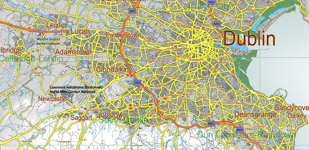
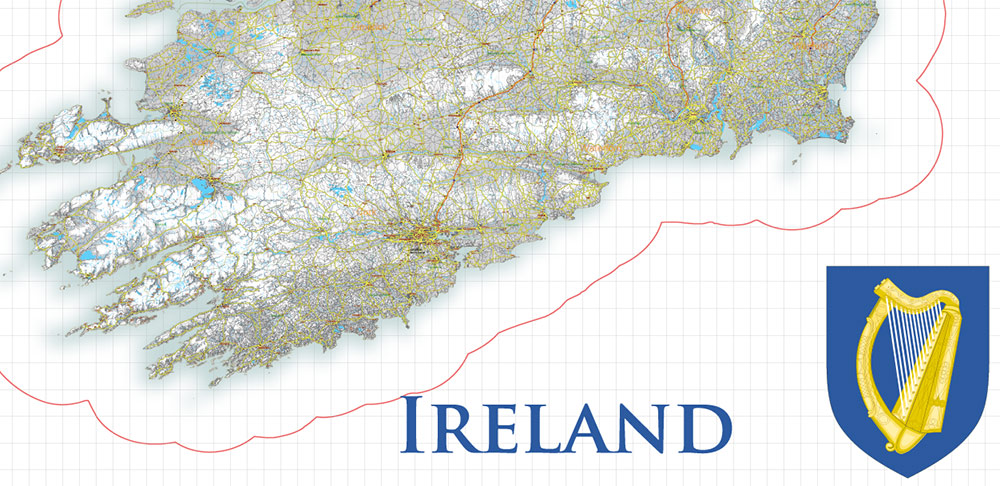
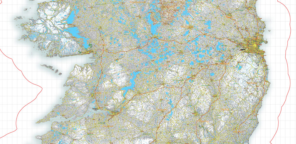
All ROADS and railroads, + Raster Relief, Water Objects, Counties, Cities, Map for design, printing, arts, projects, presentations, for architects, designers, and builders, business, logistics.
The most exact and detailed map of the Ireland in scale.
ALSO: AI, DWG, DXF, CDR and other formats: free convert for our customers.
For Editing and High-Quality Printing Size 24 x 36 inches
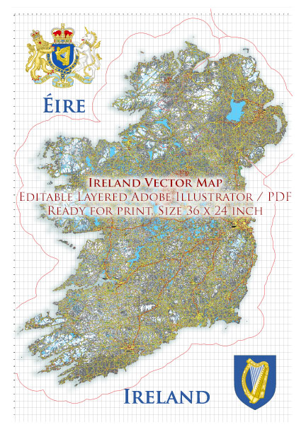
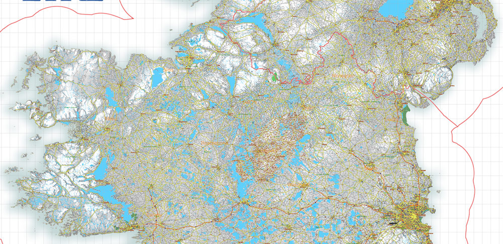
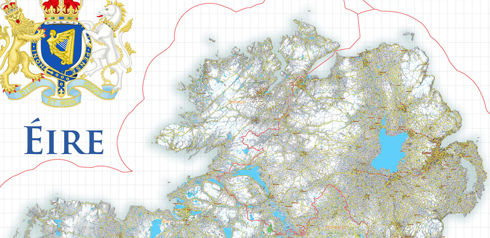
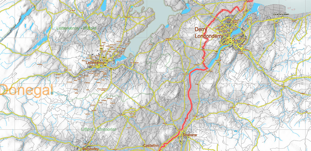
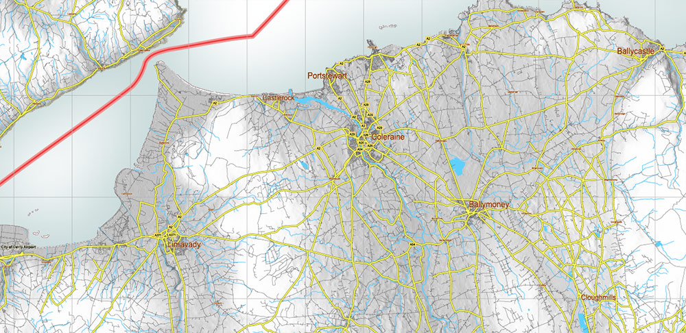
2 Ireland Full Vector Map, High Detailed Editable Layered Adobe Illustrator all roads, cities, relief, ready for print size 24×36 inches v.2
Layers list Ireland Roads Admin map:
- Names of places (city, hamlet, etc.)
- Points of cities, towns
- Main roads
- Railroads
- Waterways (lines)
- Water objects (rivers, lakes, ponds) areas
- Names of States
- States areas
- Counties areas
- Sea
- Relief (raster)
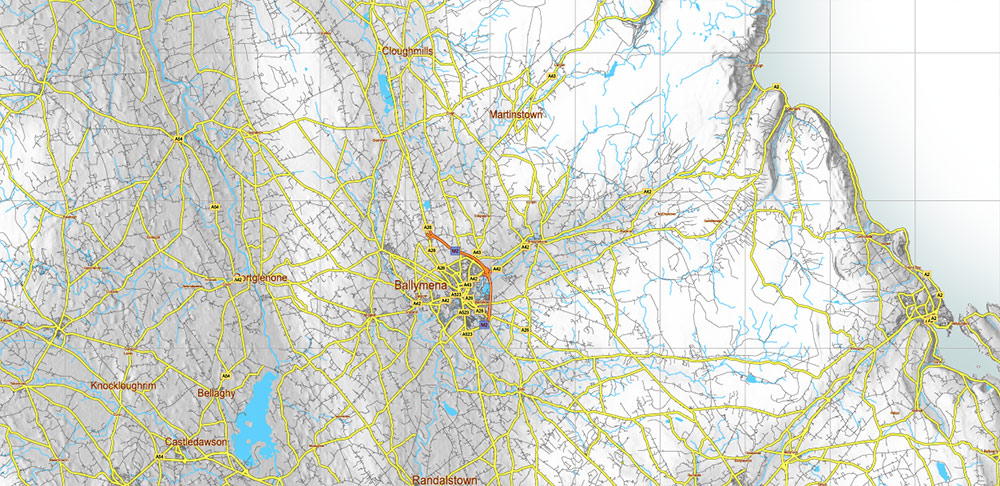
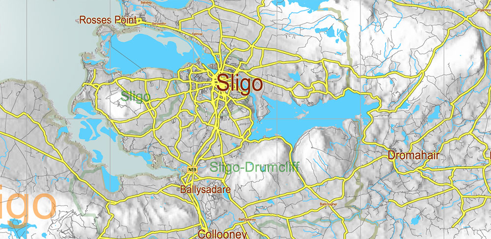
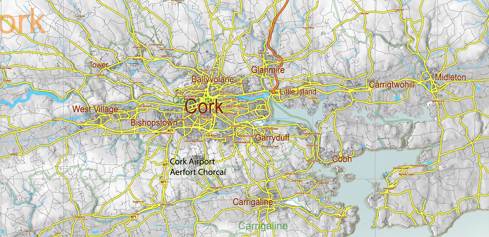
2 Ireland Full Vector Map, High Detailed Editable Layered Adobe Illustrator all roads, cities, relief, ready for print size 24×36 inches v.2
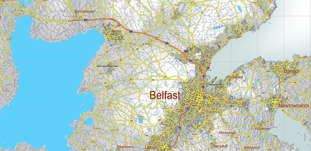
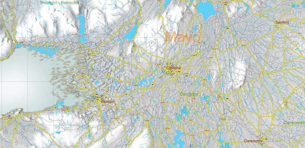
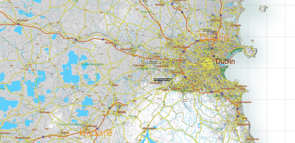
2 Ireland Full Vector Map, High Detailed Editable Layered Adobe Illustrator all roads, cities, relief, ready for print size 24×36 inches v.2
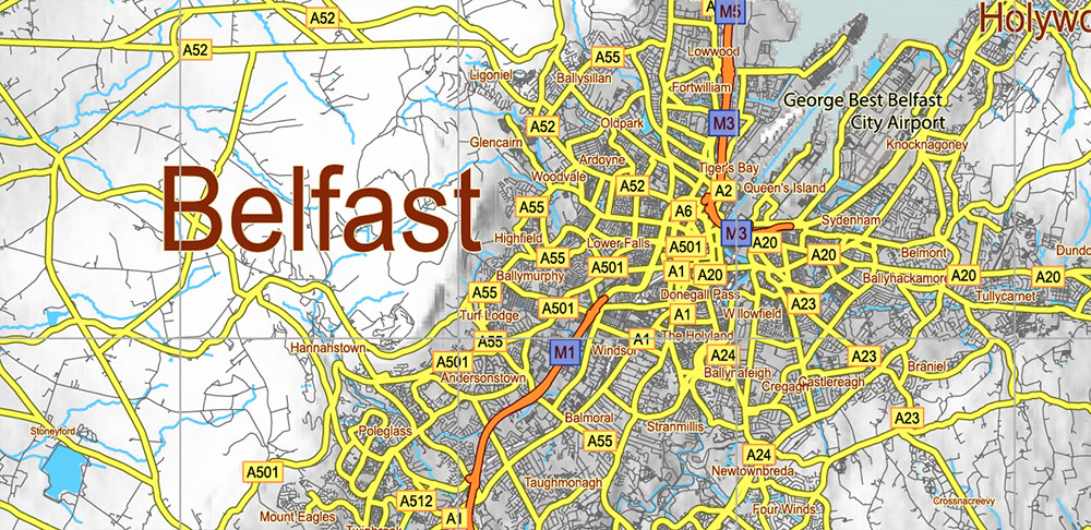
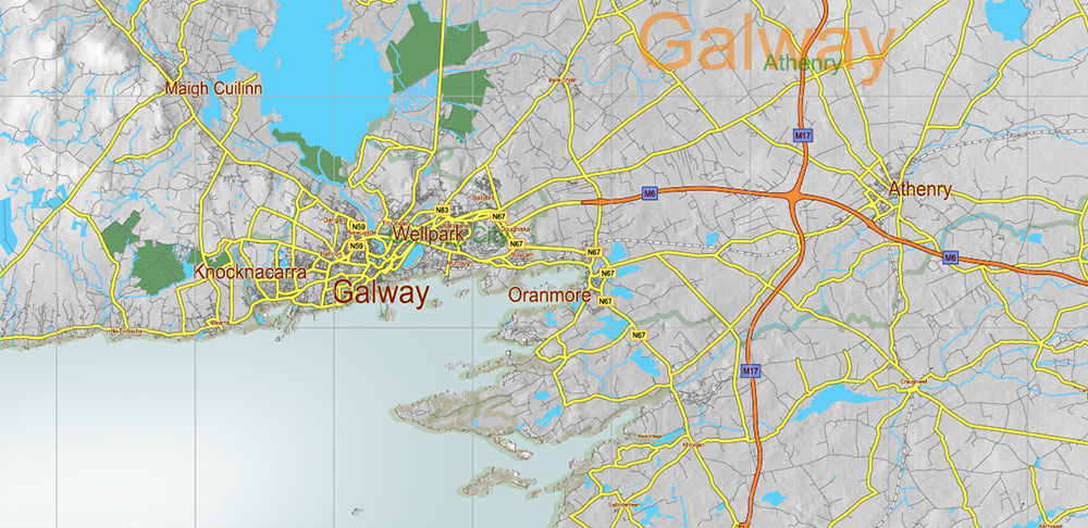
2 Ireland Full Vector Map, High Detailed Editable Layered Adobe Illustrator all roads, cities, relief, ready for print size 24×36 inches v.2
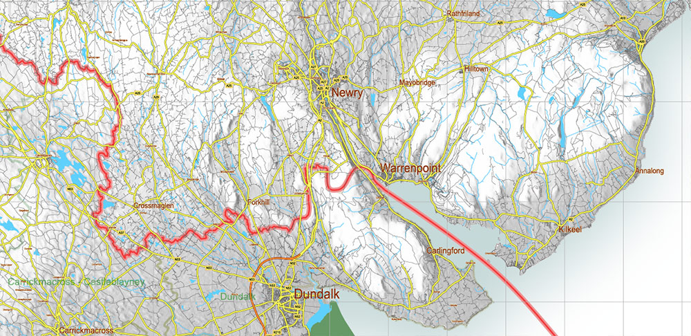
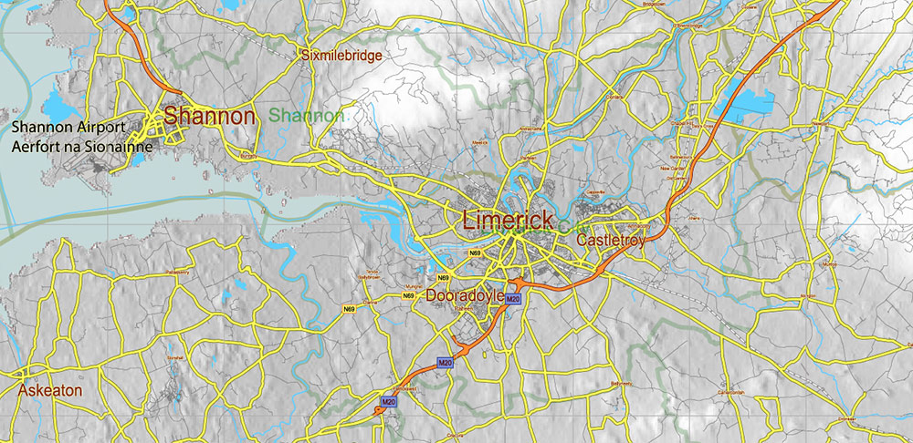
2 Ireland Full Vector Map, High Detailed Editable Layered Adobe Illustrator all roads, cities, relief, ready for print size 24×36 inches v.2
2 Ireland Full Vector Map, High Detailed Editable Layered Adobe Illustrator all roads, cities, relief, ready for print size 24×36 inches v.2
2 Ireland Full Vector Map, High Detailed Editable Layered Adobe Illustrator all roads, cities, relief, ready for print size 24×36 inches v.2
2 Ireland Full Vector Map, High Detailed Editable Layered Adobe Illustrator all roads, cities, relief, ready for print size 24×36 inches v.2
2 Ireland Full Vector Map, High Detailed Editable Layered Adobe Illustrator all roads, cities, relief, ready for print size 24×36 inches v.2
2 Ireland Full Vector Map, High Detailed Editable Layered Adobe Illustrator all roads, cities, relief, ready for print size 24×36 inches v.2
2 Ireland Full Vector Map, High Detailed Editable Layered Adobe Illustrator all roads, cities, relief, ready for print size 24×36 inches v.2
2 Ireland Full Vector Map, High Detailed Editable Layered Adobe Illustrator all roads, cities, relief, ready for print size 24×36 inches v.2
2 Ireland Full Vector Map, High Detailed Editable Layered Adobe Illustrator all roads, cities, relief, ready for print size 24×36 inches v.2
2 Ireland Full Vector Map, High Detailed Editable Layered Adobe Illustrator all roads, cities, relief, ready for print size 24×36 inches v.2
2 Ireland Full Vector Map, High Detailed Editable Layered Adobe Illustrator all roads, cities, relief, ready for print size 24×36 inches v.2
2 Ireland Full Vector Map, High Detailed Editable Layered Adobe Illustrator all roads, cities, relief, ready for print size 24×36 inches v.2
2 Ireland Full Vector Map, High Detailed Editable Layered Adobe Illustrator all roads, cities, relief, ready for print size 24×36 inches v.2
2 Ireland Full Vector Map, High Detailed Editable Layered Adobe Illustrator all roads, cities, relief, ready for print size 24×36 inches v.2

 Author: Kirill Shrayber, Ph.D. FRGS


