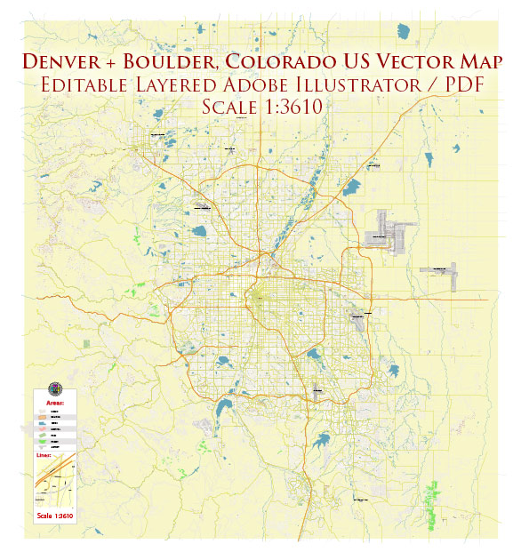
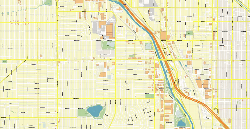
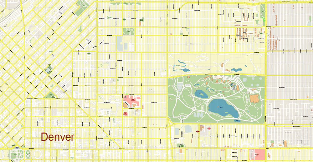
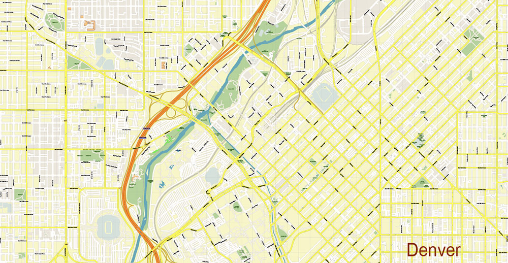
Urban plan Denver Colorado 3 10 PDF: Digital Vector Maps
Gallery of Images "Urban plan Denver Colorado 3 10 PDF":


Urban plan Denver Colorado 3 10 PDF: City Vector Maps in AutoCAD DWG DXF PDF AI
State - Colorado
Region - Mountain states of the USA
The founding date of Denver is 1858
Denver area - 401 km2 (including land - 397 km2)
The population of Denver is more than 700,000 people (19th place in the USA)
The population density in Denver is about 1,745 people/km2
It is part of the Denver-Aurora-Lakewood metropolitan area with a population of more than 2,930,000 people (19th place among US megacities)
Denver Time Zone - US Mountain Time Zone (UTC-07, MST)
Denver's nicknames are "The Mile-high City", "Queen of the West", "Wall Street of the West"
Denver is the capital and largest city of Colorado, an important economic and cultural center of the region. The advantageous geographical location of Denver, approximately in the middle between the megacities of the east and west coasts of the United States, makes it a strategically advantageous and convenient place to host federal institutions, create high-tech industries, develop tourism, educational, commercial, financial, and cultural programs.
The city grew up on the outskirts of the Great Plains at the foot of the eastern slopes of the Rocky Mountains. Denver is called a "Mile-high city" because it is located at an altitude of about 1600-1700 meters (just about a mile - 1609 meters) above sea level.
Denver is characterized by a continental arid climate with pronounced four seasons and large daily temperature fluctuations. Although in general the climate in the Denver area is quite mild, but due to the close proximity of the mountains, unpredictable fluctuations in weather conditions are possible.
Winter in Denver is usually dry and mild, with temperatures in January ranging from -10°C to 6 °C. The earlier or later onset of spring depends very much from year to year on the movement of air masses. Snowfalls are not uncommon even in the second half of April, thunderstorms often occur in spring. In summer, in July, the temperature ranges from 15 ° C to 31 ° C, there is little precipitation. Autumn is characterized by a relatively large amount of precipitation, at the end of autumn, there are often heavy snowfalls.
Denver has an average of more than three hundred sunny days a year.
Denver ranks nineteenth in the list of the largest cities in the United States, its population exceeds 700,000 people. The population density in Denver is about 1,745 people/km2, relatively small compared to many large cities in the United States of America.
The city of Denver is part of the metropolitan area (urban agglomeration) of Denver-Aurora-Lakewood, whose population exceeds 2,930,000 people.
The racial makeup of Denver 's population:
White - about 69%
Blacks (African Americans) - about 10%
Asians - about 3.4%
Native Americans - about 1%
Two or more races - about 4%
Hispanic or Latino (of any race) - about 32%
Non-Hispanic whites - about 52%
Denver has one of the highest percentages of Hispanic residents (Latinos) among major US cities.
The largest ethnic groups among the population of Denver:
Mexicans - 25%
Germans - 15%
Irish - 10%
The British - 9%
Italians - 4%
About 70% of Denver residents call English their native language, more than 20% - Spanish.
The first settlement on the site of modern Denver was founded in the summer of 1858 and was called Montana City. It was the time of the "gold rush" in Colorado (known as the "Pikes Peak Fever"), when a flood of gold prospectors poured into the territory previously practically undeveloped by European settlers. A year later, the village was abandoned, and the prospectors moved to other, more promising sites.
Nevertheless, with a long-range view to increasing the number of migrant miners, a land speculator from Kansas, William Larimer, bought up plots here and founded a new settlement, calling it Denver City. With the help of such a name, Larmer intended to ingratiate himself with James Denver, the governor of the Kansas territory, which at that time included these lands. But ironically, by the time Denver City got its name, James Denver had already left the governor's post. The governor left, but the name remained, later changing to Denver.
Denver City gradually grew, it was a typical "frontier city", whose economy at that time was based on providing miners with goods and entertainment, as well as cattle trading. In 1861, the city became the capital of the newly created Arapahoe County, and in 1867 - the capital of the Colorado Territory.
In 1870, Denver was connected by railroads to the transcontinental highway passing north in Wyoming, as well as to Kansas. Since then, the city has become an important transport hub, which has largely determined its development.
When the state of Colorado was formed in 1876, Denver claimed the right to be its capital. Denver was already the largest city in the new state at that time, in fact, it was here that legislators gathered and the government of Colorado worked. Nevertheless, given that there were several applicants for the right to be the "main city", Denver was finally assigned the status of the capital only after a referendum held in the state in 1881.
By 1890, the population of Denver exceeded one hundred thousand people. The "gold rush" in Colorado was replaced in the eighties of the XIX century by the "silver boom", the state and its capital developed rapidly. Luxury hotels, mansions of millionaires were built in the city, an opera house appeared. At the same time, in the last two decades, Denver has become infamously "famous" for its high level of corruption and crime.
At the turn of the XIX-XX centuries, Denver was the fifth most populous (more than one hundred and thirty thousand people) city in the United States west of the Mississippi River and the second (after San Francisco) in the Western United States.

In 1908, the National Convention of the Democratic Party was held in Denver. It was the first political event of this scale in the Western states, which served as a clear recognition of Denver as one of the important centers of public life in the United States.
At the beginning of the XX century, the economy of Denver, as well as the state of Colorado as a whole, was based on mining and processing of agricultural products (primarily livestock). In 1928, the construction of a railway tunnel through the Rocky Mountains was completed near the city, which significantly shortened the path to the Pacific coast and further increased the visibility of Denver as an important transportation hub. In 1929, the first airport was opened in the city.
During the Great Depression, the city was seriously affected by the decline in industrial production. In the thirties, many Denver residents were involved in public works programs funded by the U.S. government.

With the outbreak of World War II, Denver, due to its remoteness from the ocean shores, became a very attractive place for the development of the military industry. Several defense enterprises began operating in the city, which led to an increase in the number of federal employees. The trend continued after the war, when a number of federal agencies (including the National Nuclear Energy Commission, the National Institute of Standards and Metrology, and others) opened their units in the capital of Colorado. The Federal government remains one of the largest employers in the state today.
Following the federal agencies, large corporations focused on military orders also came to the city. Later, in the sixties and seventies, oil and gas companies opened their offices in Denver.
Denver was chosen as the venue for the 1976 Winter Olympics, but the authorities rejected this idea due to the high costs of preparation.
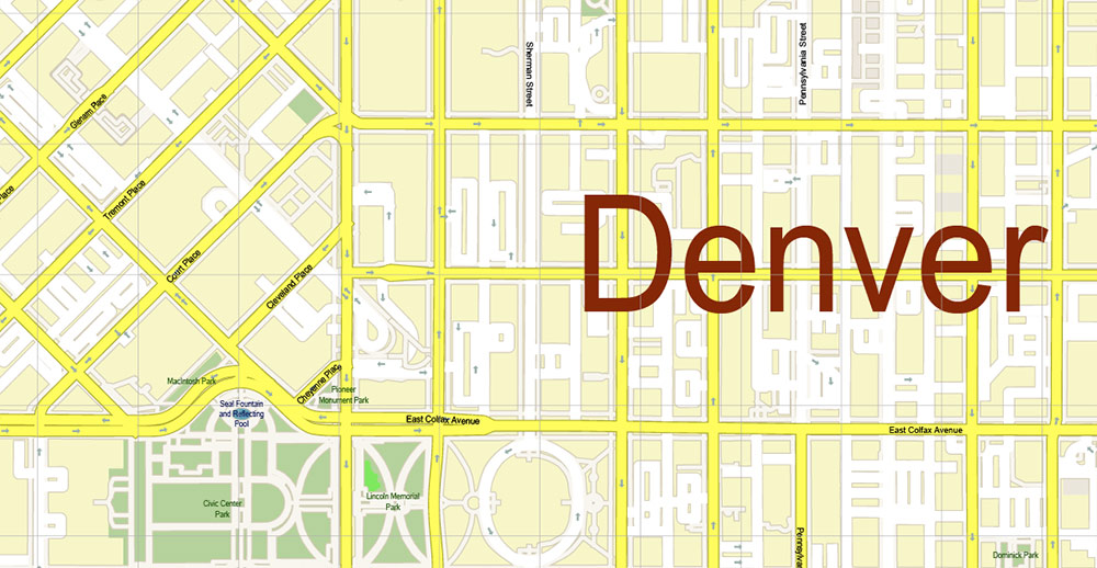
Modern Denver is not only the economic but also the cultural center of the region. The Denver Art Museum, the largest art museum between Kansas City and San Francisco, is known primarily for its collection of American Indian art. In the Museum of Nature and Science, one of the largest natural science museums in the USA, you can see (and even touch something) rich expositions devoted to paleontology, anthropology, geology, zoology, medicine, space exploration, and other topics. The theater Arts Complex in Denver is the second largest in the United States after Lincoln Center in New York. Here you can see performances of dramatic theater groups, classical ballet, and modern dance; listen to opera singing and symphony orchestras. The complex also includes an opera house, known as the "Ellie Caulkins Opera". Nature lovers can visit the Botanical Garden, zoo, and aquarium in Denver.
Gallery of Images "Urban plan Denver Colorado 3 10 PDF":
Denver Colorado fully editable layered vector City Maps
Denver metropolitan area: Vector Maps for Printing, Business, Education

Denver Colorado Digital Cartography for City Research, Transportation and Logistics

- Urban plan Memphis Tennessee PDF
- Urban plan Annapolis Maryland
- Urban plan Samara
- Urban plan Washington Baltimore PDF
- Urban plan New Orleans
- Urban plan Novgorod Russia
- Urban plan Acre Israel
- Urban plan Cartagena Spain
- Urban plan admin Indonesia
- Urban plan Dortmund Germany ai
- Urban plan Topeka Kansas PDF
- Urban plan Leeds UK
- Urban plan Austria relief road CDR
- Urban plan Sioux Falls South Dakota PDF
- Urban plan Allentown Easton Pennsylvania PDF
- Urban plan Austin Texas PDF
- Urban plan Greater Miami Florida 4 PDF
- Urban plan Shanghai China PDF ENG
- Urban plan Miami Florida 4
- Urban plan Milwaukee Wisconsin low
- Urban plan Kyoto Japan 16 ai
- Urban plan UK Great Britain Admin PDF
- Urban plan Calgary Canada
- Urban plan Gothenburg Sweden Goteborg Sverige PDF
- Urban plan Kuala Lumpur PDF
- Urban plan Tver pdf
- Urban plan Landau Germany ai
- Urban plan Boston Massachusetts low PDF
- Urban plan Eugene Oregon 3 10 PDF
- Urban plan Denver Metro PDF
- Urban plan Europe Full Extra Detailed AI
- Urban plan Mexico Country Roads Relief
- Urban plan Jakarta Indonesia autocad dwg
- Urban plan Cincinnati Ohio ai
- Urban plan Prague Praha Czech Republic ai
- Urban plan Ottawa Canada
- Urban plan Harlingen Texas 3 10 PDF
- Urban plan Nashville Tennessee PDF
- Urban plan Birmingham UK
- Urban plan Alameda Oakland California
- Urban plan Glasgow Scotland pdf
- Urban plan World Gall Peters PDF
- Urban plan Oakland Berkeley California
- Urban plan Bologna Italy pdf
- Urban plan Bratislava Slovakia PDF
- Urban plan Utrecht Netherlands 25
- Urban plan Brighton UK PDF
- Urban plan Genova Genoa Italy
- Urban plan Lille France pdf
- Urban plan Wollongong Australia
- Urban plan Evansville Indiana CDR
- Urban plan Israel Hebrew 17 AI
- Urban plan Santo Domingo
- Urban plan Christchurch New Zealand 17
- Urban plan Charleston South Carolina
- Urban plan Java Indonesia autocad dwg
- Urban plan Graz Austria PDF
- Urban plan Venezia Venice
- Urban plan South America Topo
- Urban plan Rotterdam Netherlands pdf
- Urban plan Dominican Republic Detailed PDF 12 5
- Urban plan UK Admin
- Urban plan Columbus Ohio pdf
- Urban plan Leipzig Germany
- Urban plan Los Angeles
- Urban plan Toowoomba Australia
- Urban plan Tallinn Estonia PDF
- Urban plan Dominican Republic Detailed a3 PDF
- Urban plan Adelaide Australia 17
- Urban plan Eugene Oregon 3 10
- Urban plan Yale University New Haven Connecticut PDF
- Urban plan Lawrence Kansas 3 10 PDF
- Urban plan London 4 parts pdf
- Urban plan New York City CDR
- Urban plan Bismarck North Dakota PDF
- Urban plan Czech Republic CDR
- Urban plan Adelaide Australia PDF 13
- Urban plan Liege Belgium PDF 13
- Urban plan Portland Maine
- Urban plan Houston Texas PDF
- Urban plan Cleveland Ohio Low
- Urban plan Vienna Wien Austria PDF
- Urban plan Havana Cuba PDF
- Urban plan Stockholm Sweden
- Urban plan Calgary Canada PDF
- Urban plan Hillsboro Oregon CDR
- Urban plan Houston Texas
- Urban plan Manila Grande Philippines 13 ai
- Urban plan Wisconsin State
- Urban plan Bryansk pdf
- Urban plan Hampton Roads Virginia
- Urban plan San Francisco Oakland California
- Urban plan UK Ireland PDF
- Urban plan Belgium Administrative PDF
- Urban plan Spain Admin
- Urban plan Charleroi Belgium ai
- Urban plan Paris Center France
- Urban plan Salt Lake City Utah ai
- Urban plan Athens Greece ai
- Urban plan Washington DC ai
- Urban plan Amsterdam Netherlands 13 PDF
- Urban plan Tucson Arizona ai
- Urban plan Amsterdam Netherlands 17 AI
- Urban plan US Canada all roads pdf
- Urban plan Liege Grande Belgium PDF
- Urban plan Eindhoven Netherlands PDF
- Urban plan Orel PDF Russia
- Urban plan Amsterdam Netherlands 49
- Urban plan New Orleans Louisiana pdf
- Urban plan Santo Domingo 2 PDF