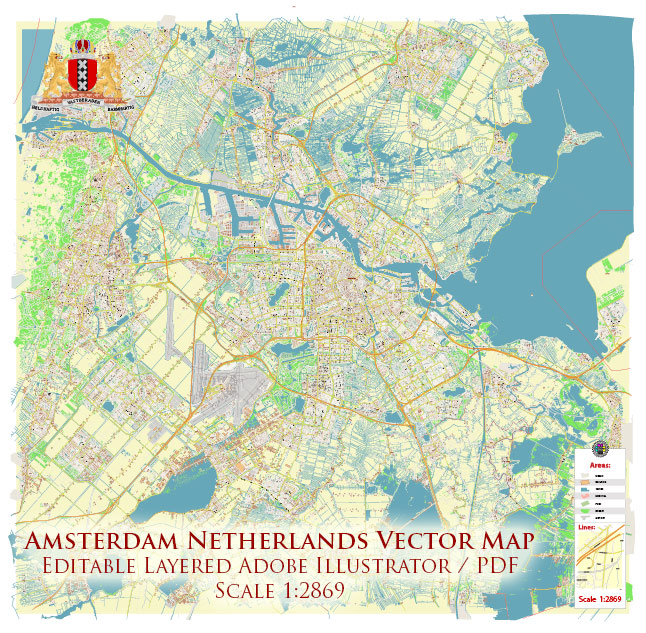
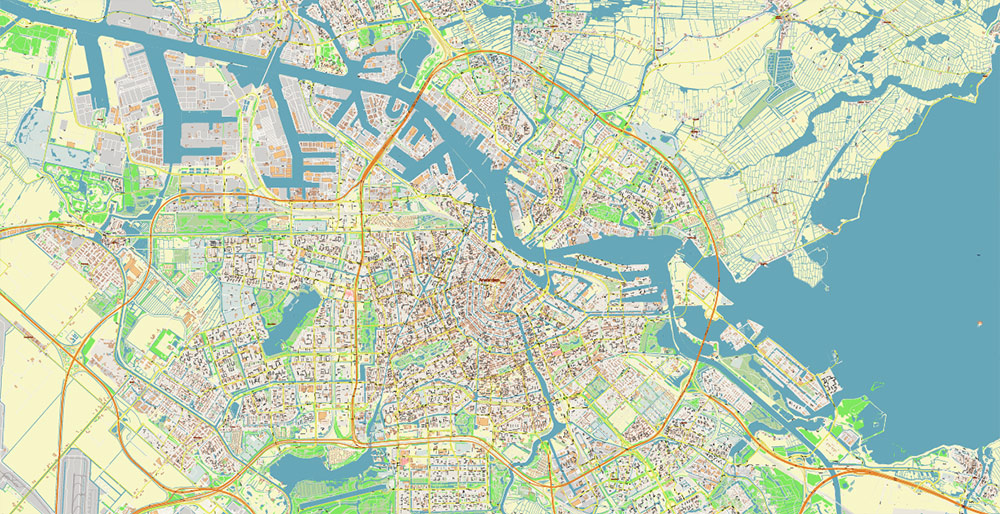
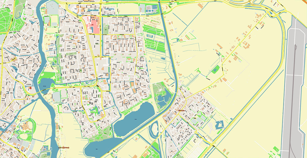
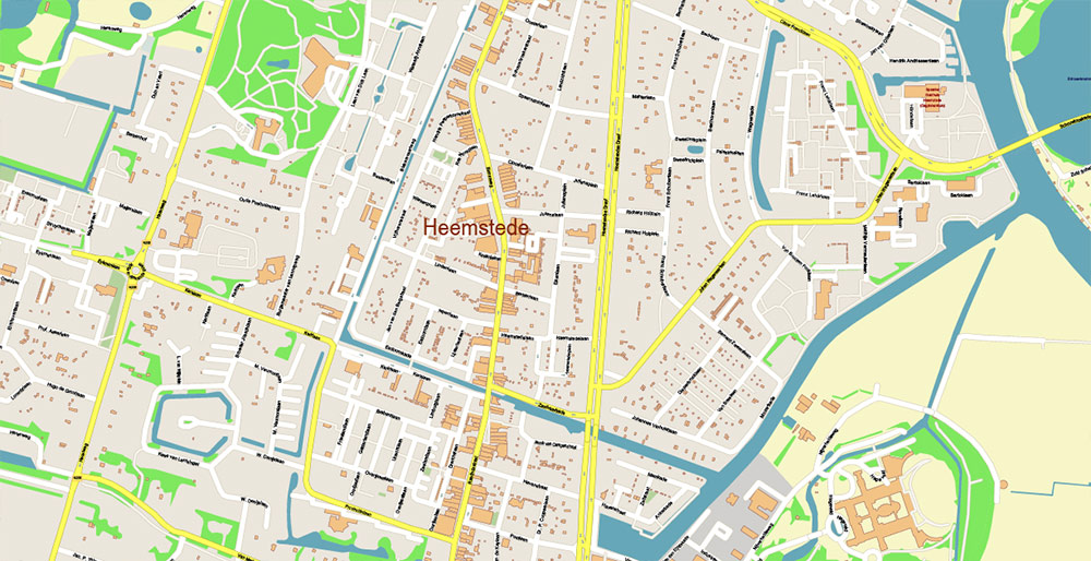
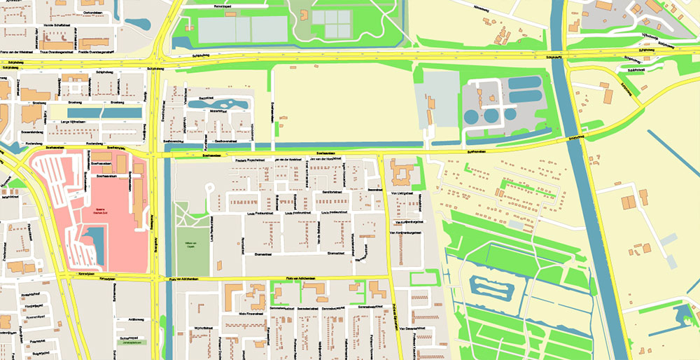
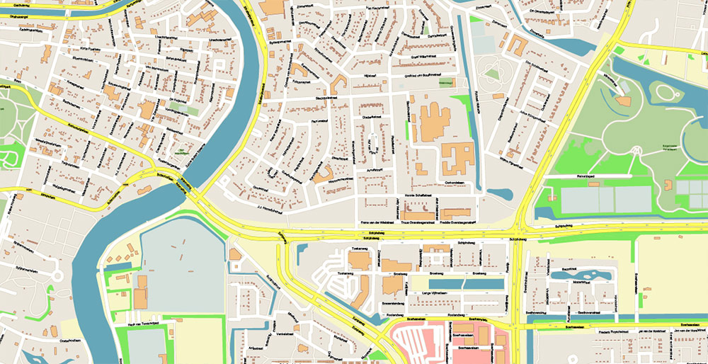
Urban plan Amsterdam Netherlands Vector Maps
Gallery of Images "Urban plan Amsterdam Netherlands 49":
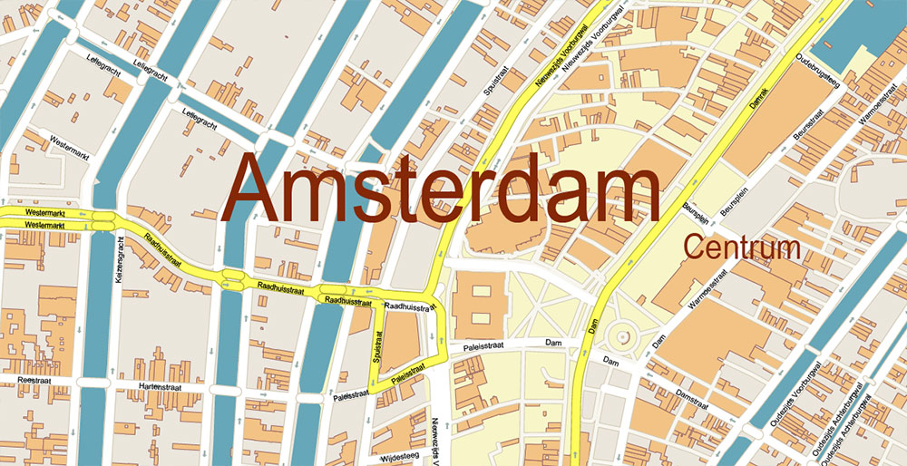
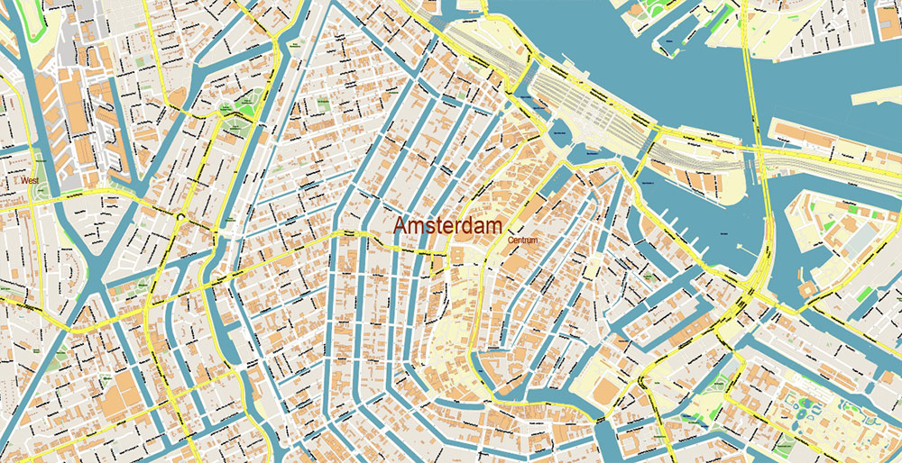
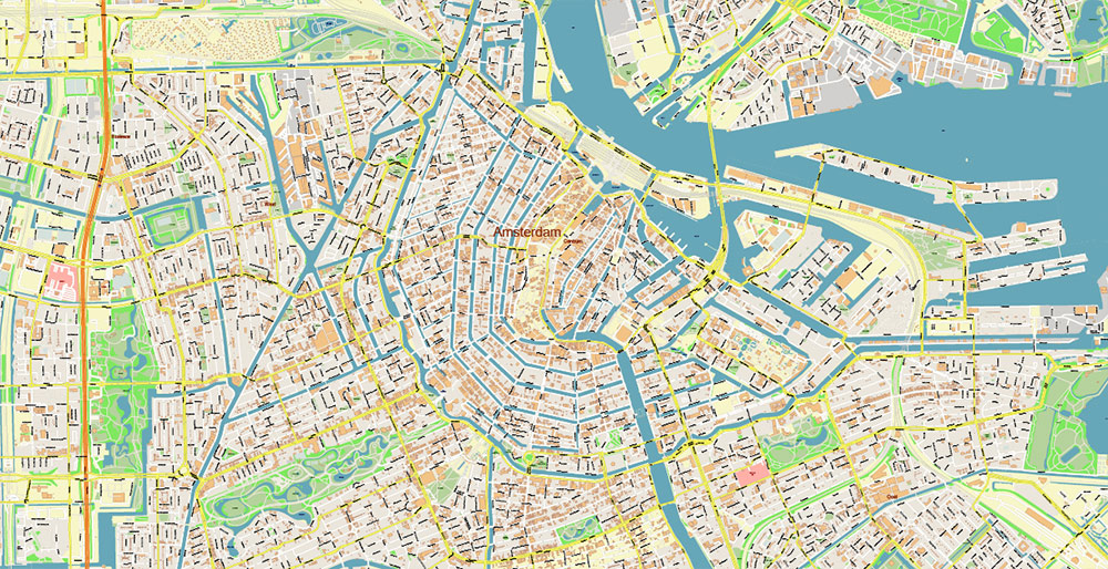
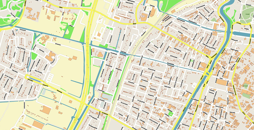
Urban plan Amsterdam Netherlands: Digital Cartography
City of Amsterdam (Netherlands)
Amsterdam is the capital and largest city of the Netherlands, located in the north of the country at the confluence of the Amstel and Hey rivers into the North Sea. The name of the city can be literally translated as "dam, the dam on the Amstel River". Amsterdam is the pearl of Northern Europe, the "Venice of the North", a city of amazing architecture, hundreds of canals, and thousands of bridges. It fascinates and falls in love with itself, at first sight, it is a place of truly free morals with a cozy atmosphere of an old European city. In Amsterdam, everyone will find something different: from going to museums and sightseeing to the delicious cuisine of local restaurants and noisy parties.
Amsterdam is located in the northwestern part of Holland, almost on the shore of the North Sea. The city is riddled with hundreds of canals that divide the center into 90 islands that connect more than 1,500 bridges and viaducts. Amsterdam lies in the lowlands. The average altitude above sea level is 1 m. The climate is temperate marine. The weather is largely determined by the proximity of the North Sea. Often in autumn and winter, piercing north-westerly winds can blow. Winter is generally quite mild with slight frosts. Although sometimes with the invasion of cold north-eastern masses, frosts can be quite severe, and the famous canals freeze to such a state that you can walk and skate on them. But due to climate change, this is happening less and less. Summer in Amsterdam is warm, but not hot. More than 800 mm of precipitation falls per year.
Amsterdam Districts
Amsterdam is divided into the following districts:
The old Center is a medieval city and the most visited area of Amsterdam. It is known for its traditional Dutch-style architecture, numerous canals, bridges, shops, and restaurants. The old center also includes the famous "Red Light District".
The Ring Canal is an area that originated in the 17th century with many chic mansions and nightclubs. It is included in the list of UNESCO World Heritage Sites.
Yordan was once a working-class district, where the intelligentsia has now found shelter, there are all sorts of art workshops and galleries, shops, and restaurants.
Plantage is a quiet and pleasant area with many museums and 19th-century architecture.
The South is one of the best areas for accommodation, as well as shopping and going to restaurants.
The North is a traditional Dutch countryside, actually a residential suburb.
The West is a huge area that can be conditionally divided into Old and New. The old district originated at the end of the 19th century. The new one was built after the Second World War and often appears in newspapers as a place of not the most positive news.
The East is a large and diverse residential area with predominantly modern architecture.
Behlmer is a residential area where more than 150 nationalities live. Notorious for robberies and theft.
Amstelveen is a green suburb, where there is a large shopping center, sports club bases.
The population is 853.3 thousand people.
Area - 219.4 sq. km
The language is Dutch. Although more than 50% of the population speak English well.
The currency is the euro.
Time - Central European UTC+1, summer +2.
Visa - Schengen.
Do not take pictures of girls in the "Red Light District". They can not only yell at you but also break your phone.
Amsterdam is one of the safest cities in the world. But you still need to follow basic safety rules, do not leave things unattended, control valuables in crowded places.
The main shopping streets go from the central station towards Leidseplein: Nieuwendijk, Kalverstraat, Heiligeweg, Leidsestraat. Many shops are concentrated in the area of Haarlemmerstraat / Haarlemmerdijk, Utrechtsestraat, Spiegelstraat (art/antiques). You can buy Chinese goods in Nieuwmarkt.
The largest street market Albert Cuyp is open from Monday to Saturday from 9.00 to 17.00
There are many restaurants and cafes in Amsterdam. Budget establishments are located in the Yordan district. There are many cheap Asian restaurants in the Nieuwmarkt area. A large number of cheap establishments of Asian and Oriental cuisine can be found in the Damstraat area.
Amsterdam is famous for its traditional local dishes. First of all, these are cheese, raw meat sausage, beer, traditional herring, fried meatballs with potatoes.
Most bars and nightclubs are concentrated in Leidseplein and Rembrandtplein.
Major cultural events and festivals
January - Amsterdam Fashion Week and Art Fair.
April (27th) is the national holiday of King's Day when Amsterdam turns orange.
May is a culinary festival and the famous tulip festival.
June - Dutch festival.
July and August - International Contemporary Dance Festival, music festivals, Martin Luther King Parade, and Gay Pride Parade.
September - Jordan Street Festival and Contemporary Art Festival.
October - Electronic Music Festival.
December is the Amsterdam Light Festival when the streets and canals are decorated with lights.
History
Amsterdam originated in the 13th century as a small fishing village by the dam on the Amstel River. In 1342, the settlement received city rights. By the 15th century, Amsterdam had become one of the most important and largest trading cities in Holland and joined the Hanseatic League.
In the 15th century, the city began to expand, ring canals were dug for defense and water management. The houses were built on a foundation of long wooden pillars. The use of wood has made the city vulnerable to urban fires, even despite the many canals. In the middle of the 15th century, a fire destroyed more than half of Amsterdam.
At the end of the 16th century, due to the capture of the main Dutch port of Antwerp by the Spaniards, the city's population increased significantly. By the 17th century, Amsterdam had become one of the largest cities in Europe along with London, Paris, and Naples. After that, the growth of the city almost stopped, and in the 18th century, the population generally decreased.
With the onset of the Industrial Revolution, a new stage of the city's growth began. By 1900, the population of Amsterdam had reached half a million. During the Second World War, Amsterdam did not suffer very much. Basically, the bombing damaged its northern areas.
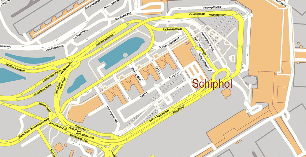
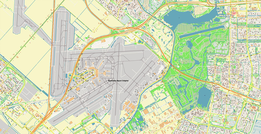
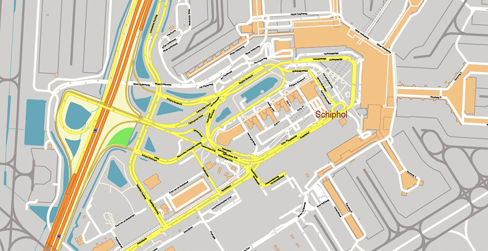
How to get
Amsterdam Airport has located 15 km to the southwest. It is one of the largest airports in the world, serving about 60 million passengers. Trains run from the airport to the city from 5.00 to 1.00 every 10 minutes. The trip takes 20 minutes and costs 4.2 euros. Some budget companies fly to the airports of Rotterdam and Eindhoven. From there, you can get to Amsterdam by bus.
It is convenient to get to the capital of the Netherlands by train. Most trains go to the central station, which is located near the historical center. High-speed lines connect Amsterdam with Antwerp, Paris, Brussels, Dusseldorf, Cologne, Frankfurt, and Berlin.
Economical FlixBus buses connect Amsterdam with cities in Belgium, France, Germany, and Luxembourg.
Amsterdam has excellent accessibility for cars. The A1 motorway leads directly from Germany, A2 - from Belgium, and Utrecht, A4 - from The Hague.
Getting around the city
The center of Amsterdam is quite compact. Getting to the main attractions on foot is not difficult. The city's public transport is represented by 16 tram lines and four metro lines. To travel by public transport, a special card is used - OV-chipkaart. These cards can be personal (personal), anonymous and disposable. For tourists, the most profitable one-time card for 1/24/48/72/96/120/144/168 hours. It allows the owner to make an unlimited number of trips and transfers by tram, metro and bus throughout its validity period. You can also buy tickets for 1 and 24 hours by tram.
Attractions
Amsterdam is a city with 800 years of history, rich in interesting sights and monuments of history and culture: from ancient churches to magnificent museums, from narrow cobbled streets and famous canals to cozy old courtyards.
De Grote Kerk or St. Bavokerk is the largest church in Haarlem (actually a suburb of Amsterdam). This Gothic structure was founded in the early 15th century and is the architectural dominant of the Grote Markt square.
The Basilica of St. Nicholas is a Roman Catholic church, one of the largest and most beautiful religious buildings in the capital of the Netherlands. The church was built at the end of the 19th century.
The Grote Kerk or Big Church is the largest religious building in the suburban town of Adama. The exact date of construction of this brick building is not exactly known. But probably the church was founded in the early 15th century.
Buiksloterkerk is a charming brick church of the early 17th century, located among the picturesque houses of Buiksloterdijk.
The North Church (Noorderkerk) is a beautiful 16th-century church located in the central part of Amsterdam in the charming location of the Jordan district. It is Protestant.
Obrechtkerk - located in the heart of South Amsterdam and has unusual architecture. Interestingly, the full name of the church is Onze Lieve Vrouw van de Allerheiligste Rozenkrans.
Posthoornkerk is a brick basilica in the shape of a cross, built-in 1863 by the famous Amsterdam architect Kuipers. Located in the center of Amsterdam near the Anne Frank House and the North Church. Currently, it is not a religious institution.
The Western Church (Westerkerk) is one of the largest Protestant churches in the Netherlands, located in the historic center of the city a few steps from the Anne Frank House. This is one of the most beautiful religious buildings in Amsterdam, built in the 17th century. Rembrandt and other famous Dutch artists are buried here.
The Southern Church (Zuiderkerk) is the first Protestant church in Amsterdam, built in the first half of the 17th century. It has not been used for religious purposes since 1929.
The Oude Kerk or Old Church is the oldest religious building in the capital of the Netherlands, built in the 14th century in the Gothic style. Although after numerous reconstructions, traces of the Renaissance and early Baroque can be found.
The Eastern Church (Oosterkerk) is a Protestant church of the 17th century. Currently, it is not a religious institution.
Amstelkerk is a 17th-century wooden church located on one of Amsterdam's most charming squares.
Windmills
One of the symbols of Holland is windmills, which can be found in the suburbs of Amsterdam. There are a huge number of them in the district, so only the most interesting and authentic ones are marked here.
Molen de Adriaan or Adrian's Mill is located in the suburban town of Haarlem, not far from its historical center. This picturesque windmill tower is located on the banks of the River Spaarn and has been decorating the city landscape for several centuries. Her address: Papentorenvest 1A, 2011 AV HAARLEM.
Molen Het Jonge Schaap means "young sheep" in Dutch. This is a copy of a windmill of the late 17th century. Address: Schaap, Kalverringdijk 31a, 1509 BT ZAANDAM.
Molen de Zoeker is a unique, still operating industrial mill for grinding oily seeds. It was built in 1676. Address: Kalverringdijk 31, 1509 BT ZAANDAM.
Windmills in Zaanse Schans is an open-air museum with a collection of historical windmills. Open from April to October. There is also a souvenir shop and a cheese farm. Address: Schansend 7, 1509 AW ZAANDAM.
The Anne Frank House is a house on the Prinsengracht embankment, where the Jewish girl Anne Frank, the author of the famous diary and one of the most famous victims of fascism, hid from the Nazis. In 1944, as a result of a denunciation, Anna and her family were discovered and sent to a concentration camp, in which she died.
The Coin Tower was built in the 14th and 15th centuries and was once part of the city gates and medieval fortifications. In the 17th century, it was used for the mint. Now there is a carillon of 38 bells installed on the tower, which sounds every hour.
Trompettersteeg is the narrowest street in Amsterdam, located in the center of the red light district. Its width is only 100 cm.
Scheepvaarthuis or shipping house is a masterpiece of the "Amsterdam School" style. Built-in the 20s of the 20th century by architect Van der Mey. Now an expensive hotel is located here.
The Weighing Chamber or De Waag is a wonderful architectural monument located in the Lower Market. The original 15th-century city gate was converted into a weighing house in 1600.
The Central Station is one of the most impressive buildings in Amsterdam. It was built according to the project of Kuipers.
Spiegelkwartier - the world of art and antiques. It is here that you can buy works of art and all sorts of rarities.
The Red Light District is one of the most famous places in Amsterdam. The largest and most famous is the De Wallen quarter. This is a network of alleys that contain many rooms and storefronts, usually illuminated with red light and providing sex services. These places are among the most visited in the Dutch capital. Attention: it is better not to photograph girls. De Wallen is one of the oldest neighborhoods in Amsterdam. It appeared in the 14th-15th century.
Probably, many people are fascinated by the old Amsterdam houses with a narrow facades, which are crowded by the canals. It turns out that earlier taxes in the city were taken for the width of the facade. That's why the people of Amsterdam built such funny buildings. The narrowest house is located at Singel, 7. Its width is only 1 meter. But, to be honest, it looks more like an extension between two buildings.
Amsterdam is not only a city of canals but also a city of bridges. And no wonder, because this maze of waterways must be somehow connected. It is estimated that there are more than 1,000 bridges in the capital of the Netherlands.
Related Images "Urban plan Amsterdam Netherlands":
Amsterdam Netherlands Editable Vector Maps
Amsterdam - Netherlands Map for Tourism, Business, Education
Amsterdam Netherlands Editable Printable Maps in Vector Formats: AutoCAD DWG DXF, Adobe Illustrator, Adobe PDF
- Urban plan Sacramento California 17
- Urban plan Charleston South Carolina 5 CDR
- Urban plan Mykonos Island PDF
- Urban plan Charleston West Virginia
- Urban plan Derry Ireland
- Urban plan Lahore Pakistan PDF
- Urban plan Seoul South Korea
- Urban plan Liege Belgium PDF 13
- Urban plan Harlingen Texas 3 10
- Urban plan Canada Admin Districts
- Urban plan Atlanta Georgia pdf
- Urban plan Massachusetts State CDR
- Urban plan Lawrence Kansas 3 10 PDF
- Urban plan Lawrence Kansas
- Urban plan Saratov pdf
- Urban plan Auckland New Zealand
- Urban plan Lancaster County Nebraska PDF
- Urban plan Adelaide Australia 13
- Urban plan Denver Colorado PDF
- Urban plan Flags Countries PDF
- Urban plan San Juan Puerto Rico
- Urban plan Princeton University Princeton New Jersey
- Urban plan Reykjavik Iceland PDF
- Urban plan Switzerland Admin
- Urban plan Columbus Ohio pdf
- Urban plan Wind Point Wisconsin
- Urban plan La Porte Baytown Texas ai
- Urban plan Rybinsk pdf
- Urban plan Columbus Ohio
- Urban plan Kansas City Missouri PDF
- Urban plan Ryazan Russia PDF
- Urban plan Pittsburgh Pennsylvania ai
- Urban plan San Antonio Texas
- Urban plan Santo Domingo 2
- Urban plan Cleveland Chio
- Urban plan Wellington New Zealand 3 11 Ai
- Urban plan Kingston Jamaica
- Urban plan Dominican Republic Detailed a3 blanco PDF
- Urban plan Cape Canaveral Florida
- Urban plan Norilsk PDF Russia
- Urban plan Tel Aviv Yafo Israel 12 PDF
- Urban plan Czech Republic Roads Relief
- Urban plan Nizhny Novgorod
- Urban plan Karlsruhe Germany PDF
- Urban plan Cincinnati Ohio
- Urban plan Jefferson City Missouri
- Urban plan Jerusalem Israel 17 english AI
- Urban plan Izhevsk PDF Russia
- Urban plan full Poland 2
- Urban plan Belfast
- Urban plan Budapest Hungary
- Urban plan Williamson Travis Hays Austin Texas
- Urban plan Copenhagen Kobenhavn Denmark
- Urban plan Sioux Falls South Dakota PDF
- Urban plan South Carolina State PDF
- Urban plan Izhevsk Russia
- Urban plan Madrid Spain
- Urban plan Evansville Indiana 3 10 PDF
- Urban plan Albany New York PDF
- Urban plan Delray
- Urban plan Cork Ireland
- Urban plan Volgograd PDF
- Urban plan Memphis Tennessee PDF
- Urban plan Portland Oregon Vancouver Washington pdf
- Urban plan Istanbul Turkey ai
- Urban plan Frankfurt am Main metro PDF
- Urban plan Sydney Australia PDF
- Urban plan Kemerovo Russia
- Urban plan Tbilisi Georgia PDF
- Urban plan New Haven Connecticut PDF
- Urban plan Ostrava Czech Republic pdf
- Urban plan Durban South Africa PDF
- Urban plan Astrakhan
- Urban plan Charleroi Belgium pdf
- Urban plan Espoo Finland pdf
- Urban plan Darwin Australia
- Urban plan Sevastopol Ukraine
- Urban plan Austin Texas pdf
- Urban plan Baltimore Maryland PDF
- Urban plan Topeka Kansas PDF
- Urban plan Istanbul Turkey
- Urban plan Camden New Jersey PDF
- Urban plan UK Admin
- Urban plan Dallas Texas pdf
- Urban plan Buffalo Niagara Falls StCatharines
- Urban plan UK Admin
- Urban plan Amiens France
- Urban plan Adelaide Australia pdf
- Urban plan Santa Clara California
- Urban plan Wind Point Wisconsin AI
- Urban plan New York City 15 PDF
- Urban plan Madison Wisconsin 3 10
- Urban plan San Juan Puerto Rico PDF
- Urban plan New Orleans
- Urban plan Finland