Extended Description of the Vector Map
Winterthur is a treasure trove of culture, history, nature, and art. The sixth most populous city in Switzerland boasts world-class art collections. Museums and monuments, a pretty old town, lively music life, spacious parks, and gardens give the small Winterthur the energy and atmosphere of a large city.
The collection of Oskar Reinhart “Am Römerholz” has become the basis of one of the most impressive museums in Winterthur. This is one of the most important private collections of the XX century, with about 200 objects of European art dating from the XIV to the XX century. The main focus is on French painting, especially the work of the Impressionists and their followers.
The Oskar Reinhart Museum exhibits more than 500 paintings, mostly by German, Swiss, and Austrian masters from the XVIII to the XX centuries. It is also worth paying attention to the villa “Flora”, which presents a rich collection of modern French paintings, and the Brynner and Kern Museum, dedicated mainly to the Dutch masters of the XVII century.
Winterthur owes its cultural wealth to a generation of patrons who emerged in the days when Winterthur was an important industrial center: with the beginning of the industrialization of the XIX century, Winterthur rapidly developed as a major economic center, thanks to an engine factory, locomotive construction, and a textile factory.
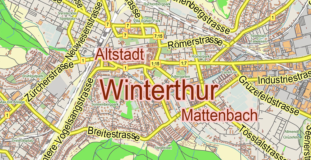
The cultural life of Winterthur is complemented by several theaters, the largest event venue in Switzerland, as well as a cabaret and comedy theater. The pretty old town of Winterthur is great for walking and shopping, as well as for spending time in the many cafes.
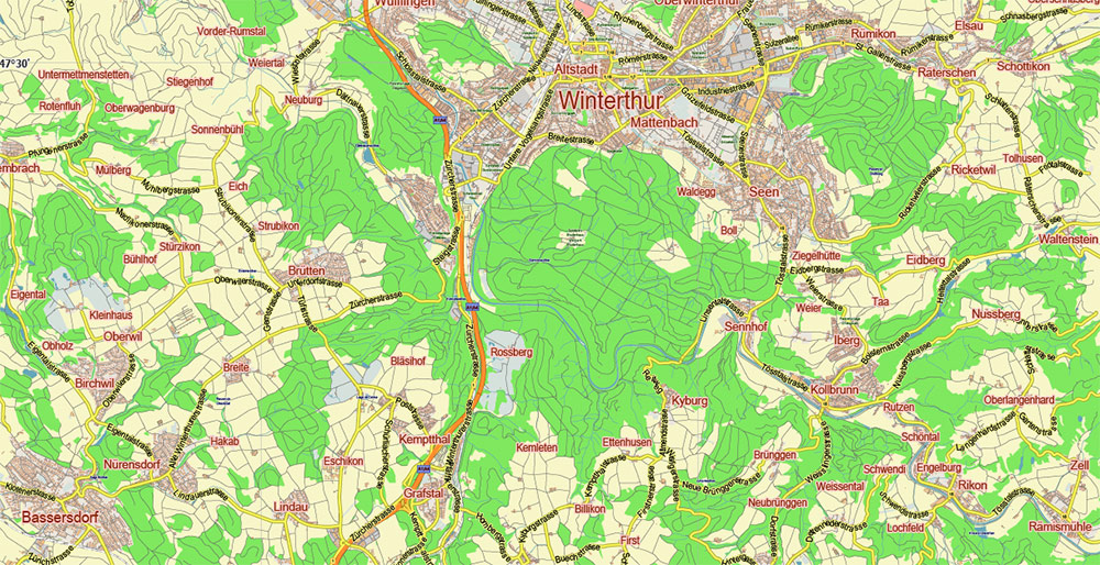
Despite its industrial traditions, Winterthur is a garden city with an impressive number of parks and squares. There is even a city tour route called “Gardens and Villas”. In the charming suburbs of Winterthur, in the forests, in the vineyards, along the banks of the Thes and the Rhine, you can find castles, to which the modern inhabitants of Winterthur in the past were directly related. Winterthur is also a great starting point for trips around Lake Constance, along the banks of the Rhine, or to the nearby metropolis of Zurich.
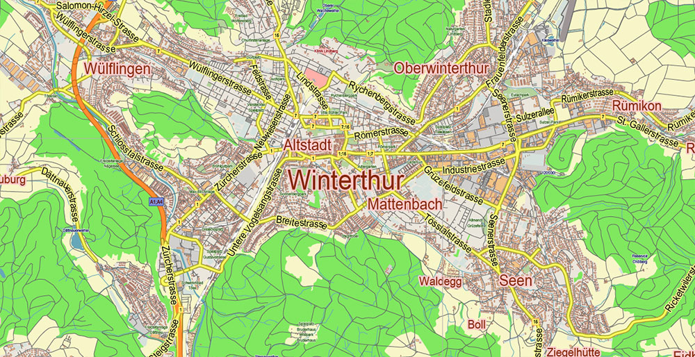
Printable Vector Map of Winterthur Switzerland Low Detailed (for small print size) City Plan scale 1:50770 full editable Adobe Illustrator Street Map in layers, scalable, text / curves format all names, 4 MB ZIP
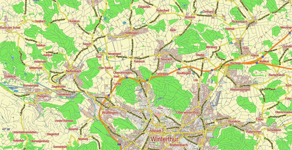
Principal street names, Main Objects, Buildings. Map for design, printing, arts, projects, presentations, for architects, designers, and builders, business, logistics.
Need AutoCAD DWG / DXF or any other format? Please, contact us!
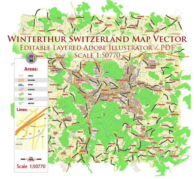
Winterthur Switzerland Map Vector City Plan Low Detailed (for small print size) Street Map editable Adobe Illustrator in layers
Layers list:
- Legend
- Grids
- Labels of roads
- Names of places (city, hamlet, etc.)
- Names of objects (hospitals, parks, water)
- Names of main streets
- Halo 1, 2, 3 names
- Main Streets, roads
- Civil streets
- Railroads
- Buildings
- Airports and heliports
- Water objects (rivers, lakes, ponds)
- Waterways
- Color fills (parks, hospital areas, land use, etc.)
- Background
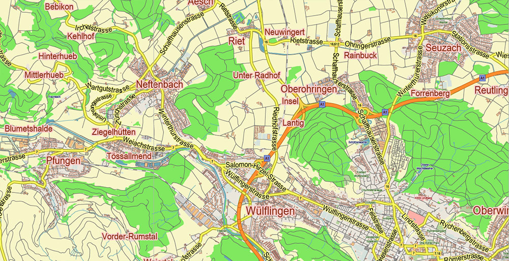
Winterthur Switzerland Map Vector City Plan Low Detailed (for small print size) Street Map editable Adobe Illustrator in layers
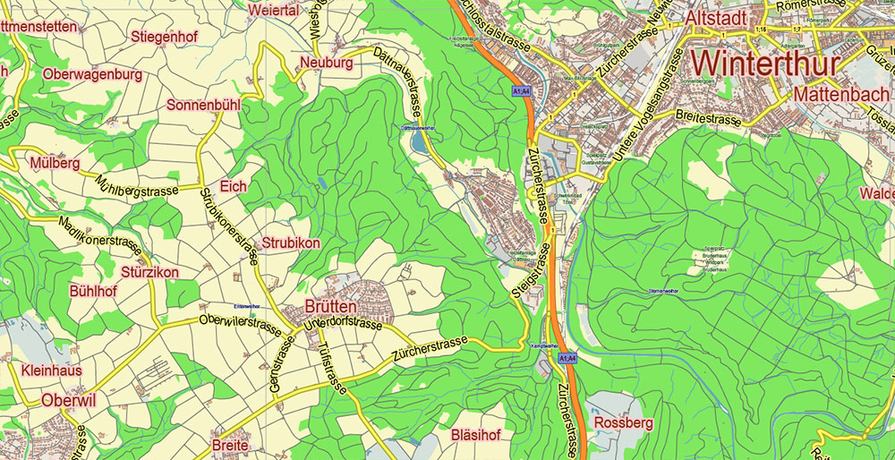
Winterthur Switzerland Map Vector City Plan Low Detailed (for small print size) Street Map editable Adobe Illustrator in layers
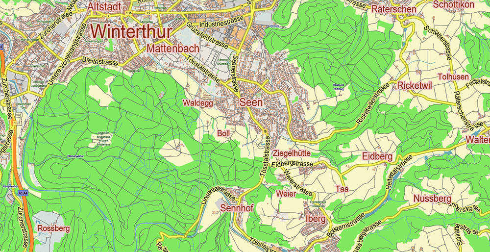
Winterthur Switzerland Map Vector City Plan Low Detailed (for small print size) Street Map editable Adobe Illustrator in layers
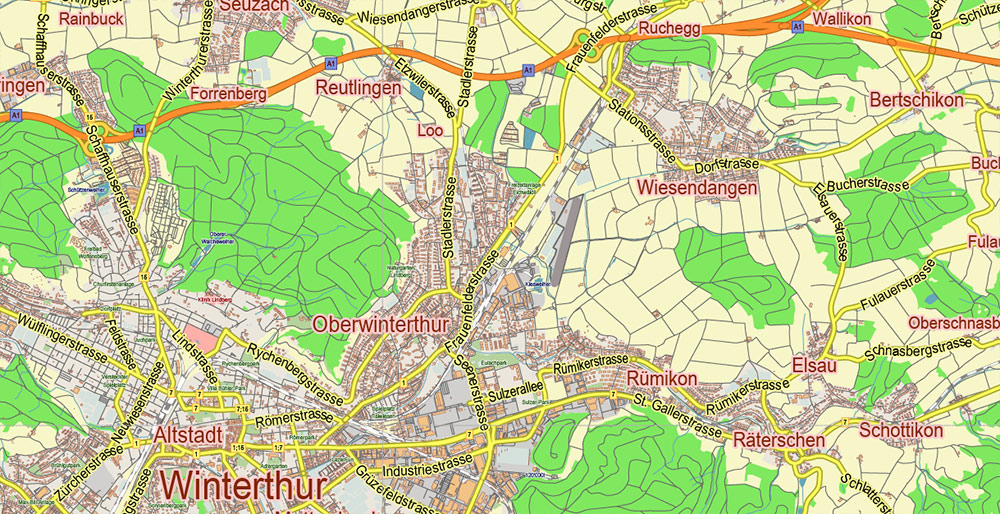
Winterthur Switzerland Map Vector City Plan Low Detailed (for small print size) Street Map editable Adobe Illustrator in layers
Winterthur Switzerland Map Vector City Plan Low Detailed (for small print size) Street Map editable Adobe Illustrator in layers
Winterthur Switzerland Map Vector City Plan Low Detailed (for small print size) Street Map editable Adobe Illustrator in layers
Winterthur Switzerland Map Vector City Plan Low Detailed (for small print size) Street Map editable Adobe Illustrator in layers
Winterthur Switzerland Map Vector City Plan Low Detailed (for small print size) Street Map editable Adobe Illustrator in layers

 Author: Kirill Shrayber, Ph.D. FRGS
 Street Map editable Adobe Illustrator in layers")