Extended Description of the Vector Map
Printable PDF Vector Map of Waipahu Hawaii USA detailed street map scale 1:4374 full editable Adobe PDF scalable, text all names, 15 MB ZIP
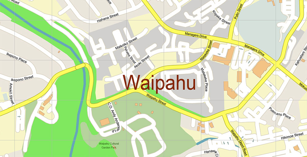
All street names, Main Objects, Buildings. Map for design, printing, arts, projects, presentations, for architects, designers, and builders, business, logistics.
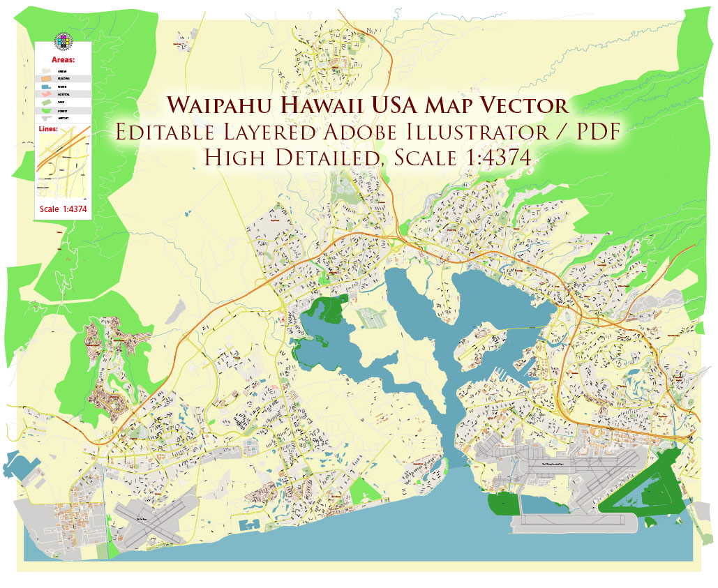
Waipahu Hawaii USA PDF Map Vector Exact City Plan High Detailed Street Map editable Adobe PDF in layers
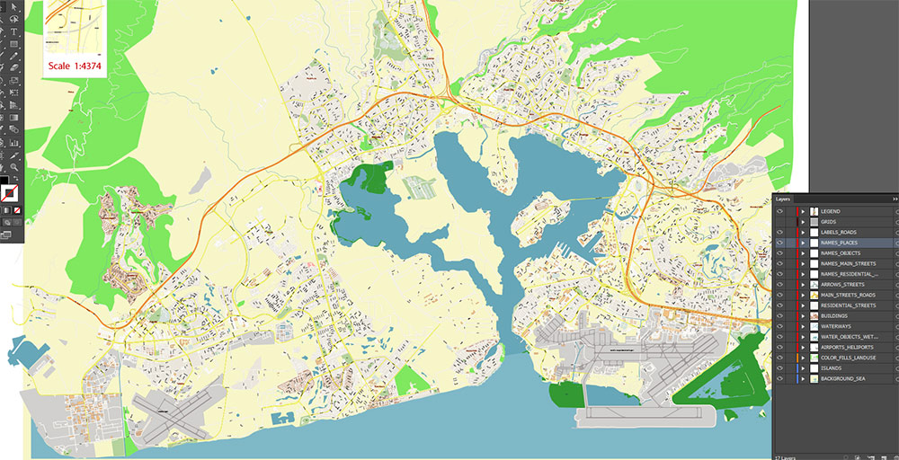
Layers list:
- Legend
- Grids
- Labels of roads
- Names of places (city, hamlet, etc.)
- Names of objects (parks, water, Hospitals)
- Names of main streets
- Names of residential streets
- Arrows of streets
- Main Streets, roads
- Residential streets
- Buildings
- Airports and Heliports
- Water objects (rivers, lakes, ponds, wetlands)
- Waterways
- Color fills (parks, hospital areas, land use, etc.)
- Islands
- Background and sea
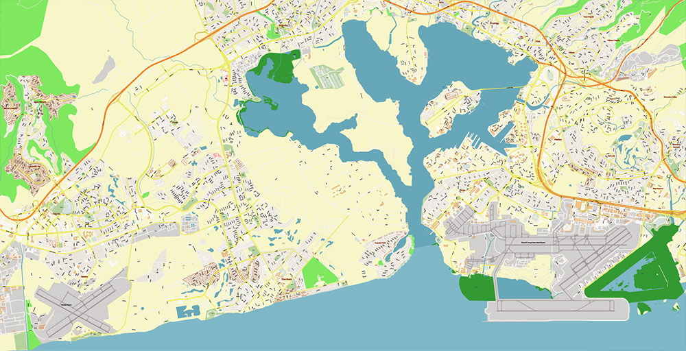
The most exact and detailed map of the city in scale.
For Editing and High-Quality Printing
Waipahu Hawaii USA PDF Map Vector Exact City Plan High Detailed Street Map editable Adobe PDF in layers
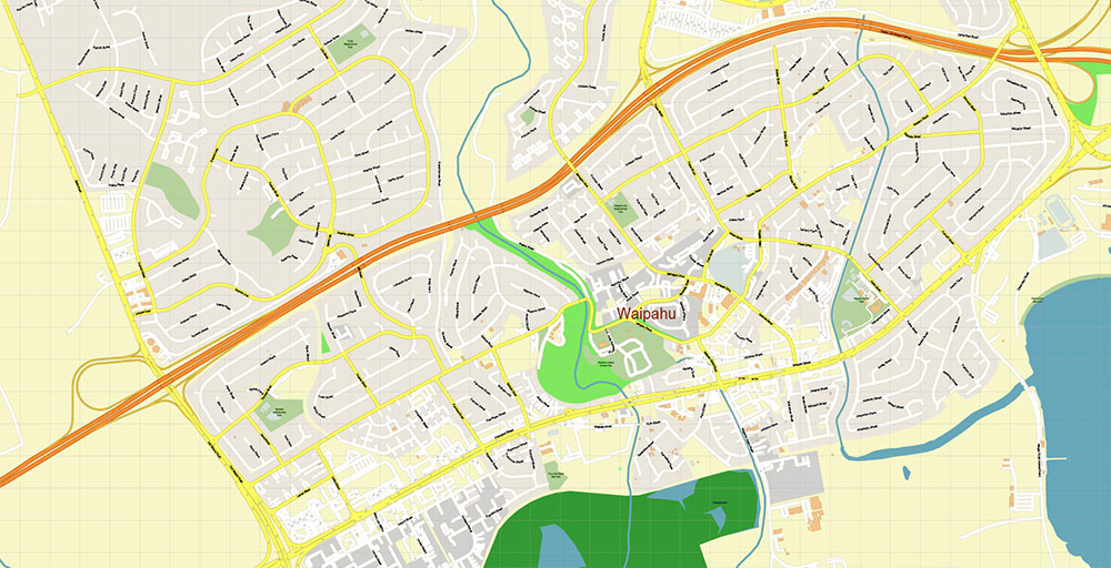
AO BRIEF — WAIPAHU, OʻAHU, HAWAIʻI, USA (CARTOGRAPHIC FOCUS)
1. Spatial Position / AO Frame
- Central-south Oʻahu, inland from Pearl Harbor shoreline
- Approx. coordinates: 21.38°N / 158.00°W
- Located within the primary Honolulu–Kapolei urban corridor
- Relief: flat coastal plain transitioning to gradual rise toward Kunia uplands
2. Terrain & Hydrography
- Terrain type: low-gradient alluvial plain, heavily urbanized
- Slope direction: north → south (drainage toward Pearl Harbor)
- Hydro lines:
- Waikele Stream — western drainage axis
- Waipahu Stream — central drainage
- Flood-prone zones along both stream corridors
- Residual plantation-era irrigation geometry still visible in urban layout
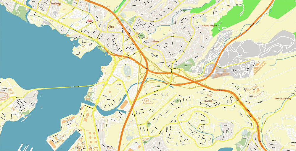
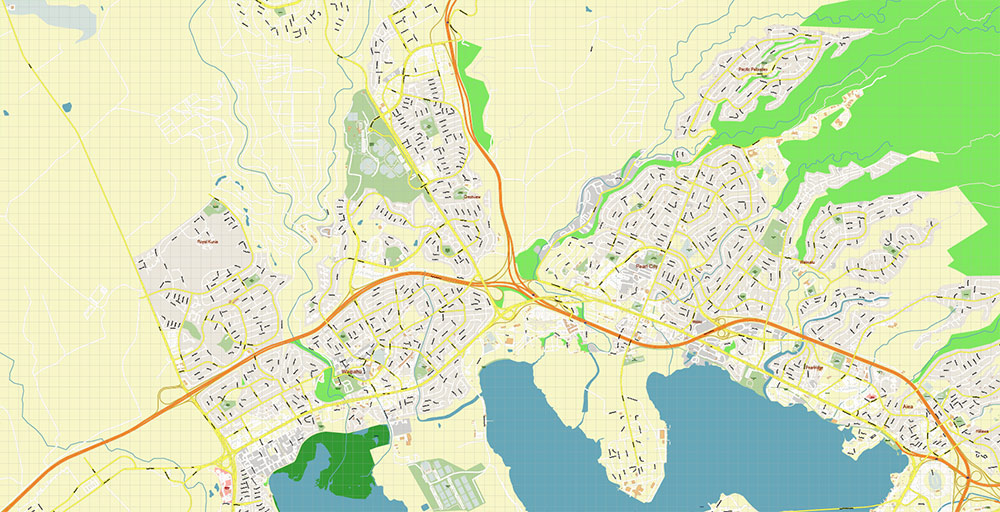
3. Road Network (Hierarchy & Geometry)
Primary Backbone (Controlled-access):
- Interstate H-1
- Orientation: E–W
- Function: island-scale მთავარი transport spine
- Geometry: multi-lane freeway, limited प्रवेश points
Secondary Arterials (Surface grid):
- Farrington Highway
- Parallel to H-1 (south side)
- მთავარი urban distributor
- Fort Weaver Road
- Axis: NE–SW
- Connects Waipahu with ʻEwa coastal zone
Vertical Connectors (Critical links):
- Kunia Road (HI-750)
- Axis: S–N
- Primary route to Central Oʻahu plateau
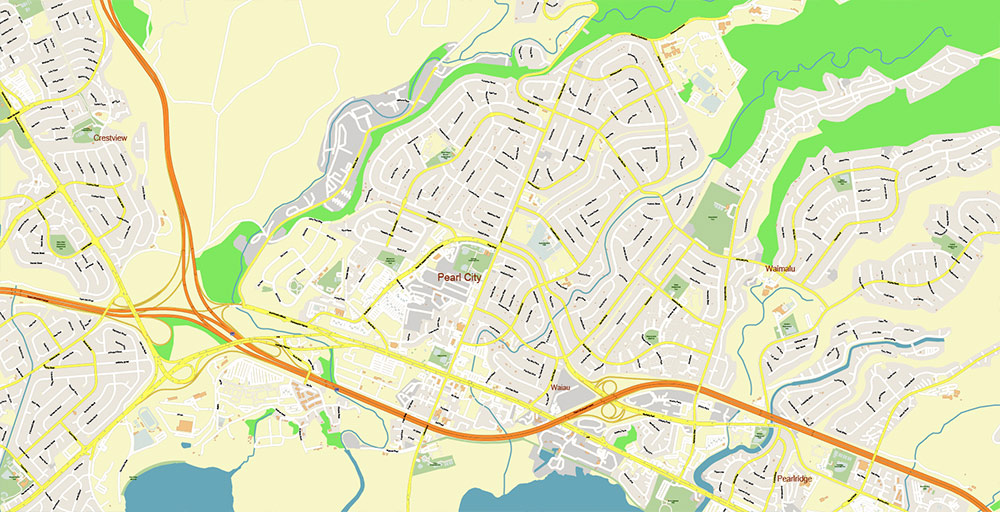
Local Network:
- Dense hybrid grid (semi-orthogonal + irregular)
- Short blocks, high intersection density
- Industrial zones with larger parcels and wider ქუჩები
4. Transport Layers (Multimodal)
- Rail axis: Honolulu Skyline (elevated, parallel to corridor)
- Stations integrated into Waipahu urban fabric
- Adds high-capacity linear layer above road network
- Bus ქსელი: dense feeder system to rail and Honolulu CBD
5. Air & Strategic Access
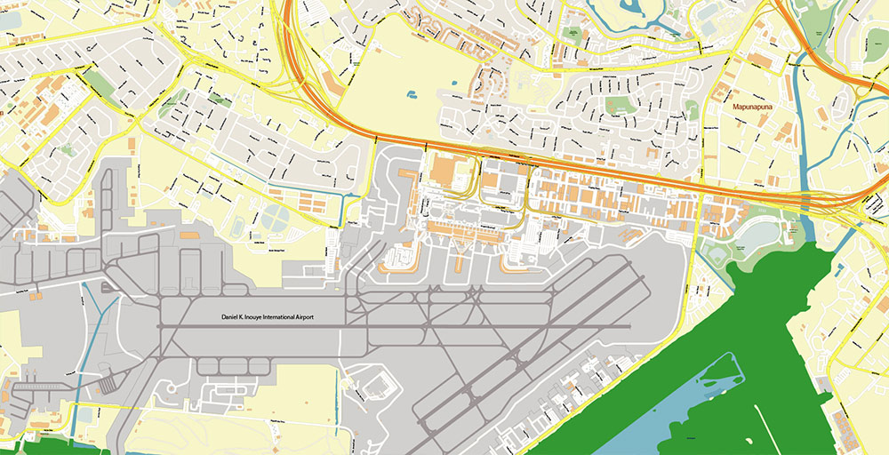
- Daniel K. Inouye International Airport
- Direction: east / ~10–15 km
- Primary civil-military air hub
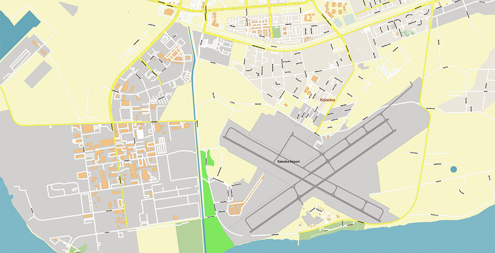
- Kalaeloa Airport
- Direction: southwest
- Secondary aviation and logistics node
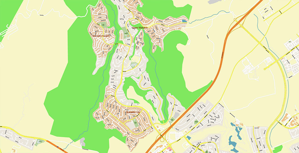
6. Urban Morphology
- Pattern: plantation-era base with later suburban infill
- Density gradient:
- Higher along Farrington Hwy and rail corridor
- Lower toward Kunia slope
- Land use structure:
- Linear commercial strips
- միջ-density residential clusters
- Industrial/logistics pockets near H-1
7. Demographic Structure (Spatial Behavior)
- Population: ~40–45K
- Highly diverse (Filipino, Pacific Islander, Asian, Native Hawaiian)
- Spatial pattern:
- পরিবার-oriented residential clusters
- Higher occupancy → increased density load
8. Constraints / Cartographic Risks
- Flood zones along stream corridors (map as hazard overlays)
- Traffic الضغط:
- H-1 (peak ساعات)
- Farrington Hwy (signalized congestion)
- Limited east–west redundancy (dependency on two მთავარი corridors)
9. Logistics Geometry
- Critical control lines:
- H-1 (regional flow)
- Farrington Hwy (urban distribution)
- Chokepoints:
- H-1 interchanges
- Stream crossings / bridges
- Redundancy: moderate (rail increases resilience)
10. Command Takeaways (Cartographic)
- AO = linear corridor settlement constrained between freeway and coastal system
- Movement defined by two parallel axes: H-1 + Farrington Hwy
- Kunia Road = critical vertical connector to upland plateau
- Hydrography creates natural segmentation + hazard zones
- Rail corridor = emerging dominant axis of density and development
Waipahu Hawaii USA PDF Map Vector Exact City Plan High Detailed Street Map editable Adobe PDF in layers
Waipahu Hawaii USA PDF Map Vector Exact City Plan High Detailed Street Map editable Adobe PDF in layers

Waipahu Hawaii USA PDF Map Vector Exact City Plan High Detailed Street Map editable Adobe PDF in layers
Waipahu Hawaii USA PDF Map Vector Exact City Plan High Detailed Street Map editable Adobe PDF in layers
Waipahu Hawaii USA PDF Map Vector Exact City Plan High Detailed Street Map editable Adobe PDF in layers
Waipahu Hawaii USA PDF Map Vector Exact City Plan High Detailed Street Map editable Adobe PDF in layers
Waipahu Hawaii USA PDF Map Vector Exact City Plan High Detailed Street Map editable Adobe PDF in layers
Waipahu Hawaii USA PDF Map Vector Exact City Plan High Detailed Street Map editable Adobe PDF in layers
Waipahu Hawaii USA PDF Map Vector Exact City Plan High Detailed Street Map editable Adobe PDF in layers
Waipahu Hawaii USA PDF Map Vector Exact City Plan High Detailed Street Map editable Adobe PDF in layers
Waipahu Hawaii USA PDF Map Vector Exact City Plan High Detailed Street Map editable Adobe PDF in layers

 Author: Kirill Shrayber, Ph.D. FRGS
 Street Map editable Adobe Illustrator in layers")
