Extended Description of the Vector Map
Printable Vector Map of Waipahu Hawaii USA detailed street map scale 1:4374 full editable Adobe Illustrator scalable, text all names, 6 MB ZIP
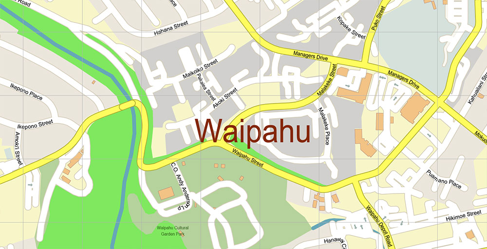
All street names, Main Objects, Buildings. Map for design, printing, arts, projects, presentations, for architects, designers, and builders, business, logistics.
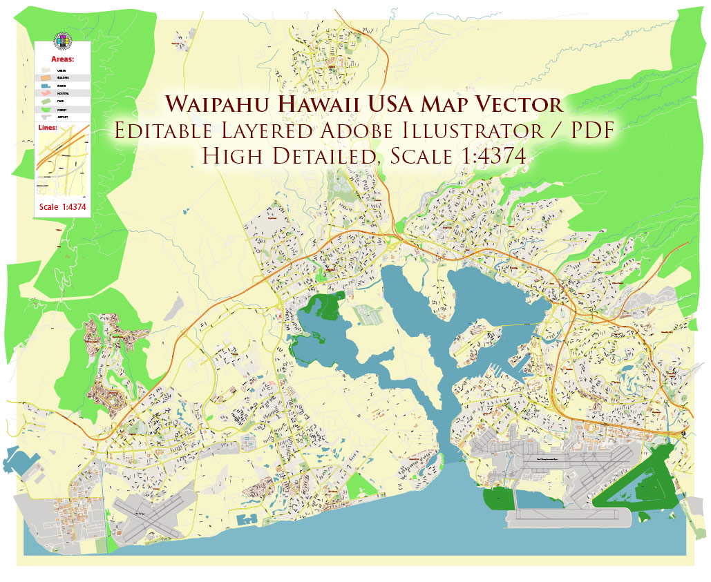
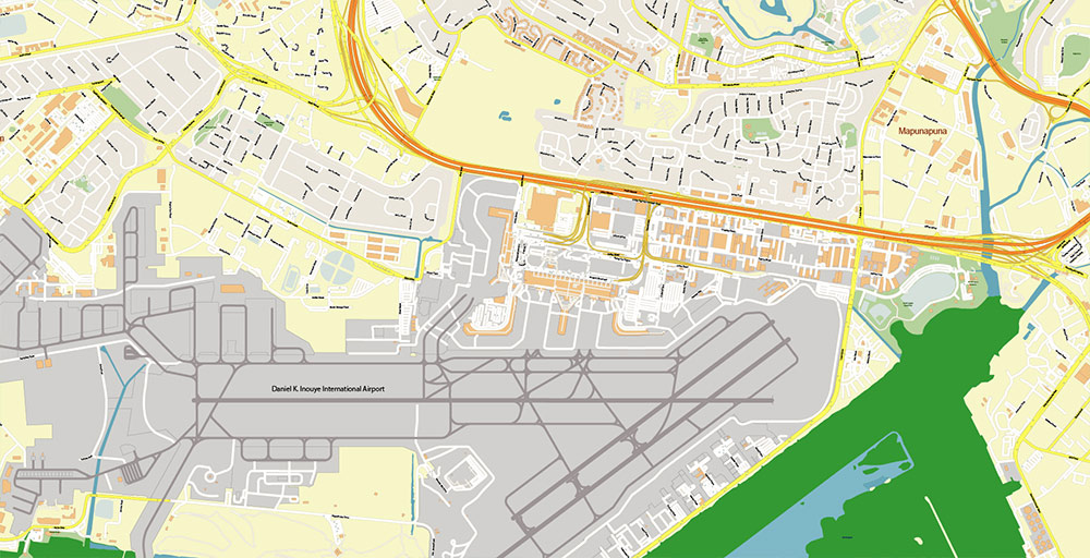
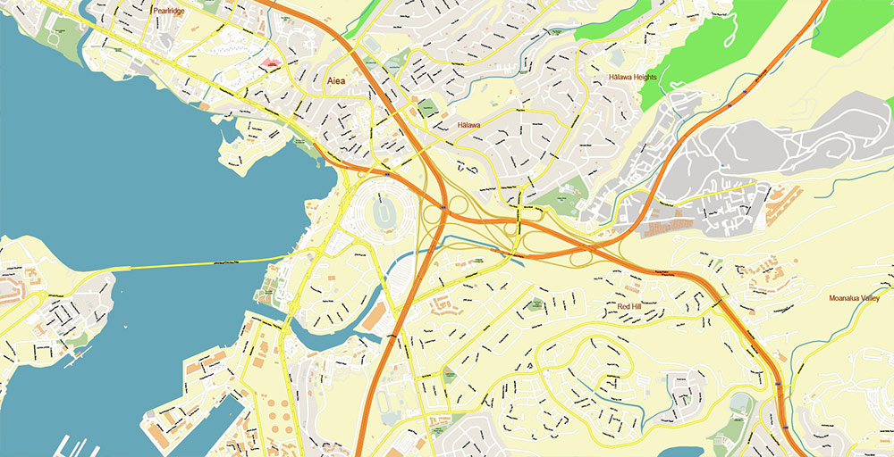
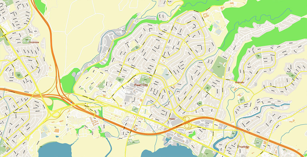
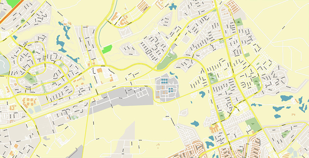
Waipahu Hawaii USA Map Vector Exact City Plan High Detailed Street Map editable Adobe Illustrator in layers
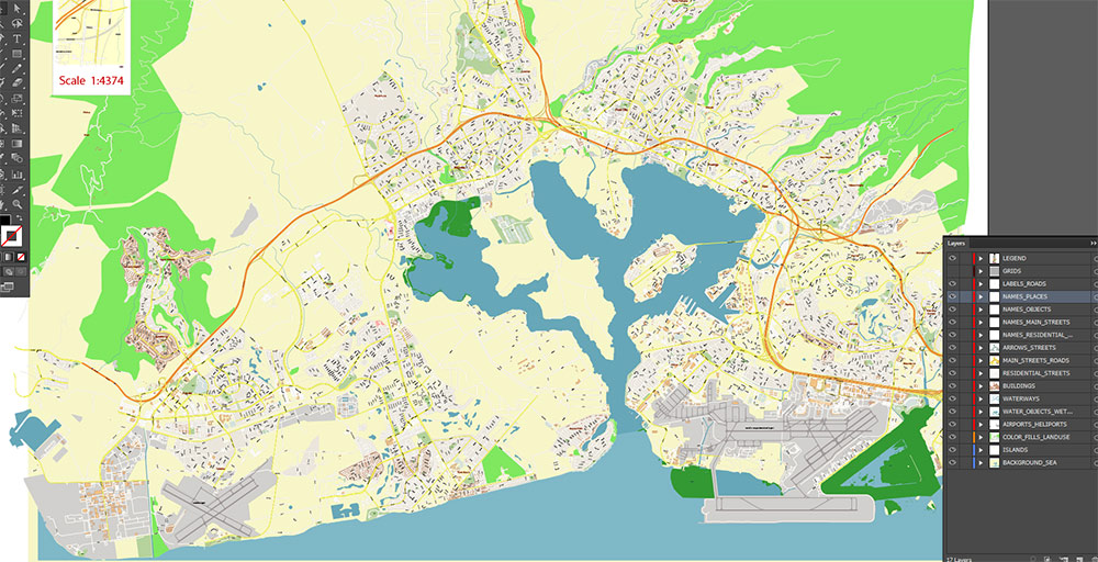
Layers list:
- Legend
- Grids
- Labels of roads
- Names of places (city, hamlet, etc.)
- Names of objects (parks, water, Hospitals)
- Names of main streets
- Names of residential streets
- Arrows of streets
- Main Streets, roads
- Residential streets
- Buildings
- Airports and Heliports
- Water objects (rivers, lakes, ponds, wetlands)
- Waterways
- Color fills (parks, hospital areas, land use, etc.)
- Islands
- Background and sea
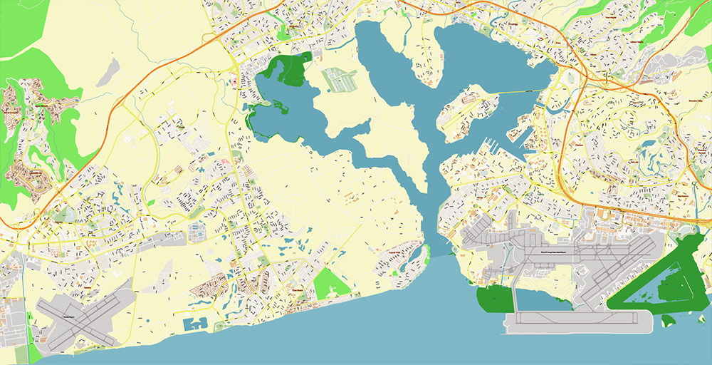
The most exact and detailed map of the city in scale.
For Editing and High-Quality Printing
Waipahu Hawaii USA Map Vector Exact City Plan High Detailed Street Map editable Adobe Illustrator in layers
AO BRIEF — WAIPAHU, OʻAHU, HAWAIʻI, USA
1. Overview
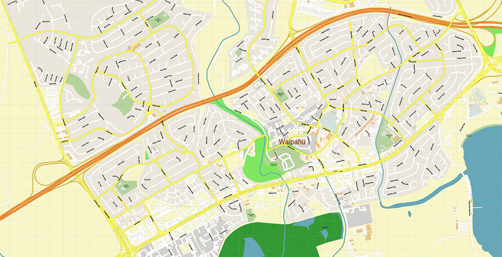
- Inland urban district on the island of Oʻahu, west of Honolulu
- Historically a sugar plantation hub; now dense suburban/industrial-residential mix
- Strategic position between Pearl Harbor area and Central Oʻahu corridor
- Low elevation basin with gradual rise toward Waipio and Mililani uplands
2. Key Roads / Lines of Communication
- Interstate H-1 — primary east–west spine; connects Waipahu to Honolulu (E) and Kapolei (W)
- Farrington Highway (HI-93/HI-90 segments) — parallel coastal/urban artery; local access + redundancy to H-1
- Kunia Road (HI-750) — north–south connector to Central Oʻahu plateau (Kunia, Wahiawā)
- Fort Weaver Road — links Waipahu to ʻEwa Beach and coastal developments
- Transit: Honolulu Skyline (rail) western segment operational/expanding — stations in/near Waipahu enhance commuter throughput
3. Airports / Air Access
- Daniel K. Inouye International Airport (HNL) — ~10–15 km east; primary gateway (civil + military overlap)
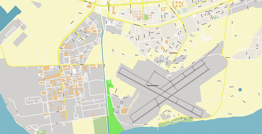
- Kalaeloa Airport (JRF) — southwest near Kapolei; secondary use (general aviation, logistics)
- Airspace influenced by Pearl Harbor–Hickam complex (joint civil-military operations)
4. Physical Geography
- Leeward (dry-side) Oʻahu; lower rainfall than windward side
- Alluvial plain with historic sugarcane irrigation infrastructure
- Drainage via Waikele Stream and Waipahu Stream into Pearl Harbor
- Coastal proximity (south) but Waipahu itself is slightly inland
- Vegetation: urbanized with remnant tropical lowland flora
5. Demography / Human Terrain
- Population: ~40–45K (Waipahu CDP scale)
- Highly diverse: strong Filipino, Native Hawaiian, Pacific Islander, and Asian communities
- Historically plantation labor base → now working/middle-class suburban population
- High density, multi-family housing + older plantation-era layouts
- Commercial clusters along Farrington Hwy and near transit nodes
6. Economic / Functional Profile
- Mixed residential + light industrial + logistics
- Retail corridors and warehouse zones tied to Pearl Harbor / Honolulu metro economy
- Significant commuter outflow toward Honolulu and Kapolei job centers
7. Hazards / Constraints
- Flooding risk in low-lying drainage basins (heavy rain events)
- Traffic congestion on H-1 and Farrington Hwy during peak hours
- Heat and humidity; lower wind ventilation than coastal zones
- Exposure to Pacific storm systems (seasonal)
8. Logistics / Sustainment
- Excellent highway access (H-1 backbone)
- Rail transit improving redundancy and commuter capacity
- Close proximity to port/air logistics via Honolulu–Pearl Harbor complex
- Dense retail/service coverage; no isolation issues
9. Command Takeaways
- Waipahu = transport node + শ্রম-density suburb in Oʻahu’s primary corridor
- Control of H-1 + Farrington = control of west–east movement
- Near-airport proximity enhances logistical value
- Urban density + multicultural population → stable but infrastructure-sensitive environment
Waipahu Hawaii USA Map Vector Exact City Plan High Detailed Street Map editable Adobe Illustrator in layers
Waipahu Hawaii USA Map Vector Exact City Plan High Detailed Street Map editable Adobe Illustrator in layers

Waipahu Hawaii USA Map Vector Exact City Plan High Detailed Street Map editable Adobe Illustrator in layers
Waipahu Hawaii USA Map Vector Exact City Plan High Detailed Street Map editable Adobe Illustrator in layers
Waipahu Hawaii USA Map Vector Exact City Plan High Detailed Street Map editable Adobe Illustrator in layers
Waipahu Hawaii USA Map Vector Exact City Plan High Detailed Street Map editable Adobe Illustrator in layers
Waipahu Hawaii USA Map Vector Exact City Plan High Detailed Street Map editable Adobe Illustrator in layers
Waipahu Hawaii USA Map Vector Exact City Plan High Detailed Street Map editable Adobe Illustrator in layers
Waipahu Hawaii USA Map Vector Exact City Plan High Detailed Street Map editable Adobe Illustrator in layers
Waipahu Hawaii USA Map Vector Exact City Plan High Detailed Street Map editable Adobe Illustrator in layers
Waipahu Hawaii USA Map Vector Exact City Plan High Detailed Street Map editable Adobe Illustrator in layers

 Author: Kirill Shrayber, Ph.D. FRGS
 Street Map editable Adobe Illustrator in layers")
