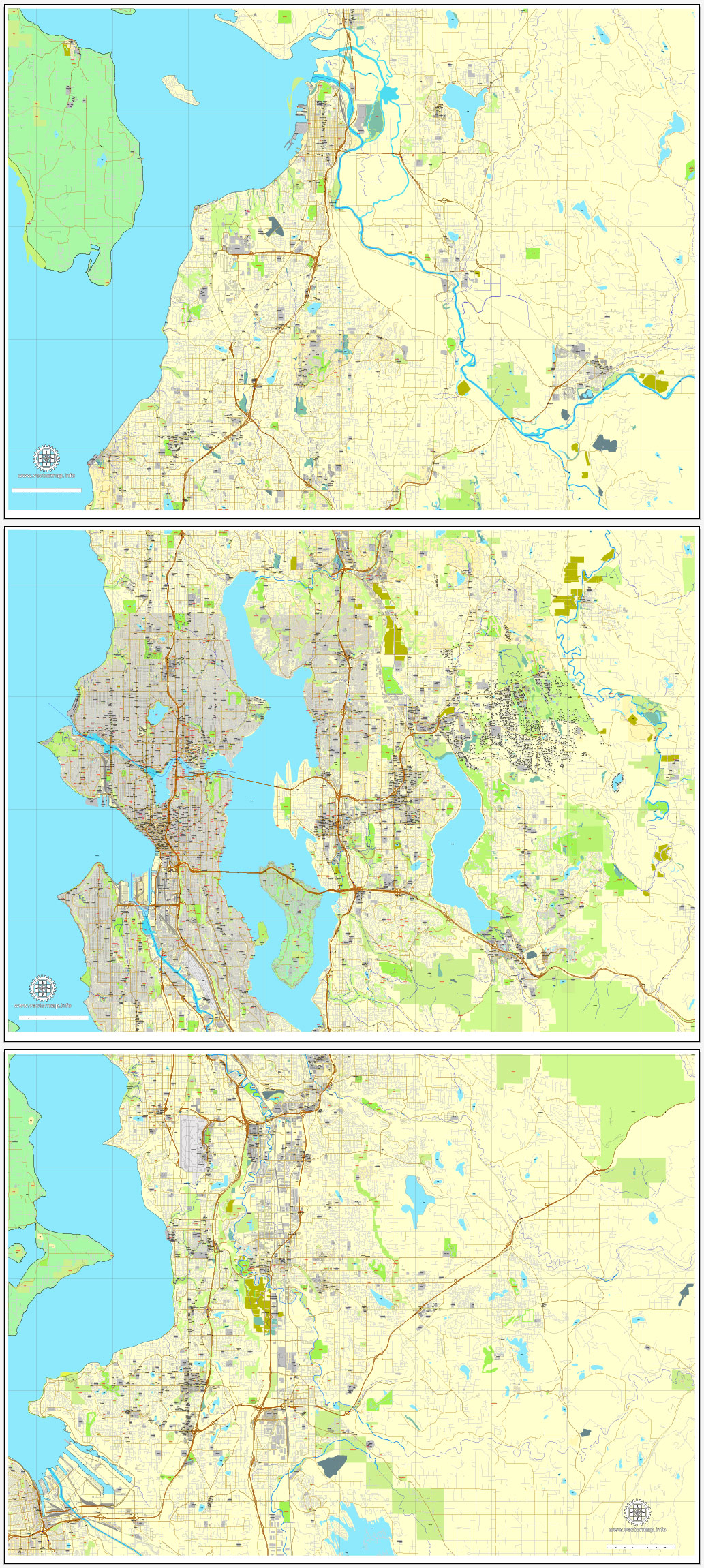
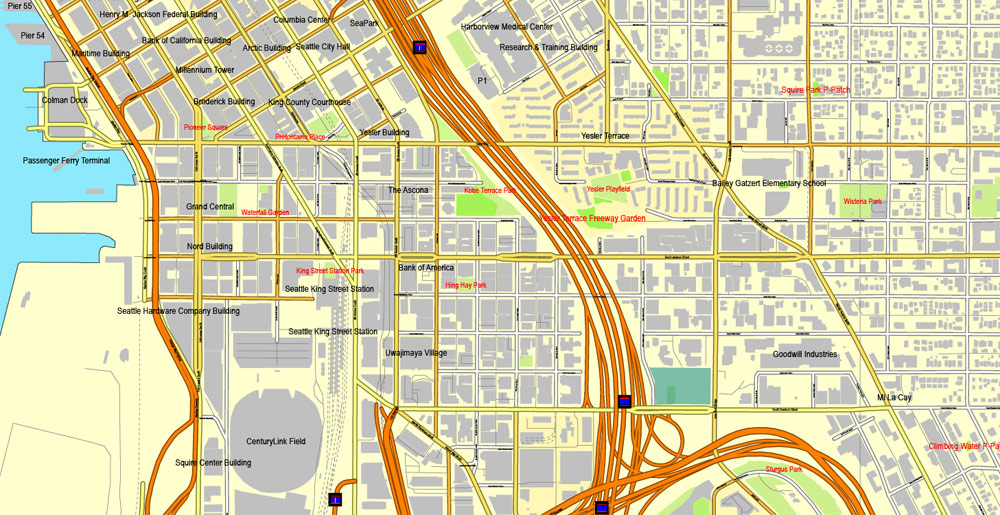
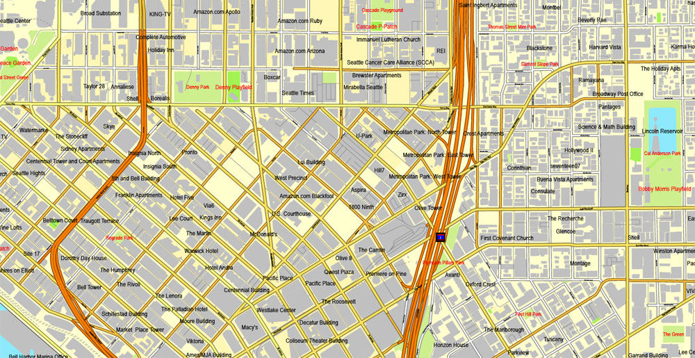
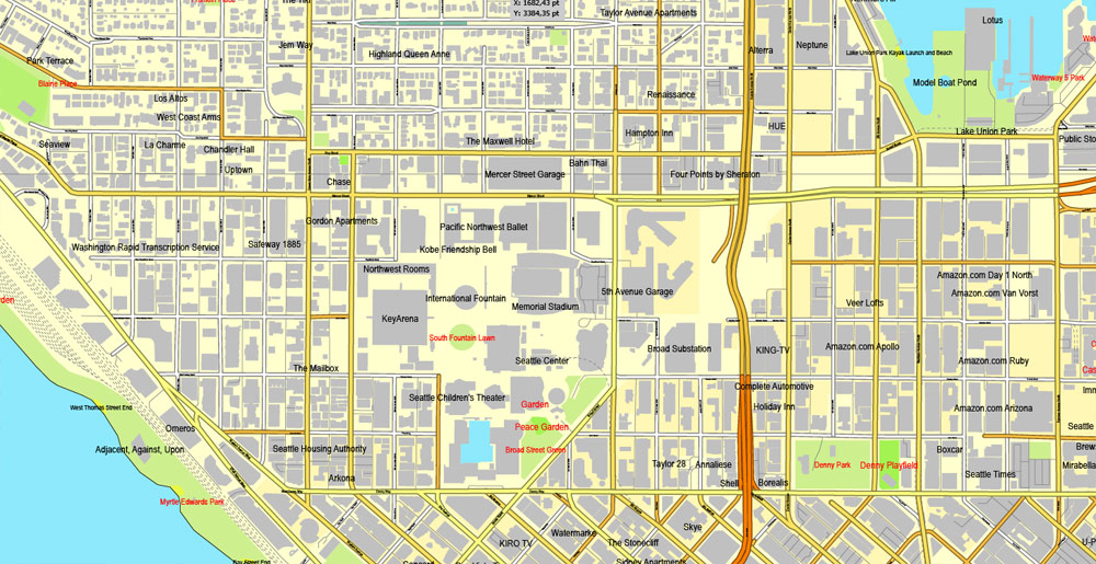
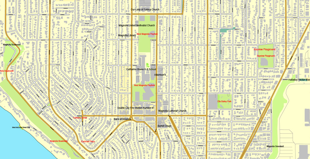
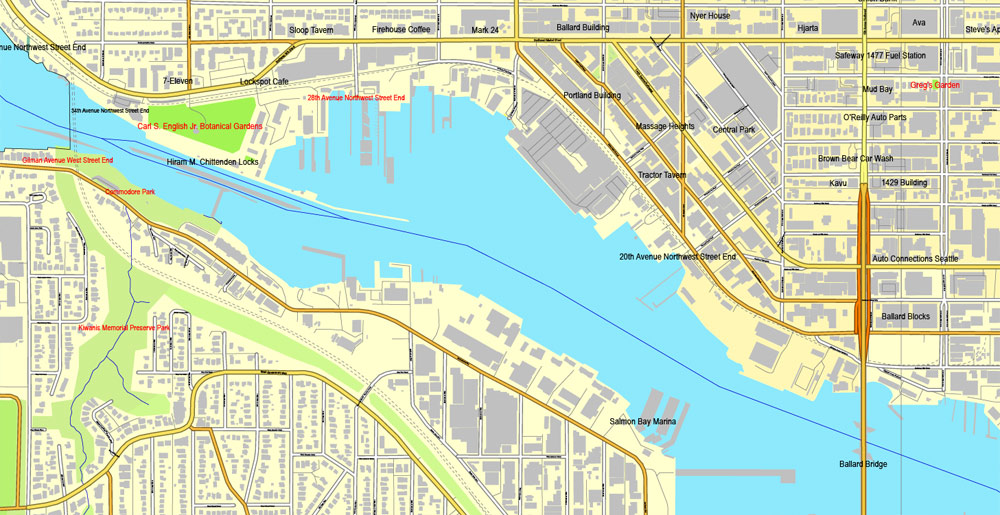
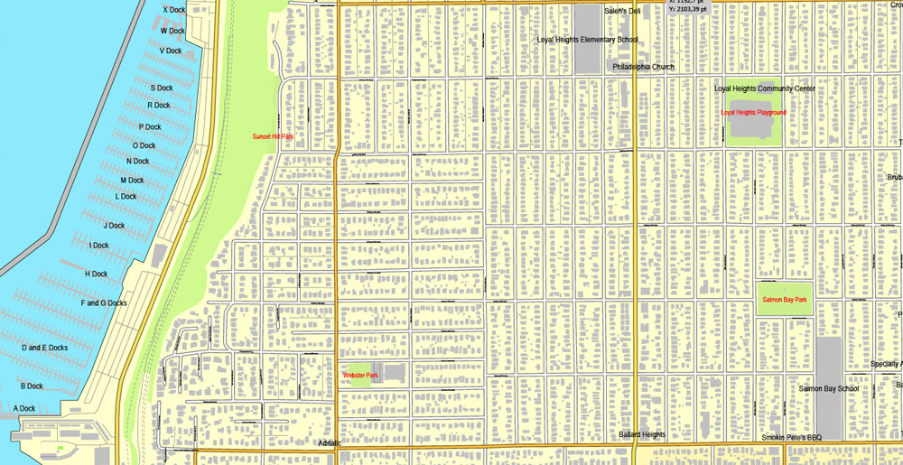
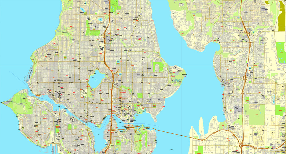
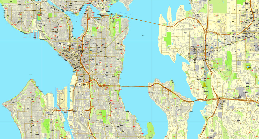
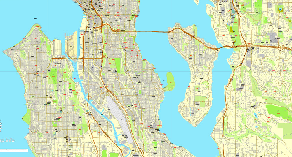
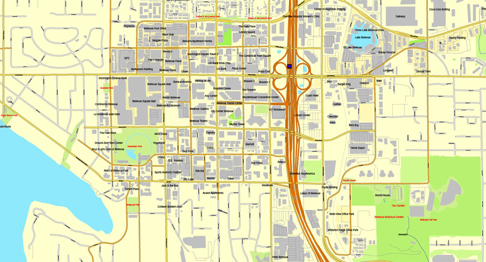
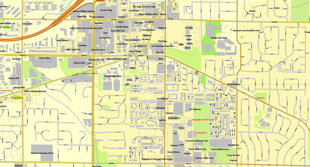
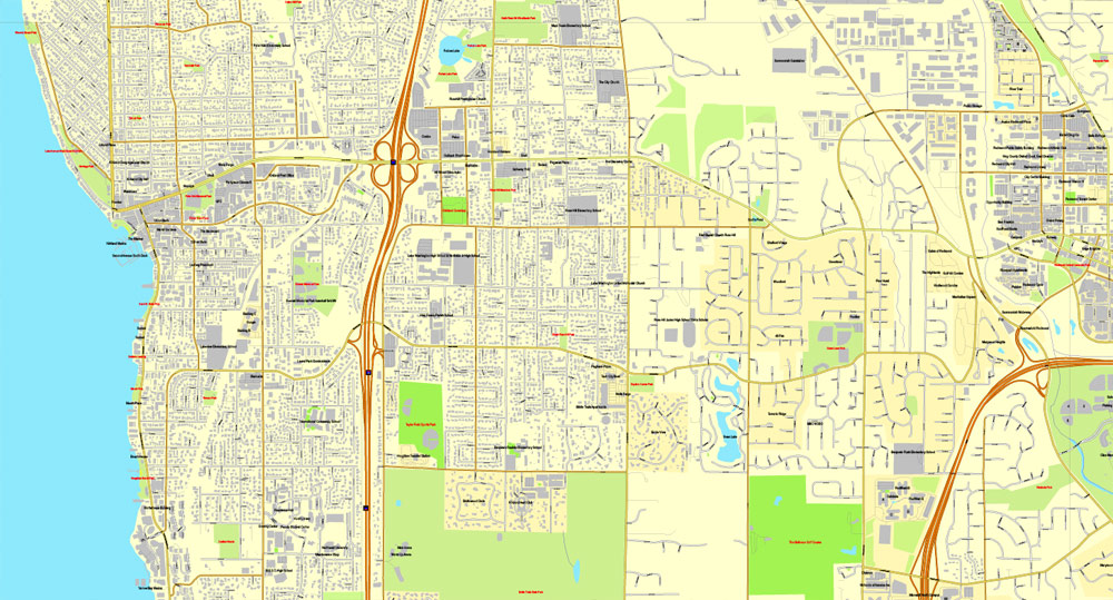
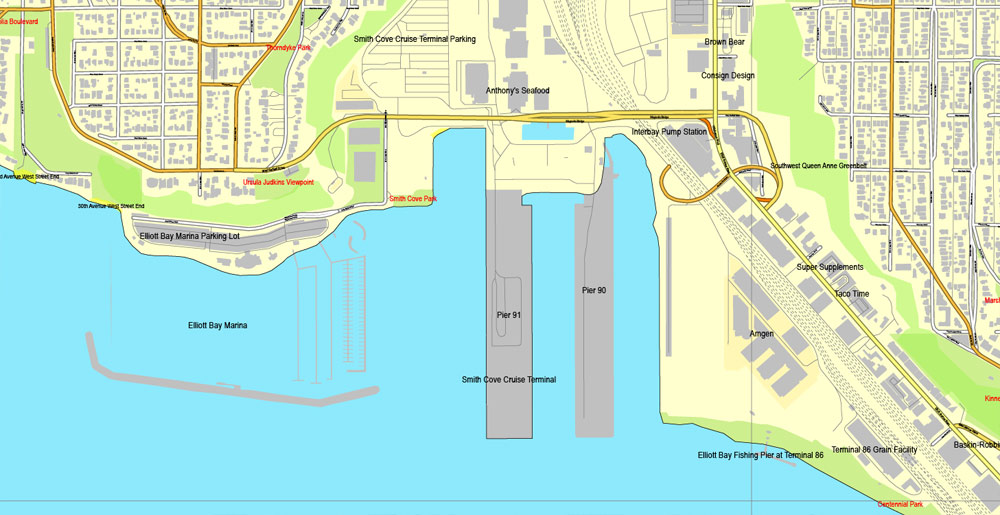
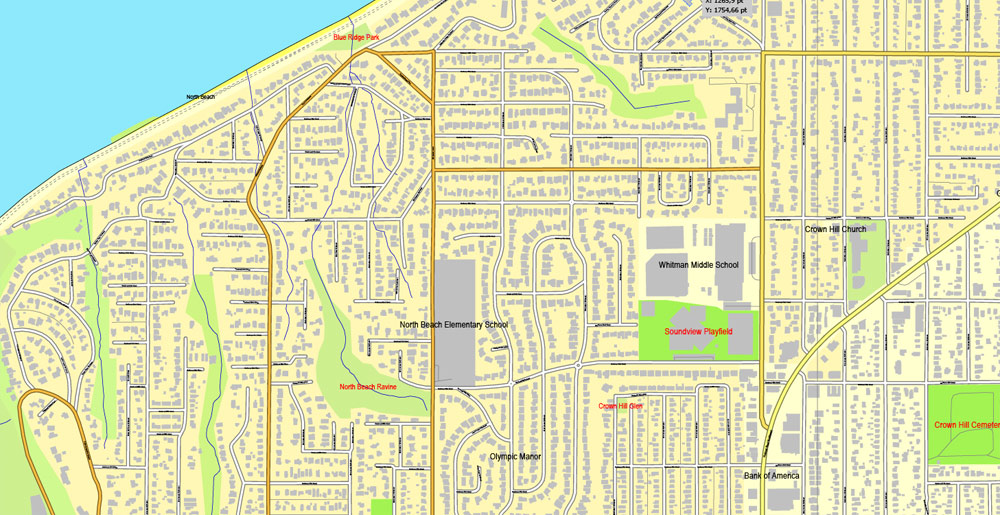
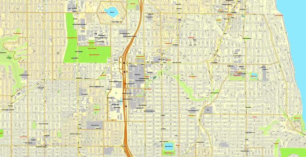
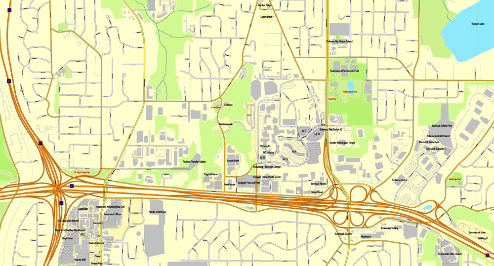
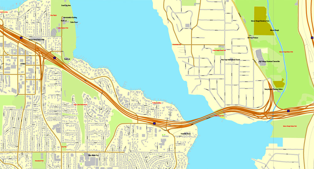
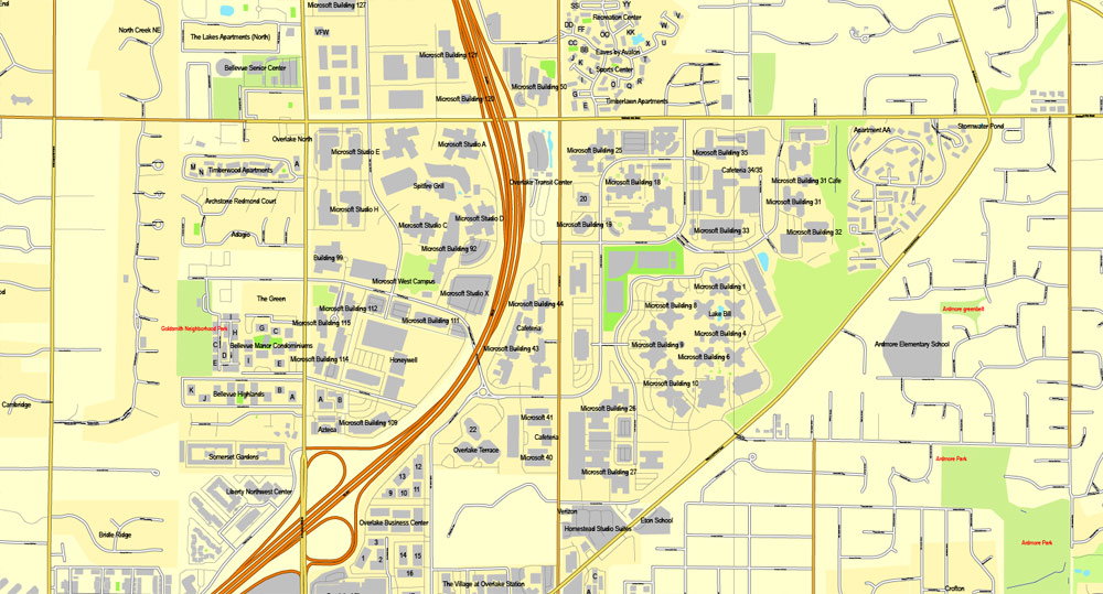
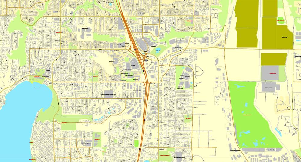
Seattle, Washington, US, vector map Adobe Illustrator editable 3 parts City Plan V3, full vector, scalable, editable, text format street names, 51 mb ZIP
All streets, All buildings. Map for design, printing, arts, projects, presentations, for architects, designers and builders.
The most accurate and detailed map of the city.
CDR, DWG, DXF and other formats – on demand, same price, please, contact
Seattle, United States.
This vector map of Seattle city is used as a basis for design, editing, and further printing.
This is the most detailed, exact map of Seattle city for high-quality printing and polygraphy. You can always clarify the map development date by contacting us.
For your convenience, all objects on Seattle vector city map are divided into layers. And the editing is very easy – colors, lines, etc.
You can easily add any objects needed (e.g. shops, salons, sale points, gas station or attraction) on any layer of Seattle vector map.
Seattle is a seaport city on the West Coast of the United States. It is the seat of King County, Washington. With an estimated 730,000 residents as of 2018, Seattle is the largest city in both the state of Washington and the Pacific Northwest region of North America. According to U.S. Census data released in 2018, the Seattle metropolitan area’s population stands at 3.87 million, and ranks as the 15th largest in the United States. In July 2013, it was the fastest-growing major city in the United States and remained in the Top 5 in May 2015 with an annual growth rate of 2.1%. In July 2016, Seattle was again the fastest-growing major U.S. city, with a 3.1% annual growth rate. Seattle is the northernmost large city in the United States.
One of the advantages of Seattle city vector maps of our production is the relevance of cartographic data, we constantly update all our products.
This vector map of Seattle city is used by:
designers, layout designers, printers, advertisers and architects. Our product – vector maps – is designed for further editing and printing in large formats – from @Wall format (a few meters) to A-0 and A-1, A-2, A-3.
The Seattle city map in vector format is used for design, urban planning, presentations and media visualizations.
The advertising and presentation map of Seattle city (usually the final designer marks the routes, and puts the client’s objects (shops, saloons, gas stations etc.)
The undoubted advantage is that people will NEVER throw out this advertising product – the map. In fact, as an advertising medium, a city map is the most “long-playing” of the well-known polygraphic advertising media, with the longest lifespan, and the maximum number of interactions with the customer.
For travelers, maps are sold at the airports and gas stations around the world. Often the source is our vector maps.
Take a look, who purchases our vector maps of Seattle city in “Our Clients and Friends” page – these are large and small companies, from super-brands like Volvo and Starbucks, to small design studios and printing houses.
It’s very easy to work with vector maps of Seattle city, even for a not very experienced designer who can turn on and off the map layers, add new objects, change the colors of fill and lines according to customer requirements.
The undoubted advantage of Seattle city vector maps in printing is an excellent and detailed visualization, when customer can expand a large paper map and instantly define his location, find a landmark, an object or address on map, unlike using the popular electronic formats of Google and Yandex maps for example.
Printable vector maps of Seattle city are much more convenient and efficient than any electronic maps on your smartphone, because ALL DETAILS are displayed in the entire space of Seattle city map.
Useful tips on working with vector maps of cities and countries in Adobe Illustrator.
«V» – launches the Selection tool (cursor, black arrow), which makes active any vector line.
«А» – launches the Direct Selection tool (white cursor), allows you to select curve elements and drag them to the desired place.
«R» – activates the Rotate tool, which helps you rotating selected objects around the center point by 360 degrees.
«E» – gives you the opportunity to use the Eraser tool and erase unnecessary parts.
«X» – switches between Fill and Stroke in the Tools section. Try to get used to this hot key and
you will quickly understand that you can’t live and work without it.
Guides are not limited to vertical and horizontal in Adobe Illustrator. You can also create a diagonal guide for example. Moreover, you can turn any contours into guides. Select the outline and go to View > Guides > Make Guides (Create Guides), or simply press Cmd/Ctrl + 5. You can also turn the guides back into an editable object. Go to menu, View > Guides > Unlock Guides (Release Guides), select the guide you want to edit and select View > Guides > Release Guides (Reset Guides), or just press Cmd/Ctrl + Option / Alt + 5).
The city is situated on an isthmus between Puget Sound (an inlet of the Pacific Ocean) and Lake Washington, about 100 miles (160 km) south of the Canada–United States border. A major gateway for trade with Asia, Seattle is the fourth-largest port in North America in terms of container handling as of 2015.
You will probably want to change the color scheme used on our Seattle vector city map.
To quickly and effectively play with colors.
Of course, you can do it manually, all objects in our Seattle city vector map are divided according to types and layers, and you can easily change the color gamma of vector objects in groups and layers.
But there is more effective way of working with the whole VECTOR MAP of Seattle city and all layers:
The overview dialog «Edit colors»/«Repaint Graphic Object» (this dialog box name can change depending on the context):
If you have selected a part or a layer of Seattle city vector map and open the dialog box by clicking the icon in the Control panel, on the Samples palette or the Color Catalog, or if you choose Edit > Edit Colors> Repaint Graphic Object, then the «Repaint Graphic Object» dialog box appears, and you get access to «Assign» and «Edit» tabs.
The Seattle area was inhabited by Native Americans for at least 4,000 years before the first permanent European settlers. Arthur A. Denny and his group of travelers, subsequently known as the Denny Party, arrived from Illinois via Portland, Oregon, on the schooner Exact at Alki Point on November 13, 1851. The settlement was moved to the eastern shore of Elliott Bay and named “Seattle” in 1852, in honor of Chief Si’ahl of the local Duwamish and Suquamish tribes.

If a picture or a map fragment is not selected, and you open the dialog box by clicking the icon in the Control panel, on the Samples palette or in the Color Catalog, the «Edit Colors» dialog box appears and you can only access the «Edit» tab.
Regardless of the name at the top of the dialog box, the right-hand side always displays the color group of the current document, as well as two default color groups: Print Color and Grayscale. These color groups can be selected and used any time.
Create and edit color groups of Seattle city vector map, and also assign colors using the «Edit Colors»/ а «Repaint Graphic Object» dialog box.
A. Creating and editing of a color group on the «Edit» tab
B. Assigning colors on the «Assign» tab
C. Select a group of colors from the «Color groups» list
The option «Repaint a graphic object» in the lower part of the dialog box allows you to preview the colors on a selected layer of Vector map, or a group of elements, and specify whether its colors will be redefined when the dialog box is closed.
The main areas of the dialog box are:
«Edit»
The «Edit» tab is designed to create a new or edit the existing color groups.
The harmony rules Menu and the Color Wheel are used to conduct experiments with color harmonies. The color wheel shows how colors are related in color harmony, and the color bars allow you to view and manipulate an individual color values. In addition, you can adjust the brightness, add and remove colors, save color groups and view colors on the selected Vector Map of Seattle city or a separated layers.
«Assign»
The «Assign» tab is used to view and control on how the original colors are replaced with colors from the color group like your corporate colors in the Vector Map of Seattle city.
The assign color ability is provided only if the entire map, layer or fragment is selected in the document. You can specify which of new colors replace the current colors, whether the spot colors should be preserved and how colors are replaced (for example, you can replace colors completely or changing the color tone while maintaining the brightness). The «Assign» tab allows you to redefine colors in the Vector Map of Seattle city, or in separate layers and fragments using the current color group or reducing the number of colors in the current Vector Map.
Color groups
Is a list of all saved color groups for current document (the same groups appear in the «Samples» palette). You can edit and delete the existing color groups, as well as creating a new ones using the list of “Color Groups” in the dialog box. All changes appear in the «Samples» palette.
The highlighted color group shows, which color group is currently edited.
Any color group can be selected and edited, or used to redefine the colors in the selected vector map of Seattle city, its fragments or elements.
Saving a color group adds this group to the specified list.
Opening the «Edit Colors»/«Repaint Graphic Object» dialog box.
Open the «Edit Colors»/«Repaint Graphic Object» dialog box using one of the following methods:
«Edit»> «Edit Colors»> «Repaint Graphic object» or «Repaint With Style».
Use these commands if you need to edit the colors in the selected vector map of Seattle city.
«Repaint Graphic object» button on the «Control» panel.
Use this button if you need to adjust colors of Seattle city vector map using the а «Repaint graphic object» dialog box.
Logging was Seattle’s first major industry, but by the late 19th century, the city had become a commercial and shipbuilding center as a gateway to Alaska during the Klondike Gold Rush. Growth after World War II was partially due to the local Boeing company, which established Seattle as a center for aircraft manufacturing. The Seattle area developed into a technology center from the 1980s onwards with companies like Microsoft becoming established in the region; Microsoft founder Bill Gates is a Seattleite by birth. Internet retailer Amazon was founded in Seattle in 1994, and major airline Alaska Airlines was founded in SeaTac, Washington, serving Seattle’s international airport, Seattle–Tacoma International Airport. The stream of new software, biotechnology, and Internet companies led to an economic revival, which increased the city’s population by almost 50,000 between 1990 and 2000.
The specified button is available if the selected vector map or its fragment contains two or more colors.
Note. This color editing method is convenient for global color adjustment in a vector map, if global colors were not used when creating a City Map of Seattle.
The «Edit colors» button or «Edit or apply colors» on the «Color Catalog» palette
Click this button if you need to edit colors on the «Color Catalog» palette or edit and then apply them to the selected Vector Map of Seattle city or its fragment.
The «Edit color group» button or «Edit or apply color group» on the «Samples» palette.
Click this button if you need to edit the colors in the specific color group or edit and apply them to the selected Vector Map of Seattle city or a group of its elements, for example, the whole layer “Streets and lines”. You can also double-click the color group in the Samples panel to open the dialog box.

If the map file is too large and your computer freezes or even can’t open it quickly:
1. Try to reduce the color resolution of the video card (display) to 256 colors while working with a large map.
2. Using Windows Task Manager, select all the application you don’t need, while working with map, just turn them off.
3. Launch Adobe Illustrator. (DO NOT OPEN the vector map file)
4. Start the Windows Task Manager using administrator rights > Find the “Illustrator” process > set the «real time» priority,
5. Open the file. When you see the LEGACY FONT popup window – click “OK” (do not update). You can restore the TEXT later.
6. Can also be useful: When file is opened – Edit > Settings > Basic Settings > disable smoothing. /// It looks scary, but works quickly)))
We recommend saving the file in Adobe Illustrator 10 version. It’s much more stable when working with VERY BIG size files.
Seattle has a noteworthy musical history. From 1918 to 1951, nearly two dozen jazz nightclubs existed along Jackson Street, from the current Chinatown/International District to the Central District. The jazz scene nurtured the early careers of Ray Charles, Quincy Jones, Ernestine Anderson, and others. Seattle is also the birthplace of rock musician Jimi Hendrix, as well as the origin of the bands Nirvana, Pearl Jam, Soundgarden, Alice in Chains, Foo Fighters and the alternative rock movement grunge.

Geography
With a land area of 83.9 square miles (217.3 km²), Seattle is the northernmost city with at least 500,000 people in the United States, farther north than Canadian cities such as Toronto, Ottawa, and Montreal, at about the same latitude as Salzburg, Austria.
The topography of Seattle is hilly. The city lies on several hills, including Capitol Hill, First Hill, West Seattle, Beacon Hill, Magnolia, Denny Hill, and Queen Anne. The Kitsap and the Olympic peninsulas along with the Olympic mountains lie to the west of Puget Sound, while the Cascade Range and Lake Sammamish lie to the east of Lake Washington. The city has over 5,540 acres (2,242 ha) of parkland.
Topography
See also: Bodies of water of Seattle, List of parks in Seattle, List of earthquakes in Washington (state), and Regrading in Seattle
Treemap comparing the volume of earth moved by the megaprojects that transformed the landscape in and around Seattle. The Denny and other regrades moved a combined total of more than 35 million cubic yards of earth. Creating Harbor Island involved 7 million cubic yards, while the Ballard Locks project moved 1.6 million, twice that of the Alaskan Way Viaduct replacement tunnel. Straightening the Duwamish River and filling its tideflats was the largest single project, at nearly 22 million cubic yards.
Seattle is located between the saltwater Puget Sound (an arm of the Pacific Ocean) to the west and Lake Washington to the east. The city’s chief harbor, Elliott Bay, is part of Puget Sound, which makes the city an oceanic port. To the west, beyond Puget Sound, are the Kitsap Peninsula and Olympic Mountains on the Olympic Peninsula; to the east, beyond Lake Washington and the Eastside suburbs, are Lake Sammamish and the Cascade Range. Lake Washington’s waters flow to Puget Sound through the Lake Washington Ship Canal (consisting of two man-made canals, Lake Union, and the Hiram M. Chittenden Locks at Salmon Bay, ending in Shilshole Bay on Puget Sound).
Aerial view of downtown Seattle.
Downtown Seattle is bounded by Elliott Bay (lower left), Broadway (from upper left to lower right), South Dearborn Street (lower right), and Denny Way (upper left, obscured by clouds).
The sea, rivers, forests, lakes, and fields surrounding Seattle were once rich enough to support one of the world’s few sedentary hunter-gatherer societies. The surrounding area lends itself well to sailing, skiing, bicycling, camping, and hiking year-round.
The city itself is hilly, though not uniformly so. Like Rome, the city is said to lie on seven hills; the lists vary but typically include Capitol Hill, First Hill, West Seattle, Beacon Hill, Queen Anne, Magnolia, and the former Denny Hill. The Wallingford, Delridge, Mount Baker, Seward Park, Washington Park, Broadmoor, Madrona, Phinney Ridge, Sunset Hill, Blue Ridge, Broadview, Laurelhurst, Hawthorne Hills, Maple Leaf, and Crown Hill neighborhoods are all located on hills as well. Many of the hilliest areas are near the city center, with Capitol Hill, First Hill, and Beacon Hill collectively constituting something of a ridge along an isthmus between Elliott Bay and Lake Washington. The break in the ridge between First Hill and Beacon Hill is man-made, the result of two of the many regrading projects that reshaped the topography of the city center.
The topography of the city center was also changed by the construction of a seawall and the artificial Harbor Island (completed 1909) at the mouth of the city’s industrial Duwamish Waterway, the terminus of the Green River. The highest point within city limits is at High Point in West Seattle, which is roughly located near 35th Ave SW and SW Myrtle St. Other notable hills include Crown Hill, View Ridge/Wedgwood/Bryant, Maple Leaf, Phinney Ridge, Mt. Baker Ridge, and Highlands/Carkeek/Bitterlake.
Due to its location in the Pacific Ring of Fire, Seattle is in a major earthquake zone. On February 28, 2001, the magnitude 6.8 Nisqually earthquake did significant architectural damage, especially in the Pioneer Square area (built on reclaimed land, as are the Industrial District and part of the city center), but caused only one fatality. Other strong quakes occurred on January 26, 1700 (estimated at 9 magnitude), December 14, 1872 (7.3 or 7.4), April 13, 1949 (7.1), and April 29, 1965 (6.5). The 1965 quake caused three deaths in Seattle directly and one more by heart failure. Although the Seattle Fault passes just south of the city center, neither it nor the Cascadia subduction zone has caused an earthquake since the city’s founding. The Cascadia subduction zone poses the threat of an earthquake of magnitude 9.0 or greater, capable of seriously damaging the city and collapsing many buildings, especially in zones built on fill.
According to the United States Census Bureau, the city has a total area of 142.5 square miles (369 km2), 83.9 square miles (217 km2) of which is land and 58.7 square miles (152 km2), water (41.16% of the total area).


Seattle
City in Washington
Seattle, on Puget Sound in the Pacific Northwest, is surrounded by water, mountains and evergreen forests, and encompasses thousands of acres of parkland (hence its nickname, “Emerald City”). It’s home to a thriving tech industry, with Microsoft and Amazon.com headquartered in its metropolitan area. The futuristic Space Needle, a legacy of the 1962 World’s Fair, is its most recognizable landmark.
Population: 652,405 (2013)
Colleges and Universities: University of Washington
Seattle is a West Coast seaport city and the seat of King County, Washington. With an estimated 684,451 residents as of 2015, Seattle is the largest city in both the state of Washington and the Pacific Northwest region of North America. In July 2013, it was the fastest-growing major city in the United States and remained in the Top 5 in May 2015 with an annual growth rate of 2.1%. The Seattle metropolitan area is the 15th largest metropolitan area in the United States with over 3.7 million inhabitants. The city is situated on an isthmus between Puget Sound (an inlet of the Pacific Ocean) and Lake Washington, about 100 miles (160 km) south of the Canada–United States border. A major gateway for trade with Asia, Seattle is the third largest port in North America in terms of container handling as of 2015.
Area
• City 142.5 sq mi (369.2 km2)
• Land 83.87 sq mi (217.2 km2)
• Water 58.67 sq mi (152.0 km2)
• Metro 8,186 sq mi (21,202 km2)
Highest elevation 520 ft (158 m)
Lowest elevation 0 ft (0 m)
Population (2010)
• City 608,660
• Estimate (2015) 684,451
• Rank US: 18th
• Density 7,969/sq mi (3,077/km2)
• Urban 3,059,393 (US: 14th)
• Metro 3,733,580 (US: 15th)
• CSA 4,459,677 (US: 13th)
Demonym(s) Seattleite
Time zone PST (UTC−8)
• Summer (DST) PDT (UTC−7)
ZIP codes
ZIP codes
98101–98119, 98121–98122, 98124–98127, 98129, 98131, 98133–98134, 98136, 98138–98139, 98141, 98144–98146, 98148, 98154–98155, 98158, 98160–98161, 98164–98166, 98168, 98170, 98174–98175, 98177–98178, 98181, 98185, 98188, 98190–98191, 98194–98195, 98198–98199
Area code 206
Free download this vector file >>>> free_vector_map_seattle_005
The Seattle area was previously inhabited by Native Americans for at least 4,000 years before the first permanent European settlers. Arthur A. Denny and his group of travelers, subsequently known as the Denny Party, arrived from Illinois via Portland, Oregon, on the schooner Exact at Alki Point on November 13, 1851. The settlement was moved to the eastern shore of Elliott Bay and named it “Seattle” in 1852, after Chief Si’ahl of the local Duwamish and Suquamish tribes.
Logging was Seattle’s first major industry, but by the late-19th century, the city had become a commercial and shipbuilding center as a gateway to Alaska during the Klondike Gold Rush. By 1910, Seattle was one of the 25 largest cities in the country. However, the Great Depression severely damaged the city’s economy. Growth returned during and after World War II partially due to the local Boeing company, which established Seattle as a center for aircraft manufacturing. The Seattle area developed as a technology center beginning in the 1980s, with companies like Microsoft becoming established in the region. In 1994, Internet retailer Amazon was founded in Seattle. The stream of new software, biotechnology, and Internet companies led to an economic revival, which increased the city’s population by almost 50,000 between 1990 and 2000.
Seattle has a noteworthy musical history. From 1918 to 1951, nearly two dozen jazz nightclubs existed along Jackson Street, from the current Chinatown/International District, to the Central District. The jazz scene developed the early careers of Ray Charles, Quincy Jones, Ernestine Anderson, and others. Seattle is also the birthplace of rock musician Jimi Hendrix and the alternative rock subgenre grunge.
Geography
With a land area of 83.9 square miles (217.3 km²), Seattle is the northernmost city with at least 500,000 people in the United States, farther north than Canadian cities such as Toronto, Ottawa, and Montreal, at about the same latitude as Salzburg, Austria.
The topography of Seattle is hilly. The city lies on several hills, including Capitol Hill, First Hill, West Seattle, Beacon Hill, Magnolia, Denny Hill, and Queen Anne. The Kitsap and the Olympic peninsulas along with the Olympic mountains lie to the west of Puget Sound, while the Cascade Range and Lake Sammamish lie to the east of Lake Washington. The city has over 5,540 acres (2,242 ha) of parkland.
https://en.wikipedia.org/wiki/Seattle
Free vector map World, Adobe Illustrator, download now maps vector clipart
Map for design, projects, presentation free to use as you like.
Free Download All World Vector Maps here >>>>>
See also: TERMS & CONDITIONS: SOFTWARE LICENSE AGREEMENT FOR DIGITAL CARTOGRAPHIC DATA

 Author: Kirill Shrayber, Ph.D. FRGS

