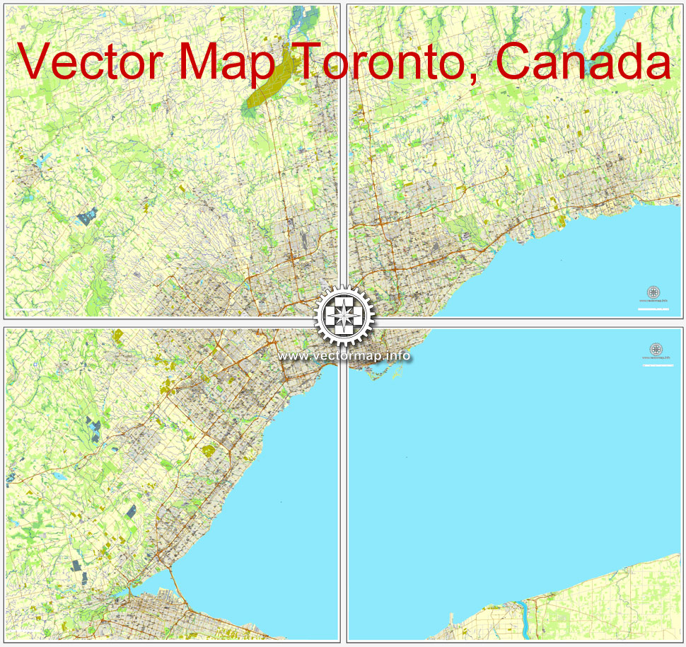
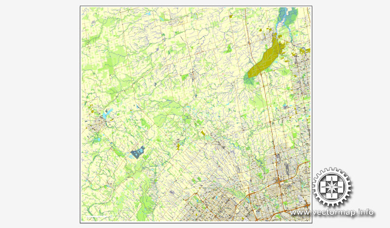
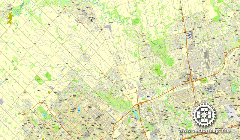
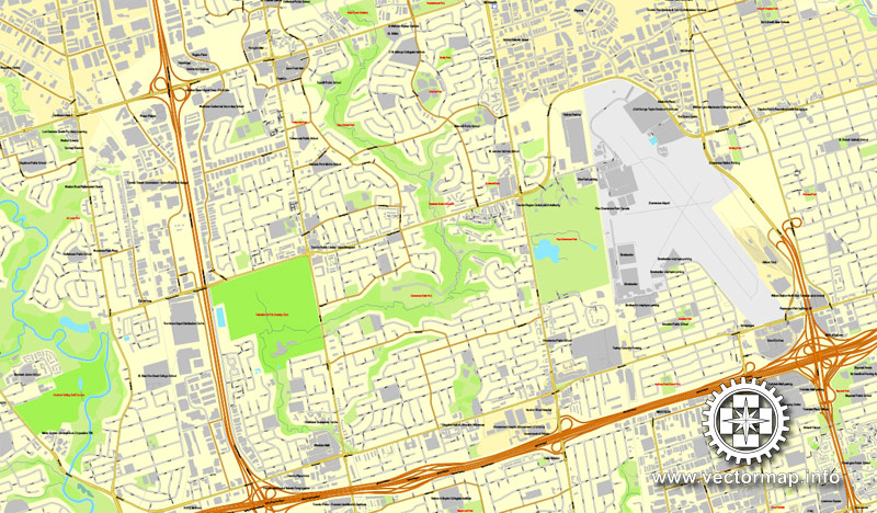
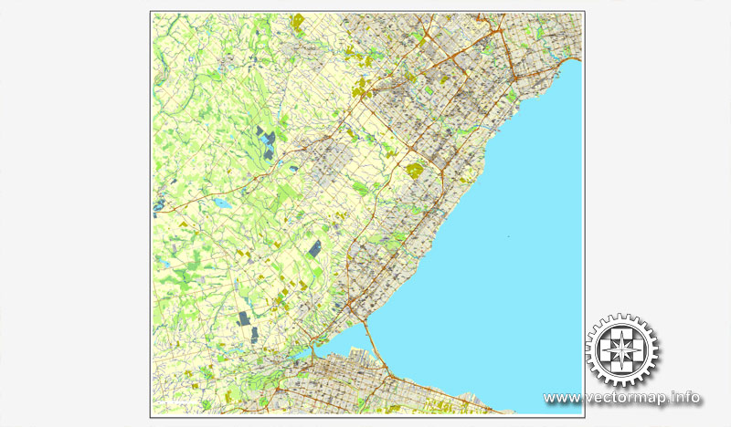
Toronto, Canada, printable vector street City Plan map 4 parts, full editable, Adobe Illustrator, full vector, scalable, editable, text format street names, 72,1 mb ZIP
All streets, some more buildings. Map for design, print, arts, projects, presentations,
for architects, designers and builders.
DXF, DWG, CDR and other formats – on request, same price, please, contact
Toronto, Canada.
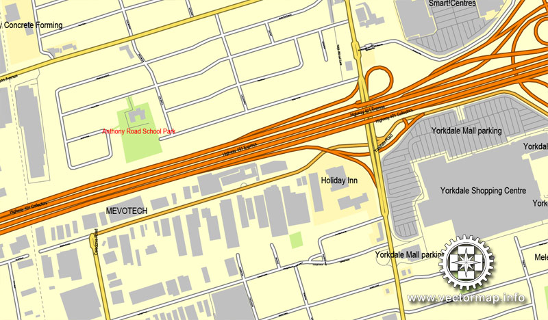
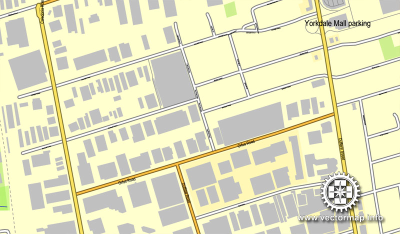
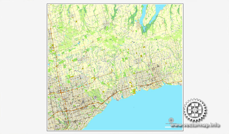
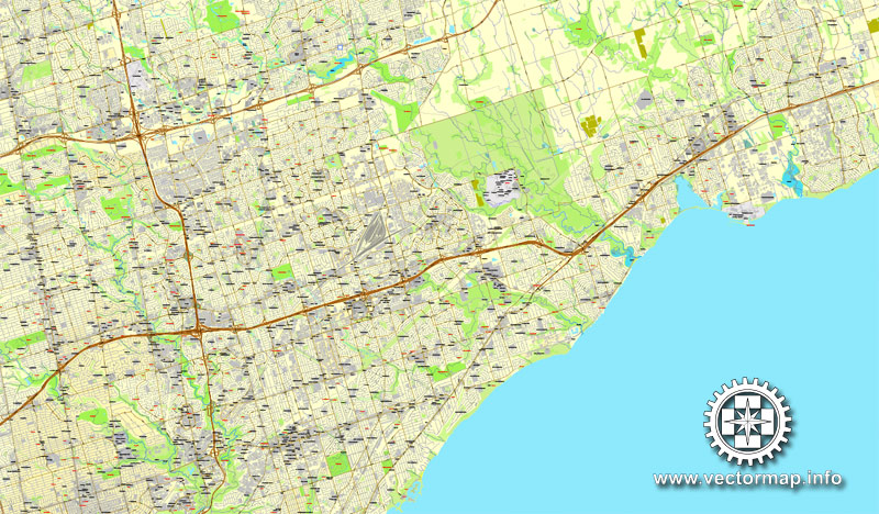
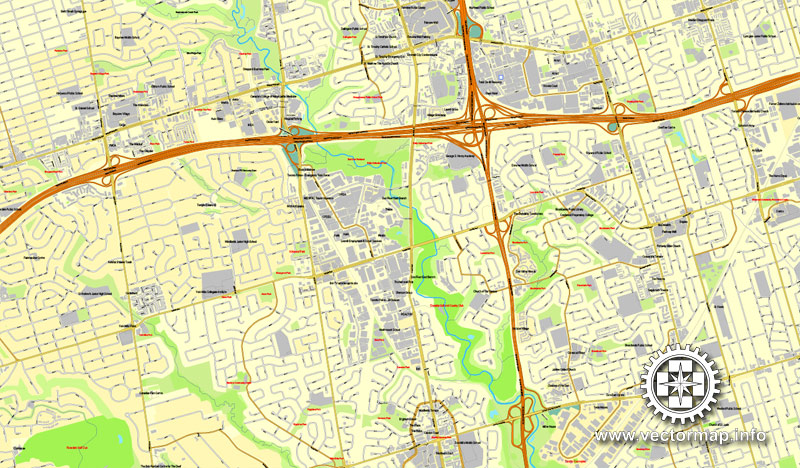
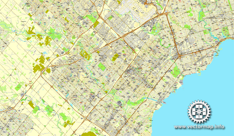
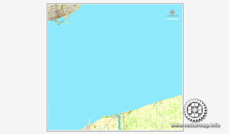
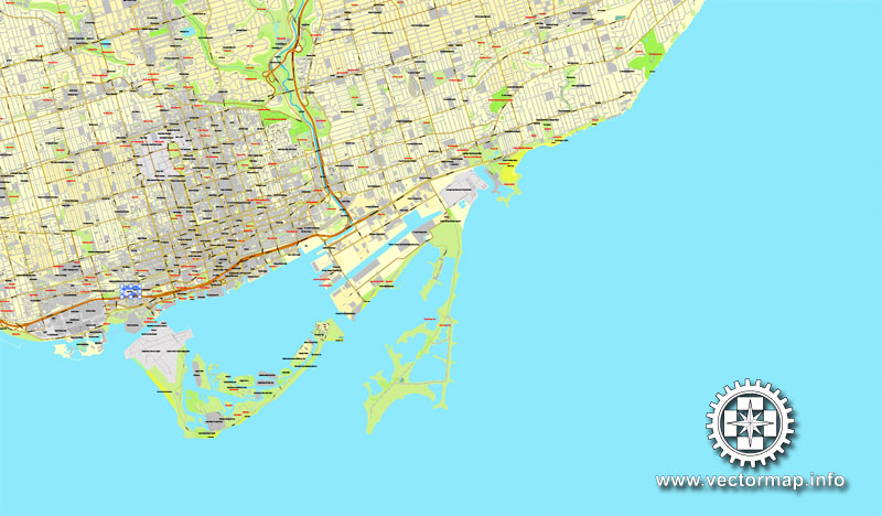
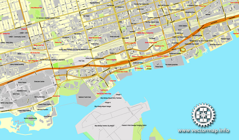
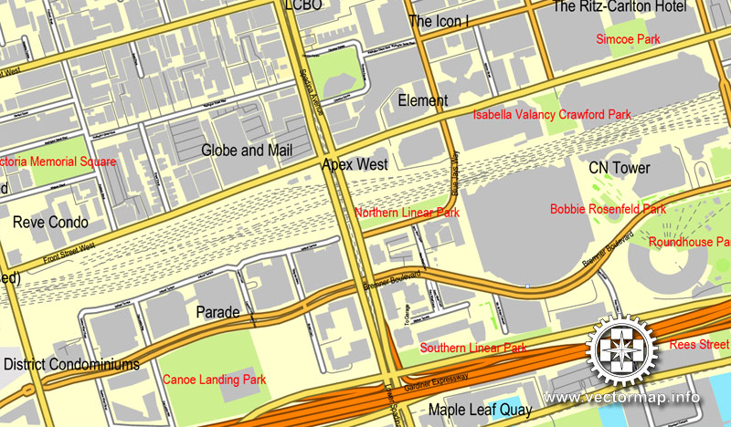
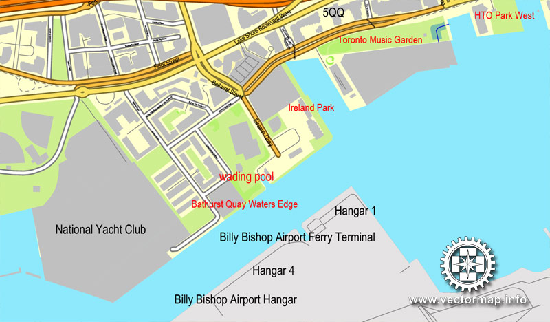
This vector map of Toronto city is used as a basis for design, editing, and further printing.
This is the most detailed, exact map of Toronto city for high-quality printing and polygraphy. You can always clarify the map development date by contacting us.
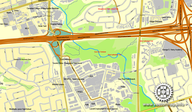
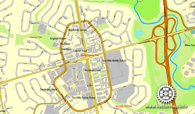
For your convenience, all objects on Toronto vector city map are divided into layers. And the editing is very easy – colors, lines, etc.
You can easily add any objects needed (e.g. shops, salons, sale points, gas station or attraction) on any layer of Toronto vector map.
Toronto is the capital city of the province of Ontario and the largest city in Canada by population, with 2,731,571 residents in 2016. Current to 2016, the Toronto census metropolitan area (CMA), of which the majority is within the Greater Toronto Area (GTA), held a population of 5,928,040, making it Canada’s most populous CMA. Toronto is the anchor of an urban agglomeration, known as the Golden Horseshoe in Southern Ontario, located on the northwestern shore of Lake Ontario. A global city, Toronto is a centre of business, finance, arts, and culture, and is recognized as one of the most multicultural and cosmopolitan cities in the world.
One of the advantages of Toronto city vector maps of our production is the relevance of cartographic data, we constantly update all our products.
This vector map of Toronto city is used by:
designers, layout designers, printers, advertisers and architects. Our product – vector maps – is designed for further editing and printing in large formats – from @Wall format (a few meters) to A-0 and A-1, A-2, A-3.
The Toronto city map in vector format is used for design, urban planning, presentations and media visualizations.
The advertising and presentation map of Toronto city (usually the final designer marks the routes, and puts the client’s objects (shops, saloons, gas stations etc.)
The undoubted advantage is that people will NEVER throw out this advertising product – the map. In fact, as an advertising medium, a city map is the most “long-playing” of the well-known polygraphic advertising media, with the longest lifespan, and the maximum number of interactions with the customer.
For travelers, maps are sold at the airports and gas stations around the world. Often the source is our vector maps.
Take a look, who purchases our vector maps of Toronto city in “Our Clients and Friends” page – these are large and small companies, from super-brands like Volvo and Starbucks, to small design studios and printing houses.
It’s very easy to work with vector maps of Toronto city, even for a not very experienced designer who can turn on and off the map layers, add new objects, change the colors of fill and lines according to customer requirements.
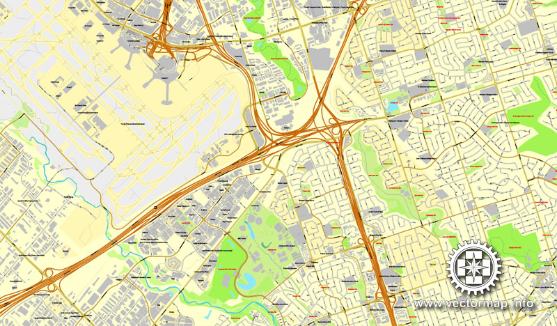
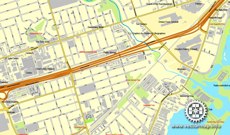
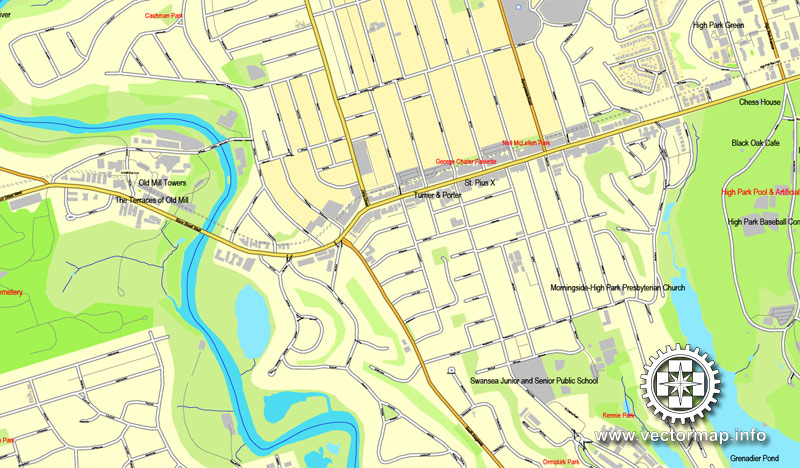
The undoubted advantage of Toronto city vector maps in printing is an excellent and detailed visualization, when customer can expand a large paper map and instantly define his location, find a landmark, an object or address on map, unlike using the popular electronic formats of Google and Yandex maps for example.
Printable vector maps of Toronto city are much more convenient and efficient than any electronic maps on your smartphone, because ALL DETAILS are displayed in the entire space of Toronto city map.
Useful tips on working with vector maps of cities and countries in Adobe Illustrator.
«V» – launches the Selection tool (cursor, black arrow), which makes active any vector line.
«А» – launches the Direct Selection tool (white cursor), allows you to select curve elements and drag them to the desired place.
«R» – activates the Rotate tool, which helps you rotating selected objects around the center point by 360 degrees.
«E» – gives you the opportunity to use the Eraser tool and erase unnecessary parts.
«X» – switches between Fill and Stroke in the Tools section. Try to get used to this hot key and
you will quickly understand that you can’t live and work without it.
Guides are not limited to vertical and horizontal in Adobe Illustrator. You can also create a diagonal guide for example. Moreover, you can turn any contours into guides. Select the outline and go to View > Guides > Make Guides (Create Guides), or simply press Cmd/Ctrl + 5. You can also turn the guides back into an editable object. Go to menu, View > Guides > Unlock Guides (Release Guides), select the guide you want to edit and select View > Guides > Release Guides (Reset Guides), or just press Cmd/Ctrl + Option / Alt + 5).
You will probably want to change the color scheme used on our Toronto vector city map.
To quickly and effectively play with colors.
Of course, you can do it manually, all objects in our Toronto city vector map are divided according to types and layers, and you can easily change the color gamma of vector objects in groups and layers.
But there is more effective way of working with the whole VECTOR MAP of Toronto city and all layers:
The overview dialog «Edit colors»/«Repaint Graphic Object» (this dialog box name can change depending on the context):
If you have selected a part or a layer of Toronto city vector map and open the dialog box by clicking the icon in the Control panel, on the Samples palette or the Color Catalog, or if you choose Edit > Edit Colors> Repaint Graphic Object, then the «Repaint Graphic Object» dialog box appears, and you get access to «Assign» and «Edit» tabs.
If a picture or a map fragment is not selected, and you open the dialog box by clicking the icon in the Control panel, on the Samples palette or in the Color Catalog, the «Edit Colors» dialog box appears and you can only access the «Edit» tab.
Regardless of the name at the top of the dialog box, the right-hand side always displays the color group of the current document, as well as two default color groups: Print Color and Grayscale. These color groups can be selected and used any time.
Create and edit color groups of Toronto city vector map, and also assign colors using the «Edit Colors»/ а «Repaint Graphic Object» dialog box.
A. Creating and editing of a color group on the «Edit» tab
B. Assigning colors on the «Assign» tab
C. Select a group of colors from the «Color groups» list
The option «Repaint a graphic object» in the lower part of the dialog box allows you to preview the colors on a selected layer of Vector map, or a group of elements, and specify whether its colors will be redefined when the dialog box is closed.
The main areas of the dialog box are:
«Edit»
The «Edit» tab is designed to create a new or edit the existing color groups.
The harmony rules Menu and the Color Wheel are used to conduct experiments with color harmonies. The color wheel shows how colors are related in color harmony, and the color bars allow you to view and manipulate an individual color values. In addition, you can adjust the brightness, add and remove colors, save color groups and view colors on the selected Vector Map of Toronto city or a separated layers.
People have travelled through and inhabited the Toronto area, situated on a broad sloping plateau interspersed with rivers, deep ravines, and urban forest, for more than 10,000 years. After the broadly disputed Toronto Purchase, when the Mississauga surrendered the area to the British Crown, the British established the town of York in 1793 and later designated it as the capital of Upper Canada. During the War of 1812, the town was the site of the Battle of York and suffered heavy damage by United States troops. York was renamed and incorporated in 1834 as the city of Toronto. It was designated as the capital of the province of Ontario in 1867 during Canadian Confederation. The city proper has since expanded past its original borders through both annexation and amalgamation to its current area of 630.2 km2 (243.3 sq mi).
«Assign»
The «Assign» tab is used to view and control on how the original colors are replaced with colors from the color group like your corporate colors in the Vector Map of Toronto city.
The assign color ability is provided only if the entire map, layer or fragment is selected in the document. You can specify which of new colors replace the current colors, whether the spot colors should be preserved and how colors are replaced (for example, you can replace colors completely or changing the color tone while maintaining the brightness). The «Assign» tab allows you to redefine colors in the Vector Map of Toronto city, or in separate layers and fragments using the current color group or reducing the number of colors in the current Vector Map.
Color groups
Is a list of all saved color groups for current document (the same groups appear in the «Samples» palette). You can edit and delete the existing color groups, as well as creating a new ones using the list of “Color Groups” in the dialog box. All changes appear in the «Samples» palette.
The highlighted color group shows, which color group is currently edited.
Any color group can be selected and edited, or used to redefine the colors in the selected vector map of Toronto city, its fragments or elements.
Saving a color group adds this group to the specified list.
Opening the «Edit Colors»/«Repaint Graphic Object» dialog box.
Open the «Edit Colors»/«Repaint Graphic Object» dialog box using one of the following methods:
«Edit»> «Edit Colors»> «Repaint Graphic object» or «Repaint With Style».
Use these commands if you need to edit the colors in the selected vector map of Toronto city.
«Repaint Graphic object» button on the «Control» panel.
Use this button if you need to adjust colors of Toronto city vector map using the а «Repaint graphic object» dialog box.
The specified button is available if the selected vector map or its fragment contains two or more colors.
Note. This color editing method is convenient for global color adjustment in a vector map, if global colors were not used when creating a City Map of Toronto.
The «Edit colors» button or «Edit or apply colors» on the «Color Catalog» palette
Click this button if you need to edit colors on the «Color Catalog» palette or edit and then apply them to the selected Vector Map of Toronto city or its fragment.
The «Edit color group» button or «Edit or apply color group» on the «Samples» palette.
Click this button if you need to edit the colors in the specific color group or edit and apply them to the selected Vector Map of Toronto city or a group of its elements, for example, the whole layer “Streets and lines”. You can also double-click the color group in the Samples panel to open the dialog box.
The diverse population of Toronto reflects its current and historical role as an important destination for immigrants to Canada. More than 50 percent of residents belong to a visible minority population group, and over 200 distinct ethnic origins are represented among its inhabitants. While the majority of Torontonians speak English as their primary language, over 160 languages are spoken in the city.
Toronto is a prominent centre for music, theatre, motion picture production, and television production, and is home to the headquarters of Canada’s major national broadcast networks and media outlets. Its varied cultural institutions, which include numerous museums and galleries, festivals and public events, entertainment districts, national historic sites, and sports activities, attract over 25 million tourists each year. Toronto is known for its many skyscrapers and high-rise buildings, in particular the tallest free-standing structure in the Western Hemisphere, the CN Tower.
If the map file is too large and your computer freezes or even can’t open it quickly:
1. Try to reduce the color resolution of the video card (display) to 256 colors while working with a large map.
2. Using Windows Task Manager, select all the application you don’t need, while working with map, just turn them off.
3. Launch Adobe Illustrator. (DO NOT OPEN the vector map file)
4. Start the Windows Task Manager using administrator rights > Find the “Illustrator” process > set the «real time» priority,
5. Open the file. When you see the LEGACY FONT popup window – click “OK” (do not update). You can restore the TEXT later.
6. Can also be useful: When file is opened – Edit > Settings > Basic Settings > disable smoothing. /// It looks scary, but works quickly)))
We recommend saving the file in Adobe Illustrator 10 version. It’s much more stable when working with VERY BIG size files.
The city is home to the Toronto Stock Exchange, the headquarters of Canada’s five largest banks, and the headquarters of many large Canadian and multinational corporations. Its economy is highly diversified with strengths in technology, design, financial services, life sciences, education, arts, fashion, business services, environmental innovation, food services, and tourism.
Geography
Toronto covers an area of 630 square kilometres (243 sq mi), with a maximum north-south distance of 21 kilometres (13 mi) and a maximum east-west distance of 43 km (27 mi). It has a 46-kilometre (29 mi) long waterfront shoreline, on the northwestern shore of Lake Ontario. The Toronto Islands and Port Lands extend out into the lake, allowing for a somewhat sheltered Toronto Harbour south of the downtown core. The city’s borders are formed by Lake Ontario to the south, Etobicoke Creek and Highway 427 to the west, Steeles Avenue to the north and the Rouge River and the Toronto-Pickering Townline to the east.
Topography
This section needs additional citations for verification. Please help improve this article by adding citations to reliable sources. Unsourced material may be challenged and removed. (July 2016) (Learn how and when to remove this template message)
Initially acting as a barrier towards development, the Toronto ravine system has since been adopted as a central piece of Toronto’s landscape.
The city is mostly flat or gentle hills and the land gently slopes upward away from the lake. The flat land is interrupted by numerous ravines cut by numerous creeks and the valleys of the three rivers in Toronto: the Humber River in the west end and the Don River east of downtown at opposite ends of Toronto Harbour, and the Rouge River at the city’s eastern limits. Most of the ravines and valley lands in Toronto today are parklands, and recreational trails are laid out along the ravines and valleys. The original town was laid out in a grid plan on the flat plain north of the harbour, and this plan was extended outwards as the city grew. The width and depth of several of the ravines and valleys are such that several grid streets such as Finch Avenue, Leslie Street, Lawrence Avenue, and St. Clair Avenue, terminate on one side of a ravine or valley and continue on the other side. Toronto has many bridges spanning the ravines. Large bridges such as the Prince Edward Viaduct were built to span wide river valleys.
Despite its deep ravines, Toronto is not remarkably hilly, but its elevation does increase steadily away from the lake. Elevation differences range from 75 metres (246 ft) above sea level at the Lake Ontario shore to 209 m (686 ft) ASL near the York University grounds in the city’s north end at the intersection of Keele Street and Steeles Avenue. There are occasional hilly areas; in particular, midtown Toronto has a number of sharply sloping hills. Lake Ontario remains occasionally visible from the peaks of these ridges as far north as Eglinton Avenue, 7 to 8 kilometres (4.3 to 5.0 mi) inland.
The Scarborough Bluffs is an escarpment along the eastern portion of the Toronto waterfront, which formed during the last glacial period.
The other major geographical feature of Toronto is its escarpments. During the last ice age, the lower part of Toronto was beneath Glacial Lake Iroquois. Today, a series of escarpments mark the lake’s former boundary, known as the “Iroquois Shoreline”. The escarpments are most prominent from Victoria Park Avenue to the mouth of Highland Creek where they form the Scarborough Bluffs. Other observable sections include the area near St. Clair Avenue West between Bathurst Street and the Don River, and north of Davenport Road from Caledonia to Spadina Road; the Casa Loma grounds sit above this escarpment.
The geography of the lake shore is greatly changed since the first settlement of Toronto. Much of the land on the north shore of the harbour is landfill, filled in during the late 19th century. Until then, the lakefront docks (then known as wharves) were set back farther inland than today. Much of the adjacent Port Lands on the east side of the harbour was a wetland filled in early in the 20th century. The shoreline from the harbour west to the Humber River has been extended into the lake. Further west, landfill has been used to create extensions of land such as Humber Bay Park.
The Toronto Islands were a natural peninsula until a storm in 1858 severed their connection to the mainland, creating a channel to the harbour. The peninsula was formed by longshore drift taking the sediments deposited along the Scarborough Bluffs shore and transporting them to the Islands area. The other source of sediment for the Port Lands wetland and the peninsula was the deposition of the Don River, which carved a wide valley through the sedimentary land of Toronto and deposited it in the harbour, which is quite shallow. The harbour and the channel of the Don River have been dredged numerous times for shipping. The lower section of the Don River was straightened and channelled in the 19th century. The former mouth drained into a wetland; today the Don drains into the harbour through a concrete waterway, the Keating Channel.

Small guide: How to work with the vector map?
You can: Mass select objects by type and color – for example, the objects type “building” (they are usually dark gray) – and remove them from the map, if you do not need them in your print or design project. You can also easily change the thickness of lines (streets), just bulk selection the road by the line color.
The streets are separated by type, for example, type “residential road” are usually white with a gray stroke. Highway usually orange with a brown or dark gray stroke.
It is easy to change the font of inscriptions, all or each individually. Also, just can be make and any other manipulation of objects on the vector map in Adobe illustrator format.
Important: All the proportions on the map are true, that is, the relative sizes of the objects are true, because Map is based on an accurate GPS projection, and It transated into the (usual for all) the Mercator projection.
You can easily change the color, stroke and fill of any object on the map, zoom without loss of quality Image Verification.
Select object

Bulk selection the same objects on the vector map

See the bulk selected objects on the vector map

Bulk delete buildungs from the vector map

Select residencial road (small street) on the vector map

Bulk selection the same lines (streets, roads) on the full map

Create fat lines of the streets on the vector maps (bulk action) 1

Create fat lines of the streets on the vector maps (bulk action) 2

Create fat lines of the streets on the vector maps (bulk action) 3

You can easily change the color, stroke and fill of any object on the map, zoom without loss of quality Image Verification.
See more Canadian cities street maps for printing
For example: Printable Map Ottawa, Canada, exact vector street City Plan map
Quebec City, Canada, PDF Map, Printable G-View Level 17
PDF map of Vancouver, Canada
Montreal vector map and surroundings, Canada, printable

 Author: Kirill Shrayber, Ph.D. FRGS
 Street Map editable Adobe Illustrator in layers")
 Street Map editable Adobe Illustrator in layers")
