Saint Louis Vector Map Missouri US printable detailed City Plan editable Street Map Adobe Illustrator
Saint Louis, Missouri, US printable vector street City Plan map, full editable, Adobe Illustrator, full vector, scalable, editable, text format street names, 7,8 mb ZIP
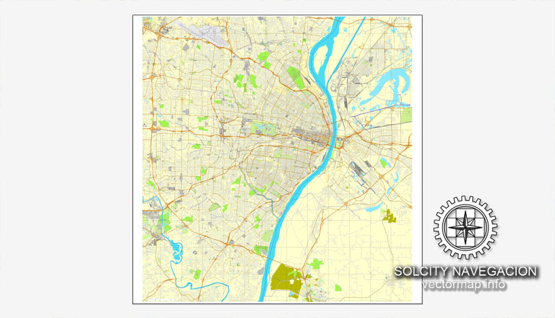
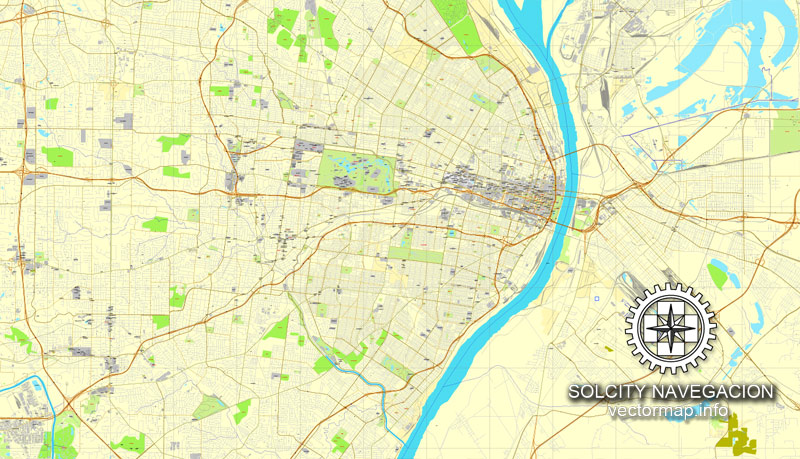
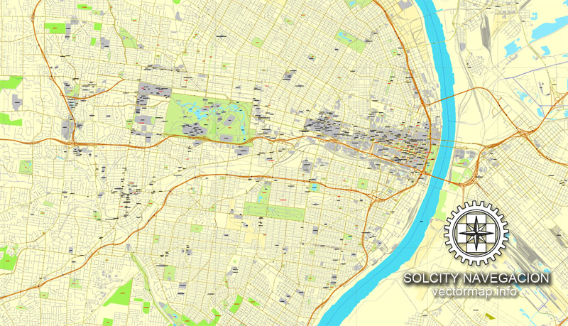
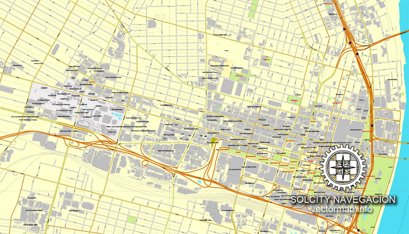
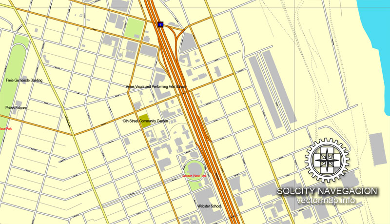
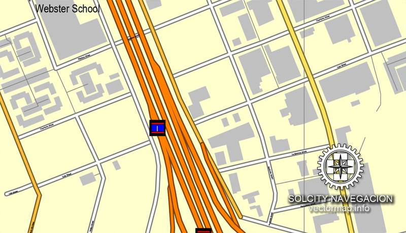
All streets, some buildings. Map for design, print, arts, projects, presentations.
PDF, DXF, CDR and other formats – on request, same price, please, contact
Saint Louis, Missouri, USA.
This vector map of Saint Louis city is used as a basis for design, editing, and further printing.
This is the most detailed, exact map of Saint Louis city for high-quality printing and polygraphy. You can always clarify the map development date by contacting us.
For your convenience, all objects on Saint Louis vector city map are divided into layers. And the editing is very easy – colors, lines, etc.
You can easily add any objects needed (e.g. shops, salons, sale points, gas station or attraction) on any layer of Saint Louis vector map.
Saint Louis is an independent city and major U.S. port in the state of Missouri, built along the western bank of the Mississippi River, which marks Missouri’s border with Illinois. The city had an estimated 2018 population of 308,626 and is the cultural and economic center of the Saint Louis metropolitan area (home to nearly 3,000,000 people), which is the largest metropolitan area in Missouri, second-largest in Illinois (after Chicago), the 22nd-largest in the United States.
One of the advantages of Saint Louis city vector maps of our production is the relevance of cartographic data, we constantly update all our products.
This vector map of Saint Louis city is used by:
designers, layout designers, printers, advertisers and architects. Our product – vector maps – is designed for further editing and printing in large formats – from @Wall format (a few meters) to A-0 and A-1, A-2, A-3.
The Saint Louis city map in vector format is used for design, urban planning, presentations and media visualizations.
The advertising and presentation map of Saint Louis city (usually the final designer marks the routes, and puts the client’s objects (shops, saloons, gas stations etc.)
The undoubted advantage is that people will NEVER throw out this advertising product – the map. In fact, as an advertising medium, a city map is the most “long-playing” of the well-known polygraphic advertising media, with the longest lifespan, and the maximum number of interactions with the customer.
For travelers, maps are sold at the airports and gas stations around the world. Often the source is our vector maps.
Take a look, who purchases our vector maps of Saint Louis city in “Our Clients and Friends” page – these are large and small companies, from super-brands like Volvo and Starbucks, to small design studios and printing houses.
It’s very easy to work with vector maps of Saint Louis city, even for a not very experienced designer who can turn on and off the map layers, add new objects, change the colors of fill and lines according to customer requirements.
The undoubted advantage of Saint Louis city vector maps in printing is an excellent and detailed visualization, when customer can expand a large paper map and instantly define his location, find a landmark, an object or address on map, unlike using the popular electronic formats of Google and Yandex maps for example.
Printable vector maps of Saint Louis city are much more convenient and efficient than any electronic maps on your smartphone, because ALL DETAILS are displayed in the entire space of Saint Louis city map.
Useful tips on working with vector maps of cities and countries in Adobe Illustrator.
«V» – launches the Selection tool (cursor, black arrow), which makes active any vector line.
«А» – launches the Direct Selection tool (white cursor), allows you to select curve elements and drag them to the desired place.
«R» – activates the Rotate tool, which helps you rotating selected objects around the center point by 360 degrees.
«E» – gives you the opportunity to use the Eraser tool and erase unnecessary parts.
«X» – switches between Fill and Stroke in the Tools section. Try to get used to this hot key and
you will quickly understand that you can’t live and work without it.
Guides are not limited to vertical and horizontal in Adobe Illustrator. You can also create a diagonal guide for example. Moreover, you can turn any contours into guides. Select the outline and go to View > Guides > Make Guides (Create Guides), or simply press Cmd/Ctrl + 5. You can also turn the guides back into an editable object. Go to menu, View > Guides > Unlock Guides (Release Guides), select the guide you want to edit and select View > Guides > Release Guides (Reset Guides), or just press Cmd/Ctrl + Option / Alt + 5).
You will probably want to change the color scheme used on our Saint Louis vector city map.
To quickly and effectively play with colors.
Of course, you can do it manually, all objects in our Saint Louis city vector map are divided according to types and layers, and you can easily change the color gamma of vector objects in groups and layers.
But there is more effective way of working with the whole VECTOR MAP of Saint Louis city and all layers:
The overview dialog «Edit colors»/«Repaint Graphic Object» (this dialog box name can change depending on the context):
If you have selected a part or a layer of Saint Louis city vector map and open the dialog box by clicking the icon in the Control panel, on the Samples palette or the Color Catalog, or if you choose Edit > Edit Colors> Repaint Graphic Object, then the «Repaint Graphic Object» dialog box appears, and you get access to «Assign» and «Edit» tabs.
If a picture or a map fragment is not selected, and you open the dialog box by clicking the icon in the Control panel, on the Samples palette or in the Color Catalog, the «Edit Colors» dialog box appears and you can only access the «Edit» tab.
Regardless of the name at the top of the dialog box, the right-hand side always displays the color group of the current document, as well as two default color groups: Print Color and Grayscale. These color groups can be selected and used any time.
Prior to European settlement, the area was a major regional center of Native American Mississippian culture. The city of Saint Louis was founded in 1764 by French fur traders Pierre Laclède and Auguste Chouteau, and named after Louis IX of France. In 1764, following France’s defeat in the Seven Years’ War, the area was ceded to Spain and retroceded back to France in 1800. In 1803, the United States acquired the territory as part of the Louisiana Purchase. During the 19th century, Saint Louis developed as a major port on the Mississippi River. In the 1870 Census, Saint Louis was ranked as the 4th-largest city in the United States. It separated from Saint Louis County in 1877, becoming an independent city and limiting its own political boundaries. In 1904, it hosted the Louisiana Purchase Exposition and the Summer Olympics.
Create and edit color groups of Saint Louis city vector map, and also assign colors using the «Edit Colors»/ а «Repaint Graphic Object» dialog box.
A. Creating and editing of a color group on the «Edit» tab
B. Assigning colors on the «Assign» tab
C. Select a group of colors from the «Color groups» list
The option «Repaint a graphic object» in the lower part of the dialog box allows you to preview the colors on a selected layer of Vector map, or a group of elements, and specify whether its colors will be redefined when the dialog box is closed.
The main areas of the dialog box are:
«Edit»
The «Edit» tab is designed to create a new or edit the existing color groups.
The harmony rules Menu and the Color Wheel are used to conduct experiments with color harmonies. The color wheel shows how colors are related in color harmony, and the color bars allow you to view and manipulate an individual color values. In addition, you can adjust the brightness, add and remove colors, save color groups and view colors on the selected Vector Map of Saint Louis city or a separated layers.
«Assign»
The «Assign» tab is used to view and control on how the original colors are replaced with colors from the color group like your corporate colors in the Vector Map of Saint Louis city.
The economy of metropolitan Saint Louis relies on service, manufacturing, trade, transportation of goods, and tourism. Its metro area is home to major corporations, including Anheuser-Busch, Express Scripts, Centene, Boeing Defense, Emerson, Energizer, Panera, Enterprise, Peabody Energy, Ameren, Post Holdings, Monsanto, Edward Jones, Go Jet, Purina and Sigma-Aldrich. Nine of the ten Fortune 500 companies based in Missouri are located within the Saint Louis metropolitan area. This city has also become known for its growing medical, pharmaceutical and research presence. Saint Louis has two professional sports teams: the Saint Louis Cardinals of Major League Baseball and the Saint Louis Blues of the National Hockey League. The city is commonly identified with the 630-foot (192 m) tall Gateway Arch in the city’s downtown.
The assign color ability is provided only if the entire map, layer or fragment is selected in the document. You can specify which of new colors replace the current colors, whether the spot colors should be preserved and how colors are replaced (for example, you can replace colors completely or changing the color tone while maintaining the brightness). The «Assign» tab allows you to redefine colors in the Vector Map of Saint Louis city, or in separate layers and fragments using the current color group or reducing the number of colors in the current Vector Map.
Color groups
Is a list of all saved color groups for current document (the same groups appear in the «Samples» palette). You can edit and delete the existing color groups, as well as creating a new ones using the list of “Color Groups” in the dialog box. All changes appear in the «Samples» palette.
The highlighted color group shows, which color group is currently edited.
Any color group can be selected and edited, or used to redefine the colors in the selected vector map of Saint Louis city, its fragments or elements.
Topography
According to the United States Census Bureau, Saint Louis has a total area of 66 square miles (170 km2), of which 62 square miles (160 km2) is land and 4.1 square miles (11 km2) (6.2%) is water. (Not shown on simple maps of the city, the land at its airport is owned by the city, served by its fire department and others, and is an exclave of Saint Louis.) The city is built primarily on bluffs and terraces that rise 100–200 feet above the western banks of the Mississippi River, in the Midwestern United States just south of the Missouri-Mississippi confluence. Much of the area is a fertile and gently rolling prairie that features low hills and broad, shallow valleys. Both the Mississippi River and the Missouri River have cut large valleys with wide flood plains.
Saving a color group adds this group to the specified list.
Opening the «Edit Colors»/«Repaint Graphic Object» dialog box.
Open the «Edit Colors»/«Repaint Graphic Object» dialog box using one of the following methods:
«Edit»> «Edit Colors»> «Repaint Graphic object» or «Repaint With Style».
Use these commands if you need to edit the colors in the selected vector map of Saint Louis city.
«Repaint Graphic object» button on the «Control» panel.
Use this button if you need to adjust colors of Saint Louis city vector map using the а «Repaint graphic object» dialog box.
The specified button is available if the selected vector map or its fragment contains two or more colors.
Note. This color editing method is convenient for global color adjustment in a vector map, if global colors were not used when creating a City Map of Saint Louis.
The «Edit colors» button or «Edit or apply colors» on the «Color Catalog» palette
Click this button if you need to edit colors on the «Color Catalog» palette or edit and then apply them to the selected Vector Map of Saint Louis city or its fragment.
The «Edit color group» button or «Edit or apply color group» on the «Samples» palette.
Limestone and dolomite of the Mississippian epoch underlie the area, and parts of the city are karst in nature. This is particularly true of the area south of downtown, which has numerous sinkholes and caves. Most of the caves in the city have been sealed, but many springs are visible along the riverfront. Coal, brick clay, and millerite ore were once mined in the city. The predominant surface rock, known as Saint Louis limestone, is used as dimension stone and rubble for construction.
Click this button if you need to edit the colors in the specific color group or edit and apply them to the selected Vector Map of Saint Louis city or a group of its elements, for example, the whole layer “Streets and lines”. You can also double-click the color group in the Samples panel to open the dialog box.
If the map file is too large and your computer freezes or even can’t open it quickly:
1. Try to reduce the color resolution of the video card (display) to 256 colors while working with a large map.
2. Using Windows Task Manager, select all the application you don’t need, while working with map, just turn them off.
3. Launch Adobe Illustrator. (DO NOT OPEN the vector map file)
4. Start the Windows Task Manager using administrator rights > Find the “Illustrator” process > set the «real time» priority,
5. Open the file. When you see the LEGACY FONT popup window – click “OK” (do not update). You can restore the TEXT later.
6. Can also be useful: When file is opened – Edit > Settings > Basic Settings > disable smoothing. /// It looks scary, but works quickly)))
We recommend saving the file in Adobe Illustrator 10 version. It’s much more stable when working with VERY BIG size files.
Near the southern boundary of the city of Saint Louis (separating it from Saint Louis County) is the River des Peres, practically the only river or stream within the city limits that is not entirely underground. Most of River des Peres was confined to a channel or put underground in the 1920s and early 1930s. The lower section of the river was the site of some of the worst flooding of the Great Flood of 1993.
The city’s eastern boundary is the Mississippi River, which separates Missouri from Illinois. The Missouri River forms the northern line of Saint Louis County, except for a few areas where the river has changed its course. The Meramec River forms most of its southern line.
Small guide: How to work with the vector map?
You can: Mass select objects by type and color – for example, the objects type “building” (they are usually dark gray) – and remove them from the map, if you do not need them in your print or design project. You can also easily change the thickness of lines (streets), just bulk selection the road by the line color.
The streets are separated by type, for example, type “residential road” are usually white with a gray stroke. Highway usually orange with a brown or dark gray stroke.
It is easy to change the font of inscriptions, all or each individually. Also, just can be make and any other manipulation of objects on the vector map in Adobe illustrator format.
Important: All the proportions on the map are true, that is, the relative sizes of the objects are true, because Map is based on an accurate GPS projection, and It transated into the (usual for all) the Mercator projection.
You can easily change the color, stroke and fill of any object on the map, zoom without loss of quality Image Verification.


 Author: Kirill Shrayber, Ph.D. FRGS


