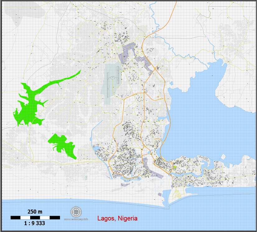
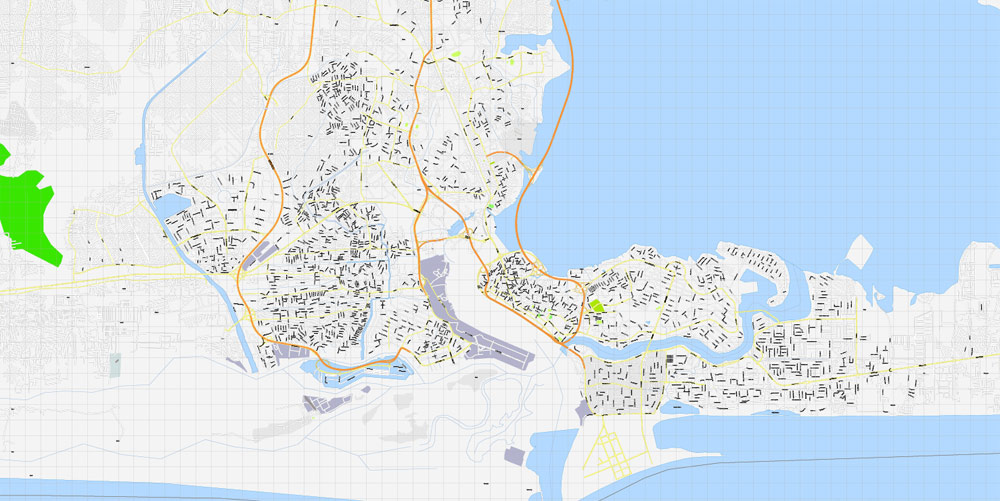
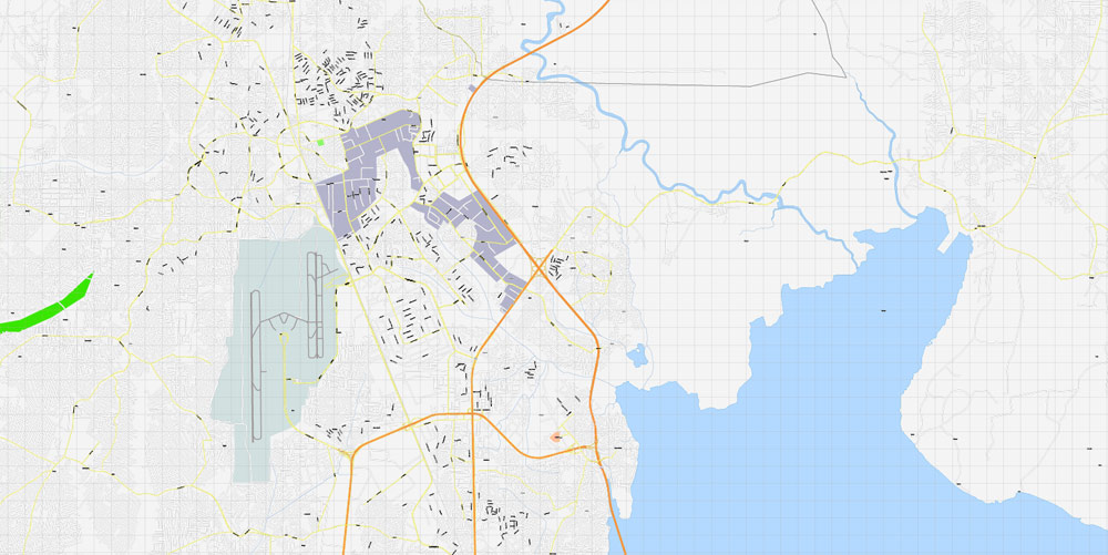
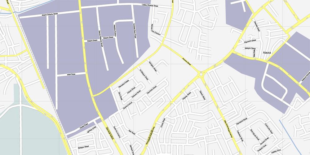
Lagos, Nigeria, printable exact vector map G-View level 16 (250 meters) street City Plan full editable, Adobe Illustrator, full vector, scalable, editable text format street names, 6 mb ZIP
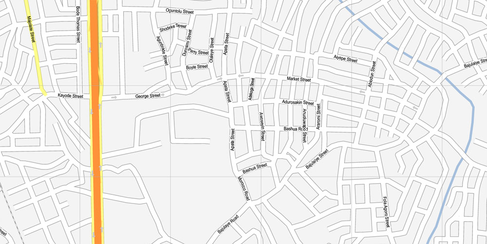
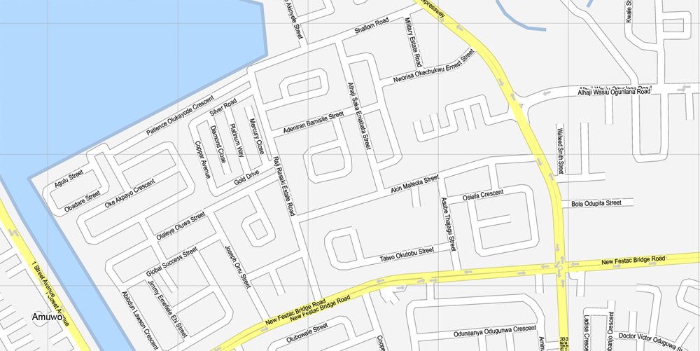
All streets, No buildings.
Map for publishing, design, printing, arts, projects, presentations, for architects, designers and builders, business, logistics. The most accurate and detailed map.
DWG, DXF, CDR and other formats – on request, same price, please, contact
Lagos, Nigeria.
This vector map of Lagos city is used as a basis for design, editing, and further printing.
This is the most detailed, exact map of Lagos city for high-quality printing and polygraphy. You can always clarify the map development date by contacting us.
For your convenience, all objects on Lagos vector city map are divided into layers. And the editing is very easy – colors, lines, etc.
You can easily add any objects needed (e.g. shops, salons, sale points, gas station or attraction) on any layer of Lagos vector map.
Lagos is a city in the Nigerian state of Lagos. The city, with its adjoining conurbation, is the most populous in Nigeria, and the most populous on the African continent. It is one of the fastest growing cities in the world, and also one of the most populous urban agglomerations. Lagos is a major financial centre in Africa; the megacity has the highest GDP, and also houses one of the largest and busiest seaports on the continent.
One of the advantages of Lagos city vector maps of our production is the relevance of cartographic data, we constantly update all our products.
This vector map of Lagos city is used by:
designers, layout designers, printers, advertisers and architects. Our product – vector maps – is designed for further editing and printing in large formats – from @Wall format (a few meters) to A-0 and A-1, A-2, A-3.
The Lagos city map in vector format is used for design, urban planning, presentations and media visualizations.
The advertising and presentation map of Lagos city (usually the final designer marks the routes, and puts the client’s objects (shops, saloons, gas stations etc.)
The undoubted advantage is that people will NEVER throw out this advertising product – the map. In fact, as an advertising medium, a city map is the most “long-playing” of the well-known polygraphic advertising media, with the longest lifespan, and the maximum number of interactions with the customer.
Lagos initially emerged as a port city that originated on a collection of islands, which are contained in the present day Local Government Areas (LGAs) of Lagos Island, Eti-Osa, Amuwo-Odofin and Apapa; the islands are separated by creeks, fringing the southwest mouth of Lagos Lagoon, while protected from the Atlantic Ocean by barrier islands and long sand spits such as Bar Beach, which stretch up to 100 km (62 mi) east and west of the mouth.
For travelers, maps are sold at the airports and gas stations around the world. Often the source is our vector maps.
Take a look, who purchases our vector maps of Lagos city in “Our Clients and Friends” page – these are large and small companies, from super-brands like Volvo and Starbucks, to small design studios and printing houses.
It’s very easy to work with vector maps of Lagos city, even for a not very experienced designer who can turn on and off the map layers, add new objects, change the colors of fill and lines according to customer requirements.
The undoubted advantage of Lagos city vector maps in printing is an excellent and detailed visualization, when customer can expand a large paper map and instantly define his location, find a landmark, an object or address on map, unlike using the popular electronic formats of Google and Yandex maps for example.
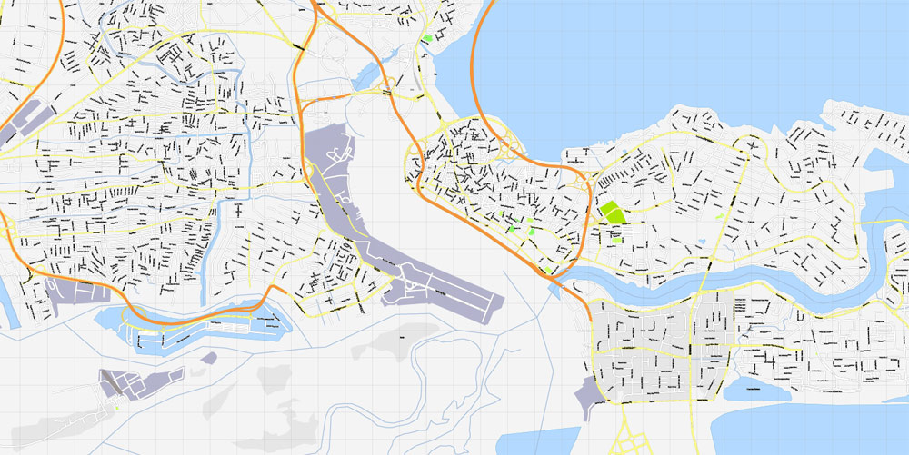
Due to rapid urbanization, the city expanded to the west of the lagoon to include areas in the present day Lagos Mainland, Ajeromi-Ifelodun and Surulere. This led to the classification of Lagos into two main areas: the Island, which was the initial city of Lagos, before it expanded into the area known as the Mainland. This city area was governed directly by the Federal Government through the Lagos City Council, until the creation of Lagos State in 1967, which led to the splitting of Lagos city into the present day seven Local Government Areas (LGAs), and an addition of other towns (which now make up 13 LGAs) from the then Western Region, to form the state.
Printable vector maps of Lagos city are much more convenient and efficient than any electronic maps on your smartphone, because ALL DETAILS are displayed in the entire space of Lagos city map.
Useful tips on working with vector maps of cities and countries in Adobe Illustrator.
«V» – launches the Selection tool (cursor, black arrow), which makes active any vector line.
«А» – launches the Direct Selection tool (white cursor), allows you to select curve elements and drag them to the desired place.
«R» – activates the Rotate tool, which helps you rotating selected objects around the center point by 360 degrees.
«E» – gives you the opportunity to use the Eraser tool and erase unnecessary parts.
«X» – switches between Fill and Stroke in the Tools section. Try to get used to this hot key and
you will quickly understand that you can’t live and work without it.
Lagos, the capital of Nigeria since its amalgamation in 1914, went on to become the capital of Lagos State after its creation. However, the state capital was later moved to Ikeja in 1976, and the federal capital moved to Abuja in 1991. Even though Lagos is still widely referred to as a city, the present day Lagos, also known as “Metropolitan Lagos”, and officially as “Lagos Metropolitan Area” is an urban agglomeration or conurbation, consisting of 20 LGAs,32 LCDAs including Ikeja, the state capital of Lagos State. This conurbation makes up 37% of Lagos State’s total land area, but houses about 85% of the state’s total population.
Guides are not limited to vertical and horizontal in Adobe Illustrator. You can also create a diagonal guide for example. Moreover, you can turn any contours into guides. Select the outline and go to View > Guides > Make Guides (Create Guides), or simply press Cmd/Ctrl + 5. You can also turn the guides back into an editable object. Go to menu, View > Guides > Unlock Guides (Release Guides), select the guide you want to edit and select View > Guides > Release Guides (Reset Guides), or just press Cmd/Ctrl + Option / Alt + 5).
You will probably want to change the color scheme used on our Lagos vector city map.
To quickly and effectively play with colors.
Of course, you can do it manually, all objects in our Lagos city vector map are divided according to types and layers, and you can easily change the color gamma of vector objects in groups and layers.
The exact population of Metropolitan Lagos is disputed. In the 2006 federal census data, the conurbation had a population of about 8 million people. However, the figure was disputed by the Lagos State Government, which later released its own population data, putting the population of Lagos Metropolitan Area at approximately 16 million. As at 2015, unofficial figures put the population of “Greater Metropolitan Lagos”, which includes Lagos and its surrounding metro area, extending as far as into Ogun State, at approximately 21 million.
But there is more effective way of working with the whole VECTOR MAP of Lagos city and all layers:
The overview dialog «Edit colors»/«Repaint Graphic Object» (this dialog box name can change depending on the context):
If you have selected a part or a layer of Lagos city vector map and open the dialog box by clicking the icon in the Control panel, on the Samples palette or the Color Catalog, or if you choose Edit > Edit Colors> Repaint Graphic Object, then the «Repaint Graphic Object» dialog box appears, and you get access to «Assign» and «Edit» tabs.
If a picture or a map fragment is not selected, and you open the dialog box by clicking the icon in the Control panel, on the Samples palette or in the Color Catalog, the «Edit Colors» dialog box appears and you can only access the «Edit» tab.
Regardless of the name at the top of the dialog box, the right-hand side always displays the color group of the current document, as well as two default color groups: Print Color and Grayscale. These color groups can be selected and used any time.
Geography
The Island is a loose geographical term that is used to define the area of Lagos that is separated from the “mainland” by the main channel draining the lagoon into the Atlantic Ocean, which forms Lagos Harbour. The Island is mainly a collection of islands that are separated from each other by creeks of varying sizes and are connected together by bridges. The smaller sections of some creeks have been dredged and built over. This part of Lagos is the area where most business activities and entertainment events in Lagos takes place.
Create and edit color groups of Lagos city vector map, and also assign colors using the «Edit Colors»/ а «Repaint Graphic Object» dialog box.
A. Creating and editing of a color group on the «Edit» tab
B. Assigning colors on the «Assign» tab
C. Select a group of colors from the «Color groups» list
The option «Repaint a graphic object» in the lower part of the dialog box allows you to preview the colors on a selected layer of Vector map, or a group of elements, and specify whether its colors will be redefined when the dialog box is closed.
The main areas of the dialog box are:
«Edit»
The «Edit» tab is designed to create a new or edit the existing color groups.
The harmony rules Menu and the Color Wheel are used to conduct experiments with color harmonies. The color wheel shows how colors are related in color harmony, and the color bars allow you to view and manipulate an individual color values. In addition, you can adjust the brightness, add and remove colors, save color groups and view colors on the selected Vector Map of Lagos city or a separated layers.
It also houses most of the upscale residential areas in Lagos. The Local Government areas that are considered to be in the Island include Lagos Island, Amuwo-Odofin, Apapa (sometimes also regarded as being on the mainland), and Eti-Osa. The major upscale island neighbourhoods within these LGAs include Ikoyi and Victoria Island. Three major bridges join the island to the mainland. They are the Carter Bridge, which starts from Iddo; the Eko Bridge (formerly called the Second Mainland Bridge); and the Third Mainland Bridge, which passes through densely populated mainland suburbs.
«Assign»
The «Assign» tab is used to view and control on how the original colors are replaced with colors from the color group like your corporate colors in the Vector Map of Lagos city.
The assign color ability is provided only if the entire map, layer or fragment is selected in the document. You can specify which of new colors replace the current colors, whether the spot colors should be preserved and how colors are replaced (for example, you can replace colors completely or changing the color tone while maintaining the brightness). The «Assign» tab allows you to redefine colors in the Vector Map of Lagos city, or in separate layers and fragments using the current color group or reducing the number of colors in the current Vector Map.
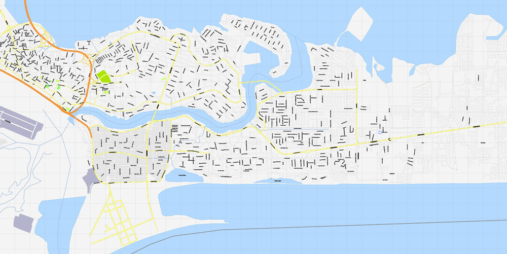
Lagos Island contains a central business district. This district is characterised by high-rise buildings. The island also contains many of the city’s largest wholesale marketplaces (such as the popular Idumota and Balogun Markets). It also has the National Museum of Nigeria, the Central Mosque, the Glover Memorial Hall, Christ’s Church Cathedral (CMS) and the Oba’s Palace (Iga Idunganran). Another major part of Lagos Island is Marina.
Color groups
Is a list of all saved color groups for current document (the same groups appear in the «Samples» palette). You can edit and delete the existing color groups, as well as creating a new ones using the list of “Color Groups” in the dialog box. All changes appear in the «Samples» palette.
The highlighted color group shows, which color group is currently edited.
Any color group can be selected and edited, or used to redefine the colors in the selected vector map of Lagos city, its fragments or elements.
Saving a color group adds this group to the specified list.
Opening the «Edit Colors»/«Repaint Graphic Object» dialog box.
Open the «Edit Colors»/«Repaint Graphic Object» dialog box using one of the following methods:
«Edit»> «Edit Colors»> «Repaint Graphic object» or «Repaint With Style».
It borders around the idumota and Balogun markets and houses major Banking institutions. Though formerly in a derelict condition, Lagos Island’s Tinubu Square is a site of historical importance; it was here that the Amalgamation Ceremony that unified the North and South protectorate to form Nigeria took place in 1914.
Use these commands if you need to edit the colors in the selected vector map of Lagos city.
«Repaint Graphic object» button on the «Control» panel.
Use this button if you need to adjust colors of Lagos city vector map using the а «Repaint graphic object» dialog box.
The specified button is available if the selected vector map or its fragment contains two or more colors.
Note. This color editing method is convenient for global color adjustment in a vector map, if global colors were not used when creating a City Map of Lagos.
The «Edit colors» button or «Edit or apply colors» on the «Color Catalog» palette
Click this button if you need to edit colors on the «Color Catalog» palette or edit and then apply them to the selected Vector Map of Lagos city or its fragment.
Ikoyi
Ikoyi is situated on the eastern half of Lagos Island and joined to it by a land fill. Ikoyi is also connected to Victoria Island by Falomo bridge, which carries a main road over Five Cowrie creek. Ikoyi housed the headquarters of the federal government of Nigeria and other buildings owned by the government, including the old federal secretariat complex. The complex today is on reestablishment.
The «Edit color group» button or «Edit or apply color group» on the «Samples» palette.
Click this button if you need to edit the colors in the specific color group or edit and apply them to the selected Vector Map of Lagos city or a group of its elements, for example, the whole layer “Streets and lines”. You can also double-click the color group in the Samples panel to open the dialog box.
If the map file is too large and your computer freezes or even can’t open it quickly:
1. Try to reduce the color resolution of the video card (display) to 256 colors while working with a large map.
2. Using Windows Task Manager, select all the application you don’t need, while working with map, just turn them off.
3. Launch Adobe Illustrator. (DO NOT OPEN the vector map file)
4. Start the Windows Task Manager using administrator rights > Find the “Illustrator” process > set the «real time» priority,
5. Open the file. When you see the LEGACY FONT popup window – click “OK” (do not update). You can restore the TEXT later.
6. Can also be useful: When file is opened – Edit > Settings > Basic Settings > disable smoothing. /// It looks scary, but works quickly)))
We recommend saving the file in Adobe Illustrator 10 version. It’s much more stable when working with VERY BIG size files.
In Ikoyi there are military and police barracks, a top-security prison and a federal high court of Nigeria. Ikoyi also has a number of hotels, night clubs, a recreational park and one of Africa’s largest golf courses. Originally a middle class neighbourhood, in recent years, it has become a fashionable residential enclave for the upper middle class to the upper class. There are also commercial activities in Ikoyi, which is spotted in increasing number of offices, banks, and shopping complexes. The commercial section is concentrated in the South-West.
Victoria Island
Victoria Island with its annexe is situated to the south of Lagos Island. It has expensive real estate properties and for that reason, many new luxury condos and apartments are blooming up everywhere. Along with Ikoyi, Victoria Island occupies a major area in Lagos that boasts of several sizeable shopping districts. On its sea shore along the Atlantic front, there is environmentally reconstructed Bar Beach.
Iddo
Across the main channel of the lagoon from Lagos Island, there is a smaller settlement called Iddo. Iddo is also a railroad terminus and it is now situated in the Lagos Mainland local government area after it was connected to the mainland like a peninsula.
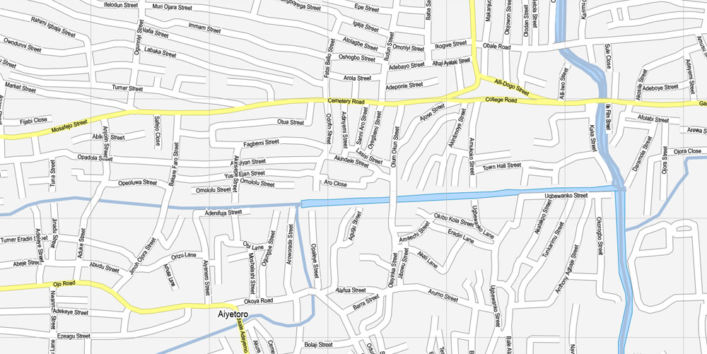
Mainland
A huge population of Lagosians also live on the Lagos mainland, and most industries are located there. The mainland is known for its music and nightlife, which used to be located in areas around Yaba and Surulere. However, in recent years more night clubs have sprung up on the Island, making the Island (particularly Victoria Island and Lekki Phase 1) the main nightlife attractions. Mainland LGAs include Surulere, Ajeromi-Ifelodun and Lagos Mainland. Metropolitan Lagos suburban LGAs include: Agege, Apapa, Mushin, Oshodi-Isolo and Ikeja (site of Murtala Muhammed International Airport and the capital of Lagos State).
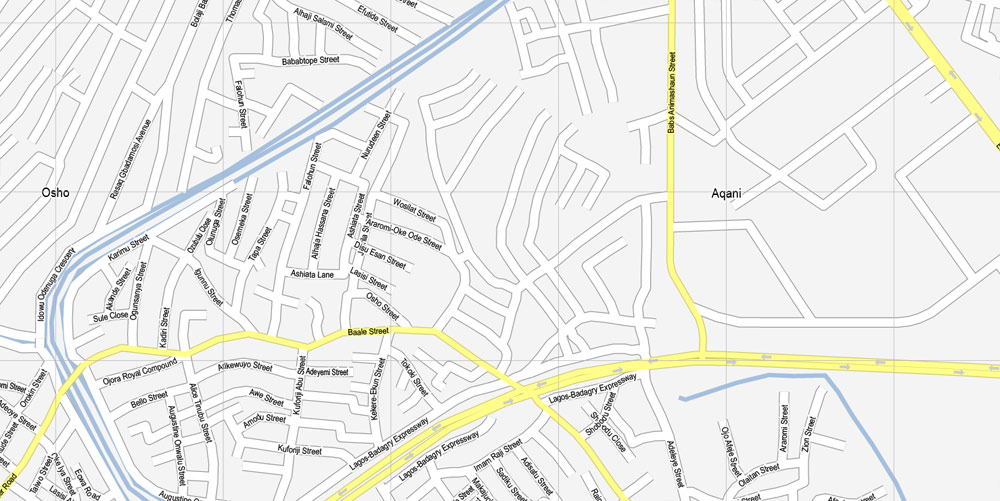
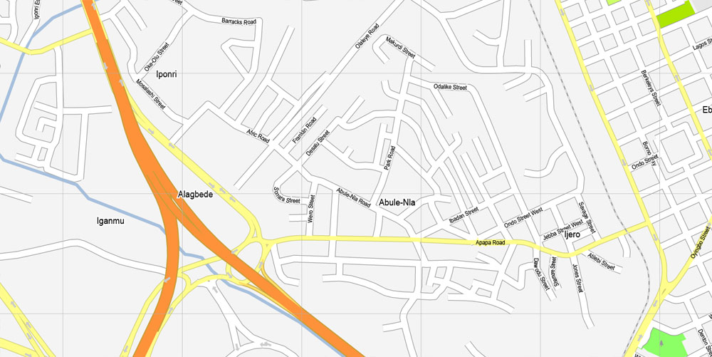
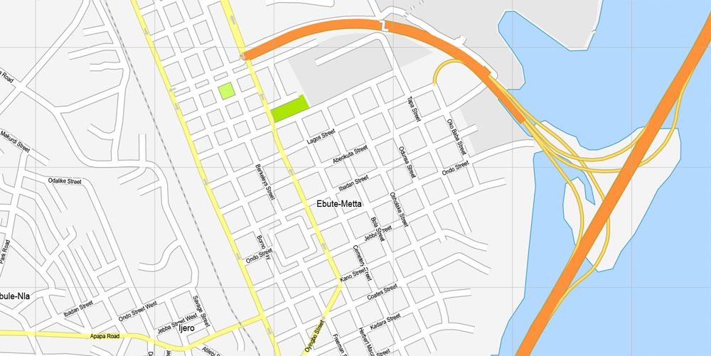
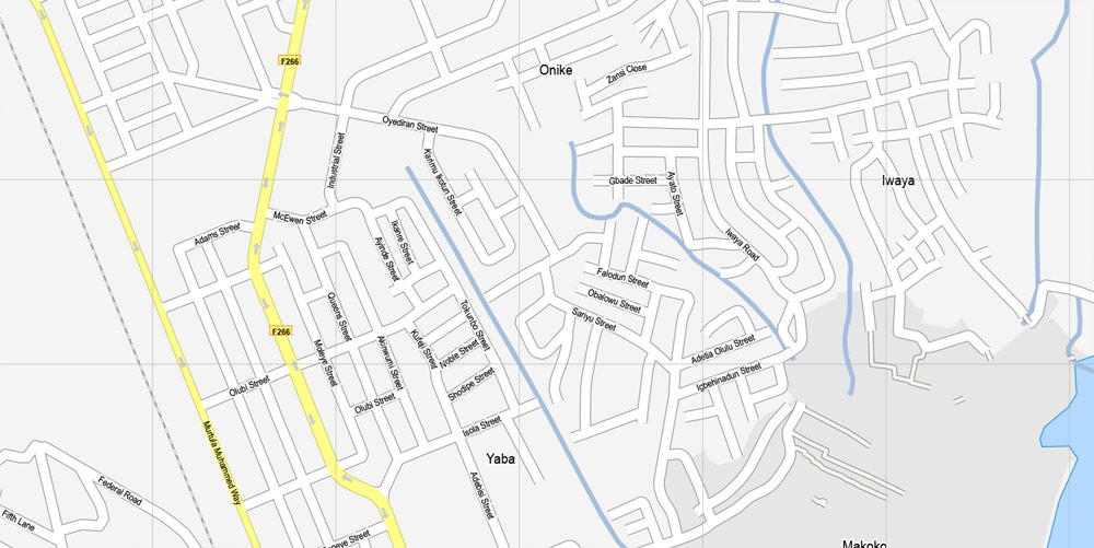
Major Areas on the mainland include Ebute Metta, Yaba and Ejigbo. Some rivers, like Badagry Creek, flow parallel to the coast for some distance before exiting through the sand bars to the sea.

 Author: Kirill Shrayber, Ph.D. FRGS

