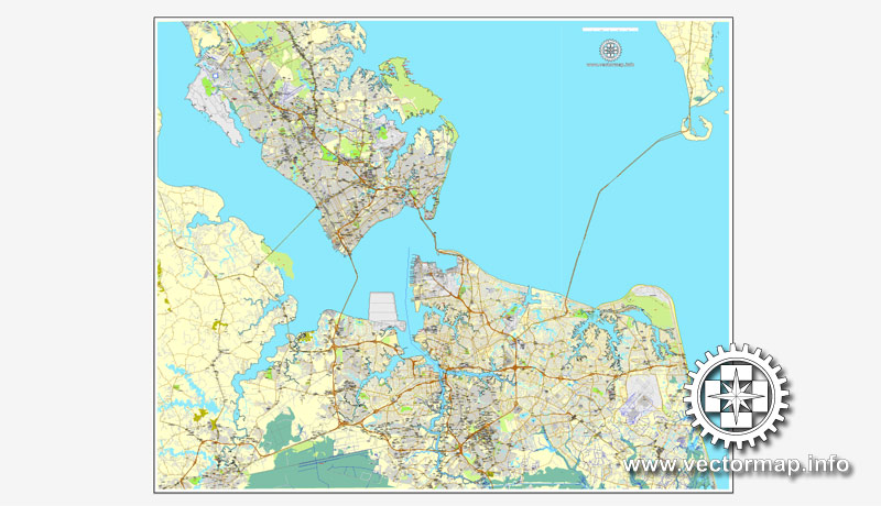
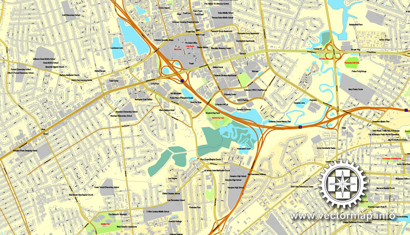
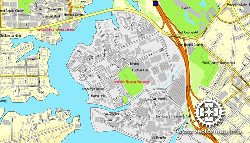
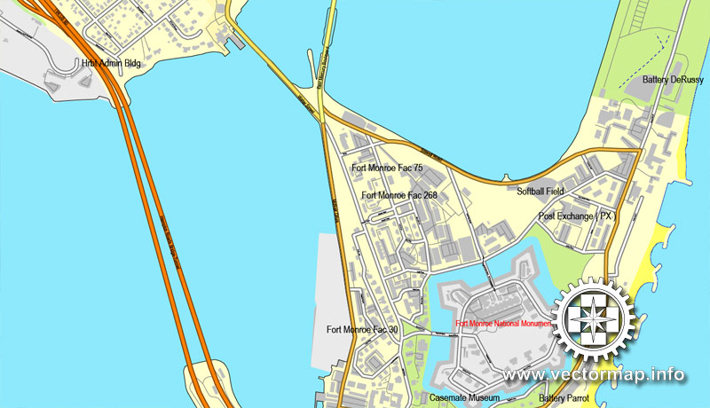
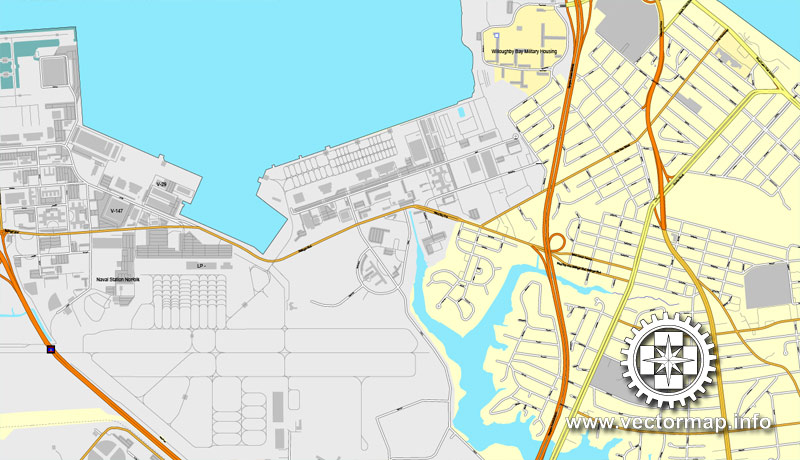
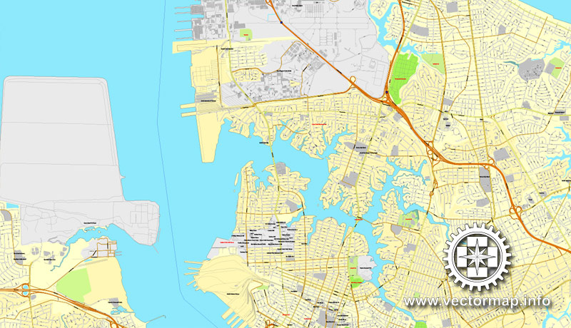
Hampton Roads, Virginia, US, vector map V.2 Adobe Illustrator, full vector, scalable, editable, text format street names, 44,2 mb ZIP
All streets, some more buildings. Map for design, print, arts, projects, presentations,
for architects, designers and builders.
CDR, DWG, DXF and other formats – on demand, same price, please, contact
Hampton Roads, Virginia, USA.
This vector map of Hampton Roads is used as a basis for design, editing, and further printing.
This is the most detailed, exact map of Hampton Roads for high-quality printing and polygraphy. You can always clarify the map development date by contacting us.
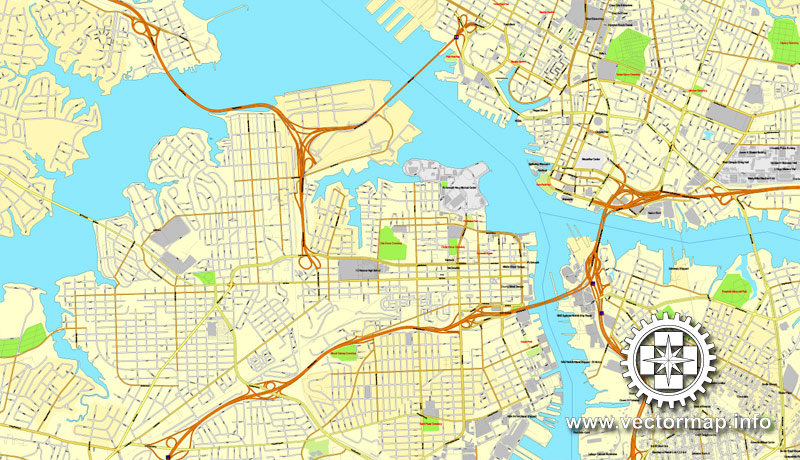
For your convenience, all objects on Hampton Roads vector map are divided into layers. And the editing is very easy – colors, lines, etc.
You can easily add any objects needed (e.g. shops, salons, sale points, gas station or attraction) on any layer of Hampton Roads vector map.
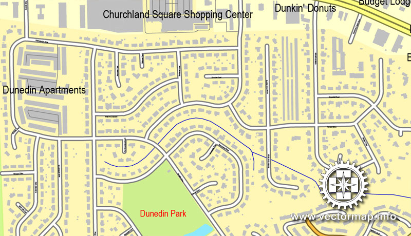
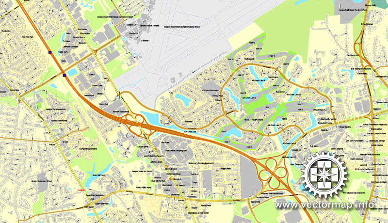
Hampton Roads is the name of both a body of water that serves as a wide channel for the James, Nansemond and Elizabeth rivers between Old Point Comfort and Sewell’s Point where the Chesapeake Bay flows into the Atlantic Ocean and the surrounding metropolitan region located in the Southeastern Virginia and Northeastern North Carolina portions of the Tidewater region.
One of the advantages of Hampton Roads vector maps of our production is the relevance of cartographic data, we constantly update all our products.
This vector map of Hampton Roads is used by:
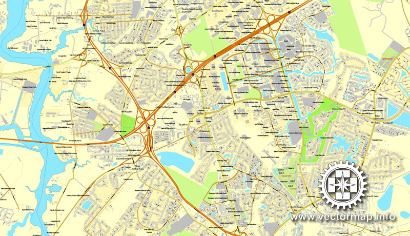
designers, layout designers, printers, advertisers and architects. Our product – vector maps – is designed for further editing and printing in large formats – from @Wall format (a few meters) to A-0 and A-1, A-2, A-3.
Hampton Roads map in vector format is used for design, urban planning, presentations and media visualizations.
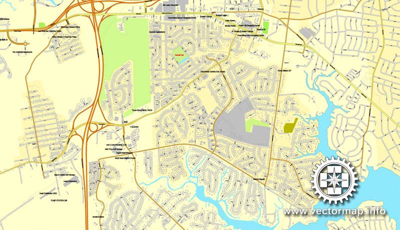
Advertising and presentation map of Hampton Roads (usually the final designer marks the routes, and puts the client’s objects (shops, saloons, gas stations etc.)
The undoubted advantage is that people will NEVER throw out this advertising product – the map. In fact, as an advertising medium, a map is the most “long-playing” of the well-known polygraphic advertising media, with the longest lifespan, and the maximum number of interactions with the customer.
For travelers, maps are sold at the airports and gas stations around the world. Often the source is our vector maps.
Take a look, who purchases our vector maps of Hampton Roads in “Our Clients and Friends” page – these are large and small companies, from super-brands like Volvo and Starbucks, to small design studios and printing houses.
It’s very easy to work with vector maps of Hampton Roads, even for a not very experienced designer who can turn on and off the map layers, add new objects, change the colors of fill and lines according to customer requirements.
The undoubted advantage of Hampton Roads vector maps in printing is an excellent and detailed visualization, when customer can expand a large paper map and instantly define his location, find a landmark, an object or address on map, unlike using the popular electronic formats of Google and Yandex maps for example.
Printable vector maps of Hampton Roads are much more convenient and efficient than any electronic maps on your smartphone, because ALL DETAILS are displayed in the entire space of Hampton Roads map.
Useful tips on working with vector maps of cities and countries in Adobe Illustrator.
«V» – launches the Selection tool (cursor, black arrow), which makes active any vector line.
«А» – launches the Direct Selection tool (white cursor), allows you to select curve elements and drag them to the desired place.
«R» – activates the Rotate tool, which helps you rotating selected objects around the center point by 360 degrees.
«E» – gives you the opportunity to use the Eraser tool and erase unnecessary parts.
«X» – switches between Fill and Stroke in the Tools section. Try to get used to this hot key and
you will quickly understand that you can’t live and work without it.
Guides are not limited to vertical and horizontal in Adobe Illustrator. You can also create a diagonal guide for example. Moreover, you can turn any contours into guides. Select the outline and go to View > Guides > Make Guides (Create Guides), or simply press Cmd/Ctrl + 5. You can also turn the guides back into an editable object. Go to menu, View > Guides > Unlock Guides (Release Guides), select the guide you want to edit and select View > Guides > Release Guides (Reset Guides), or just press Cmd/Ctrl + Option / Alt + 5).
You will probably want to change the color scheme used on our Hampton Roads vector map.
To quickly and effectively play with colors.
Of course, you can do it manually, all objects in our Hampton Roads vector map are divided according to types and layers, and you can easily change the color gamma of vector objects in groups and layers.
But there is more effective way of working with the whole VECTOR MAP of Hampton Roads and all layers:
The overview dialog «Edit colors»/«Repaint Graphic Object» (this dialog box name can change depending on the context):
If you have selected a part or a layer of Hampton Roads vector map and open the dialog box by clicking the icon in the Control panel, on the Samples palette or the Color Catalog, or if you choose Edit > Edit Colors> Repaint Graphic Object, then the «Repaint Graphic Object» dialog box appears, and you get access to «Assign» and «Edit» tabs.
If a picture or a map fragment is not selected, and you open the dialog box by clicking the icon in the Control panel, on the Samples palette or in the Color Catalog, the «Edit Colors» dialog box appears and you can only access the «Edit» tab.
Regardless of the name at the top of the dialog box, the right-hand side always displays the color group of the current document, as well as two default color groups: Print Color and Grayscale. These color groups can be selected and used any time.
Create and edit color groups of Hampton Roads vector map, and also assign colors using the «Edit Colors»/ а «Repaint Graphic Object» dialog box.
A. Creating and editing of a color group on the «Edit» tab
B. Assigning colors on the «Assign» tab
C. Select a group of colors from the «Color groups» list
The option «Repaint a graphic object» in the lower part of the dialog box allows you to preview the colors on a selected layer of Vector map, or a group of elements, and specify whether its colors will be redefined when the dialog box is closed.
The main areas of the dialog box are:
«Edit»
The «Edit» tab is designed to create a new or edit the existing color groups.
The harmony rules Menu and the Color Wheel are used to conduct experiments with color harmonies. The color wheel shows how colors are related in color harmony, and the color bars allow you to view and manipulate an individual color values. In addition, you can adjust the brightness, add and remove colors, save color groups and view colors on the selected Vector Map of Hampton Roads or a separated layers.
«Assign»
The «Assign» tab is used to view and control on how the original colors are replaced with colors from the color group like your corporate colors in the Vector Map of Hampton Roads.
The assign color ability is provided only if the entire map, layer or fragment is selected in the document. You can specify which of new colors replace the current colors, whether the spot colors should be preserved and how colors are replaced (for example, you can replace colors completely or changing the color tone while maintaining the brightness). The «Assign» tab allows you to redefine colors in the Vector Map of Hampton Roads, or in separate layers and fragments using the current color group or reducing the number of colors in the current Vector Map.
Color groups
Is a list of all saved color groups for current document (the same groups appear in the «Samples» palette). You can edit and delete the existing color groups, as well as creating a new ones using the list of “Color Groups” in the dialog box. All changes appear in the «Samples» palette.
The highlighted color group shows, which color group is currently edited.
Comprising the Virginia Beach–Norfolk–Newport News, VA–NC metropolitan area and an extended Combined Statistical Area that includes the Elizabeth City, NC Micropolitan Statistical Area and Kill Devil Hills, NC Micropolitan Statistical Area, Hampton Roads is known for its large military presence, ice-free harbor, shipyards, coal piers, and miles of waterfront property and beaches, all of which contribute to the diversity and stability of the region’s economy.
Any color group can be selected and edited, or used to redefine the colors in the selected vector map of Hampton Roads, its fragments or elements.
Saving a color group adds this group to the specified list.
Opening the «Edit Colors»/«Repaint Graphic Object» dialog box.
Open the «Edit Colors»/«Repaint Graphic Object» dialog box using one of the following methods:
«Edit»> «Edit Colors»> «Repaint Graphic object» or «Repaint With Style».
Use these commands if you need to edit the colors in the selected vector map of Hampton Roads.
«Repaint Graphic object» button on the «Control» panel.
Use this button if you need to adjust colors of Hampton Roads vector map using the а «Repaint graphic object» dialog box.
The specified button is available if the selected vector map or its fragment contains two or more colors.
Note. This color editing method is convenient for global color adjustment in a vector map, if global colors were not used when creating a Map of Hampton Roads.
The «Edit colors» button or «Edit or apply colors» on the «Color Catalog» palette
Click this button if you need to edit colors on the «Color Catalog» palette or edit and then apply them to the selected Vector Map of Hampton Roads or its fragment.
The «Edit color group» button or «Edit or apply color group» on the «Samples» palette.
Click this button if you need to edit the colors in the specific color group or edit and apply them to the selected Vector Map of Hampton Roads or a group of its elements, for example, the whole layer “Streets and lines”. You can also double-click the color group in the Samples panel to open the dialog box.
If the map file is too large and your computer freezes or even can’t open it quickly:
1. Try to reduce the color resolution of the video card (display) to 256 colors while working with a large map.
2. Using Windows Task Manager, select all the application you don’t need, while working with map, just turn them off.
3. Launch Adobe Illustrator. (DO NOT OPEN the vector map file)
4. Start the Windows Task Manager using administrator rights > Find the “Illustrator” process > set the «real time» priority,
5. Open the file. When you see the LEGACY FONT popup window – click “OK” (do not update). You can restore the TEXT later.
6. Can also be useful: When file is opened – Edit > Settings > Basic Settings > disable smoothing. /// It looks scary, but works quickly)))
We recommend saving the file in Adobe Illustrator 10 version. It’s much more stable when working with VERY BIG size files.
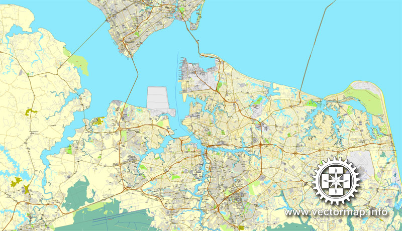
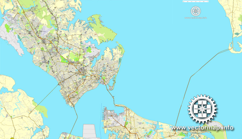
The body of water known as Hampton Roads is one of the world’s largest natural harbors (more accurately a roadstead or “roads”). It incorporates the mouths of the Elizabeth River, Nansemond River, and James River with several smaller rivers and empties into the Chesapeake Bay near its mouth leading to the Atlantic Ocean.
The land area includes a collection of cities, counties and towns on the Virginia Peninsula and in South Hampton Roads. Some of the outlying areas further from the harbor may or may not be included as part of “Hampton Roads”, depending upon the organization or usage. For example, as defined for federal economic purposes, the Hampton Roads metropolitan statistical area (MSA) includes two counties in northeastern North Carolina and two counties in Virginia’s Middle Peninsula. The Virginia Beach–Norfolk–Newport News, VA–NC MSA has a population of over 1.7 million, making it the 37th-largest metropolitan area in the United States. The Combined Statistical Area includes four additional counties in North Carolina, pushing the regional population to over 1.8 million residents, the 32nd largest CSA in the country.
The area is home to hundreds of historical sites and attractions. The harbor was the key to Hampton Roads’ growth, both on land and in water-related activities and events. While the harbor and its tributaries were (and still are) important transportation conduits, at the same time they presented obstacles to land-based commerce and travel.
Creating and maintaining adequate infrastructure has long been a major challenge. The Hampton Roads Bridge–Tunnel (HRBT) and the Monitor–Merrimac Memorial Bridge–Tunnel (MMMBT) are major harbor crossings of the Hampton Roads Beltway interstate, which links the large population centers of Hampton Roads. In 2007, the Hampton Roads Transportation Authority (HRTA) was formed under a controversial state law to levy various additional taxes, fees, and tolls to generate funding for major regional transportation projects, including a long-sought but costly third crossing of the harbor of Hampton Roads.
Geography
The metropolitan area and water area is located in the Tidewater region, a low-lying plains region that composes of Southeastern portions of Virginia and Northeastern portions of North Carolina.
The water area known as Hampton Roads is a wide channel through which the waters of the James River, Nansemond River, and Elizabeth River pass (between Old Point Comfort to the north and Sewell’s Point to the south) into the Chesapeake Bay and the Atlantic Ocean.
Norfolk and Hampton Roads are among the worst-hit parts of the United States regarding effects of global warming. As of 2016, the region is a few decades ahead in feeling the effects of sea-level rise compared to many American coastal areas.
The geology and topography of the Hampton Roads region is influenced by the Chesapeake Bay Impact Crater which is one of three factors contributing to the sinking of Hampton Roads at a rate between 15 and 23 centimeters (5.9 and 9.1 inches) per century.
The region has extensive natural areas, including 26 miles (42 km) of Atlantic Ocean and Chesapeake Bay beaches, the Great Dismal Swamp, picturesque rivers, state parks, wildlife refuges, and botanical gardens. Inland from the bay, the region includes Lake Drummond, one of only two natural lakes found in Virginia, and miles of waterfront property along the various rivers and waterways. The region’s native flora is consistent with that of the Southeast Coastal Plain and the lower Southeast Maritime Forest.
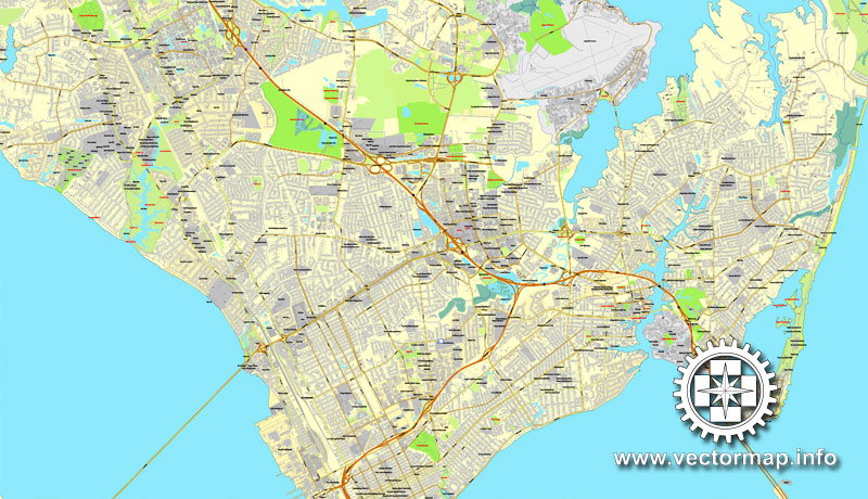
The land area which constitutes “Hampton Roads” varies depending upon perspective and purpose. Most of the land area of Hampton Roads is geographically divided into 2 smaller regions: the eastern portion of the Virginia Peninsula (the Peninsula) and South Hampton Roads (locally known as “the Southside”), which are separated by the harbor. When speaking of communities of Hampton Roads, virtually all sources (including the three discussed in the following paragraphs) include the seven major cities, two smaller ones, and three counties within those two subregions.
In addition, the Middle Peninsula counties of Gloucester and Mathews, while not part of the geographical Hampton Roads area, are included in the vast metropolitan region’s population. Also, a small portion of northeastern North Carolina (Currituck County) is included in the region’s statistics. Due to a peculiarity in the drawing of the Virginia-North Carolina border, Knott’s Island in that county is connected to Virginia by land, but is only accessible to other parts of North Carolina across waterways via a ferry system.
Each of the following current cities, counties and towns is included by at least one of the three organizations that define “Hampton Roads”
Hampton is a Hampton Roads community.
The Hampton Roads area consists of nine independent cities (which are not part of any county). Chesapeake, Norfolk, Portsmouth, Suffolk, and Virginia Beach cover the Southside of Hampton Roads while Hampton, Newport News, Poquoson, and Williamsburg reside on the Peninsula. Franklin borders Suffolk but the Census Bureau does not consider it as a part of the metro area.
The metro area has one county in North Carolina, Currituck. The remaining counties, in Virginia, include Isle of Wight and Surry on the Southside, James City and York on the Virginia Peninsula, and Gloucester and Mathews on the Middle Peninsula. While Southampton is adjacent to Surry, Isle of Wight, and the City of Suffolk, the Census Bureau does not consider it part of the metro area.
Five incorporated towns reside in the metro area including Claremont in Surry County, Dendron in Surry County, Smithfield in Isle of Wight County, Surry, Surry County’s seat, and Windsor in Isle of Wight County. (Two other incorporated towns, Boykins and Courtland are located in Southampton County, and therefore, like the county within which they are located, are not part of the federally defined metropolitan area).
Other unincorporated towns and communities in the metropolitan area which are not within its cities include Gloucester Courthouse and Gloucester Point in Gloucester County, Isle of Wight Courthouse, Rushmere, Rescue, Carrollton, Benns Church, and Walters in Isle of Wight County, Yorktown, Grafton, Seaford, and Tabb in York County, Jamestown, Ford’s Colony, Grove, Lightfoot, Toano, and Norge in James City County, Moyock, Knotts Island, and Currituck in Currituck County, North Carolina.
The Hampton Roads MSA, with a population of about 1.7 million, is the seventh largest metropolitan area in the Southeastern United States after Washington metropolitan area, Miami–Fort Lauderdale–Pompano Beach, FL MSA, Atlanta–Sandy Springs–Marietta, GA MSA, Tampa–St. Petersburg–Clearwater, FL MSA, Orlando–Kissimmee, FL MSA, and Charlotte–Gastonia-Rock Hill, NC–SC MSA.
Small guide: How to work with the vector map?
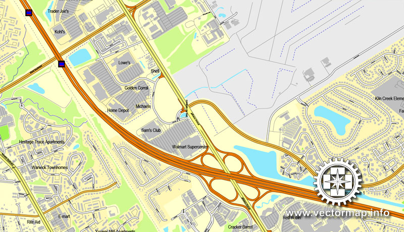
You can: Mass select objects by type and color – for example, the objects type “building” (they are usually dark gray) – and remove them from the map, if you do not need them in your print or design project. You can also easily change the thickness of lines (streets), just bulk selection the road by the line color.
The streets are separated by type, for example, type “residential road” are usually white with a gray stroke. Highway usually orange with a brown or dark gray stroke.
All objects are divided by types: different types of roads and streets, polygons of buildings, landfills, urban areas, parks and more other.
It is easy to change the font of inscriptions, all or each individually. Also, just can be make and any other manipulation of objects on the vector map in Adobe illustrator format.
Important: All the proportions on the map are true, that is, the relative sizes of the objects are true, because Map is based on an accurate GPS projection, and It transated into the (usual for all) the Mercator projection.
You can easily change the color, stroke and fill of any object on the map, zoom without loss of quality Image Verification.
Select object

Bulk selection the same objects on the vector map

See the bulk selected objects on the vector map

Bulk delete buildungs from the vector map

Select residencial road (small street) on the vector map

Bulk selection the same lines (streets, roads) on the full map

Create fat lines of the streets on the vector maps (bulk action) 1

Create fat lines of the streets on the vector maps (bulk action) 2

Create fat lines of the streets on the vector maps (bulk action) 3

You can easily change the color, stroke and fill of any object on the map, zoom without loss of quality Image Verification.

 Author: Kirill Shrayber, Ph.D. FRGS
 City Plan editable Adobe Illustrator Street Map in layers")
