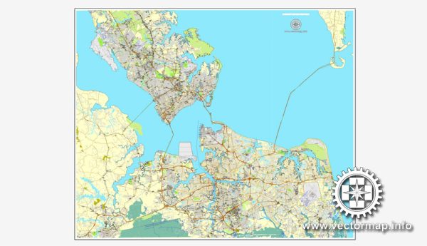
Hampton Roads, which includes cities like Norfolk, Newport News, Chesapeake, and Portsmouth in Virginia, has a well-developed transportation infrastructure due to its strategic location as a major port and military hub.
Vectormap.Net provide you with the most accurate and up-to-date vector maps in Adobe Illustrator, PDF and other formats, designed for editing and printing. Please read the vector map descriptions carefully.
- Road Transportation:
- Interstate Highways: Hampton Roads is served by several major highways, including I-64, I-264, I-464, and I-664, facilitating the movement of goods and people within the region.
- Highway Tunnels and Bridges: The area is known for its tunnels and bridges, such as the Hampton Roads Bridge-Tunnel, Monitor-Merrimac Memorial Bridge-Tunnel, and the Chesapeake Bay Bridge-Tunnel, which connect the various cities and aid in the flow of traffic.
- Public Transportation:
- Hampton Roads Transit (HRT): HRT provides public transportation services in the region, including buses, paratransit, and light rail. The Tide, a light rail system, connects Norfolk with Virginia Beach.
- Air Transportation:
- Norfolk International Airport (ORF): Located in Norfolk, this airport serves the entire Hampton Roads region and offers domestic and limited international flights.
- Port Facilities:
- Port of Virginia: The Port of Virginia, with terminals in Norfolk and Portsmouth, is a major East Coast port. It handles containerized cargo, bulk cargo, and is a crucial gateway for international trade.
- Rail Transportation:
- Norfolk Southern and CSX Transportation: These major freight railroads operate in the region, providing efficient rail connectivity for the transportation of goods.
- Military Installations:
- Hampton Roads is home to several military installations, including Naval Station Norfolk, the largest naval base in the world. These installations have their own transportation infrastructure to support the movement of military personnel and equipment.
- Water Transportation:
- In addition to the Port of Virginia, Hampton Roads has an extensive network of navigable waterways, including the Elizabeth River and the Chesapeake Bay. This allows for the movement of goods by water, and there are ferry services connecting various points.
- Infrastructure Projects:
- Over the years, the region has seen various infrastructure projects aimed at improving transportation, such as road expansions, tunnel upgrades, and improvements to public transit systems.
It’s important to note that transportation infrastructure is dynamic, with ongoing projects and changes. For the latest and most accurate information, it’s recommended to check with local transportation authorities or official government sources in the Hampton Roads region.


 Author: Kirill Shrayber, Ph.D.