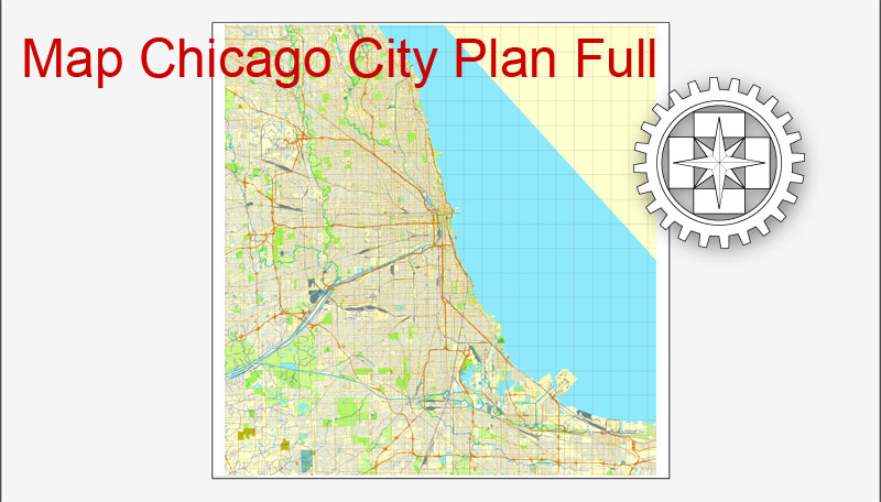
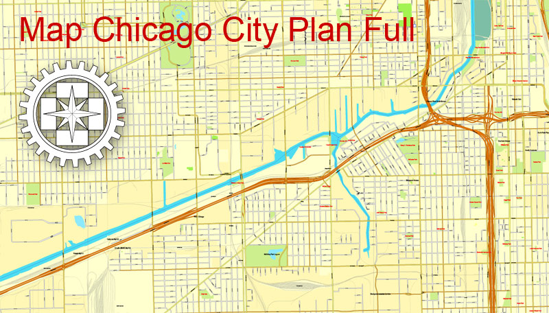
Printable City Plan Map of Chicago, IL, US, Adobe Illustrator, full vector, scalable, editable, text format street names, 12,4 mb ZIP
All streets.
DWG, DXF, CDR and other formats – on demand, same price, please, contact
Chicago, Illinois, USA.
This vector map of Chicago city is used as a basis for design, editing, and further printing.
This is the most detailed, exact map of Chicago city for high-quality printing and polygraphy. You can always clarify the map development date by contacting us.
You can easily add any objects needed (e.g. shops, salons, sale points, gas station or attraction) on any layer of Chicago vector map.
Chicago is the third most populous city in the United States. As of the 2017 census-estimate, Chicago has a population of 2,716,450, which makes it the most populous city in both the state of Illinois and the Midwestern United States.
One of the advantages of Chicago city vector maps of our production is the relevance of cartographic data, we constantly update all our products.
This vector map of Chicago city is used by:
designers, layout designers, printers, advertisers and architects. Our product – vector maps – is designed for further editing and printing in large formats – from @Wall format (a few meters) to A-0 and A-1, A-2, A-3.
It is the county seat of Cook County, the second most populous county in the United States. Chicago is the principal city of the Chicago metropolitan area, which is often referred to as “Chicagoland.” The Chicago metropolitan area has nearly 10 million people, is the third-largest in the United States, the fourth largest in North America, and the third largest metropolitan area in the world by land area.
The advertising and presentation map of Chicago city (usually the final designer marks the routes, and puts the client’s objects (shops, saloons, gas stations etc.)
The undoubted advantage is that people will NEVER throw out this advertising product – the map. In fact, as an advertising medium, a city map is the most “long-playing” of the well-known polygraphic advertising media, with the longest lifespan, and the maximum number of interactions with the customer.
For travelers, maps are sold at the airports and gas stations around the world. Often the source is our vector maps.
Located on the shores of Lake Michigan, Chicago was incorporated as a city in 1837 near a portage between the Great Lakes and the Mississippi River watershed and grew rapidly in the mid-nineteenth century. After the Great Chicago Fire of 1871, which destroyed several square miles and left more than 100,000 homeless, the city made a concerted effort to rebuild.
Take a look, who purchases our vector maps of Chicago city in “Our Clients and Friends” page – these are large and small companies, from super-brands like Volvo and Starbucks, to small design studios and printing houses.
It’s very easy to work with vector maps of Chicago city, even for a not very experienced designer who can turn on and off the map layers, add new objects, change the colors of fill and lines according to customer requirements.
The construction boom accelerated population growth throughout the following decades, and by 1900 Chicago was one of the five largest cities in the world. During this period, Chicago made noted contributions to urban planning and zoning standards, including new construction styles (including the Chicago School of architecture), the development of the City Beautiful Movement, and the steel-framed skyscraper.
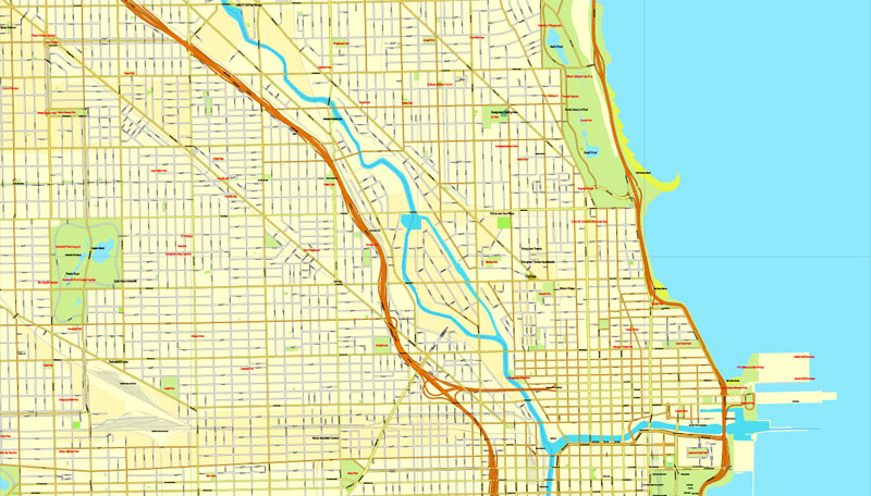
The undoubted advantage of Chicago city vector maps in printing is an excellent and detailed visualization, when customer can expand a large paper map and instantly define his location, find a landmark, an object or address on map, unlike using the popular electronic formats of Google and Yandex maps for example.
Printable vector maps of Chicago city are much more convenient and efficient than any electronic maps on your smartphone, because ALL DETAILS are displayed in the entire space of Chicago city map.
Chicago is an international hub for finance, commerce, industry, technology, telecommunications, and transportation. It was the site of the creation of the first standardized futures contracts at the Chicago Board of Trade, which today is the largest and most diverse derivatives market in the world, generating 20% of all volume in commodities and financial futures.
Useful tips on working with vector maps of cities and countries in Adobe Illustrator.
«V» – launches the Selection tool (cursor, black arrow), which makes active any vector line.
«А» – launches the Direct Selection tool (white cursor), allows you to select curve elements and drag them to the desired place.
«R» – activates the Rotate tool, which helps you rotating selected objects around the center point by 360 degrees.
«E» – gives you the opportunity to use the Eraser tool and erase unnecessary parts.
«X» – switches between Fill and Stroke in the Tools section. Try to get used to this hot key and
you will quickly understand that you can’t live and work without it.
O’Hare International Airport is the one of the busiest airports in the world, and the region also has the largest number of U.S. highways and railroad freight. In 2012, Chicago was listed as an alpha global city by the Globalization and World Cities Research Network, and it ranked seventh in the entire world in the 2017 Global Cities Index. Chicago has the fourth-largest gross metropolitan product in the world—generating about $670.5 billion according to September 2017 estimates—ranking it after the metropolitan areas of Tokyo, New York City, and Los Angeles, and ranking ahead of number five London and number six Paris.
Guides are not limited to vertical and horizontal in Adobe Illustrator. You can also create a diagonal guide for example. Moreover, you can turn any contours into guides. Select the outline and go to View > Guides > Make Guides (Create Guides), or simply press Cmd/Ctrl + 5. You can also turn the guides back into an editable object. Go to menu, View > Guides > Unlock Guides (Release Guides), select the guide you want to edit and select View > Guides > Release Guides (Reset Guides), or just press Cmd/Ctrl + Option / Alt + 5).
Chicago has one of the world’s largest and most diversified and balanced economies, not being dependent on any one industry, with no single industry employing more than 14% of the workforce. Chicago was the second most visited city in the United States with 55 million domestic and international visitors, behind the 62 million visitors to New York City in 2017. The city ranked first place in the 2018 Time Out City Life Index, a global quality of life survey of 15,000 people in 32 cities.
To quickly and effectively play with colors.
Of course, you can do it manually, all objects in our Chicago city vector map are divided according to types and layers, and you can easily change the color gamma of vector objects in groups and layers.
Landmarks in the city include Millennium Park, Navy Pier, the Magnificent Mile, the Art Institute of Chicago, Museum Campus, the Willis (Sears) Tower, the Museum of Science and Industry, and Lincoln Park Zoo.
But there is more effective way of working with the whole VECTOR MAP of Chicago city and all layers:
The overview dialog «Edit colors»/«Repaint Graphic Object» (this dialog box name can change depending on the context):
If you have selected a part or a layer of Chicago city vector map and open the dialog box by clicking the icon in the Control panel, on the Samples palette or the Color Catalog, or if you choose Edit > Edit Colors> Repaint Graphic Object, then the «Repaint Graphic Object» dialog box appears, and you get access to «Assign» and «Edit» tabs.
Chicago’s culture includes the visual arts, literature, film, theater, comedy (especially improvisational comedy), food, and music, particularly jazz, blues, soul, hip-hop, gospel, and electronic dance music including house music. Of the area’s many colleges and universities, the University of Chicago, Northwestern University, and the University of Illinois at Chicago are classified as “highest research” doctoral universities. Chicago has professional sports teams in each of the major professional leagues, including two Major League Baseball teams.
Create and edit color groups of Chicago city vector map, and also assign colors using the «Edit Colors»/ а «Repaint Graphic Object» dialog box.
A. Creating and editing of a color group on the «Edit» tab
B. Assigning colors on the «Assign» tab
C. Select a group of colors from the «Color groups» list
The option «Repaint a graphic object» in the lower part of the dialog box allows you to preview the colors on a selected layer of Vector map, or a group of elements, and specify whether its colors will be redefined when the dialog box is closed.
Geography
Chicago’s present natural geography is a result of the large glaciers of the Ice Age, namely the Wisconsinan Glaciation that carved out the modern basin of Lake Michigan (which formed from the glacier’s meltwater). The city of Chicago itself sits on the Chicago Plain, a flat plain that was once the bottom of ancestral Lake Chicago.
The main areas of the dialog box are:
«Edit»
The «Edit» tab is designed to create a new or edit the existing color groups.
The harmony rules Menu and the Color Wheel are used to conduct experiments with color harmonies. The color wheel shows how colors are related in color harmony, and the color bars allow you to view and manipulate an individual color values. In addition, you can adjust the brightness, add and remove colors, save color groups and view colors on the selected Vector Map of Chicago city or a separated layers.
This plain has very little topographical relief, in fact, topographical relief is so unusual in the plain that what would be unnoticed hills and ridges in other locales have been given names. The highest natural point within the city limits is in the Beverly neighborhood at 41°42′12.5″N 87°40′37″W at 672 ft (205 m). In pioneer days, this hill was called Blue Island, so named because at a distance it looked like an island set in a trackless prairie sea.
«Assign»
The «Assign» tab is used to view and control on how the original colors are replaced with colors from the color group like your corporate colors in the Vector Map of Chicago city.
The assign color ability is provided only if the entire map, layer or fragment is selected in the document. You can specify which of new colors replace the current colors, whether the spot colors should be preserved and how colors are replaced (for example, you can replace colors completely or changing the color tone while maintaining the brightness). The «Assign» tab allows you to redefine colors in the Vector Map of Chicago city, or in separate layers and fragments using the current color group or reducing the number of colors in the current Vector Map.
In fact it, and the nearby Stony Island, were both islands in Lake Chicago, as it receded. On the North side, the diagonals Clark Street and Ridge Boulevard run along ridges that were once sandbars in the Lake.
One special feature of the Chicago area was the now-vanished Mud Lake in the Des Plaines River watershed. During heavy periods of rain or when the Des Plaines overflowed its banks due to downstream ice dams in the early spring, the river would flow through Mud Lake to the South Branch of the Chicago River, forming a favorite portage for early traders and creating the path of the future I&M and Chicago Sanitary and Ship Canals.
Color groups
Is a list of all saved color groups for current document (the same groups appear in the «Samples» palette). You can edit and delete the existing color groups, as well as creating a new ones using the list of “Color Groups” in the dialog box. All changes appear in the «Samples» palette.
The highlighted color group shows, which color group is currently edited.
Any color group can be selected and edited, or used to redefine the colors in the selected vector map of Chicago city, its fragments or elements.
When the city we know today was initially founded in the 1830s, the land was swampy and most of the early building began on low dunes around the Chicago River’s mouth. Indeed, Chicago’s low lying geography, which ultimately became crucial to its boom town development (as the site of the Chicago Portage and canal), could not initially attract substantial early settlement because the tall grass prairie around its lake and river systems was underlain by hard packed glacial clay, making much of the area forbidding wetlands.
Saving a color group adds this group to the specified list.
Opening the «Edit Colors»/«Repaint Graphic Object» dialog box.
Open the «Edit Colors»/«Repaint Graphic Object» dialog box using one of the following methods:
«Edit»> «Edit Colors»> «Repaint Graphic object» or «Repaint With Style».
Use these commands if you need to edit the colors in the selected vector map of Chicago city.
Thus, the paradox of Chicago’s development as a city in the 19th century became taking advantage of this geography, but also overcoming its limitations.
«Repaint Graphic object» button on the «Control» panel.
Use this button if you need to adjust colors of Chicago city vector map using the а «Repaint graphic object» dialog box.
The specified button is available if the selected vector map or its fragment contains two or more colors.
Note. This color editing method is convenient for global color adjustment in a vector map, if global colors were not used when creating a City Map of Chicago.
North of the city of Chicago, there are steep bluffs and ravines that run along Lake Michigan. In contrast, south of the city of Chicago into Northwest Indiana it is without bluffs, but instead has sand dunes. The greatest example of these can be seen at Indiana Dunes National Lakeshore, where some dunes reach up to almost 200 feet.
The «Edit colors» button or «Edit or apply colors» on the «Color Catalog» palette
Click this button if you need to edit colors on the «Color Catalog» palette or edit and then apply them to the selected Vector Map of Chicago city or its fragment.
The «Edit color group» button or «Edit or apply color group» on the «Samples» palette.
Click this button if you need to edit the colors in the specific color group or edit and apply them to the selected Vector Map of Chicago city or a group of its elements, for example, the whole layer “Streets and lines”. You can also double-click the color group in the Samples panel to open the dialog box.
Farther inland, a series of moraines surrounds the Chicago Plain. This surrounding area is hilly and higher than the Chicago Plain. Past the moraines, the land flattens out again, but is interspersed with a few deep river valleys such as the Illinois River, Fox River, Des Plaines River, and Kankakee River. Here you may find rock cliffs and rock ravines, which are absent from the interior Chicago area (the ravines of the north shore and south suburbs are soil ravines without any rock).
If the map file is too large and your computer freezes or even can’t open it quickly:
1. Try to reduce the color resolution of the video card (display) to 256 colors while working with a large map.
2. Using Windows Task Manager, select all the application you don’t need, while working with map, just turn them off.
3. Launch Adobe Illustrator. (DO NOT OPEN the vector map file)
4. Start the Windows Task Manager using administrator rights > Find the “Illustrator” process > set the «real time» priority,
5. Open the file. When you see the LEGACY FONT popup window – click “OK” (do not update). You can restore the TEXT later.
6. Can also be useful: When file is opened – Edit > Settings > Basic Settings > disable smoothing. /// It looks scary, but works quickly)))
We recommend saving the file in Adobe Illustrator 10 version. It’s much more stable when working with VERY BIG size files.
Also, a very large limestone quarry (Thornton Quarry) exists just south of the city of Chicago in the suburb of Thornton. It was once a coral reef when the Midwest was covered by a warm inland sea (hundreds of millions of years before the glaciation of the Chicago area). The rest of the Chicago area does not have bedrock this close to the surface.
Cityscape
After building the first ever skyscraper (Home Insurance Building), Chicago has been at the forefront of skyscraper building ever since. Today Chicago can boast to having 4 of the 10 tallest buildings in the United States and 9 of the 100 in the world.
By modern standards, Chicago has little reason to build up: being located in the Midwest, it has plenty of room to sprawl outwards on almost Euclideanesque flat ground. There is the Chicago River, which may bring some argument as to geographic restriction, but the impact of which was strongly lessened by the strict adherence to the Chicago grid across the river.
Today, Chicago is going through a massive skyscraper building boom, with projects like 55 East Erie (the tallest residential building in the U.S. outside New York City) and Trump International Hotel (completed in August 2008, it is the second tallest in Chicago and the tallest building built in the U.S. for nearly three decades) breaking ground frequently. This can be attributed to the precedent that Chicago has always had a history of frantic skyscraper building, mostly beginning after the Great Chicago Fire when the price of land in the city increased. This caused architects to start building upward. Since this time developers simply follow the pattern set before them.
Topography
Chicago is located in northeastern Illinois on the southwestern shores of Lake Michigan. It is the principal city in the Chicago metropolitan area, situated in the Midwestern United States and the Great Lakes region. Chicago rests on a continental divide at the site of the Chicago Portage, connecting the Mississippi River and the Great Lakes watersheds. The city lies beside huge freshwater Lake Michigan, and two rivers—the Chicago River in downtown and the Calumet River in the industrial far South Side—flow entirely or partially through Chicago. Chicago’s history and economy are closely tied to its proximity to Lake Michigan. While the Chicago River historically handled much of the region’s waterborne cargo, today’s huge lake freighters use the city’s Lake Calumet Harbor on the South Side. The lake also provides another positive effect: moderating Chicago’s climate, making waterfront neighborhoods slightly warmer in winter and cooler in summer.
When Chicago was founded in 1837, most of the early building was around the mouth of the Chicago River, as can be seen on a map of the city’s original 58 blocks. The overall grade of the city’s central, built-up areas is relatively consistent with the natural flatness of its overall natural geography, generally exhibiting only slight differentiation otherwise. The average land elevation is 579 ft (176.5 m) above sea level. While measurements vary somewhat, the lowest points are along the lake shore at 578 ft (176.2 m), while the highest point, at 672 ft (205 m), is the morainal ridge of Blue Island in the city’s far south side.
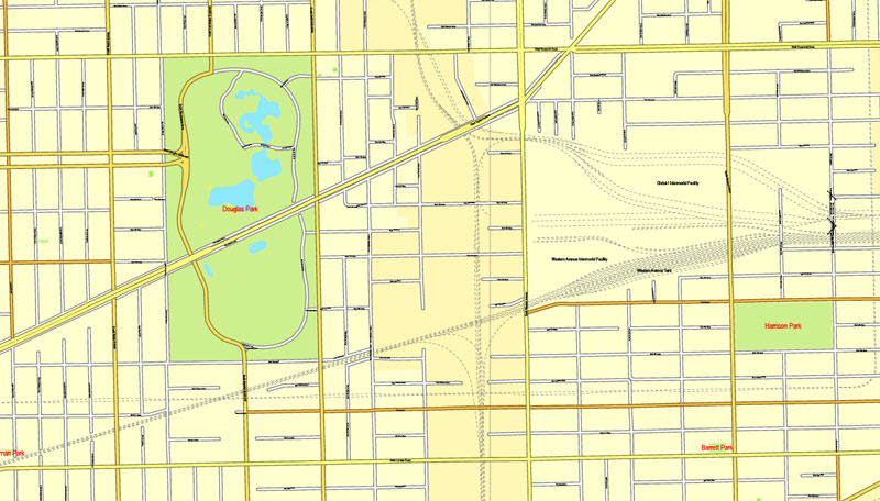
The Chicago Loop is the central business district, but Chicago is also a city of neighborhoods. Lake Shore Drive runs adjacent to a large portion of Chicago’s waterfront. Some of the parks along the waterfront include Lincoln Park, Grant Park, Burnham Park and Jackson Park. There are twenty-four public beaches across 26 miles (42 km) of the waterfront. Landfill extends into portions of the lake providing space for Navy Pier, Northerly Island, the Museum Campus, and large portions of the McCormick Place Convention Center. Most of the city’s high-rise commercial and residential buildings are close to the waterfront.
An informal name for the entire Chicago metropolitan area is “Chicagoland”, which generally means the city and all its suburbs. The Chicago Tribune, which coined the term, includes the city of Chicago, the rest of Cook County, eight nearby Illinois counties: Lake, McHenry, DuPage, Kane, Kendall, Grundy, Will and Kankakee, and three counties in Indiana: Lake, Porter and LaPorte. The Illinois Department of Tourism defines Chicagoland as Cook County without the city of Chicago, and only Lake, DuPage, Kane and Will counties. The Chicagoland Chamber of Commerce defines it as all of Cook and DuPage, Kane, Lake, McHenry and Will counties.
Communities
Major sections of the city include the central business district, called The Loop, and the North, the South, and West Sides. The three sides of the city are represented on the Flag of Chicago by three horizontal white stripes. The North Side is the most densely populated residential section of the city, and many high-rises are located on this side of the city along the lakefront. The South Side is the largest section of the city, encompassing roughly 60% of the city’s land area. The South Side contains most of the facilities of the Port of Chicago.
In the late 1920s, sociologists at the University of Chicago subdivided the city into 77 distinct community areas, which can further be subdivided into over 200 informally defined neighborhoods.
Streetscape
Main article: Roads and expressways in Chicago
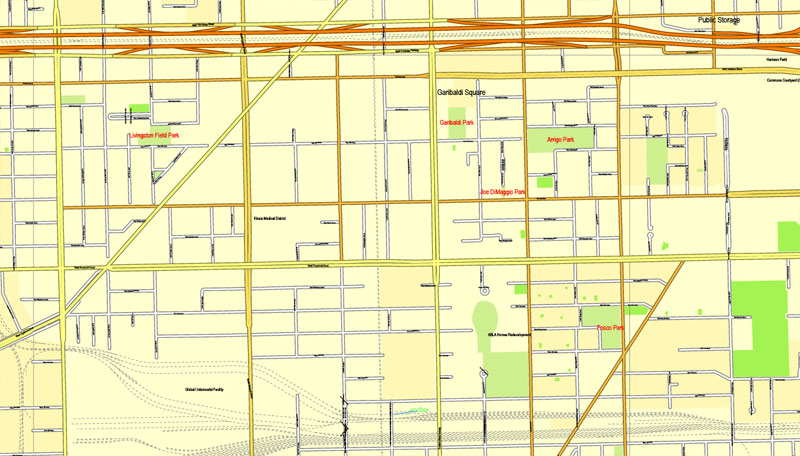
Chicago’s streets were laid out in a street grid that grew from the city’s original townsite plat, which was bounded by Lake Michigan on the east, North Avenue on the north, Wood Street on the west, and 22nd Street on the south. Streets following the Public Land Survey System section lines later became arterial streets in outlying sections. As new additions to the city were platted, city ordinance required them to be laid out with eight streets to the mile in one direction and sixteen in the other direction (about one street per 200 meters in one direction and one street per 100 meters in the other direction). The grid’s regularity provided an efficient means of developing new real estate property. A scattering of diagonal streets, many of them originally Native American trails, also cross the city (Elston, Milwaukee, Ogden, Lincoln, etc.). Many additional diagonal streets were recommended in the Plan of Chicago, but only the extension of Ogden Avenue was ever constructed.
In 2016, Chicago was ranked the sixth-most walkable large city in the United States. Many of the city’s residential streets have a wide patch of grass and/or trees between the street and the sidewalk itself. This helps to keep pedestrians on the sidewalk further away from the street traffic. Chicago’s Western Avenue is the longest continuous urban street in the world. Other famous streets include Michigan Avenue, State Street, Clark Street, and Belmont Avenue. The City Beautiful movement inspired Chicago’s boulevards and parkways.
Small guide: How to work with the vector map?
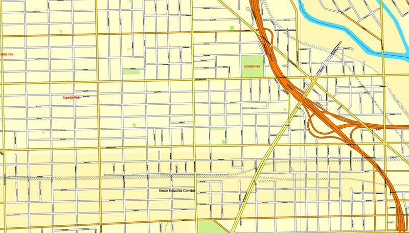
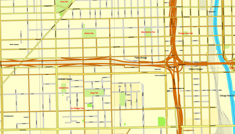
You can: Mass select objects by type and color – for example, the objects type “building” (they are usually dark gray) – and remove them from the map, if you do not need them in your print or design project. You can also easily change the thickness of lines (streets), just bulk selection the road by the line color.
The streets are separated by type, for example, type “residential road” are usually white with a gray stroke. Highway usually orange with a brown or dark gray stroke.
All objects are divided by types: different types of roads and streets, polygons of buildings, landfills, urban areas, parks and more other.
It is easy to change the font of inscriptions, all or each individually. Also, just can be make and any other manipulation of objects on the vector map in Adobe illustrator format.
Important: All the proportions on the map are true, that is, the relative sizes of the objects are true, because Map is based on an accurate GPS projection, and It transated into the (usual for all) the Mercator projection.
You can easily change the color, stroke and fill of any object on the map, zoom without loss of quality Image Verification.
Select object

Bulk selection the same objects on the vector map

See the bulk selected objects on the vector map

Bulk delete buildungs from the vector map

Select residencial road (small street) on the vector map

Bulk selection the same lines (streets, roads) on the full map

Create fat lines of the streets on the vector maps (bulk action) 1

Create fat lines of the streets on the vector maps (bulk action) 2

Create fat lines of the streets on the vector maps (bulk action) 3

You can easily change the color, stroke and fill of any object on the map, zoom without loss of quality Image Verification.

 Author: Kirill Shrayber, Ph.D. FRGS
 + Counties Areas editable Adobe Illustrator in layers")

