Extended Description of the Vector Map
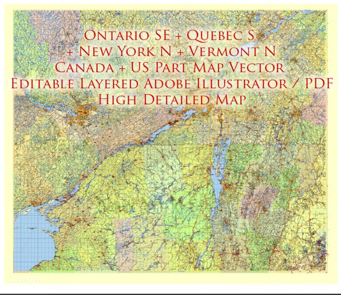
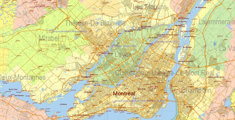
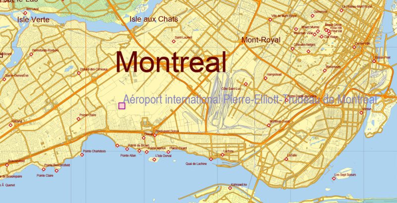
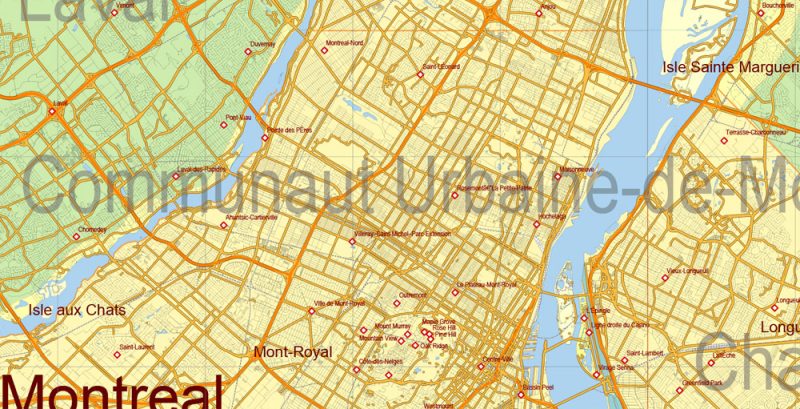
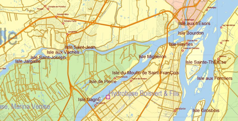
Printable PDF Vector Map of US North-East; Canada South-East Part High Detailed Road Admin Map scale fully editable Adobe PDF in layers, scalable, text format all names, 140 MB ZIP
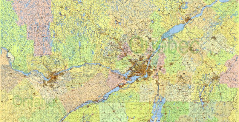
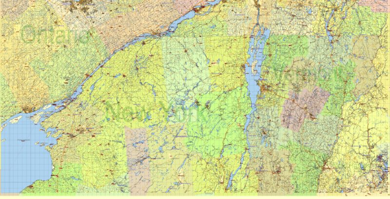
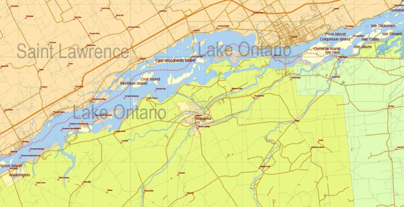
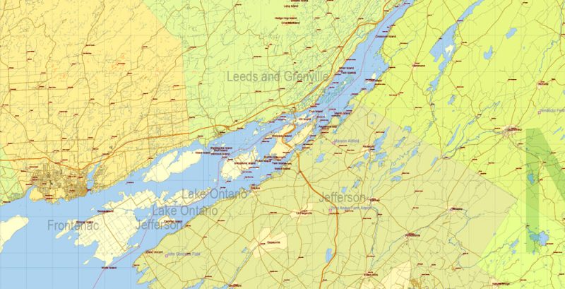
Included East of Ontario CA, South of Quebec CA, North of New York, Vermont, New Hampshire States of US. Map for design, printing, arts, projects, presentations, for architects, designers, and builders, business, logistics.
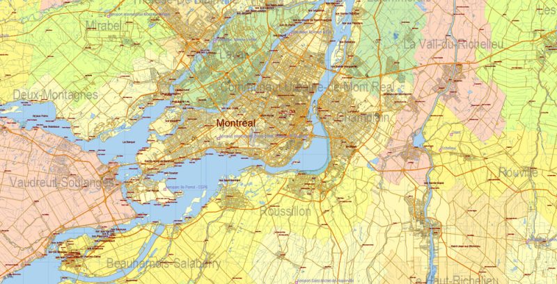
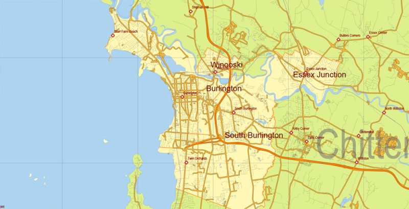
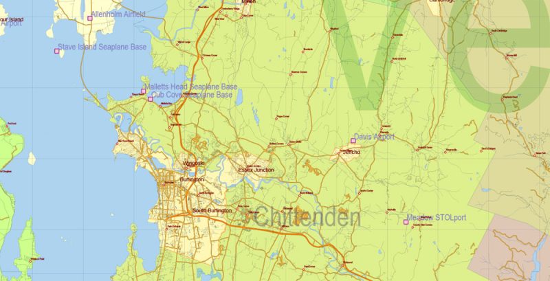
Layers: states, counties, civil_roads, airports and aerodromes, main_roads, urban_areas, water, waterways, railroads, names 1-2-3-4-5, grids, legend, etc.
The most exact and detailed map of this area in scale.
IF YOU NEED: We can add the layer areas and numbers zip (postal) codes.
For Editing and High-Quality Printing
Map covered area:
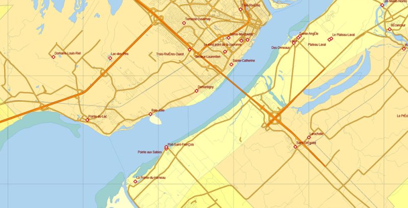
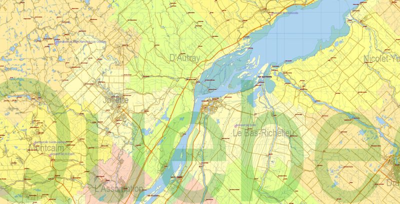
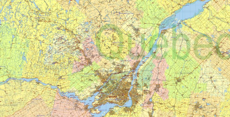
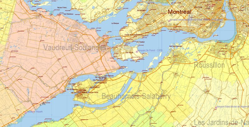
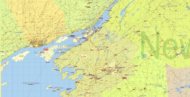
US North East + Canada South East part PDF Map Vector Exact Plan High Detailed Road Admin Map editable Adobe PDF in layers
US North East + Canada South East part PDF Map Vector Exact Plan High Detailed Road Admin Map editable Adobe PDF in layers
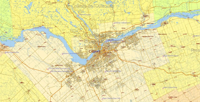
US North East + Canada South East part Map Vector Exact Plan High Detailed Road Admin Map editable Adobe Illustrator in layers
US North East + Canada South East part PDF Map Vector Exact Plan High Detailed Road Admin Map editable Adobe PDF in layers
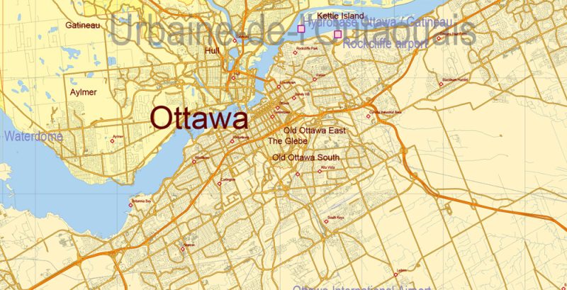
US North East + Canada South East part PDF Map Vector Exact Plan High Detailed Road Admin Map editable Adobe PDF in layers
US North East + Canada South East part PDF Map Vector Exact Plan High Detailed Road Admin Map editable Adobe PDF in layers
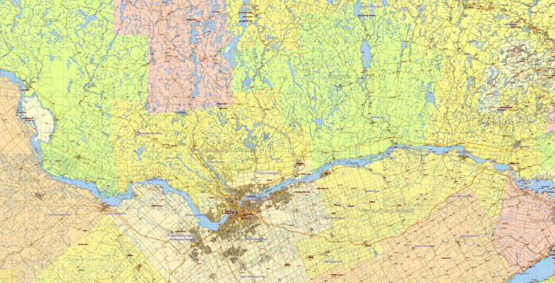
US North East + Canada South East part PDF Map Vector Exact Plan High Detailed Road Admin Map editable Adobe PDF in layers
US North East + Canada South East part PDF Map Vector Exact Plan High Detailed Road Admin Map editable Adobe PDF in layers
US North East + Canada South East part PDF Map Vector Exact Plan High Detailed Road Admin Map editable Adobe PDF in layers
US North East + Canada South East part PDF Map Vector Exact Plan High Detailed Road Admin Map editable Adobe PDF in layers
US North East + Canada South East part PDF Map Vector Exact Plan High Detailed Road Admin Map editable Adobe PDF in layers
US North East + Canada South East part PDF Map Vector Exact Plan High Detailed Road Admin Map editable Adobe PDF in layers
US North East + Canada South East part PDF Map Vector Exact Plan High Detailed Road Admin Map editable Adobe PDF in layers
US North East + Canada South East part PDF Map Vector Exact Plan High Detailed Road Admin Map editable Adobe PDF in layers
US North East + Canada South East part PDF Map Vector Exact Plan High Detailed Road Admin Map editable Adobe PDF in layers
US North East + Canada South East part PDF Map Vector Exact Plan High Detailed Road Admin Map editable Adobe PDF in layers
US North East + Canada South East part PDF Map Vector Exact Plan High Detailed Road Admin Map editable Adobe PDF in layers
US North East + Canada South East part PDF Map Vector Exact Plan High Detailed Road Admin Map editable Adobe PDF in layers
US North East + Canada South East part PDF Map Vector Exact Plan High Detailed Road Admin Map editable Adobe PDF in layers
US North East + Canada South East part PDF Map Vector Exact Plan High Detailed Road Admin Map editable Adobe PDF in layers
Author Rating
Aggregate Rating
no rating based on 0 votes
@vectormapper
Product Name US North East + Canada South East part PDF Map Vector Exact Plan High Detailed Road Admin Map editable Adobe PDF in layers
Price
USD 79
Product Availability
Available in Stock


 Author: Kirill Shrayber, Ph.D. FRGS
