Extended Description of the Vector Map
Printable PDF Vector Map UK + Ireland Geological + Relief exact high detailed editable layered Adobe PDF scalable, editable, text format all names, 103 MB ZIP
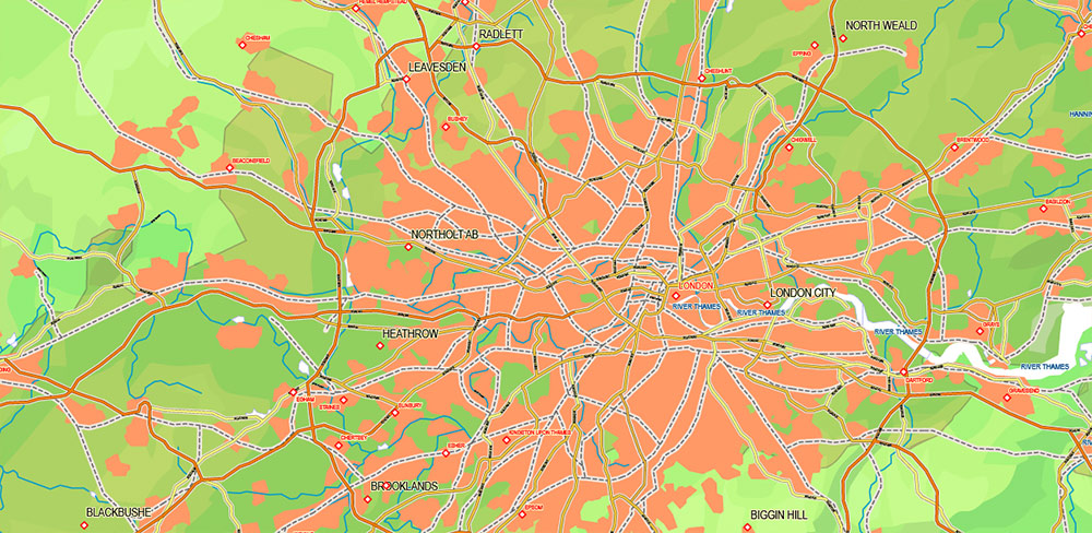
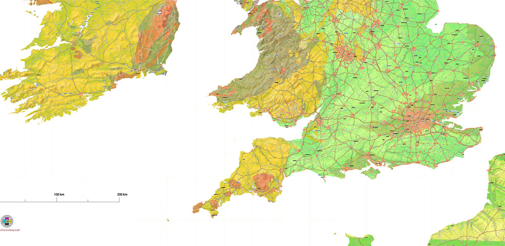
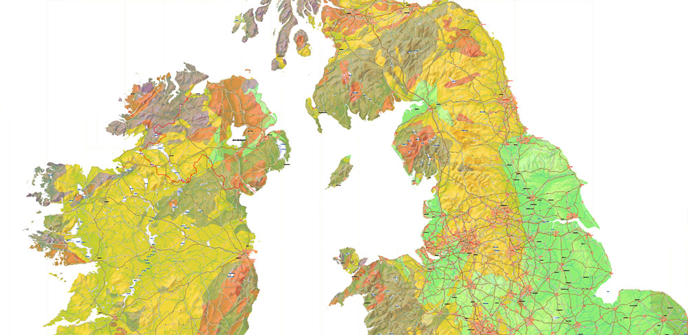
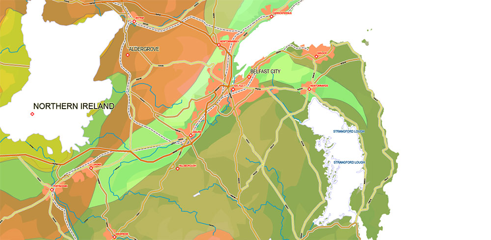
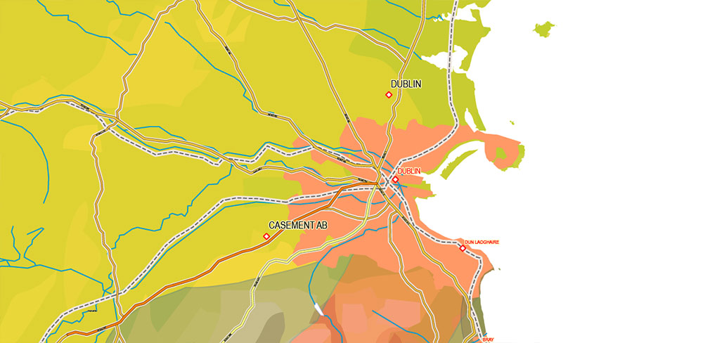
Principal roads, railroads, waterways, water areas and relief, geology layer, urban areas
Map for design, printing, arts, projects, presentations, for architects, designers, and builders, business, logistics.
The most exact and detailed map of UK + Ireland Geological + Relief
Map for editing and High-Quality Printing
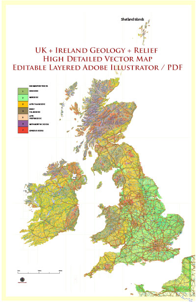
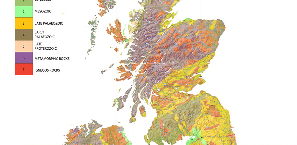
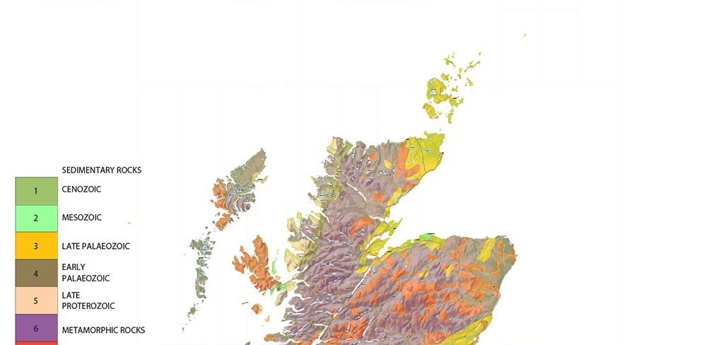
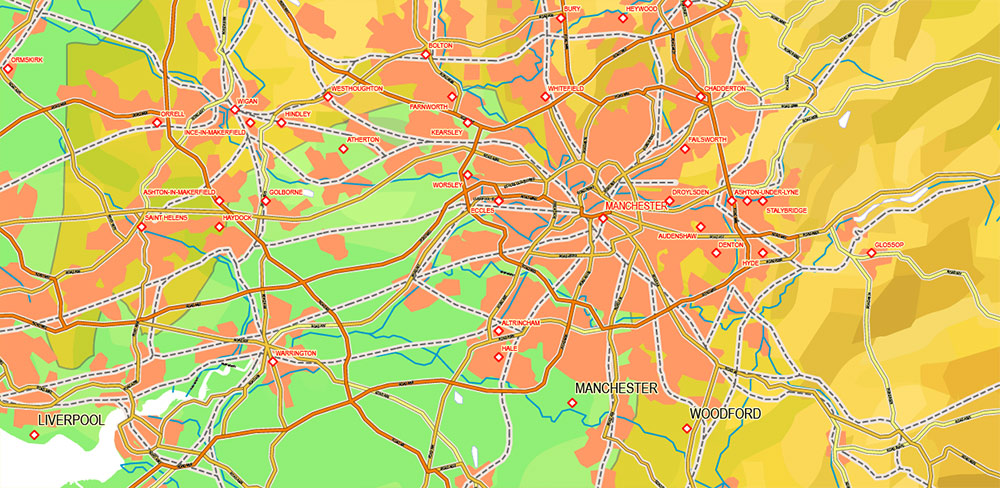
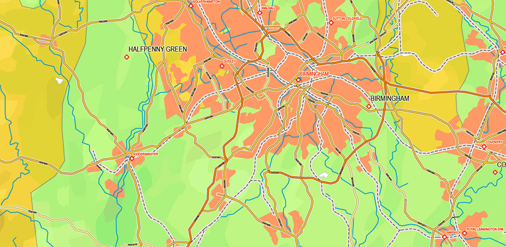
UK + Ireland Geological + Relief PDF Vector Map High Detailed editable layered Adobe PDF
Layers list:
- Legend (scale in km)
- Names urban areas
- Names places (with halo)
- Names Water objects
- Points of Places
- State boundaries (Ireland – Northern Ireland)
- Main Roads
- Railroads
- Urban areas
- Water objects (areas)
- Waterways
- Geology areas
- Relief (vector)
UK + Ireland Geological + Relief PDF Vector Map High Detailed editable layered Adobe PDF
UK + Ireland Geological + Relief PDF Vector Map High Detailed editable layered Adobe PDF
UK + Ireland Geological + Relief PDF Vector Map High Detailed editable layered Adobe PDF
UK + Ireland Geological + Relief PDF Vector Map High Detailed editable layered Adobe PDF
UK + Ireland Geological + Relief PDF Vector Map High Detailed editable layered Adobe PDF
UK + Ireland Geological + Relief PDF Vector Map High Detailed editable layered Adobe PDF
UK + Ireland Geological + Relief PDF Vector Map High Detailed editable layered Adobe PDF
UK + Ireland Geological + Relief PDF Vector Map High Detailed editable layered Adobe PDF
UK + Ireland Geological + Relief PDF Vector Map High Detailed editable layered Adobe PDF

 Author: Kirill Shrayber, Ph.D. FRGS

