Extended Description of the Vector Map
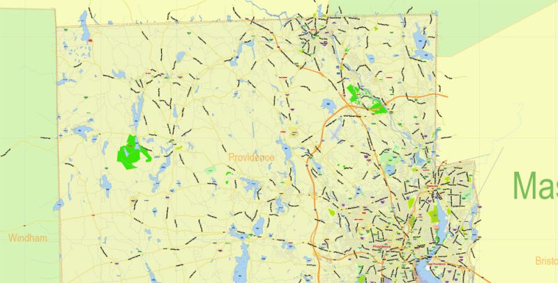
Printable PDF Vector Map of Rhode Island State US detailed Plan scale 1:56202 full editable Adobe PDF Road Admin Map in layers, scalable, text format all names, 22 MB ZIP
Principal street names, All Cities and Towns, Main Objects, Counties. Map for design, printing, arts, projects, presentations, for architects, designers, and builders, business, logistics.
Layers: color_fills, water, streets_roads, labels_roads, counties_areas, state_areas, names_objects, names_streets, names_places, grids, legend, etc.
If you need: we can add postal codes (zip codes areas with numbers) to the map as a separated layer.
The most exact and detailed map of the state in scale.
For Editing and High-Quality Printing
Rhode Island
Rhode Island – one of the States of The New England region, located on the Atlantic coast. By its size, Rhode Island is the smallest American state, and in terms of population (more than 1 million people) is in the last ten States. For this state earned the official nickname “little Roddy.”
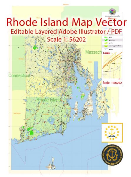
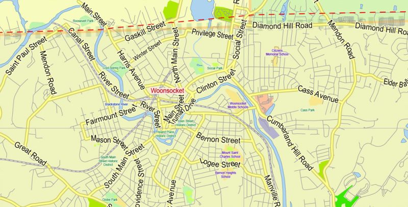
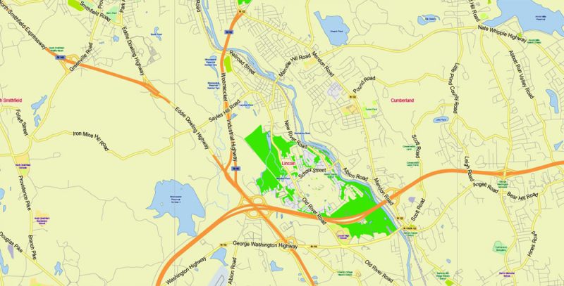
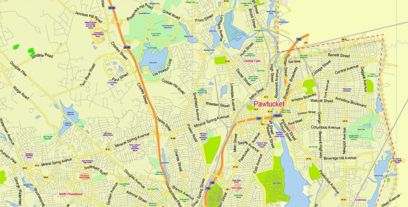
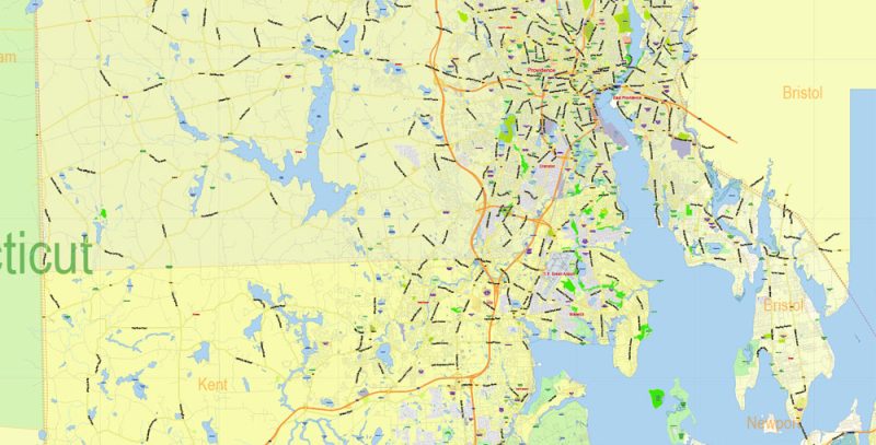
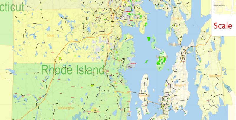
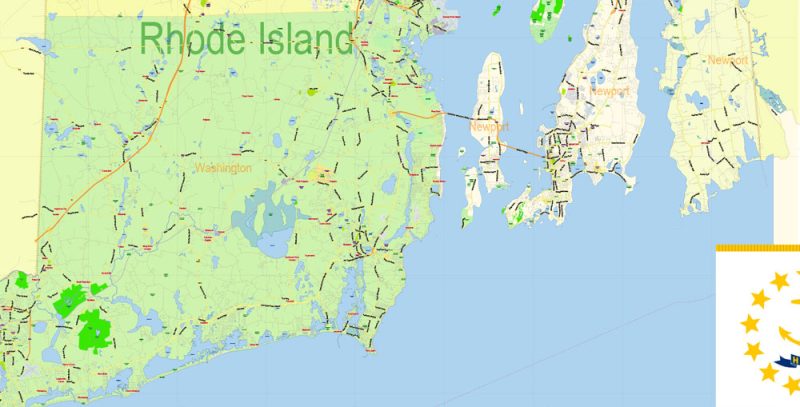
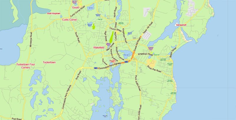
Rhode Island State Map Vector Exact Plan detailed Road Admin Map editable Adobe Illustrator in layers
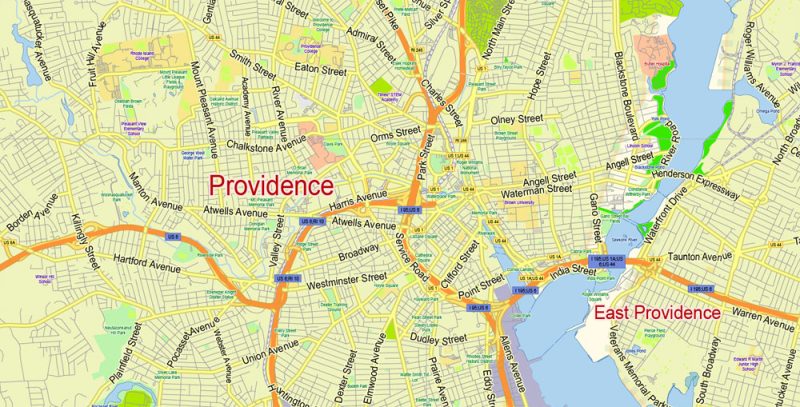
The territory of the state consists of the mainland and the island (actually, the island of Rhode), and this is reflected in its full and official name – the State of Rhode Island and Providence Plantations. The city of Providence is the administrative center of the state and its largest settlement.
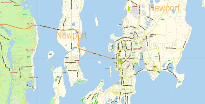
Rhode Island State Map Vector Exact Plan detailed Road Admin Map editable Adobe Illustrator in layers
Rhode Island of the thirteen British colonies that adopted the American Constitution was the last, but slavery in this state was abolished among the first – in the middle of the XVII century.
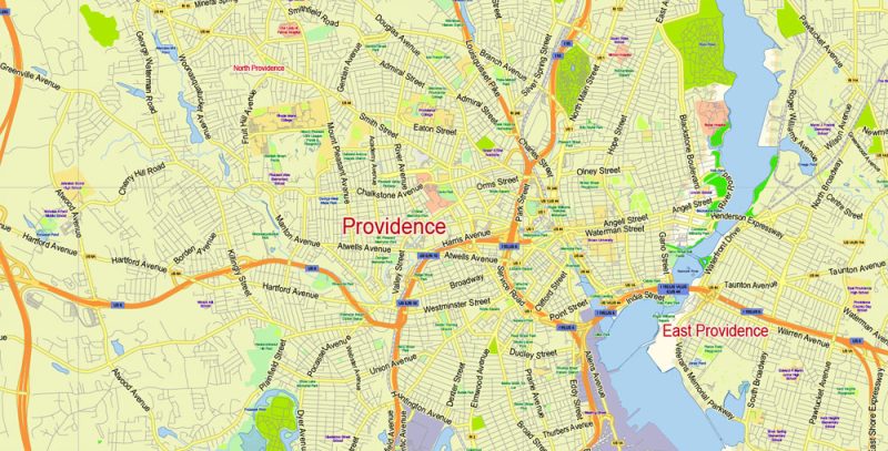
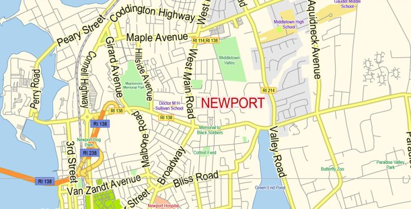
Rhode Island State Map Vector Exact Plan detailed Road Admin Map editable Adobe Illustrator in layers
The state of Rhode Island has many Hiking trails covering both natural and historical sites. For example, Coventry Greenway runs along the former railway in Coventry Park. There are also river routes through Providence, Cycling and Hiking, including swamps, forests, and meadows.
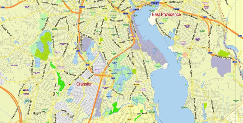
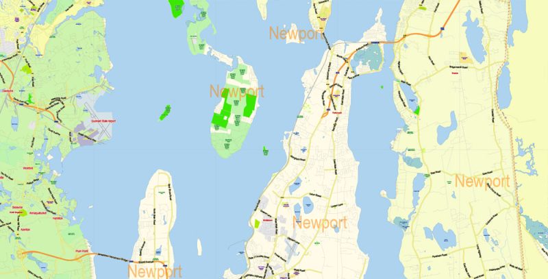
Rhode Island State Map Vector Exact Plan detailed Road Admin Map editable Adobe Illustrator in layers
To the attractions of the state and applies state Park Misquamicut state beach. On the Atlantic coast, in addition to white sand, there is a children’s amusement Park, opportunities for water sports and fishing, a restaurant with panoramic windows.
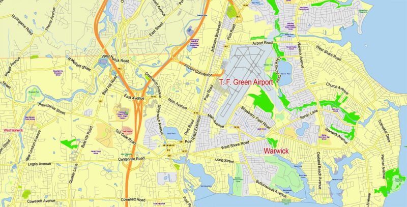
Rhode Island State Map Vector Exact Plan detailed Road Admin Map editable Adobe Illustrator in layers
Providence was founded in the first half of the XVII century. Its founder was Roger Williams, whose monument was erected on one of the squares. In Providence, the name of the founder are Victorian Park and even the zoo – by the way, the oldest in America was opened in 1872.
Rhode Island State Map Vector Exact Plan detailed Road Admin Map editable Adobe Illustrator in layers
The city stands at the confluence of three rivers, one of which gave the city its name. On the East Bank of the river, Providence is the historical part of the state capital. The Rhode Island Capitol was built in the late 19th century. The city has several prestigious educational institutions, including Brown University and the Rhode Island school Of design.
Rhode Island State Map Vector Exact Plan detailed Road Admin Map editable Adobe Illustrator in layers
The state capital is on the North shore of Narragansett Bay, the waters of which are about three dozen Islands of various sizes, of which RI (the second title – Aquidneck) with an area of about a hundred square kilometers is the largest.
Rhode Island State Map Vector Exact Plan detailed Road Admin Map editable Adobe Illustrator in layers
Rhode Island State Map Vector Exact Plan detailed Road Admin Map editable Adobe Illustrator in layers
Rhode Island State Map Vector Exact Plan detailed Road Admin Map editable Adobe Illustrator in layers
Rhode Island State Map Vector Exact Plan detailed Road Admin Map editable Adobe Illustrator in layers
Rhode Island State Map Vector Exact Plan detailed Road Admin Map editable Adobe Illustrator in layers
Rhode Island State Map Vector Exact Plan detailed Road Admin Map editable Adobe Illustrator in layers
Rhode Island State Map Vector Exact Plan detailed Road Admin Map editable Adobe Illustrator in layers
Rhode Island State Map Vector Exact Plan detailed Road Admin Map editable Adobe Illustrator in layers
Rhode Island State Map Vector Exact Plan detailed Road Admin Map editable Adobe Illustrator in layers


 Author: Kirill Shrayber, Ph.D. FRGS

