Printable PDF Vector Map Bremen Germany exact Detailed City Plan scale 1:2820 editable Adobe PDF Street Map in layers 70 Mb ZIP.
All streets names, main objects. Map for publishing, design, printing, publications, arts, projects, presentations, for architects, designers and builders, business, logistics. The most exact and detailed map of the city in scale
Layers: legend, grids, labels_roads, names_places, names_streets, names_objects, streets_roads, color_fills, arrows_streets, etc.
Text format all names
For High Quality Printing
DWG, DXF, CDR, ESRI Shapes, and other formats – by request, same price, please contact.
Bremen in Germany, which is one of the oldest coastal cities in the country, arose in 782 on the site of a former fishing village. Perhaps it would have remained an unknown village if not for Charlemagne, who decided to equip his residence here. In 1186 Bremen received several privileges at once, and 150 years later it became the most important commercial port of medieval Prussia. However, the Free Hanseatic City of Bremen acquired a special status, and with them its current official name, only at the beginning of the 19th century. Now it is the tenth-largest metropolis in Germany – its population according to 2017 is about 600 thousand inhabitants, and the length of the borders reaches 130 km.
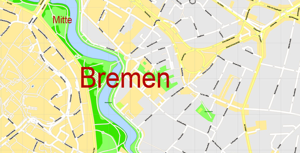
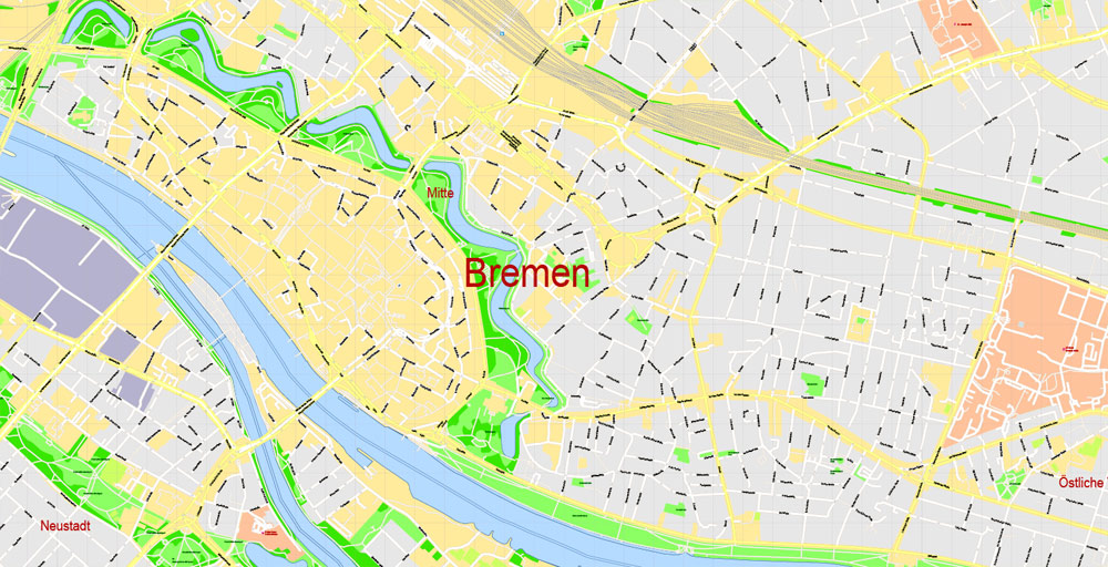
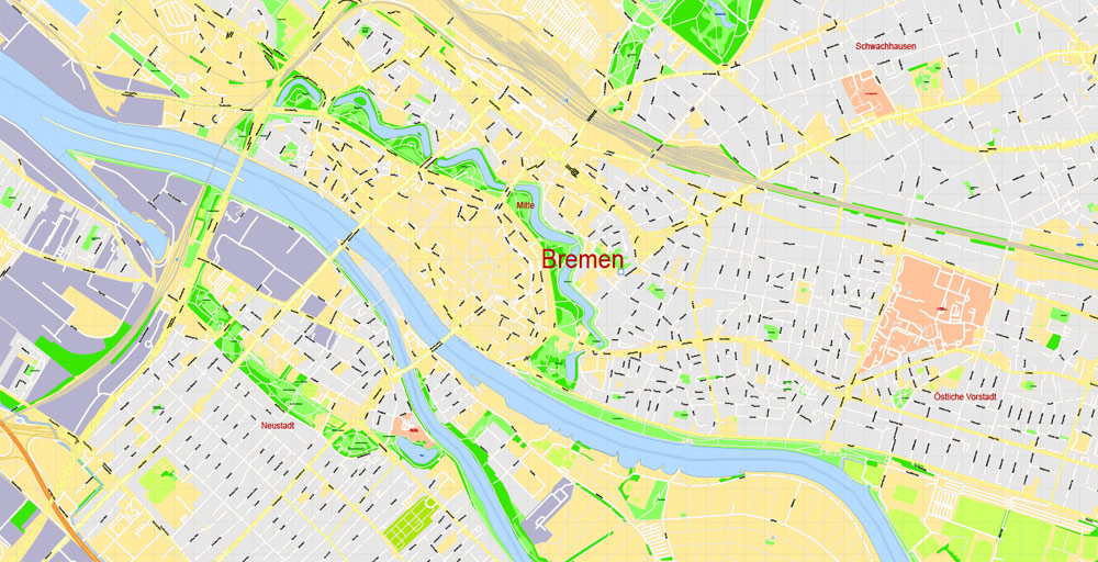
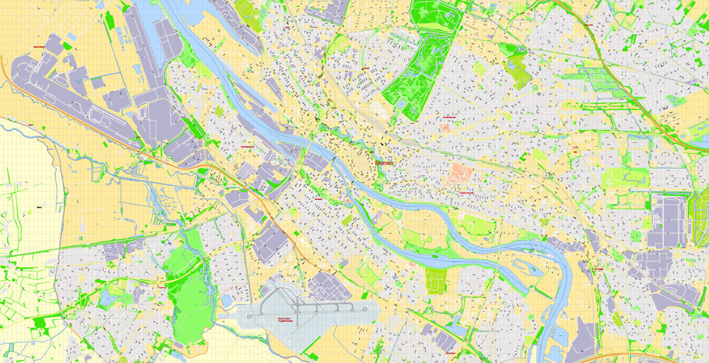
Looking at the photo of the city of Bremen in Germany, you will see that it lies on both banks of the Weser River and is divided into 5 large districts: North (Nord), South (Süd), West (West), East (Ost) and Central (Mitte). Almost every one of them has one or another university offering favorable learning conditions. In this regard, more than 30 thousand students attend Bremen every year, which makes it attractive not only for lovers of antiquity.
Attractions
Schnoor Quarter
The construction of the historical quarter, located 300 m from the Market Square, began in the middle of the 13th century. Despite such a long history of its existence, it managed to preserve its unique appearance and unique medieval atmosphere. At the same time, the oldest building of the Schnoor Viertel is considered to be the Gothic Church of St. Johana, where street artists, artisans and musicians constantly gather around the walls.
In ancient times, ropes were made in the Schnoor quarter. Now it is a popular tourist destination filled with shops, souvenir shops, restaurants, pubs, museums and art galleries.
Market Square
If you don’t know what to see from the sights of Bremen, take a look at Marktplatz, the central square of the city, considered one of the most beautiful in Europe. The architectural ensemble standing in its surroundings was built in the Middle Ages. Strangely enough, neither the burgher houses nor the historical monuments, which will be discussed later, suffered at all during World War II, which wiped out more than 90% of urban buildings from the face of the earth.
Among the most significant objects of the Market Square are the large Hanseatic cross, the Schutting building, where the merchant guild used to gather in the old days, and the 10th statue of Roland guarding the historical center of the city. In one hand he holds the shield with the imperial eagle, and in the other – the sword of justice. There is a popular belief among the locals that as soon as this medieval knight disappears from the face of the earth, Bremen will lose its independence. The belief in this turned out to be so strong that during World War II, Roland was the most protected city monument. Moreover, the Brazilian city of the same name, founded by Bremen settlers, was named after him.
Another interesting feature of Marktplatz is the Bremer Loch or Bremen Hole. This is a small clew located behind the city hall building right in the middle of the sidewalk. Music or animal voices are regularly heard from this hole. You should not be scared – this is how gratitude sounds for every coin thrown inside.
Bremen Town Hall
One of the most important historical sights of Bremen is the City Hall, towering in the middle of the Market Square. The monumental structure, built over several centuries, combines elements of two different styles – Gothic and Weser Renaissance.
The Bremen City Hall building consists of 2 adjacent buildings: the Old One, in which local politics was formed for more than 600 years in a row, and the New One, attached at the beginning of the 20th century. Being the main symbol of a free and excessively rich city, the Town Hall impresses not only with its beautiful facade made of glazed bricks, but also with its interior design. Among the numerous rooms that make up this building, the Senate Room, the Golden Chamber and the Great Hall, whose wall paintings reflect scenes from the Solomon Court, are of the greatest interest.
The legendary Ratskeller pub, located on the ground floor of the Town Hall, deserves no less attention. The establishment includes several halls and cellars in which the oldest wines of Germany are stored – some of them were bottled back in 1653. They say that many famous people have visited here in their time – dukes, emperors, composers, writers, etc. The Bremen Town Hall is operational – it still houses the city hall. In the summer of 204, it was included in the UNESCO World Heritage List.
Gallery of Images “Urban plan Bremen Germany ai”:
Bremen
City in Germany
Bremen is a city straddling the Weser River in northwest Germany. It’s known for its role in maritime trade, represented by Hanseatic buildings on the Market Square. The ornate and Gothic town hall has a Renaissance facade and large model ships in its upper hall. Nearby is the Roland statue, a giant stone figure symbolizing freedom of trade. St. Peter’s Cathedral features medieval crypts and twin spires.
Area
• City 326.73 km2 (126.15 sq mi)
• Metro 11,627 km2 (4,489 sq mi)
Elevation 12 m (39 ft)
Population
• City 557,464
• Density 1,700/km2 (4,400/sq mi)
• Metro 2,400,000
Free vector maps:

Free download printable map Europe vector Adobe Illustrator >>>
Free download printable PDF map Europe vector Adobe PDF >>>


 Author: Kirill Shrayber, Ph.D. FRGS


