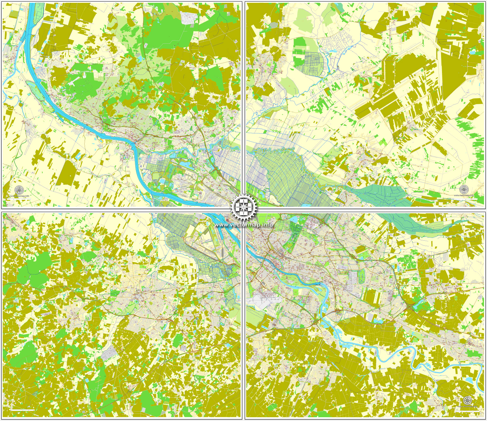
Bremen, Germany, printable vector street City Plan map in 4 parts, full editable, Adobe Illustrator, full vector, scalable, editable, text format street names, 56 mb ZIP
All streets, All buildings. Map for design, print, arts, projects, presentations.
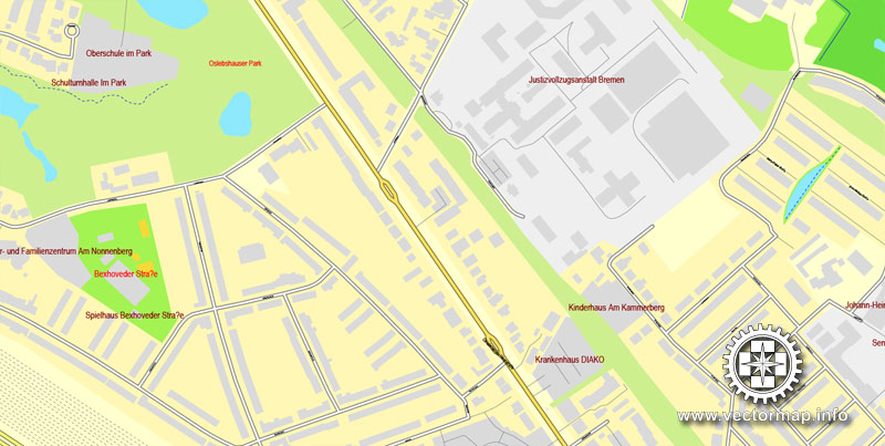
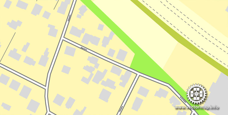
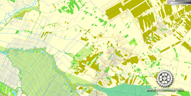
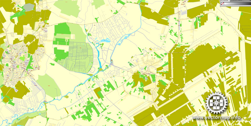
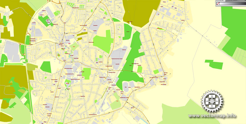
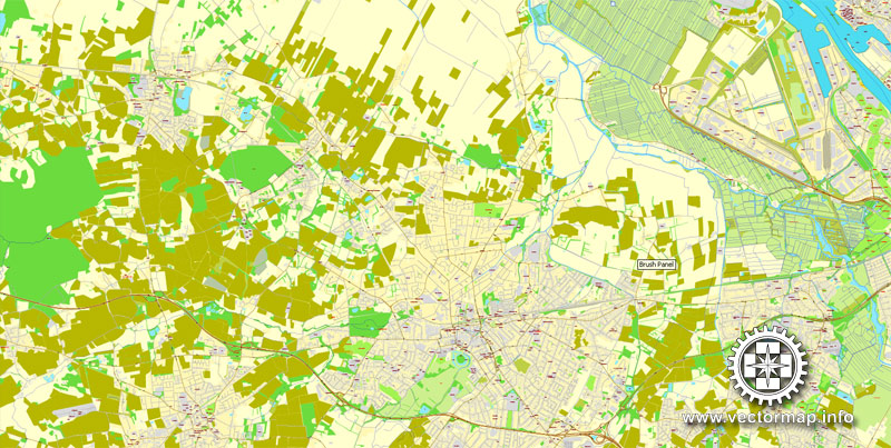
The most accurate and detailed map of the city.
You can edit this file by Adobe Illustrator, Adobe Acrobat, Corel Draw.
DXF, DWG, CDR and other formats – on request, same price, please, contact
Bremen, Germany.
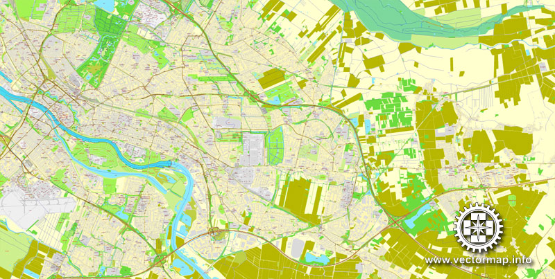
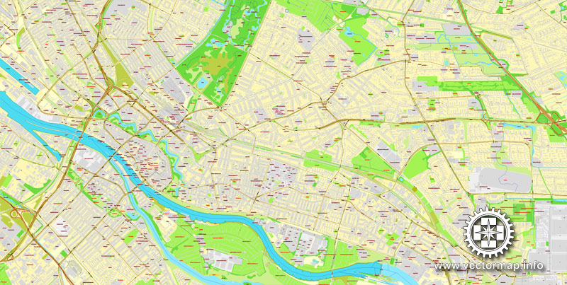
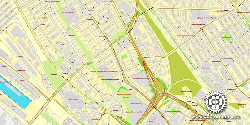
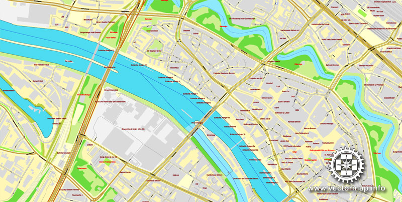
This vector map of Bremen city is used as a basis for design, editing, and further printing.
This is the most detailed, exact map of Bremen city for high-quality printing and polygraphy. You can always clarify the map development date by contacting us.
For your convenience, all objects on Bremen vector city map are divided into layers. And the editing is very easy – colors, lines, etc.
One of the advantages of Bremen city vector maps of our production is the relevance of cartographic data, we constantly update all our products.
The City Municipality of Bremen is a Hanseatic city in northwestern Germany, which belongs to the Free Hanseatic City of Bremen (also called just “Bremen” for short), a federal state of Germany.
This vector map of Bremen city is used by:
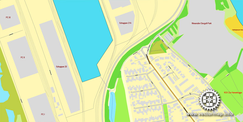
designers, layout designers, printers, advertisers and architects. Our product – vector maps – is designed for further editing and printing in large formats – from @Wall format (a few meters) to A-0 and A-1, A-2, A-3.
The Bremen city map in vector format is used for design, urban planning, presentations and media visualizations.
As a commercial and industrial city with a major port on the River Weser, Bremen is part of the Bremen/Oldenburg Metropolitan Region, with 2.5 million people. Bremen is the second most populous city in Northern Germany and eleventh in Germany.
The advertising and presentation map of Bremen city (usually the final designer marks the routes, and puts the client’s objects (shops, saloons, gas stations etc.)
The undoubted advantage is that people will NEVER throw out this advertising product – the map. In fact, as an advertising medium, a city map is the most “long-playing” of the well-known polygraphic advertising media, with the longest lifespan, and the maximum number of interactions with the customer.
Bremen is a major cultural and economic hub in the northern regions of Germany. Bremen is home to dozens of historical galleries and museums, ranging from historical sculptures to major art museums, such as the Übersee-Museum Bremen.
For travelers, maps are sold at the airports and gas stations around the world. Often the source is our vector maps.
Take a look, who purchases our vector maps of Bremen city in “Our Clients and Friends” page – these are large and small companies, from super-brands like Volvo and Starbucks, to small design studios and printing houses.
Bremen has a reputation as a working-class city. Bremen is home to a large number of multinational companies and manufacturing centers. Companies headquartered in Bremen include the Hachez chocolate company and Vector Foiltec. Four-time German football champions Werder Bremen are also based in the city. Weder Bremen share long feuds with the rival team in the neighbouring city of Hamburg, HSV with brawls at almost every match.
It’s very easy to work with vector maps of Bremen city, even for a not very experienced designer who can turn on and off the map layers, add new objects, change the colors of fill and lines according to customer requirements.
The undoubted advantage of Bremen city vector maps in printing is an excellent and detailed visualization, when customer can expand a large paper map and instantly define his location, find a landmark, an object or address on map, unlike using the popular electronic formats of Google and Yandex maps for example.
Bremen is some 60 km (37 mi) south of the mouth of the Weser on the North Sea. Bremen and Bremerhaven (at the mouth of the Weser) together comprise the state of the Free Hanseatic City of Bremen (official German name: Freie Hansestadt Bremen).
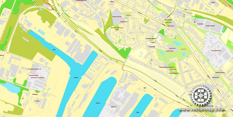
Printable vector maps of Bremen city are much more convenient and efficient than any electronic maps on your smartphone, because ALL DETAILS are displayed in the entire space of Bremen city map.
Geography
Bremen’s city hall, cathedral and Bürgerschaft
View from the Stephanibrücke towards the city centre and cathedral
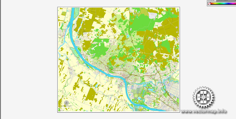
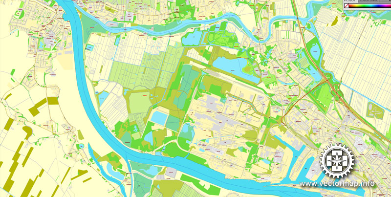
Bremen lies on both sides of the River Weser, about 60 kilometres (37 miles) upstream of its estuary on the North Sea and its transition to the Outer Weser by Bremerhaven. Opposite Bremen’s Altstadt is the point where the “Middle Weser” becomes the “Lower Weser” and, from the area of Bremen’s port, the river has been made navigable to ocean-going vessels.
Useful tips on working with vector maps of cities and countries in Adobe Illustrator.
«V» – launches the Selection tool (cursor, black arrow), which makes active any vector line.
«А» – launches the Direct Selection tool (white cursor), allows you to select curve elements and drag them to the desired place.
«R» – activates the Rotate tool, which helps you rotating selected objects around the center point by 360 degrees.
«E» – gives you the opportunity to use the Eraser tool and erase unnecessary parts.
«X» – switches between Fill and Stroke in the Tools section. Try to get used to this hot key and
you will quickly understand that you can’t live and work without it.
The region on the left bank of the Lower Weser, through which the Ochtum flows, is the Weser Marshes, the landscape on its right bank is part of the Elbe-Weser Triangle. The Lesum, and its tributaries, the Wümme and Hamme, the Schönebecker Aue and Blumenthaler Aue, are the downstream tributaries of the Weser.
Guides are not limited to vertical and horizontal in Adobe Illustrator. You can also create a diagonal guide for example. Moreover, you can turn any contours into guides. Select the outline and go to View > Guides > Make Guides (Create Guides), or simply press Cmd/Ctrl + 5. You can also turn the guides back into an editable object. Go to menu, View > Guides > Unlock Guides (Release Guides), select the guide you want to edit and select View > Guides > Release Guides (Reset Guides), or just press Cmd/Ctrl + Option / Alt + 5).
You will probably want to change the color scheme used on our Bremen vector city map.
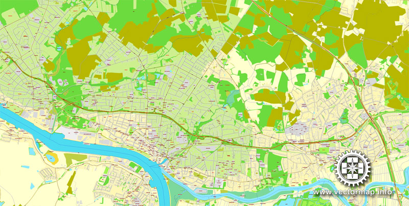
The city’s municipal area is about 38 kilometres (24 miles) long and 16 kilometres (10 miles) wide. In terms of area, Bremen is the thirteenth largest city in Germany; and in terms of population the second largest city in northwest Germany after Hamburg and the tenth largest in the whole of Germany (see: List of cities in Germany).
To quickly and effectively play with colors.
Of course, you can do it manually, all objects in our Bremen city vector map are divided according to types and layers, and you can easily change the color gamma of vector objects in groups and layers.
But there is more effective way of working with the whole VECTOR MAP of Bremen city and all layers:
The overview dialog «Edit colors»/«Repaint Graphic Object» (this dialog box name can change depending on the context):
If you have selected a part or a layer of Bremen city vector map and open the dialog box by clicking the icon in the Control panel, on the Samples palette or the Color Catalog, or if you choose Edit > Edit Colors> Repaint Graphic Object, then the «Repaint Graphic Object» dialog box appears, and you get access to «Assign» and «Edit» tabs.
Bremen lies about 50 kilometres (31 miles) east of the city of Oldenburg, 110 kilometres (68 miles) southwest of Hamburg, 120 kilometres (75 miles) northwest of Hanover, 100 kilometres (62 miles) north of Minden and 105 kilometres (65 miles) northeast of Osnabrück. Part of Bremerhaven’s port territory forms an exclave of the City of Bremen.
If a picture or a map fragment is not selected, and you open the dialog box by clicking the icon in the Control panel, on the Samples palette or in the Color Catalog, the «Edit Colors» dialog box appears and you can only access the «Edit» tab.
Hills of Bremen
The inner city lies on a Weser dune, which reaches a natural height of 10.5 m above sea level (NN) at Bremen Cathedral; its highest point, though, is 14.4 m above sea level (NN) and lies to the east at the Polizeihaus, Am Wall 196. The highest natural feature in the city of Bremen is 32.5 m above NN and lies in Friedehorst Park in the northwestern borough of Burglesum. As a result, Bremen has the lowest high point of all the German states. However, the man-made tip of the rubbish dump Blockland-Deponie in Bremen-Walle is higher at 49 m above NN.
Regardless of the name at the top of the dialog box, the right-hand side always displays the color group of the current document, as well as two default color groups: Print Color and Grayscale. These color groups can be selected and used any time.
Create and edit color groups of Bremen city vector map, and also assign colors using the «Edit Colors»/ а «Repaint Graphic Object» dialog box.
A. Creating and editing of a color group on the «Edit» tab
B. Assigning colors on the «Assign» tab
C. Select a group of colors from the «Color groups» list
The option «Repaint a graphic object» in the lower part of the dialog box allows you to preview the colors on a selected layer of Vector map, or a group of elements, and specify whether its colors will be redefined when the dialog box is closed.
The main areas of the dialog box are:
«Edit»
The «Edit» tab is designed to create a new or edit the existing color groups.
The harmony rules Menu and the Color Wheel are used to conduct experiments with color harmonies. The color wheel shows how colors are related in color harmony, and the color bars allow you to view and manipulate an individual color values. In addition, you can adjust the brightness, add and remove colors, save color groups and view colors on the selected Vector Map of Bremen city or a separated layers.
«Assign»
The «Assign» tab is used to view and control on how the original colors are replaced with colors from the color group like your corporate colors in the Vector Map of Bremen city.
The assign color ability is provided only if the entire map, layer or fragment is selected in the document. You can specify which of new colors replace the current colors, whether the spot colors should be preserved and how colors are replaced (for example, you can replace colors completely or changing the color tone while maintaining the brightness). The «Assign» tab allows you to redefine colors in the Vector Map of Bremen city, or in separate layers and fragments using the current color group or reducing the number of colors in the current Vector Map.
Color groups
Is a list of all saved color groups for current document (the same groups appear in the «Samples» palette). You can edit and delete the existing color groups, as well as creating a new ones using the list of “Color Groups” in the dialog box. All changes appear in the «Samples» palette.
The highlighted color group shows, which color group is currently edited.
Any color group can be selected and edited, or used to redefine the colors in the selected vector map of Bremen city, its fragments or elements.

Saving a color group adds this group to the specified list.
Opening the «Edit Colors»/«Repaint Graphic Object» dialog box.
Open the «Edit Colors»/«Repaint Graphic Object» dialog box using one of the following methods:
«Edit»> «Edit Colors»> «Repaint Graphic object» or «Repaint With Style».
Use these commands if you need to edit the colors in the selected vector map of Bremen city.
«Repaint Graphic object» button on the «Control» panel.
Use this button if you need to adjust colors of Bremen city vector map using the а «Repaint graphic object» dialog box.
The specified button is available if the selected vector map or its fragment contains two or more colors.
Note. This color editing method is convenient for global color adjustment in a vector map, if global colors were not used when creating a City Map of Bremen.
The «Edit colors» button or «Edit or apply colors» on the «Color Catalog» palette
Click this button if you need to edit colors on the «Color Catalog» palette or edit and then apply them to the selected Vector Map of Bremen city or its fragment.
The «Edit color group» button or «Edit or apply color group» on the «Samples» palette.
Click this button if you need to edit the colors in the specific color group or edit and apply them to the selected Vector Map of Bremen city or a group of its elements, for example, the whole layer “Streets and lines”. You can also double-click the color group in the Samples panel to open the dialog box.
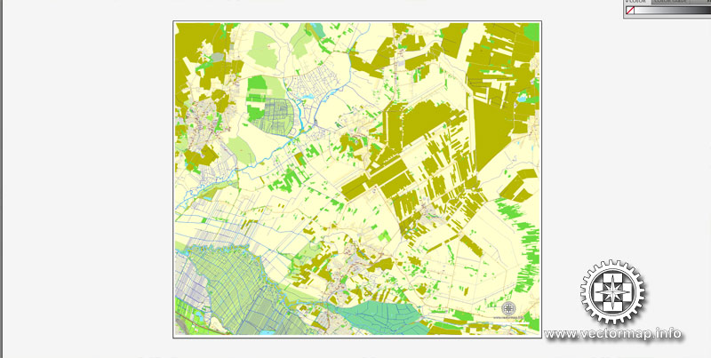
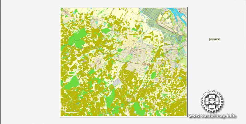
If the map file is too large and your computer freezes or even can’t open it quickly:
1. Try to reduce the color resolution of the video card (display) to 256 colors while working with a large map.
2. Using Windows Task Manager, select all the application you don’t need, while working with map, just turn them off.
3. Launch Adobe Illustrator. (DO NOT OPEN the vector map file)
4. Start the Windows Task Manager using administrator rights > Find the “Illustrator” process > set the «real time» priority,
5. Open the file. When you see the LEGACY FONT popup window – click “OK” (do not update). You can restore the TEXT later.
6. Can also be useful: When file is opened – Edit > Settings > Basic Settings > disable smoothing. /// It looks scary, but works quickly)))
We recommend saving the file in Adobe Illustrator 10 version. It’s much more stable when working with VERY BIG size files.

World map vector, Free vector maps, Vector world map, Vector map, Vector maps, World map, Map of the world, Worldmap, World map vector, World vector map, World relief map, Map of middle east, Map western europe, West europe maps, Map of the world modifiable, High resolution world map, World map illustrator, World map PDF editable, World vector map download,
Free vector map World Political, Adobe Illustrator, download now maps vector clipart
Map for design, projects, presentation free to use as you like.
All free World Vector Maps clipart
Bremen
City in Germany
The City Municipality of Bremen is a Hanseatic city in northwestern Germany, which belongs to the state Free Hanseatic City of Bremen or shortly Bremen.
Area: 326.7 km²
Population: 546,451 (2013) UNdata
The City Municipality of Bremen is a Hanseatic city in northwestern Germany, which belongs to the state Free Hanseatic City of Bremen or shortly Bremen.
A commercial and industrial city with a major port on the River Weser, Bremen is part of the Bremen/Oldenburg Metropolitan Region, with 2.4 million people. Bremen is the second most populous city in Northern Germany and tenth in Germany.
Bremen is a major cultural and economic hub in the northern regions of Germany. Bremen is home to dozens of historical galleries and museums, ranging from historical sculptures to major art museums, such as the Übersee-Museum Bremen. Bremen has a reputation as a working class city. Along with this, Bremen is home to a large number of multinational companies and manufacturing centers. Companies headquartered in Bremen include the Hachez chocolate company and Vector Foiltec. Four-time German football champions Werder Bremen are also based in the city.
Bremen is some 60 km (37 mi) south from the Weser mouth on the North Sea. With Bremerhaven right on the mouth the two comprise the state of the Free Hanseatic City of Bremen (official German name: Freie Hansestadt Bremen).
Small guide: How to work with the vector map?
You can: Mass select objects by type and color – for example, the objects type “building” (they are usually dark gray) – and remove them from the map, if you do not need them in your print or design project. You can also easily change the thickness of lines (streets), just bulk selection the road by the line color.
The streets are separated by type, for example, type “residential road” are usually white with a gray stroke. Highway usually orange with a brown or dark gray stroke.
It is easy to change the font of inscriptions, all or each individually. Also, just can be make and any other manipulation of objects on the vector map in Adobe illustrator format.
Important: All the proportions on the map are true, that is, the relative sizes of the objects are true, because Map is based on an accurate GPS projection, and It transated into the (usual for all) the Mercator projection.
You can easily change the color, stroke and fill of any object on the map, zoom without loss of quality Image Verification.
Select object

Bulk selection the same objects on the vector map

See the bulk selected objects on the vector map

Bulk delete buildungs from the vector map

Select residencial road (small street) on the vector map

Bulk selection the same lines (streets, roads) on the full map

Create fat lines of the streets on the vector maps (bulk action) 1

Create fat lines of the streets on the vector maps (bulk action) 2

Create fat lines of the streets on the vector maps (bulk action) 3

You can easily change the color, stroke and fill of any object on the map, zoom without loss of quality Image Verification.

 Author: Kirill Shrayber, Ph.D. FRGS


