Printable Map Vigo County + Terre Haute Indiana, US, exact vector street G-View Level 17 (100 meters scale) map, V.08.12. fully editable, Adobe Illustrator, full vector, scalable, editable text format of street names, 2 Mb ZIP.
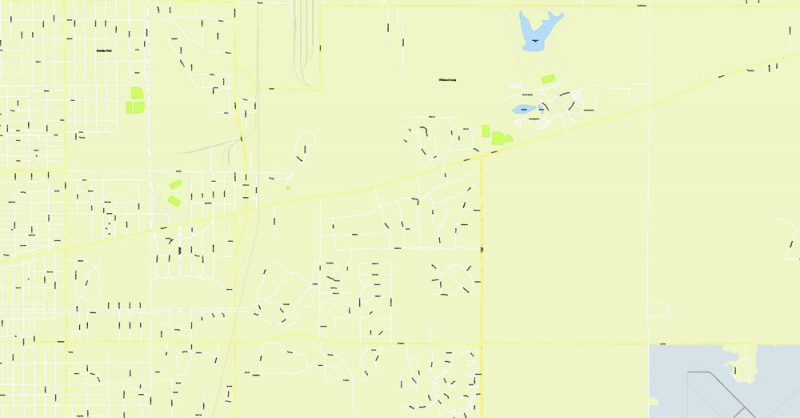
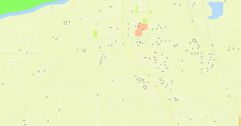
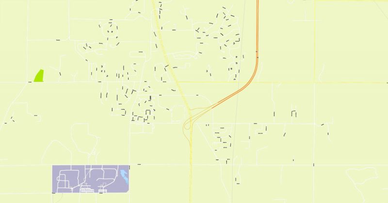
All streets named, main objects, no buildings. Map for publishing, design, printing, publications, arts, projects, presentations, for architects, designers and builders, business, logistics. The most exact and detailed map.
Separated layers: streets and roads, color fills, road labels, names 1,2,3, street arrows, objects, scales, county borders, color fill county area.
DWG, DXF, CDR, ESRI Shapes, and other formats – by request, same price, please contact.
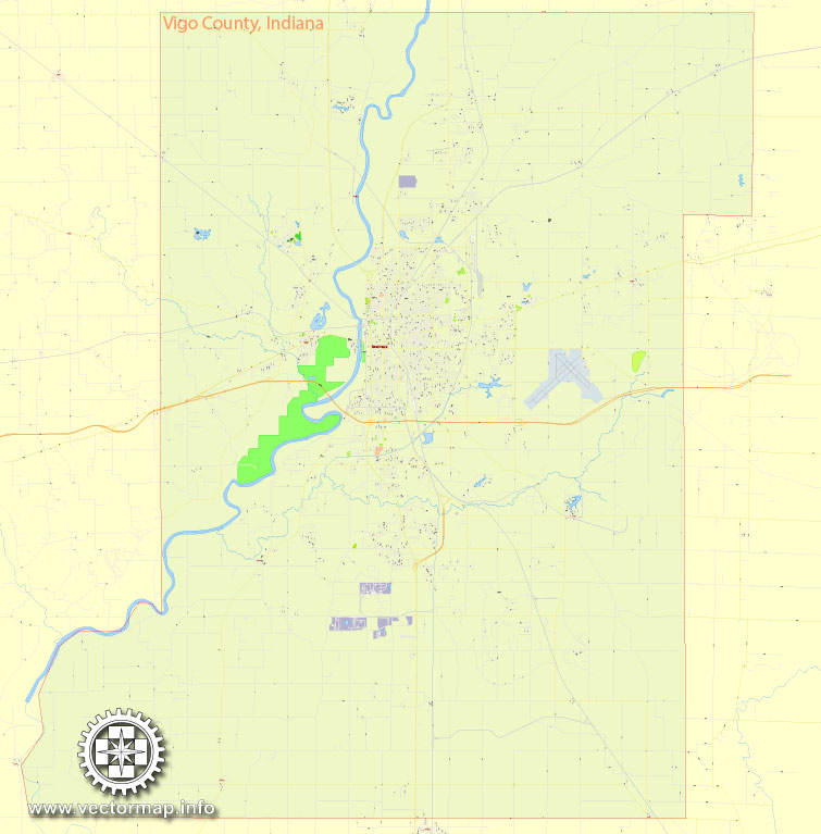
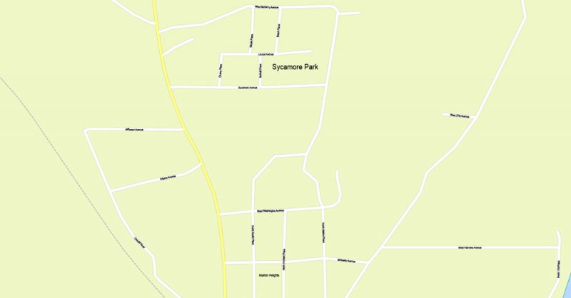
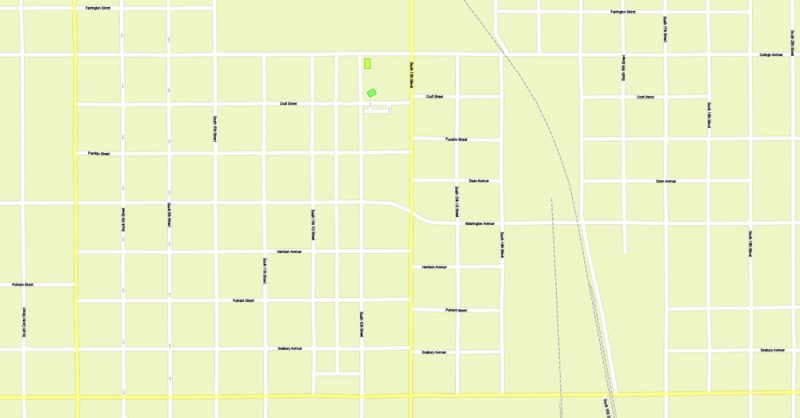
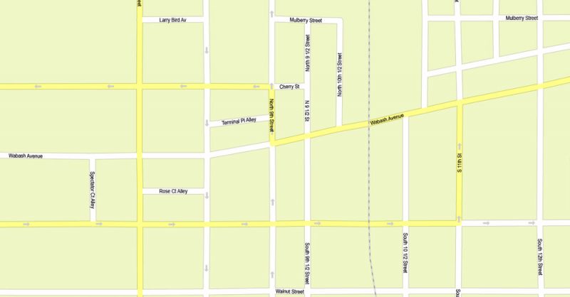
Vigo County + Terre Haute, Indiana.
This vector map of Vigo County is used as a basis for design, editing, and further printing.
This is the most detailed, exact map of Vigo County for high-quality printing and polygraphy. You can always clarify the map development date by contacting us.
For your convenience, all objects on Vigo County vector map are divided into layers. And the editing is very easy – colors, lines, etc.
You can easily add any objects needed (e.g. shops, salons, sale points, gas station or attraction) on any layer of Vigo County vector map.
Vigo County is a county located along the western border of the U.S. state of Indiana. According to the 2010 census, the population was 107,848. The county seat is Terre Haute.
One of the advantages of Vigo County vector maps of our production is the relevance of cartographic data, we constantly update all our products.
This vector map of Vigo County is used by:
designers, layout designers, printers, advertisers and architects. Our product – vector maps – is designed for further editing and printing in large formats – from @Wall format (a few meters) to A-0 and A-1, A-2, A-3.
Vigo County map in vector format is used for design, urban planning, presentations and media visualizations.
Advertising and presentation map of Vigo County (usually the final designer marks the routes, and puts the client’s objects (shops, saloons, gas stations etc.)
The undoubted advantage is that people will NEVER throw out this advertising product – the map. In fact, as an advertising medium, a map is the most “long-playing” of the well-known polygraphic advertising media, with the longest lifespan, and the maximum number of interactions with the customer.
For travelers, maps are sold at the airports and gas stations around the world. Often the source is our vector maps.
Take a look, who purchases our vector maps of Vigo County in “Our Clients and Friends” page – these are large and small companies, from super-brands like Volvo and Starbucks, to small design studios and printing houses.
It’s very easy to work with vector maps of Vigo County, even for a not very experienced designer who can turn on and off the map layers, add new objects, change the colors of fill and lines according to customer requirements.
The undoubted advantage of Vigo County vector maps in printing is an excellent and detailed visualization, when customer can expand a large paper map and instantly define his location, find a landmark, an object or address on map, unlike using the popular electronic formats of Google and Yandex maps for example.
Printable vector maps of Vigo County are much more convenient and efficient than any electronic maps on your smartphone, because ALL DETAILS are displayed in the entire space of Vigo County map.
Vigo County is included in the Terre Haute, Indiana, Metropolitan Statistical Area.
The county contains four incorporated settlements with a total population of nearly 63,000, as well as several unincorporated communities. It is divided into twelve townships which provide local services to the residents.
Useful tips on working with vector maps of cities and countries in Adobe Illustrator.
«V» – launches the Selection tool (cursor, black arrow), which makes active any vector line.
«А» – launches the Direct Selection tool (white cursor), allows you to select curve elements and drag them to the desired place.
«R» – activates the Rotate tool, which helps you rotating selected objects around the center point by 360 degrees.
«E» – gives you the opportunity to use the Eraser tool and erase unnecessary parts.
«X» – switches between Fill and Stroke in the Tools section. Try to get used to this hot key and
you will quickly understand that you can’t live and work without it.
Guides are not limited to vertical and horizontal in Adobe Illustrator. You can also create a diagonal guide for example. Moreover, you can turn any contours into guides. Select the outline and go to View > Guides > Make Guides (Create Guides), or simply press Cmd/Ctrl + 5. You can also turn the guides back into an editable object. Go to menu, View > Guides > Unlock Guides (Release Guides), select the guide you want to edit and select View > Guides > Release Guides (Reset Guides), or just press Cmd/Ctrl + Option / Alt + 5).
You will probably want to change the color scheme used on our Vigo County vector map.
To quickly and effectively play with colors.
Of course, you can do it manually, all objects in our Vigo County vector map are divided according to types and layers, and you can easily change the color gamma of vector objects in groups and layers.
But there is more effective way of working with the whole VECTOR MAP of Vigo County and all layers:
The overview dialog «Edit colors»/«Repaint Graphic Object» (this dialog box name can change depending on the context):
If you have selected a part or a layer of Vigo County vector map and open the dialog box by clicking the icon in the Control panel, on the Samples palette or the Color Catalog, or if you choose Edit > Edit Colors> Repaint Graphic Object, then the «Repaint Graphic Object» dialog box appears, and you get access to «Assign» and «Edit» tabs.
If a picture or a map fragment is not selected, and you open the dialog box by clicking the icon in the Control panel, on the Samples palette or in the Color Catalog, the «Edit Colors» dialog box appears and you can only access the «Edit» tab.
Regardless of the name at the top of the dialog box, the right-hand side always displays the color group of the current document, as well as two default color groups: Print Color and Grayscale. These color groups can be selected and used any time.
Create and edit color groups of Vigo County vector map, and also assign colors using the «Edit Colors»/ а «Repaint Graphic Object» dialog box.
A. Creating and editing of a color group on the «Edit» tab
B. Assigning colors on the «Assign» tab
C. Select a group of colors from the «Color groups» list
The option «Repaint a graphic object» in the lower part of the dialog box allows you to preview the colors on a selected layer of Vector map, or a group of elements, and specify whether its colors will be redefined when the dialog box is closed.
The main areas of the dialog box are:
«Edit»
The «Edit» tab is designed to create a new or edit the existing color groups.
The harmony rules Menu and the Color Wheel are used to conduct experiments with color harmonies. The color wheel shows how colors are related in color harmony, and the color bars allow you to view and manipulate an individual color values. In addition, you can adjust the brightness, add and remove colors, save color groups and view colors on the selected Vector Map of Vigo County or a separated layers.
«Assign»
The «Assign» tab is used to view and control on how the original colors are replaced with colors from the color group like your corporate colors in the Vector Map of Vigo County.
The assign color ability is provided only if the entire map, layer or fragment is selected in the document. You can specify which of new colors replace the current colors, whether the spot colors should be preserved and how colors are replaced (for example, you can replace colors completely or changing the color tone while maintaining the brightness). The «Assign» tab allows you to redefine colors in the Vector Map of Vigo County, or in separate layers and fragments using the current color group or reducing the number of colors in the current Vector Map.
Color groups
Is a list of all saved color groups for current document (the same groups appear in the «Samples» palette). You can edit and delete the existing color groups, as well as creating a new ones using the list of “Color Groups” in the dialog box. All changes appear in the «Samples» palette.
The highlighted color group shows, which color group is currently edited.
Any color group can be selected and edited, or used to redefine the colors in the selected vector map of Vigo County, its fragments or elements.
Saving a color group adds this group to the specified list.
Opening the «Edit Colors»/«Repaint Graphic Object» dialog box.
Open the «Edit Colors»/«Repaint Graphic Object» dialog box using one of the following methods:
«Edit»> «Edit Colors»> «Repaint Graphic object» or «Repaint With Style».
Use these commands if you need to edit the colors in the selected vector map of Vigo County.
«Repaint Graphic object» button on the «Control» panel.
Use this button if you need to adjust colors of Vigo County vector map using the а «Repaint graphic object» dialog box.
The specified button is available if the selected vector map or its fragment contains two or more colors.
Note. This color editing method is convenient for global color adjustment in a vector map, if global colors were not used when creating a Map of Vigo County.
The «Edit colors» button or «Edit or apply colors» on the «Color Catalog» palette
Click this button if you need to edit colors on the «Color Catalog» palette or edit and then apply them to the selected Vector Map of Vigo County or its fragment.
The «Edit color group» button or «Edit or apply color group» on the «Samples» palette.
Click this button if you need to edit the colors in the specific color group or edit and apply them to the selected Vector Map of Vigo County or a group of its elements, for example, the whole layer “Streets and lines”. You can also double-click the color group in the Samples panel to open the dialog box.
If the map file is too large and your computer freezes or even can’t open it quickly:
1. Try to reduce the color resolution of the video card (display) to 256 colors while working with a large map.
2. Using Windows Task Manager, select all the application you don’t need, while working with map, just turn them off.
3. Launch Adobe Illustrator. (DO NOT OPEN the vector map file)
4. Start the Windows Task Manager using administrator rights > Find the “Illustrator” process > set the «real time» priority,
5. Open the file. When you see the LEGACY FONT popup window – click “OK” (do not update). You can restore the TEXT later.
6. Can also be useful: When file is opened – Edit > Settings > Basic Settings > disable smoothing. /// It looks scary, but works quickly)))
We recommend saving the file in Adobe Illustrator 10 version. It’s much more stable when working with VERY BIG size files.
The county is one of the best bellwether regions for voting in U.S. presidential elections; it has voted for the winning candidate in every election since 1956 and in all but two elections since 1888. Only one county in the United States (Valencia County, New Mexico) has voted for the winning candidate longer.
Geography
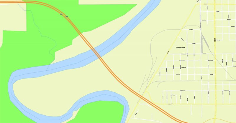
To the north of Vigo County, the Wabash River defines the boundary between Vermillion and Parke counties; the river then enters Vigo County and winds to the south-southwest, defining the southern portion of the county’s western border before continuing south along Sullivan County’s western border. Vigo County is thus the southernmost county in Indiana on the right bank of the Wabash. Clay County lies to the east. Across the state line are Edgar County to the northwest and Clark County to the southwest. According to the 2010 census, the county has a total area of 410.45 square miles (1,063.1 km2), of which 403.31 square miles (1,044.6 km2) (or 98.26%) is land and 7.14 square miles (18.5 km2) (or 1.74%) is water.
In 1819, the year after the county was formed, it was divided into four townships: Honey Creek, Wabash, Harrison and Independence. Prairie Creek Township was formed later that year. In the following years more townships were formed and township borders were altered several times. Otter Creek, Raccoon and Sugar Creek townships were created in 1820, and Independence Township became known as Paris Township. Raccoon and Wabash townships became part of Parke County when it was split from Vigo County in 1821. Nevins and Riley were formed in 1822. In 1824, Paris Township was renamed again to Fayette Township. Pierson Township was created in 1829, then Lost Creek in 1831, then Linton in 1841 and finally Prairieton in 1857, for a total of twelve townships.
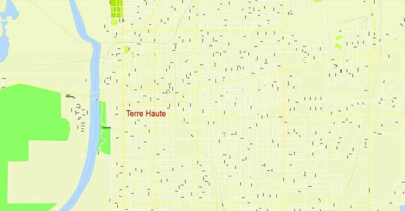
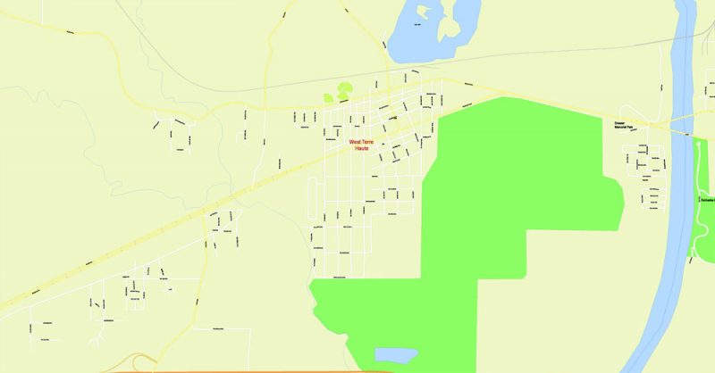
There are four incorporated settlements within Vigo County. The largest, Terre Haute, has a population of almost 60,000 and covers all of Harrison Township and extends into several surrounding townships. West Terre Haute, as its name indicates, lies to the west, along U.S. Route 40; it has a population of about 2,300. The town of Seelyville lies to the east of Terre Haute, also along U.S. Route 40, with a population of about 1,200. The smallest town, Riley, is southeast of Terre Haute and has a population of only 160.
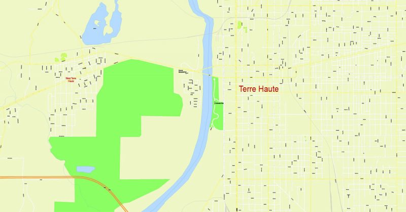
Terre Haute is a city in and the county seat of Vigo County, Indiana, United States, near the state’s western border with Illinois. As of the 2010 census, the city had a total population of 60,785 and its metropolitan area had a population of 170,943.
Located along the Wabash River, Terre Haute is the “capital” of the Wabash Valley. The city is home to several higher education institutions, including Indiana State University, Saint Mary-of-the-Woods College, Rose-Hulman Institute of Technology and Ivy Tech Community College of Indiana.
Geography
Terre Haute is located alongside the eastern bank of the Wabash River in western Indiana. The city lies about 75 miles (121 km) west of Indianapolis.
According to the 2010 census, Terre Haute has a total area of 35.272 square miles (91.35 km2), of which 34.54 square miles (89.46 km2) (or 97.92%) is land and 0.732 square miles (1.90 km2) (or 2.08%) is water.
The Wabash River dominates the physical geography of the city, forming its western border. Small bluffs on the east side of city mark the edge of the historic flood plain. Lost Creek and Honey Creek drain the northern and southern sections of the city, respectively. In the late 19th century (particularly during the Terre Haute Oil Craze of 1889), several oil and mineral wells were productive in and near the center of the city. Pioneer Oil of Lawrenceville, IL, began drilling for oil at 10th and Chestnut streets on the Indiana State University campus in late December 2013, the first oil well drilled in downtown Terre Haute since 1903. That well produced oil into the 1920s.
Terre Haute is at the intersection of two major roadways: U.S. 40 from California to Maryland and US 41 from Copper Harbor, Michigan to Miami, Florida. (US 41 is now locally named “3rd Street,” but historically it was “7th Street,” making “7th and Wabash” the Crossroads of America.) Terre Haute is located 77 miles (124 km) southwest of Indianapolis and within 185 miles (298 km) of Chicago, St. Louis, Louisville, and Cincinnati.
Vigo County, Indiana
Vigo County is a county located along the western border of the U.S. state of Indiana. The county seat is Terre Haute.
Area: 1,063 km²
Founded: 1818
Population: 108,291
Free vector maps:

Free download Vector Map US Interstate roads, Adobe PDF, V.2 Free_Map_US_Interstates_Roads_2.pdf
Free download Vector Map US Interstate roads, Adobe Illustrator, V.2 Free_Map_US_Interstates_Roads_2.ai

Free Download Vector Map US County and State Adobe Illustrator
Free_Vector_Map_US_States_County_Map.ai
Free Download Vector Map US County and State Adobe PDF
Free_Vector_Map_US_States_County_Map.pdf

Free Vector Map US Census Data Top US Ancestries by County Adobe Illustrator
Free_Vector_Map_US_Census-Data-Top-US-Ancestries-by-County.ai
Free Vector Map US Census Data Top US Ancestries by County Adobe PDF
Free_Vector_Map_US_Census-Data-Top-US-Ancestries-by-County.pdf
Free US Maps from WIKIPEDIA
Small guide: How to work with the vector map?
You can: Mass select objects by type and color – for example, the objects type “building” (they are usually dark gray) – and remove them from the map, if you do not need them in your print or design project. You can also easily change the thickness of lines (streets), just bulk selection the road by the line color.
The streets are separated by type, for example, type “residential road” are usually white with a gray stroke. Highway usually orange with a brown or dark gray stroke.
It is easy to change the font of inscriptions, all or each individually. Also, just can be make and any other manipulation of objects on the vector map in Adobe illustrator format.
Important: All the proportions on the map are true, that is, the relative sizes of the objects are true, because Map is based on an accurate GPS projection, and It transated into the (usual for all) the Mercator projection.
You can easily change the color, stroke and fill of any object on the map, zoom without loss of quality Image Verification.
Select object

Bulk selection the same objects on the vector map

See the bulk selected objects on the vector map

Bulk delete buildungs from the vector map

Select residencial road (small street) on the vector map

Bulk selection the same lines (streets, roads) on the full map

Create fat lines of the streets on the vector maps (bulk action) 1

Create fat lines of the streets on the vector maps (bulk action) 2

Create fat lines of the streets on the vector maps (bulk action) 3

You can easily change the color, stroke and fill of any object on the map, zoom without loss of quality Image Verification.

 Author: Kirill Shrayber, Ph.D. FRGS
 Indiana US Map Vector City Plan High Detailed Street Map editable Adobe Illustrator in layers")

