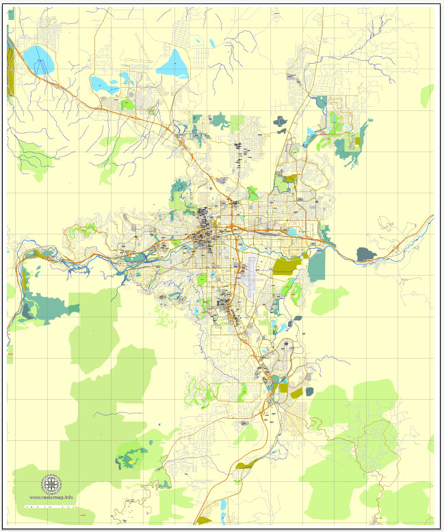
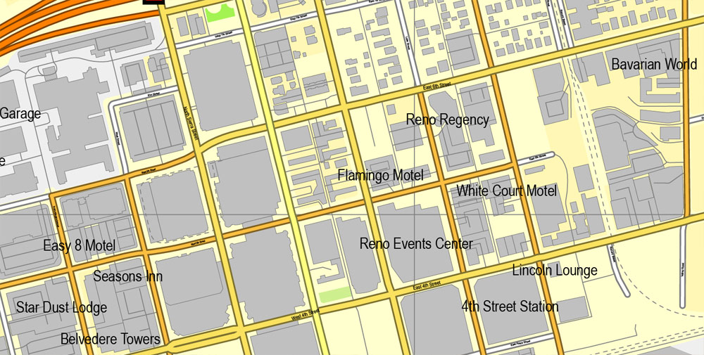
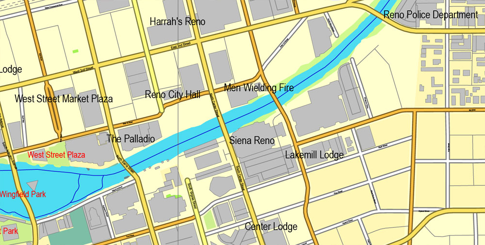
Reno, Nevada, US, exact vector street City Plan map V3.09, full editable, Adobe Illustrator, full vector, scalable, editable text format street names, 10 mb ZIP
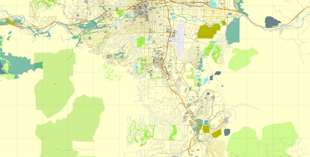
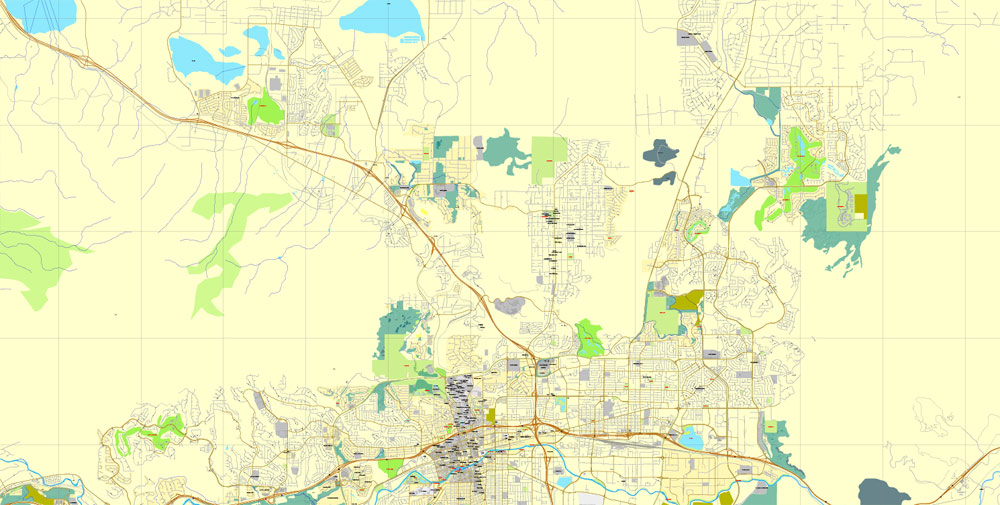
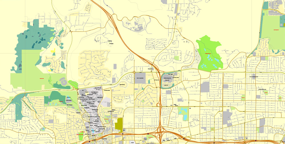
All streets, Principal buildings. Map for publishing, design, printing, publications, arts, projects, presentations, for architects, designers and builders, business, logistics. The most exact and detailed map of the city.
DXF, DWG, CDR and other formats – on request, same price, please, contact
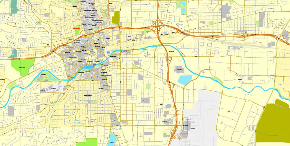
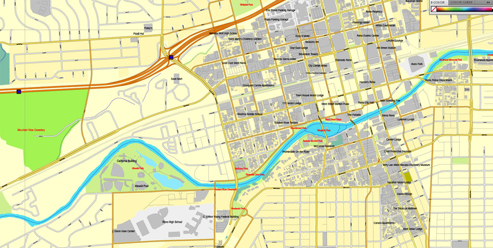
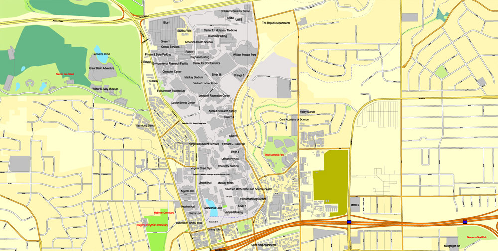
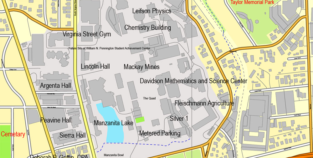
Reno, Nevada, USA.
This vector map of Reno city is used as a basis for design, editing, and further printing.
This is the most detailed, exact map of Reno city for high-quality printing and polygraphy. You can always clarify the map development date by contacting us.
For your convenience, all objects on Reno vector city map are divided into layers. And the editing is very easy – colors, lines, etc.
You can easily add any objects needed (e.g. shops, salons, sale points, gas station or attraction) on any layer of Reno vector map.
Reno is a city in the U.S. state of Nevada, located in the western part of the state, approximately 22 miles (35 km) from Lake Tahoe. Known as “The Biggest Little City in the World”, Reno is famous for its hotels and casinos and as the birthplace of Harrah’s Entertainment (now known as Caesars Entertainment Corporation). It is the county seat of Washoe County, in the northwestern part of the state. The city sits in a high desert at the foot of the Sierra Nevada and its downtown area (along with Sparks) occupies a valley informally known as the Truckee Meadows. It is named after slain Union Major General Jesse L. Reno.
One of the advantages of Reno city vector maps of our production is the relevance of cartographic data, we constantly update all our products.
This vector map of Reno city is used by:
designers, layout designers, printers, advertisers and architects. Our product – vector maps – is designed for further editing and printing in large formats – from @Wall format (a few meters) to A-0 and A-1, A-2, A-3.
The Reno city map in vector format is used for design, urban planning, presentations and media visualizations.
The advertising and presentation map of Reno city (usually the final designer marks the routes, and puts the client’s objects (shops, saloons, gas stations etc.)
The undoubted advantage is that people will NEVER throw out this advertising product – the map. In fact, as an advertising medium, a city map is the most “long-playing” of the well-known polygraphic advertising media, with the longest lifespan, and the maximum number of interactions with the customer.
For travelers, maps are sold at the airports and gas stations around the world. Often the source is our vector maps.
Reno is the third-most populous city in Nevada after Las Vegas and Henderson and the most populous city in the state outside the Las Vegas Valley, with an estimated population of 248,853 in 2017. Reno is part of the Reno–Sparks metropolitan area, which consists of all of both Washoe and Storey counties and has a 2017 estimated population of 464,593.
Take a look, who purchases our vector maps of Reno city in “Our Clients and Friends” page – these are large and small companies, from super-brands like Volvo and Starbucks, to small design studios and printing houses.
It’s very easy to work with vector maps of Reno city, even for a not very experienced designer who can turn on and off the map layers, add new objects, change the colors of fill and lines according to customer requirements.
The undoubted advantage of Reno city vector maps in printing is an excellent and detailed visualization, when customer can expand a large paper map and instantly define his location, find a landmark, an object or address on map, unlike using the popular electronic formats of Google and Yandex maps for example.
Printable vector maps of Reno city are much more convenient and efficient than any electronic maps on your smartphone, because ALL DETAILS are displayed in the entire space of Reno city map.
Useful tips on working with vector maps of cities and countries in Adobe Illustrator.
«V» – launches the Selection tool (cursor, black arrow), which makes active any vector line.
«А» – launches the Direct Selection tool (white cursor), allows you to select curve elements and drag them to the desired place.
«R» – activates the Rotate tool, which helps you rotating selected objects around the center point by 360 degrees.
«E» – gives you the opportunity to use the Eraser tool and erase unnecessary parts.
«X» – switches between Fill and Stroke in the Tools section. Try to get used to this hot key and
you will quickly understand that you can’t live and work without it.
Guides are not limited to vertical and horizontal in Adobe Illustrator. You can also create a diagonal guide for example. Moreover, you can turn any contours into guides. Select the outline and go to View > Guides > Make Guides (Create Guides), or simply press Cmd/Ctrl + 5. You can also turn the guides back into an editable object. Go to menu, View > Guides > Unlock Guides (Release Guides), select the guide you want to edit and select View > Guides > Release Guides (Reset Guides), or just press Cmd/Ctrl + Option / Alt + 5).
Geography
Wetlands are an important part of the Reno/Tahoe area. They act as a natural filter for the solids that come out of the water treatment plant. Plant roots absorb nutrients from the water and naturally filter it. Wetlands are home to over 75% of the species in the Great Basin. However, the area’s wetlands are at risk of being destroyed due to development around the city. While developers build on top of the wetlands they fill them with dirt, destroying the habitat they create for the plants and animals. Washoe County has devised a plan that will help protect these ecosystems: mitigation. In the future, when developers try to build over a wetland, they will be responsible for creating another wetland near Washoe Lake.
You will probably want to change the color scheme used on our Reno vector city map.
To quickly and effectively play with colors.
Of course, you can do it manually, all objects in our Reno city vector map are divided according to types and layers, and you can easily change the color gamma of vector objects in groups and layers.
But there is more effective way of working with the whole VECTOR MAP of Reno city and all layers:
The overview dialog «Edit colors»/«Repaint Graphic Object» (this dialog box name can change depending on the context):
If you have selected a part or a layer of Reno city vector map and open the dialog box by clicking the icon in the Control panel, on the Samples palette or the Color Catalog, or if you choose Edit > Edit Colors> Repaint Graphic Object, then the «Repaint Graphic Object» dialog box appears, and you get access to «Assign» and «Edit» tabs.
If a picture or a map fragment is not selected, and you open the dialog box by clicking the icon in the Control panel, on the Samples palette or in the Color Catalog, the «Edit Colors» dialog box appears and you can only access the «Edit» tab.
Regardless of the name at the top of the dialog box, the right-hand side always displays the color group of the current document, as well as two default color groups: Print Color and Grayscale. These color groups can be selected and used any time.
Create and edit color groups of Reno city vector map, and also assign colors using the «Edit Colors»/ а «Repaint Graphic Object» dialog box.
A. Creating and editing of a color group on the «Edit» tab
B. Assigning colors on the «Assign» tab
C. Select a group of colors from the «Color groups» list
The option «Repaint a graphic object» in the lower part of the dialog box allows you to preview the colors on a selected layer of Vector map, or a group of elements, and specify whether its colors will be redefined when the dialog box is closed.
The main areas of the dialog box are:
«Edit»
The «Edit» tab is designed to create a new or edit the existing color groups.
The harmony rules Menu and the Color Wheel are used to conduct experiments with color harmonies. The color wheel shows how colors are related in color harmony, and the color bars allow you to view and manipulate an individual color values. In addition, you can adjust the brightness, add and remove colors, save color groups and view colors on the selected Vector Map of Reno city or a separated layers.
«Assign»
The «Assign» tab is used to view and control on how the original colors are replaced with colors from the color group like your corporate colors in the Vector Map of Reno city.
The assign color ability is provided only if the entire map, layer or fragment is selected in the document. You can specify which of new colors replace the current colors, whether the spot colors should be preserved and how colors are replaced (for example, you can replace colors completely or changing the color tone while maintaining the brightness). The «Assign» tab allows you to redefine colors in the Vector Map of Reno city, or in separate layers and fragments using the current color group or reducing the number of colors in the current Vector Map.
Color groups
Is a list of all saved color groups for current document (the same groups appear in the «Samples» palette). You can edit and delete the existing color groups, as well as creating a new ones using the list of “Color Groups” in the dialog box. All changes appear in the «Samples» palette.
The highlighted color group shows, which color group is currently edited.
Any color group can be selected and edited, or used to redefine the colors in the selected vector map of Reno city, its fragments or elements.
Saving a color group adds this group to the specified list.
Opening the «Edit Colors»/«Repaint Graphic Object» dialog box.
Open the «Edit Colors»/«Repaint Graphic Object» dialog box using one of the following methods:
«Edit»> «Edit Colors»> «Repaint Graphic object» or «Repaint With Style».
Use these commands if you need to edit the colors in the selected vector map of Reno city.
«Repaint Graphic object» button on the «Control» panel.
Use this button if you need to adjust colors of Reno city vector map using the а «Repaint graphic object» dialog box.
The specified button is available if the selected vector map or its fragment contains two or more colors.
Note. This color editing method is convenient for global color adjustment in a vector map, if global colors were not used when creating a City Map of Reno.
The «Edit colors» button or «Edit or apply colors» on the «Color Catalog» palette
Click this button if you need to edit colors on the «Color Catalog» palette or edit and then apply them to the selected Vector Map of Reno city or its fragment.
The «Edit color group» button or «Edit or apply color group» on the «Samples» palette.
Click this button if you need to edit the colors in the specific color group or edit and apply them to the selected Vector Map of Reno city or a group of its elements, for example, the whole layer “Streets and lines”. You can also double-click the color group in the Samples panel to open the dialog box.
If the map file is too large and your computer freezes or even can’t open it quickly:
1. Try to reduce the color resolution of the video card (display) to 256 colors while working with a large map.
2. Using Windows Task Manager, select all the application you don’t need, while working with map, just turn them off.
3. Launch Adobe Illustrator. (DO NOT OPEN the vector map file)
4. Start the Windows Task Manager using administrator rights > Find the “Illustrator” process > set the «real time» priority,
5. Open the file. When you see the LEGACY FONT popup window – click “OK” (do not update). You can restore the TEXT later.
6. Can also be useful: When file is opened – Edit > Settings > Basic Settings > disable smoothing. /// It looks scary, but works quickly)))
We recommend saving the file in Adobe Illustrator 10 version. It’s much more stable when working with VERY BIG size files.
The Truckee River serves as Reno’s primary source of drinking water. It supplies Reno with 80 million U.S. gallons (300 Ml) of water a day during the summer, and 40 million U.S. gallons (150 Ml) of water per day in the winter. Before the water goes to the homes around the Reno area, it must go to one of two water treatment plants, Chalk Bluff or Glendale Water Treatment Plant. As an attempt to save water, golf courses in Reno have been using treated effluent water instead of treated water from one of Reno’s water plants.
The Reno-Sparks wastewater treatment plant discharges tertiary treated effluent to the Truckee River. In the 1990s this capacity was increased from 20 to 30 million U.S. gallons (70 to 110 million liters) per day. While treated, the effluent contains suspended solids, nitrogen, and phosphorus, aggravating water quality concerns of the river and its receiving waters of Pyramid Lake. Local agencies working with the Environmental Protection Agency have developed a number of watershed management strategies to accommodate this expanded effluent discharge; to accomplish this successful outcome, the DSSAM Model was developed and calibrated for the Truckee River in order to analyze the most cost-effective available management strategy set. The resulting management strategies included a package of measures such as land use controls in the Lake Tahoe basin, urban runoff controls in Reno and Sparks, and best management practices for wastewater discharge.
Reno Nevada and the Truckee Meadows south west of the Reno Tahoe International Airport has a large herd of Mustang horses. These horses nurse and range around the runoff of Steamboat Creek. The Mustang is a notable iconic image of the Nevada range land which includes Reno.
The Reno area is frequently subject to wildfires, causing property damage and sometimes loss of life. In August 1960, the Donner Ridge fire resulted in a loss of electricity to the city for four days. In November 2011, arcing from powerlines caused a fire in Caughlin in southwest Reno that destroyed 26 homes and killed one older man, and only two months later in January 2012 another fire in Washoe Drive sparked by fireplace ashes destroyed 29 homes and killed one older woman. Around 10,000 residents were evacuated, and a state of emergency was declared. The fires came at the end of Reno’s longest recorded dry spell.
Reno is a city in the U.S. state of Nevada by the Sierra Nevadas and Lake Tahoe. Dubbed “The Biggest Little City in the World,” it’s known for its casinos and its proximity to many ski resorts. Downtown’s National Automobile Museum showcases more than 200 vintage cars. The MidTown District is lined with shops and restaurants. North of downtown, Animal Ark is a sanctuary for rescued bears, cheetahs and other wildlife.
Population: 233,294 (2013)
Free vector maps:

Free download Vector Map US Interstate roads, Adobe PDF, V.2 Free_Map_US_Interstates_Roads_2.pdf
Free download Vector Map US Interstate roads, Adobe Illustrator, V.2 Free_Map_US_Interstates_Roads_2.ai

Free Download Vector Map US County and State Adobe Illustrator
Free_Vector_Map_US_States_County_Map.ai
Free Download Vector Map US County and State Adobe PDF
Free_Vector_Map_US_States_County_Map.pdf

Free Vector Map US Census Data Top US Ancestries by County Adobe Illustrator
Free_Vector_Map_US_Census-Data-Top-US-Ancestries-by-County.ai
Free Vector Map US Census Data Top US Ancestries by County Adobe PDF
Free_Vector_Map_US_Census-Data-Top-US-Ancestries-by-County.pdf

 Author: Kirill Shrayber, Ph.D. FRGS

