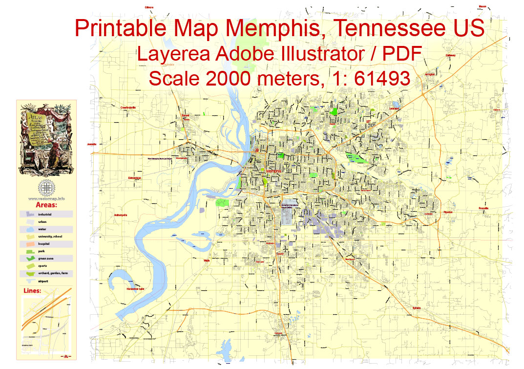
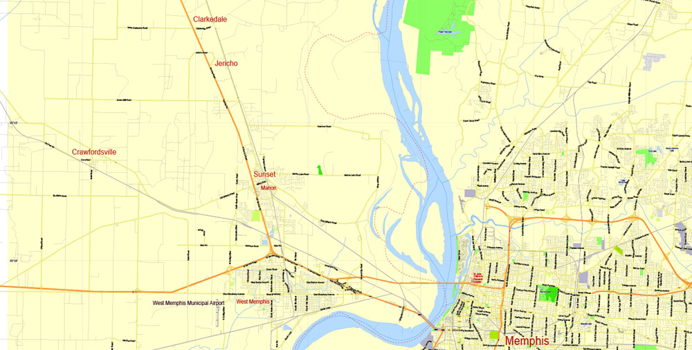
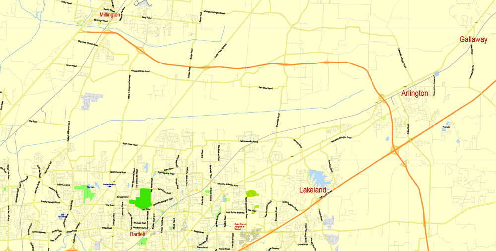
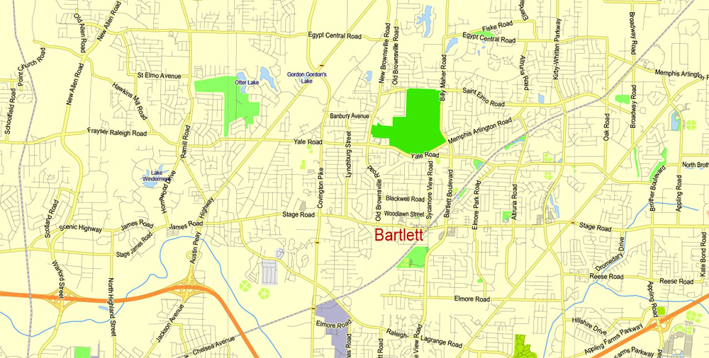
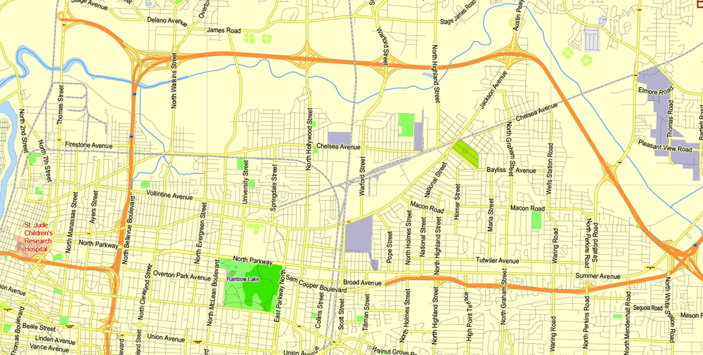
Printable Map Memphis, Tennessee US, exact vector City Plan Map street G-View Level 13 (2000 meters scale) full editable, Adobe Illustrator, full vector, scalable, editable text format street names, 9 mb ZIP
Major streets named, Main Objects. Map for design, printing, arts, projects, presentations, for architects, designers and builders, business, logistics.
Layers: color fills, streets_roads, labels_roads, names_objects, names_streets, names_places, grids, halo.
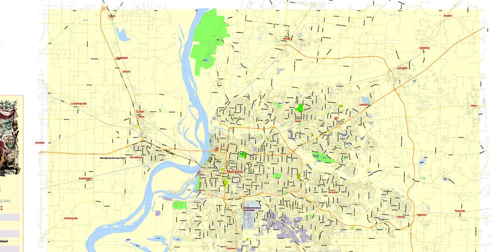
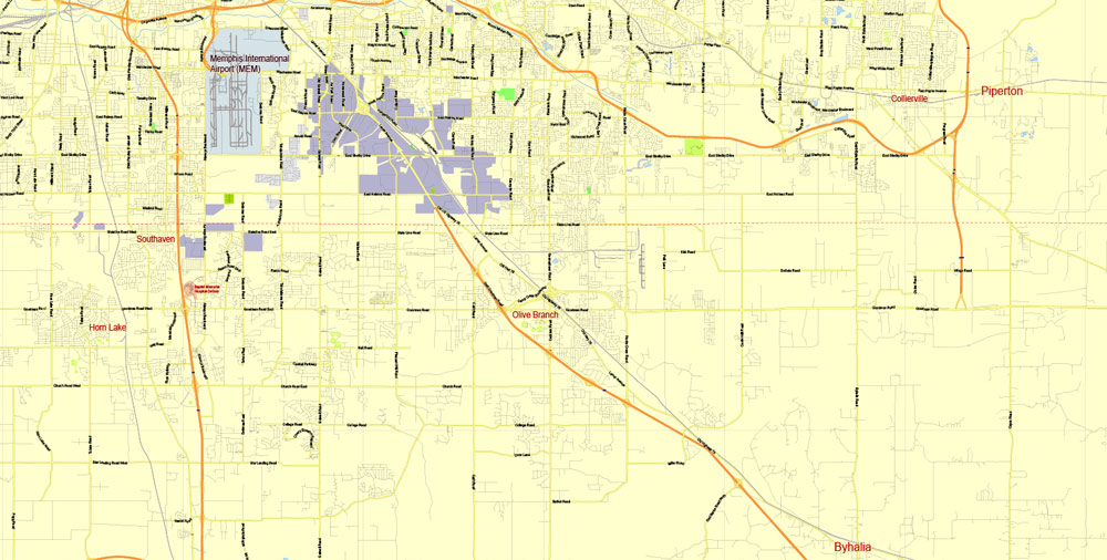
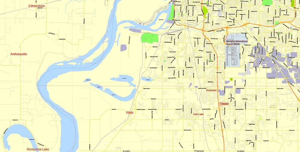
The most exact and detailed map of the city.
For print ANY format.
DWG, DXF and other formats – on request, same price, please, contact
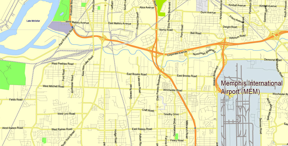
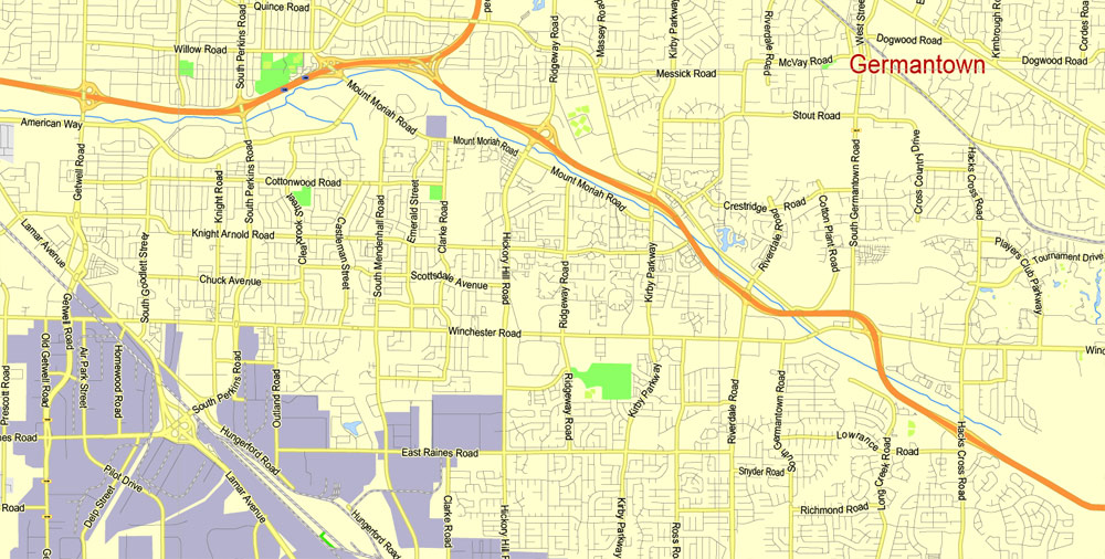
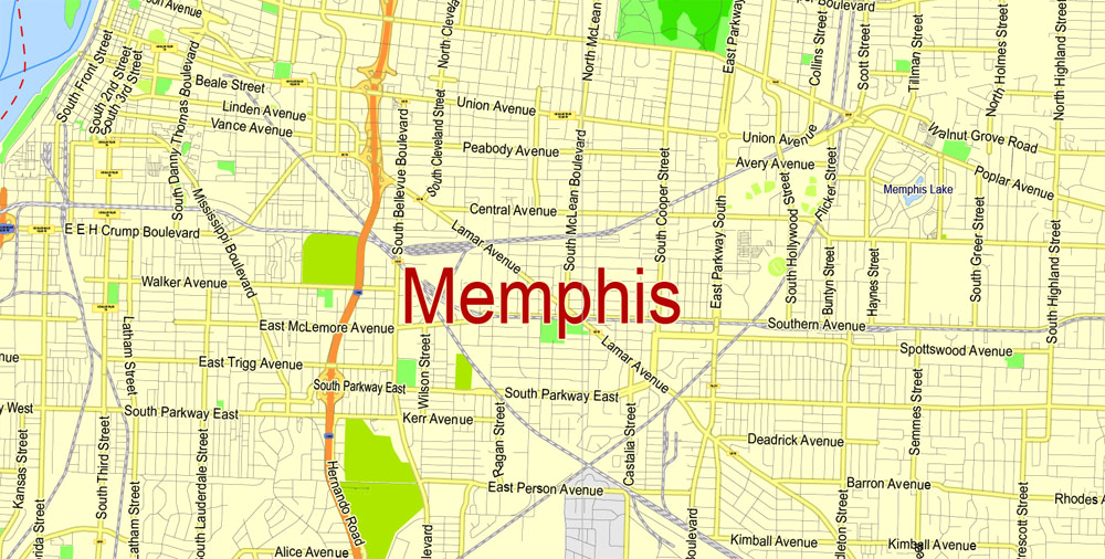
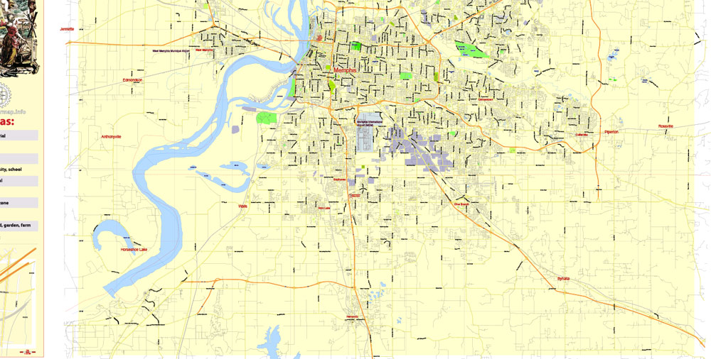
Memphis, Tennessee.
This vector map of Memphis city is used as a basis for design, editing, and further printing.
This is the most detailed, exact map of Memphis city for high-quality printing and polygraphy. You can always clarify the map development date by contacting us.
For your convenience, all objects on Memphis vector city map are divided into layers. And the editing is very easy – colors, lines, etc.
You can easily add any objects needed (e.g. shops, salons, sale points, gas station or attraction) on any layer of Memphis vector map.
Memphis is located along the Mississippi River in southwestern Tennessee. The 2017 city population was 652,236, and a metropolitan area population of 1,348,260. The city is the anchor of West Tennessee and the greater Mid-South region, which includes portions of neighboring Arkansas and Mississippi. Memphis is the seat of Shelby County, the most populous county in Tennessee. As one of the most historic and cultural cities of the southern United States, the city features a wide variety of landscapes and distinct neighborhoods.
One of the advantages of Memphis city vector maps of our production is the relevance of cartographic data, we constantly update all our products.
This vector map of Memphis city is used by:
designers, layout designers, printers, advertisers and architects. Our product – vector maps – is designed for further editing and printing in large formats – from @Wall format (a few meters) to A-0 and A-1, A-2, A-3.
The Memphis city map in vector format is used for design, urban planning, presentations and media visualizations.
The advertising and presentation map of Memphis city (usually the final designer marks the routes, and puts the client’s objects (shops, saloons, gas stations etc.)
The undoubted advantage is that people will NEVER throw out this advertising product – the map. In fact, as an advertising medium, a city map is the most “long-playing” of the well-known polygraphic advertising media, with the longest lifespan, and the maximum number of interactions with the customer.
For travelers, maps are sold at the airports and gas stations around the world. Often the source is our vector maps.
Take a look, who purchases our vector maps of Memphis city in “Our Clients and Friends” page – these are large and small companies, from super-brands like Volvo and Starbucks, to small design studios and printing houses.
It’s very easy to work with vector maps of Memphis city, even for a not very experienced designer who can turn on and off the map layers, add new objects, change the colors of fill and lines according to customer requirements.
The undoubted advantage of Memphis city vector maps in printing is an excellent and detailed visualization, when customer can expand a large paper map and instantly define his location, find a landmark, an object or address on map, unlike using the popular electronic formats of Google and Yandex maps for example.
Printable vector maps of Memphis city are much more convenient and efficient than any electronic maps on your smartphone, because ALL DETAILS are displayed in the entire space of Memphis city map.
The land of present-day Memphis was first discovered by Spanish conquistador Hernando de Soto in 1541 with his expedition into the New World. The high bluffs protecting the location from the waters of the Mississippi would then be contested between the Spanish, French, and the English as Memphis took shape. Modern Memphis was founded in 1819 by three prominent Americans: John Overton, James Winchester, and future president Andrew Jackson.
Memphis grew into one of the largest cities of the Antebellum South as a market for agricultural goods, natural resources like lumber, and the American slave trade. After the American Civil War and the end of slavery, the city experienced even faster growth into the 20th century as it became among the largest world markets for cotton and lumber.

Useful tips on working with vector maps of cities and countries in Adobe Illustrator.
«V» – launches the Selection tool (cursor, black arrow), which makes active any vector line.
«А» – launches the Direct Selection tool (white cursor), allows you to select curve elements and drag them to the desired place.
«R» – activates the Rotate tool, which helps you rotating selected objects around the center point by 360 degrees.
«E» – gives you the opportunity to use the Eraser tool and erase unnecessary parts.
«X» – switches between Fill and Stroke in the Tools section. Try to get used to this hot key and
you will quickly understand that you can’t live and work without it.
Guides are not limited to vertical and horizontal in Adobe Illustrator. You can also create a diagonal guide for example. Moreover, you can turn any contours into guides. Select the outline and go to View > Guides > Make Guides (Create Guides), or simply press Cmd/Ctrl + 5. You can also turn the guides back into an editable object. Go to menu, View > Guides > Unlock Guides (Release Guides), select the guide you want to edit and select View > Guides > Release Guides (Reset Guides), or just press Cmd/Ctrl + Option / Alt + 5).
Home to Tennessee’s largest African-American population, Memphis played a prominent role in the American civil rights movement and was the site of Dr. Martin Luther King, Jr.’s 1968 assassination. The city now hosts the National Civil Rights Museum—a Smithsonian affiliate institution. Since the civil rights era, Memphis has grown to become one of the nation’s leading commercial centers in transportation and logistics. The city’s largest employer is the multinational courier corporation FedEx, which maintains its global air hub at Memphis International Airport, making it the second-busiest cargo airport in the world.
You will probably want to change the color scheme used on our Memphis vector city map.
To quickly and effectively play with colors.
Of course, you can do it manually, all objects in our Memphis city vector map are divided according to types and layers, and you can easily change the color gamma of vector objects in groups and layers.
But there is more effective way of working with the whole VECTOR MAP of Memphis city and all layers:
The overview dialog «Edit colors»/«Repaint Graphic Object» (this dialog box name can change depending on the context):
If you have selected a part or a layer of Memphis city vector map and open the dialog box by clicking the icon in the Control panel, on the Samples palette or the Color Catalog, or if you choose Edit > Edit Colors> Repaint Graphic Object, then the «Repaint Graphic Object» dialog box appears, and you get access to «Assign» and «Edit» tabs.
If a picture or a map fragment is not selected, and you open the dialog box by clicking the icon in the Control panel, on the Samples palette or in the Color Catalog, the «Edit Colors» dialog box appears and you can only access the «Edit» tab.
Regardless of the name at the top of the dialog box, the right-hand side always displays the color group of the current document, as well as two default color groups: Print Color and Grayscale. These color groups can be selected and used any time.
Today, Memphis is a regional center for commerce, education, media, art, and entertainment. The city has long had a prominent music scene, with historic blues clubs on Beale Street originating the unique Memphis blues sound during early 20th century. The city’s music has continued to be shaped by a multi-cultural mix of influences across the blues, country, rock n’ roll, soul, and hip-hop genres. Memphis barbecue has achieved international prominence, and the city hosts the World Championship Barbecue Cooking Contest, which attracts over 100,000 visitors to the city annually.
Create and edit color groups of Memphis city vector map, and also assign colors using the «Edit Colors»/ а «Repaint Graphic Object» dialog box.
A. Creating and editing of a color group on the «Edit» tab
B. Assigning colors on the «Assign» tab
C. Select a group of colors from the «Color groups» list
The option «Repaint a graphic object» in the lower part of the dialog box allows you to preview the colors on a selected layer of Vector map, or a group of elements, and specify whether its colors will be redefined when the dialog box is closed.
The main areas of the dialog box are:
«Edit»
The «Edit» tab is designed to create a new or edit the existing color groups.
The harmony rules Menu and the Color Wheel are used to conduct experiments with color harmonies. The color wheel shows how colors are related in color harmony, and the color bars allow you to view and manipulate an individual color values. In addition, you can adjust the brightness, add and remove colors, save color groups and view colors on the selected Vector Map of Memphis city or a separated layers.
«Assign»
The «Assign» tab is used to view and control on how the original colors are replaced with colors from the color group like your corporate colors in the Vector Map of Memphis city.
The assign color ability is provided only if the entire map, layer or fragment is selected in the document. You can specify which of new colors replace the current colors, whether the spot colors should be preserved and how colors are replaced (for example, you can replace colors completely or changing the color tone while maintaining the brightness). The «Assign» tab allows you to redefine colors in the Vector Map of Memphis city, or in separate layers and fragments using the current color group or reducing the number of colors in the current Vector Map.
Color groups
Is a list of all saved color groups for current document (the same groups appear in the «Samples» palette). You can edit and delete the existing color groups, as well as creating a new ones using the list of “Color Groups” in the dialog box. All changes appear in the «Samples» palette.
The highlighted color group shows, which color group is currently edited.
Any color group can be selected and edited, or used to redefine the colors in the selected vector map of Memphis city, its fragments or elements.
Saving a color group adds this group to the specified list.
Opening the «Edit Colors»/«Repaint Graphic Object» dialog box.
Open the «Edit Colors»/«Repaint Graphic Object» dialog box using one of the following methods:
«Edit»> «Edit Colors»> «Repaint Graphic object» or «Repaint With Style».
Use these commands if you need to edit the colors in the selected vector map of Memphis city.
«Repaint Graphic object» button on the «Control» panel.
Use this button if you need to adjust colors of Memphis city vector map using the а «Repaint graphic object» dialog box.
The specified button is available if the selected vector map or its fragment contains two or more colors.
Note. This color editing method is convenient for global color adjustment in a vector map, if global colors were not used when creating a City Map of Memphis.
The «Edit colors» button or «Edit or apply colors» on the «Color Catalog» palette
Click this button if you need to edit colors on the «Color Catalog» palette or edit and then apply them to the selected Vector Map of Memphis city or its fragment.
The «Edit color group» button or «Edit or apply color group» on the «Samples» palette.
Click this button if you need to edit the colors in the specific color group or edit and apply them to the selected Vector Map of Memphis city or a group of its elements, for example, the whole layer “Streets and lines”. You can also double-click the color group in the Samples panel to open the dialog box.
If the map file is too large and your computer freezes or even can’t open it quickly:
1. Try to reduce the color resolution of the video card (display) to 256 colors while working with a large map.
2. Using Windows Task Manager, select all the application you don’t need, while working with map, just turn them off.
3. Launch Adobe Illustrator. (DO NOT OPEN the vector map file)
4. Start the Windows Task Manager using administrator rights > Find the “Illustrator” process > set the «real time» priority,
5. Open the file. When you see the LEGACY FONT popup window – click “OK” (do not update). You can restore the TEXT later.
6. Can also be useful: When file is opened – Edit > Settings > Basic Settings > disable smoothing. /// It looks scary, but works quickly)))
We recommend saving the file in Adobe Illustrator 10 version. It’s much more stable when working with VERY BIG size files.
Downtown Memphis rises from a bluff along the Mississippi River. The city and metro area spread out through suburbanization, and encompass southwest Tennessee, northern Mississippi and eastern Arkansas. Several large parks were founded in the city in the early 20th century, notably Overton Park in Midtown and the 4,500-acre (18 km2) Shelby Farms. The city is a national transportation hub and Mississippi River crossing for Interstate 40, (east-west), Interstate 55 (north-south), barge traffic, Memphis International Airport (FedEx’s “SuperHub” facility) and numerous freight railroads that serve the city.
In both 2011 and 2012, the magazine Travel + Leisure ranked Memphis among the top ten “America’s Dirtiest City”, for widespread visibly littered public spaces, with unremoved trash, based on surveys by both readership and local citizens.
On a more positive note, in 2013 Forbes magazine ranked Memphis as one of the top 15 cities in the United States with an “emerging downtown” area.
Also in 2013, USA Today readers voted Beale Street as America’s Best Iconic Street and Graceland as the Best Iconic American Attraction. The National Civil Rights Museum (at the Lorraine Motel, the site of Rev. Martin Luther King’s assassination) ranked third in the poll of national attractions.
Riverfront
The Memphis Riverfront stretches along the Mississippi River from the Meeman-Shelby Forest State Park in the north, to the T. O. Fuller State Park in the south. The River Walk is a park system that connects downtown Memphis from Mississippi River Greenbelt Park in the north, to Tom Lee Park in the south.
Memphis
City in Tennessee
Memphis is a city on the Mississippi River in southwest Tennessee, famous for the influential strains of blues, soul and rock ‘n’ roll that originated there. Elvis Presley, B.B. King and Johnny Cash recorded albums at the legendary Sun Studio, and Presley’s Graceland mansion is a popular attraction. Other music landmarks include the Rock ‘n’ Soul Museum, Blues Hall of Fame and Stax Museum of American Soul Music.
Area
• City 324.0 sq mi (839.2 km2)
• Land 315.1 sq mi (816.0 km2)
• Water 9.0 sq mi (23.2 km2)
Elevation 337 ft (103 m)
Population
• City 646,889
• Estimate 652,717
• Rank US: 25th
• Density 2,000/sq mi (770/km2)
• Urban 1,060,061 (US: 41st)
• Metro 1,341,746 (US: 41st)
Free US vector maps

Free Download Vector Map US County and State Adobe Illustrator
Free_Vector_Map_US_States_County_Map.ai
Free Download Vector Map US County and State Adobe PDF
Free_Vector_Map_US_States_County_Map.pdf

Free Download Vector Map US With States Names, Adobe Illustrator
Free_Map_of_USA_with_state_names_en.ai
Free Download Vector Map US With States Names, Adobe PDF
Free_Map_of_USA_with_state_names_en.pdf
From WIKI
Free vector map World, Adobe Illustrator, download now maps vector clipart
Map for design, projects, presentation free to use as you like.
See also: TERMS & CONDITIONS: SOFTWARE LICENSE AGREEMENT FOR DIGITAL CARTOGRAPHIC DATA.
Need more USA Vector Maps, printable and editable?

 Author: Kirill Shrayber, Ph.D. FRGS

