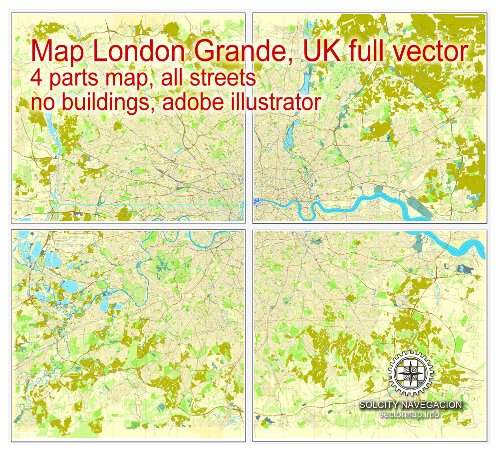
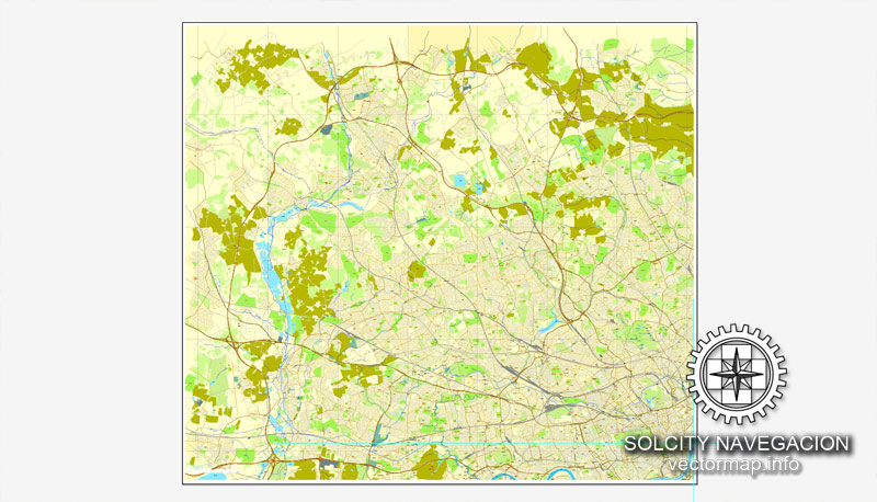
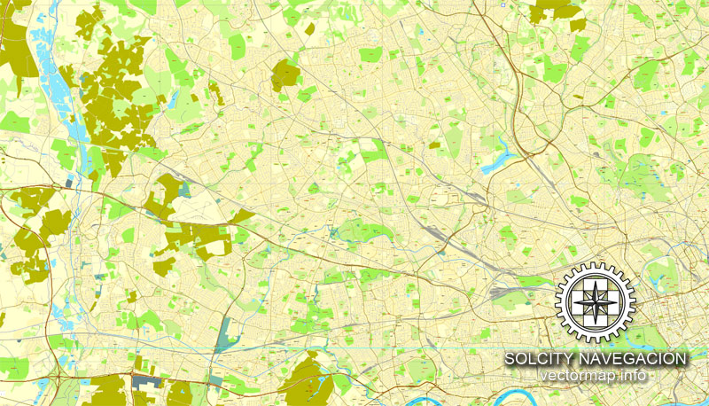
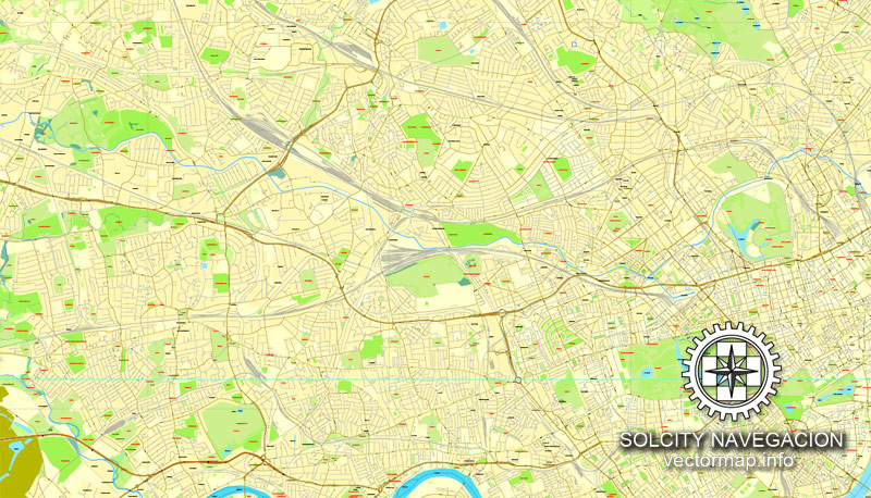
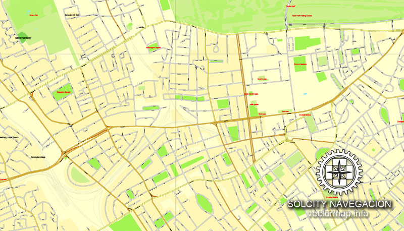
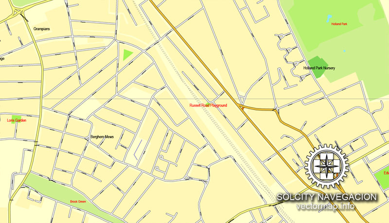
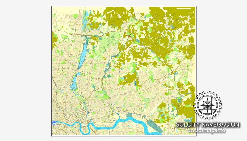
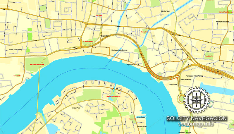
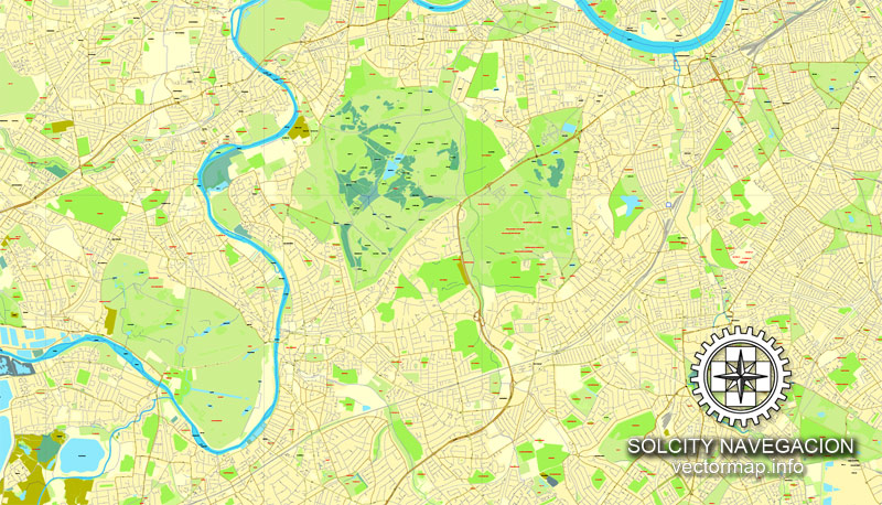
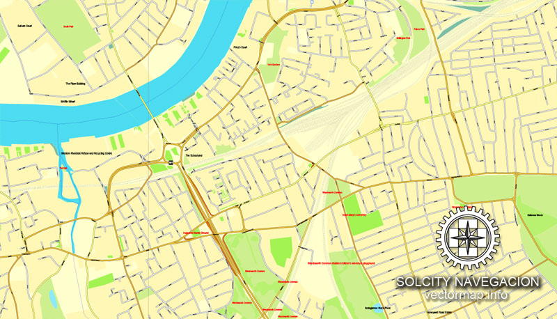
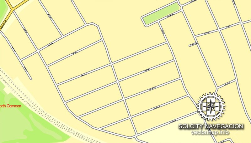
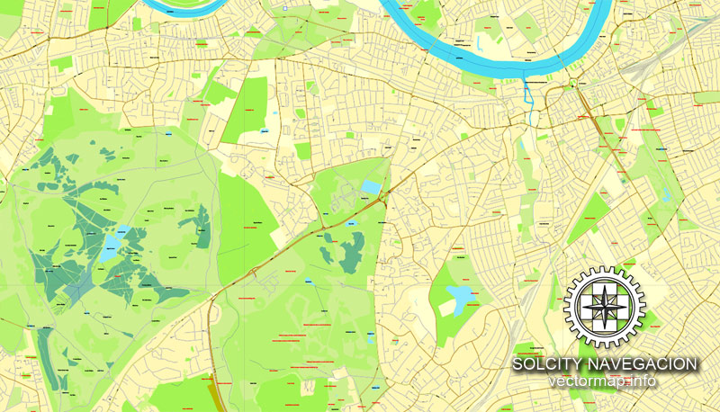
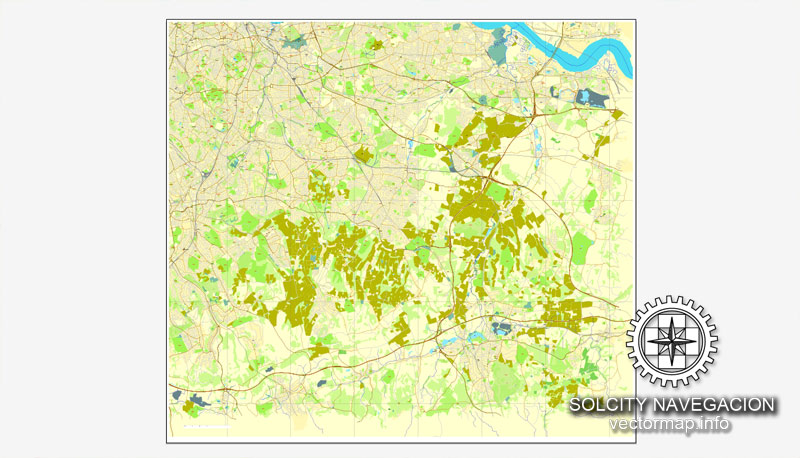
London, England, UK Great Britain, printable vector street City Plan map in 4 parts, full editable, Adobe PDF, full vector, scalable, editable, text format street names, 115 mb ZIP
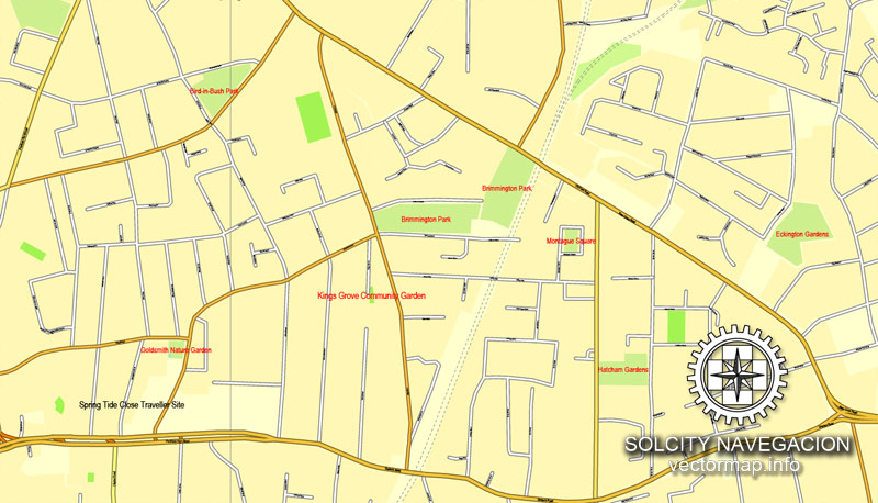
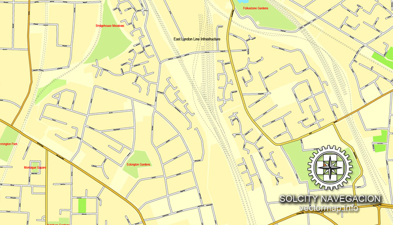
All streets, NO buildings. Map for design, print, arts, projects, presentations.
You can edit this file by Adobe Illustrator, Adobe Acrobat, Corel Draw.
The most accurate and detailed map of the city.
DXF, DWG, CDR and other formats – on request, same price, please, contact
London, United Kingdom (England)
This vector map of London city is used as a basis for design, editing, and further printing.
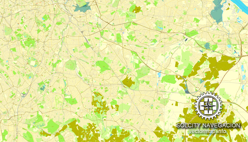
This is the most detailed, exact map of London city for high-quality printing and polygraphy. You can always clarify the map development date by contacting us.
For your convenience, all objects on London vector city map are divided into layers. And the editing is very easy – colors, lines, etc.
You can easily add any objects needed (e.g. shops, salons, sale points, gas station or attraction) on any layer of London vector map.
London is the capital and largest city of both the United Kingdom and England. Standing on the River Thames in southeastern England, 50 miles (80 km) upstream from its estuary with the North Sea, London has been a major settlement for two millennia. Londinium was founded by the Romans. The City of London, London’s ancient core − an area of just 1.12 square miles (2.9 km2) and colloquially known as the Square Mile − retains its medieval boundaries. The City of Westminster is also an Inner London borough holding city status. Greater London is governed by the Mayor of London and the London Assembly.
One of the advantages of London city vector maps of our production is the relevance of cartographic data, we constantly update all our products.
This vector map of London city is used by:
designers, layout designers, printers, advertisers and architects. Our product – vector maps – is designed for further editing and printing in large formats – from @Wall format (a few meters) to A-0 and A-1, A-2, A-3.
London city map in vector format is used for design, urban planning, presentations and media visualizations.
Advertising and presentation map of London city (usually the final designer marks the routes, and puts the client’s objects (shops, saloons, gas stations etc.)
The undoubted advantage is that people will NEVER throw out this advertising product – the map. In fact, as an advertising medium, a city map is the most “long-playing” of the well-known polygraphic advertising media, with the longest lifespan, and the maximum number of interactions with the customer.
For travelers, maps are sold at the airports and gas stations around the world. Often the source is our vector maps.
Take a look, who purchases our vector maps of London city in “Our Clients and Friends” page – these are large and small companies, from super-brands like Volvo and Starbucks, to small design studios and printing houses.
It’s very easy to work with vector maps of London city, even for a not very experienced designer who can turn on and off the map layers, add new objects, change the colors of fill and lines according to customer requirements.
The undoubted advantage of London city vector maps in printing is an excellent and detailed visualization, when customer can expand a large paper map and instantly define his location, find a landmark, an object or address on map, unlike using the popular electronic formats of Google and Yandex maps for example.
London is often considered as the world’s leading global city and has been termed as the world’s most powerful, most desirable, most influential, most visited, most expensive, innovative, sustainable, most investment friendly, most popular for work, and the most vegetarian friendly city in the world. London exerts a considerable impact upon the arts, commerce, education, entertainment, fashion, finance, healthcare, media, professional services, research and development, tourism and transportation. London ranks 26 out of 300 major cities for economic performance. It is one of the largest financial centres and has either the fifth or sixth largest metropolitan area GDP. It is the most-visited city as measured by international arrivals and has the busiest city airport system as measured by passenger traffic. It is the leading investment destination, hosting more international retailers and ultra high-net-worth individuals than any other city. London’s universities form the largest concentration of higher education institutes in Europe. In 2012, London became the first city to have hosted three modern Summer Olympic Games.
Printable vector maps of London city are much more convenient and efficient than any electronic maps on your smartphone, because ALL DETAILS are displayed in the entire space of London city map.
Useful tips on working with vector maps of cities and countries in Adobe Illustrator.
«V» – launches the Selection tool (cursor, black arrow), which makes active any vector line.
«А» – launches the Direct Selection tool (white cursor), allows you to select curve elements and drag them to the desired place.
«R» – activates the Rotate tool, which helps you rotating selected objects around the center point by 360 degrees.
«E» – gives you the opportunity to use the Eraser tool and erase unnecessary parts.
«X» – switches between Fill and Stroke in the Tools section. Try to get used to this hot key and
you will quickly understand that you can’t live and work without it.
Guides are not limited to vertical and horizontal in Adobe Illustrator. You can also create a diagonal guide for example. Moreover, you can turn any contours into guides. Select the outline and go to View > Guides > Make Guides (Create Guides), or simply press Cmd/Ctrl + 5. You can also turn the guides back into an editable object. Go to menu, View > Guides > Unlock Guides (Release Guides), select the guide you want to edit and select View > Guides > Release Guides (Reset Guides), or just press Cmd/Ctrl + Option / Alt + 5).
You will probably want to change the color scheme used on our London vector city map.
To quickly and effectively play with colors.
Of course, you can do it manually, all objects in our London city vector map are divided according to types and layers, and you can easily change the color gamma of vector objects in groups and layers.
But there is more effective way of working with the whole VECTOR MAP of London city and all layers:
The overview dialog «Edit colors»/«Repaint Graphic Object» (this dialog box name can change depending on the context):
If you have selected a part or a layer of London city vector map and open the dialog box by clicking the icon in the Control panel, on the Samples palette or the Color Catalog, or if you choose Edit > Edit Colors> Repaint Graphic Object, then the «Repaint Graphic Object» dialog box appears, and you get access to «Assign» and «Edit» tabs.
If a picture or a map fragment is not selected, and you open the dialog box by clicking the icon in the Control panel, on the Samples palette or in the Color Catalog, the «Edit Colors» dialog box appears and you can only access the «Edit» tab.
Regardless of the name at the top of the dialog box, the right-hand side always displays the color group of the current document, as well as two default color groups: Print Color and Grayscale. These color groups can be selected and used any time.
Create and edit color groups of London city vector map, and also assign colors using the «Edit Colors»/ а «Repaint Graphic Object» dialog box.
A. Creating and editing of a color group on the «Edit» tab
B. Assigning colors on the «Assign» tab
C. Select a group of colors from the «Color groups» list
The option «Repaint a graphic object» in the lower part of the dialog box allows you to preview the colors on a selected layer of Vector map, or a group of elements, and specify whether its colors will be redefined when the dialog box is closed.
The main areas of the dialog box are:
«Edit»
The «Edit» tab is designed to create a new or edit the existing color groups.
The harmony rules Menu and the Color Wheel are used to conduct experiments with color harmonies. The color wheel shows how colors are related in color harmony, and the color bars allow you to view and manipulate an individual color values. In addition, you can adjust the brightness, add and remove colors, save color groups and view colors on the selected Vector Map of London city or a separated layers.
«Assign»
The «Assign» tab is used to view and control on how the original colors are replaced with colors from the color group like your corporate colors in the Vector Map of London city.
The assign color ability is provided only if the entire map, layer or fragment is selected in the document. You can specify which of new colors replace the current colors, whether the spot colors should be preserved and how colors are replaced (for example, you can replace colors completely or changing the color tone while maintaining the brightness). The «Assign» tab allows you to redefine colors in the Vector Map of London city, or in separate layers and fragments using the current color group or reducing the number of colors in the current Vector Map.
London has a diverse range of people and cultures, and more than 300 languages are spoken in the region. Its estimated mid-2016 municipal population (corresponding to Greater London) was 8,787,892, the most populous of any city in the European Union55] and accounting for 13.4% of the UK population. London’s urban area is the second most populous in the EU, after Paris, with 9,787,426 inhabitants at the 2011 census. The population within the London commuter belt is the most populous in the EU with 14,040,163 inhabitants in 2016. London was the world’s most populous city from c. 1831 to 1925.
Color groups
Is a list of all saved color groups for current document (the same groups appear in the «Samples» palette). You can edit and delete the existing color groups, as well as creating a new ones using the list of “Color Groups” in the dialog box. All changes appear in the «Samples» palette.
The highlighted color group shows, which color group is currently edited.
Any color group can be selected and edited, or used to redefine the colors in the selected vector map of London city, its fragments or elements.
Saving a color group adds this group to the specified list.
Opening the «Edit Colors»/«Repaint Graphic Object» dialog box.
Open the «Edit Colors»/«Repaint Graphic Object» dialog box using one of the following methods:
«Edit»> «Edit Colors»> «Repaint Graphic object» or «Repaint With Style».
Use these commands if you need to edit the colors in the selected vector map of London city.
«Repaint Graphic object» button on the «Control» panel.
Use this button if you need to adjust colors of London city vector map using the а «Repaint graphic object» dialog box.
The specified button is available if the selected vector map or its fragment contains two or more colors.
Note. This color editing method is convenient for global color adjustment in a vector map, if global colors were not used when creating a City Map of London.
The «Edit colors» button or «Edit or apply colors» on the «Color Catalog» palette
Click this button if you need to edit colors on the «Color Catalog» palette or edit and then apply them to the selected Vector Map of London city or its fragment.
London contains four World Heritage Sites: the Tower of London; Kew Gardens; the site comprising the Palace of Westminster, Westminster Abbey, and St Margaret’s Church; and the historic settlement in Greenwich where the Royal Observatory, Greenwich defines the Prime Meridian, 0° longitude, and Greenwich Mean Time. Other landmarks include Buckingham Palace, the London Eye, Piccadilly Circus, St Paul’s Cathedral, Tower Bridge, Trafalgar Square and The Shard. London has numerous museums, galleries, libraries and sporting events. These include the British Museum, National Gallery, Natural History Museum, Tate Modern, British Library and West End theatres. The London Underground is the oldest underground railway network in the world.
The «Edit color group» button or «Edit or apply color group» on the «Samples» palette.
Click this button if you need to edit the colors in the specific color group or edit and apply them to the selected Vector Map of London city or a group of its elements, for example, the whole layer “Streets and lines”. You can also double-click the color group in the Samples panel to open the dialog box.
If the map file is too large and your computer freezes or even can’t open it quickly:
1. Try to reduce the color resolution of the video card (display) to 256 colors while working with a large map.
2. Using Windows Task Manager, select all the application you don’t need, while working with map, just turn them off.
3. Launch Adobe Illustrator. (DO NOT OPEN the vector map file)
4. Start the Windows Task Manager using administrator rights > Find the “Illustrator” process > set the «real time» priority,
5. Open the file. When you see the LEGACY FONT popup window – click “OK” (do not update). You can restore the TEXT later.
6. Can also be useful: When file is opened – Edit > Settings > Basic Settings > disable smoothing. /// It looks scary, but works quickly)))
We recommend saving the file in Adobe Illustrator 10 version. It’s much more stable when working with VERY BIG size files.
London, also referred to as Greater London, is one of nine regions of England and the top-level subdivision covering most of the city’s metropolis. The small ancient City of London at its core once comprised the whole settlement, but as its urban area grew, the Corporation of London resisted attempts to amalgamate the city with its suburbs, causing “London” to be defined in a number of ways for different purposes.
Forty per cent of Greater London is covered by the London post town, within which ‘LONDON’ forms part of postal addresses. The London telephone area code (020) covers a larger area, similar in size to Greater London, although some outer districts are excluded and some places just outside are included. The Greater London boundary has been aligned to the M25 motorway in places.
Outward urban expansion is now prevented by the Metropolitan Green Belt, although the built-up area extends beyond the boundary in places, resulting in a separately defined Greater London Urban Area. Beyond this is the vast London commuter belt. Greater London is split for some purposes into Inner London and Outer London. The city is split by the River Thames into North and South, with an informal central London area in its interior. The coordinates of the nominal centre of London, traditionally considered to be the original Eleanor Cross at Charing Cross near the junction of Trafalgar Square and Whitehall, are about 51°30′26″N 00°07′39″W. However the geographical centre of London, on one definition, is in the London Borough of Lambeth, just 0.1 miles to the northeast of Lambeth North tube station.
Topography
Greater London encompasses a total area of 1,583 square kilometres (611 sq mi), an area which had a population of 7,172,036 in 2001 and a population density of 4,542 inhabitants per square kilometre (11,760/sq mi). The extended area known as the London Metropolitan Region or the London Metropolitan Agglomeration, comprises a total area of 8,382 square kilometres (3,236 sq mi) has a population of 13,709,000 and a population density of 1,510 inhabitants per square kilometre (3,900/sq mi). Modern London stands on the Thames, its primary geographical feature, a navigable river which crosses the city from the south-west to the east. The Thames Valley is a floodplain surrounded by gently rolling hills including Parliament Hill, Addington Hills, and Primrose Hill. Historically London grew up at the lowest bridging point on the Thames. The Thames was once a much broader, shallower river with extensive marshlands; at high tide, its shores reached five times their present width.
Since the Victorian era the Thames has been extensively embanked, and many of its London tributaries now flow underground. The Thames is a tidal river, and London is vulnerable to flooding. The threat has increased over time because of a slow but continuous rise in high water level by the slow ’tilting’ of the British Isles (up in Scotland and Northern Ireland and down in southern parts of England, Wales and Ireland) caused by post-glacial rebound.
In 1974, a decade of work began on the construction of the Thames Barrier across the Thames at Woolwich to deal with this threat. While the barrier is expected to function as designed until roughly 2070, concepts for its future enlargement or redesign are already being discussed.


Small guide: How to work with the vector map?
You can: Mass select objects by type and color – for example, the objects type “building” (they are usually dark gray) – and remove them from the map, if you do not need them in your print or design project. You can also easily change the thickness of lines (streets), just bulk selection the road by the line color.
The streets are separated by type, for example, type “residential road” are usually white with a gray stroke. Highway usually orange with a brown or dark gray stroke.
It is easy to change the font of inscriptions, all or each individually. Also, just can be make and any other manipulation of objects on the vector map in Adobe illustrator format.
Important: All the proportions on the map are true, that is, the relative sizes of the objects are true, because Map is based on an accurate GPS projection, and It transated into the (usual for all) the Mercator projection.
You can easily change the color, stroke and fill of any object on the map, zoom without loss of quality Image Verification.
Select object

Bulk selection the same objects on the vector map

See the bulk selected objects on the vector map

Bulk delete buildungs from the vector map

Select residencial road (small street) on the vector map

Bulk selection the same lines (streets, roads) on the full map

Create fat lines of the streets on the vector maps (bulk action) 1

Create fat lines of the streets on the vector maps (bulk action) 2

Create fat lines of the streets on the vector maps (bulk action) 3

You can easily change the color, stroke and fill of any object on the map, zoom without loss of quality Image Verification.

 Author: Kirill Shrayber, Ph.D. FRGS


 V3.09, full vector")
 V3.09, full vector")