PDF Map Eugene + Springfield Oregon, US, exact vector street City Plan Layered map, V.09. fully editable, Adobe PDF, full vector, scalable, editable text format of street names, 13 Mb ZIP.
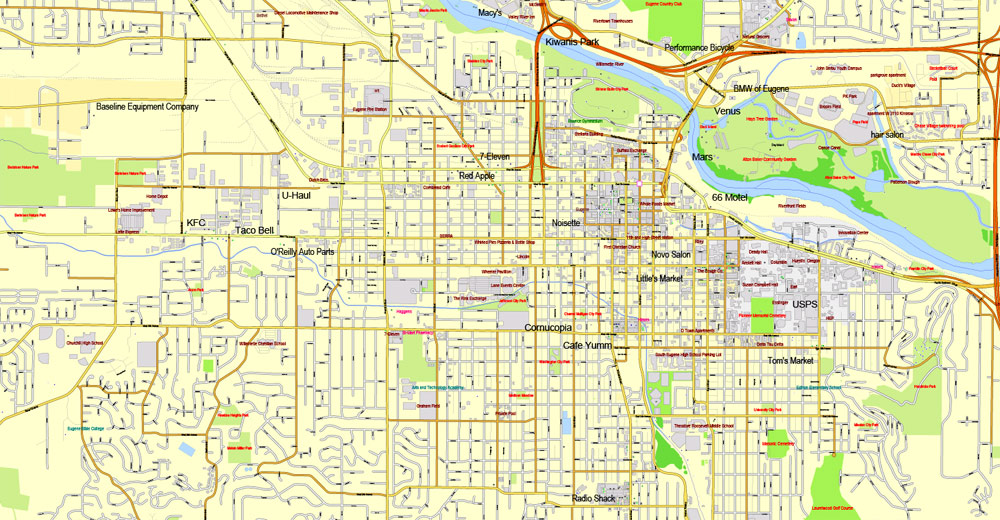
All streets named, main objects, All buildings. Map for publishing, design, printing, publications, arts, projects, presentations, for architects, designers and builders, business, logistics. The most exact and detailed map.
Separated layers: streets and roads, color fills, objects, names 1,2,3, etc.
Different color names by type of objects.
For printing LARGE (WALL) format.
You can edit this file by Adobe Illustrator, Adobe Acrobat, Corel Draw.
DWG, DXF, CDR, ESRI Shapes, and other formats – by request, same price, please contact.
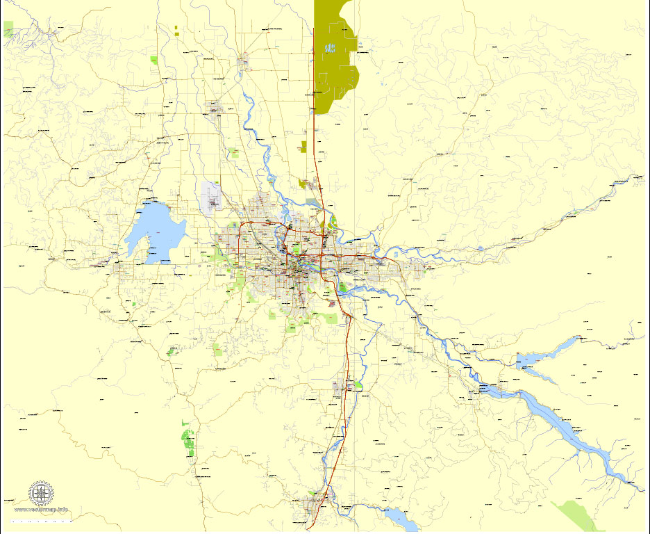
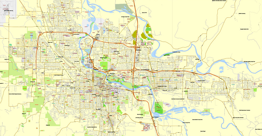
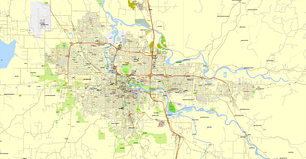
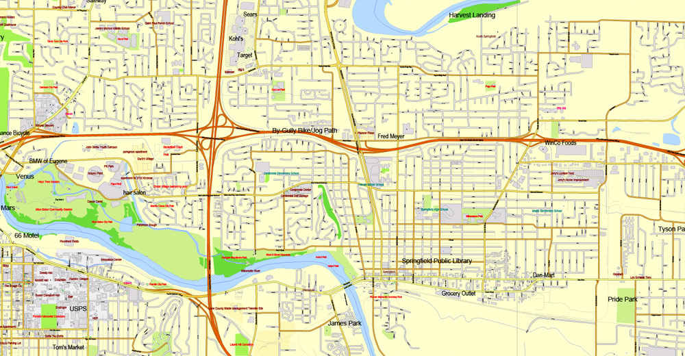
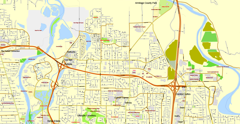
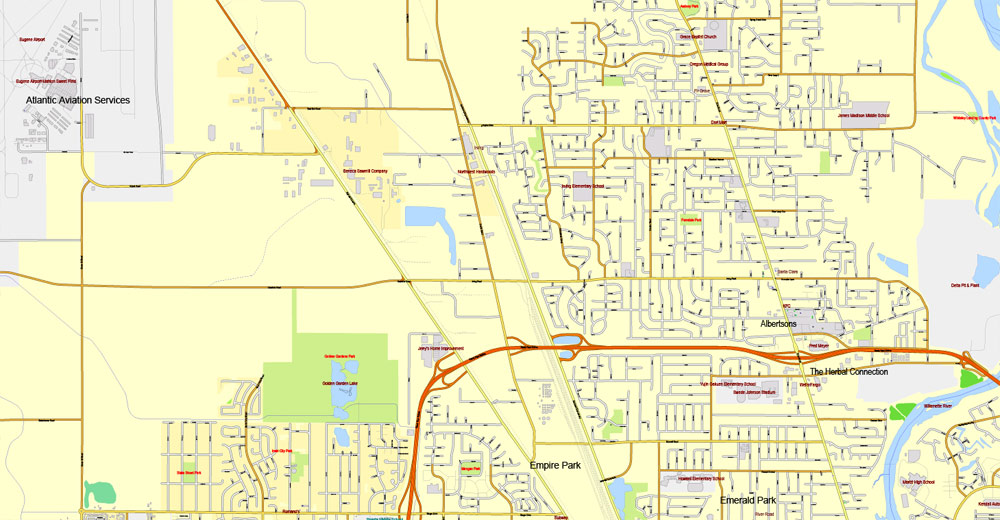
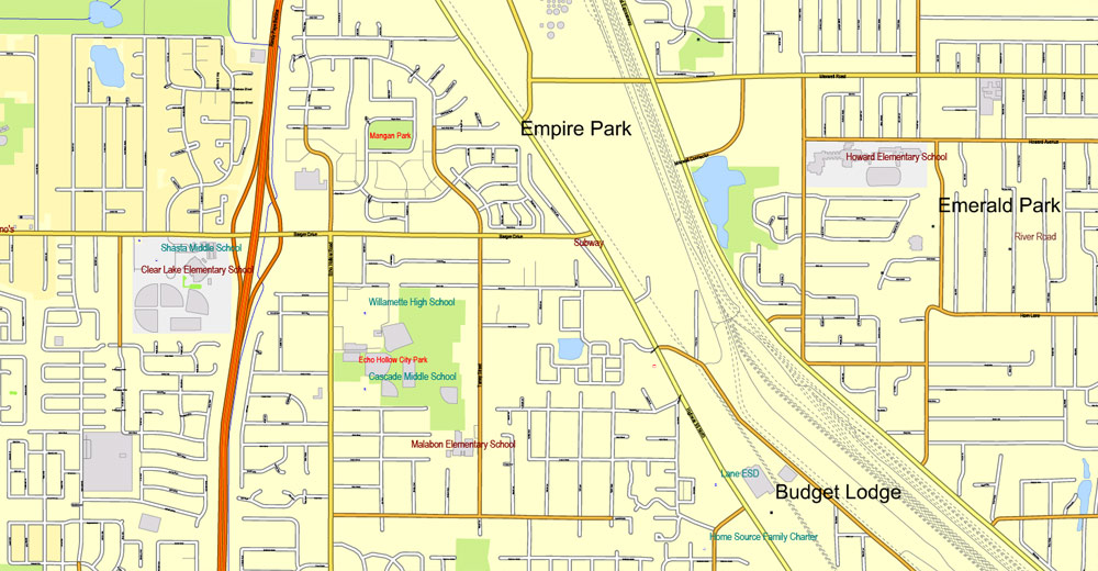
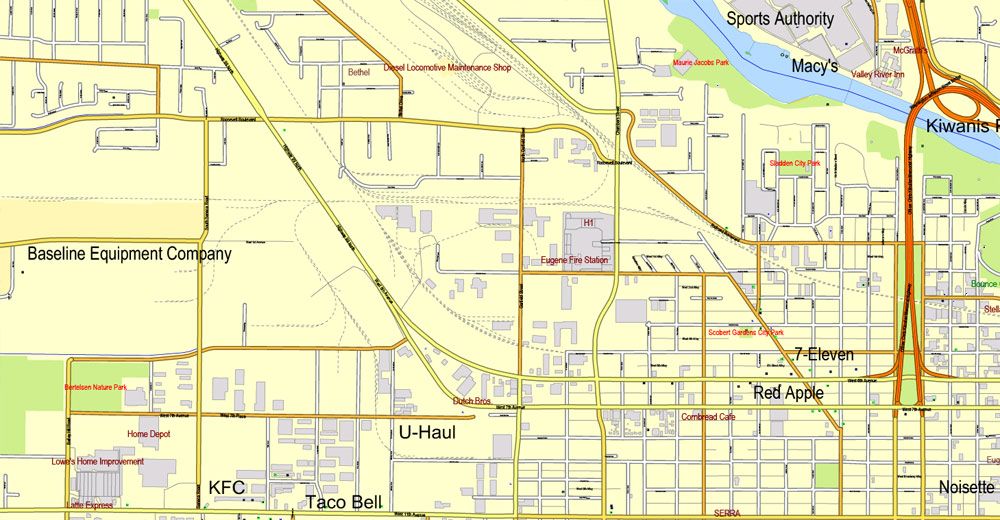
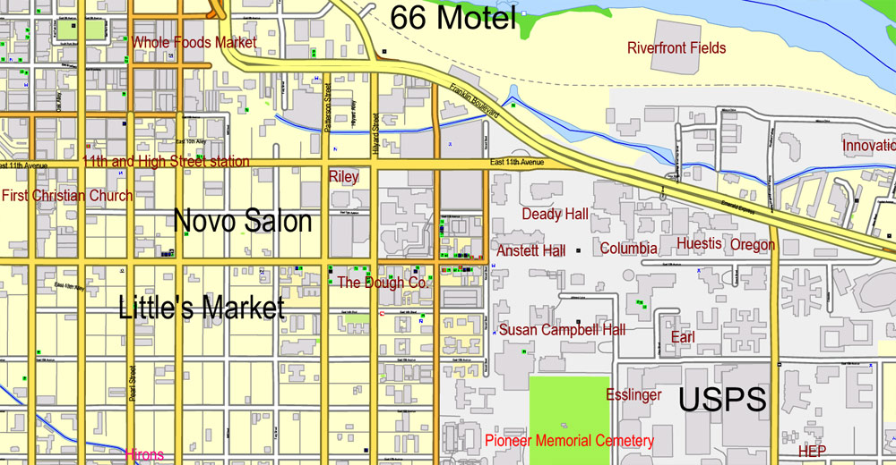
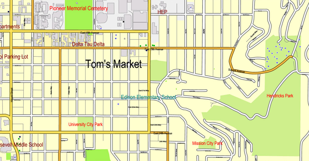
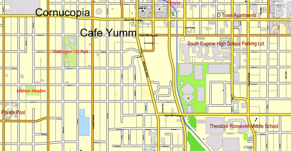
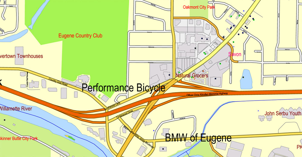
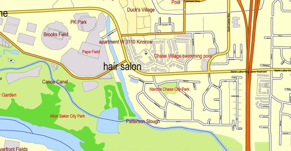
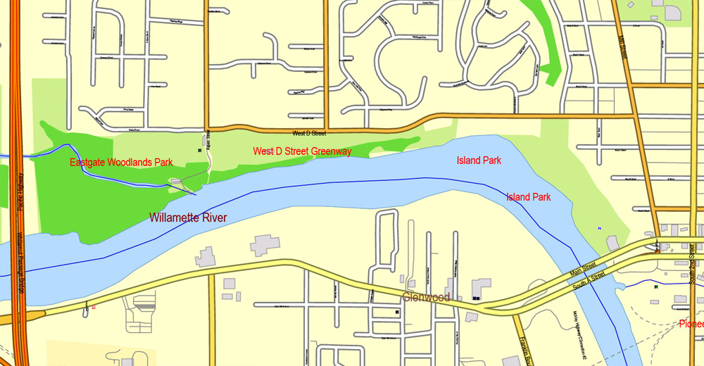
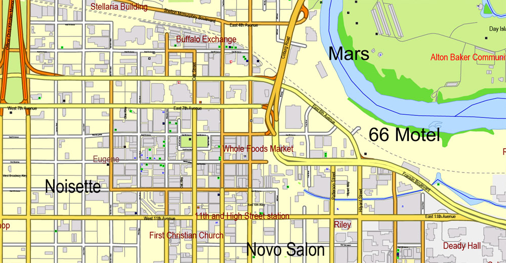
Eugene + Springfield, Oregon, USA.
This vector map of Eugene + Springfield city is used as a basis for design, editing, and further printing.
This is the most detailed, exact map of Eugene + Springfield city for high-quality printing and polygraphy. You can always clarify the map development date by contacting us.
For your convenience, all objects on Eugene + Springfield vector city map are divided into layers. And the editing is very easy – colors, lines, etc.
You can easily add any objects needed (e.g. shops, salons, sale points, gas station or attraction) on any layer of Eugene + Springfield vector map.
Eugene is a Pacific Northwest city in the U.S. state of Oregon. It is at the southern end of the verdant Willamette Valley, near the confluence of the McKenzie and Willamette Rivers, about 50 miles (80 km) east of the Oregon Coast.
As of the 2010 census, Eugene had a population of 156,185; it is the state’s second most populous city (after Portland) and the county seat of Lane County. The Eugene-Springfield, Oregon metropolitan statistical area (MSA) is the 146th largest metropolitan statistical area in the US and the third-largest in the state, behind the Portland Metropolitan Area and the Salem Metropolitan Area. The city’s population for 2014 was estimated to be 160,561 by the US Census.
One of the advantages of Eugene + Springfield city vector maps of our production is the relevance of cartographic data, we constantly update all our products.
This vector map of Eugene + Springfield city is used by:
designers, layout designers, printers, advertisers and architects. Our product – vector maps – is designed for further editing and printing in large formats – from @Wall format (a few meters) to A-0 and A-1, A-2, A-3.
Eugene + Springfield city map in vector format is used for design, urban planning, presentations and media visualizations.
Advertising and presentation map of Eugene + Springfield city (usually the final designer marks the routes, and puts the client’s objects (shops, saloons, gas stations etc.)
The undoubted advantage is that people will NEVER throw out this advertising product – the map. In fact, as an advertising medium, a city map is the most “long-playing” of the well-known polygraphic advertising media, with the longest lifespan, and the maximum number of interactions with the customer.
For travelers, maps are sold at the airports and gas stations around the world. Often the source is our vector maps.
Take a look, who purchases our vector maps of Eugene + Springfield city in “Our Clients and Friends” page – these are large and small companies, from super-brands like Volvo and Starbucks, to small design studios and printing houses.
It’s very easy to work with vector maps of Eugene + Springfield city, even for a not very experienced designer who can turn on and off the map layers, add new objects, change the colors of fill and lines according to customer requirements.
The undoubted advantage of Eugene + Springfield city vector maps in printing is an excellent and detailed visualization, when customer can expand a large paper map and instantly define his location, find a landmark, an object or address on map, unlike using the popular electronic formats of Google and Yandex maps for example.
Printable vector maps of Eugene + Springfield city are much more convenient and efficient than any electronic maps on your smartphone, because ALL DETAILS are displayed in the entire space of Eugene + Springfield city map.
Useful tips on working with vector maps of cities and countries in Adobe Illustrator.
«V» – launches the Selection tool (cursor, black arrow), which makes active any vector line.
«А» – launches the Direct Selection tool (white cursor), allows you to select curve elements and drag them to the desired place.
«R» – activates the Rotate tool, which helps you rotating selected objects around the center point by 360 degrees.
«E» – gives you the opportunity to use the Eraser tool and erase unnecessary parts.
«X» – switches between Fill and Stroke in the Tools section. Try to get used to this hot key and
you will quickly understand that you can’t live and work without it.
Guides are not limited to vertical and horizontal in Adobe Illustrator. You can also create a diagonal guide for example. Moreover, you can turn any contours into guides. Select the outline and go to View > Guides > Make Guides (Create Guides), or simply press Cmd/Ctrl + 5. You can also turn the guides back into an editable object. Go to menu, View > Guides > Unlock Guides (Release Guides), select the guide you want to edit and select View > Guides > Release Guides (Reset Guides), or just press Cmd/Ctrl + Option / Alt + 5).
You will probably want to change the color scheme used on our Eugene + Springfield vector city map.
To quickly and effectively play with colors.
Of course, you can do it manually, all objects in our Eugene + Springfield city vector map are divided according to types and layers, and you can easily change the color gamma of vector objects in groups and layers.
But there is more effective way of working with the whole VECTOR MAP of Eugene + Springfield city and all layers:
The overview dialog «Edit colors»/«Repaint Graphic Object» (this dialog box name can change depending on the context):
If you have selected a part or a layer of Eugene + Springfield city vector map and open the dialog box by clicking the icon in the Control panel, on the Samples palette or the Color Catalog, or if you choose Edit > Edit Colors> Repaint Graphic Object, then the «Repaint Graphic Object» dialog box appears, and you get access to «Assign» and «Edit» tabs.
If a picture or a map fragment is not selected, and you open the dialog box by clicking the icon in the Control panel, on the Samples palette or in the Color Catalog, the «Edit Colors» dialog box appears and you can only access the «Edit» tab.
Regardless of the name at the top of the dialog box, the right-hand side always displays the color group of the current document, as well as two default color groups: Print Color and Grayscale. These color groups can be selected and used any time.
Create and edit color groups of Eugene + Springfield city vector map, and also assign colors using the «Edit Colors»/ а «Repaint Graphic Object» dialog box.
A. Creating and editing of a color group on the «Edit» tab
B. Assigning colors on the «Assign» tab
C. Select a group of colors from the «Color groups» list
The option «Repaint a graphic object» in the lower part of the dialog box allows you to preview the colors on a selected layer of Vector map, or a group of elements, and specify whether its colors will be redefined when the dialog box is closed.
The main areas of the dialog box are:
«Edit»
The «Edit» tab is designed to create a new or edit the existing color groups.
The harmony rules Menu and the Color Wheel are used to conduct experiments with color harmonies. The color wheel shows how colors are related in color harmony, and the color bars allow you to view and manipulate an individual color values. In addition, you can adjust the brightness, add and remove colors, save color groups and view colors on the selected Vector Map of Eugene + Springfield city or a separated layers.
«Assign»
The «Assign» tab is used to view and control on how the original colors are replaced with colors from the color group like your corporate colors in the Vector Map of Eugene + Springfield city.
The assign color ability is provided only if the entire map, layer or fragment is selected in the document. You can specify which of new colors replace the current colors, whether the spot colors should be preserved and how colors are replaced (for example, you can replace colors completely or changing the color tone while maintaining the brightness). The «Assign» tab allows you to redefine colors in the Vector Map of Eugene + Springfield city, or in separate layers and fragments using the current color group or reducing the number of colors in the current Vector Map.
Color groups
Is a list of all saved color groups for current document (the same groups appear in the «Samples» palette). You can edit and delete the existing color groups, as well as creating a new ones using the list of “Color Groups” in the dialog box. All changes appear in the «Samples» palette.
The highlighted color group shows, which color group is currently edited.
Any color group can be selected and edited, or used to redefine the colors in the selected vector map of Eugene + Springfield city, its fragments or elements.
Saving a color group adds this group to the specified list.
Opening the «Edit Colors»/«Repaint Graphic Object» dialog box.
Open the «Edit Colors»/«Repaint Graphic Object» dialog box using one of the following methods:
«Edit»> «Edit Colors»> «Repaint Graphic object» or «Repaint With Style».
Use these commands if you need to edit the colors in the selected vector map of Eugene + Springfield city.
«Repaint Graphic object» button on the «Control» panel.
Use this button if you need to adjust colors of Eugene + Springfield city vector map using the а «Repaint graphic object» dialog box.
The specified button is available if the selected vector map or its fragment contains two or more colors.
Note. This color editing method is convenient for global color adjustment in a vector map, if global colors were not used when creating a City Map of Eugene + Springfield.
The «Edit colors» button or «Edit or apply colors» on the «Color Catalog» palette
Click this button if you need to edit colors on the «Color Catalog» palette or edit and then apply them to the selected Vector Map of Eugene + Springfield city or its fragment.
The «Edit color group» button or «Edit or apply color group» on the «Samples» palette.
Click this button if you need to edit the colors in the specific color group or edit and apply them to the selected Vector Map of Eugene + Springfield city or a group of its elements, for example, the whole layer “Streets and lines”. You can also double-click the color group in the Samples panel to open the dialog box.
If the map file is too large and your computer freezes or even can’t open it quickly:
1. Try to reduce the color resolution of the video card (display) to 256 colors while working with a large map.
2. Using Windows Task Manager, select all the application you don’t need, while working with map, just turn them off.
3. Launch Adobe Illustrator. (DO NOT OPEN the vector map file)
4. Start the Windows Task Manager using administrator rights > Find the “Illustrator” process > set the «real time» priority,
5. Open the file. When you see the LEGACY FONT popup window – click “OK” (do not update). You can restore the TEXT later.
6. Can also be useful: When file is opened – Edit > Settings > Basic Settings > disable smoothing. /// It looks scary, but works quickly)))
We recommend saving the file in Adobe Illustrator 10 version. It’s much more stable when working with VERY BIG size files.
Eugene is home to the University of Oregon and Lane Community College. The city is also noted for its natural environment, recreational opportunities (especially bicycling, running/jogging, rafting, and kayaking), and focus on the arts. Eugene’s official slogan is “A Great City for the Arts and Outdoors”. It is also referred to as the “Emerald City” and as “Track Town, USA”. The Nike corporation had its beginnings in Eugene. In 2021, the city will host the 18th Track and Field World Championships.
Geography of Eugene.
The flat-roofed buildings of downtown Eugene in front of Spencer Butte, a prominent forested hill
According to the United States Census Bureau, the city has a total area of 43.74 square miles (113.29 km2), of which 43.72 square miles (113.23 km2) is land and 0.02 square miles (0.05 km2) is water. Eugene is at an elevation of 426 feet (130 m).
To the north of downtown is Skinner Butte. Northeast of the city is the Coburg Hills. Spencer Butte is a prominent landmark south of the city. Mount Pisgah is southeast of Eugene and includes Mount Pisgah Arboretum and Howard Buford Recreation Area, a Lane County Park. Eugene is surrounded by foothills and forests to the south, east, and west, while to the north the land levels out into the Willamette Valley and consists of mostly farmland.
The Willamette and McKenzie Rivers run through Eugene and its neighboring city, Springfield. Another important stream is Amazon Creek, whose headwaters are near Spencer Butte. The creek discharges west of the city into Fern Ridge Reservoir, maintained for winter flood control by the Army Corps of Engineers. Eugene Yacht Club hosts a sailing school and sailing regattas at Fern Ridge during summer months.
Springfield is a city in Lane County, Oregon, United States. Located in the Southern Willamette Valley, it is within the Eugene-Springfield Metropolitan Statistical Area. Separated from Eugene to the west, mainly by Interstate 5, Springfield is the second-most populous city in the metropolitan area after Eugene. As of the 2010 census, the city has a total population of 59,403.
The Briggs family first settled the Springfield area, arriving in 1848. The community was incorporated as a city in 1885. The city was named after a natural spring located in a field or prairie within the current city boundaries. For the majority of the 20th century the economy of Springfield was largely dependent on the Oregon timber industry, but since the 1990s the economy has diversified with PeaceHealth now the largest employer in the city. Public education in the city is provided by the Springfield School District.
Geography of Springfield.
According to the United States Census Bureau, the city has a total area of 15.75 square miles (40.79 km2), of which, 15.74 square miles (40.77 km2) is land and 0.01 square miles (0.03 km2) is water.
The McKenzie River forms the northern city limits.
Eugene
City in Oregon
Eugene is a city of the Pacific Northwest located in the U.S. state of Oregon. It is located at the southern end of the Willamette Valley, near the confluence of the McKenzie and Willamette Rivers, about 50 miles east of the Oregon Coast.
Area
• City 43.74 sq mi (113.29 km2)
• Land 43.72 sq mi (113.23 km2)
• Water 0.02 sq mi (0.05 km2)
Elevation 430 ft (131.1 m)
Population
• City 156,185
• Estimate 163,460
• Rank US: 155th
• Density 3,572.4/sq mi (1,379.3/km2)
• Urban 247,421 (US: 151st)
• Metro 362,895 (US: 146th)
Springfield
City in Oregon
Springfield is a city in Lane County, Oregon, United States. Located in the Southern Willamette Valley, it is within the Eugene-Springfield Metropolitan Statistical Area.
Area
• Total 15.75 sq mi (40.79 km2)
• Land 15.74 sq mi (40.77 km2)
• Water 0.01 sq mi (0.03 km2)
Elevation 454 ft (138.4 m)
Population
• Total 59,403
• Estimate 60,177
• Density 3,774.0/sq mi (1,457.1/km2)
Free vector maps:

Free download Vector Map US Interstate roads, Adobe PDF, V.2 Free_Map_US_Interstates_Roads_2.pdf
Free download Vector Map US Interstate roads, Adobe Illustrator, V.2 Free_Map_US_Interstates_Roads_2.ai

Free Download Vector Map US County and State Adobe Illustrator
Free_Vector_Map_US_States_County_Map.ai
Free Download Vector Map US County and State Adobe PDF
Free_Vector_Map_US_States_County_Map.pdf

Free Vector Map US Census Data Top US Ancestries by County Adobe Illustrator
Free_Vector_Map_US_Census-Data-Top-US-Ancestries-by-County.ai
Free Vector Map US Census Data Top US Ancestries by County Adobe PDF
Free_Vector_Map_US_Census-Data-Top-US-Ancestries-by-County.pdf
Free US Maps from WIKIPEDIA
Small guide: How to work with the vector map?
You can: Mass select objects by type and color – for example, the objects type “building” (they are usually dark gray) – and remove them from the map, if you do not need them in your print or design project. You can also easily change the thickness of lines (streets), just bulk selection the road by the line color.
The streets are separated by type, for example, type “residential road” are usually white with a gray stroke. Highway usually orange with a brown or dark gray stroke.
It is easy to change the font of inscriptions, all or each individually. Also, just can be make and any other manipulation of objects on the vector map in Adobe illustrator format.
Important: All the proportions on the map are true, that is, the relative sizes of the objects are true, because Map is based on an accurate GPS projection, and It transated into the (usual for all) the Mercator projection.
You can easily change the color, stroke and fill of any object on the map, zoom without loss of quality Image Verification.
Select object

Bulk selection the same objects on the vector map

See the bulk selected objects on the vector map

Bulk delete buildungs from the vector map

Select residencial road (small street) on the vector map

Bulk selection the same lines (streets, roads) on the full map

Create fat lines of the streets on the vector maps (bulk action) 1

Create fat lines of the streets on the vector maps (bulk action) 2

Create fat lines of the streets on the vector maps (bulk action) 3

You can easily change the color, stroke and fill of any object on the map, zoom without loss of quality Image Verification.

 Author: Kirill Shrayber, Ph.D. FRGS
 map, V.11. fully editable, Adobe Illustrator")

