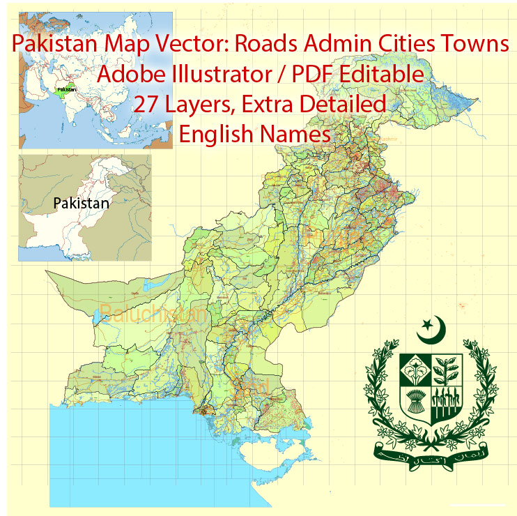
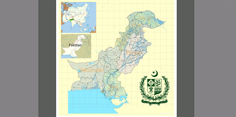
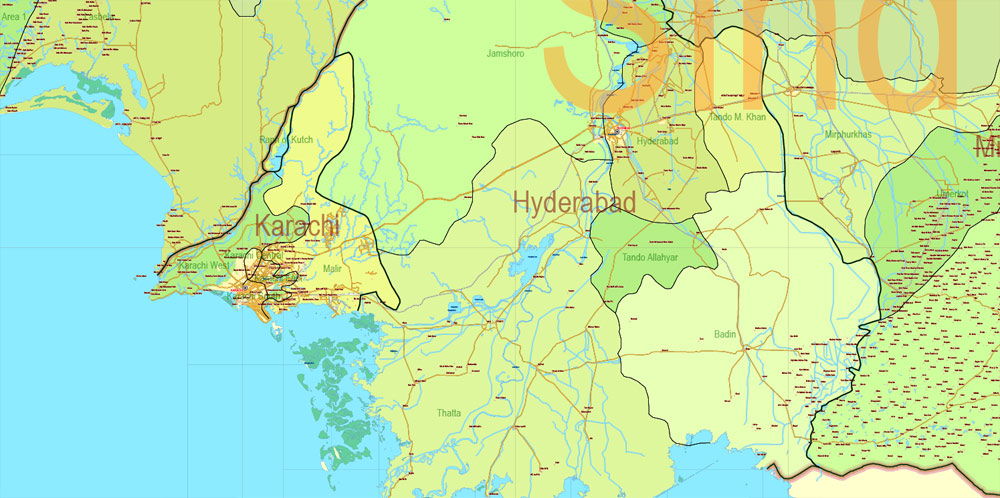
Printable Vector Map of Pakistan Full Country Extra detailed Road Admin full editable Adobe Illustrator Map in 27 layers , scalable, editable text format all names, 36 mb ZIP English Names
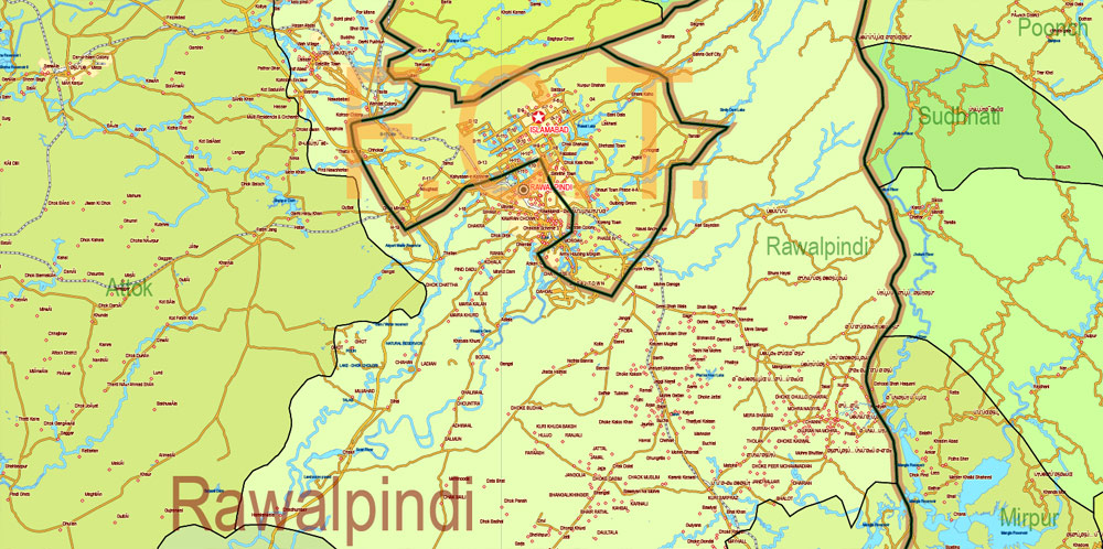
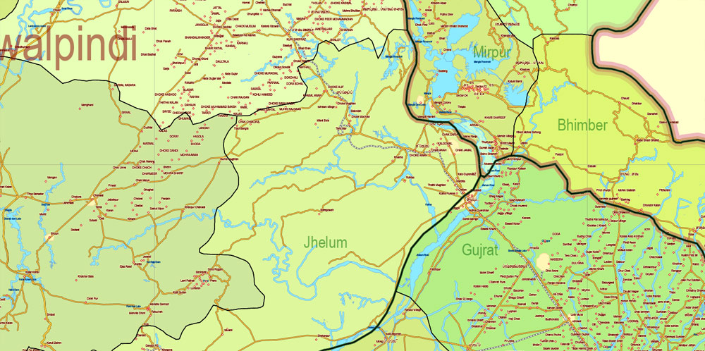
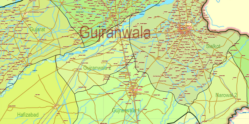
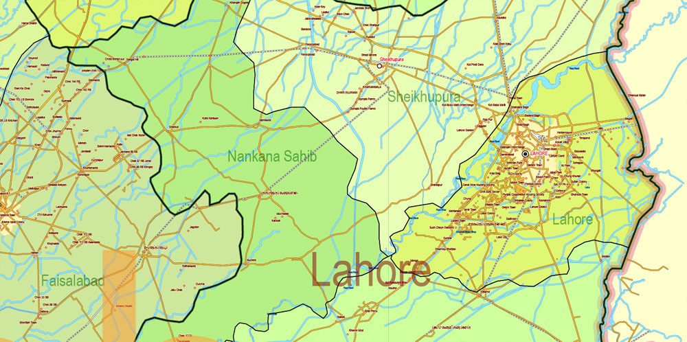
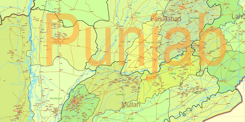
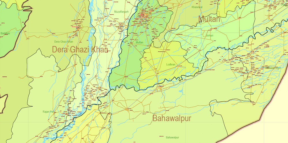
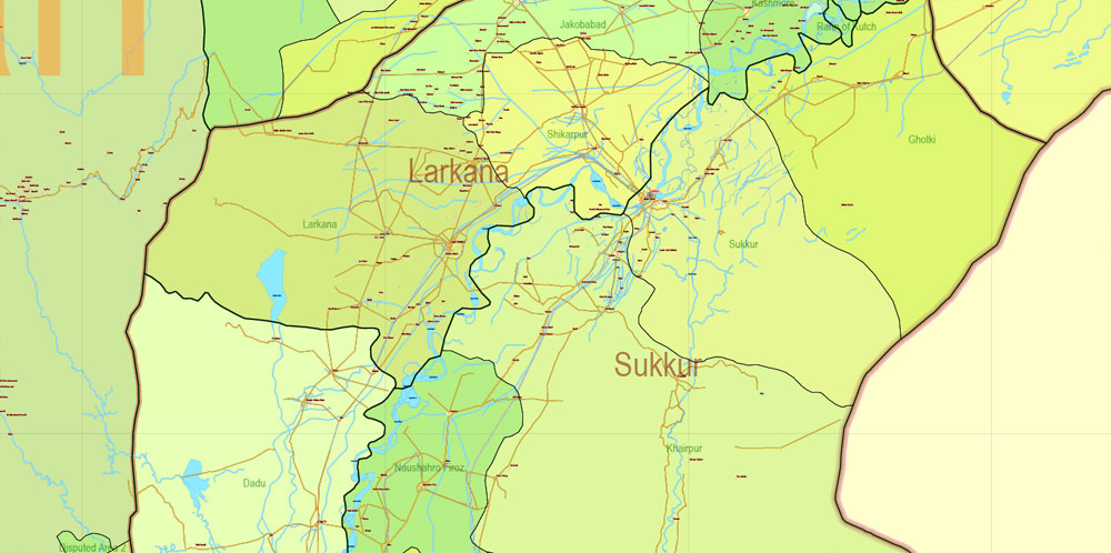
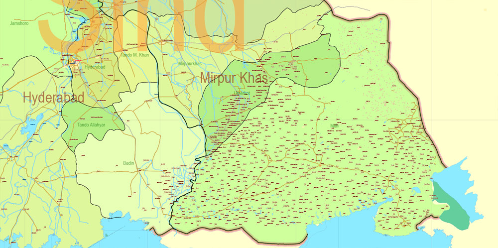
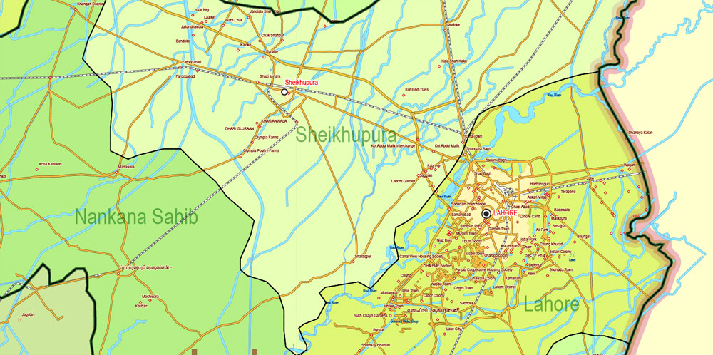
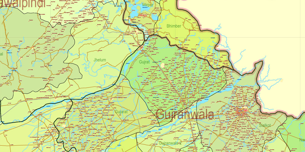
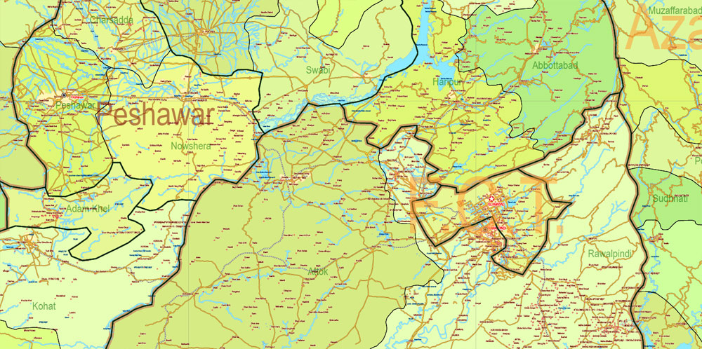
All cities and small towns, main roads, railroads, water objects, provinces, districts and admin areas. Map for design, printing, arts, projects, presentations, for architects, designers and builders, business, logistics.
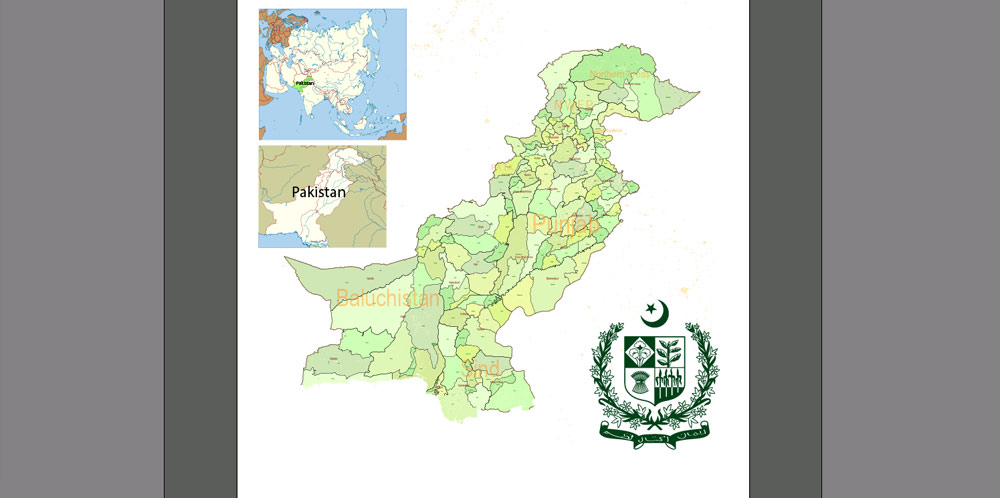
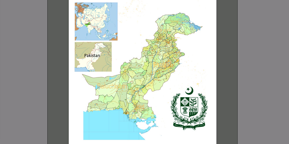
Layers: 27 layers for each type of objects.
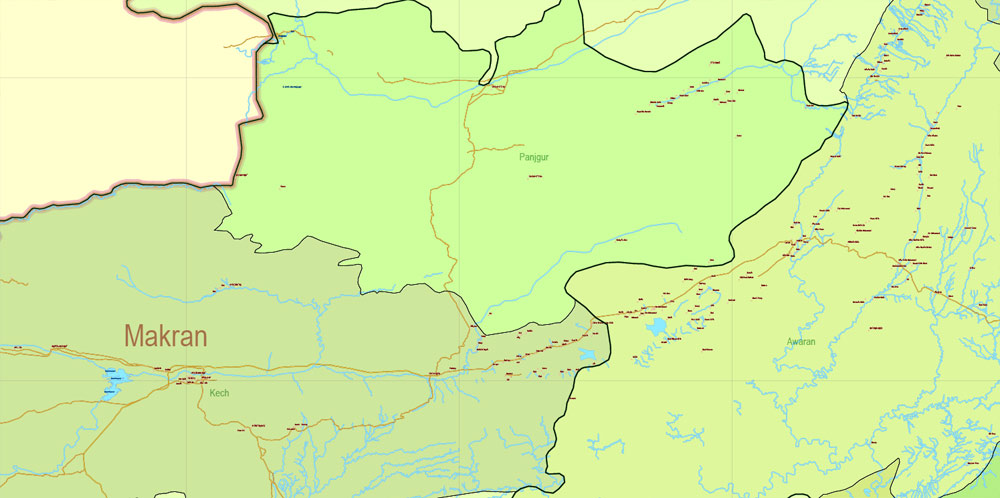
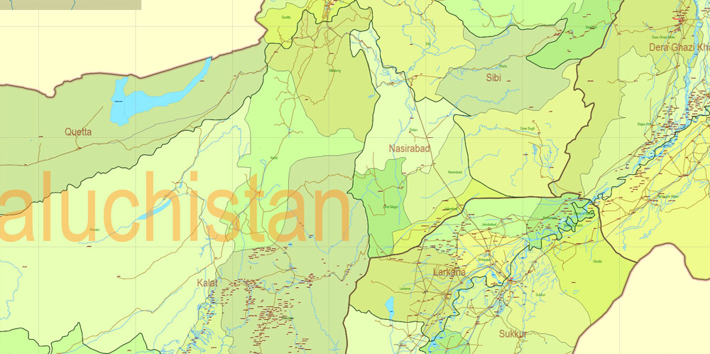
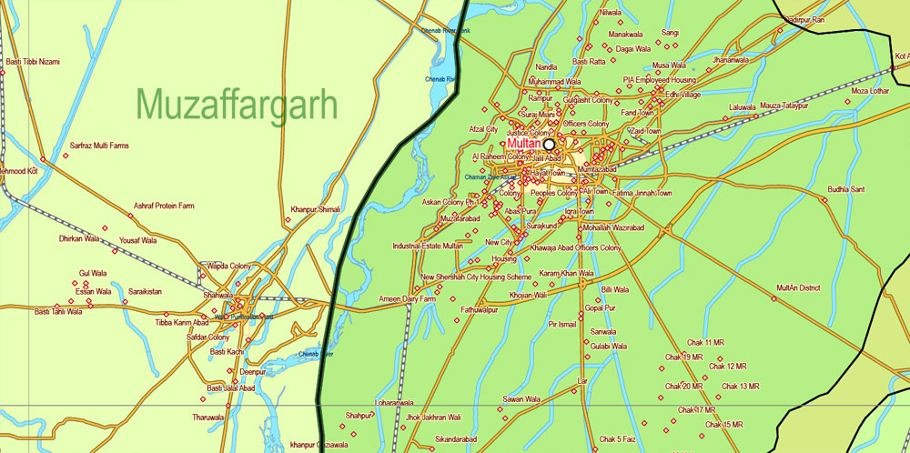
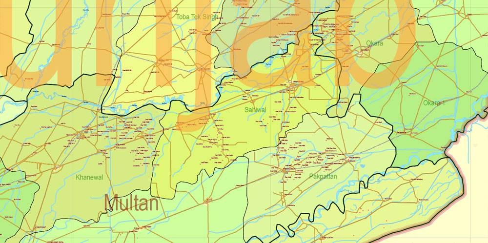
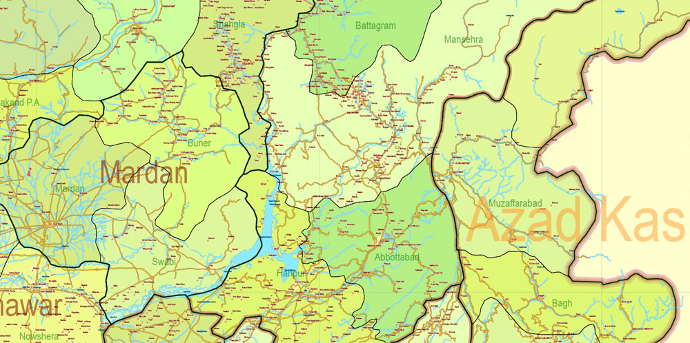
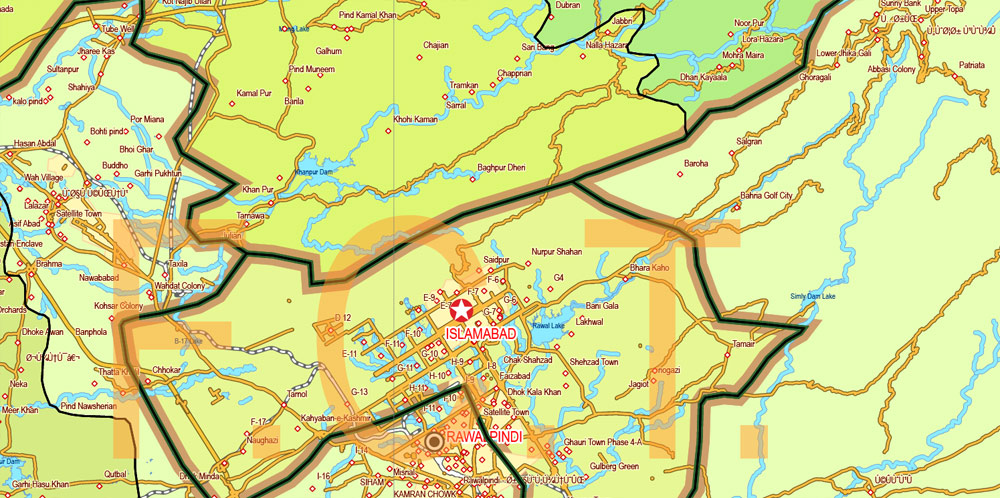
The most exact and detailed map of the Pakistan.
For High Quality Printing
DWG, DXF and other formats – on request, same price, please, contact
Pakistan
Country in South Asia
Pakistan officially the Islamic Republic of Pakistan is a country in South Asia. It is the fifth-most populous country with a population exceeding 212,742,631 people. In area, it is the 33rd-largest country, spanning 881,913 square kilometres (340,509 square miles). Pakistan has a 1,046-kilometre (650-mile) coastline along the Arabian Sea and Gulf of Oman in the south and is bordered by India to the east, Afghanistan to the west, Iran to the southwest, and China in the far northeast. It is separated narrowly from Tajikistan by Afghanistan’s Wakhan Corridor in the northwest, and also shares a maritime border with Oman.
This vector map of Pakistan is used as a basis for design, editing, and further printing.
It is separated narrowly from Tajikistan by Afghanistan’s Wakhan Corridor in the northwest, and also shares a maritime border with Oman.
The territory that now constitutes Pakistan was the site of several ancient cultures and intertwined with the history of the broader Indian subcontinent.
One of the advantages of Pakistan vector maps of our production is the relevance of cartographic data, we constantly update all our products.
The ancient history involves the Neolithic site of Mehrgarh and the Bronze Age Indus Valley Civilisation, and was later home to kingdoms ruled by people of different faiths and cultures, including Hindus, Indo-Greeks, Muslims, Turco-Mongols, Afghans and Sikhs.
The main areas of the dialog box are:
«Edit»
The «Edit» tab is designed to create a new or edit the existing color groups.
The harmony rules Menu and the Color Wheel are used to conduct experiments with color harmonies. The color wheel shows how colors are related in color harmony, and the color bars allow you to view and manipulate an individual color values. In addition, you can adjust the brightness, add and remove colors, save color groups and view colors on the selected Vector Map of Pakistan or a separated layers.
«Assign»
The «Assign» tab is used to view and control on how the original colors are replaced with colors from the color group like your corporate colors in the Vector Map of Pakistan city.
The assign color ability is provided only if the entire map, layer or fragment is selected in the document. You can specify which of new colors replace the current colors, whether the spot colors should be preserved and how colors are replaced (for example, you can replace colors completely or changing the color tone while maintaining the brightness). The «Assign» tab allows you to redefine colors in the Vector Map of Pakistan city, or in separate layers and fragments using the current color group or reducing the number of colors in the current Vector Map.
Printable vector maps of Pakistan are much more convenient and efficient than any electronic maps on your smartphone, because ALL DETAILS are displayed in the entire space of Pakistan map.
The area has been ruled by numerous empires and dynasties, including the Persian Achaemenid Empire, Alexander III of Macedon, the Seleucid Empire, the Indian Maurya Empire, the Gupta Empire, the Arab Umayyad Caliphate, the Delhi Sultanate, the Mongol Empire, the Mughal Empire, the Afghan Durrani Empire, the Sikh Empire (partially) and, most recently, the British Empire.
The advertising and presentation map of Pakistan (usually the final designer marks the routes, and puts the client’s objects (shops, saloons, gas stations etc.)
The undoubted advantage is that people will NEVER throw out this advertising product – the map. In fact, as an advertising medium, a map is the most “long-playing” of the well-known polygraphic advertising media, with the longest lifespan, and the maximum number of interactions with the customer.
Pakistan is the only country to have been created in the name of Islam. It is an ethnically and linguistically diverse country, with a similarly diverse geography and wildlife. Initially a dominion, Pakistan adopted a constitution in 1956, becoming an Islamic republic.
Color groups
Is a list of all saved color groups for current document (the same groups appear in the «Samples» palette). You can edit and delete the existing color groups, as well as creating a new ones using the list of “Color Groups” in the dialog box. All changes appear in the «Samples» palette.
The highlighted color group shows, which color group is currently edited.
Any color group can be selected and edited, or used to redefine the colors in the selected vector map of Pakistan city, its fragments or elements.
An ethnic civil war in 1971 resulted in the secession of East Pakistan as the new country of Bangladesh. In 1973 Pakistan adopted a new constitution which stipulated that all laws are to conform to the injunctions of Islam as laid down in the Quran and Sunnah.
A regional and middle power, Pakistan has the sixth-largest standing armed forces in the world and is also a nuclear power as well as a declared nuclear-weapons state, the second in South Asia and the only nation in the Muslim world to have that status. Pakistan has a semi-industrialised economy with a well-integrated agriculture sector and a growing services sector. It is ranked among the emerging and growth-leading economies of the world, and is backed by one of the world’s largest and fastest-growing middle class.
The Pakistan map in vector format is used for design, urban planning, presentations and media visualizations.
Pakistan’s political history since independence has been characterized by periods of military rule, political instability and conflicts with India.
The undoubted advantage of Pakistan vector maps in printing is an excellent and detailed visualization, when customer can expand a large paper map and instantly define his location, find a landmark, an object or address on map, unlike using the popular electronic formats of Google and Yandex maps for example.
The country continues to face challenging problems, including overpopulation, terrorism, poverty, illiteracy, and corruption. Pakistan is a member of the UN, the Shanghai Cooperation Organisation, the OIC, the Commonwealth of Nations, the SAARC and the Islamic Military Counter Terrorism Coalition.
The geography and climate of Pakistan are extremely diverse, and the country is home to a wide variety of wildlife. Pakistan covers an area of 881,913 km2 (340,509 sq mi), approximately equal to the combined land areas of France and the United Kingdom. It is the 33rd-largest nation by total area, although this ranking varies depending on how the disputed territory of Kashmir is counted. Pakistan has a 1,046 km (650 mi) coastline along the Arabian Sea and the Gulf of Oman in the south and land borders of 6,774 km (4,209 mi) in total: 2,430 km (1,510 mi) with Afghanistan, 523 km (325 mi) with China, 2,912 km (1,809 mi) with India and 909 km (565 mi) with Iran. It shares a marine border with Oman, and is separated from Tajikistan by the cold, narrow Wakhan Corridor. Pakistan occupies a geopolitically important location at the crossroads of South Asia, the Middle East, and Central Asia.
But there is more effective way of working with the whole VECTOR MAP of Pakistan and all layers:
The overview dialog «Edit colors»/«Repaint Graphic Object» (this dialog box name can change depending on the context):
If you have selected a part or a layer of Pakistan vector map and open the dialog box by clicking the icon in the Control panel, on the Samples palette or the Color Catalog, or if you choose Edit > Edit Colors> Repaint Graphic Object, then the «Repaint Graphic Object» dialog box appears, and you get access to «Assign» and «Edit» tabs.
Geologically, Pakistan is located in the Indus–Tsangpo Suture Zone and overlaps the Indian tectonic plate in its Sindh and Punjab provinces; Balochistan and most of Khyber Pakhtunkhwa are within the Eurasian plate, mainly on the Iranian plateau. Gilgit–Baltistan and Azad Kashmir lie along the edge of the Indian plate and hence are prone to violent earthquakes. This region has the highest rates of seismicity and largest earthquakes in the Himalaya region.
Regardless of the name at the top of the dialog box, the right-hand side always displays the color group of the current document, as well as two default color groups: Print Color and Grayscale. These color groups can be selected and used any time.
Create and edit color groups of Pakistan vector map, and also assign colors using the «Edit Colors»/ а «Repaint Graphic Object» dialog box.
For your convenience, all objects on Pakistan vector map are divided into layers. And the editing is very easy – colors, lines, etc.
Ranging from the coastal areas of the south to the glaciated mountains of the north, Pakistan’s landscapes vary from plains to deserts, forests, hills, and plateaus.
It’s very easy to work with vector maps of Pakistan city, even for a not very experienced designer who can turn on and off the map layers, add new objects, change the colors of fill and lines according to customer requirements.
K2, the second-highest mountain on Earth
Katpana Desert, the world’s highest cold desert
Nanga Parbat, the ninth-highest mountain on Earth
The Deosai Plains are the world’s second highest alpine plain.
Pakistan is divided into three major geographic areas: the northern highlands, the Indus River plain, and the Balochistan Plateau.
You will probably want to change the color scheme used on our Pakistan vector map.
To quickly and effectively play with colors.
Of course, you can do it manually, all objects in our Pakistan vector map are divided according to types and layers, and you can easily change the color gamma of vector objects in groups and layers.
Take a look, who purchases our vector maps of Pakistan in “Our Clients and Friends” page – these are large and small companies, from super-brands like Volvo and Starbucks, to small design studios and printing houses.
A. Creating and editing of a color group on the «Edit» tab
B. Assigning colors on the «Assign» tab
C. Select a group of colors from the «Color groups» list
The option «Repaint a graphic object» in the lower part of the dialog box allows you to preview the colors on a selected layer of Vector map, or a group of elements, and specify whether its colors will be redefined when the dialog box is closed.
The northern highlands contain the Karakoram, Hindu Kush, and Pamir mountain ranges (see mountains of Pakistan), which contain some of the world’s highest peaks, including five of the fourteen eight-thousanders (mountain peaks over 8,000 metres or 26,250 feet), which attract adventurers and mountaineers from all over the world, notably K2 (8,611 m or 28,251 ft) and Nanga Parbat (8,126 m or 26,660 ft).
The «Edit color group» button or «Edit or apply color group» on the «Samples» palette.
Click this button if you need to edit the colors in the specific color group or edit and apply them to the selected Vector Map of Pakistan or a group of its elements, for example, the whole layer “Streets and lines”. You can also double-click the color group in the Samples panel to open the dialog box.
If the map file is too large and your computer freezes or even can’t open it quickly:
1. Try to reduce the color resolution of the video card (display) to 256 colors while working with a large map.
2. Using Windows Task Manager, select all the application you don’t need, while working with map, just turn them off.
3. Launch Adobe Illustrator. (DO NOT OPEN the vector map file)
4. Start the Windows Task Manager using administrator rights > Find the “Illustrator” process > set the «real time» priority,
5. Open the file. When you see the LEGACY FONT popup window – click “OK” (do not update). You can restore the TEXT later.
6. Can also be useful: When file is opened – Edit > Settings > Basic Settings > disable smoothing. /// It looks scary, but works quickly)))
We recommend saving the file in Adobe Illustrator 10 version. It’s much more stable when working with VERY BIG size files.
You can easily add any objects needed (e.g. shops, salons, sale points, gas station or attraction) on any layer of Pakistan vector map.
The Balochistan Plateau lies in the west and the Thar Desert in the east. The 1,609 km (1,000 mi) Indus River and its tributaries flow through the country from the Kashmir region to the Arabian Sea. There is an expanse of alluvial plains along it in the Punjab and Sindh. The climate varies from tropical to temperate, with arid conditions in the coastal south.
This vector map of Pakistan is used by:
designers, layout designers, printers, advertisers and architects. Our product – vector maps – is designed for further editing and printing in large formats – from @Wall format (a few meters) to A-0 and A-1, A-2, A-3.
There is a monsoon season with frequent flooding due to heavy rainfall, and a dry season with significantly less rainfall or none at all. There are four distinct seasons in Pakistan: a cool, dry winter from December through February; a hot, dry spring from March through May; the summer rainy season, or southwest monsoon period, from June through September; and the retreating monsoon period of October and November. Rainfall varies greatly from year to year, and patterns of alternate flooding and drought are common.
The specified button is available if the selected vector map or its fragment contains two or more colors.
Note. This color editing method is convenient for global color adjustment in a vector map, if global colors were not used when creating a Map of Pakistan.
The «Edit colors» button or «Edit or apply colors» on the «Color Catalog» palette
Click this button if you need to edit colors on the «Color Catalog» palette or edit and then apply them to the selected Vector Map of Pakistan or its fragment.
Useful tips on working with vector maps of cities and countries in Adobe Illustrator.
«V» – launches the Selection tool (cursor, black arrow), which makes active any vector line.
«А» – launches the Direct Selection tool (white cursor), allows you to select curve elements and drag them to the desired place.
«R» – activates the Rotate tool, which helps you rotating selected objects around the center point by 360 degrees.
«E» – gives you the opportunity to use the Eraser tool and erase unnecessary parts.
«X» – switches between Fill and Stroke in the Tools section. Try to get used to this hot key and
you will quickly understand that you can’t live and work without it.
If a picture or a map fragment is not selected, and you open the dialog box by clicking the icon in the Control panel, on the Samples palette or in the Color Catalog, the «Edit Colors» dialog box appears and you can only access the «Edit» tab.
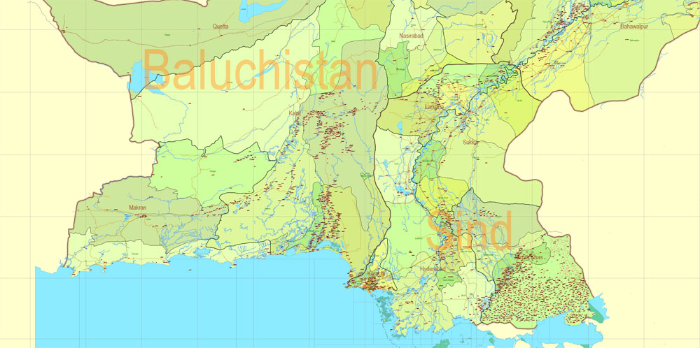
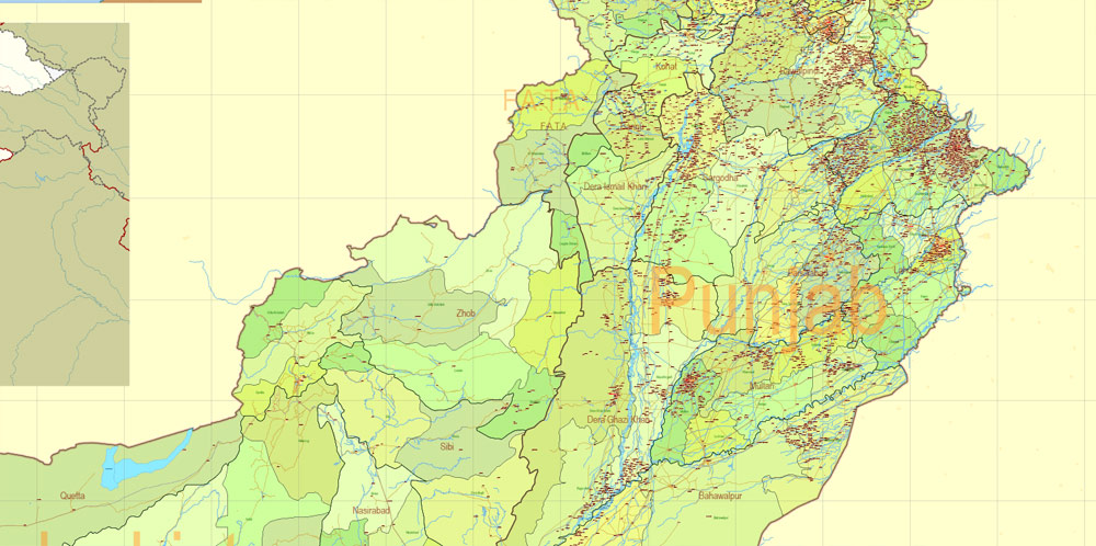
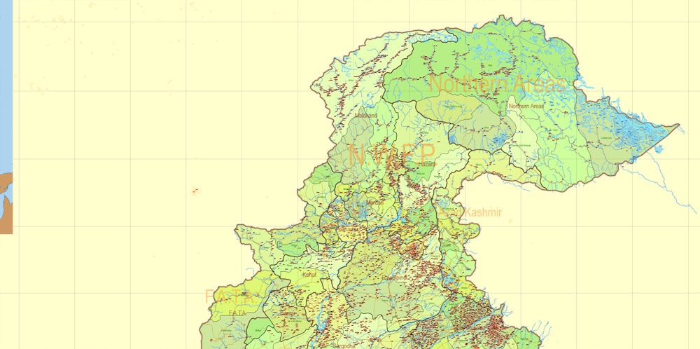
Administrative divisions
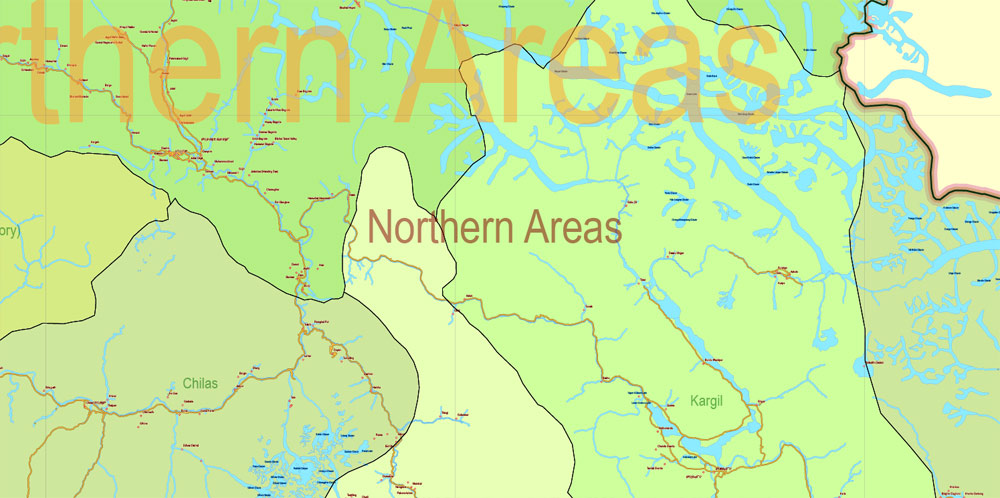
A federal parliamentary republic state, Pakistan is a federation that comprises four provinces: Punjab, Khyber Pakhtunkhwa, Sindh, and Balochistan and three territories: Islamabad Capital Territory, Gilgit–Baltistan, and Azad Kashmir. The Government of Pakistan exercises the de facto jurisdiction over the Frontier Regions and the western parts of the Kashmir Regions, which are organised into the separate political entities Azad Kashmir and Gilgit–Baltistan (formerly Northern Areas). In 2009, the constitutional assignment (the Gilgit–Baltistan Empowerment and Self-Governance Order) awarded the Gilgit–Baltistan a semi-provincial status, giving it self-government.
Saving a color group adds this group to the specified list.
Opening the «Edit Colors»/«Repaint Graphic Object» dialog box.
Open the «Edit Colors»/«Repaint Graphic Object» dialog box using one of the following methods:
«Edit»> «Edit Colors»> «Repaint Graphic object» or «Repaint With Style».
The local government system consists of a three-tier system of districts, tehsils, and union councils, with an elected body at each tier. There are about 130 districts altogether, of which Azad Kashmir has ten and Gilgit–Baltistan seven. The Tribal Areas comprise seven tribal agencies and six small frontier regions detached from neighbouring districts.
Law enforcement is carried out by a joint network of the intelligence community with jurisdiction limited to the relevant province or territory.
Use these commands if you need to edit the colors in the selected vector map of Pakistan city.
«Repaint Graphic object» button on the «Control» panel.
Use this button if you need to adjust colors of Pakistan vector map using the а «Repaint graphic object» dialog box.
Guides are not limited to vertical and horizontal in Adobe Illustrator. You can also create a diagonal guide for example. Moreover, you can turn any contours into guides. Select the outline and go to View > Guides > Make Guides (Create Guides), or simply press Cmd/Ctrl + 5. You can also turn the guides back into an editable object. Go to menu, View > Guides > Unlock Guides (Release Guides), select the guide you want to edit and select View > Guides > Release Guides (Reset Guides), or just press Cmd/Ctrl + Option / Alt + 5).
This is the most detailed, exact map of Pakistan for high-quality printing and polygraphy. You can always clarify the map development date by contacting us.
The National Intelligence Directorate coordinates the information intelligence at both federal and provincial level; including the FIA, IB, Motorway Police, and paramilitary forces such as the Pakistan Rangers and the Frontier Corps.
Pakistan’s “premier” intelligence agency, the Inter-Services Intelligence (ISI), was formed just within a year after the Independence of Pakistan in 1947.
For travelers, maps are sold at the airports and gas stations around the world. Often the source is our vector maps.
Pakistan’s ISI was ranked as the top intelligence agency in the world in 2011 by the International Business Times UK. ABC News Point in 2014 also reported that the ISI was ranked as the top intelligence agency in the world while Zee News reported the ISI as ranking fifth among the world’s most powerful intelligence agencies.
The court system is organised as a hierarchy, with the Supreme Court at the apex, below which are High Courts, Federal Shariat Courts (one in each province and one in the federal capital), District Courts (one in each district), Judicial Magistrate Courts (in every town and city), Executive Magistrate Courts, and civil courts. The Penal code has limited jurisdiction in the Tribal Areas, where law is largely derived from tribal customs.
Area
• Total 881,913 km2 (340,509 sq mi) (33rd)
• Water (%) 2.86
Population
• 2017 census 212,742,631 (5th)
• Density 244.4/km2 (633.0/sq mi) (56th)
Free vector map World, Adobe Illustrator, download now maps vector clipart
Map for design, projects, presentation free to use as you like.
See also: TERMS & CONDITIONS: SOFTWARE LICENSE AGREEMENT FOR DIGITAL CARTOGRAPHIC DATA.

 Author: Kirill Shrayber, Ph.D. FRGS