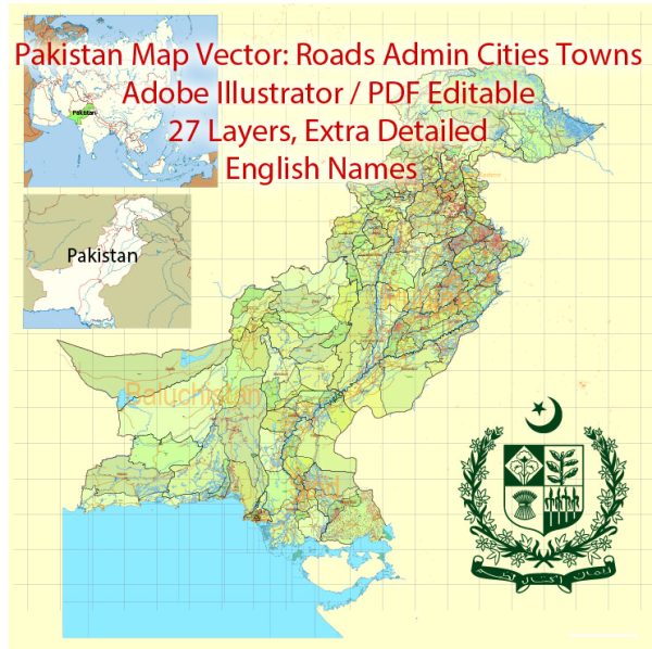
Information about some of the principal cities, waterways, and main roads in Pakistan. Vectormap.Net provide you with the most accurate and up-to-date vector maps in Adobe Illustrator, PDF and other formats, designed for editing and printing. Please read the vector map descriptions carefully. Here is a general overview:
Principal Cities:
- Islamabad: The capital city of Pakistan, known for its modern infrastructure and being the political center.
- Karachi: The largest city and the economic hub of Pakistan, located on the southern coast. It has a bustling port and is a major financial and industrial center.
- Lahore: Known as the cultural capital, Lahore is in the province of Punjab. It has a rich history, with many historical and cultural landmarks.
- Rawalpindi: Located adjacent to Islamabad, Rawalpindi is an important city with a strong military presence.
- Faisalabad: A major industrial city in Punjab, known for its textile industry.
- Peshawar: The capital of Khyber Pakhtunkhwa province, Peshawar has a rich historical and cultural significance.
Waterways:
- Indus River: The longest river in Pakistan, flowing from Tibet through northern India and into Pakistan. It plays a crucial role in the country’s agriculture and economy.
- Jhelum River: A tributary of the Indus River, flowing through both Indian-administered Jammu and Kashmir and Pakistan.
- Chenab River: Another major tributary of the Indus, flowing through Indian-administered Jammu and Kashmir and entering Pakistan.
Main Roads:
- Karakoram Highway: Connects Islamabad (Pakistan) to Kashgar (China) and is one of the highest paved roads in the world, passing through the Karakoram Range.
- Grand Trunk Road (GT Road): One of Asia’s oldest and longest roads, it connects Bangladesh, India, and Pakistan.
- Motorway M-2: Connects Lahore to Islamabad and is part of the larger motorway network in Pakistan.
- National Highway (N-5): Runs from Karachi in the south to Torkham on the Afghanistan border in the north, passing through major cities like Hyderabad, Sukkur, Multan, Lahore, and Rawalpindi.
- Lahore-Islamabad Motorway (M-1): Connects Lahore to Islamabad and is an integral part of the motorway system.


 Author: Kirill Shrayber, Ph.D.