Extended Description of the Vector Map
Geography
Norway is located in the north of Europe, in the western part of the Scandinavian Peninsula.
It is bordered to the north by the Arctic Ocean (the Barents Sea), to the northeast by Russia, Finland, and Sweden, and to the east by Sweden.
In the south, the Skagerrak Strait separates it from Denmark, in the west, the country is washed by the North Sea.
Norway has a long coastline, cut by fjords, and a mountainous area covered in many places by several of the largest glaciers in Europe. About 500 sq. m.
Norway’s territory is located within the Arctic Circle, but the west coast of the country is ice-free all year round thanks to the warm waters of the Gulf Stream. The territory of Norway is mainly mountainous (Langfjella ridge, the highest point – Gallhepiggen, 2469 m) and is covered with forests, tundra, and mountain vegetation, while only 3.5% of the land is suitable for cultivation.
Wildlife includes reindeer, wolves, musk oxen, and lemmings. Many of the 30,000 Sami people live a traditional life and raise reindeer far to the north. The lack of suitable areas for agriculture forced the Norwegians to turn their attention to marine fishing, commercial fish farming plays an important role, both in the economy and in the social life of the country.
Near the coast, there are a large number of large islands (Lofoten, Westerolen, Senja, Magere, Sere), numerous small islands, and skerries — St. 150 thousand. The length of the country from north to south is 1,700 km. The area is 387 thousand square kilometers (including more than 62 thousand square kilometers on the islands).
The northernmost point is North Cape (71°11 ‘ 8 ‘ north latitude). The largest lake is Mesa (362 sq. km). The largest glacier is Justedalsbre (480 sq. km). The highest peak is Gallhepiggen (2469 m).
The longest fjord is Sognefjord (200 km). Norway is located between 59°57′ north latitude and 10°43 ‘ east longitude. The territory of the country is stretched in the form of a narrow strip from the southwest to the northeast. The largest width of the country is 430 km, the smallest (in the area of Narvik) – approx. 7 km. In the south, Norway is washed by the Skagerrak Strait.
Climate
Despite the northern geographical location, the climate in Norway is not very severe, if you keep in mind that Siberia and Alaska are located at the same latitude.
The reason for the relatively warm climate is the Gulf Stream, which carries its waters from Mexico and warms the entire Norwegian coast. Ports do not freeze in winter. For example, in Stavanger, snow is rare and temperatures rarely fall below zero degrees C.
On the other hand, the warm current also brings a large amount of precipitation.
In Bergen (the record holder for precipitation), up to 250 mm of rain falls in the autumn month (September or October)! However, in the east of Norway and in the center of the climate is drier and in some summer months, it can be very dry. In short, the seasons are clearly defined, and in the summer months, in some years, the temperature can reach up to +30 degrees C.
If we are talking about the coast, then even near the Far North, for example in Tromsø, in winter it is only -4 degrees C.
But as you move away to the east, the climate becomes more continental and in the Finnmark area, the temperature can drop to -50 degrees. In general, the average temperature of summer is not much different from winter.
The average annual temperature is + 5.3 °C, the average temperature in July is +17 °C, and the average temperature in January is -5 °C. The amount of precipitation is quite significant; the average amount of rain per year is 671 mm.
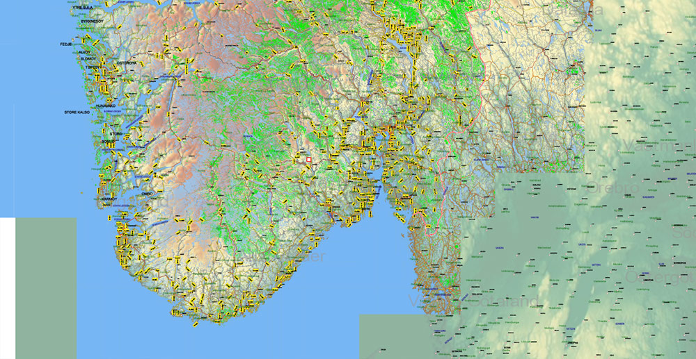
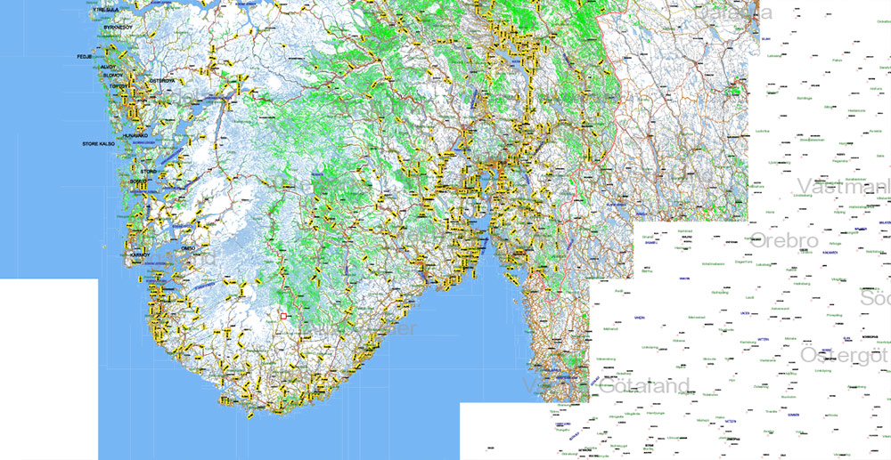
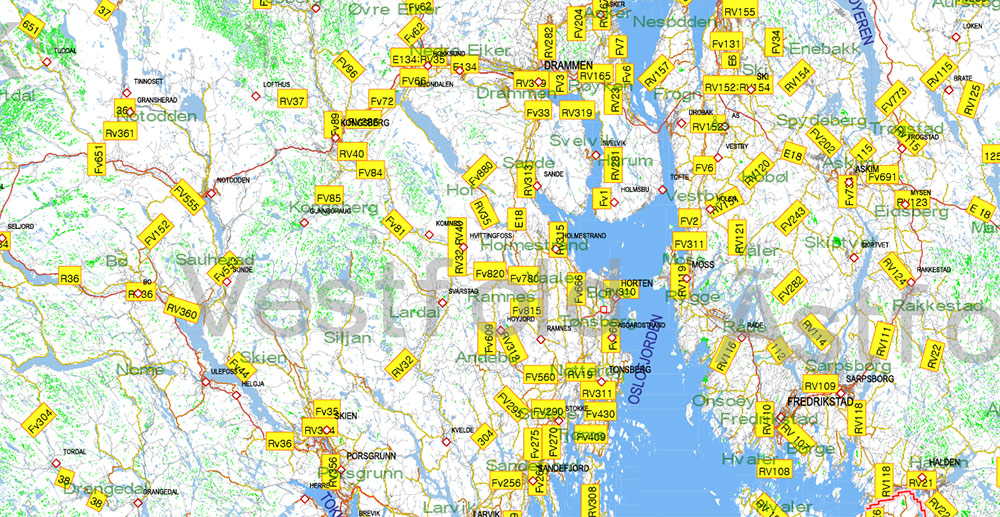
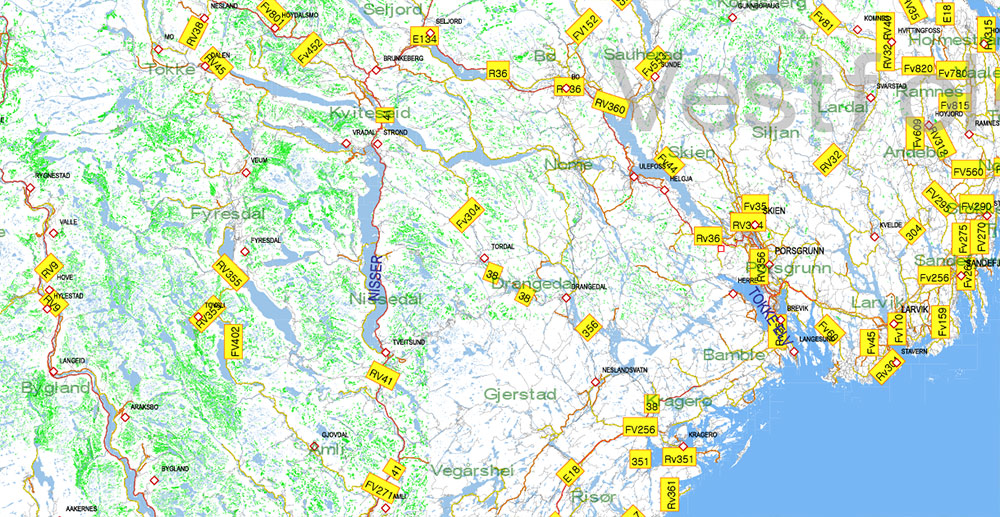
Printable PDF Vector Map of Norway All Roads + Relief + Admin areas (provinces and counties) full editable Adobe PDF Map in layers, in 1 file, scalable, 1.328 MB ZIP (1,391 GB!!!! size in decompressed file, USE POWERFULL MACHINE!)
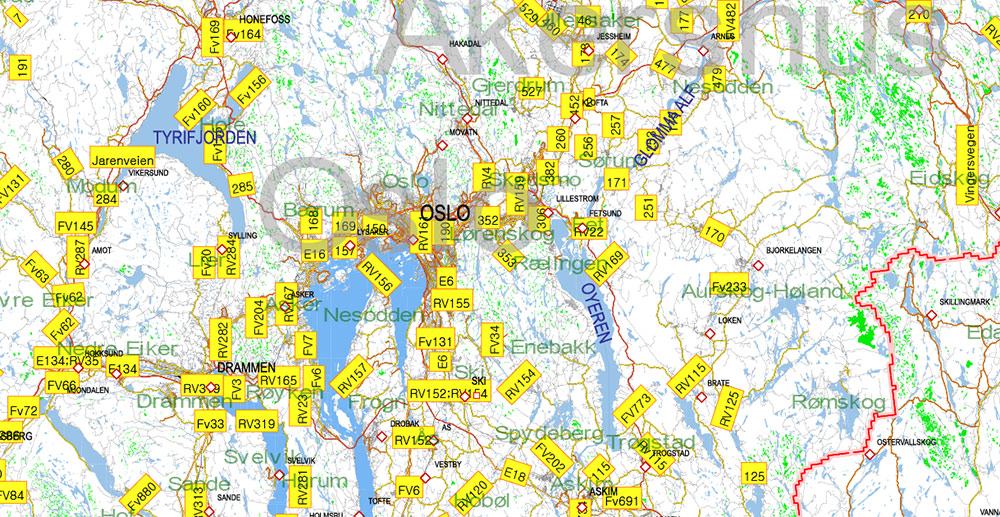
All streets and roads, All Cities and Towns, Counties, Provinces, Relief layer (raster HR). Map for design, printing, arts, projects, presentations, for architects, designers, and builders, business, logistics.
Excluded: Svalbard (Spitsbergen)
For Editing and High-Quality Printing, Royalty free
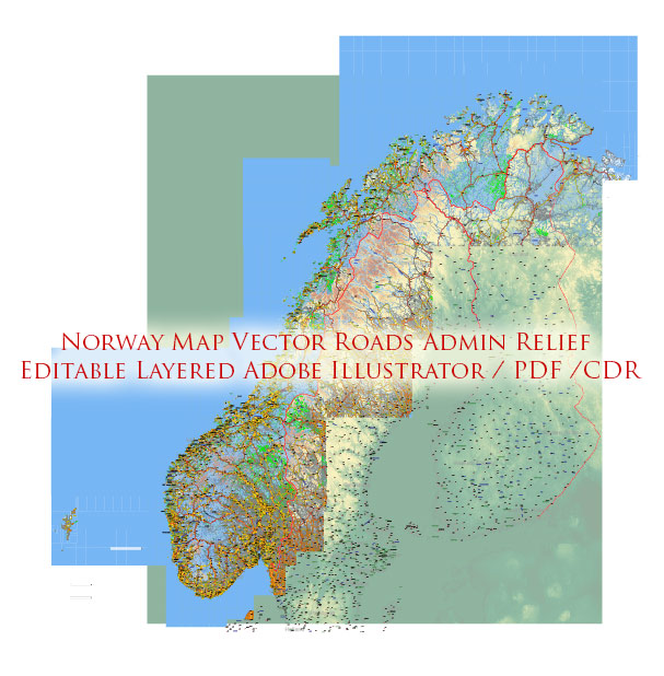
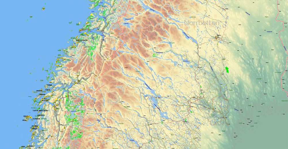
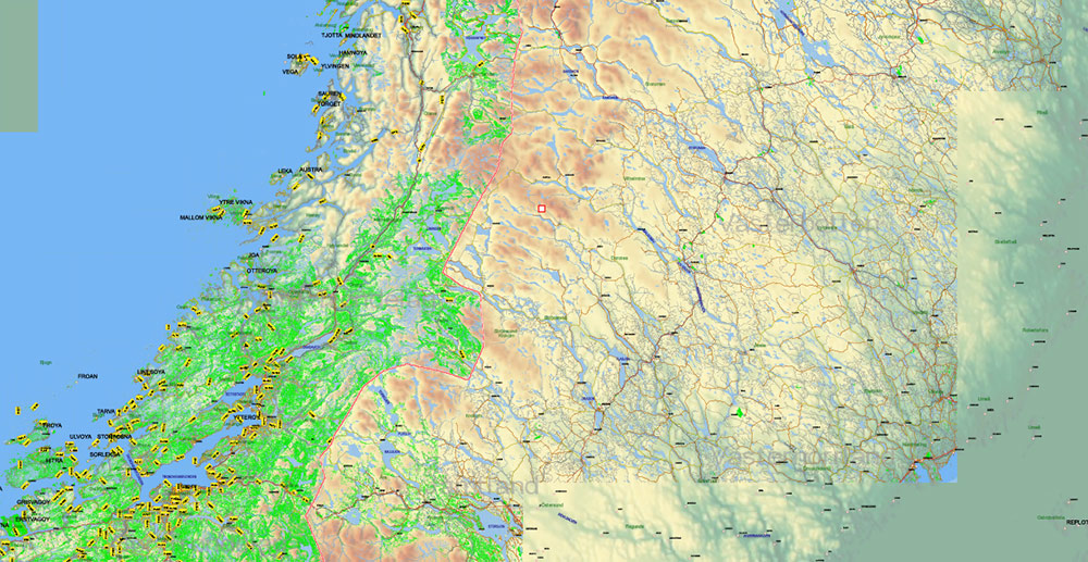
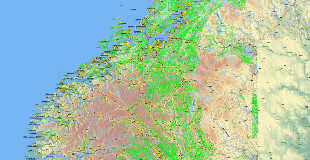
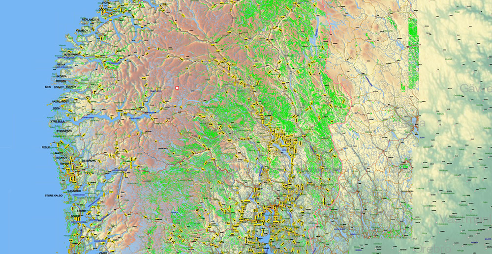
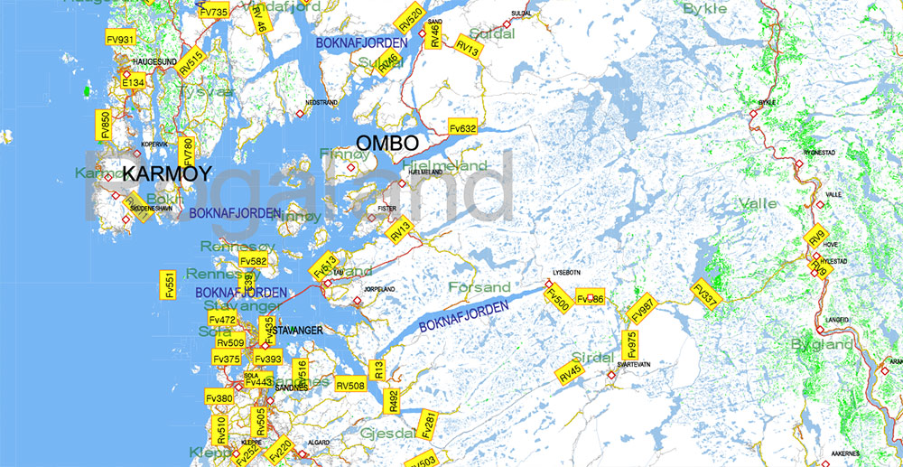
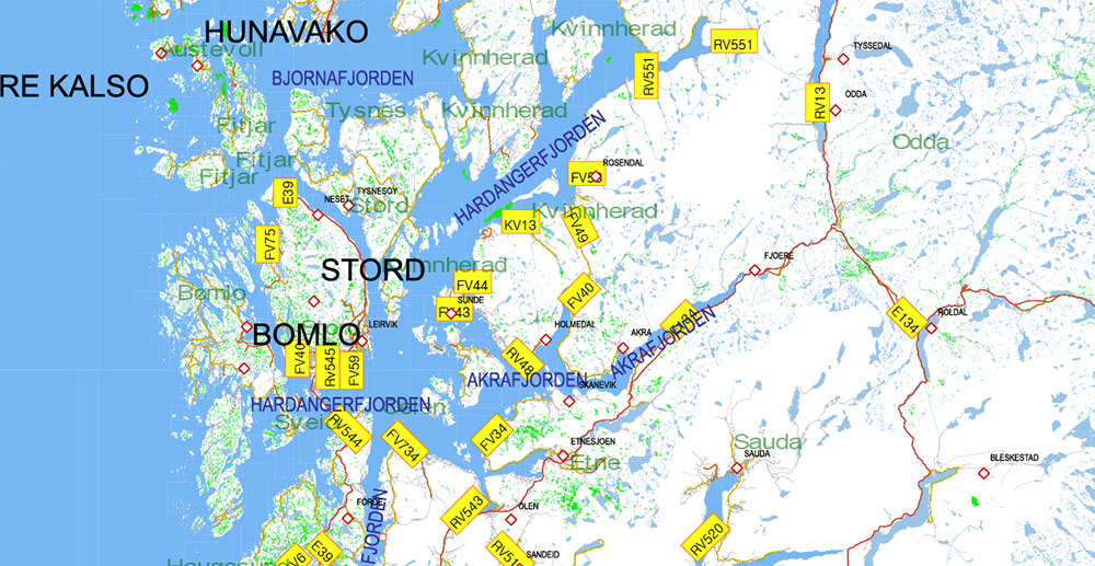
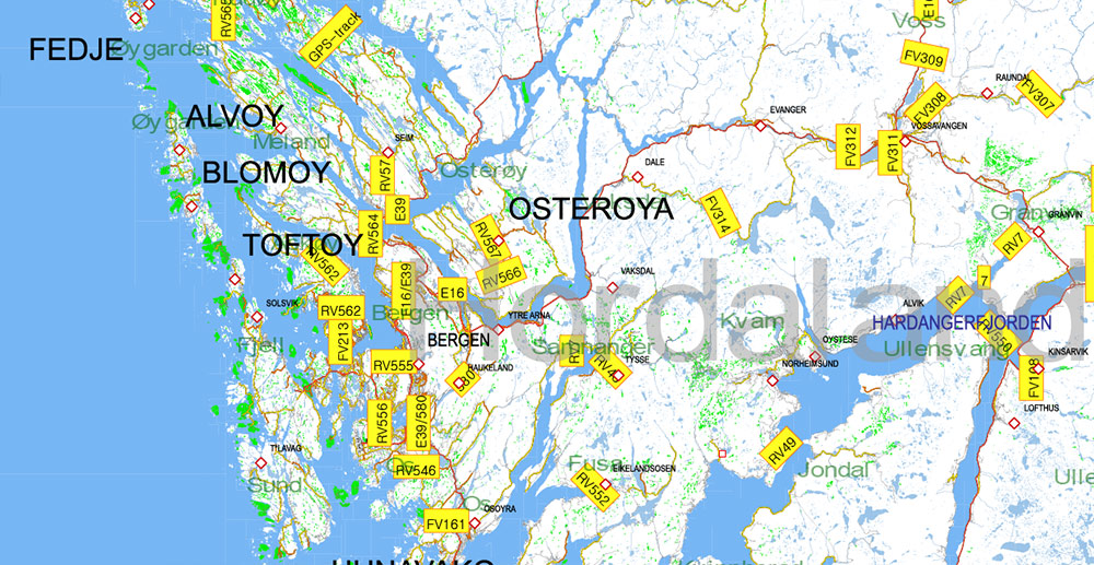
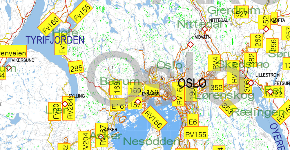
Norway PDF Map Vector Full Extra High Detailed 01 (all roads) in ONE file + Relief + Admin Areas editable Adobe PDF in layers
Layers list:
- Names of Cities and Towns
- Numbers of roads
- Names of Water objects
- Names of Provinces
- Names of Counties
- Points of the Cities and Towns
- Major Roads – Highways
- Minor Roads and streets
- Country Borders
- Railroads and Aeroway lines
- Water objects (rivers, lakes, ponds, swamps, reefs)
- Waterways
- Sea
- Country Areas
- Provinces Areas
- Relief (topo raster image HR TIFF 150 DPI)
Norway PDF Map Vector Full Extra High Detailed 01 (all roads) in ONE file + Relief + Admin Areas editable Adobe PDF in layers
Norway PDF Map Vector Full Extra High Detailed 01 (all roads) in ONE file + Relief + Admin Areas editable Adobe PDF in layers
Norway PDF Map Vector Full Extra High Detailed 01 (all roads) in ONE file + Relief + Admin Areas editable Adobe PDF in layers
Norway PDF Map Vector Full Extra High Detailed 01 (all roads) in ONE file + Relief + Admin Areas editable Adobe PDF in layers
Norway PDF Map Vector Full Extra High Detailed 01 (all roads) in ONE file + Relief + Admin Areas editable Adobe PDF in layers
Norway PDF Map Vector Full Extra High Detailed 01 (all roads) in ONE file + Relief + Admin Areas editable Adobe PDF in layers
Norway PDF Map Vector Full Extra High Detailed 01 (all roads) in ONE file + Relief + Admin Areas editable Adobe PDF in layers
Norway PDF Map Vector Full Extra High Detailed 01 (all roads) in ONE file + Relief + Admin Areas editable Adobe PDF in layers
Norway PDF Map Vector Full Extra High Detailed 01 (all roads) in ONE file + Relief + Admin Areas editable Adobe PDF in layers
Norway PDF Map Vector Full Extra High Detailed 01 (all roads) in ONE file + Relief + Admin Areas editable Adobe PDF in layers
Norway PDF Map Vector Full Extra High Detailed 01 (all roads) in ONE file + Relief + Admin Areas editable Adobe PDF in layers
Norway PDF Map Vector Full Extra High Detailed 01 (all roads) in ONE file + Relief + Admin Areas editable Adobe PDF in layers
Norway PDF Map Vector Full Extra High Detailed 01 (all roads) in ONE file + Relief + Admin Areas editable Adobe PDF in layers
Norway PDF Map Vector Full Extra High Detailed 01 (all roads) in ONE file + Relief + Admin Areas editable Adobe PDF in layers
Norway PDF Map Vector Full Extra High Detailed 01 (all roads) in ONE file + Relief + Admin Areas editable Adobe PDF in layers
Norway PDF Map Vector Full Extra High Detailed 01 (all roads) in ONE file + Relief + Admin Areas editable Adobe PDF in layers

 Author: Kirill Shrayber, Ph.D. FRGS


 + Relief + Admin Areas editable Adobe Illustrator in layers (2 parts NS)")