Extended Description of the Vector Map
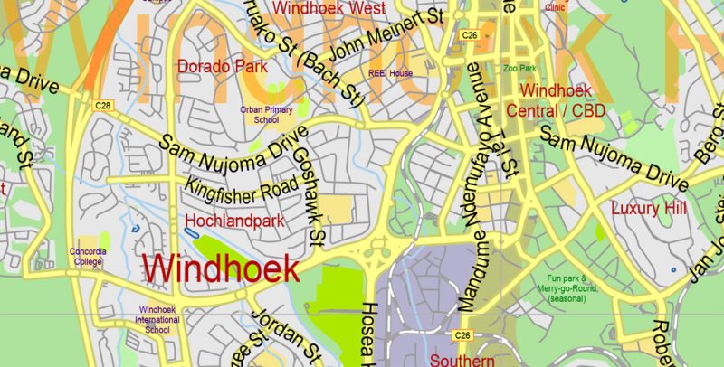
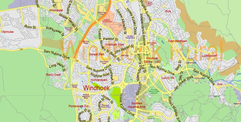
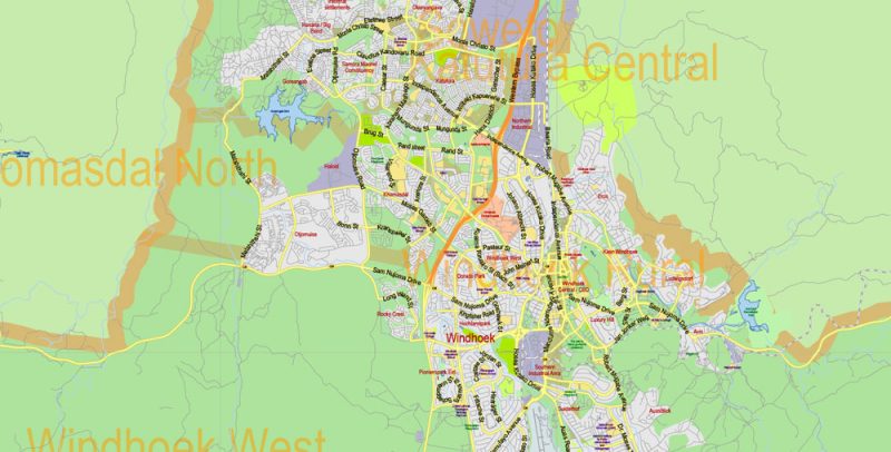
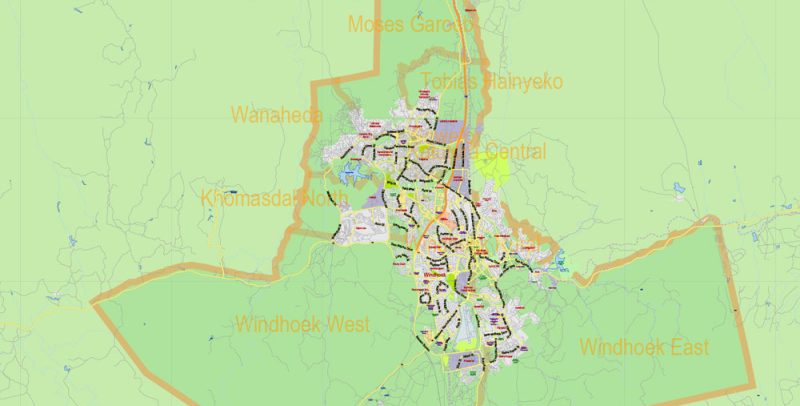
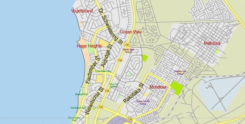
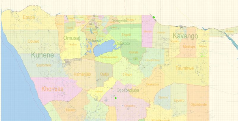
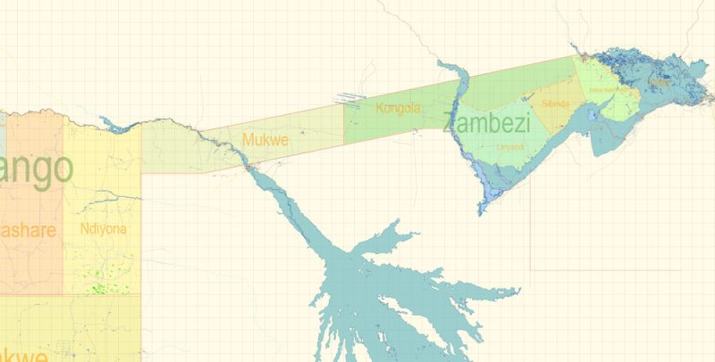
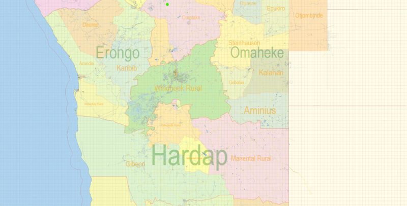
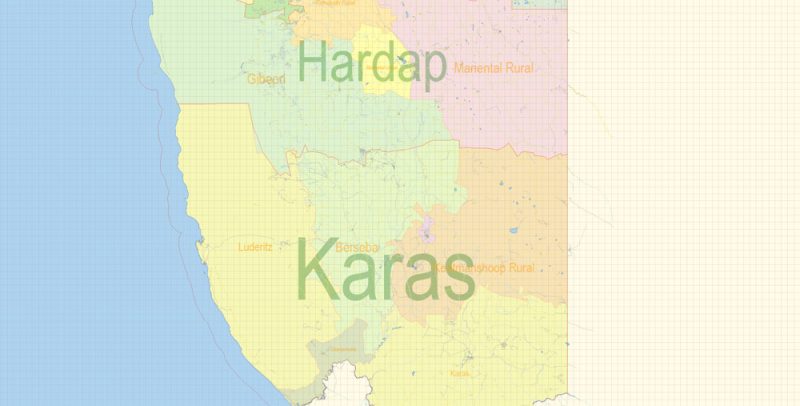
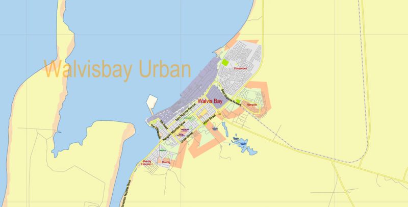
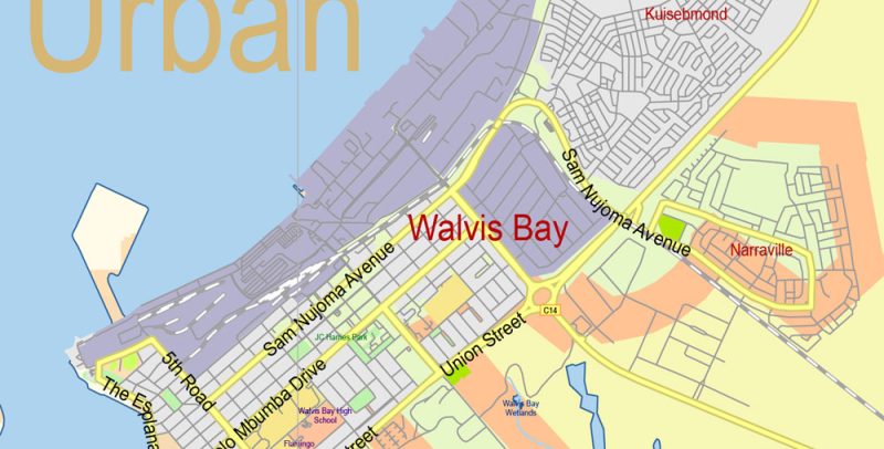
Printable Vector Map of Namibia detailed Country Plan scale 2000 m 1:69200 full editable Adobe Illustrator Street Map in layers, scalable, text format all names, 24 MB ZIP
All street names, Main Objects, Buildings. Map for design, printing, arts, projects, presentations, for architects, designers, and builders, business, logistics.
Layers: color_fills, water, streets_roads 1-2, labels_roads, names_objects, names_streets, names_places, admin_areas, provinces, buildings, grids, legend, etc.
The most exact and detailed map of the country in scale.
For Editing and High-Quality Printing
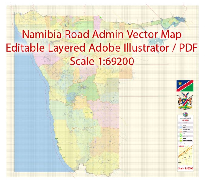
Namibia Map Vector Exact Country Plan detailed Road Admin Map editable Adobe Illustrator in layers
Namibia
The Geography Of Namibia
Namibia is a country in South-West Africa. It is bordered to the North by Angola and Zambia, to the East by Botswana, to the Southeast and South by South Africa. From the West, it is washed by the Atlantic ocean.
The main part of Namibia consists of hills, occupying the center of the country. There is the highest point (mount königstein (Brandberg), 2,606 m). From the West, the Central Plateau is bounded by the Namib desert, which faces the Atlantic ocean, from the South by the Orange river, from the East by 20 m and 21 m degrees of East longitude and the Kalahari desert. The Caprivi strip and the far North of the country are occupied by jungle.
Namibia Map Vector Exact Country Plan detailed Road Admin Map editable Adobe Illustrator in layers
State
State system
Namibia is a Republic. The head of state is the President. The legislature is a bicameral Parliament: the National Council and the National Assembly.
Language
Official language: English, Afrikaans
80% of Namibian Africans speak Bantu. Of these, the most common languages are Ovambo (spoken by 70% of the Bantu-speaking population), Guerrero (9%) and Lozi (6%). Afrikaans is a common language in the southern regions.
Namibia Map Vector Exact Country Plan detailed Road Admin Map editable Adobe Illustrator in layers
Religion
Christians make up about 90% of the population (the majority of Protestants (mostly Lutherans), Catholics – 14% of the population), 10% adhere to traditional African beliefs (animalism, fetishism, ancestor cult, homemakers, forces of nature, etc.).
Namibia Map Vector Exact Country Plan detailed Road Admin Map editable Adobe Illustrator in layers
Currency
International name: NAD
The Namibian dollar is 100 cents. In circulation banknotes of 5, 10, 20, 50, 100 and 200 N$, coins of 1 (out of circulation), 2, 5, 10, 20 and 50 cents, as well as 1, 2 and 5 N$.
Currency exchange can be made at the exchange offices of the international airport, as well as in banks and their branches almost throughout the country. As a rule, there is no reverse exchange of Namibian dollars for hard currency.
Namibia Map Vector Exact Country Plan detailed Road Admin Map editable Adobe Illustrator in layers
Credit cards, as well as traveler’s checks, are accepted at most major hotels, shops, restaurants and gas stations. They can also be used to collect cash through the ATM system owned by First National Bank (“BOB”). One-time withdrawal is limited to the amount of 1000 N$.
Travel checks can be cashed at Bank offices, but there may not be us dollars in cash in the Bank, so such operations should be carried out on a preliminary call to the Bank. Preference is given to checks in us dollars and Rand of South Africa.
Namibia Map Vector Exact Country Plan detailed Road Admin Map editable Adobe Illustrator in layers
Namibia Map Vector Exact Country Plan detailed Road Admin Map editable Adobe Illustrator in layers
Namibia Map Vector Exact Country Plan detailed Road Admin Map editable Adobe Illustrator in layers
Namibia Map Vector Exact Country Plan detailed Road Admin Map editable Adobe Illustrator in layers
Namibia Map Vector Exact Country Plan detailed Road Admin Map editable Adobe Illustrator in layers
Namibia Map Vector Exact Country Plan detailed Road Admin Map editable Adobe Illustrator in layers
Namibia Map Vector Exact Country Plan detailed Road Admin Map editable Adobe Illustrator in layers


 Author: Kirill Shrayber, Ph.D. FRGS